
Scattered thunderstorms with severe gusts, hail and a tornado risk are possible near a cold front from the Ohio Valley to the Mid-Atlantic tonight. Tropical Storm Bertha is expected to bring tropical storm conditions to portions of the Gulf Coast from the panhandle of Florida into Louisiana through Wednesday. Read More >
|
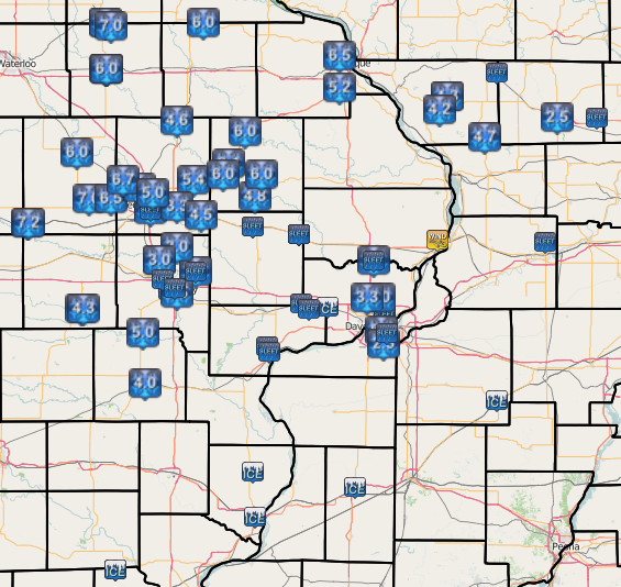
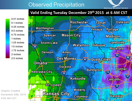
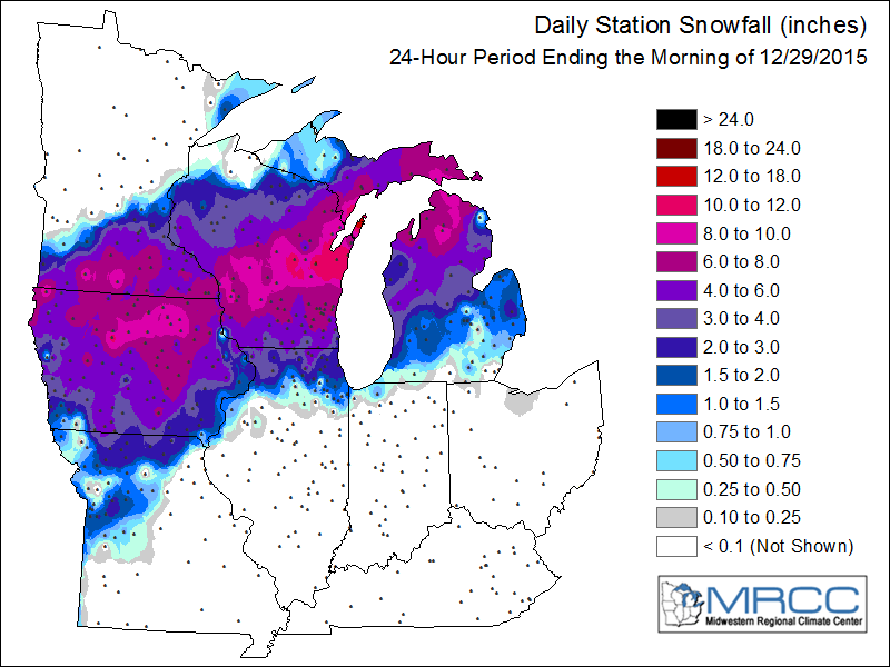
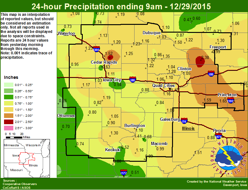
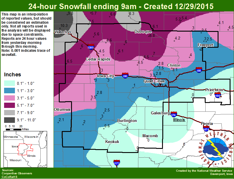
A potent low pressure system tracked from eastern Oklahoma and Missouri into northern Illinois and the Great Lakes region, from December 28th to the early morning hours of the 29th. An unseasonably warm and moist airmass interacted with the system to produce heavy mixed precipitation across the region. Thundersnow was reported in some areas, as well as heavy snow, sleet accumulations up to 2-4 inches, and glaze ice amounts over a quarter inch. The ice and strong winds gusting to 50 mph resulted in widespread downed trees and powerlines, and power outages. The hardest hit areas, with glaze ice amounts of 1/4-1/2 inch, were located from southeast Iowa, across the Mississippi River into Henderson, Mercer, Warren, Rock Island and Henry counties in Illinois. The highest amounts of combined snow and sleet, in the 5-7 inch range, occurred west and north of a line from Brighton, IA in Washington County, to Cedar Rapids, Anamosa, and Stockton, IL. |
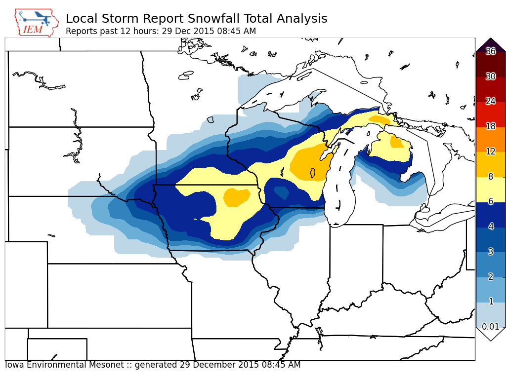 |
| See Also: Des Moines | LaCrosse | Milwaukee | Chicago | Courtesy: Iowa Environmental Mesonet |
Snow/Ice:
| Storm Reports | Regional Rain | Regional Snow | Local Rain | Local Snow & Sleet | |||||||
 |
 |
 |
 |
 |
|||||||
| Interactive Map | Courtesy: Midwestern Regional Climate Center | ||||||||||
|
|||||||||||
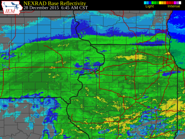
Radar:
| Click on the image for the Iowa Environmental Mesonet Radar Loop. |
 |
Environment:
| 12/28 AM Weather Balloon Ob (SKEWT KDVN) |
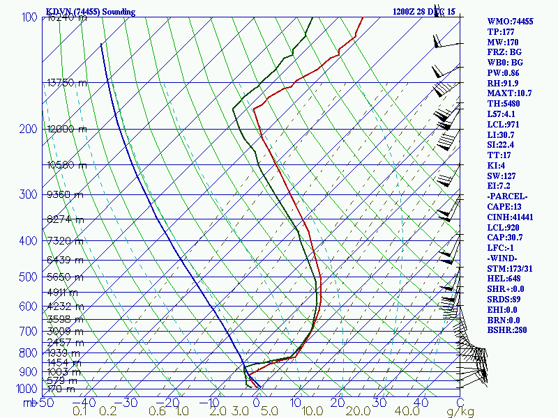 |
| Courtesy: College of DuPage |
 |
Media use of NWS Web News Stories is encouraged! Please acknowledge the NWS as the source of any news information accessed from this site. |
|

