Heat expands across the Desert Southwest, Plains, Mississippi Valley and Midwest into Monday. Fire weather concerns continue for portions of the Intermountain West. Active monsoonal moisture fuels thunderstorms over the Southwest with possible flash flooding. Tropical cyclone Fausto in the Pacific, should weaken as it approaches Hawaii; Dangerous surf, swells and rip currents are expected. Read More >
Quad Cities, IA/IL
Weather Forecast Office
Overview
|
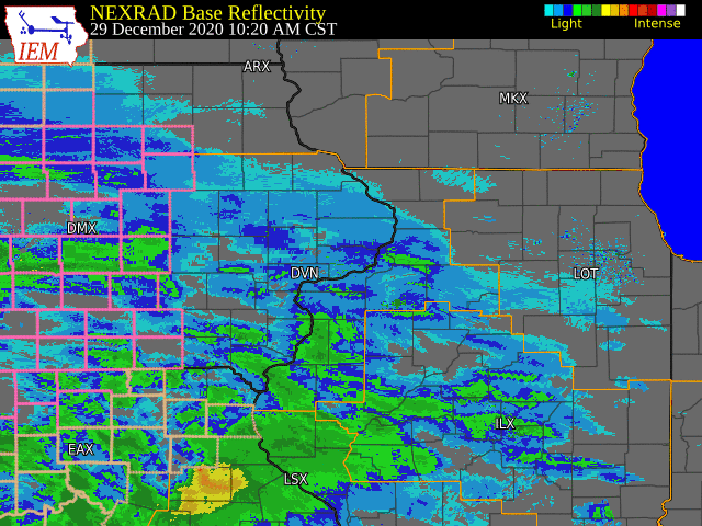
A potent winter storm produced heavy snow, along with freezing rain and sleet, across the region Tuesday afternoon and night. 8 to 12 inches of snow fell in the heaviest band between Interstate 80 and U.S. Highway 20. The highest freezing rain accumulations occurred along the U.S. Highway 34 corridor from Fairfield, IA to Oquawka, IL, where 0.2 to 0.3 inches of glaze ice was reported. Thunderstorms also occurred in eastern Iowa Tuesday evening, and resulted in extreme snowfall rates of 2 to 3 inches per hour.
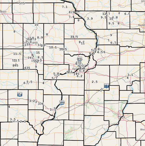
Official National Weather Service Observations Moline: 6.2" Davenport: 9.1" Dubuque: 7.4" ***Cedar Rapids, Iowa City and Burlington do not measure snow as part of their climate records. Please see the Snowfall Amounts and Storm Reports sections for reported snow amounts in these locations.*** |
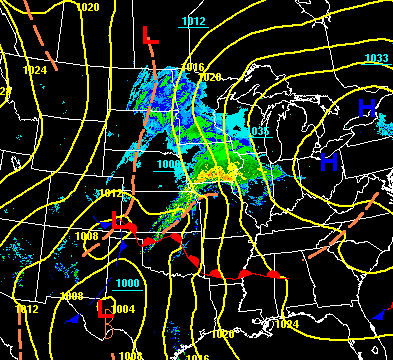 WPC - Surface Map and Radar |
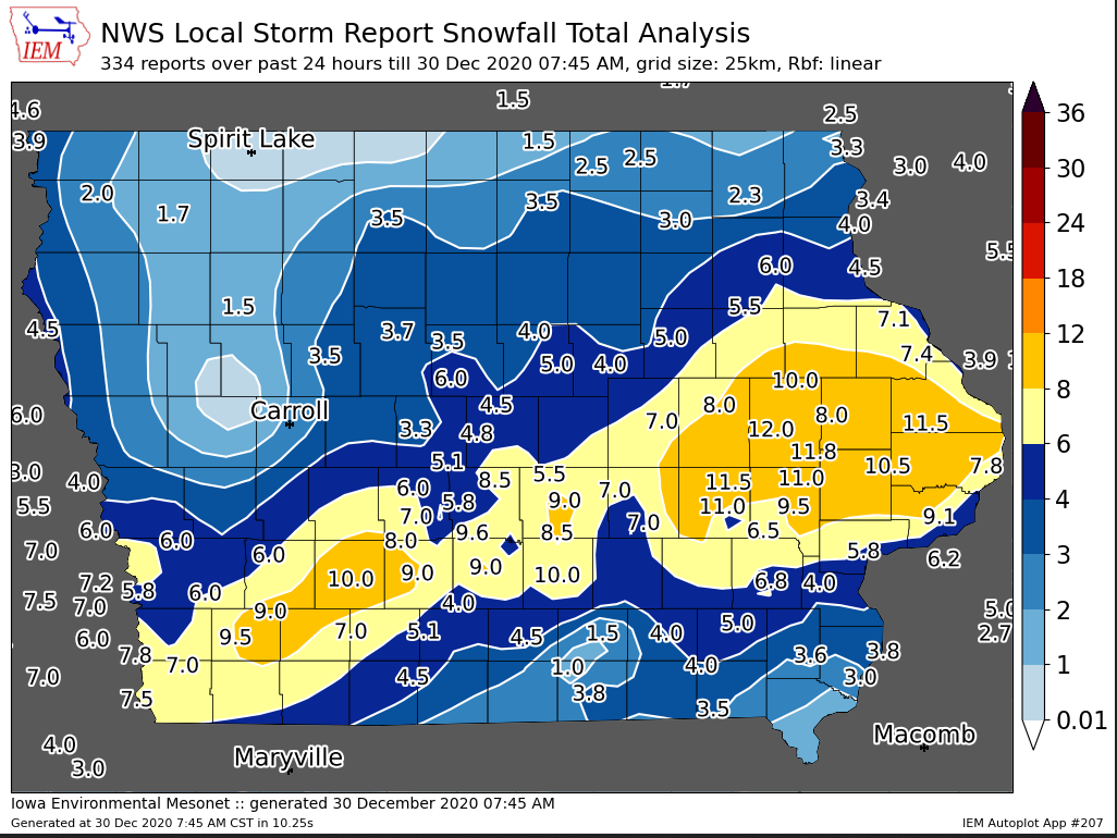
Snowfall Amounts (courtesy IEM)
 |
|
 |
Media use of NWS Web News Stories is encouraged! Please acknowledge the NWS as the source of any news information accessed from this site. |
|
Hazardous Weather
Watches, Warnings, & Advisories
Briefing
Hazards Page
View Local Storm Reports
Submit Report
Road Reports
Text Products
Forecasts
Fire Weather
Briefing
Hourly Forecast Graphs
Forecast Discussion
User-Defined Area
Activity Planner
Local Forecasts
Space Weather
Text Products
River Graphs
Airport Forecasts
Snow and Ice Probabilities
Winter Storm Severity Index (WSSI)
Current Conditions
Observations
Drought Monitor
Radar
Satellite
Text Products
Rivers and Lakes
River Graphs
Sunrise/Sunset Tables
Seasons (Equinoxes/Solstices)
Road Reports
Past Weather
Recent Observation History
Climate Summaries
Past Events
Climate Normals/Averages
Climate Records
Climate/Almanac Data
Holiday Climatology
Climate Maps
Monthly Climate Stats
Annual Climate Stats
Observation Site History
Sunrise/Sunset Tables
US Dept of Commerce
National Oceanic and Atmospheric Administration
National Weather Service
Quad Cities, IA/IL
9040 N Harrison Street
Davenport Municipal Airport
Davenport, IA 52806-7326
563-386-3976
Comments? Questions? Please Contact Us.