 Severe thunderstorms are not expected today or tonight.
 Severe thunderstorms will be possible later today or tonight.
 Severe thunderstorms will be possible in the next 6 hours.
 Severe thunderstorms will be possible in the next 3 hours. No tornado risk. Tornado risk less than 5 percent. Tornado risk equal to or greater than 5 percent. Tornado risk equal to or greater than 10 percent.
 Tornado risk equal to or greater than 30 percent. No risk of hail. Risk of sub-severe hail (< 1" diameter); Chance of severe hail less than 15 percent. Chance of severe hail equal to or greater than 15 percent. Chance of severe hail equal to or greater than 30 percent. Chance of severe hail equal to or greater than 45 percent. No thunderstorm wind risk. Risk for sub-severe wind gusts (less than 58 mph); or Probability of severe wind gusts (58 mph or greater) less than 15%. Probability of severe wind gusts equal to or greater than 15%. Probability of severe wind gusts equal to or greater than 30%. Probability of severe wind gusts equal to or greater than 45%. No risk of severe thunderstorms. Risk for severe thunderstorms less than 15%. Risk for severe thunderstorms greater than or equal to 15%. Risk for severe thunderstorms greater than or equal to 30%. Risk for severe thunderstorms greater than or equal to 45%. No risk of severe thunderstorms. Risk for severe thunderstorms less than 15%. Risk for severe thunderstorms greater than or equal to 15%. Risk for severe thunderstorms greater than or equal to 30%. Risk for severe thunderstorms greater than or equal to 45%. No risk of severe thunderstorms. Risk for severe thunderstorms less than 15%. Risk for severe thunderstorms greater than or equal to 15%. Risk for severe thunderstorms greater than or equal to 30%. Risk for severe thunderstorms greater than or equal to 45%. No risk of severe thunderstorms. Risk for severe thunderstorms less than 15%. Risk for severe thunderstorms greater than or equal to 15%. Risk for severe thunderstorms greater than or equal to 30%. Risk for severe thunderstorms greater than or equal to 45%. No risk of severe thunderstorms. Risk for severe thunderstorms less than 15%. Risk for severe thunderstorms greater than or equal to 15%. Risk for severe thunderstorms greater than or equal to 30%. Risk for severe thunderstorms greater than or equal to 45%. No risk of severe thunderstorms. Risk for severe thunderstorms less than 15%. Risk for severe thunderstorms greater than or equal to 15%. Risk for severe thunderstorms greater than or equal to 30%. Risk for severe thunderstorms greater than or equal to 45%. No risk of severe thunderstorms. Risk for severe thunderstorms less than 15%. Risk for severe thunderstorms greater than or equal to 15%. Risk for severe thunderstorms greater than or equal to 30%. Risk for severe thunderstorms greater than or equal to 45%. None. Isolated to scattered in coverage. Numerous thunderstorms. Widespread thunderstorms. Nearly continuous cloud-to- ground lightning strikes in and near storms. None. Isolated to scattered in coverage. Numerous thunderstorms. Widespread thunderstorms. Nearly continuous cloud-to- ground lightning strikes in and near storms. None. Isolated to scattered in coverage. Numerous thunderstorms. Widespread thunderstorms. Nearly continuous cloud-to- ground lightning strikes in and near storms. None. Isolated to scattered in coverage. Numerous thunderstorms. Widespread thunderstorms. Nearly continuous cloud-to- ground lightning strikes in and near storms. None. Isolated to scattered in coverage. Numerous thunderstorms. Widespread thunderstorms. Nearly continuous cloud-to- ground lightning strikes in and near storms. None. Isolated to scattered in coverage. Numerous thunderstorms. Widespread thunderstorms. Nearly continuous cloud-to- ground lightning strikes in and near storms. None. Isolated to scattered in coverage. Numerous thunderstorms. Widespread thunderstorms. Nearly continuous cloud-to- ground lightning strikes in and near storms. Sustained winds < 20 mph and Wind gusts < 35 mph. Sustained winds 26-29 mph or Wind gusts 35-44 mph. Sustained winds 30-39 mph or Wind gusts 45-57 mph. Sustained winds 40-49 mph or Wind gusts 58-64 mph. Sustained winds > 50 mph or Wind gusts > 65 mph. Sustained winds < 20 mph and Wind gusts < 35 mph. Sustained winds 26-29 mph or Wind gusts 35-44 mph. Sustained winds 30-39 mph or Wind gusts 45-57 mph. Sustained winds 40-49 mph or Wind gusts 58-64 mph. Sustained winds > 50 mph or Wind gusts > 65 mph. Sustained winds < 20 mph and Wind gusts < 35 mph. Sustained winds 26-29 mph or Wind gusts 35-44 mph. Sustained winds 30-39 mph or Wind gusts 45-57 mph. Sustained winds 40-49 mph or Wind gusts 58-64 mph. Sustained winds > 50 mph or Wind gusts > 65 mph. Sustained winds < 20 mph and Wind gusts < 35 mph. Sustained winds 26-29 mph or Wind gusts 35-44 mph. Sustained winds 30-39 mph or Wind gusts 45-57 mph. Sustained winds 40-49 mph or Wind gusts 58-64 mph. Sustained winds > 50 mph or Wind gusts > 65 mph. Sustained winds < 20 mph and Wind gusts < 35 mph. Sustained winds 26-29 mph or Wind gusts 35-44 mph. Sustained winds 30-39 mph or Wind gusts 45-57 mph. Sustained winds 40-49 mph or Wind gusts 58-64 mph. Sustained winds > 50 mph or Wind gusts > 65 mph. Sustained winds < 20 mph and Wind gusts < 35 mph. Sustained winds 26-29 mph or Wind gusts 35-44 mph. Sustained winds 30-39 mph or Wind gusts 45-57 mph. Sustained winds 40-49 mph or Wind gusts 58-64 mph. Sustained winds > 50 mph or Wind gusts > 65 mph. Sustained winds < 20 mph and Wind gusts < 35 mph. Sustained winds 26-29 mph or Wind gusts 35-44 mph. Sustained winds 30-39 mph or Wind gusts 45-57 mph. Sustained winds 40-49 mph or Wind gusts 58-64 mph. Sustained winds > 50 mph or Wind gusts > 65 mph. No Flooding risk. Risk of localized flash flooding of small streams, and minor flooding of poor drainage or urban areas. Risk of flash flooding of several roads and small streams. Risk of flash flooding of numerous roads and small streams. Risk of widespread flash flooding of roads and small streams. No Flooding risk. Risk of localized flash flooding of small streams, and minor flooding of poor drainage or urban areas. Risk of flash flooding of several roads and small streams. Risk of flash flooding of numerous roads and small streams. Risk of widespread flash flooding of roads and small streams. No Flooding risk. Risk of localized flash flooding of small streams, and minor flooding of poor drainage or urban areas. Risk of flash flooding of several roads and small streams. Risk of flash flooding of numerous roads and small streams. Risk of widespread flash flooding of roads and small streams. No Flooding risk. Risk of localized flash flooding of small streams, and minor flooding of poor drainage or urban areas. Risk of flash flooding of several roads and small streams. Risk of flash flooding of numerous roads and small streams. Risk of widespread flash flooding of roads and small streams. No Flooding risk. Risk of localized flash flooding of small streams, and minor flooding of poor drainage or urban areas. Risk of flash flooding of several roads and small streams. Risk of flash flooding of numerous roads and small streams. Risk of widespread flash flooding of roads and small streams. No Flooding risk. Risk of localized flash flooding of small streams, and minor flooding of poor drainage or urban areas. Risk of flash flooding of several roads and small streams. Risk of flash flooding of numerous roads and small streams. Risk of widespread flash flooding of roads and small streams. No Flooding risk. Risk of localized flash flooding of small streams, and minor flooding of poor drainage or urban areas. Risk of flash flooding of several roads and small streams. Risk of flash flooding of numerous roads and small streams. Risk of widespread flash flooding of roads and small streams. Open burning is usually safe with proper containers and precautions under low fire danger conditions. Open burning is usually safe with the proper precautions. Burning should be done in the early morning and late evening to avoid windier and drier conditions from midday through mid-afternoon. Any open burning is discouraged due to increased wind and lower humidity - except by experienced fire personnel. Approaching Red Flag conditions. Open burning should not be attempted. Conditions exceed minimum criteria for a Red Flag Warning in most cases. Very strong winds, well in excess of Red Flag Criteria combined with moderate to low humidity. Open burning is usually safe with proper containers and precautions under low fire danger conditions. Open burning is usually safe with the proper precautions. Burning should be done in the early morning and late evening to avoid windier and drier conditions from midday through mid-afternoon. Any open burning is discouraged due to increased wind and lower humidity - except by experienced fire personnel. Approaching Red Flag conditions. Open burning should not be attempted. Conditions exceed minimum criteria for a Red Flag Warning in most cases. Very strong winds, well in excess of Red Flag Criteria combined with moderate to low humidity. Open burning is usually safe with proper containers and precautions under low fire danger conditions. Open burning is usually safe with the proper precautions. Burning should be done in the early morning and late evening to avoid windier and drier conditions from midday through mid-afternoon. Any open burning is discouraged due to increased wind and lower humidity - except by experienced fire personnel. Approaching Red Flag conditions. Open burning should not be attempted. Conditions exceed minimum criteria for a Red Flag Warning in most cases. Very strong winds, well in excess of Red Flag Criteria combined with moderate to low humidity. Open burning is usually safe with proper containers and precautions under low fire danger conditions. Open burning is usually safe with the proper precautions. Burning should be done in the early morning and late evening to avoid windier and drier conditions from midday through mid-afternoon. Any open burning is discouraged due to increased wind and lower humidity - except by experienced fire personnel. Approaching Red Flag conditions. Open burning should not be attempted. Conditions exceed minimum criteria for a Red Flag Warning in most cases. Very strong winds, well in excess of Red Flag Criteria combined with moderate to low humidity. Open burning is usually safe with proper containers and precautions under low fire danger conditions. Open burning is usually safe with the proper precautions. Burning should be done in the early morning and late evening to avoid windier and drier conditions from midday through mid-afternoon. Any open burning is discouraged due to increased wind and lower humidity - except by experienced fire personnel. Approaching Red Flag conditions. Open burning should not be attempted. Conditions exceed minimum criteria for a Red Flag Warning in most cases. Very strong winds, well in excess of Red Flag Criteria combined with moderate to low humidity. Open burning is usually safe with proper containers and precautions under low fire danger conditions. Open burning is usually safe with the proper precautions. Burning should be done in the early morning and late evening to avoid windier and drier conditions from midday through mid-afternoon. Any open burning is discouraged due to increased wind and lower humidity - except by experienced fire personnel. Approaching Red Flag conditions. Open burning should not be attempted. Conditions exceed minimum criteria for a Red Flag Warning in most cases. Very strong winds, well in excess of Red Flag Criteria combined with moderate to low humidity. Open burning is usually safe with proper containers and precautions under low fire danger conditions. Open burning is usually safe with the proper precautions. Burning should be done in the early morning and late evening to avoid windier and drier conditions from midday through mid-afternoon. Any open burning is discouraged due to increased wind and lower humidity - except by experienced fire personnel. Approaching Red Flag conditions. Open burning should not be attempted. Conditions exceed minimum criteria for a Red Flag Warning in most cases. Very strong winds, well in excess of Red Flag Criteria combined with moderate to low humidity. Probability of a fast moving fire is low. High potential for fire to spread. Dangerous burning conditions exist. Fires will spread rapidly and show erratic behavior. Critical burning conditions exist. All fires have the potential to become large and spread quickly and become erratic with extreme fire behavioral characteristics. Extreme grassland fire weather conditions that are rarely experienced in our area. Any fire that starts will spread rapidly and be almost impossible to control. Probability of a fast moving fire is low. High potential for fire to spread. Dangerous burning conditions exist. Fires will spread rapidly and show erratic behavior. Critical burning conditions exist. All fires have the potential to become large and spread quickly and become erratic with extreme fire behavioral characteristics. Extreme grassland fire weather conditions that are rarely experienced in our area. Any fire that starts will spread rapidly and be almost impossible to control. Probability of a fast moving fire is low. High potential for fire to spread. Dangerous burning conditions exist. Fires will spread rapidly and show erratic behavior. Critical burning conditions exist. All fires have the potential to become large and spread quickly and become erratic with extreme fire behavioral characteristics. Extreme grassland fire weather conditions that are rarely experienced in our area. Any fire that starts will spread rapidly and be almost impossible to control. Probability of a fast moving fire is low. High potential for fire to spread. Dangerous burning conditions exist. Fires will spread rapidly and show erratic behavior. Critical burning conditions exist. All fires have the potential to become large and spread quickly and become erratic with extreme fire behavioral characteristics. Extreme grassland fire weather conditions that are rarely experienced in our area. Any fire that starts will spread rapidly and be almost impossible to control. Probability of a fast moving fire is low. High potential for fire to spread. Dangerous burning conditions exist. Fires will spread rapidly and show erratic behavior. Critical burning conditions exist. All fires have the potential to become large and spread quickly and become erratic with extreme fire behavioral characteristics. Extreme grassland fire weather conditions that are rarely experienced in our area. Any fire that starts will spread rapidly and be almost impossible to control. Probability of a fast moving fire is low. High potential for fire to spread. Dangerous burning conditions exist. Fires will spread rapidly and show erratic behavior. Critical burning conditions exist. All fires have the potential to become large and spread quickly and become erratic with extreme fire behavioral characteristics. Extreme grassland fire weather conditions that are rarely experienced in our area. Any fire that starts will spread rapidly and be almost impossible to control. Probability of a fast moving fire is low. High potential for fire to spread. Dangerous burning conditions exist. Fires will spread rapidly and show erratic behavior. Critical burning conditions exist. All fires have the potential to become large and spread quickly and become erratic with extreme fire behavioral characteristics. Extreme grassland fire weather conditions that are rarely experienced in our area. Any fire that starts will spread rapidly and be almost impossible to control. None: Maximum Heat Index < 95 degrees F. Limited: Maximum Heat Index 95 to 104 degrees F. Elevated: Maximum Heat Index 105 to 109 degrees F OR Maximum Heat Index greater than or equal to 100 degrees F for 4 consecutive days. Significant: Maximum Heat Index 110 to 114 degrees F OR Maximum Heat Index greater than or equal to 105 degrees F for 4 consecutive days. Extreme: Maximum heat index greater than or equal to 115 degrees F OR Maximum Apparent Temperataure greater than or equal to 105 degrees F for 5 consecutive days. None: Maximum Heat Index < 95 degrees F. Limited: Maximum Heat Index 95 to 104 degrees F. Elevated: Maximum Heat Index 105 to 109 degrees F OR Maximum Heat Index greater than or equal to 100 degrees F for 4 consecutive days. Significant: Maximum Heat Index 110 to 114 degrees F OR Maximum Heat Index greater than or equal to 105 degrees F for 4 consecutive days. Extreme: Maximum heat index greater than or equal to 115 degrees F OR Maximum Apparent Temperataure greater than or equal to 105 degrees F for 5 consecutive days. None: Maximum Heat Index < 95 degrees F. Limited: Maximum Heat Index 95 to 104 degrees F. Elevated: Maximum Heat Index 105 to 109 degrees F OR Maximum Heat Index greater than or equal to 100 degrees F for 4 consecutive days. Significant: Maximum Heat Index 110 to 114 degrees F OR Maximum Heat Index greater than or equal to 105 degrees F for 4 consecutive days. Extreme: Maximum heat index greater than or equal to 115 degrees F OR Maximum Apparent Temperataure greater than or equal to 105 degrees F for 5 consecutive days. None: Maximum Heat Index < 95 degrees F. Limited: Maximum Heat Index 95 to 104 degrees F. Elevated: Maximum Heat Index 105 to 109 degrees F OR Maximum Heat Index greater than or equal to 100 degrees F for 4 consecutive days. Significant: Maximum Heat Index 110 to 114 degrees F OR Maximum Heat Index greater than or equal to 105 degrees F for 4 consecutive days. Extreme: Maximum heat index greater than or equal to 115 degrees F OR Maximum Apparent Temperataure greater than or equal to 105 degrees F for 5 consecutive days. None: Maximum Heat Index < 95 degrees F. Limited: Maximum Heat Index 95 to 104 degrees F. Elevated: Maximum Heat Index 105 to 109 degrees F OR Maximum Heat Index greater than or equal to 100 degrees F for 4 consecutive days. Significant: Maximum Heat Index 110 to 114 degrees F OR Maximum Heat Index greater than or equal to 105 degrees F for 4 consecutive days. Extreme: Maximum heat index greater than or equal to 115 degrees F OR Maximum Apparent Temperataure greater than or equal to 105 degrees F for 5 consecutive days. None: Maximum Heat Index < 95 degrees F. Limited: Maximum Heat Index 95 to 104 degrees F. Elevated: Maximum Heat Index 105 to 109 degrees F OR Maximum Heat Index greater than or equal to 100 degrees F for 4 consecutive days. Significant: Maximum Heat Index 110 to 114 degrees F OR Maximum Heat Index greater than or equal to 105 degrees F for 4 consecutive days. Extreme: Maximum heat index greater than or equal to 115 degrees F OR Maximum Apparent Temperataure greater than or equal to 105 degrees F for 5 consecutive days. None: Maximum Heat Index < 95 degrees F. Limited: Maximum Heat Index 95 to 104 degrees F. Elevated: Maximum Heat Index 105 to 109 degrees F OR Maximum Heat Index greater than or equal to 100 degrees F for 4 consecutive days. Significant: Maximum Heat Index 110 to 114 degrees F OR Maximum Heat Index greater than or equal to 105 degrees F for 4 consecutive days. Extreme: Maximum heat index greater than or equal to 115 degrees F OR Maximum Apparent Temperataure greater than or equal to 105 degrees F for 5 consecutive days. No risk of fog. Patchy Fog or Freezing Fog. Areas of Fog or Freezing Fog. Widespread Fog or Freezing Fog Fog with near zero visibilities. No risk of fog. Patchy Fog or Freezing Fog. Areas of Fog or Freezing Fog. Widespread Fog or Freezing Fog Fog with near zero visibilities. No risk of fog. Patchy Fog or Freezing Fog. Areas of Fog or Freezing Fog. Widespread Fog or Freezing Fog Fog with near zero visibilities. No risk of fog. Patchy Fog or Freezing Fog. Areas of Fog or Freezing Fog. Widespread Fog or Freezing Fog Fog with near zero visibilities. No risk of fog. Patchy Fog or Freezing Fog. Areas of Fog or Freezing Fog. Widespread Fog or Freezing Fog Fog with near zero visibilities. No risk of fog. Patchy Fog or Freezing Fog. Areas of Fog or Freezing Fog. Widespread Fog or Freezing Fog Fog with near zero visibilities. No risk of fog. Patchy Fog or Freezing Fog. Areas of Fog or Freezing Fog. Widespread Fog or Freezing Fog Fog with near zero visibilities. No snow or sleet. Snow and/or sleet with less than 1 inch of accumulation expected. Snow and/or sleet with 1 to 5.9 inches of accumulation expected. Snow and/or sleet with 6 to 11.9 inches of accumulation expected. Snow and/or sleet with greater than or equal to 12 inches of accumulation expected. No snow or sleet. Snow and/or sleet with less than 1 inch of accumulation expected. Snow and/or sleet with 1 to 5.9 inches of accumulation expected. Snow and/or sleet with 6 to 11.9 inches of accumulation expected. Snow and/or sleet with greater than or equal to 12 inches of accumulation expected. No snow or sleet. Snow and/or sleet with less than 1 inch of accumulation expected. Snow and/or sleet with 1 to 5.9 inches of accumulation expected. Snow and/or sleet with 6 to 11.9 inches of accumulation expected. Snow and/or sleet with greater than or equal to 12 inches of accumulation expected. No snow or sleet. Snow and/or sleet with less than 1 inch of accumulation expected. Snow and/or sleet with 1 to 5.9 inches of accumulation expected. Snow and/or sleet with 6 to 11.9 inches of accumulation expected. Snow and/or sleet with greater than or equal to 12 inches of accumulation expected. No snow or sleet. Snow and/or sleet with less than 1 inch of accumulation expected. Snow and/or sleet with 1 to 5.9 inches of accumulation expected. Snow and/or sleet with 6 to 11.9 inches of accumulation expected. Snow and/or sleet with greater than or equal to 12 inches of accumulation expected. No snow or sleet. Snow and/or sleet with less than 1 inch of accumulation expected. Snow and/or sleet with 1 to 5.9 inches of accumulation expected. Snow and/or sleet with 6 to 11.9 inches of accumulation expected. Snow and/or sleet with greater than or equal to 12 inches of accumulation expected. No snow or sleet. Snow and/or sleet with less than 1 inch of accumulation expected. Snow and/or sleet with 1 to 5.9 inches of accumulation expected. Snow and/or sleet with 6 to 11.9 inches of accumulation expected. Snow and/or sleet with greater than or equal to 12 inches of accumulation expected. No freezing rain or drizzle. Very light freezing rain or drizzle with up to a thin glaze, OR Freezing Fog. Freezing rain or drizzle with accumulation less than 1/4 inch. Freezing rain with accumulation of 1/4 inch to less than 1 inch. Freezing rain with accumulation of greater than or equal to 1 inch. No freezing rain or drizzle. Very light freezing rain or drizzle with up to a thin glaze, OR Freezing Fog. Freezing rain or drizzle with accumulation less than 1/4 inch. Freezing rain with accumulation of 1/4 inch to less than 1 inch. Freezing rain with accumulation of greater than or equal to 1 inch. No freezing rain or drizzle. Very light freezing rain or drizzle with up to a thin glaze, OR Freezing Fog. Freezing rain or drizzle with accumulation less than 1/4 inch. Freezing rain with accumulation of 1/4 inch to less than 1 inch. Freezing rain with accumulation of greater than or equal to 1 inch. No freezing rain or drizzle. Very light freezing rain or drizzle with up to a thin glaze, OR Freezing Fog. Freezing rain or drizzle with accumulation less than 1/4 inch. Freezing rain with accumulation of 1/4 inch to less than 1 inch. Freezing rain with accumulation of greater than or equal to 1 inch. No freezing rain or drizzle. Very light freezing rain or drizzle with up to a thin glaze, OR Freezing Fog. Freezing rain or drizzle with accumulation less than 1/4 inch. Freezing rain with accumulation of 1/4 inch to less than 1 inch. Freezing rain with accumulation of greater than or equal to 1 inch. No freezing rain or drizzle. Very light freezing rain or drizzle with up to a thin glaze, OR Freezing Fog. Freezing rain or drizzle with accumulation less than 1/4 inch. Freezing rain with accumulation of 1/4 inch to less than 1 inch. Freezing rain with accumulation of greater than or equal to 1 inch. No freezing rain or drizzle. Very light freezing rain or drizzle with up to a thin glaze, OR Freezing Fog. Freezing rain or drizzle with accumulation less than 1/4 inch. Freezing rain with accumulation of 1/4 inch to less than 1 inch. Freezing rain with accumulation of greater than or equal to 1 inch. No danger of frost or freeze causing damage to vegetation. Patchy frost during the growing season with minor damage to unprotected vegetation. Frost expected during the growing season with damage to unprotected vegetation. Freeze expected (less than or equal to 32 degrees F for 3 or more hours) during the growing season with significant damage to unprotected vegetation. Hard freeze (less than or equal to 28 degrees F) during the growing season with catastrophic damage to unprotected vegetation. No danger of frost or freeze causing damage to vegetation. Patchy frost during the growing season with minor damage to unprotected vegetation. Frost expected during the growing season with damage to unprotected vegetation. Freeze expected (less than or equal to 32 degrees F for 3 or more hours) during the growing season with significant damage to unprotected vegetation. Hard freeze (less than or equal to 28 degrees F) during the growing season with catastrophic damage to unprotected vegetation. No danger of frost or freeze causing damage to vegetation. Patchy frost during the growing season with minor damage to unprotected vegetation. Frost expected during the growing season with damage to unprotected vegetation. Freeze expected (less than or equal to 32 degrees F for 3 or more hours) during the growing season with significant damage to unprotected vegetation. Hard freeze (less than or equal to 28 degrees F) during the growing season with catastrophic damage to unprotected vegetation. No danger of frost or freeze causing damage to vegetation. Patchy frost during the growing season with minor damage to unprotected vegetation. Frost expected during the growing season with damage to unprotected vegetation. Freeze expected (less than or equal to 32 degrees F for 3 or more hours) during the growing season with significant damage to unprotected vegetation. Hard freeze (less than or equal to 28 degrees F) during the growing season with catastrophic damage to unprotected vegetation. No danger of frost or freeze causing damage to vegetation. Patchy frost during the growing season with minor damage to unprotected vegetation. Frost expected during the growing season with damage to unprotected vegetation. Freeze expected (less than or equal to 32 degrees F for 3 or more hours) during the growing season with significant damage to unprotected vegetation. Hard freeze (less than or equal to 28 degrees F) during the growing season with catastrophic damage to unprotected vegetation. No danger of frost or freeze causing damage to vegetation. Patchy frost during the growing season with minor damage to unprotected vegetation. Frost expected during the growing season with damage to unprotected vegetation. Freeze expected (less than or equal to 32 degrees F for 3 or more hours) during the growing season with significant damage to unprotected vegetation. Hard freeze (less than or equal to 28 degrees F) during the growing season with catastrophic damage to unprotected vegetation. No danger of frost or freeze causing damage to vegetation. Patchy frost during the growing season with minor damage to unprotected vegetation. Frost expected during the growing season with damage to unprotected vegetation. Freeze expected (less than or equal to 32 degrees F for 3 or more hours) during the growing season with significant damage to unprotected vegetation. Hard freeze (less than or equal to 28 degrees F) during the growing season with catastrophic damage to unprotected vegetation. Minimum wind chill greater than or equal to 10 degrees F. Minimum wind chill 0 to 9 deg F. Minimum wind chill -10 to -19 deg. F Minimum wind chill -20 to -29 deg. F. Minimum wind chill less than or equal to -30 degrees F Minimum wind chill greater than or equal to 10 degrees F. Minimum wind chill 0 to 9 deg F. Minimum wind chill -10 to -19 deg. F Minimum wind chill -20 to -29 deg. F. Minimum wind chill less than or equal to -30 degrees F Minimum wind chill greater than or equal to 10 degrees F. Minimum wind chill 0 to 9 deg F. Minimum wind chill -10 to -19 deg. F Minimum wind chill -20 to -29 deg. F. Minimum wind chill less than or equal to -30 degrees F Minimum wind chill greater than or equal to 10 degrees F. Minimum wind chill 0 to 9 deg F. Minimum wind chill -10 to -19 deg. F Minimum wind chill -20 to -29 deg. F. Minimum wind chill less than or equal to -30 degrees F Minimum wind chill greater than or equal to 10 degrees F. Minimum wind chill 0 to 9 deg F. Minimum wind chill -10 to -19 deg. F Minimum wind chill -20 to -29 deg. F. Minimum wind chill less than or equal to -30 degrees F Minimum wind chill greater than or equal to 10 degrees F. Minimum wind chill 0 to 9 deg F. Minimum wind chill -10 to -19 deg. F Minimum wind chill -20 to -29 deg. F. Minimum wind chill less than or equal to -30 degrees F Minimum wind chill greater than or equal to 10 degrees F. Minimum wind chill 0 to 9 deg F. Minimum wind chill -10 to -19 deg. F Minimum wind chill -20 to -29 deg. F. Minimum wind chill less than or equal to -30 degrees F No marine hazard risk. Winds >= 15 knots and/or Waves >= 2 feet. Winds >= 23 knots and/or Waves >= 4 feet. Winds >= 34 knots and/or Waves >= 9 feet. Winds >= 48 knots and/or Waves >= 14 feet. No marine hazard risk. Winds >= 15 knots and/or Waves >= 2 feet. Winds >= 23 knots and/or Waves >= 4 feet. Winds >= 34 knots and/or Waves >= 9 feet. Winds >= 48 knots and/or Waves >= 14 feet. No marine hazard risk. Winds >= 15 knots and/or Waves >= 2 feet. Winds >= 23 knots and/or Waves >= 4 feet. Winds >= 34 knots and/or Waves >= 9 feet. Winds >= 48 knots and/or Waves >= 14 feet. No marine hazard risk. Winds >= 15 knots and/or Waves >= 2 feet. Winds >= 23 knots and/or Waves >= 4 feet. Winds >= 34 knots and/or Waves >= 9 feet. Winds >= 48 knots and/or Waves >= 14 feet. No marine hazard risk. Winds >= 15 knots and/or Waves >= 2 feet. Winds >= 23 knots and/or Waves >= 4 feet. Winds >= 34 knots and/or Waves >= 9 feet. Winds >= 48 knots and/or Waves >= 14 feet. No marine hazard risk. Winds >= 15 knots and/or Waves >= 2 feet. Winds >= 23 knots and/or Waves >= 4 feet. Winds >= 34 knots and/or Waves >= 9 feet. Winds >= 48 knots and/or Waves >= 14 feet. No marine hazard risk. Winds >= 15 knots and/or Waves >= 2 feet. Winds >= 23 knots and/or Waves >= 4 feet. Winds >= 34 knots and/or Waves >= 9 feet. Winds >= 48 knots and/or Waves >= 14 feet. No freezing spray risk. Moderate Freezing Spray Expected Heavy Freezing Spray Expected No freezing spray risk. Moderate Freezing Spray Expected Heavy Freezing Spray Expected No freezing spray risk. Moderate Freezing Spray Expected Heavy Freezing Spray Expected No freezing spray risk. Moderate Freezing Spray Expected Heavy Freezing Spray Expected No freezing spray risk. Moderate Freezing Spray Expected Heavy Freezing Spray Expected No freezing spray risk. Moderate Freezing Spray Expected Heavy Freezing Spray Expected No freezing spray risk. Moderate Freezing Spray Expected Heavy Freezing Spray Expected No Coastal Flooding risk. Winds >= 30mph and Wave Heights >= 8 feet; Isolated areas of beach erosion and coastal flooding possible. Winds >=35 mph and Wave Heights >=11 feet. Scattered areas of beach erosion and coastal flooding possible. Winds >=40 mph and Wave Heights >=14 feet. Significant beach erosion and coastal flooding possible. Winds >= 45 mph and Wave Heights >= 17 feet. Widespread beach erosion and coastal flooding possible. No Coastal Flooding risk. Winds >= 30mph and Wave Heights >= 8 feet; Isolated areas of beach erosion and coastal flooding possible. Winds >=35 mph and Wave Heights >=11 feet. Scattered areas of beach erosion and coastal flooding possible. Winds >=40 mph and Wave Heights >=14 feet. Significant beach erosion and coastal flooding possible. Winds >= 45 mph and Wave Heights >= 17 feet. Widespread beach erosion and coastal flooding possible. No Coastal Flooding risk. Winds >= 30mph and Wave Heights >= 8 feet; Isolated areas of beach erosion and coastal flooding possible. Winds >=35 mph and Wave Heights >=11 feet. Scattered areas of beach erosion and coastal flooding possible. Winds >=40 mph and Wave Heights >=14 feet. Significant beach erosion and coastal flooding possible. Winds >= 45 mph and Wave Heights >= 17 feet. Widespread beach erosion and coastal flooding possible. No Coastal Flooding risk. Winds >= 30mph and Wave Heights >= 8 feet; Isolated areas of beach erosion and coastal flooding possible. Winds >=35 mph and Wave Heights >=11 feet. Scattered areas of beach erosion and coastal flooding possible. Winds >=40 mph and Wave Heights >=14 feet. Significant beach erosion and coastal flooding possible. Winds >= 45 mph and Wave Heights >= 17 feet. Widespread beach erosion and coastal flooding possible. No Coastal Flooding risk. Winds >= 30mph and Wave Heights >= 8 feet; Isolated areas of beach erosion and coastal flooding possible. Winds >=35 mph and Wave Heights >=11 feet. Scattered areas of beach erosion and coastal flooding possible. Winds >=40 mph and Wave Heights >=14 feet. Significant beach erosion and coastal flooding possible. Winds >= 45 mph and Wave Heights >= 17 feet. Widespread beach erosion and coastal flooding possible. No Coastal Flooding risk. Winds >= 30mph and Wave Heights >= 8 feet; Isolated areas of beach erosion and coastal flooding possible. Winds >=35 mph and Wave Heights >=11 feet. Scattered areas of beach erosion and coastal flooding possible. Winds >=40 mph and Wave Heights >=14 feet. Significant beach erosion and coastal flooding possible. Winds >= 45 mph and Wave Heights >= 17 feet. Widespread beach erosion and coastal flooding possible. No Coastal Flooding risk. Winds >= 30mph and Wave Heights >= 8 feet; Isolated areas of beach erosion and coastal flooding possible. Winds >=35 mph and Wave Heights >=11 feet. Scattered areas of beach erosion and coastal flooding possible. Winds >=40 mph and Wave Heights >=14 feet. Significant beach erosion and coastal flooding possible. Winds >= 45 mph and Wave Heights >= 17 feet. Widespread beach erosion and coastal flooding possible. No Swim Risk. Large waves and strong currents are not expected along the shore. However, dangerous currents can still form near river mouths and shoreline structures, such as piers or breakwalls, even during low wave heights. Large waves and strong currents are likely along the shore. Only experienced swimmers should consider entering the water. Stay away from river mouths and shoreline stuctures. Dangerous waves and currents are expected along the shore. Swimming conditions may be life threatening to anyone entering the water. Extreme: No Swim Risk. Large waves and strong currents are not expected along the shore. However, dangerous currents can still form near river mouths and shoreline structures, such as piers or breakwalls, even during low wave heights. Large waves and strong currents are likely along the shore. Only experienced swimmers should consider entering the water. Stay away from river mouths and shoreline stuctures. Dangerous waves and currents are expected along the shore. Swimming conditions may be life threatening to anyone entering the water. Extreme: No Swim Risk. Large waves and strong currents are not expected along the shore. However, dangerous currents can still form near river mouths and shoreline structures, such as piers or breakwalls, even during low wave heights. Large waves and strong currents are likely along the shore. Only experienced swimmers should consider entering the water. Stay away from river mouths and shoreline stuctures. Dangerous waves and currents are expected along the shore. Swimming conditions may be life threatening to anyone entering the water. Extreme: No Swim Risk. Large waves and strong currents are not expected along the shore. However, dangerous currents can still form near river mouths and shoreline structures, such as piers or breakwalls, even during low wave heights. Large waves and strong currents are likely along the shore. Only experienced swimmers should consider entering the water. Stay away from river mouths and shoreline stuctures. Dangerous waves and currents are expected along the shore. Swimming conditions may be life threatening to anyone entering the water. Extreme: No Swim Risk. Large waves and strong currents are not expected along the shore. However, dangerous currents can still form near river mouths and shoreline structures, such as piers or breakwalls, even during low wave heights. Large waves and strong currents are likely along the shore. Only experienced swimmers should consider entering the water. Stay away from river mouths and shoreline stuctures. Dangerous waves and currents are expected along the shore. Swimming conditions may be life threatening to anyone entering the water. Extreme: No Swim Risk. Large waves and strong currents are not expected along the shore. However, dangerous currents can still form near river mouths and shoreline structures, such as piers or breakwalls, even during low wave heights. Large waves and strong currents are likely along the shore. Only experienced swimmers should consider entering the water. Stay away from river mouths and shoreline stuctures. Dangerous waves and currents are expected along the shore. Swimming conditions may be life threatening to anyone entering the water. Extreme: No Swim Risk. Large waves and strong currents are not expected along the shore. However, dangerous currents can still form near river mouths and shoreline structures, such as piers or breakwalls, even during low wave heights. Large waves and strong currents are likely along the shore. Only experienced swimmers should consider entering the water. Stay away from river mouths and shoreline stuctures. Dangerous waves and currents are expected along the shore. Swimming conditions may be life threatening to anyone entering the water. Extreme:
Back to NWS Quad Cities Main Page
Regional Radar Loop |
Local Radar Loop |
Links to Other Radar Displays:
|
|
 |
| Current Conditions and Seven Day Forecast
|
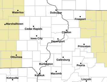
-- OR -- | Hourly Weather Graph (click on your location on the map) |
|
Coming soon... |
|
||||||
|
|||||||
Categorical Outlook |
Tornado Probabilistic Outlook |
Hail Probabilistic Outlook |
Severe Wind Probabilistic Outlook |
| Current Conditions and Seven Day Forecast
|
-- OR -- | Hourly Weather Graph (click on your location on the map) |
|
|
|
Coming Soon |
|
||||||
|
|||||||
Day 2 Categorical Outlook |
Day 2 Probabilistic Outlook |
Day 3 Categorical Outlook |
Day 3 Probabilistic Outlook |
| Current Conditions and Seven Day Forecast
|
-- OR -- | Hourly Weather Graph (click on your location on the map) |
Weather Watcher Training
Weather Watching Tools
Additional Training

