Overview
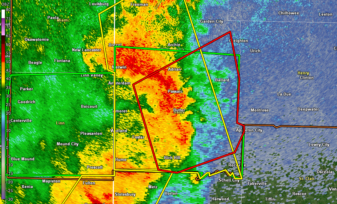
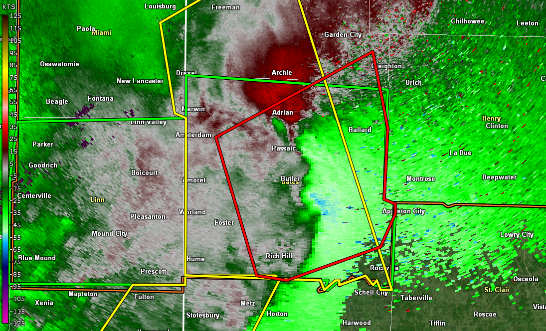
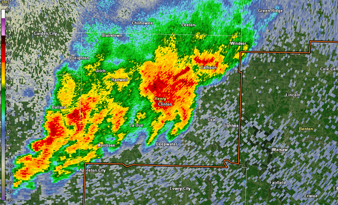
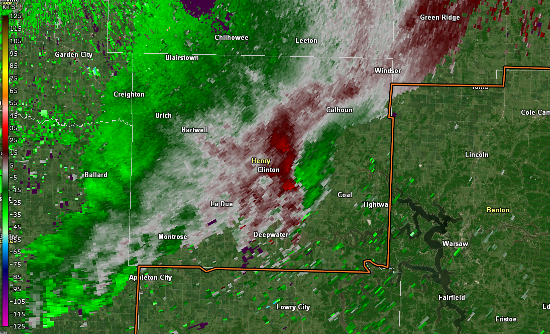
On Friday, April 26th, A supercell thunderstorm developed the evening of Friday, April 26, 2024 along the Linn (KS) and Bourbon (KS) County border, moving east between 5 and 7 PM CDT. Several reports of brief tornadoes were reported as the storm moved east-northeast into Missouri, along the Bates (MO) and Vernon (MO) county lines. Through 7 PM as it moved into far northwestern St. Clair (MO) county and finally Henry (MO) county it resulted in another few brief tornado reports. NWS Springfield has track and rating information for those storms in Bourbon (KS), Vernon (MO), and St. Clair (MO) counties. That same day, a second area of storms in far northwestern Missouri resulted in two confirmed tornadoes, the first in far northeastern Holt county, south of Skidmore via the fire department. The second tornado was part of a supercell that developed a few miles south of the Iowa border in Worth County. A tornado was reported about 1 mile south of the border, before it intensified into southern Ringgold County Iowa. WFO Des Moines has more information on the bulk of the path. On Saturday, April 27, 2024, Numerous severe thunderstorms developed over eastern Kansas and western Missouri during the afternoon and evening. Tornadoes occurred with multiple supercell thunderstorms in far northeast Kansas and northern Missouri during the afternoon and early evening. A quasi-linear convective system developed in southeast Kansas during the mid- evening hours and moved into western and central Missouri. Multiple tornadoes occurred with these storms in Bates and Henry counties.
Tornadoes:
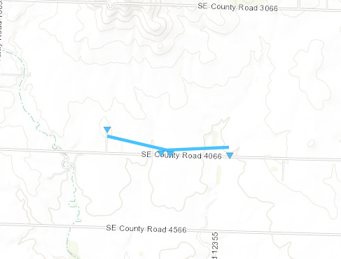
Tornado - Northeast of Rich Hill, MO
Bates County
| Date |
26 April 2024 |
| Time (Local) |
06:36 PM CDT |
| EF Rating |
EF-0 |
| Est. Peak Winds |
85 MPH |
| Path Length |
1 mile |
| Max Width |
70 yards |
| Injuries/Deaths |
0/0 |
|
Summary: A brief tornado developed in association with a supercell moving through eastern Bates County, southwest of Appleton City. This was the first tornado identified with this storm in Bates County.
|
Track Map
Downloadable KMZ File
|
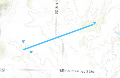
Tornado - Southeast Appleton City, MO
Bates County
| Date |
26 April 2024 |
| Time (Local) |
6:42 PM CDT |
| EF Rating |
EF-0 |
| Est. Peak Winds |
85 MPH |
| Path Length |
1.2 miles |
| Max Width |
70 yards |
| Injuries/Deaths |
0/0 |
|
Summary: This is the second brief tornado to develop associated with the supercell that moved northeast through eastern Bates County the evening of the 26th of April.
|
Track Map
Downloadable KMZ File
|
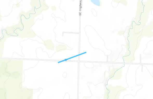
Tornado - Southeast Clinton, MO
Henry County
| Date |
26 April 2024 |
| Time (Local) |
7:32 PM CDT |
| EF Rating |
EF-0 |
| Est. Peak Winds |
75 MPH |
| Path Length |
0.25 miles |
| Max Width |
30 yards |
| Injuries/Deaths |
0/0 |
|
Summary: Associated with the same supercell as the Bates County tornadoes. This tornado was a short-lived EF-0 southwest of the Clinton Airport.
|
Track Map
Downloadable KMZ File
|
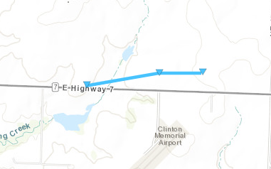
Tornado - East of Clinton, MO
Henry County
| Date |
26 April 2024 |
| Time (Local) |
7:36 PM CDT |
| EF Rating |
EF-0 |
| Est. Peak Winds |
75 MPH |
| Path Length |
0.75 miles |
| Max Width |
50 yards |
| Injuries/Deaths |
0/0 |
|
Summary: Associated with the same supercell as the tornadoes above. This tornado was a short-lived EF-0 just north of the Clinton Airport.
|
Track Map
Downloadable KMZ File
|
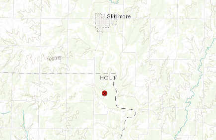
Tornado - South of Skidmore, MO
Holt County
| Date |
26 April 2024 |
| Time (Local) |
6:14 PM CDT |
| EF Rating |
EF-Unknown |
| Est. Peak Winds |
Unknown |
| Path Length |
Unknown |
| Max Width |
Unknown |
| Injuries/Deaths |
0/0 |
|
Summary: Fire Department observed a brief, weak, tornado in open country. No damage to trees or structures reported or witnessed.
|
Track Map
Downloadable KMZ File
|
Tornado - Northern Worth County
Worth County
| Date |
26 April 2024 |
| Time (Local) |
7:23 PM CDT |
| EF Rating |
EF-0 |
| Est. Peak Winds |
75 MPH |
| Path Length |
1 mile |
| Max Width |
30 yards |
| Injuries/Deaths |
0/0 |
|
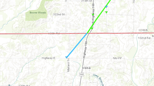
Summary: This tornado was the beginning of an EF-1 Tornado on the Iowa side of the border. This Summary is only for the Missouri Side, but it is all-one tornado per the survey. Thank you to NWS Des Moines for Surveying the path.
|
Track Map
Downloadable KMZ File
|
Tornado - White Cloud, KS
Doniphan County
| Date |
27 April 2024 |
| Time (Local) |
2:15 PM CDT |
| EF Rating |
EF-Unknown |
| Est. Peak Winds |
Unknown |
| Path Length |
0.02 miles |
| Max Width |
50 yards |
| Injuries/Deaths |
0/0 |
|
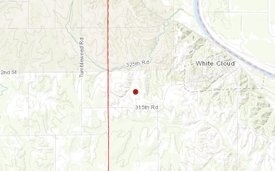
Summary: A tornado was reported by emergency management 2 miles west southwest of White Cloud at 215 pm on 4/27. A mutual aid storm survey conducted by NWS Topeka indicated no damage in the vicinity of the tornado. Therefore, the tornado is rated EF-Unknown. We thank Doniphan County emergency management and the National Weather Service in Topeka for their help in completing this survey.
|
Track Map
Downloadable KMZ File
|
Tornado - Gentry, MO
Gentry County
| Date |
27 April 2024 |
| Time (Local) |
4:12 PM CDT |
| EF Rating |
EF-1 |
| Est. Peak Winds |
90 MPH |
| Path Length |
11.81 miles |
| Max Width |
250 yards |
| Injuries/Deaths |
0/0 |
|
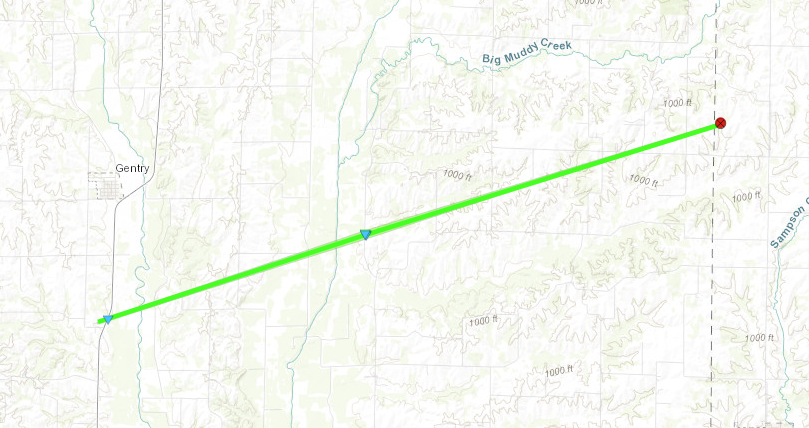
Summary: This EF1 tornado began near or just west of U.S. Highway 169 south of Gentry, where a tractor trailer was blown over. Little damage was observed as the tornado moved northeast to 558 Road southeast of Gentry. A residence at this location sustained roof damage, damage to multiple grain bins, and complete destruction of a small barn. Multiple tree limbs were downed in the area, and debris from inside the barn was strewn around the property. The tornado continued northeast from this location, but little damage was observed beyond this point. The end point is estimated based on spotter reports of the tornado crossing into Harrison County before lifting, though it is possible the tornado lifted before this. We thank Gentry County Emergency Management for their help in conducting this survey.
|
Track Map
Downloadable KMZ File
|
Tornado - Spickard, MO
Grundy County
| Date |
27 April 2024 |
| Time (Local) |
4:58 PM CDT |
| EF Rating |
EF-0 |
| Est. Peak Winds |
70 MPH |
| Path Length |
3.89 miles |
| Max Width |
100 yards |
| Injuries/Deaths |
0/0 |
|
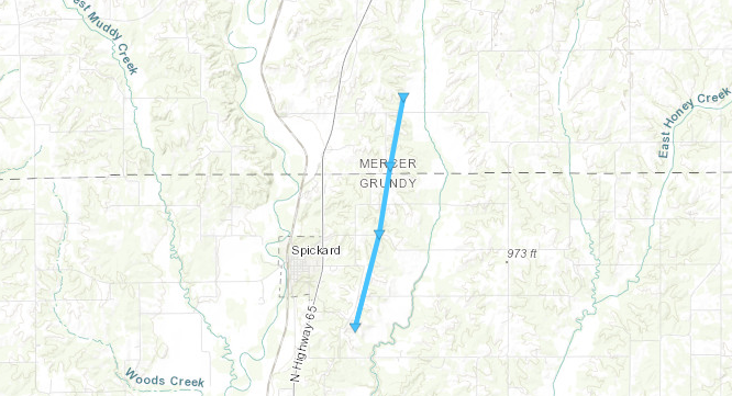
Summary:
A weak EF0 tornado began southeast of Spickard east of 7th Avenue, producing sporadic and intermittent tree damage along its path. The tornado tracked north-northeast across Hwy B and
County Line Road into Mercer County before dissipating north of Jasper Road. We thank Grundy County emergency management for their
help in conducting this survey.
|
Track Map
Downloadable KMZ File
|
Tornado - Brookfield, MO
Linn County (MO)
| Date |
27 April 2024 |
| Time (Local) |
6:40 PM CDT |
| EF Rating |
EF-Unknown |
| Est. Peak Winds |
Unknown |
| Path Length |
0.04 miles |
| Max Width |
50 yards |
| Injuries/Deaths |
0/0 |
|
Summary:
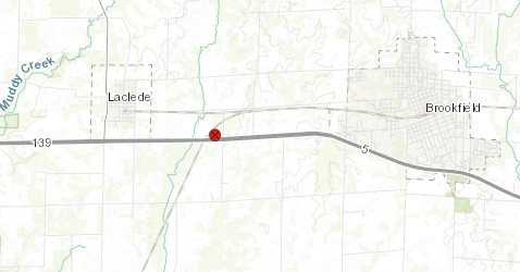
A trained spotter reported a brief tornado just west of Brookfield at 640 pm. No damage was observed. Therefore, the tornado is rated as EF-Unknown.
|
Track Map
Downloadable KMZ File
|
Tornado - Butler, MO
Bates County
| Date |
27 April 2024 |
| Time (Local) |
8:23 PM CDT |
| EF Rating |
EF-1 |
| Est. Peak Winds |
95 MPH |
| Path Length |
2.45 miles |
| Max Width |
250 yards |
| Injuries/Deaths |
0/0 |
|
Summary:
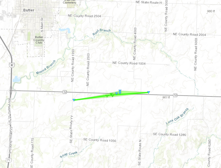
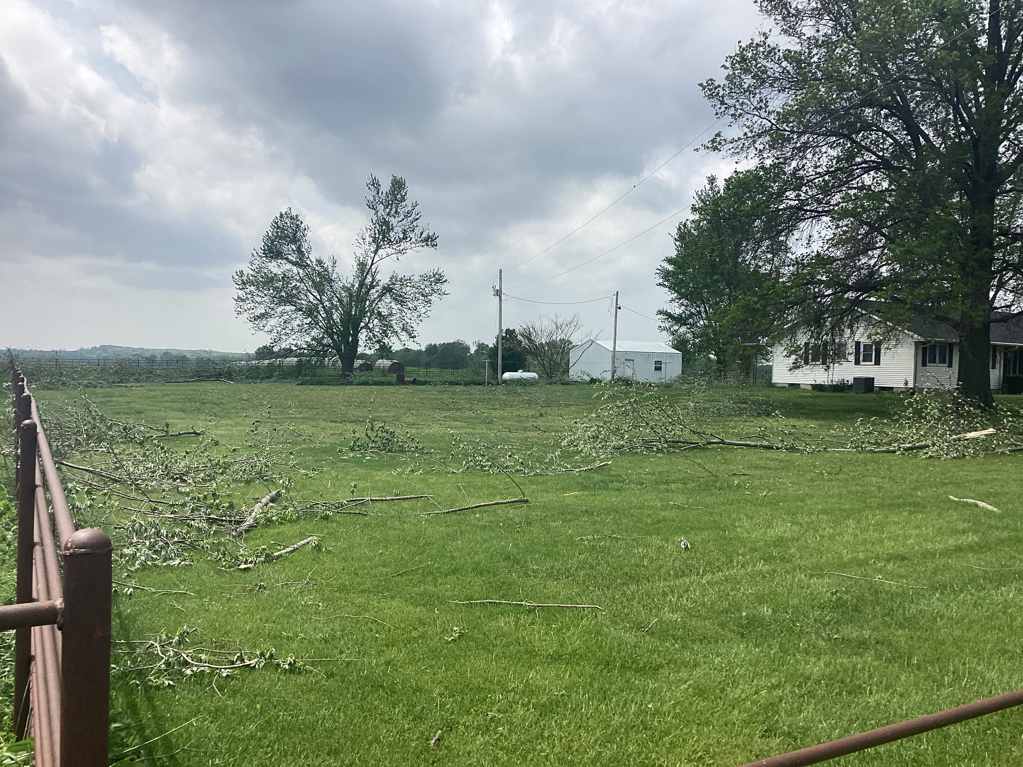
This tornado began just east of Route YY and just south of State Highway 52 southeast of Butler in Bates County, where minor tree damage was observed. The tornado strengthened as it moved east-northeast toward SH 52, snapping or uprooting several trees at a residence just south of the highway. The fallen trees were in a variety of directions, confirming the presence of a tornado. The tornado continued along the highway east past Route N, where power poles were damaged and additional minor tree damage was
observed. The last signs of damage were just east of Route N, where small limbs were downed at a residence.
|
Track Map
Downloadable KMZ File
|
Tornado - Ballard, MO
Bates County
| Date |
27 April 2024 |
| Time (Local) |
8:30 PM CDT |
| EF Rating |
EF-1 |
| Est. Peak Winds |
95 MPH |
| Path Length |
10.64 miles |
| Max Width |
500 yards |
| Injuries/Deaths |
0/0 |
|
Summary:
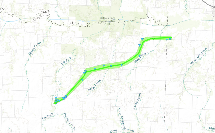
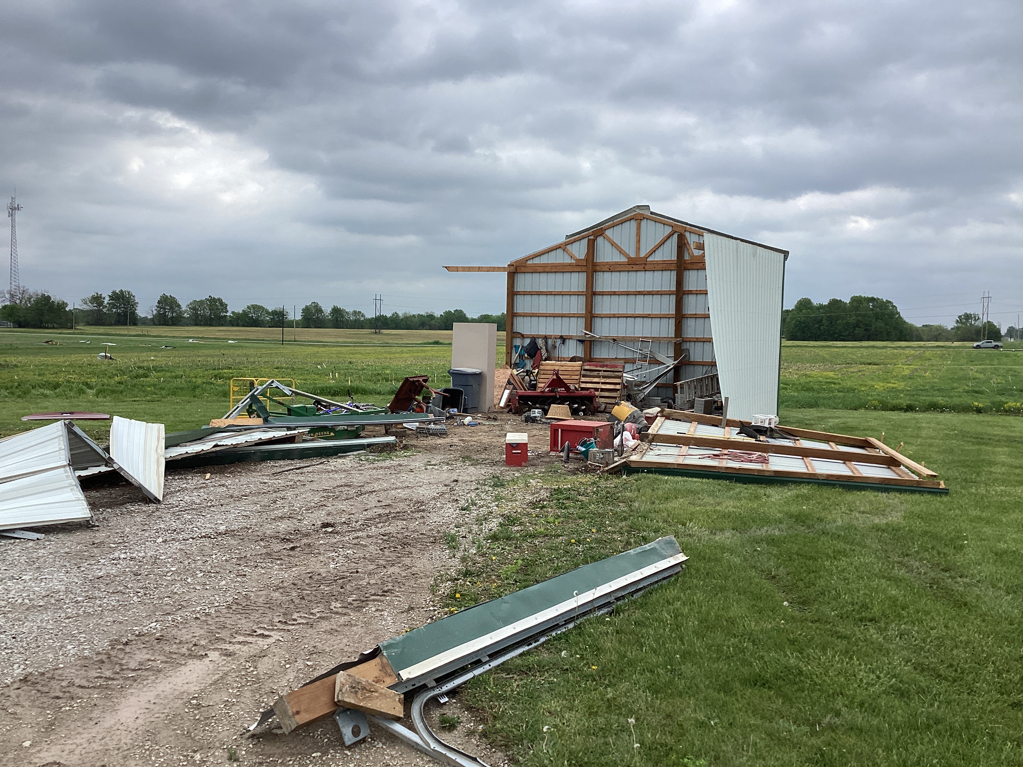
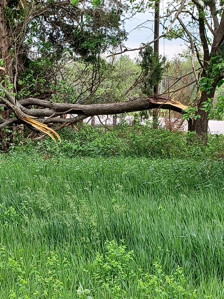
This EF1 tornado began just south of Route 18 east of Passaic. Some of the worst damage of the tornado affected a farm property, where one outbuilding collapsed, another had a garage door blown off, and multiple trees were damaged or uprooted. Large debris from the damaged property was blown well northeast, in some cases
over 100 yards. The tornado tracked northeast, damaging a grove of trees to the south of SH 18 and producing minor damage to an outbuilding and mobile home on the north side of the highway. The tornado then tracked northeast to Route T, producing sporadic tree damage and some minor property damage. The damage track
continued east-northeast along County Road 13004, with more sporadic tree damage. One of the larger trees fell onto a residence, damaging the property as well as power lines.
Intermittent tree damage continued northeast to Route BB and County Road 13003, with more significant tree damage eastward along Sunset Drive just west of the Henry County line. Damage
became more intermittent eastward into Henry County, with no damage observed a half mile past the county line. However, much of this area north of 400 Road in Henry County is inaccessible,
so it is possible the tornado continued a short distance longer to the north or northeast of the end of the preliminary track.
|
Track Map
Downloadable KMZ File
|
Tornado - Montrose, MO
Bates County
| Date |
27 April 2024 |
| Time (Local) |
8:45 PM CDT |
| EF Rating |
EF-0 |
| Est. Peak Winds |
70 MPH |
| Path Length |
2.45 miles |
| Max Width |
300 yards |
| Injuries/Deaths |
0/0 |
|
Summary:
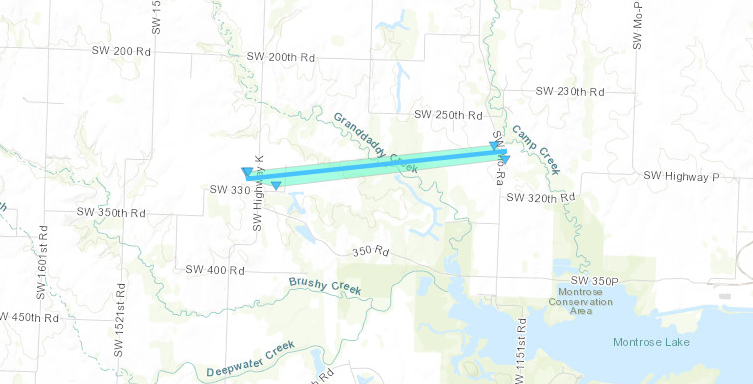
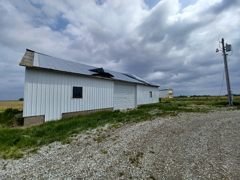
A brief EF0 tornado occurred north of Montrose from the same mesovortex that produced the tornado just southeast of Butler. The first signs of damage occurred just west of Route K, where a farm building had metal roofing damage, and small trees were downed. A larger tree was split just east of Route K, with other minor limbs downed in the area. The tornado moved through generally inaccessible property before reaching Route RA between County Roads 250 and 320, where multiple trees suffered damage. No damage was noted farther west or east of this path. Given that the tree damage was in a variety of directions, the damage confirms the presence of a brief tornado. The also received spotter video of a power flash in this general area, with a strong indication of rotation on radar.
|
Track Map
Downloadable KMZ File
|
The Enhanced Fujita (EF) Scale classifies tornadoes into the following categories:
EF0
Weak
65-85 mph |
EF1
Moderate
86-110 mph |
EF2
Significant
111-135 mph |
EF3
Severe
136-165 mph |
EF4
Extreme
166-200 mph |
EF5
Catastrophic
200+ mph |
 |
Photos & Video
Photos from Damage Surveys
Storm Reports
Insert storm reports here. Copy in PNS or paste map.
Rain Reports
Insert rainfall reports here. Copy in PNS, paste rainfall map, or create table.





 Weather Story
 Weather Map
 Local Radar
 Follow us on X
 Follow us on Facebook
 Follow us on YouTube
 EAX RSS Feed