

Nationwide Test of Emergency Alert System - Today - November 17, 2026 at 1:20 PM CST
Published 2026-11-17
FEMA and FCC EAS Test November 17, 2026 at 1:20 PM CST

Heavy to excessive rainfall will continue to threaten considerable flash and urban flooding impacts over the east central Florida coast from Palm Coast to near Melbourne through today. A subtropical or tropical storm may form near or offshore of the southeast U.S. coast this weekend. Regardless of development, strong winds, rough surf, coastal flooding, and heavy rain are likely. Read More >
| < | November 2026 | |||||
| Sun | Mon | Tue | Wed | Thu | Fri | Sat |
|
1
|
2
|
3
|
4
|
5
|
6
|
7
|
|
8
|
9
|
10
|
11
|
12
|
13
|
14
|
|
15
|
16
|
18
|
19
|
20
|
21
|
|
|
22
|
23
|
24
|
25
|
26
|
27
|
28
|
|
29
|
30
|
1
|
2
|
3
|
4
|
5
|
FEMA and FCC EAS Test November 17, 2026 at 1:20 PM CST
Service to the the NOAA Weather Radio transmitter in Cameron (KZZ85) has been interrupted by a fire at a third party facility. There is no estimated time for a return to service, but we encourage members of the public to have multiple ways to receive weather information. We apologize for any inconvenience this outage may cause.
The National Weather Service (NWS) office in Kansas City/Pleasant Hill MO will be conducting a required, scheduled update to their Advanced Weather Interactive Processing System (AWIPS) system from 7 am Monday June 9th through approximately 4 pm Wednesday June 11th.
The National Weather Service in Kansas City is postponing the schedule weekly Weather Radio test due to ongoing/expected hazardous weather. The radio test will be conducted on the next good weather day.
Soliciting Comments through November 2, 2024 on the Discontinuation of the Max/Min Temperature and Precipitation Table Product (RTP) for all NWS Central Region Offices.
Are you #WeatherReady for the Winter? Check out our latest weather safety graphics, videos, social media posts, and more at: weather.gov/wrn/winter_safety
Some Perspective on the October 26, 2020 Early Season Snow Event
Late Tuesday afternoon an area of thunderstorms developed over southeastern Kansas, tracking northeast and eventually producing both a 31.82 mile long EF-4 tornado across Douglas and Leavenworth counties in Kansas, and a 5.84 mile long EF-2 tornado near Kearney, MO.
A couple of brief tornadoes developed near Longview Lake, Lake Lotawana, and southern Lafayette County on the evening of May 24th causing minor damage to trees and some structural damage.

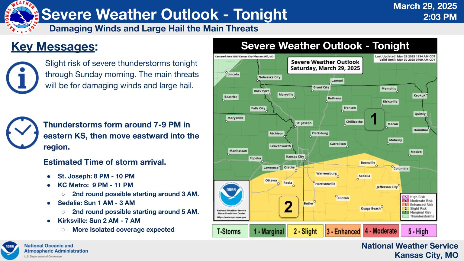 Weather Story
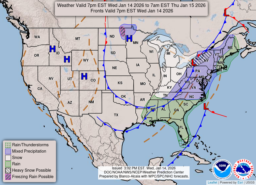 Weather Map
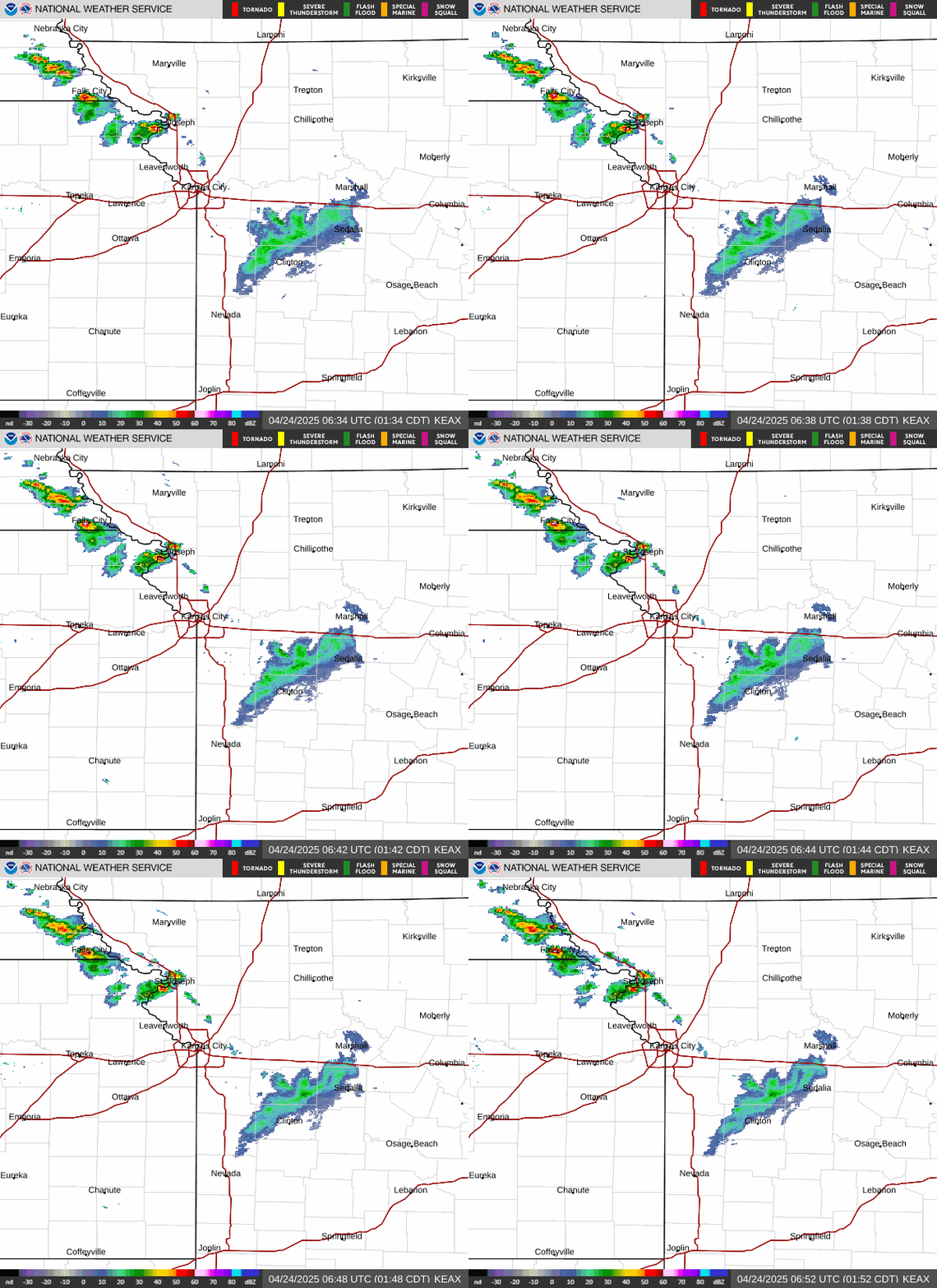 Local Radar
 Follow us on X
 Follow us on Facebook
 Follow us on YouTube
 EAX RSS Feed