
Dangerous and extreme heat will remain across portions of the southern U.S. this week. Heavy rainfall may bring significant flash flooding across portions of the Mid-Atlantic and Northeast through the night, and additional flash flooding concerns across New England on Wednesday. Monsoonal thunderstorms will bring a flash flood risk to the Four Corners region, especially in burn scar areas Read More >
May 4, 2003 Radar and Damage Photos
Below is a collection of Radar, Damage, and Tornado pictures from the May 4, 2003 tornadic event.
| Tornado Outbreak - May 4, 2003 | |
 |
 |
| Radar images of tornadic supercell over Clay County Missouri, just north-northeast of downtown Kansas City | |
 |
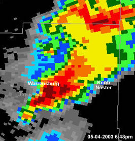 |
| Radar images of tornadic supercell in Cass and Johnson Counties in Missouri | |
 |
 |
|
||||
| Click on the Image for Larger Versions | ||||||
Tornado Outbreak - May 4, 2003 - South of Basehor, KS
The images below were taken by Christina Frazier on May 4, 2003 south of Basehor, KS
 |
 |
 |
 |
 |
 |
 |
| Tornado Outbreak - May 4, 2003 - Kansas City, KS The images of a tornado below were taken by Andrew Revering on May 4, 2003 near the intersection of Interstate 70 and 110th street looking north northeast.
|
||||||||
|
|
|||||
|
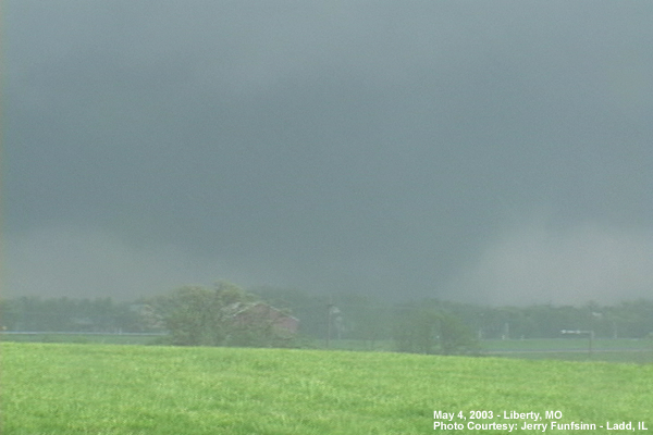
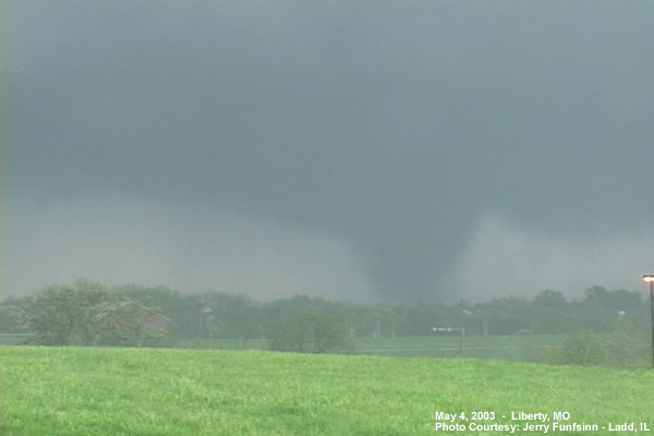
Tornado Outbreak - May 4, 2003 - Liberty, MO
|
||||
| Tornado Outbreak - May 4, 2003 - Southwest of Knob Noster, MO The images below were taken by Dave Ewoldt on May 4, 2003 southwest of Knob Noster, MO
|
||||||||||||||
|
Tornado Outbreak - May 4, 2003 - near Intersection of Highway 2 & Highway 131
|
|||||||||||
|
Tornado Outbreak - May 4, 2003 - Kansas City, KS
|
|||||
|
Tornado Outbreak - May 4, 2003 - Leavenworth County - Platte County - Clay County
|
||||||||


")
")
")


 Weather Story
 Weather Map
 Local Radar