
Flash flooding threatens areas from the Tennessee Valley to the Carolinas as storms repeat along a stalled front. Monsoonal storms may trigger flooding in the Southwest. Dangerous heat expands across the Desert Southwest, Plains, mid-Mississippi Valley and Southern Tier. Critical fire weather for interior Pacific Northwest. Cooler, drier air brings brief relief to the Great Lakes and Northeast. Read More >
Overview
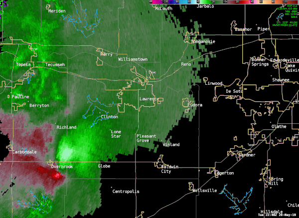
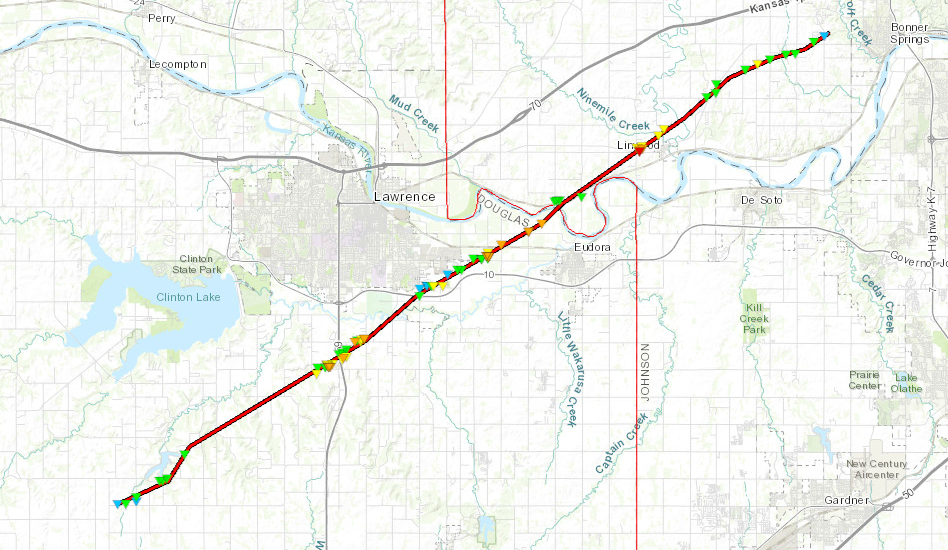
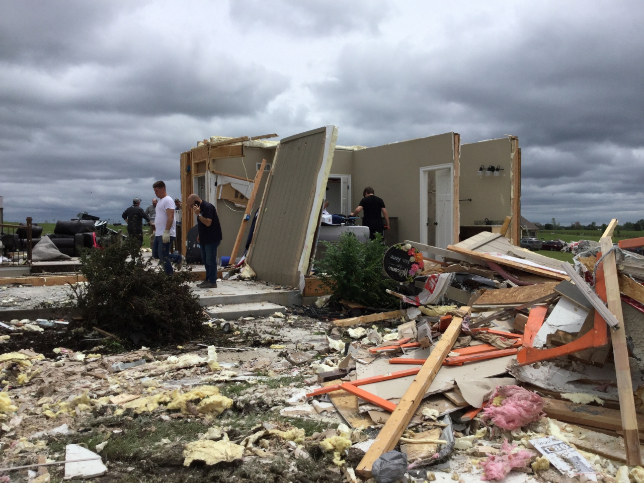
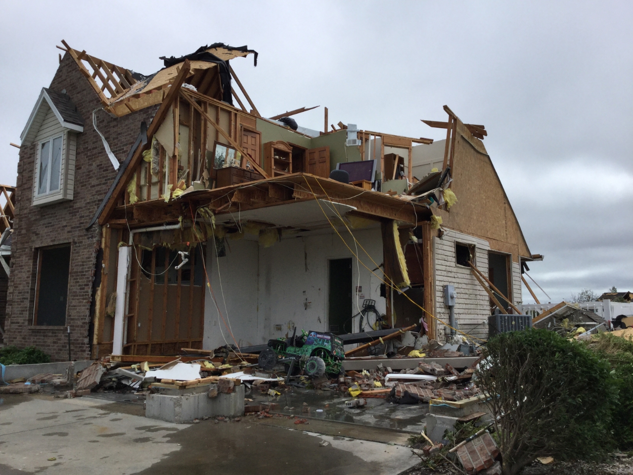
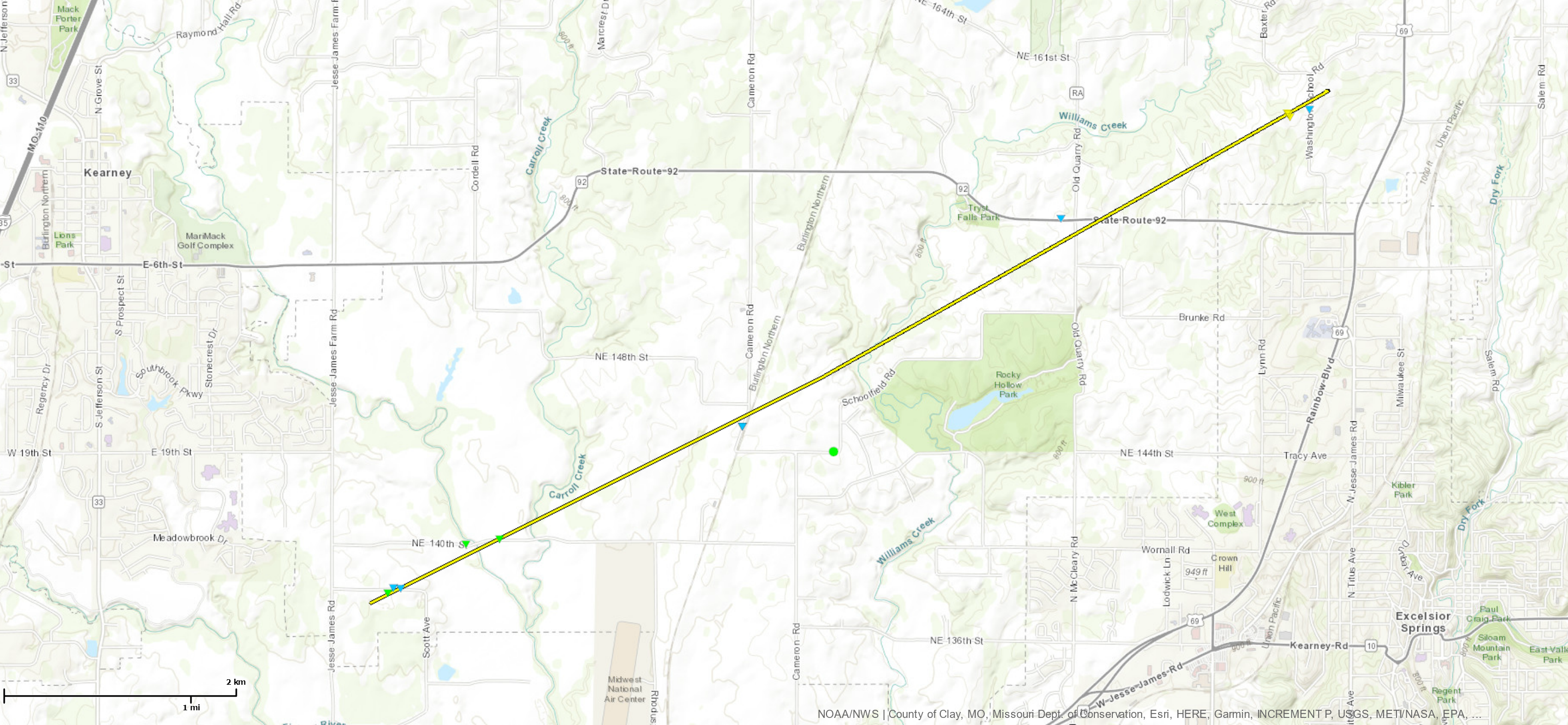
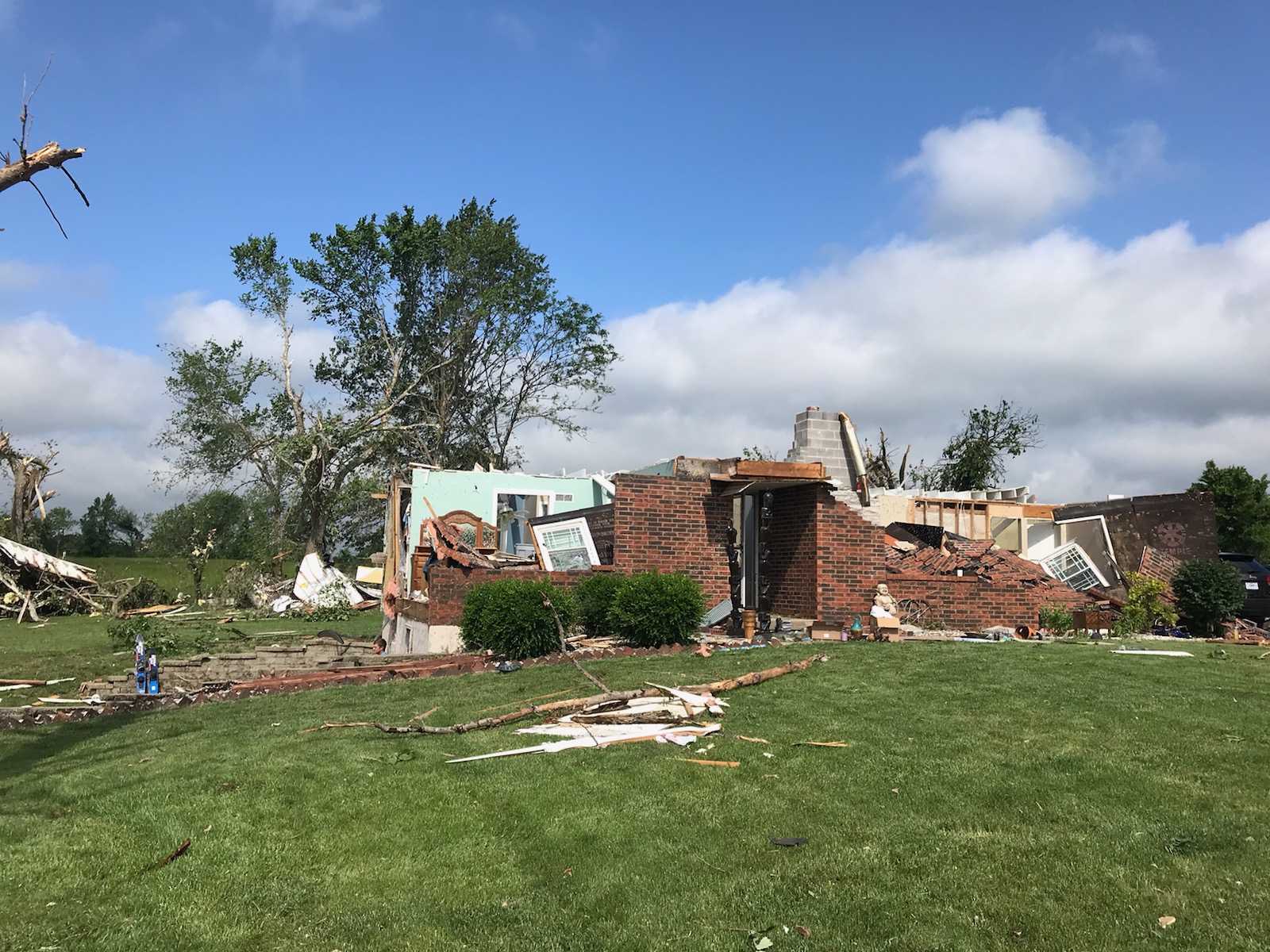
Late Tuesday afternoon, an area of thunderstorms developed over southeastern Kansas; through 4 PM, these storms became anchored on a warm front, which provided a source of forcing and enhanced low level wind shear. The strongest storm developed a tornado south of Clinton Lake in southwestern Douglas County, KS (NWS Topeka) and continued through southeastern Lawrence, KS (NWS Topeka) before crossing into Leavenworth County, KS, moving through the town of Linwood, KS and the area west of Bonner Springs, KS. The storm began to cycle as it moved into the western Kansas City Metro area and stopped producing a tornado. As it moved east and northeast, a new tornado developed in Clay County, MO, near Kearney, MO, which ended just north of Excelsior Springs, MO.
Tornadoes
|
Tornado - Douglas/Leavenworth County
|
||||||||||||||||
|
||||||||||||||||
|
Tornado - Kearney, MO
|
||||||||||||||||
|
||||||||||||||||
The Enhanced Fujita (EF) Scale classifies tornadoes into the following categories:
| EF0 Weak 65-85 mph |
EF1 Moderate 86-110 mph |
EF2 Significant 111-135 mph |
EF3 Severe 136-165 mph |
EF4 Extreme 166-200 mph |
EF5 Catastrophic 200+ mph |
 |
|||||
Photos & Video
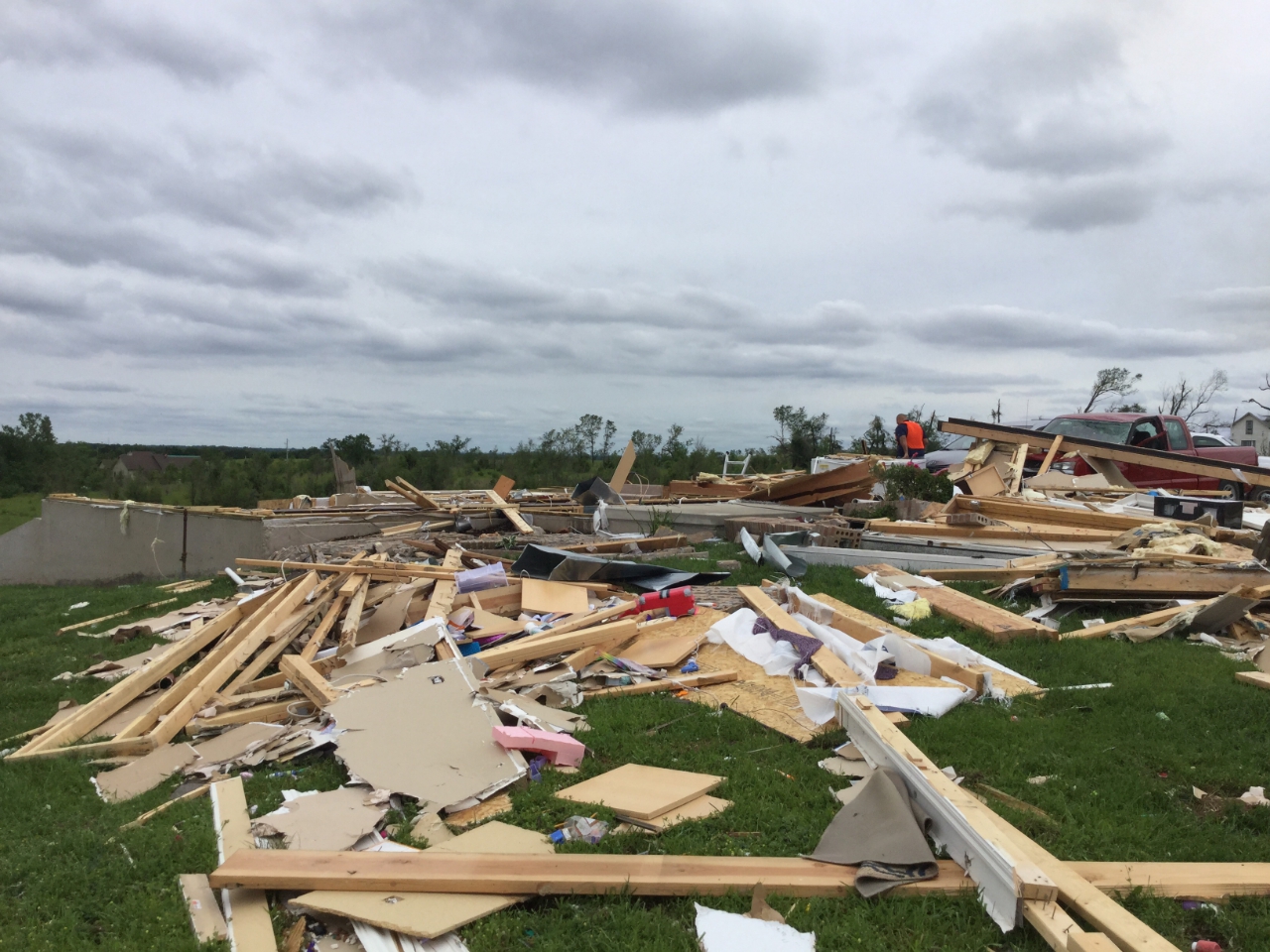
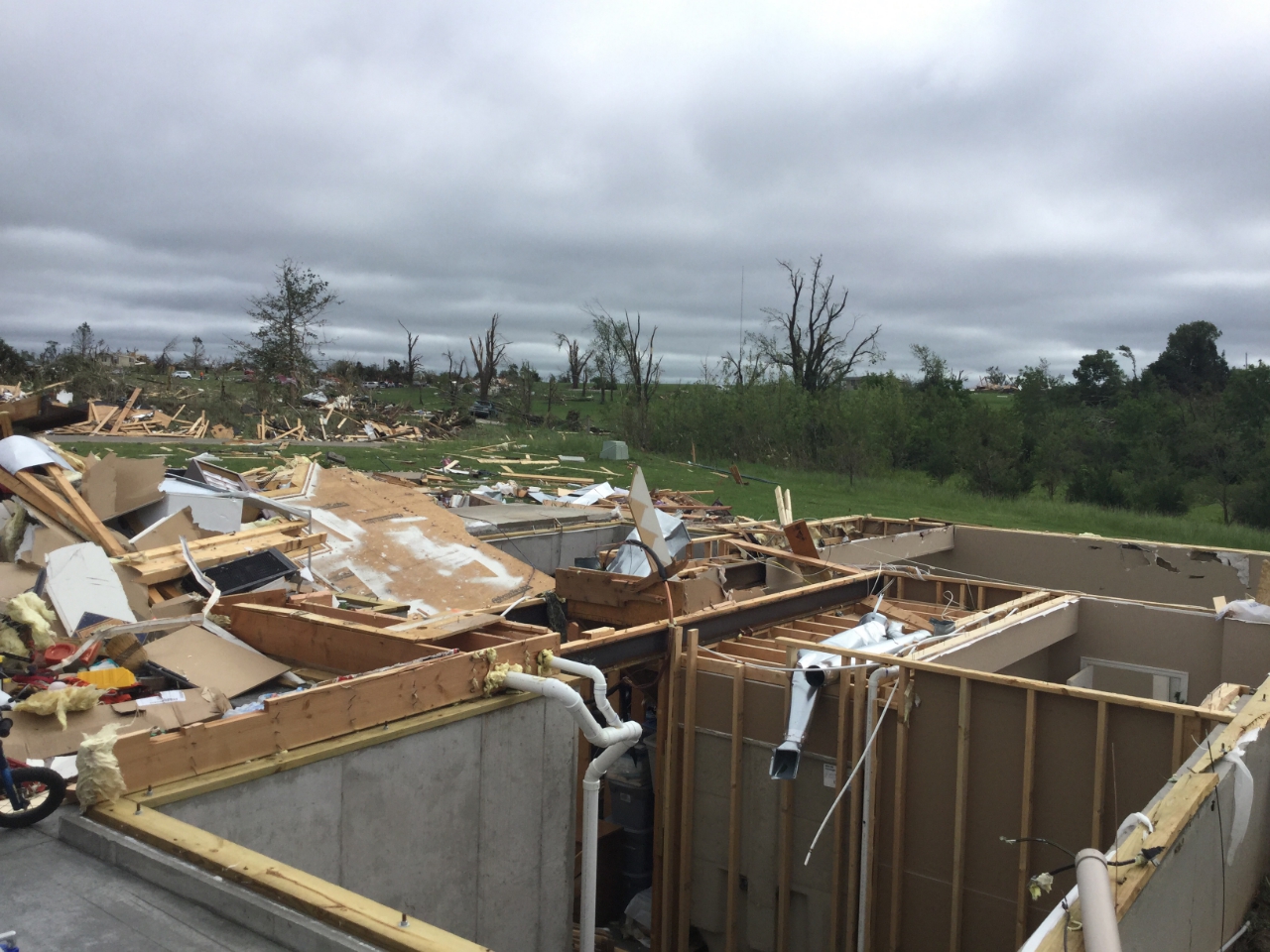
Additional Photos from the May 28, 2019 Tornadoes
 |
 |
.jpg) |
 |
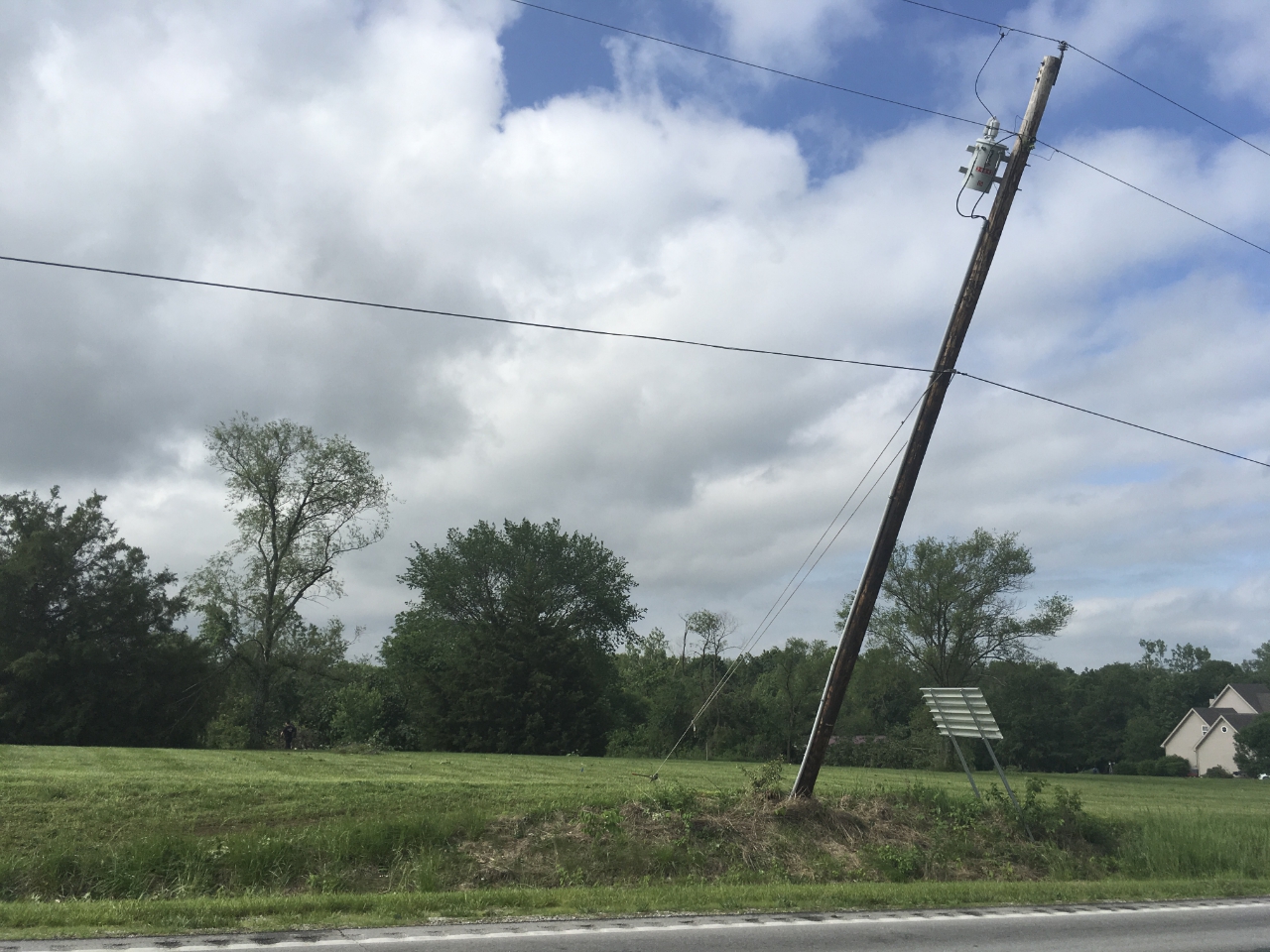
| Power poles leaning from Kearney, MO; EF-2 (NWS Survey) |
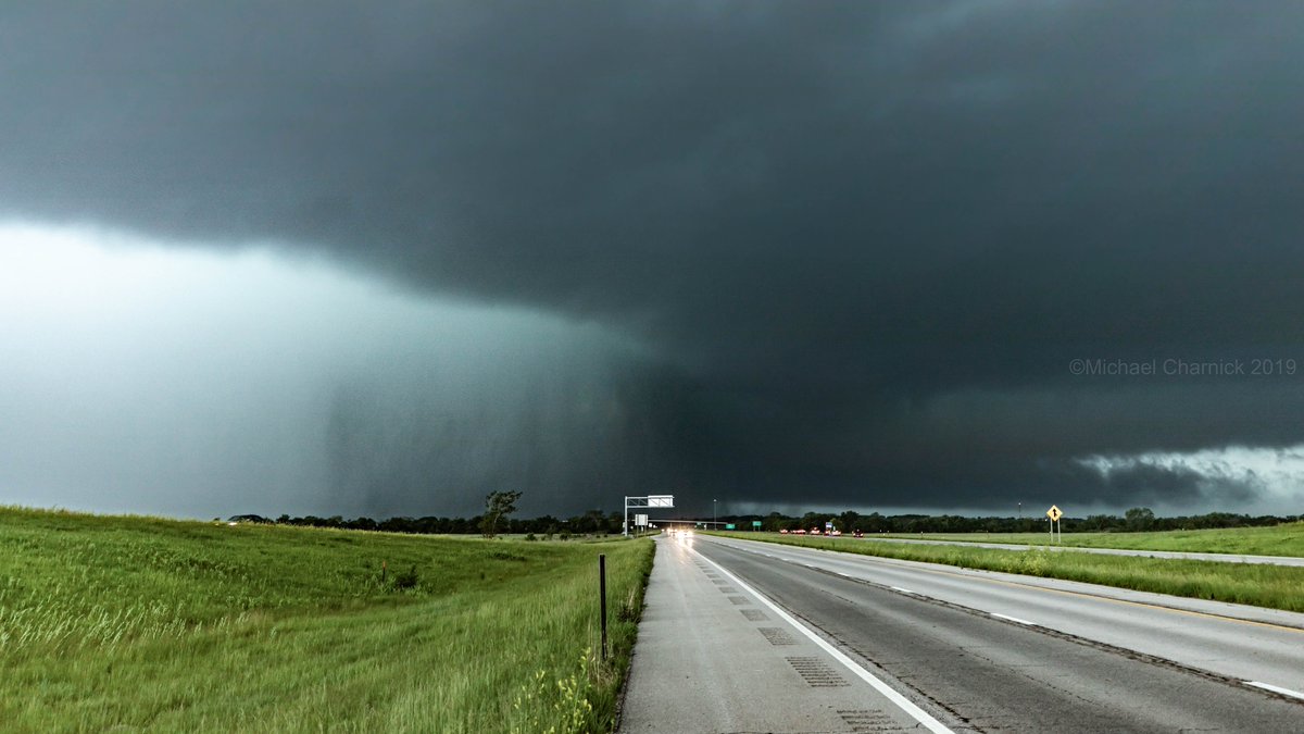
View of Thunderstorm responsible for the Linwood, KS Tornado (@charnick_wx) |
Damage to the greenhouse in Linwood, KS (NWS Survey) |
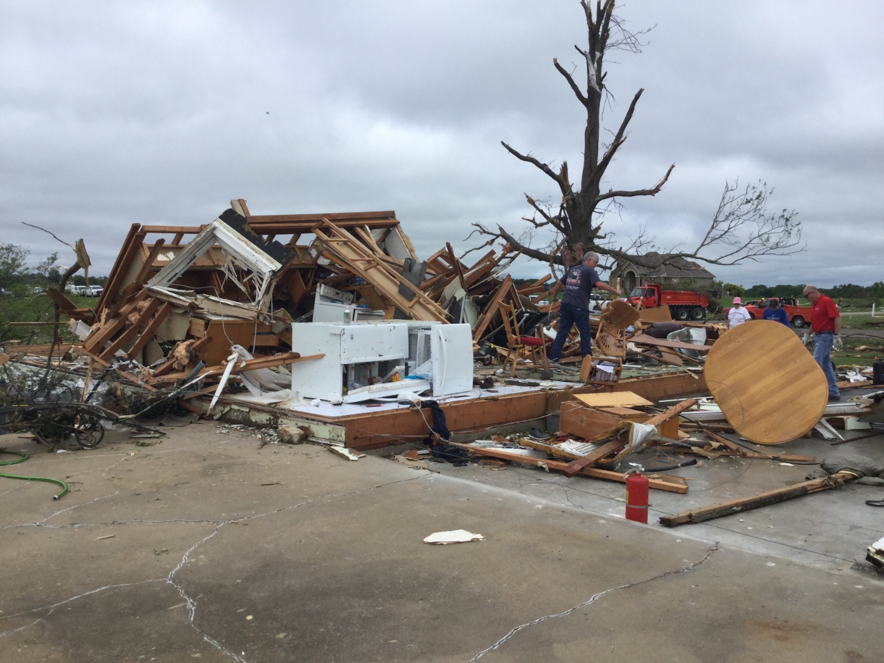
EF-3 damage to a home in Linwood, KS (NWS Survey) |
Radar Imagery
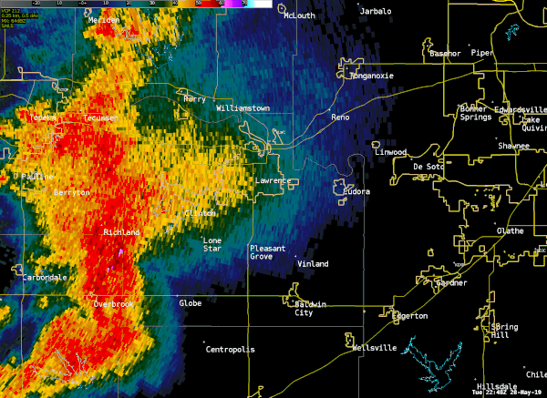
KTOP 0.5° Reflectivity and Velocity
 |
 |
| Loop of radar reflectivity (0.5 degree) from the KTOP radar throughout the Douglas/Leavenworth county tornado. |
Loop of radar storm-relative velocity (0.5 degree) from the KTOP radar throughout the Douglas/Leavenworth county tornado. |
 |
Media use of NWS Web News Stories is encouraged! Please acknowledge the NWS as the source of any news information accessed from this site. |
|


.jpg)
.jpg)
 Weather Story
 Weather Map
 Local Radar