
Widespread, life-threatening considerable flash flooding is expected in south-central Texas through at least Friday. Catastrophic river flooding and rapid rises on small streams, arroyos, and typically dry washes are expected in the Texas Hill Country. Wildfire smoke is impacting air quality across much of the Great Lakes region into the Northeast U.S. with Air Quality Alerts in effect. Read More >
Kansas City/Pleasant Hill, MO
Weather Forecast Office
August 5, 2017 Flash Flooding in Kansas City
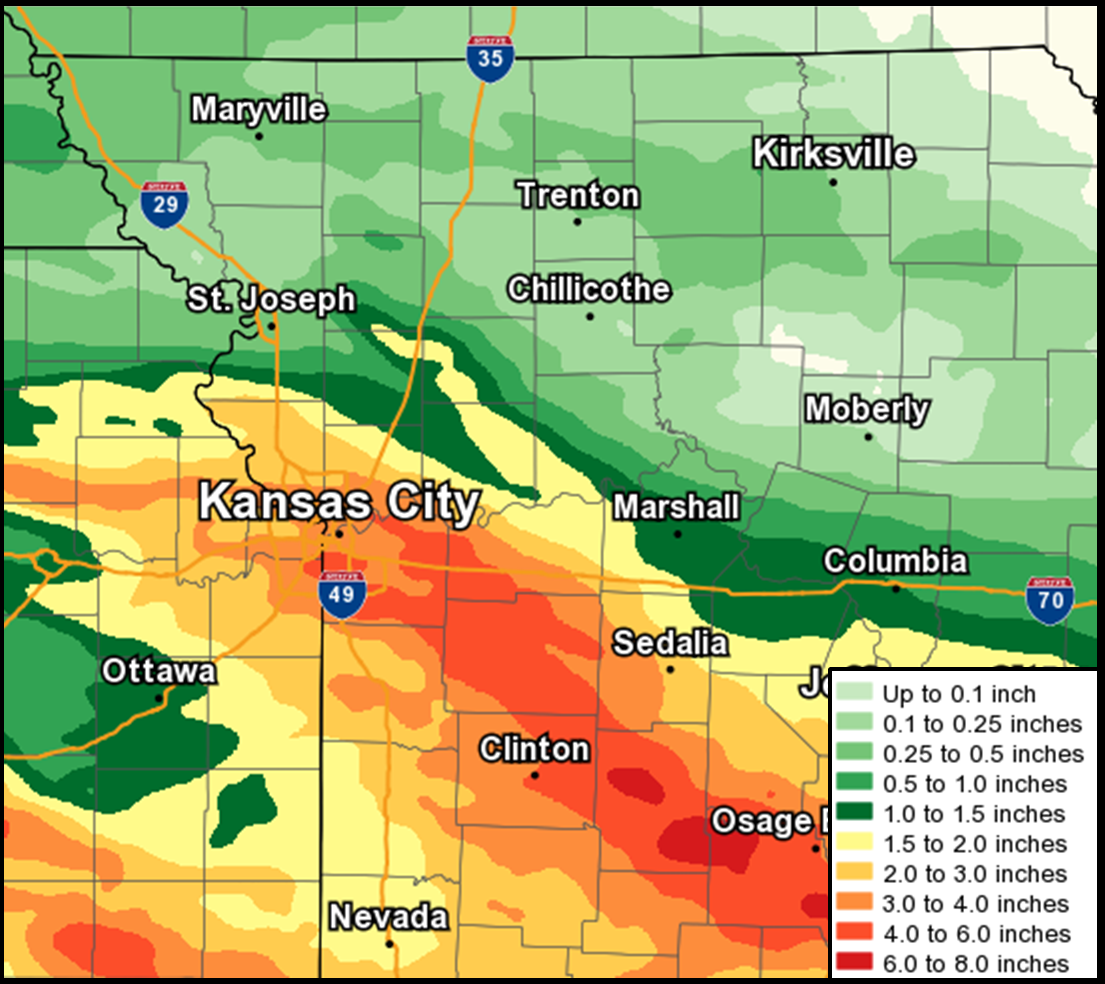
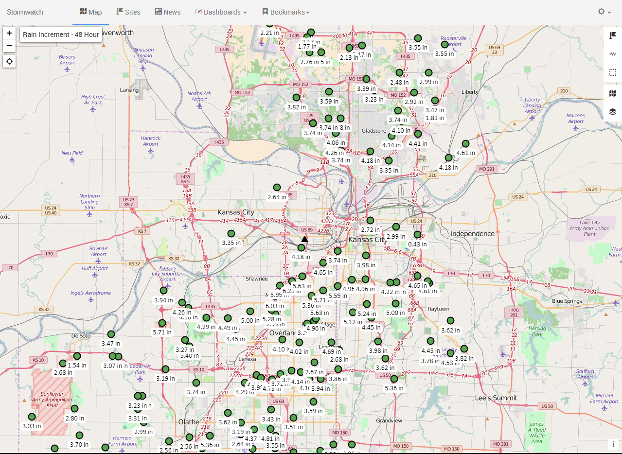
On the evening of August 5, 2017 a round of thunderstorms formed just north of Kansas City. The orientation of these storms ensured that repeated heavy rain would run over the same areas. This training of thunderstorms produced prolonged heavy rain over the Kansas City Metro area resulting in 3 to 6 inches of rain over a 4-6 hour period and causing quite a bit of flooding in and around Kansas City. Most notable was the flooding in and around Westport, where 3 to 4 feet of water came up to the businesses. Several water rescues were conducted around Kansas City through the evening and overnight hours, but remarkably no one was injured or killed in this event. To the east and south of Kansas City, numerous rural roads and streams encountered flooding, which caused numerous road closures in areas predominantly south of Interstate 70.
 |
 |
| Storm totals across eastern Kansas and western Missouri mostly in the 3 to 6 inch range, with some locations approaching 7 inches. |
Rainfall totals in the Kansas City Metro area generally ranged from 2 to 4 inches. Image from stormwatch.com |
Click on images for larger versions
Hazards
Decision Support
Situation Report
Local Weather Story
Submit Report
Storm Prediction Center
Weather Prediction Center
National Hurricane Center
Active Alerts
National Radar
Current Weather
Local Radar
Local Precipitation/Temperature
National Radar
Satellite
Observations
Observed Precipitation
Water and Air
Air Quality
Missouri Basin RFC
National Rivers
Local Rivers
Forecasts
Decision Support
Weather Story
Forecast Discussion
Local Fire Weather
National Fire Weather
Aviation Weather
FAA Center Weather
Graphical Forecasts
Weather Prediction Center
Space Weather Center
Climate
Climate Prediction Center
KC Records and Normals
KC Holiday Climate
KC Seasonal Rankings
National Climate Services
Climate Data Center
Drought
Local Storm Reports
US Dept of Commerce
National Oceanic and Atmospheric Administration
National Weather Service
Kansas City/Pleasant Hill, MO
1803 North 7 Highway
Pleasant Hill, MO 64080-9421
816-540-6132 (6021 automated weather)
Comments? Questions? Please Contact Us.


 Weather Story
 Weather Map
 Local Radar