
A slow moving front will bring rounds of strong to severe thunderstorms and heavy rainfall to the central Plains eastward to the east-central U.S.. The first widespread significant heat wave of summer for the Intermountain West and Plains is expected to develop today and expand through next week. Dangerous heat will continue to impact portions of the Southwest and Southeast. Read More >
Overview
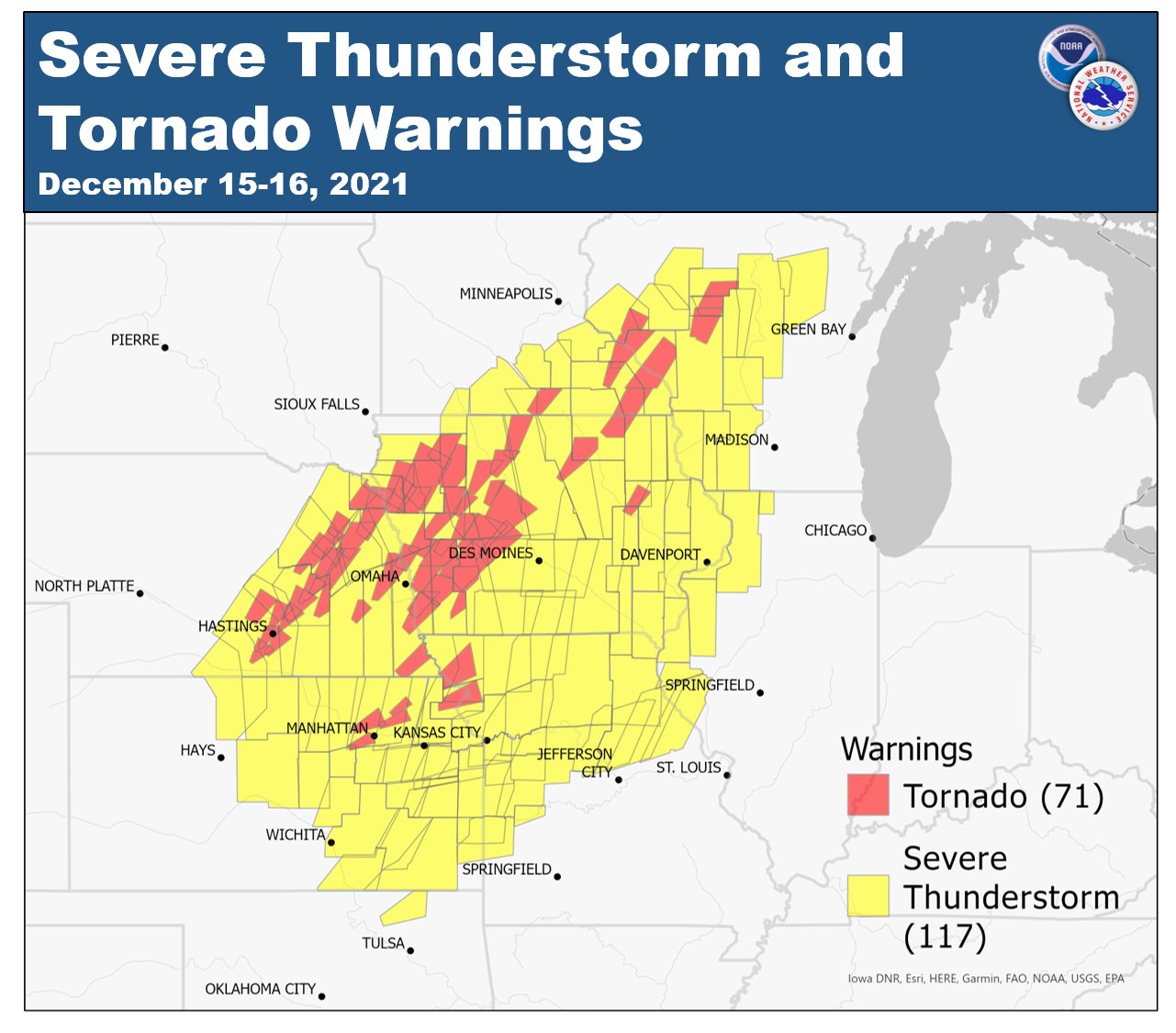
On December 15, 2021, a large-scale weather event rolled through the Central Plains and Upper Midwest bringing tornadoes, dust storms, wildfires, and snow across several central and northern states. Record high temperatures were set across the region including Kansas City, with the Kansas City International Airport tying its all-time December high temperature.
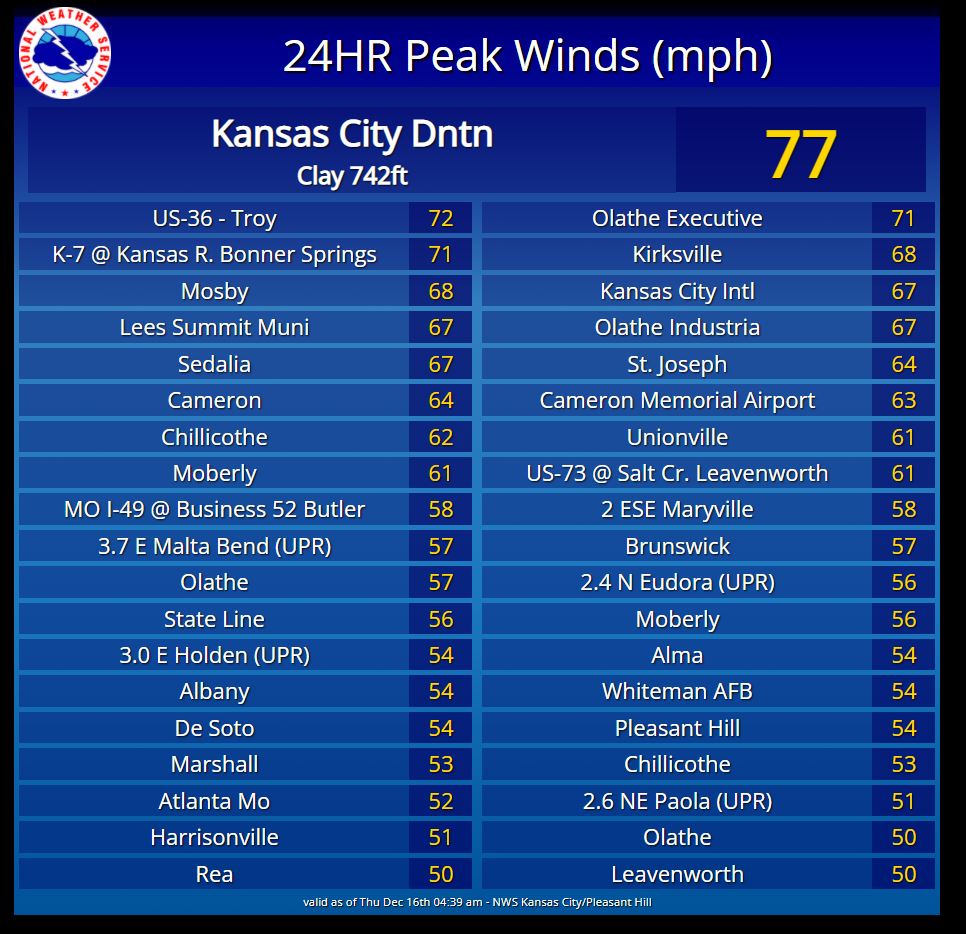
Non-convective winds both ahead and behind the thunderstorms were quite strong. Several locations around the area reported wind gusts above 50 MPH with Lees Summit peaking at 53 MPH, St. Joseph reached 52 MPH, and Johnson County Executive Airport in Olathe, KS reached 60 MPH. Once the line of storms arrived, several areas reported winds in excess of 75 MPH. The Kansas City Downtown Airport reached a peak gust of 77MPH. This resulted in the roof damage to a few airport buildings. Numerous trees and power poles fell across much of eastern Kansas and western Missouri. Areas in far northwest Missouri observed winds of 80-90 MPH as the thunderstorms moved through. Several homes and buildings were damaged across northern Missouri including missing shingles, peeled siding, and blown out windows.
Photos & Video
 |
 |
 |
 |
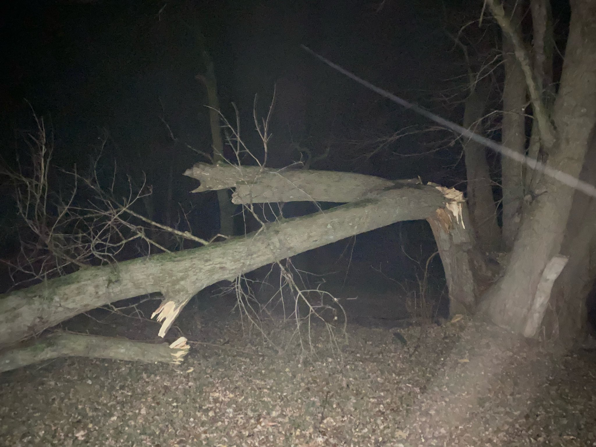
| Tree fallen in the Brookside neighborhood of Kansas City, MO. (source: Social Media) |
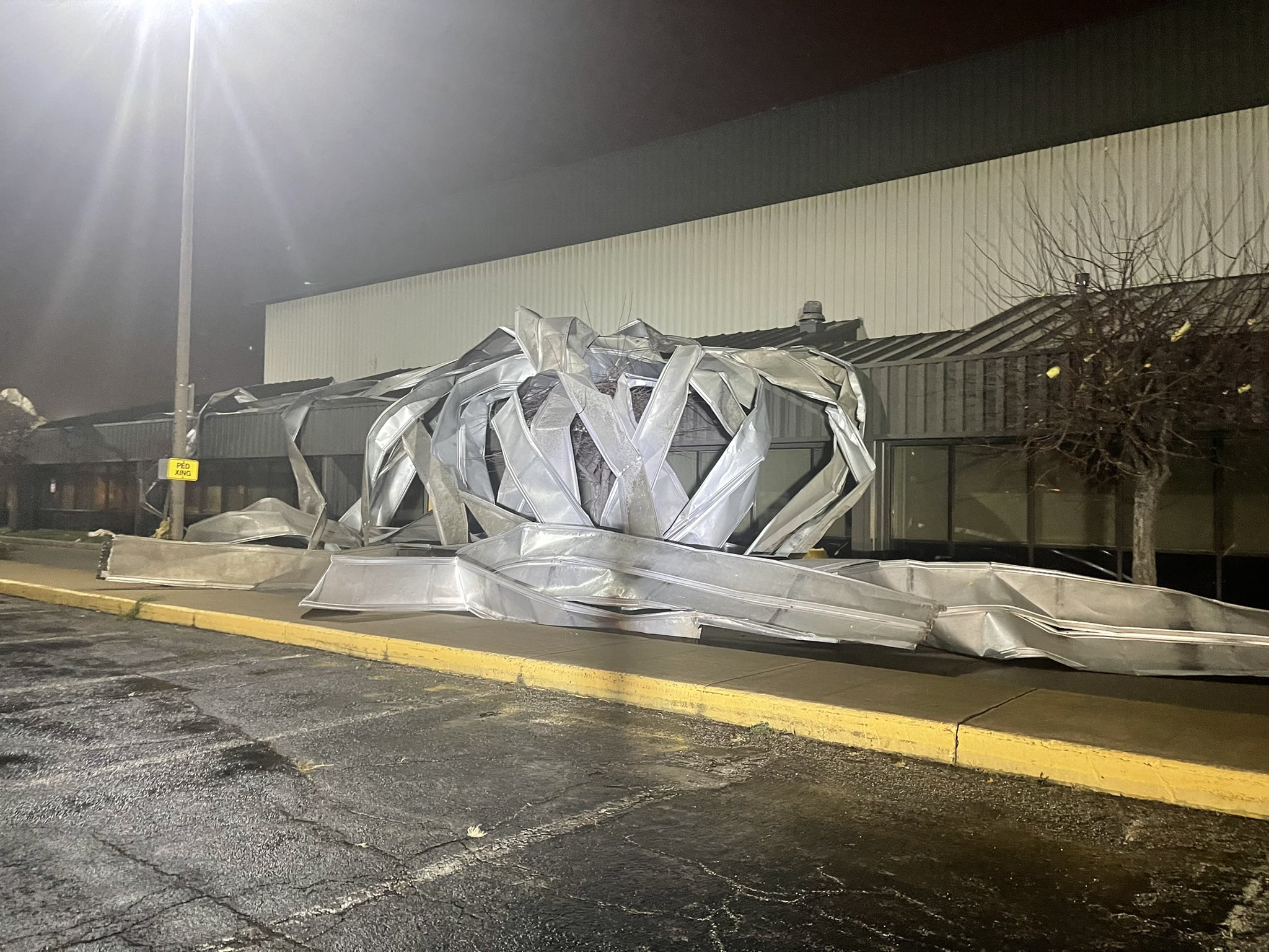
Roof damage to an airport building at the Kansas City Downtown Airport (source: Broadcast Media) |
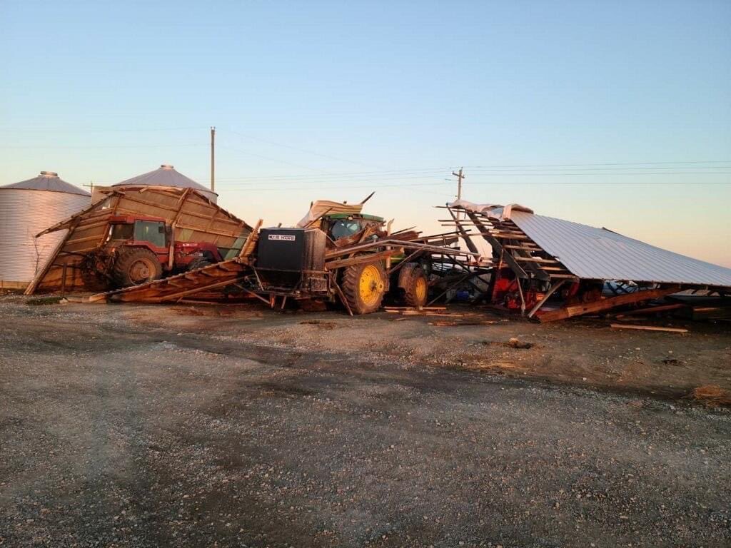
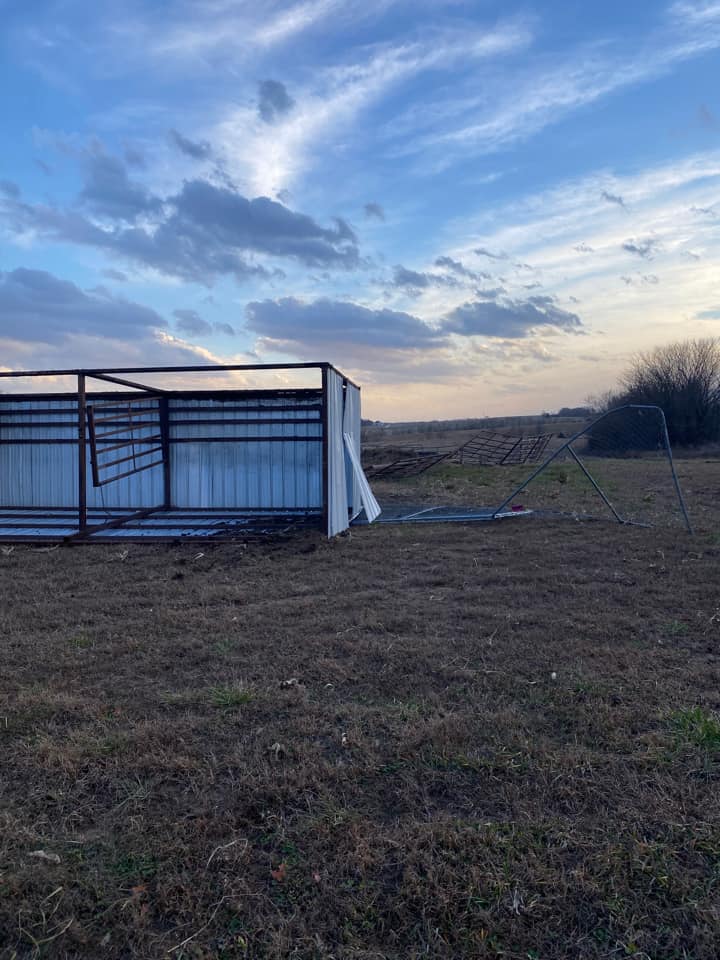
Wind damage to a metal outbuilding in Ridgeway, MO. (source: Social Media) |
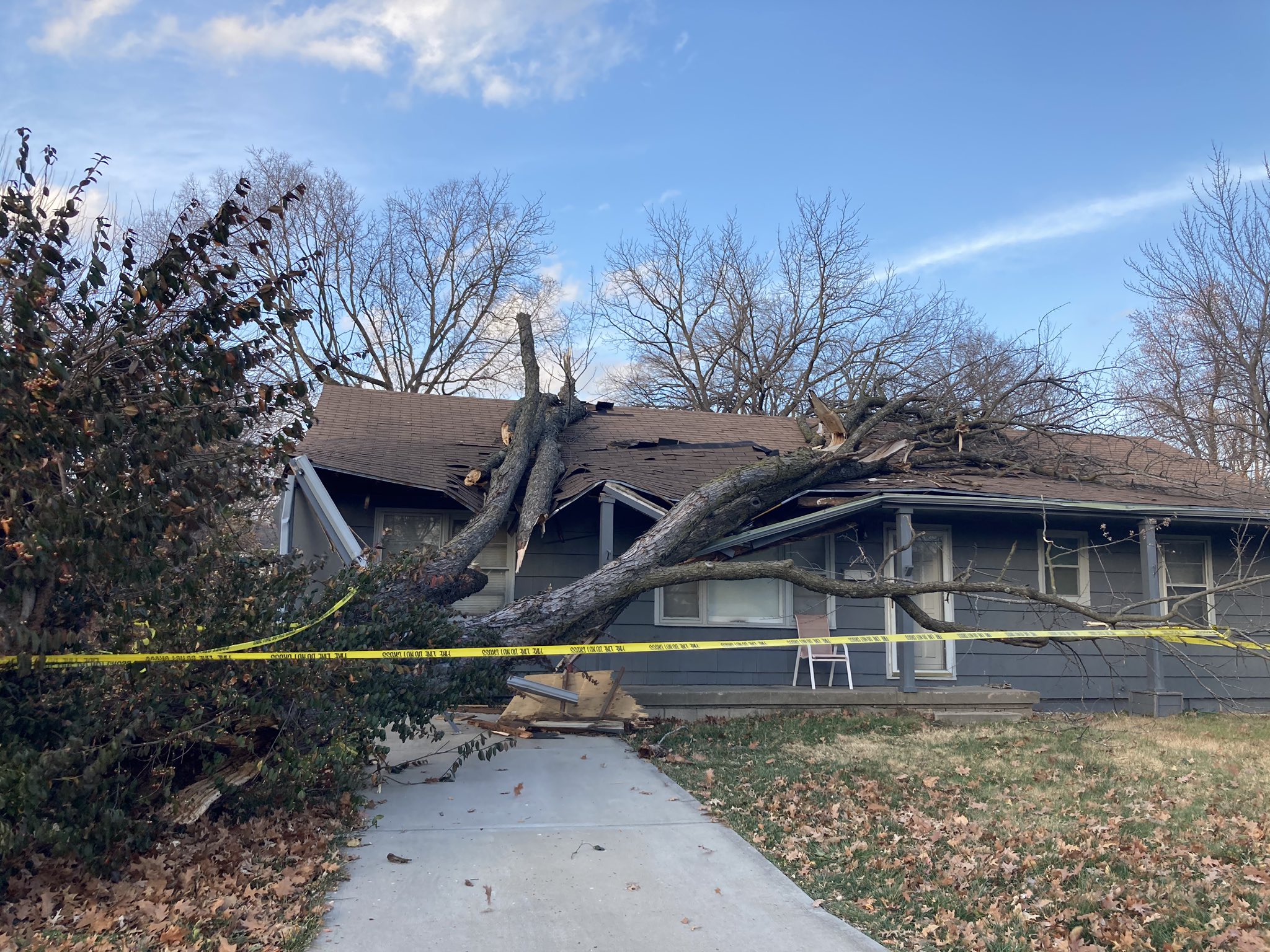
Tree fallen on house in Overland Park, KS. Damage occurred ahead of evening thunderstorms. (source: Social Media) |
 |
 |
 |
 |
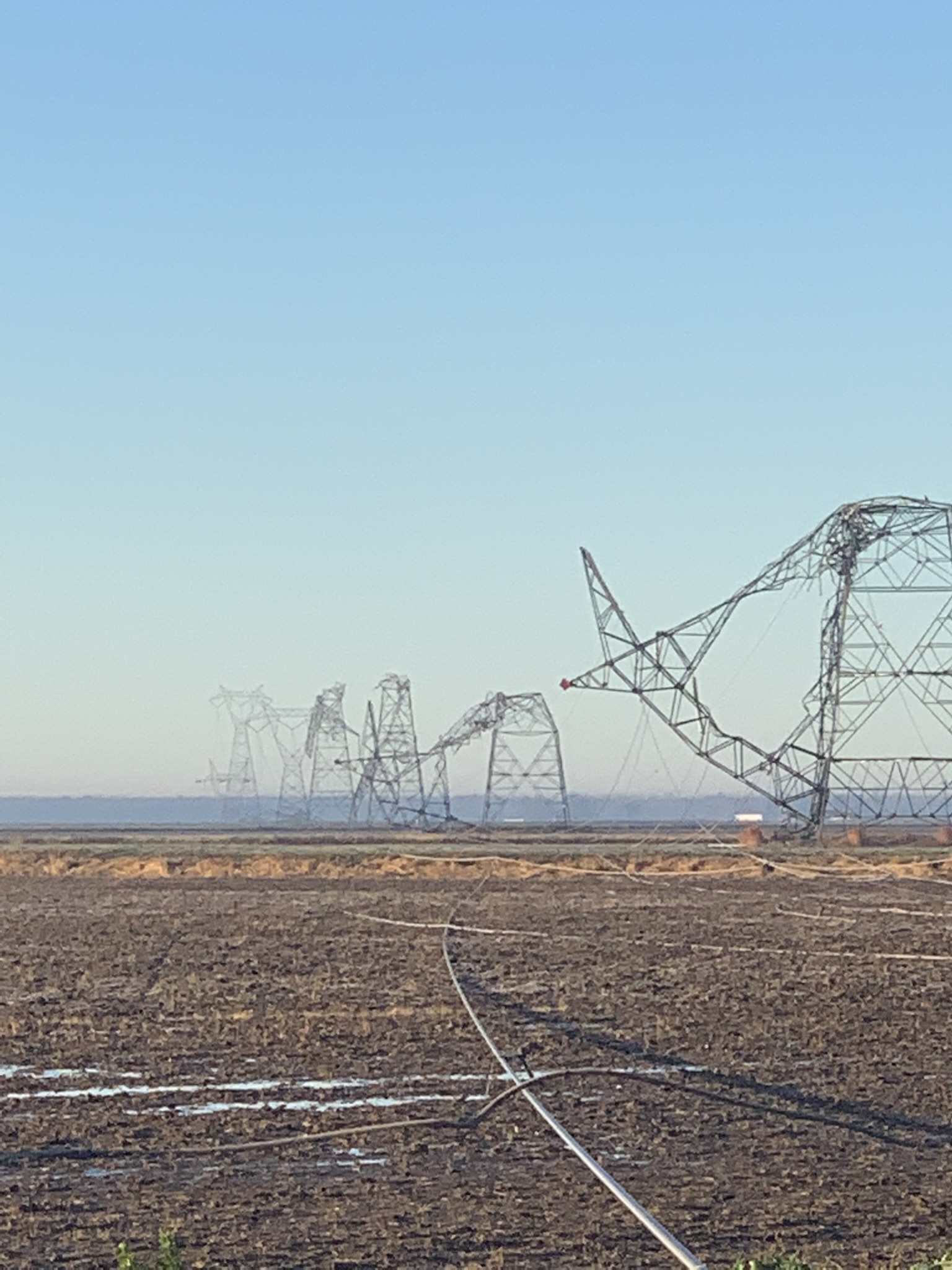
| Downed high voltage power lines in Cooper and Randolph County, Missouri. (source: Social Media) |
Trees snapped in Brookfield, MO. (source: Social Media) |
Metal shed damaged by high winds ahead of thunderstorms in Tonganoxie, KS. (source: Social Media) |
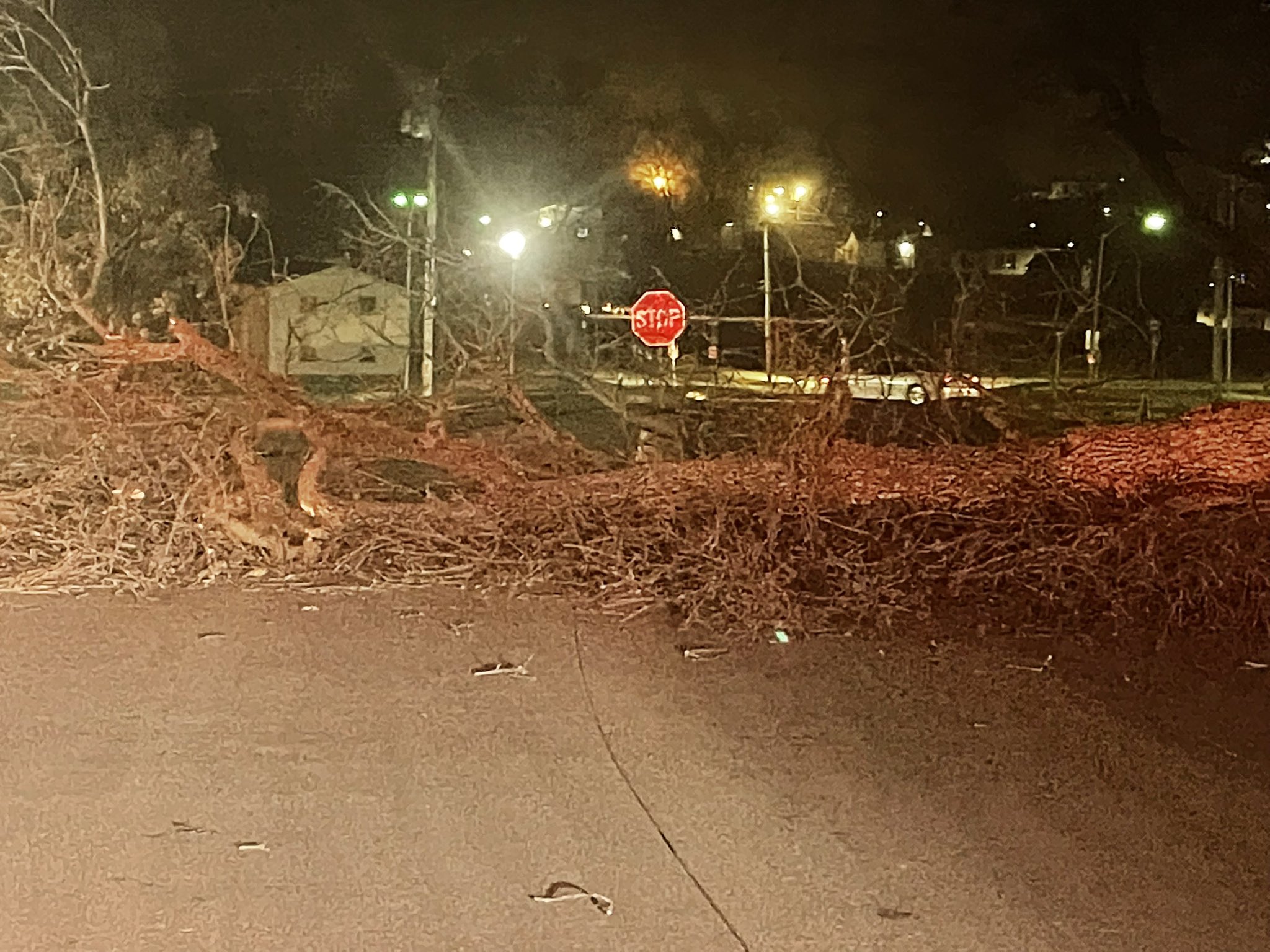
Tree fallen across 7th Street on Northwest Missouri State's campus in Maryville, MO. (source: Emergency Management) |
 |
 |
 |
 |
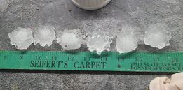
| Hail stone which fell in Gardner, KS. (source: Social Media) |
Hail stone measured in Rock Port, MO during evening thunderstorms. (source: Social Media) |
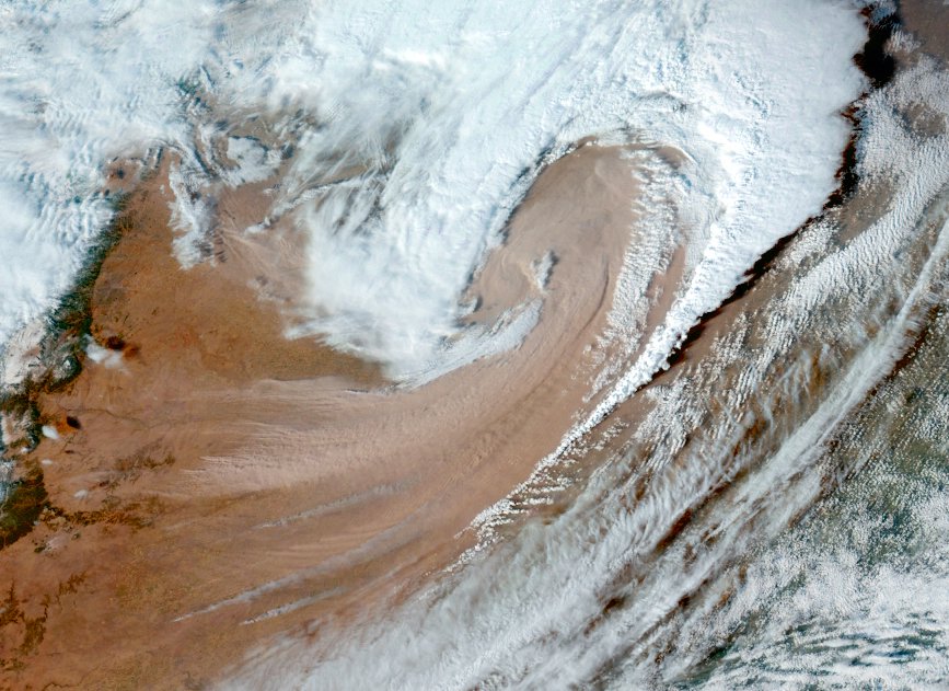
Satellite imagery of the storm as it moved across Kansas. Areas of blowing dust and smoke can be seen being pulled into the cyclone. (source: NOAA) |
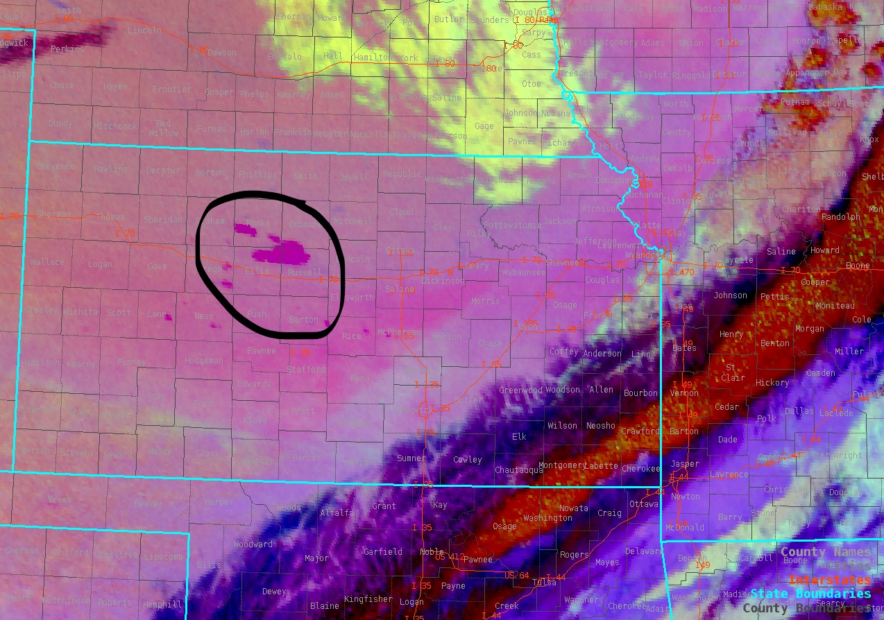
Satellite imagery highlighting a large grass fire in Russell County KS. Smoke from the fire could be smelled throughout eastern KS and western MO after thunderstorms moved through. (source: NOAA) |
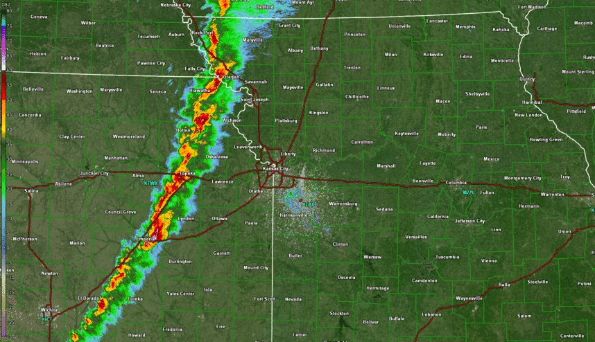
Radar
Below is radar reflectivity from 3pm to 7:30pm on December 15 as the storms moved through eastern Kansas and western MO.
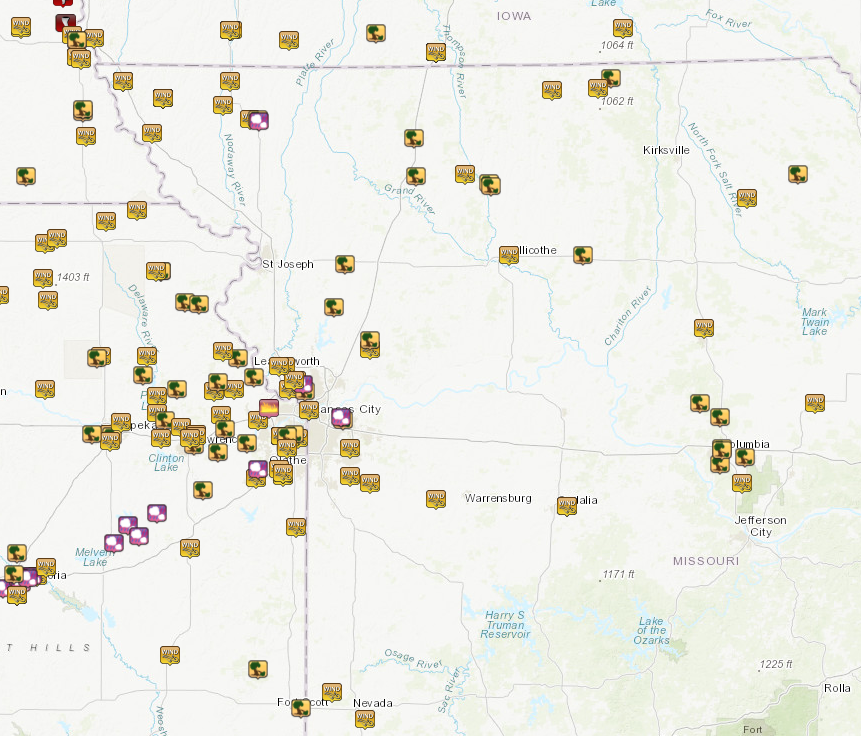
Storm Reports
Several storm reports were collected including a large number of wind gusts exceeding 75 MPH. Link to an interactive map of storm reports.
Peak Wind Gusts
Below are some of the peak wind gusts reported throughout the region.
 |
Media use of NWS Web News Stories is encouraged! Please acknowledge the NWS as the source of any news information accessed from this site. |
|


 Weather Story
 Weather Map
 Local Radar