
Tropical Depression Two is expected to gradually strengthen and could bring tropical storm conditions to the Florida Panhandle beginning late Monday. Areas of flash flooding will be possible through Thursday along the eastern and central Gulf Coast. Severe thunderstorms will develop and move along a cold front crossing the Upper Midwest Monday, and through the Ohio Valley/Mid-Atlantic on Tuesday. Read More >
Overview
|
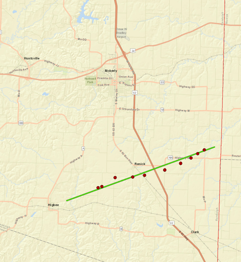
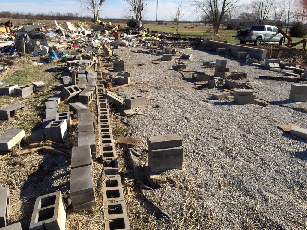
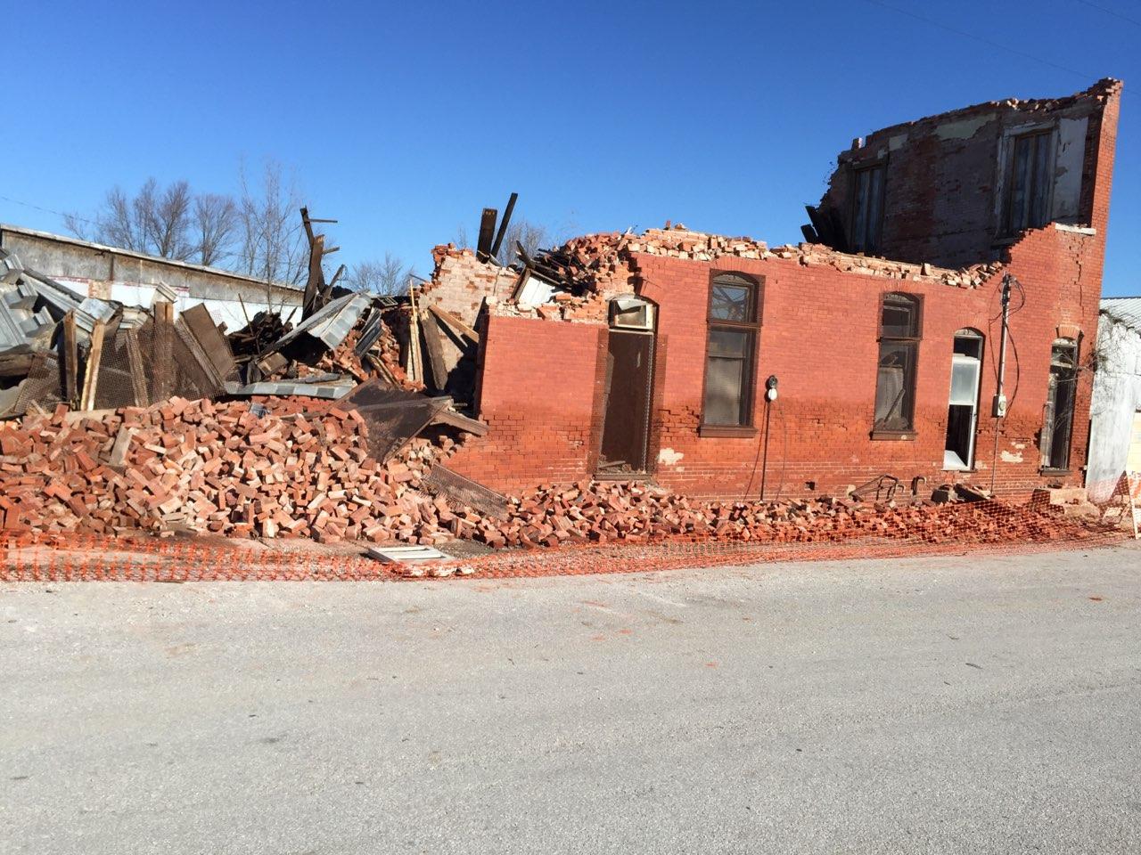
On the afternoon of December 4, 2017, a line of thunderstorms formed in western Missouri and through the rest of the afternoon moved eastward into central Missouri. Several low-topped supercells formed along this line of storms, one of which produced a tornado that did damage to residences between Higbee and Renick, Missouri. The worst of the damage occurred just east of Higbee, where a couple residences were completely destroyed, one of which was a mobile home. One person was critically injured, and another person suffered minor injuries. The tornado lasted about 15 minutes, and eventually dissipated just east of Renick, near the Randolph/Monroe County line. |
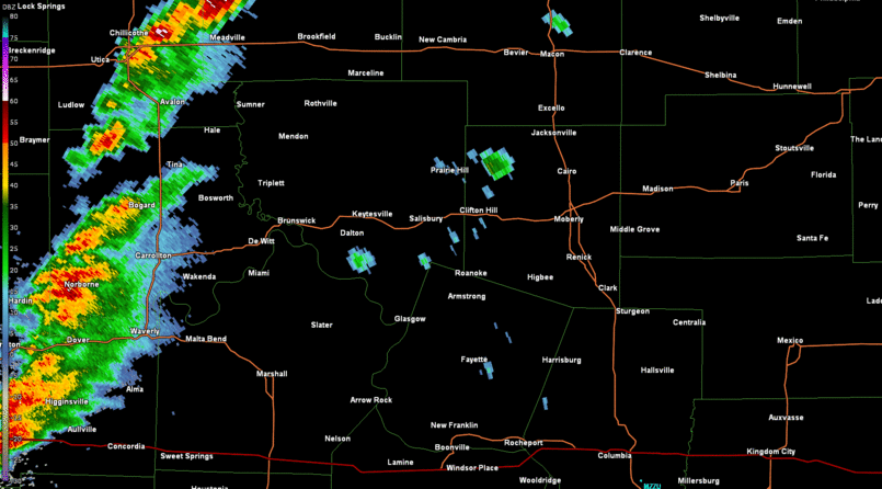 Radar loop of the storms that went through Randolph County, producing the Higbee to Renick EF-1 tornado on Monday December 4. |
Tornadoes:
The Enhanced Fujita (EF) Scale classifies tornadoes into the following categories:
|
Higbee-Renick Tornado
|
||||||||||||||||
|
||||||||||||||||
| EF0 Weak 65-85 mph |
EF1 Moderate 86-110 mph |
EF2 Significant 111-135 mph |
EF3 Severe 136-165 mph |
EF4 Extreme 166-200 mph |
EF5 Catastrophic 200+ mph |
 |
|||||
 |
Media use of NWS Web News Stories is encouraged! Please acknowledge the NWS as the source of any news information accessed from this site. |
|


 Weather Story
 Weather Map
 Local Radar