Overview
|
A prolonged freezing drizzle and freezing rain event impacted all of eastern Kansas and western and central Missouri from February 5 until February 7. While the bulk of the precipitation fell overnight February 6, into the morning of February 7 the higher impacts appeared to come on February 5, when freezing drizzle caused roads to become slick. In some areas the roads were completely impassible, and numerous injury vehicle accidents occurred. At least three fatalities were caused by the icy roads on February 5, one in Miami County Kansas, and two in Lafayette County Missouri. |
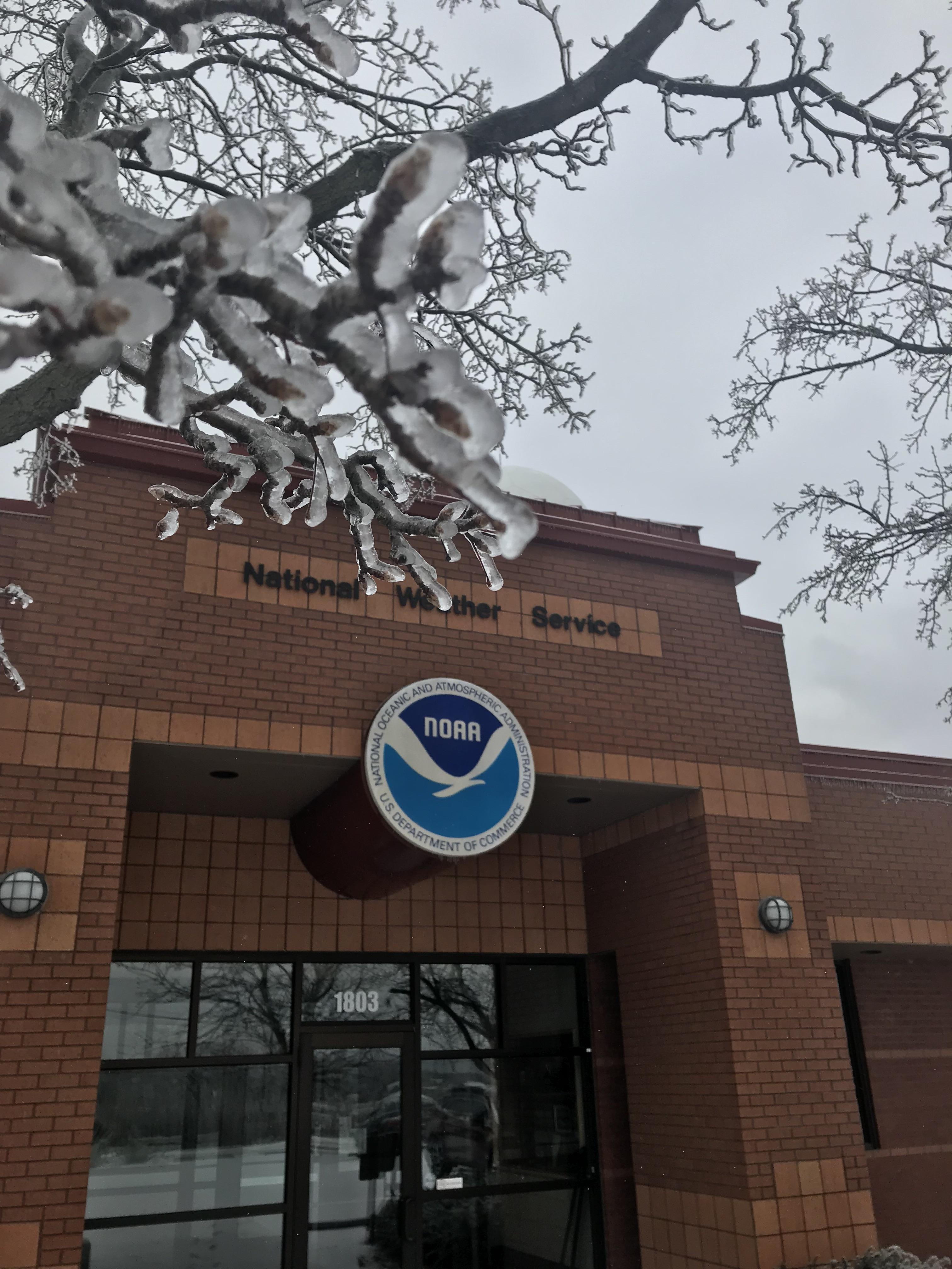 The National Weather Service office in Pleasant Hill, Missouri received approximately 1/3" to 1/2" of ice from Feb 5-7, 2019 |
 |
 |
 |
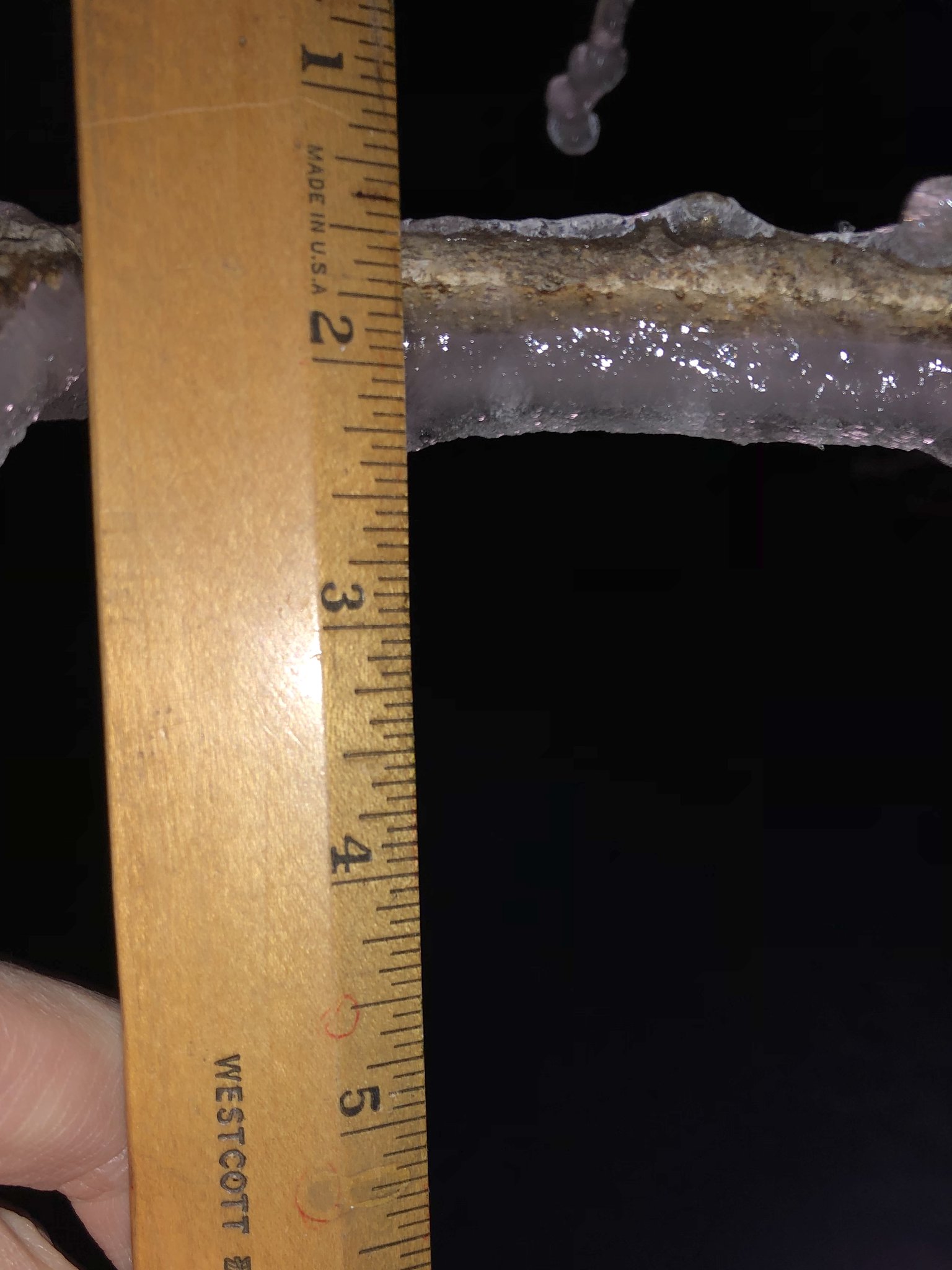
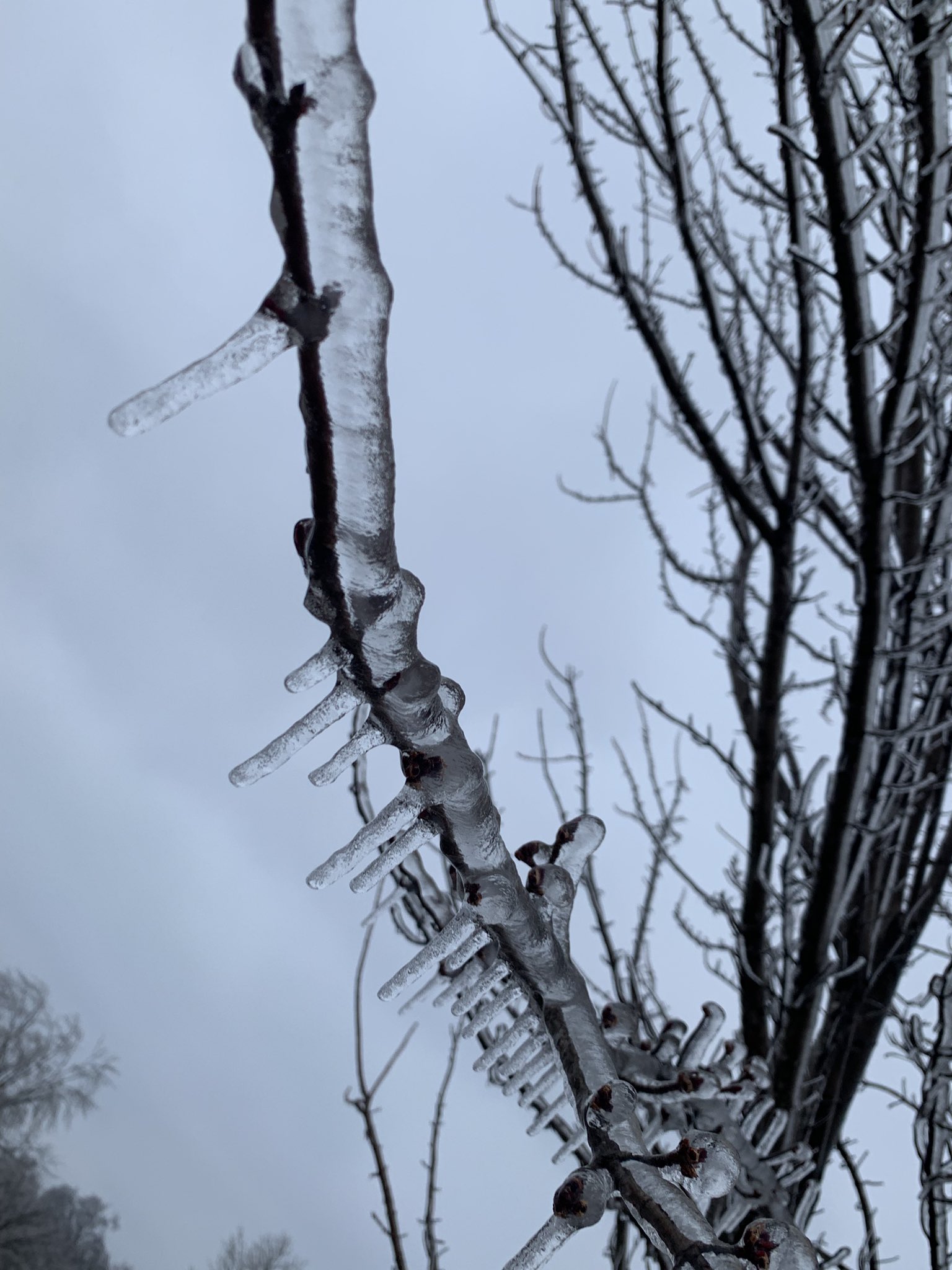
| Official NWS Observation at the office in Pleasant Hill, Missouri revealed nearly 1/2" ice accumulation on tree branches. | Residents in Johnson County Missouri measured over 1/2" of ice accumulation. Photo: Matthew Smith (@Matthew_KCSC) |
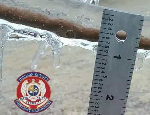
Residents in Johnson County Missouri measured over 1/2" of ice accumulation. Photo: Johnson County Emergency Management |
 |
 |
 |
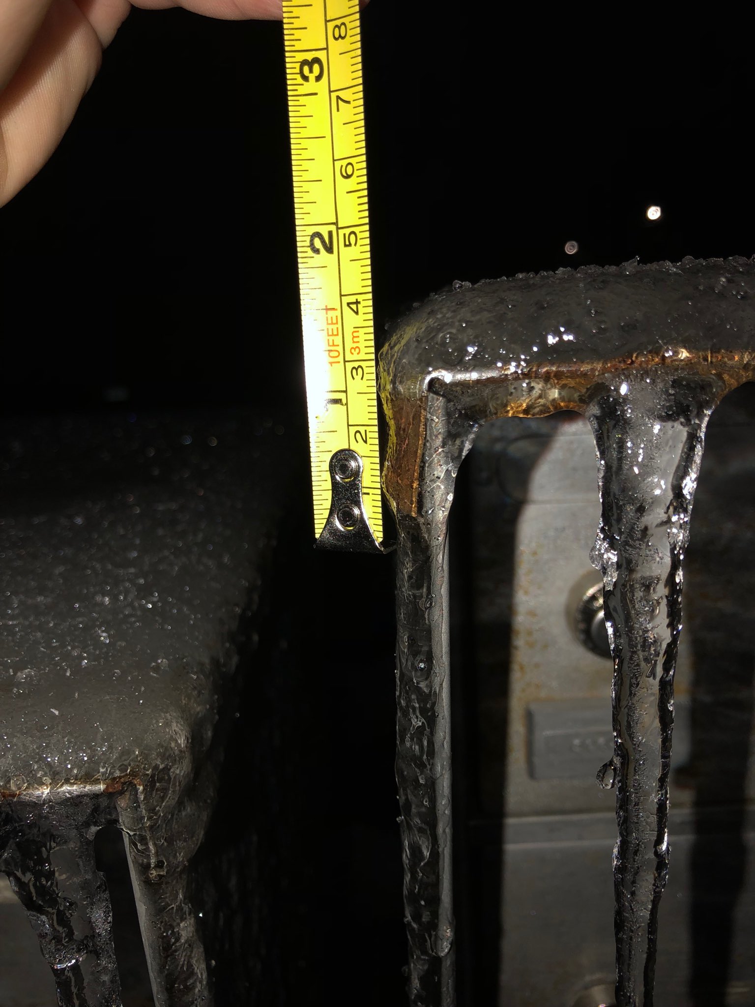
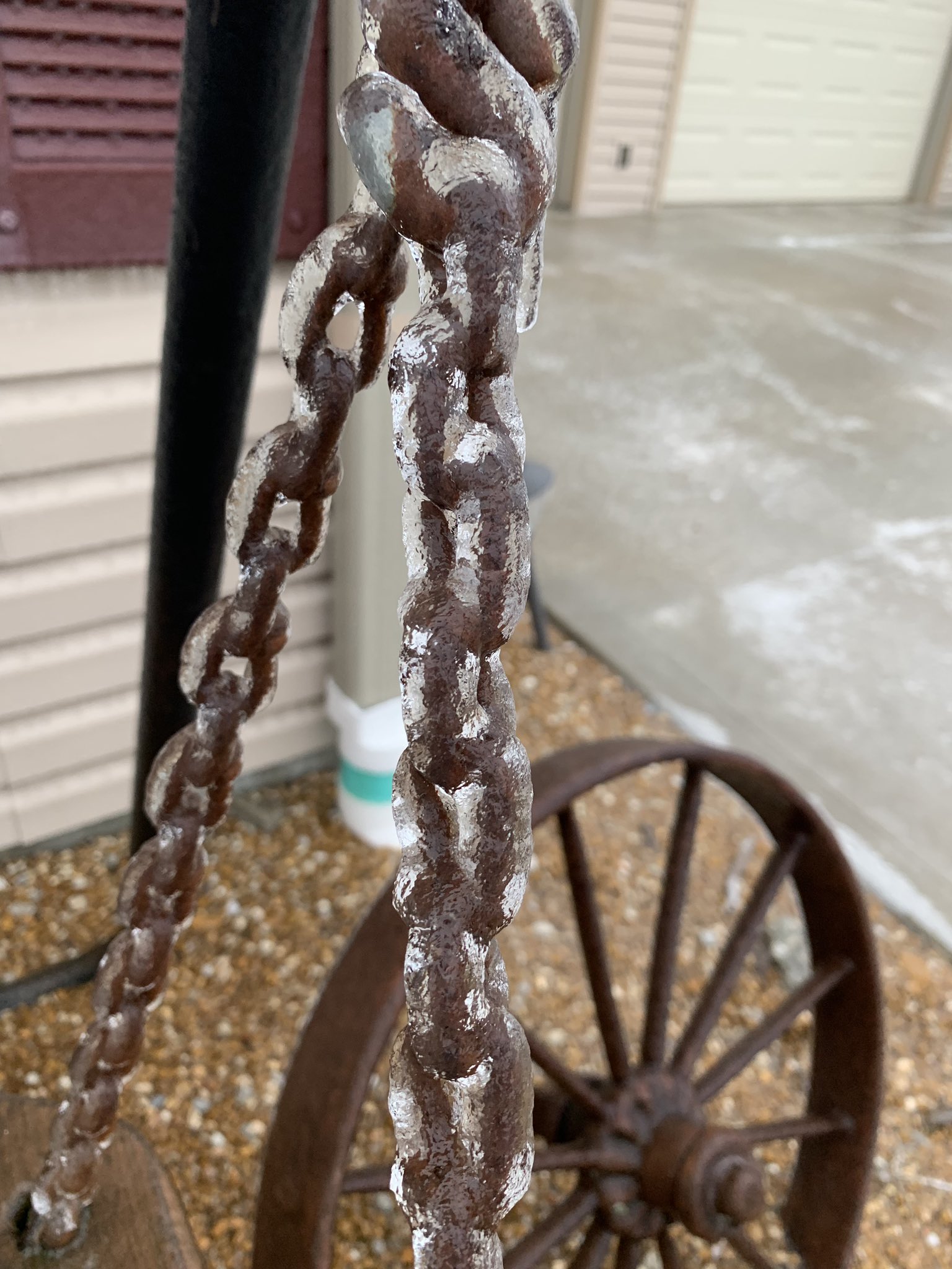
| Residents in Clinton, MO reported ice totals approaching 1/2" on tree branches and elevated surfaces Photo: Dara Gilkey Bigler (@dara_bigler) |
Residents in Clinton, MO reported ice totals approaching 1/2" on tree branches and elevated surfaces Photo: Dara Gilkey Bigler (@dara_bigler) |
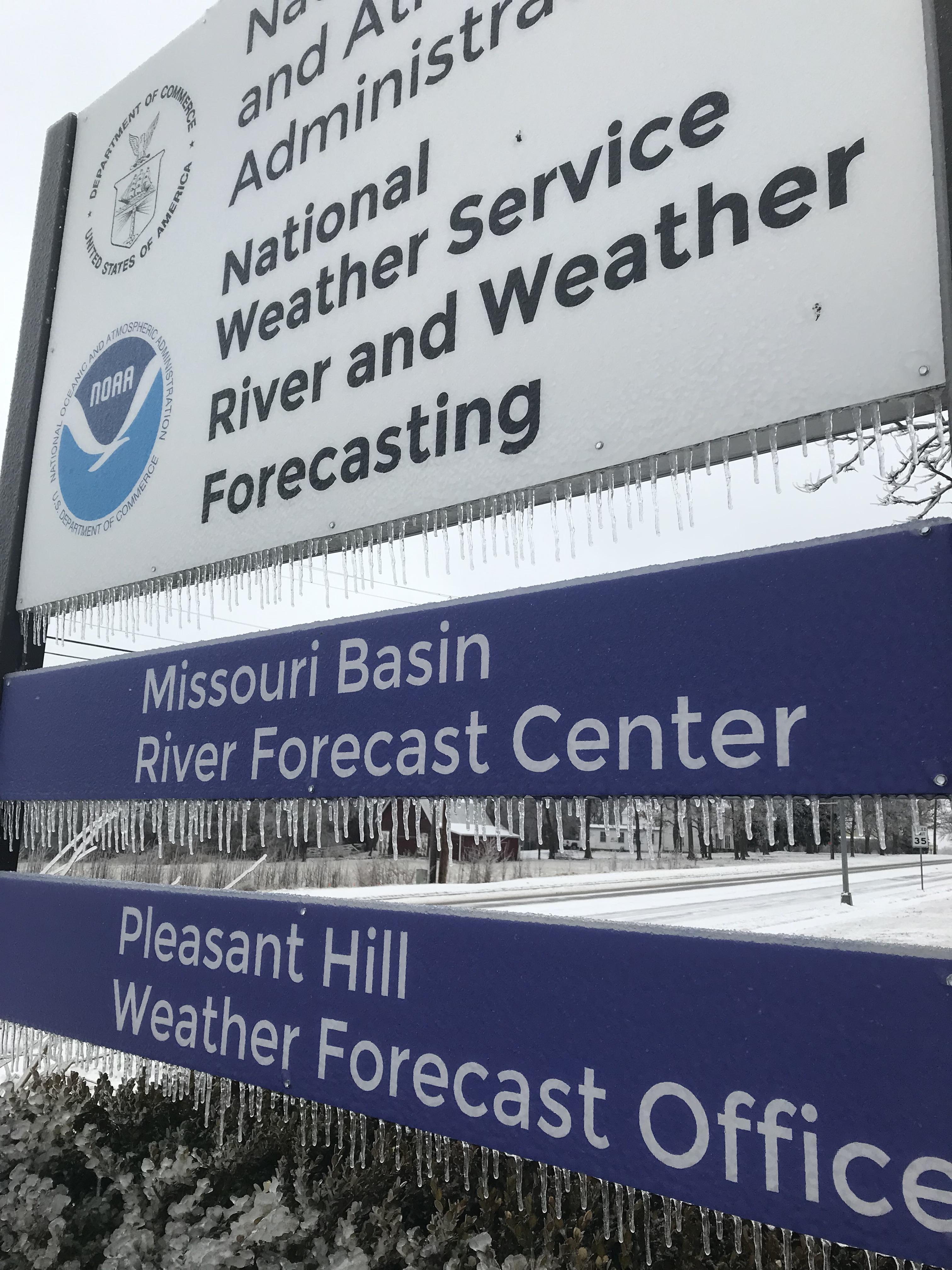
The NWS sign in Pleasant Hill shows signs of the icy weather that impacted the region on February 5-7, 2019. |
 |
Media use of NWS Web News Stories is encouraged! Please acknowledge the NWS as the source of any news information accessed from this site. |
|


 Weather Story
 Weather Map
 Local Radar