
Severe thunderstorms and showers pose a risk for excessive rain, localized flash flooding, strong gusts and/or large hail across portions of the northern and central Plains, the Lower Missouri to Lower Ohio Valleys, and across the Mid-Atlantic this afternoon and evening. Extreme heat is ongoing over the Desert Southwest and the Southeast U.S.. Read More >
Kansas City/Pleasant Hill, MO
Weather Forecast Office
Overview
|
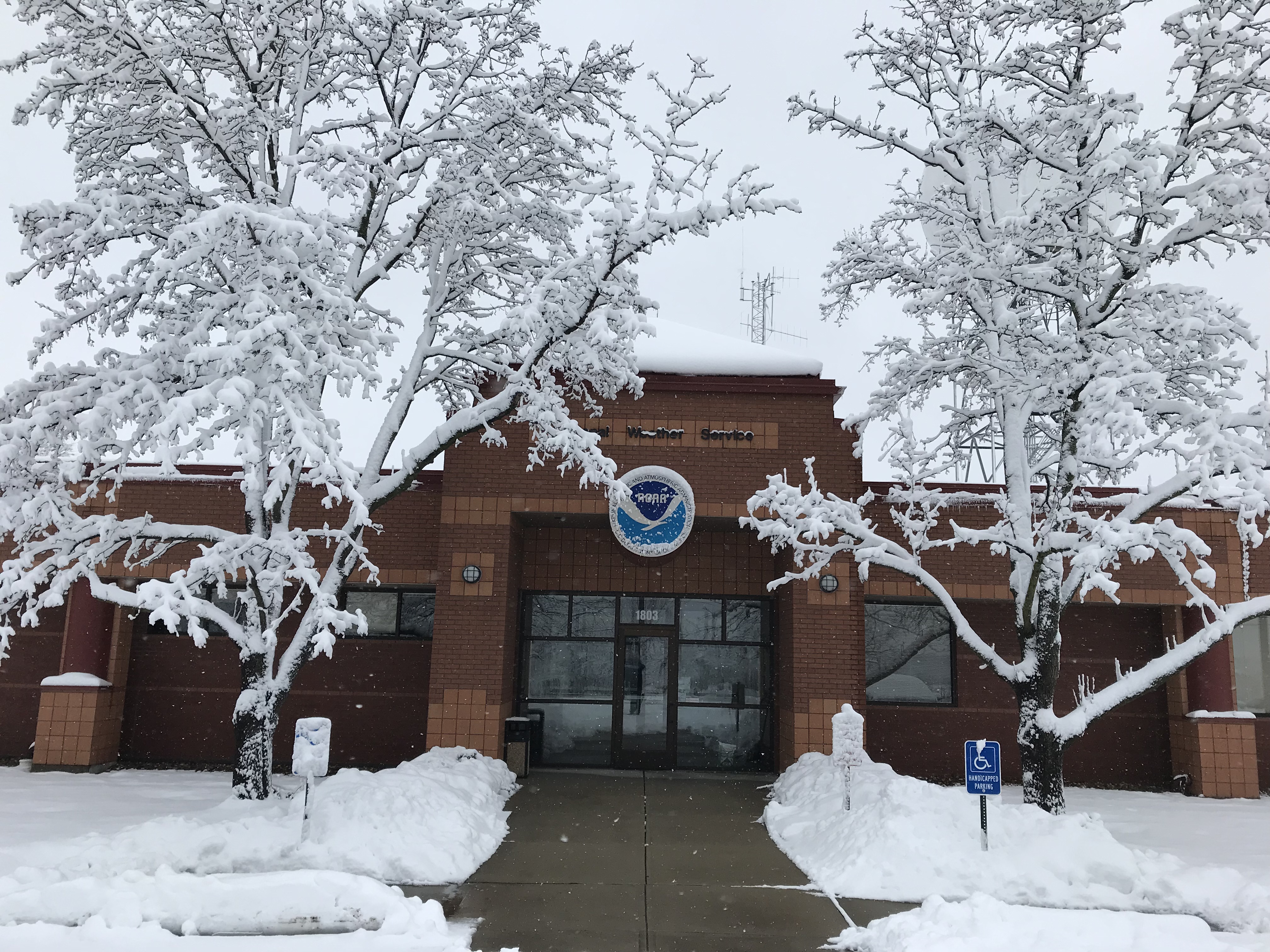
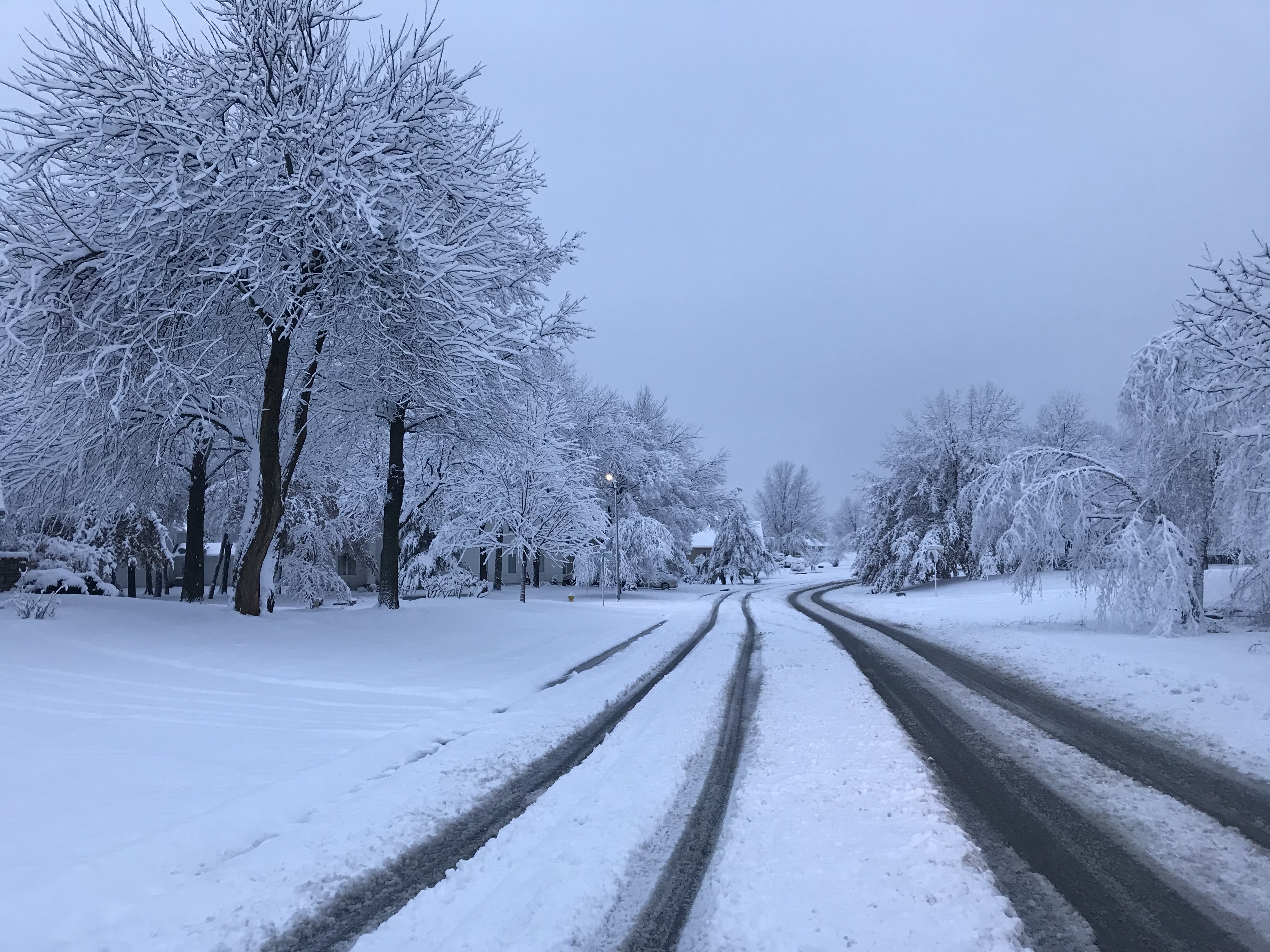
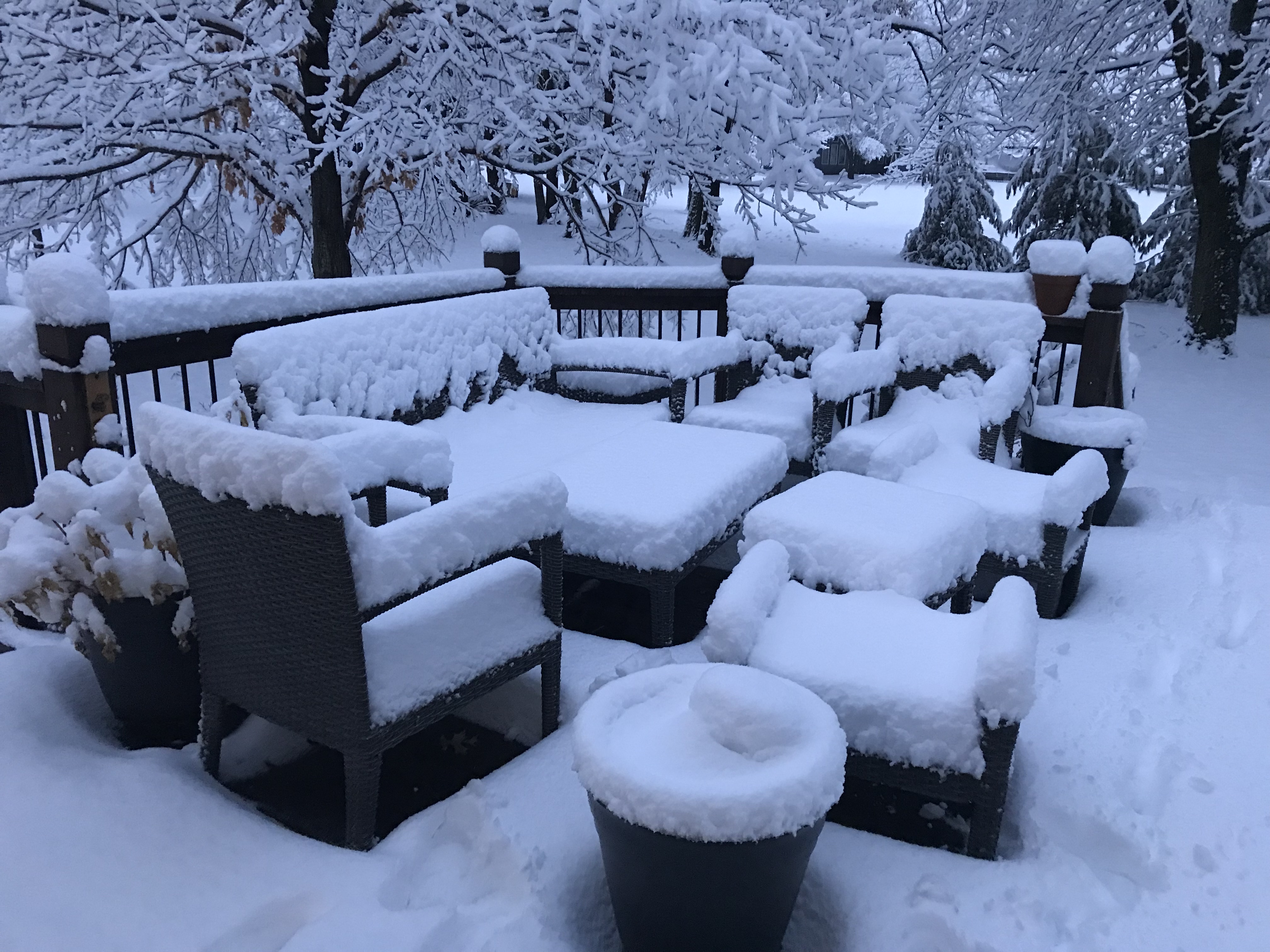
Light rain changed over to light snow by the mid afternoon on Friday January 11. After several hours of not accumulating due to warm surface temperatures snow began to pile up shortly after sunset. While the atmosphere was certainly cold enough to produce plenty of snow it was warm enough to keep the snow to liquid ratio rather low. So, while more than 1" of liquid in many areas, this translated to roughly 5 to 8 inches of snow. Some of that liquid fell as rain, but the low snow to liquid ratio caused it to be a rather densely packed snow which clung to trees across the area, forming a picturesque winter wonderland. Snow continued to fall through the day on January 12, but most of the snowfall occurred through the night between January 11 and 12. Some totals in the region exceeded 12 inches, but most areas ended up with between 5 and 8 inches. |
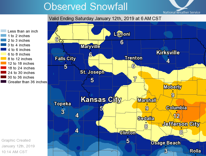 More snow fell through the day on Jan 12, but the bulk of it fell before 9 am. |
 |
 |
 |
| The National Weather Service in Pleasant Hill measured between 7 and 8 inches through noon on January 12. |
The "wet snow" clung to trees and powerlines, causing a picturesque winter wonderland. |
7 to 8 inches of snow fell in Lee's Summit |
 |
Media use of NWS Web News Stories is encouraged! Please acknowledge the NWS as the source of any news information accessed from this site. |
|
Hazards
Decision Support
Situation Report
Local Weather Story
Submit Report
Storm Prediction Center
Weather Prediction Center
National Hurricane Center
Active Alerts
National Radar
Current Weather
Local Radar
Local Precipitation/Temperature
National Radar
Satellite
Observations
Observed Precipitation
Water and Air
Air Quality
Missouri Basin RFC
National Rivers
Local Rivers
Forecasts
Decision Support
Weather Story
Forecast Discussion
Local Fire Weather
National Fire Weather
Aviation Weather
FAA Center Weather
Graphical Forecasts
Weather Prediction Center
Space Weather Center
Climate
Climate Prediction Center
KC Records and Normals
KC Holiday Climate
KC Seasonal Rankings
National Climate Services
Climate Data Center
Drought
Local Storm Reports
US Dept of Commerce
National Oceanic and Atmospheric Administration
National Weather Service
Kansas City/Pleasant Hill, MO
1803 North 7 Highway
Pleasant Hill, MO 64080-9421
816-540-6132 (6021 automated weather)
Comments? Questions? Please Contact Us.


 Weather Story
 Weather Map
 Local Radar