
A slow moving front will bring rounds of strong to severe thunderstorms and heavy rainfall to the central Plains eastward to the east-central U.S.. The first widespread significant heat wave of summer for the Intermountain West and Plains is expected to develop today and expand through next week. Dangerous heat will continue to impact portions of the Southwest and Southeast. Read More >
Overview
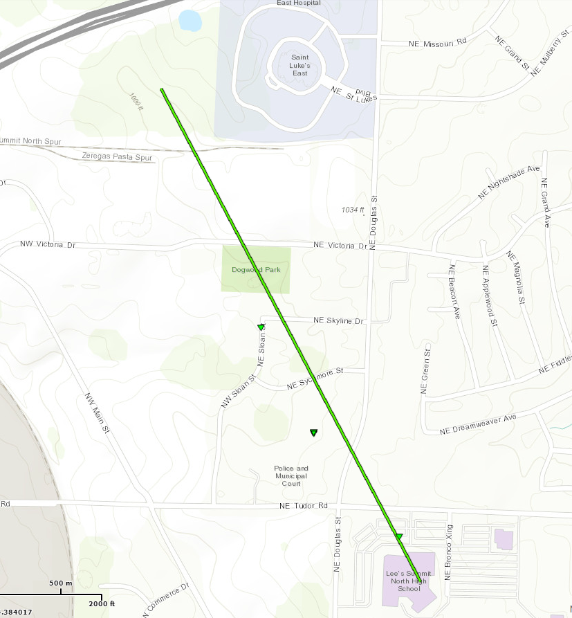
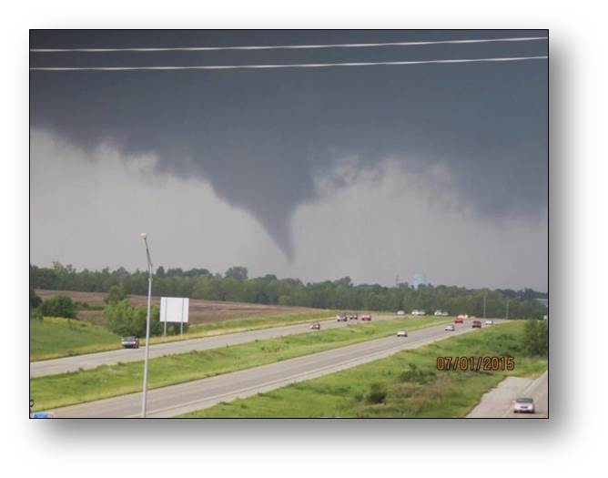
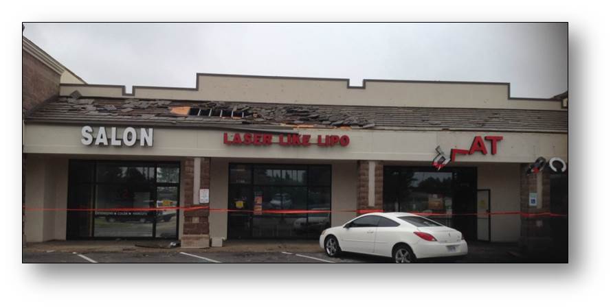
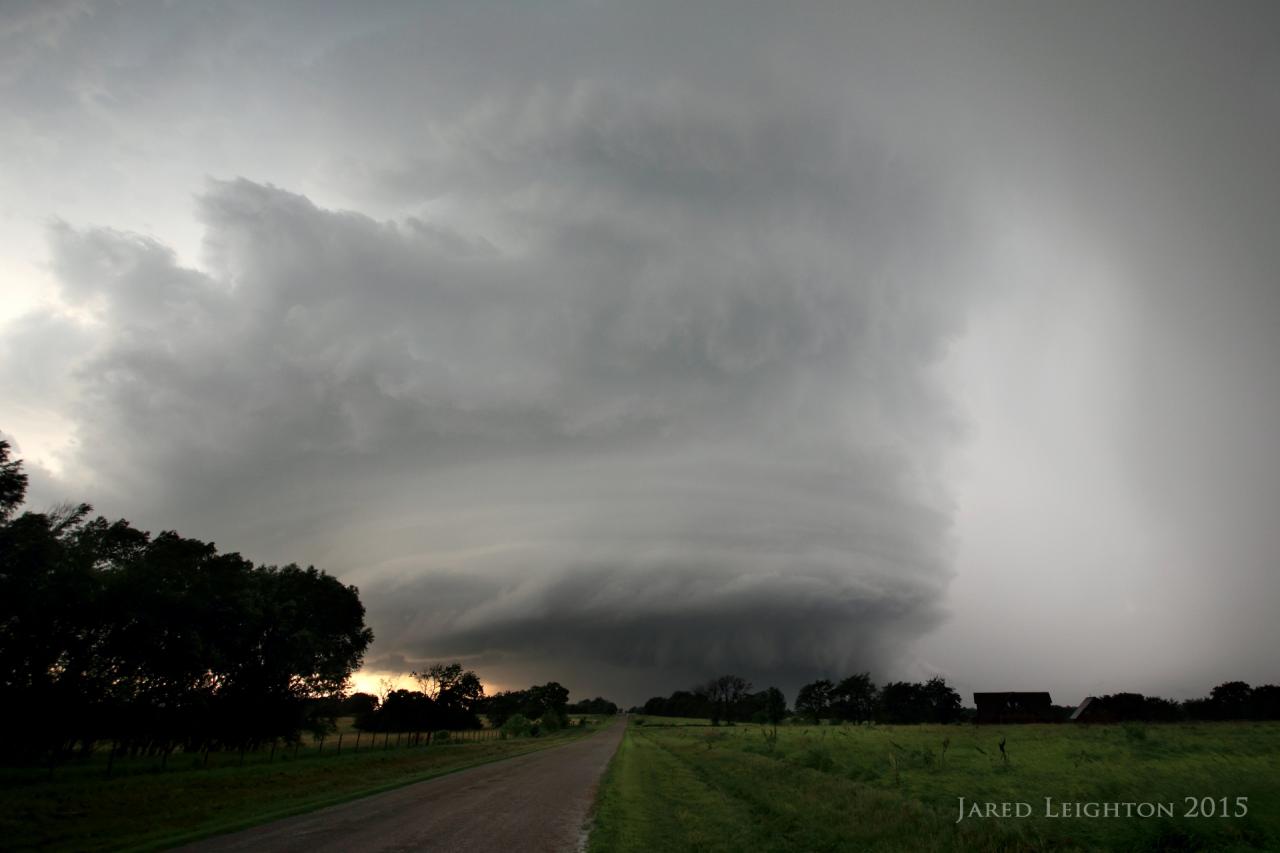
Within a northwest flow pattern, extreme instability developed across the region. The greatest combination of instability and shear occurred during the afternoon and evening hours when supercell thunderstorms, producing several relatively weak tornadoes occurred on the southeast side of the Kansas City Metropolitan area. Several tornadoes occurred in Lee's Summit and just west-southwest of the Pleasant Hill Weather Forecast Office. The most significant of the three confirmed tornadoes occurred in Lee's Summit. This tornado did only minor structural damage The storms also produced widespread heavy rainfall and there were numerous reports of 3 to 5+ rainfall reports. This led to numerous areas of flash flooding.
Tornadoes:
|
Lee's Summit Tornado
|
||||||||||||||||
|
||||||||||||||||
|
Lake Lotawana Tornado
Track Map 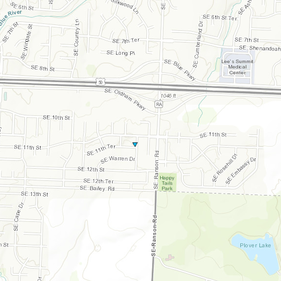 
|
||||||||||||||||
|
|
||||||||||||||||
|
Pleasant Hill Tornado
Track Map 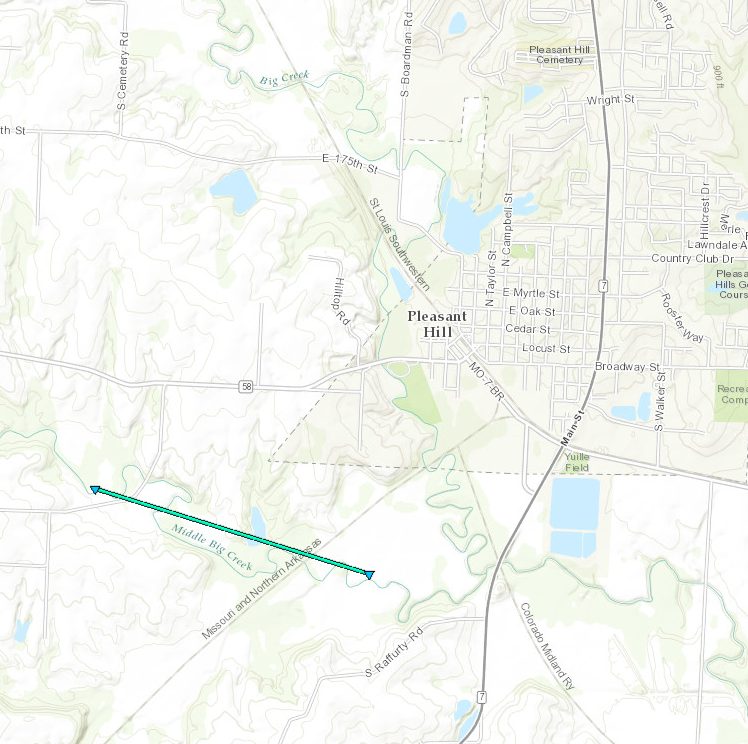
|
||||||||||||||||
|
|
||||||||||||||||
The Enhanced Fujita (EF) Scale classifies tornadoes into the following categories:
| EF0 Weak 65-85 mph |
EF1 Moderate 86-110 mph |
EF2 Significant 111-135 mph |
EF3 Severe 136-165 mph |
EF4 Extreme 166-200 mph |
EF5 Catastrophic 200+ mph |
 |
|||||
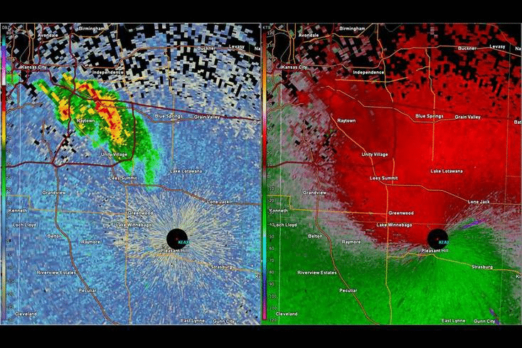
Radar:
Header
 |
|
Radar loop of the storms that formed in Kansas City.
Notice the tornado rotation as the storm moves into Lee's
Summit. A second tornado forms as the storm moves into
the Pleasant Hill area.
|
 |
Media use of NWS Web News Stories is encouraged! Please acknowledge the NWS as the source of any news information accessed from this site. |
|


 Weather Story
 Weather Map
 Local Radar