
Widespread, life-threatening considerable flash flooding is expected in south-central Texas through at least Friday. Catastrophic river flooding and rapid rises on small streams, arroyos, and typically dry washes are expected in the Texas Hill Country. Wildfire smoke is impacting air quality across much of the Great Lakes region into the Northeast U.S. with Air Quality Alerts in effect. Read More >
Overview
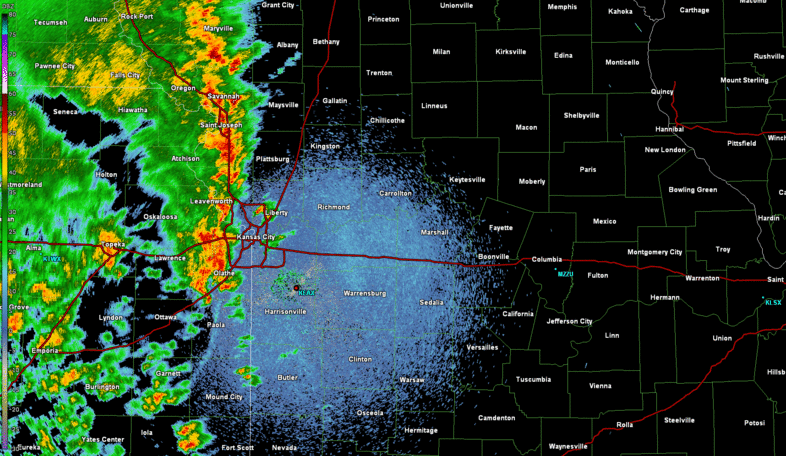
A multicellular thunderstorm complex that, generally, has a linear appearance (i.e., MCS, squall line) but also exhibits localized storm-scale vortices that can behave very similar to low-level mesocyclones and are capable of producing tornadoes called a quasi-linear convective system (QLCS) moved through east central Kansas and west central Missouri producing multiple QLCS tornadoes and significant damage associated with numerous mesovortices. Interestingly, there was a supercell ahead of the line that also produced a tornado. Also, this line of storms produced extreme rain rates and widespread flash flooding was reported throughout the Kansas City area.
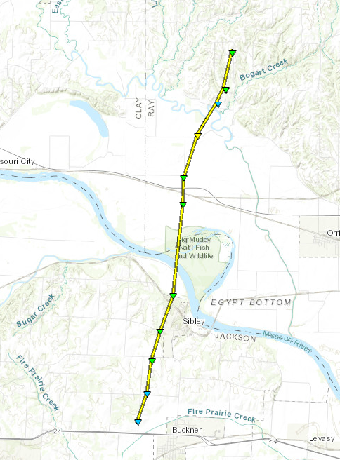
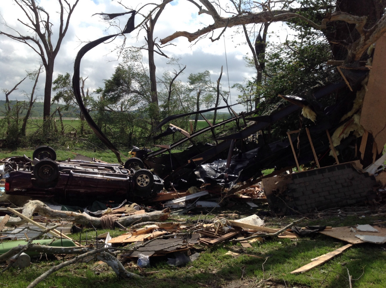
Ahead of the advancing QLCS a supercell formed and produced a tornado in northern Jackson County, just southwest of Sibley, Missouri and barely missed the main part of the city just to the west. Although it remained mostly in rural parts of Jackson County it did impact some outbuildings and did plenty of tree damage to areas just west of Sibley. The tornado then moved across the Missouri River, into Ray County where it did impact a mobile home, ripped its support straps out of the ground, and wrapped it around a nearby tree. No one was occupying the residence at the time, so no injuries were reported. The tornado dissipated in rural Ray County, just northwest of Orrick.
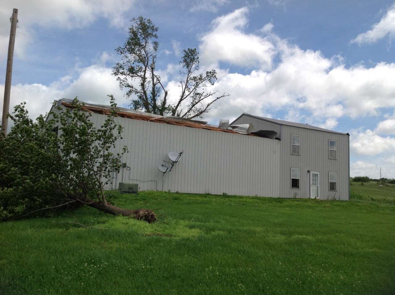
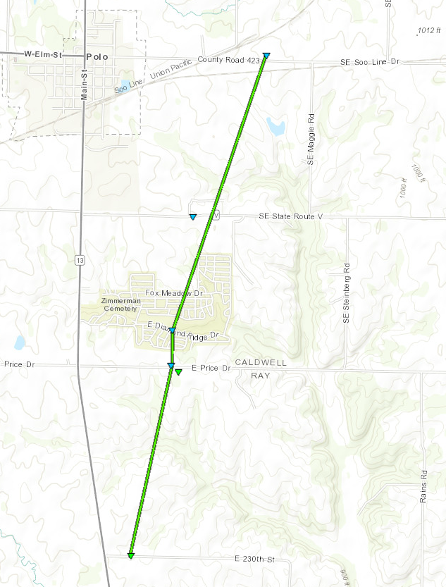
The supercell that produced an EF-2 tornado near Sibley went on to produce a 2nd tornado near the city of Polo. It formed a few miles south of Polo in Ray County, producing some EF-1 damage to outbuildings in Ray County. The tornado then crossed into Caldwell County, and dissipated just east of Polo. Three other tornadoes occurred with this system and cause minor damage. One occurred in Bates County near Adrian. Another occurred near Clinton, Missouri, and earlier in the evening one briefly touched down in Lawson, Missouri. No injuries were reported with any of these tornadoes. Aside from the tornadoes, widespread wind damage occurred across the region from this line of convective storms.
Radar loop of the evening of May 16 into the overnight hours of May 17.
Notice the supercells ahead of the advancing squall line moving into Missouri from Kansas.
Visit the radar section below for closer details of some of the features from this system.
Click on image or here to enlarge.
Tornadoes:
|
Sibley, Missouri Tornado
|
||||||||||||||||
|
||||||||||||||||
|
Polo, Missouri Tornado
|
||||||||||||||||
|
||||||||||||||||
|
Lawson, Missouri Tornado
Track Map 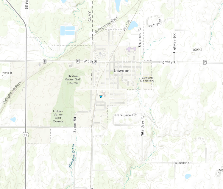 
|
||||||||||||||||
|
|
||||||||||||||||
|
Adrian, Missouri Tornado
Track Map 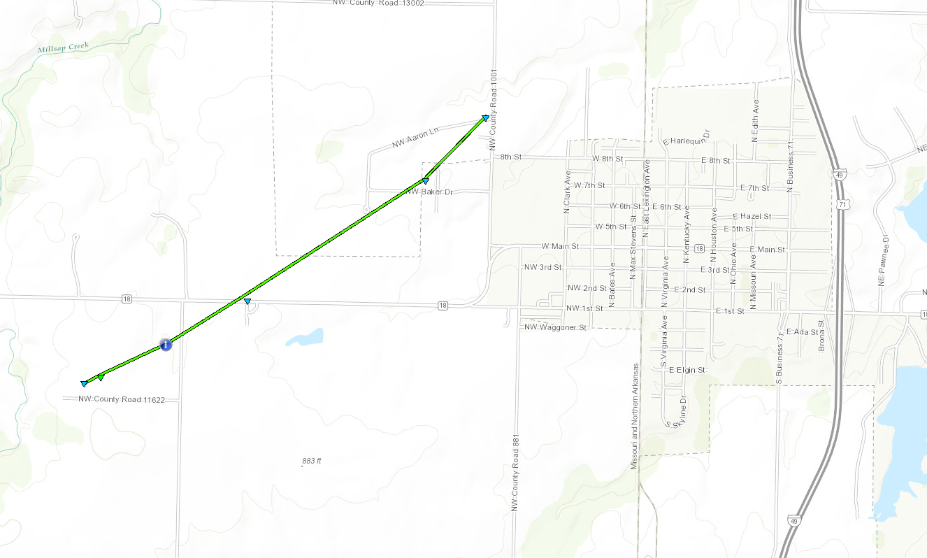
|
||||||||||||||||
|
|
||||||||||||||||
|
Clinton, Missouri Tornado
Track Map 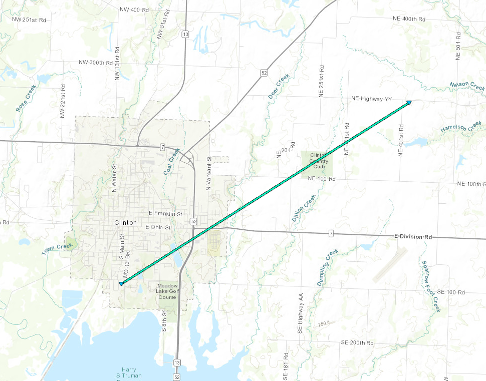
|
||||||||||||||||
|
|
||||||||||||||||
The Enhanced Fujita (EF) Scale classifies tornadoes into the following categories:
| EF0 Weak 65-85 mph |
EF1 Moderate 86-110 mph |
EF2 Significant 111-135 mph |
EF3 Severe 136-165 mph |
EF4 Extreme 166-200 mph |
EF5 Catastrophic 200+ mph |
 |
|||||
Wind:
Add a written summary or simply an LSR map in this section. If writing an extensive report, you can break the report down into wind and hail below (otherwise delete).
 |
 |
 |
 |
|
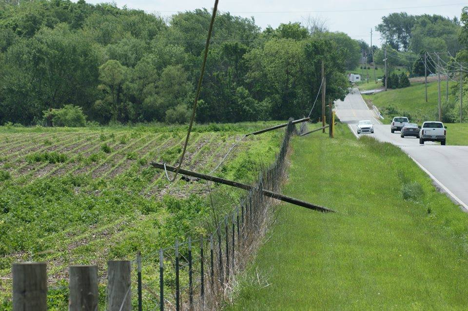
Strong winds knocked over several power poles near Excelsior Springs, MO (Photo: Brandon McDaniel) |
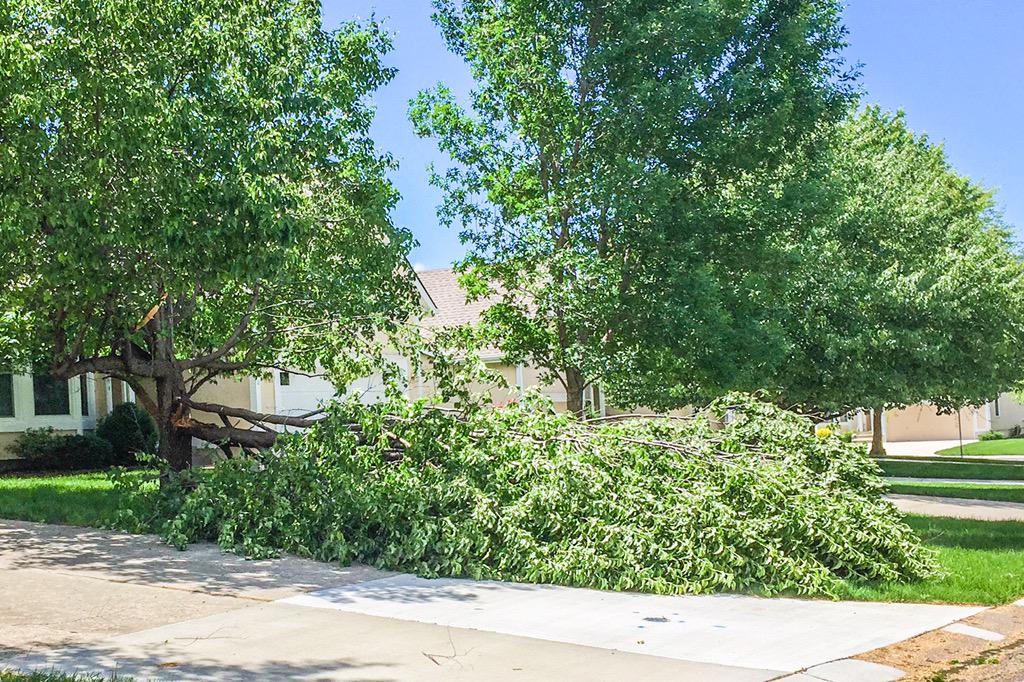
Strong winds caused some tree damage in Lee's Summit, MO (Photo: Mark Schierholz) |
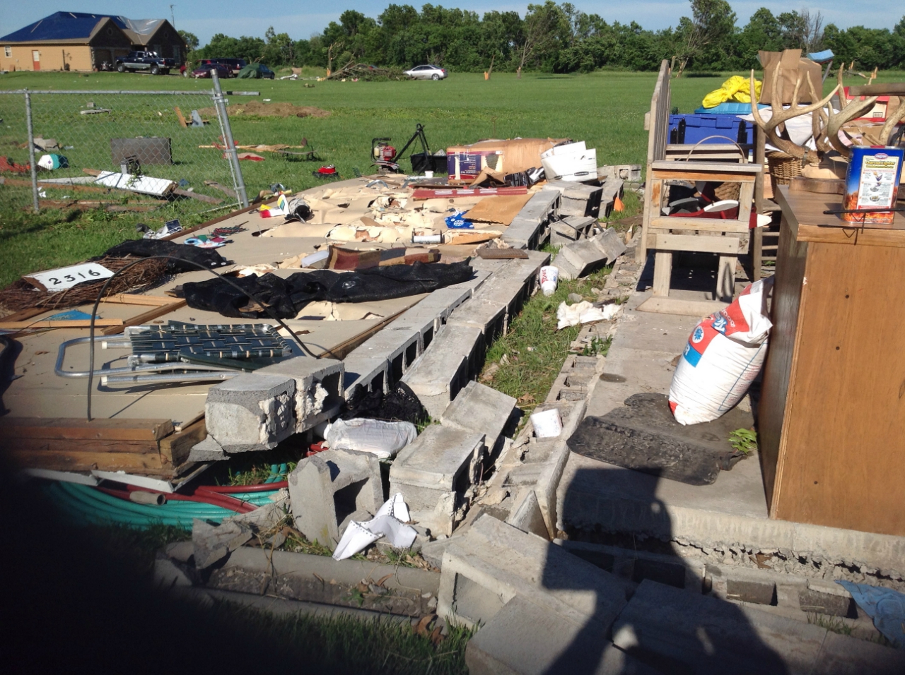
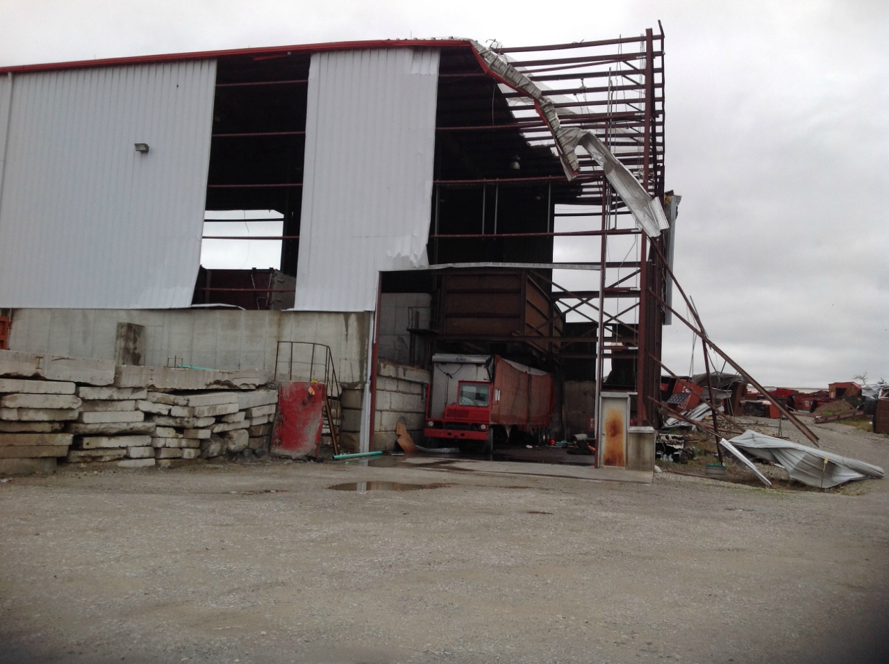
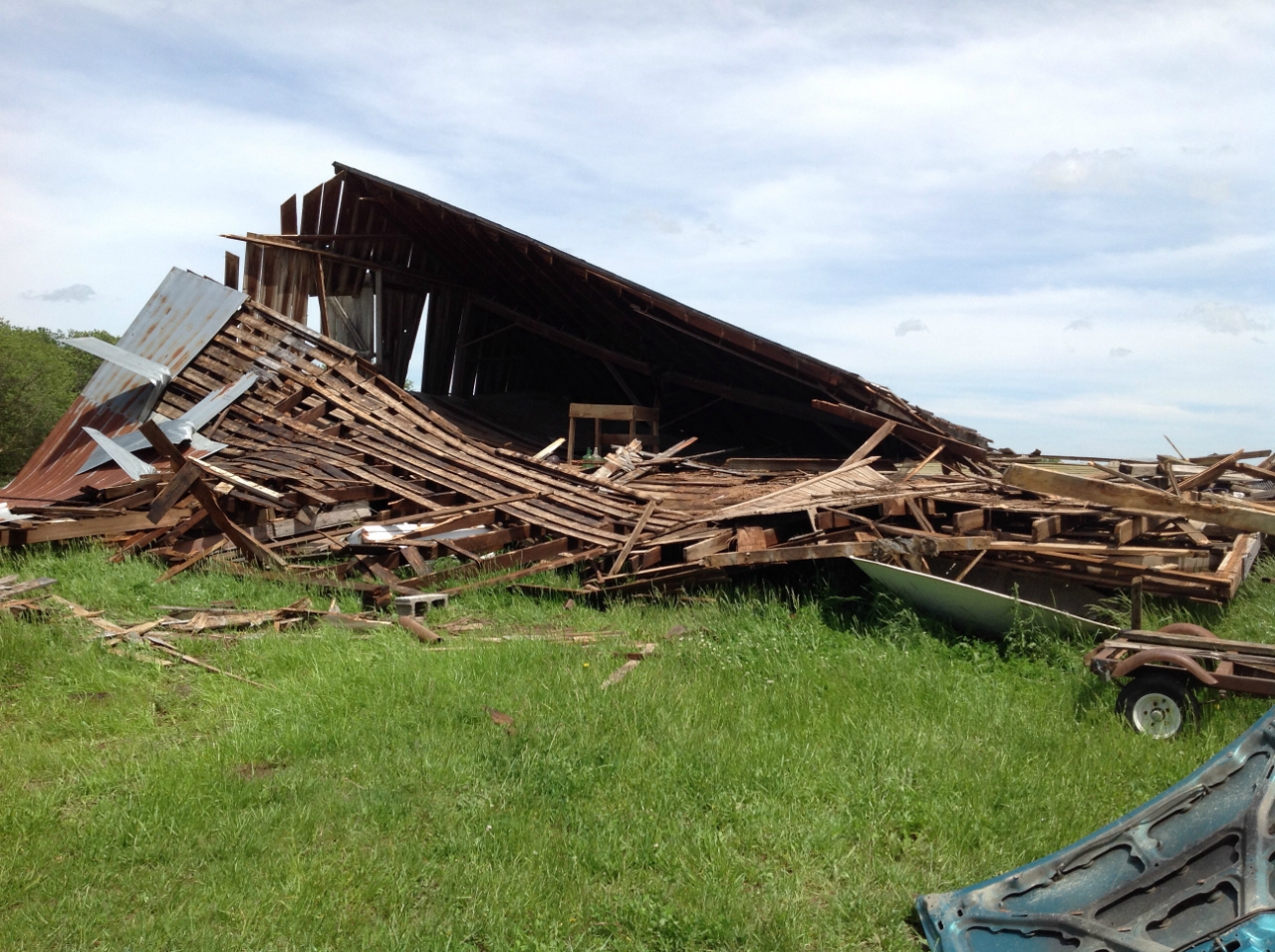
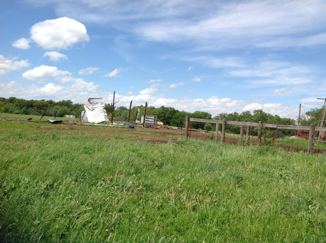
This mobile home was destroyed when storms came through Adrian, MO. This damage was possibly caused by a tornado that was confirmed in the area. |
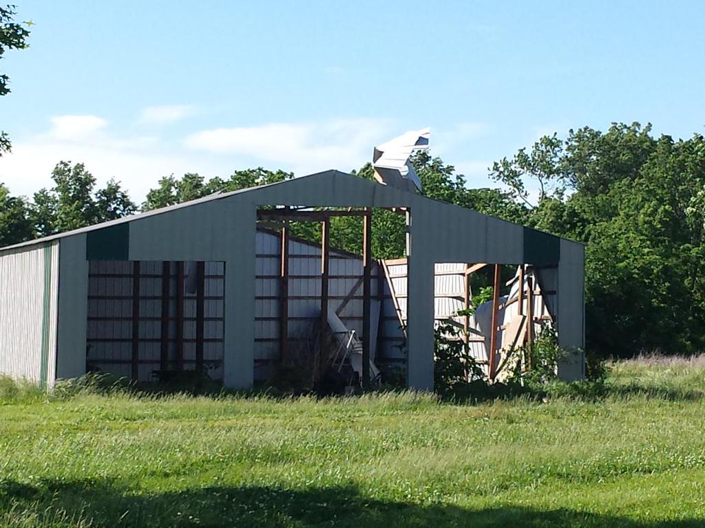
Damage to a metal outbuilding in Adrian, MO. This damage was possibly caused by a tornado that was confirmed in the area. (Photo: John Cameron) |
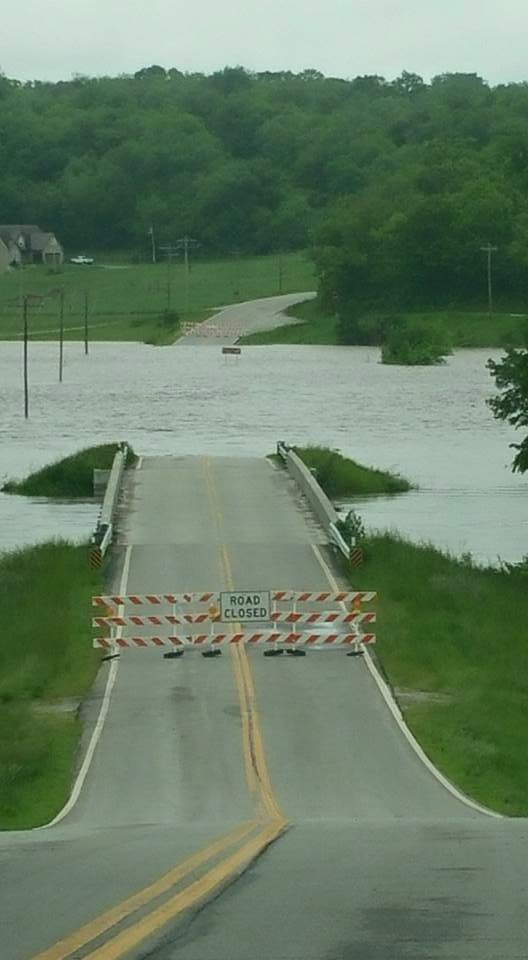
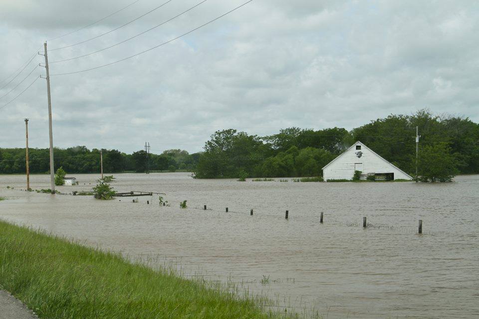
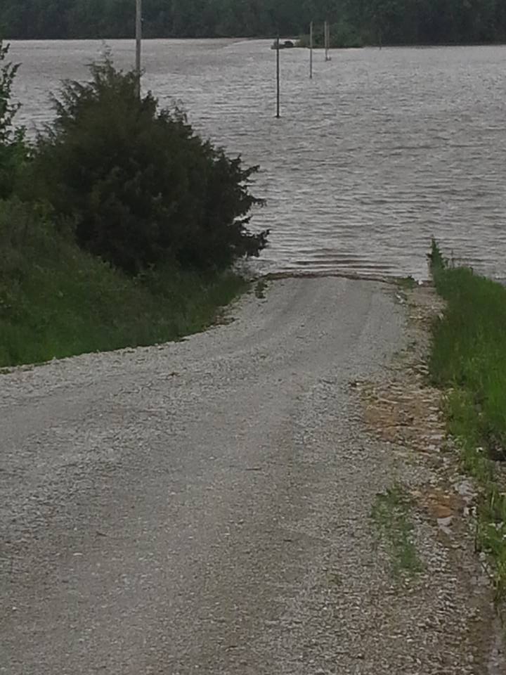
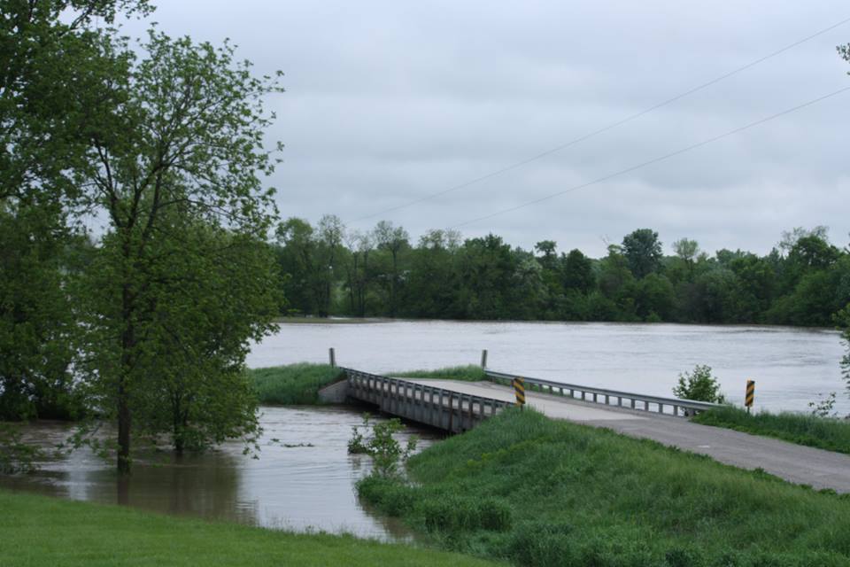
Flooding:
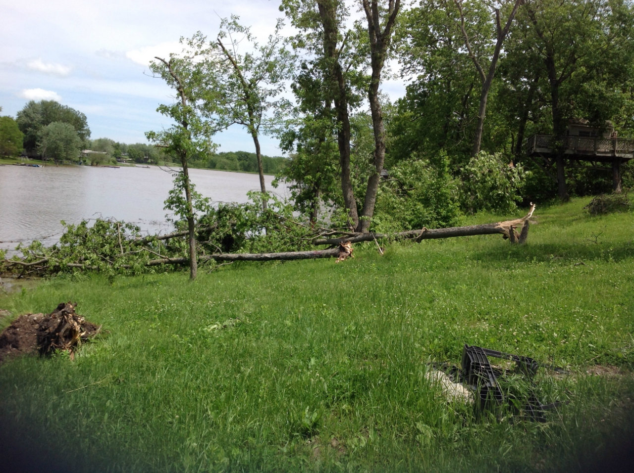
The heavy rain produced areas of flash flooding across the region.
 |
 |
 |
 |
|
Flooding along the Crooked River, east of Lawson, MO (Photo: Diana Willis) |
Flooding in Excelsior Springs, MO (Photo: Brandon McDaniel) |
Kinball Road in Kingston, MO (Photo: Kevin Adams) |
Brushy Creek in Clinton County MO (Photo: Tobey McMullen) |
Radar:
Header
 |
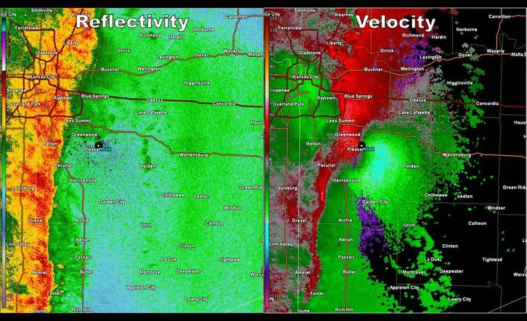 |
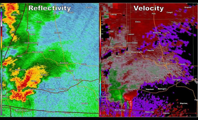
| A supercell formed just east of Kansas City, and produced a tornado that caused EF-2 damage between Sibley and Orrick. The storm went on to produce a second tornado near Polo. This second tornado did not cause much damage, which was relegated to some tree damage in rural portions of Ray and Caldwell Counties. | As the squall line pushed into western Missouri, it produced several mesovortex tornadoes. These tornadoes are similar to their supercellular counterpart in that they produce winds over 100 mph, but are slightly different in how they form. These mesovortices can be seen inside the yellow circles, embedded within the squall line. |
Storm Reports
 |
|
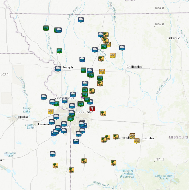
Wind and flooding were the most prominent hazards from this system as it moved through the area. Click on the image for an interactive damage report map. |
 |
Media use of NWS Web News Stories is encouraged! Please acknowledge the NWS as the source of any news information accessed from this site. |
|


 Weather Story
 Weather Map
 Local Radar