
A cold front will sweep eastward today accompanied by strong to severe thunderstorms for the mid-Atlantic and Northeast today. In the wake of this cold front, autumn like temperatures and gusty winds from the Plains, Mississippi Valley, Great Lakes to most of the eastern seaboard. Fire weather conditions for lower Mississippi Valley into portions of California. For Guam, a typhoon is approaching. Read More >
Kansas City/Pleasant Hill, MO
Weather Forecast Office
Overview
|
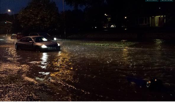
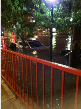
On the afternoon and evening of September 19, a line of thunderstorms moved through western Missouri, including the Kansas City Metro area. Reports of 3 to 4 inches of rain were received across the area. There was some damage from thunderstorm winds, but most of it was pretty minor. The more noteworthy aspect of this event was the localized flash flooding in the downtown portions of Kansas City. Brush Creek experienced some flash flooding, and several cars were submerged in Westport. |
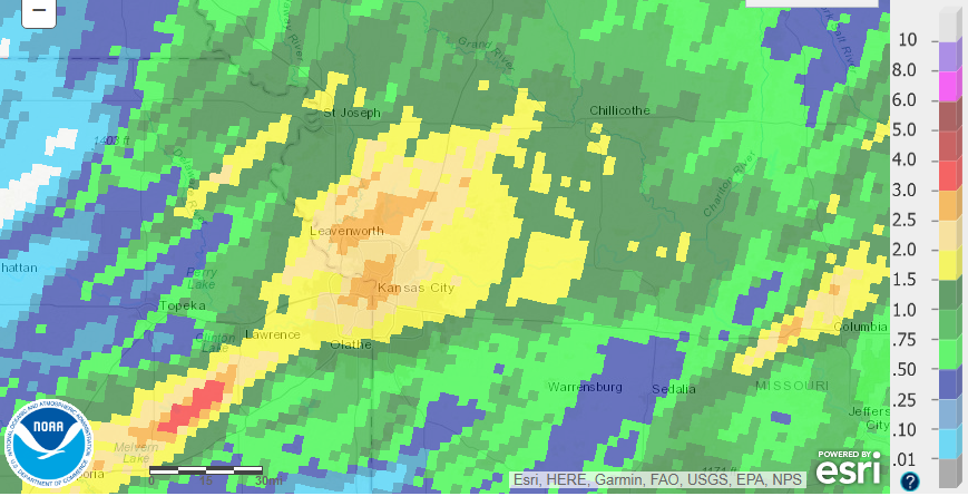 Observed precipitation taking place on September 19, 2013. Notice the 3 inch areas right over the Kansas City Metro. This heavy rain caused much of the flooding experienced in the downtown and Westport areas. |
Flooding
Flooding Photos
 |
 |
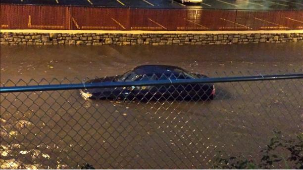 |
| Vehicles drive through flooded roads in the Westport area. Many of these vehicles got stuck in the water, prompting emergency rescues. | Vehicles drive through flooded roads in the Westport area. Many of these vehicles got stuck in the water, prompting emergency rescues. | Vehicles drive through flooded roads in the Westport area. Many of these vehicles got stuck in the water, prompting emergency rescues. |
 |
Media use of NWS Web News Stories is encouraged! Please acknowledge the NWS as the source of any news information accessed from this site. |
|
Hazards
Decision Support
Situation Report
Local Weather Story
Submit Report
Storm Prediction Center
Weather Prediction Center
National Hurricane Center
Active Alerts
National Radar
Current Weather
Local Radar
Local Precipitation/Temperature
National Radar
Satellite
Observations
Observed Precipitation
Water and Air
National Rivers
Local Rivers
Air Quality
Missouri Basin RFC
Forecasts
Decision Support
Weather Story
Forecast Discussion
Local Fire Weather
National Fire Weather
Aviation Weather
FAA Center Weather
Graphical Forecasts
Weather Prediction Center
Space Weather Center
Climate
Climate Prediction Center
KC Records and Normals
KC Holiday Climate
KC Seasonal Rankings
National Climate Services
Climate Data Center
Drought
Local Storm Reports

US Dept of Commerce
National Oceanic and Atmospheric Administration
National Weather Service
Kansas City/Pleasant Hill, MO
1803 North 7 Highway
Pleasant Hill, MO 64080-9421
816-540-6132 (6021 automated weather)
Comments? Questions? Please Contact Us.


 Weather Story
 Weather Map
 Local Radar
 Follow us on X
 Follow us on Facebook
 Follow us on YouTube
 EAX RSS Feed