
A Nor'easter will create hazardous marine and coastal conditions along the Mid-Atlantic coast through mid-week, with significant coastal flooding and beach erosion possible. Meanwhile, another strong storm system is forecast to bring high winds and heavy precipitation to portions of southern Alaska. Elsewhere, relatively benign weather is expected through the first half of the work week. Read More >
Kansas City/Pleasant Hill, MO
Weather Forecast Office
Strong thunderstorms moved through the Grandview and Plaza areas around midday producing two microbursts. These winds downed trees and caused damage to the roof of the Plaza Branch of the Kansas City Public Library.
Below is a series of satellite images showing the cluster of thunderstorms as they moved into the Kansas City area. The IR image shows a small area of colder cloud top temperatures had developed, indicating that the storms had intensified. The images show the tops then warmed as the storms moved across Kansas City, which is indicative of a collapsing thunderstorm and associated microburst.
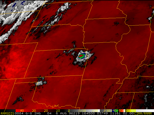 1645Z 1645Z |
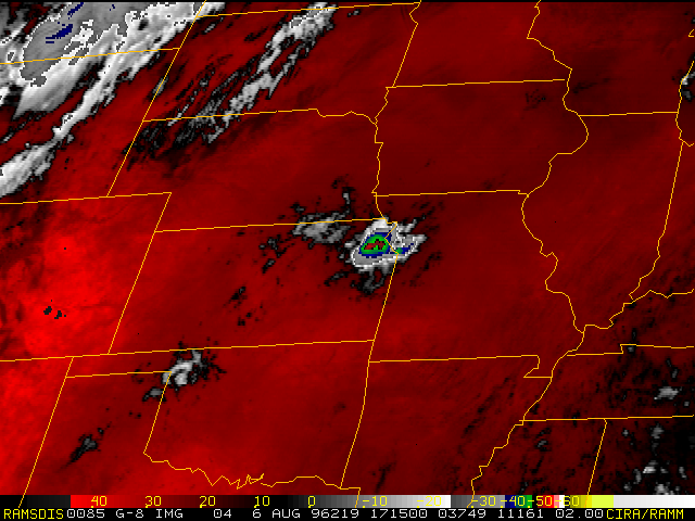 1715Z 1715Z |
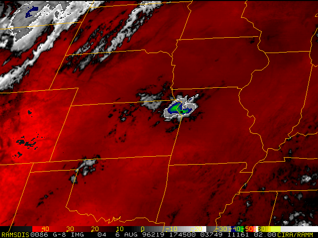 1745Z 1745Z |
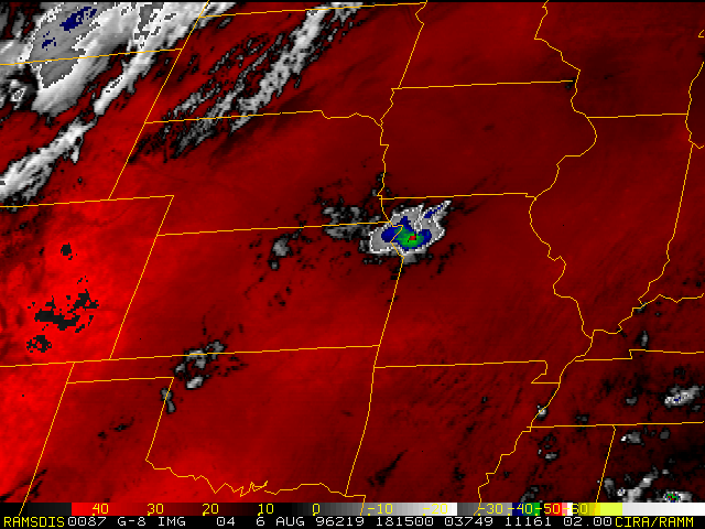 1815Z 1815Z |
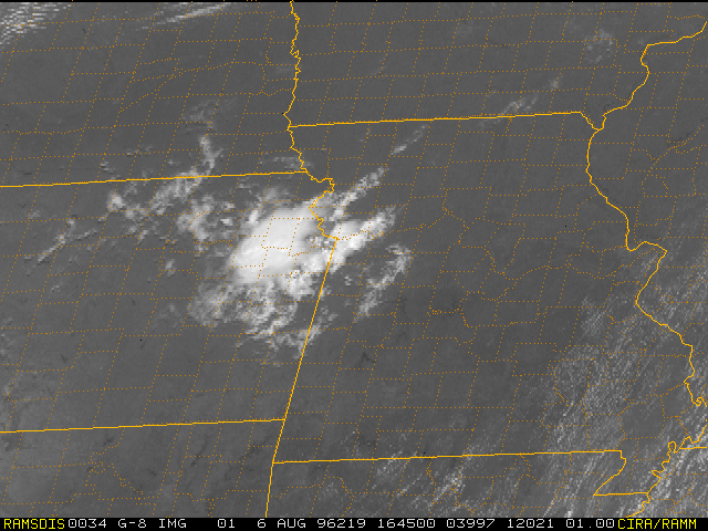 1645Z 1645Z |
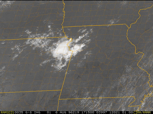 1715Z 1715Z |
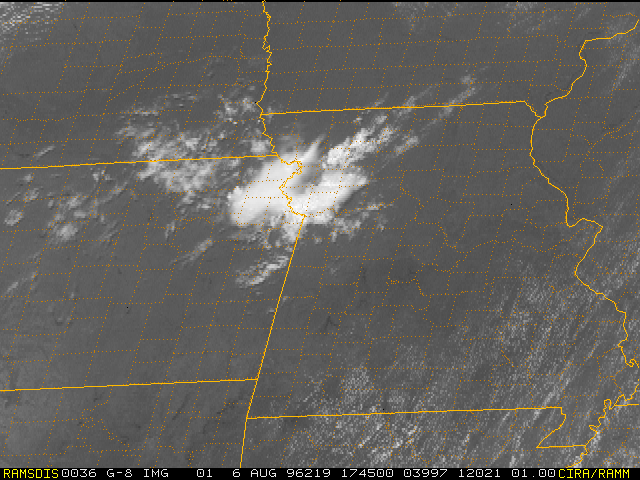 1745Z 1745Z |
Hazards
Decision Support
Situation Report
Local Weather Story
Submit Report
Storm Prediction Center
Weather Prediction Center
National Hurricane Center
Active Alerts
National Radar
Current Weather
Local Radar
Local Precipitation/Temperature
National Radar
Satellite
Observations
Observed Precipitation
Water and Air
Missouri Basin RFC
National Rivers
Local Rivers
Air Quality
Forecasts
Decision Support
Weather Story
Forecast Discussion
Local Fire Weather
National Fire Weather
Aviation Weather
FAA Center Weather
Graphical Forecasts
Weather Prediction Center
Space Weather Center
Climate
Climate Prediction Center
KC Records and Normals
KC Holiday Climate
KC Seasonal Rankings
National Climate Services
Climate Data Center
Drought
Local Storm Reports

US Dept of Commerce
National Oceanic and Atmospheric Administration
National Weather Service
Kansas City/Pleasant Hill, MO
1803 North 7 Highway
Pleasant Hill, MO 64080-9421
816-540-6132 (6021 automated weather)
Comments? Questions? Please Contact Us.


 Weather Story
 Weather Map
 Local Radar
 Follow us on X
 Follow us on Facebook
 Follow us on YouTube
 EAX RSS Feed