
Remnant moisture from Tropical Storm Rachel will persist over portions of the Great Basin and Southwest on Monday, bringing a potential heavy to excessive rainfall risk. Well above average and potentially record breaking temperatures will develop across the Plains and Midwest early this week, spreading into the Lower Mississippi Valley and Southeast midweek. Read More >
Kansas City/Pleasant Hill, MO
Weather Forecast Office
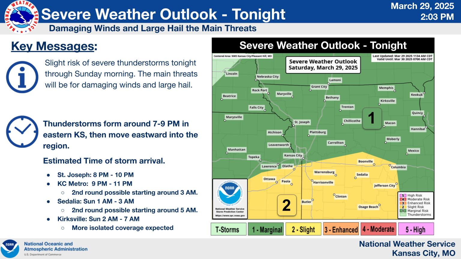
Early Spring Storms Bring Damaging Tornadoes to Northern Missouri and Large Hail to the KC Metro Area
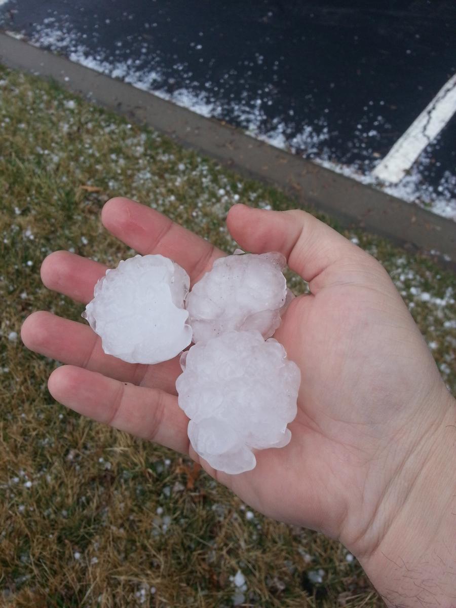
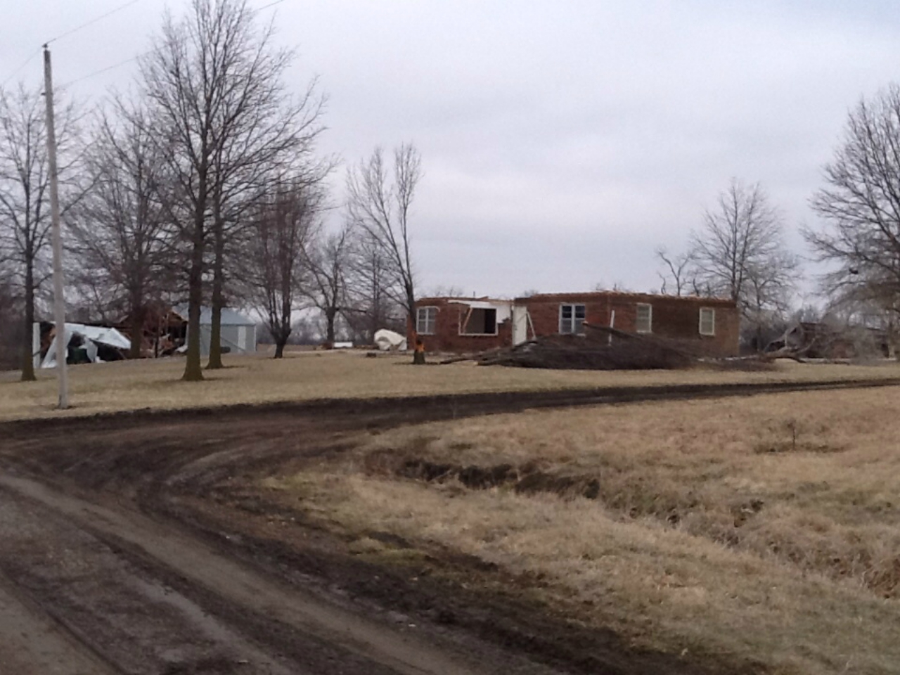
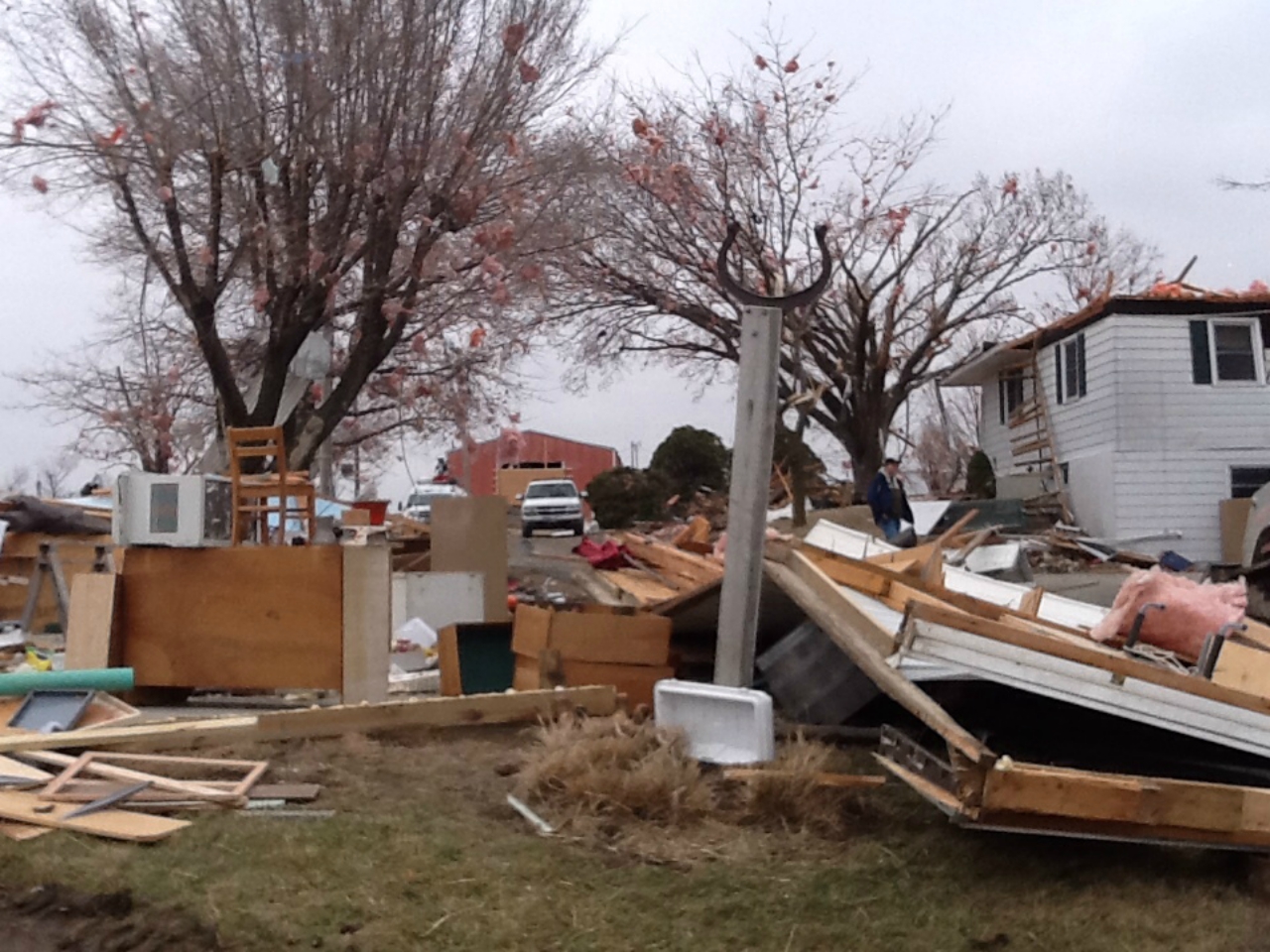
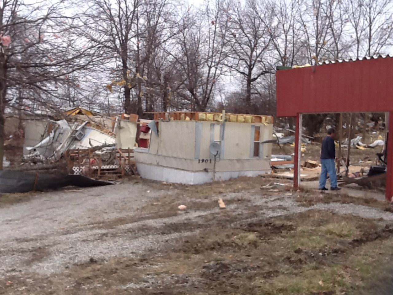
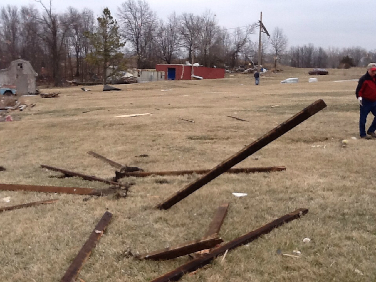
An early spring severe weather system moved through far eastern Kansas and western Missouri causing several supercell thunderstorms to produce large hail up to 2 inches in diameter across the Kansas City Metro area. Farther to the north, across Daviess and Grudy Counties several tornadoes were reported. Several structures sustained heavy damage in and around the Jameson area. As the storm continued to the northeast it produced one more tornado that caused damage to several residences and structures in and around Tindall.
Storm Reports
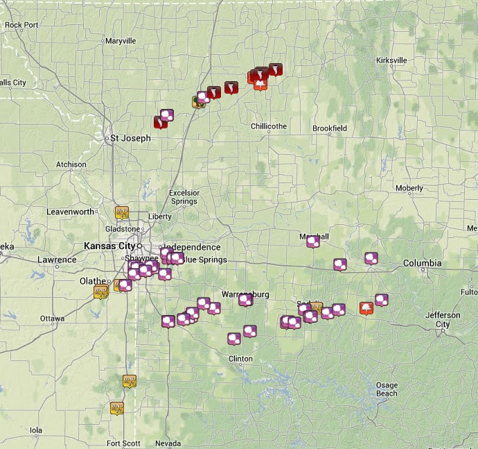
Click image for interactive Storm Report Interface
Tornado Paths
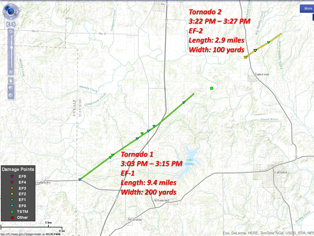
Click image for larger size
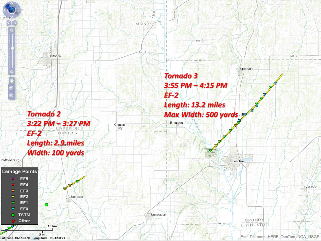
Click image for larger size

Hazards
Decision Support
Situation Report
Local Weather Story
Submit Report
Storm Prediction Center
Weather Prediction Center
National Hurricane Center
Active Alerts
National Radar
Current Weather
Local Radar
Local Precipitation/Temperature
National Radar
Satellite
Observations
Observed Precipitation
Water and Air
Missouri Basin RFC
National Rivers
Local Rivers
Air Quality
Forecasts
Decision Support
Weather Story
Forecast Discussion
Local Fire Weather
National Fire Weather
Aviation Weather
FAA Center Weather
Graphical Forecasts
Weather Prediction Center
Space Weather Center
Climate
Climate Prediction Center
KC Records and Normals
KC Holiday Climate
KC Seasonal Rankings
National Climate Services
Climate Data Center
Drought
Local Storm Reports

US Dept of Commerce
National Oceanic and Atmospheric Administration
National Weather Service
Kansas City/Pleasant Hill, MO
1803 North 7 Highway
Pleasant Hill, MO 64080-9421
816-540-6132 (6021 automated weather)
Comments? Questions? Please Contact Us.


 Weather Story
 Weather Map
 Local Radar
 Follow us on X
 Follow us on Facebook
 Follow us on YouTube
 EAX RSS Feed