
A Nor'easter will create hazardous marine and coastal conditions along the Mid-Atlantic coast through mid-week, with significant coastal flooding and beach erosion possible. Meanwhile, another strong storm system is forecast to bring high winds and heavy precipitation to portions of southern Alaska. Elsewhere, relatively benign weather is expected through the first half of the work week. Read More >
Overview
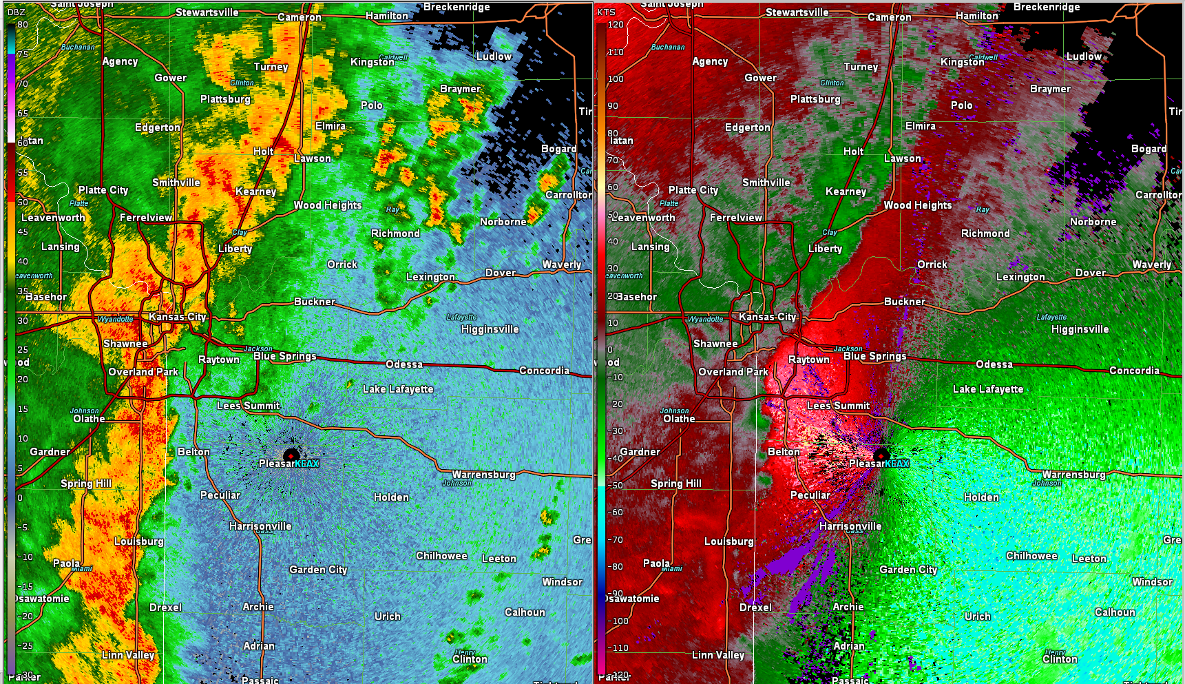
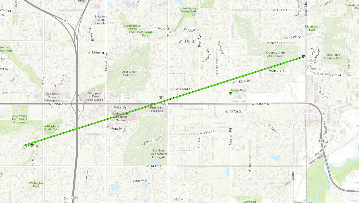
On the evening of May 2, 2018 strong thunderstorms moved out of Kansas and into western Missouri. These storms formed squall line tornadoes, that did damage across portions of the Kansas City Metro Area. The bulk of the damage occurred in Johnson County, Kansas, where several trees were destroyed in the Nottingham Neighborhood near 140th and Antioch. The tornado continued east, where it did window damage at a couple schools along 135th Street. The tornado dissipated near the state line. Several other areas had some tornado and wind damage, although not quite as extensive. Several areas had trees blown down with some damage done to objects they fell onto.
Tornadoes:
|
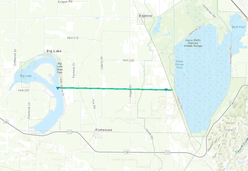
Tornado - Holt County
|
||||||||||||||||
|
Tornado - Overland Park - Leawood
|
||||||||||||||||||
|
Tornado - Belton, Missouri
Track Map 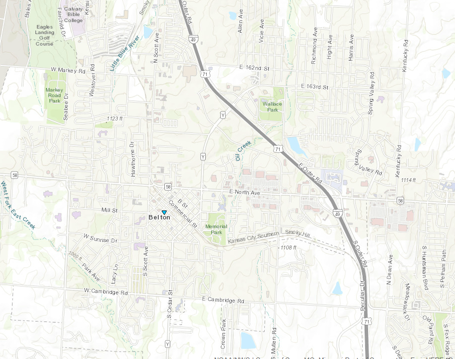 
|
||||||||||||||||
|
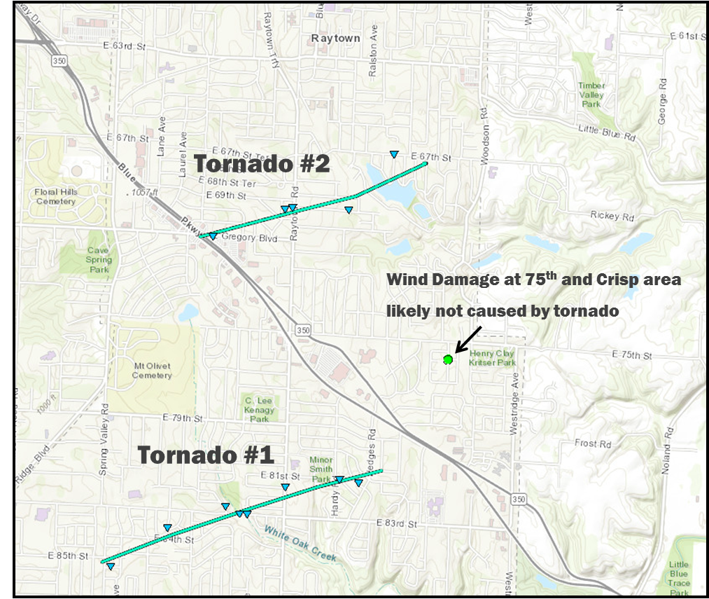
Tornado - Raytown, Missouri #1
|
||||||||||||||||
|
Tornado - Raytown, Missouri #2
|
||||||||||||||||
The Enhanced Fujita (EF) Scale classifies tornadoes into the following categories:
| EF0 Weak 65-85 mph |
EF1 Moderate 86-110 mph |
EF2 Significant 111-135 mph |
EF3 Severe 136-165 mph |
EF4 Extreme 166-200 mph |
EF5 Catastrophic 200+ mph |
 |
|||||
Wind:
.jpg) |
.jpg) |
.jpg) |
.jpg) |
|
Strong tornadic winds caused power pole and tree damage across Johnson County. Photo Courtesy Johnson County Emergency Management |
Strong tornadic winds caused power pole and tree damage across Johnson County. Photo Courtesy Johnson County Emergency Management |
Strong tornadic winds caused power pole and tree damage across Johnson County. Photo Courtesy Johnson County Emergency Management |
Strong tornadic winds caused power pole and tree damage across Johnson County. Photo Courtesy Johnson County Emergency Management |
 |
Media use of NWS Web News Stories is encouraged! Please acknowledge the NWS as the source of any news information accessed from this site. |
|



 Weather Story
 Weather Map
 Local Radar
 Follow us on X
 Follow us on Facebook
 Follow us on YouTube
 EAX RSS Feed