Summary of North and Central Georgia
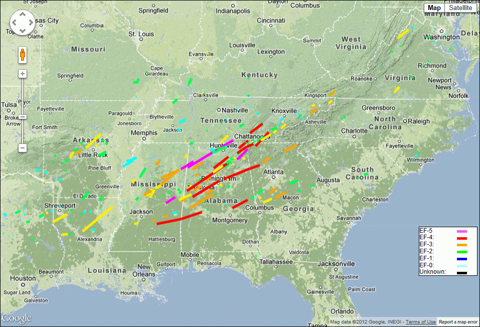
Tornado Outbreak April 27th and 28th
Event Summary
A strong area of low pressure lifted through the Ohio valley allowing a cold front to sweep through the lower Mississippi valley during the evening hours of April 27th. Ahead of the front, increased moisture emanating off the Gulf of America combined with a potent upper level system to produce widespread severe weather. All of north and central Georgia was placed under a moderate risk of severe thunderstorms and northwest Georgia was covered by a rare high risk area. As the evening progressed, a Tornado Watch was issued with the designation of PDS, or Particularly Dangerous Situation, indicating a high potential for strong and long lived tornadoes. Numerous long-tracked tornadoes, including several EF-5 tornadoes, raked over much of the southeast states causing extensive damage and, unfortunately, loss of life. In total, 15 tornadoes tracked across the Peachtree City forecast area, which includes most of north and central Georgia. As of May 3rd, the total number of confirmed tornadoes from April 25th to 28th had grown to 178. The previous record for a multi-day event was April 3-4, 1974 when 148 tornadoes occurred.
Storm surveys were conducted in the days following the event. Information posted below is based on results from survey teams and will be updated as additional information is received.
| Counties | Date and Time | Rating | # of Deaths | # of Injuries |
|---|---|---|---|---|
| Catoosa | April 27, 8:15 PM | EF-4 | 7 | 30 |
| Dade, Walker | April 27, 5:35 PM | EF-3 | 2 | 50 |
| Bartow, Cherokee, Pickens | April 27, 9:25 PM | EF-3 | 0 | 6 |
| Meriwether, Spalding, Henry | April 28, 12:03 AM | EF-3 | 2 | - |
| Pike, Lamar, Monroe, Butts | April 28, 12:38 AM | EF-3 | 2 | 22 |
| Polk, Floyd, Bartow | April 27, 8:45 PM | EF-2 | 0 | 4 |
| Lumpkin, White | April 27, 10:30 PM | EF-2 | 0 | 1 |
| Troup | April 27, 11:20 PM | EF-2 | 0 | 6 |
| Harris, Meriwether, Upson | April 27, 11:50 PM | EF-2 | 0 | 0 |
| Dade | April 27, 8:40 AM | EF-1 | 0 | 0 |
| Dade | April 27, 7:50 PM | EF-1 | 0 | 0 |
| Troup, Heard, Coweta | April 27, 10:45 PM | EF-1 | 0 | 1 |
| Newton, Morgan, Greene | April 28, 1:11 AM | EF-1 | 0 | 0 |
| Putnam, Hancock | April 28, 2:30 AM | EF-1 | 0 | 0 |
| Warren | April 28, 3:39 AM | EF-1 | 0 | 0 |
EF4 Tornado
A National Weather Service survey team determined that an EF4 tornado with winds of 175 MPH occurred in Catoosa County. It touched down approximately 815 PM EDT Wednesday evening along Davis Ridge Road, traveling through Ringgold to Cohutta and into Tennessee. The path length was 13 miles with a width of one third of a mile. Seven fatalities and 30 injuries occurred with this tornado. 75 to 100 homes were damaged or destroyed. The worst damage was located on Cherokee Valley Road where 12 homes were obliterated.
![[ Path of EF-4 tornado that struck Catoosa county. ]](/images/ffc/events/20110427/RinggoldEF4TornadoPath_sm.jpg) Path of EF-4 tornado that struck Catoosa County |
![[ Tornado Damage from Catoosa county. ]](/images/ffc/events/20110427/Catoosa_Damage_086.JPG) Tornado path through Cherokee Valley and along Cherokee Ridge northeast of Ringgold, GA. |
![[ Tornado Damage from Catoosa county. ]](/images/ffc/events/20110427/dade_066.JPG) EF4 damage along Cherokee Valley Road northeast of Ringgold, GA. At least 15 homes were obliterated on this valley floor. Four fatalities occurred in this area. |
![[ Tornado Damage from Catoosa county. ]](/images/ffc/events/20110427/Dade_131.JPG) Remains of a house near the EF4 tornado damage. A family survived the tornado by taking shelter in this bathroom – the only room left standing. |
![[ Reflectivity image of Catoosa Tornado. ]](/images/ffc/events/20110427/catoosa_tor_2011apr27_refl_sm.png) Reflectivity image of Catoosa County tornado |
![[ Storm Relative Velocity of Catoosa tornado. ]](/images/ffc/events/20110427/catoosa_tor_2011apr27_srm_sm.png) Storm Relative Velocity of Catoosa County tornado |
EF3 Tornadoes
A National Weather Service survey team determined that an EF3 tornado with winds of 150 MPH occurred in Dade and Walker Counties. The tornado moved across the state line into Dade County around 5 miles southwest of Trenton at approximately 535 PM EDT, and lifted just west of Fort Oglethorpe in Walker County around 557 PM EDT. The path length was 18 miles with a width of six tenths of a mile. Note that this path length ONLY includes the area in Georgia (the tornado tracked into Georgia from Alabama). Homes were destroyed, 18 with major damage and tens of thousands of trees were downed. There were 2 fatalities and 12 injuries with this storm.
![[ Path of EF-3 tornado that struck Dade and Walker Counties ]](/images/ffc/events/20110427/TrentonEF3TornadoPath_sm.jpg) Path of EF-3 tornado that struck Dade and Walker Counties |
![[ Tornado Damage from Dadecounty ]](/images/ffc/events/20110427/Dade_037.JPG) Remnants of home swept off a ridge overlooking Trenton, GA |
![[ Tornado Damage from Dade county ]](/images/ffc/events/20110427/Dade_051.JPG) Destroyed homes at Georgia/Alabama line near County Road 201 |
![[ Tornado Damage from Dade county ]](/images/ffc/events/20110427/Dade_066.JPG) Several damaged/destroyed homes and a bank building (upper right) in Trenton |
![[ Reflectivity image of Dade county tornado ]](/images/ffc/events/20110427/dade_tor2_2011apr27_refl_sm.png) Reflectivity image of tornado in Dade County |
![[ Storm Relative Velocity of Dade county tornado ]](/images/ffc/events/20110427/dade_tor2_2011apr27_srm_sm.png) Storm Relative Velocity image of tornado in Dade County |
Bartow, Cherokee, and Pickens Counties
A National Weather Service survey team along with the Cherokee county Emergency Management determined that an EF3 tornado with winds of 150 MPH touched down around 925 PM EDT Wednesday evening. It tracked from 5 miles northeast of Kingston in Bartow County, crossing northwest Cherokee County, and lifted approximately 7 miles west of Jasper in Pickens County near the intersection of Jerusalem Church Road and State Highway 53 at approximately 945 PM EDT. The path length was 23 miles and width was a half mile. Several chicken houses were destroyed along Interstate 75, several outbuildings were destroyed and hundreds of trees were downed in Bartow County. Hundreds of trees were snapped or uprooted in Cherokee County. Extensive damage was reported along Henderson Mountain Road and Bryant Road in Pickens County where several mobile homes were destroyed. At least 3 injuries were reported with this tornado, two in Bartow and one in Pickens.
![[ Path of EF-3 tornado that struck Bartow, Cherokee, and Pickens Counties ]](/images/ffc/events/20110427/bartow_cherokee_pickens_tor_track_2011april27_sm.png) Path of EF-3 tornado that struck Bartow, Cherokee, and Pickens Counties |
![[ Tornado Damage from Bartow county ]](/images/ffc/events/20110427/Bartow_Tor_1.JPG) Car pushed into a pool by a tornado in Bartow County |
![[ Tornado Damage from Bartow county ]](/images/ffc/events/20110427/Bartow_tor_2.JPG) House destroyed by tornado in Bartow County |
![[ Tornado Damage from Bartow county ]](/images/ffc/events/20110427/Bartow_Tor_3.JPG) Aerial photo showing damage from tornado in Bartow County |
![[ Reflectivity image of Bartow Tornado ]](/images/ffc/events/20110427/bartow_tor_2011apr27_refl_sm.png) Reflectivity image of tornado in Bartow County |
![[ Storm Relative Velocity of Bartow Tornado ]](/images/ffc/events/20110427/bartow_tor_2011apr27_srm_sm.png) Storm Relative Velocity image of tornado in Bartow County |
Meriwether, Spalding, and Henry Counties
A National Weather Service survey team determined that an EF3 tornado with winds of 140 MPH touched down 6 miles north northeast of Gay in Meriwether County at approximately 1203 AM EDT Thursday morning. It tracked across Spalding county and lifted 2 miles south of Hampton in Henry county at approximately 1228 AM EDT. The tornado had a path length of 20 miles and a width of half of a mile.
![[ Path of EF-3 tornado that struck Meriwether, Spalding, and Henry counties ]](/images/ffc/events/20110427/spalding_tor_track_2011april27_sm.png) Path of EF-3 tornado that struck Meriwether, Spalding, and Henry Counties |
![[ Tornado Damage from Spalding county ]](/images/ffc/events/20110427/Spalding_tor_1.JPG) Home destroyed in the Birdie area (Spalding County) |
![[ Tornado Damage from Spalding county ]](/images/ffc/events/20110427/Spalding_Tor_2.JPG) Home destroyed in the Birdie area (Spalding County) |
![[ Tornado Damage from Spalding county ]](/images/ffc/events/20110427/Spalding_Tor_3.JPG) Damage between Vaughn and Rio (Spalding County) |
![[ Reflectivity image of Spalding county tornado ]](/images/ffc/events/20110427/spalding_tor_2011apr28_refl_sm.png) Reflectivity image of tornado in Spalding County |
![[ Storm Relative Velocity of Spalding county tornado ]](/images/ffc/events/20110427/spalding_tor_2011apr28_srm_sm.png) Storm Relative Velocity image of tornado in Spalding County |
Pike, Lamar, Monroe, and Butts Counties
A National Weather Service survey team determined that an EF3 tornado with winds of 140 MPH crossed Pike, Lamar, Monroe and Butts Counties early Thursday morning. The tornado touched down at approximately 1238 AM EDT Thursday morning along highway 19 about 4 miles south of Meansville in south central Pike county. Three houses were destroyed along Piedmont Road about three miles west of Barnesville. Two fatalities occurred when a house was destroyed along Grove Street in Lamar county. A Chevron gas station and a church were destroyed in Barnesville. Three tractor trailers were blown off the road near I-75 at approximately 102 AM EDT. Three houses were damaged, one of which was destroyed. Three people were injured in the damaged house. The tornado lifted in southeast Butts county at approximately 115 AM EDT. The tornado had a path length of approximately 30 miles and a maximum width of six tenths of a mile.
![[ Path of EF-3 tornado that struck Pike, Lamar, Monroe, and Butts counties ]](/images/ffc/events/20110427/pike_tor_track_28april2011_sm.png) Path of EF-3 tornado that struck Pike, Lamar, Monroe, and Butts Counties |
![[ Tornado Damage from Lamar county. ]](/images/ffc/events/20110427/Barnesville_tor_2.JPG) Damage to home on Piedmont Road west of Barnesville (Lamar County) |
![[ Tornado Damage from Lamar county. ]](/images/ffc/events/20110427/Barnesville_tor_1.JPG) Chevron gas station in Barnesville (Lamar County) |
![[ Tornado Damage from Monroe county. ]](/images/ffc/events/20110427/Monroe_Tor_1.JPG) Damage to home in the Weldon Road area (Monroe County) |
![[ Reflectivity image of Lamar Tornado. ]](/images/ffc/events/20110427/lamar_tor_2011apr28_refl_sm.png) Reflectivity image of tornado in Lamar County |
![[ Storm Relative Velocity of Lamar Tornado. ]](/images/ffc/events/20110427/lamar_tor_2011apr28_srm_sm.png) Storm Relative Velocity image of tornado in Lamar County |
![[ 3-D View of Storm Relative Velocity of the tornado as it tracked across Barnesville. ]](/images/ffc/events/20110427/Barnesville_Tornado_srm.gif) 3-D View of the Storm Relative Velocity of the tornado as it tracked across Barnesville. (Courtesy of Jonathan Fox) |
EF2 Tornadoes
Polk, Floyd, and Bartow Counties
A National Weather Service survey team determined that an EF2 tornado with maximum winds of 125 MPH moved across extreme northwest Polk, south Floyd, and Bartow Counties Wednesday evening. The tornado touched down about 6 miles southwest of Cave Springs in Polk county around 845 PM EDT Wednesday. It lifted about 4 miles southwest of Kingston in Bartow county around 925 PM EDT. The path length was 26 miles long and had a width of a half mile wide. More than 13 structures were destroyed and in addition about 10 chicken houses were destroyed.
![[ Path of EF-2 tornado that struck Polk, Floyd, and Bartow Counties. ]](/images/ffc/events/20110427/polk_floyd_bartow_2011april27_sm.png) Path of EF-2 tornado that struck Polk, Floyd, and Bartow Counties |
![[ Tornado Damage from Polk county. ]](/images/ffc/events/20110427/PolkFloydCoLineMountainHomeLoop2.JPG) Chicken houses destroyed on Mountain Home Road (Polk/Floyd County line) |
![[ Tornado Damage from Floyd county. ]](/images/ffc/events/20110427/OldCedartownRd2.JPG) Damage to home on Old Cedartown Road just south of Lindale (Floyd County) |
![[ Reflectivity image of Floyd Tornado. ]](/images/ffc/events/20110427/floyd_tor_2011apr27_refl_sm.png) Reflectivity image of tornado in Floyd County |
![[ Storm Relative Velocity of Floyd Tornado. ]](/images/ffc/events/20110427/floyd_tor_2011apr27_srm_sm.png) Storm Relative Velocity image of tornado in Floyd County |
A National Weather Service survey team in conjunction with the White county Emergency Management Staff determined that an EF2 tornado with maximum winds of 120 MPH moved across northeast Lumpkin and into northern White county. The tornado touched down about 5 miles east southeast of Suches in Lumpkin county around 1030 PM EDT Wednesday and tracked 17.5 miles northeast to the White-Habersham county line about 7 miles north northeast of Helen around 1050 PM EDT. This tornado continued into Habersham and Rabun counties where it produced further damage (see the latest report from the Greenville-Spartanburg NWS Office for more information). This long tracked tornado downed tens of thousands of trees across the steep terrain of the Chattachoochee National Forest. Due to the remote nature of the area, only 12 homes were damaged, mostly due to trees falling on them. A White county patrolman was trapped on Richard B. Russell Parkway for a few hours after falling trees blocked the road on both sides. The maximum path width was a quarter of a mile. Please note that these photos provide undeniable evidence that mountains and valleys do not offer any protection from tornadoes.
![[ Path of EF-2 tornado that struck Lumpkin and White Counties. ]](/images/ffc/events/20110427/LumpkinWhiteEF2TornadoPath_sm.jpg) Path of EF-2 tornado that struck Lumpkin and White Counties |
![[ Thousands of trees down in the Chattahoochee National Forest ]](/images/ffc/events/20110427/White_Tor.JPG) Thousands of trees down in the Chattahoochee National Forest |
![[ Trees on homes in the Tray Mountain Road area of northeast White county ]](/images/ffc/events/20110427/White_Tor_2.JPG) Trees on homes in the Tray Mountain Road area of northeast White County |
![[ Trees on a home in the Poplar Stump road area of northwest White county ]](/images/ffc/events/20110427/white_tor_3.JPG) Trees on a home in the Poplar Stump road area of northwest White County |
![[ Reflectivity image of Lumpkin and White county tornado ]](/images/ffc/events/20110427/lumpkin-white_tor_2011apr27_refl_sm.png) Reflectivity image of tornado in Lumpkin and White Counties |
![[ Storm Relative Velocity of Lumpkin and White county tornado ]](/images/ffc/events/20110427/lumpkin-white_tor_2011apr27_srm_sm.png) Storm Relative Velocity image of tornado in Lumpkin and White Counties |
Troup county (south of LaGrange)
A National Weather Service survey team determined that an EF2 tornado with winds of 120 MPH developed 5 miles south of LaGrange around 1120 PM EDT Wednesday night. The tornado tracked for 7 miles before lifting around 6 miles east southeast of LaGrange at 1130 PM EDT. The path length was 7 miles and the width was up to one quarter mile. Around 15 homes were destroyed and around 50 homes sustained heavy to minor damage along its path. Thousands of trees were snapped and uprooted with many powerlines down. The most significant damage occurred near Highway 219 and Murphy Road about 2 miles south of the city limits of LaGrange. About 12 homes were destroyed in this area. One home was picked up and thrown 50 feet and its sunroom was thrown 300 yards. A well built log cabin on a hill top was blown off its foundation in the opposite direction of the tornado's movement and destroyed. There were at least 5 injuries in this area as well.
![[ Path of EF-2 tornado that struck Troup county. ]](/images/ffc/events/20110427/TroupEF2TornadoPath_sm.jpg) Path of EF-2 tornado that struck Troup County |
![[ Tornado Damage from Troup county. ]](/images/ffc/events/20110427/Troup_Tor_1.JPG) This home was thrown 50 feet from its foundation and rotated 90 degrees. The residents were taking shelter in the bathroom and were not injured. |
![[ ]](/images/ffc/events/20110427/troup_tor_2.jpg) Well-built cabin destroyed on top of a hill overlooking Murphy Rd |
![[ ]](/images/ffc/events/20110427/troup_tor_3.jpg) Damaged home near Hood Rd near Vulcan Materials Facility |
![[ Reflectivity image of Troup Tornado. ]](/images/ffc/events/20110427/troup_tor_2011apr27_refl_sm.png) Reflectivity image of tornado in Troup County |
![[ Storm Relative Velocity of Troup Tornado. ]](/images/ffc/events/20110427/troup_tor_2011apr27_srm_sm.png) Storm Relative Velocity image of tornado in Troup County |
Harris, Meriwether, and Upson Counties
A National Weather Service survey team determined that an EF2 tornado with winds of 130 MPH crossed Harris, Meriwether, and Upson Counties Wednesday night. The tornado touched down 2 miles northwest of Pine Mountain Valley around 1150 PM EDT Wednesday night and lifted about 9 miles northwest of Thomaston along Highway 74 around 1225 AM EDT. The path length was 24 miles long with an average width of half a mile. Its widest point was close to three quarters of a mile along Highway 354 (just north of Pine Mountain Valley). Thousands of trees were snapped and uprooted with many power lines down. While significant damage was experienced along most of the path with house damage and barns destroyed, the most extensive was located within Franklin Delano State Park. Within the park, it is estimated that 30 percent of the 40 structures located in a campground were heavily damaged or destroyed including a large assembly shelter. Due to the extensive tree damage limiting access within the park, assessments for the precise number of homes and cabins affected are ongoing.
![[ Path of EF-2 tornado that struck Harris, Meriweather, and Upson Counties. ]](/images/ffc/events/20110427/harris_tor_path_2011apr27.JPG) Path of EF-2 tornado that struck Harris, Meriwether, and Upson Counties |
![[ Tornado Damage from Harris county. ]](/images/ffc/events/20110427/Harris_tor_1.jpg) Damage to a structure in FDR State Park (Harris County) |
![[ Tornado Damage from Meriwether county. ]](/images/ffc/events/20110427/Harris_tor_2.JPG) Damage to a hotel near Warm Springs (Meriwether County) |
![[ Tornado Damage from Meriwether county. ]](/images/ffc/events/20110427/Harris_Tor_3.JPG) Tree uprooted (Meriwether County) |
![[ Reflectivity image of Meriwether Tornado. ]](/images/ffc/events/20110427/meriwether_tor_2011apr28_refl_sm.png) Reflectivity image of tornado in Meriwether County |
![[ Storm Relative Velocity of Meriwether Tornado. ]](/images/ffc/events/20110427/meriwether_tor_2011apr28_srm_sm.png) Storm Relative Velocity image of tornado in Meriwether County |
EF1 Tornadoes
Dade county (occurring Wednesday morning)
A National Weather Service survey team determined that an EF1 tornado with 110 MPH winds tracked from Trenton northward to the Tennessee state line in Dade County at approximately 8:40 AM. The tornado had a path length of 7 miles and was 50 yards wide. There was minor damage to homes and an elementary school.
![[ Path of EF-1 tornado that struck Dade county. ]](/images/ffc/events/20110427/trenton_ef1_tor_track_2011april27_sm.png) Path of EF-1 tornado that struck Dade County at 8:40 AM |
Dade County (occurring Wednesday evening)
A National Weather Service survey team determined that an EF1 tornado with 110 MPH winds tracked from Fox Mountain to Rising Fawn in Dade County at approximately 7:50 PM. This tornado tracked into the state from Alabama and within Georgia it had a path length of 3 miles and was 100 yards wide.
![[ Path of EF-1 tornado that struck Dade county. ]](/images/ffc/events/20110427/dade_rising_fawn_tor_track_2011april27_sm.png) Path of EF-1 tornado that struck Dade County at 7:50 PM |
![[ Reflectivity image of Dade Tornado (7:50 PM). ]](/images/ffc/events/20110427/dade_tor3_2011apr27_refl_sm.png) Reflectivity image of tornado in Dade County (7:50 PM) |
![[ Storm Relative Velocity of Dade Tornado. ]](/images/ffc/events/20110427/dade_tor3_2011apr27_srm_sm.png) Storm Relative Velocity image of tornado in Dade County (7:50 PM) |
Troup, Heard and Coweta Counties
A National Weather Service survey team determined that an EF1 tornado with winds of 90 MPH crossed parts of northeast Troup, southeast Heard and southwest Coweta Counties. The tornado touched down 3 miles west of Hillcrest around 1045 PM EDT Wednesday night and lifted 5 miles northwest of Grantville around 1110 PM EDT Wednesday night. The path length was 17 miles with a maximum width around 100 yards. A hauling trailer and horse trailer were thrown around 20 feet. About 5 homes were damaged in southeast Heard county in and near Miller Road. One home was heavily damaged as it lost two exterior walls and part of its roof. Around 1000 trees were estimated to be snapped or uprooted along its path. No injuries were reported.
![[ Path of EF-1 tornado that struck Troup, Heard, and Coweta counties ]](/images/ffc/events/20110427/TroupHeardCowetaEF1TornadoPath_sm.jpg) Path of EF-1 tornado that struck Troup, Heard, and Coweta Counties |
![[ Tornado Damage from Heard county. ]](/images/ffc/events/20110427/Troup_Heard_Coweta_1.JPG) Extensive Tree damage (Coweta County) |
![[ Tornado Damage from Heard county. ]](/images/ffc/events/20110427/Troup_Heard_Coweta_2.JPG) Damage to home in the Miller Road area (Heard County) |
![[ Tornado Damage from Heard county. ]](/images/ffc/events/20110427/Troup_heard_coweta_3.JPG) Damage to home in the Miller Road area (Heard County) |
![[ Reflectivity image of Troup Tornado. ]](/images/ffc/events/20110427/troup_tor1_2011apr27_refl_sm.png) Reflectivity image of tornado in Troup County |
![[ Storm Relative Velocity of Troup Tornado. ]](/images/ffc/events/20110427/troup_tor1_2011apr27_srm_sm.png) Storm Relative Velocity image of tornado in Troup County |
Newton, Morgan, and Greene Counties
A National Weather Service survey team determined that an EF1 tornado with winds of 105 MPH occurred early Thursday morning. It touched down 1 mile west of Newborn in Newton County at approximately 111 AM EDT Thursday morning and lifted 6 miles west of Greensboro in Greene County at approximately 138 AM EDT. It had a path length of 25 miles and a width of half a mile. A shopping center in Madison had a tin roof peeled back. Thousands of trees were downed. Approximately 50 structures sustained damage from downed trees. One trailer had part of the back ripped off. Two trailers sustained tree damage. Three other trailers that were not tied down were flipped.
![[ Path of EF-1 tornado that struck Newton, Morgan, and Greene Counties. ]](/images/ffc/events/20110427/morgan_tor_track_2011april27_sm.jpg) Path of EF-1 tornado that struck Newton, Morgan, and Greene Counties |
![[ Tornado Damage from Newton county. ]](/images/ffc/events/20110427/Newton_Tor_1.JPG) Tree damage (Newton County) |
![[ Tornado Damage from Morgan county. ]](/images/ffc/events/20110427/Morgan_Tor_1.JPG) Shopping Center in Madison (Morgan County) |
![[ Tornado Damage from Greene county. ]](/images/ffc/events/20110427/Greene_Tor_1.JPG) Tree damage (Greene County) |
![[ Reflectivity image of Morgan Tornado. ]](/images/ffc/events/20110427/morgan_tor_2011apr28_refl_sm.png) Reflectivity image of tornado in Morgan County |
![[ Storm Relative Velocity of Morgan Tornado. ]](/images/ffc/events/20110427/morgan_tor_2011apr28_srm_sm.png) Storm Relative Velocity image of tornado in Morgan County |
A National Weather Service survey team determined that an EF1 tornado with winds of 90 MPH crossed parts of Putnam and Hancock Counties. The tornado touched down 8 miles southeast of Eatonton near Flat Rock around 230 AM EDT Thursday morning, then lifted 8 miles west northwest of Devereux around 305 AM EDT. The path length was 7 miles and the width was around 200 yards. The roof of an outbuilding was lifted off and 4 homes were heavily damaged or destroyed by falling trees. Numerous trees were snapped or uprooted along its path with several powerlines down.
![[ Path of EF-1 tornado that struck Putnam and Hancock Counties. ]](/images/ffc/events/20110427/putnam_hancock_tor_track_2011april28_sm.png) Path of EF-1 tornado that struck Putnam and Hancock Counties |
![[ Tornado Damage from Putnam county ]](/images/ffc/events/20110427/Putnam357.jpg) Trees on a house near Lake Sinclair (Putnam County) |
![[ Tornado Damage from Putnam county ]](/images/ffc/events/20110427/Putnam364.jpg) Trees on a house near Lake Sinclair (Putnam County) |
![[ Tornado Damage from Putnam county ]](/images/ffc/events/20110427/Putnam367.jpg) Trees down at Lake Sinclair (Putnam County) |
![[ Reflectivity image of Putnam Tornado. ]](/images/ffc/events/20110427/putnam_tor_2011apr28_refl_sm.png) Reflectivity image of tornado in Putnam County |
![[ Storm Relative Velocity of Putnam Tornado. ]](/images/ffc/events/20110427/putnam_tor_2011apr28_srm_sm.png) Storm Relative Velocity image of tornado in Putnam County |
A National Weather Service survey team determined that an EF1 tornado with winds of 105 MPH touched down 4 miles southwest of Norwood at approximately 339 AM EDT Thursday morning and lifted 1 mile northeast of Camak in Warren County at approximately 351 AM EDT. It had a path length of 8 miles and a width of a quarter of a mile. Eight structures were damaged due to fallen trees and hundreds of trees were downed.
![[ Path of EF-1 tornado that struck Warren county. ]](/images/ffc/events/20110427/warren_tor_track_2011april28_sm.png) Path of EF-1 tornado that struck Warren County |
![[ Tornado Damage from Warren county. ]](/images/ffc/events/20110427/Warren_Tor_1.JPG) Damage to home (Warren County) |
![[ Tornado Damage from Warren county. ]](/images/ffc/events/20110427/Warren_Tor_2.JPG) Damage to home (Warren County) |
![[ Reflectivity image of Warren Tornado. ]](/images/ffc/events/20110427/warren_tor_2011apr28_refl_sm.png) Reflectivity image of tornado in Warren County |
![[ Storm Relative Velocity of Warren Tornado. ]](/images/ffc/events/20110427/warren_tor_2011apr28_srm_sm.png) Storm Relative Velocity image of tornado in Warren County |

