Atlanta/Peachtree City, GA
Weather Forecast Office
|
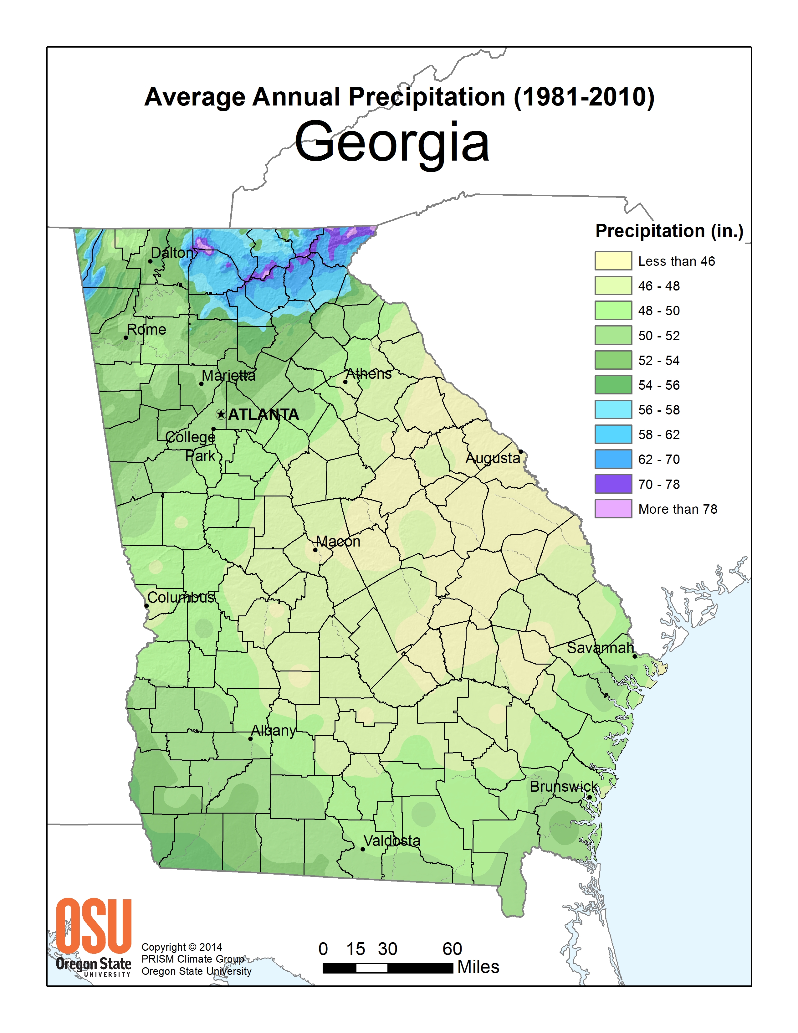
Rainfall Resources
NATIONAL MAPS
|
|
Current Hazards
Local Storm Reports
Local
Submit Storm Report
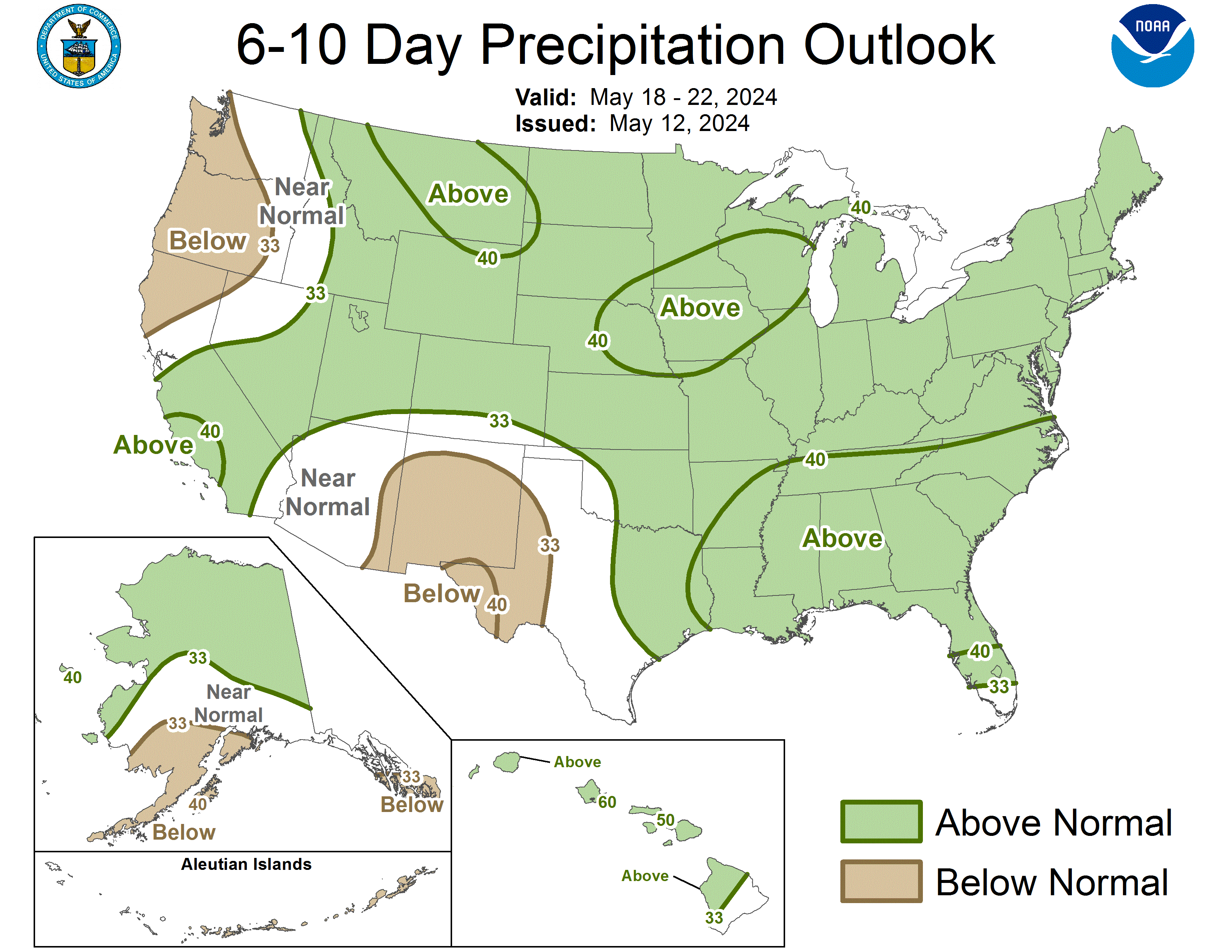
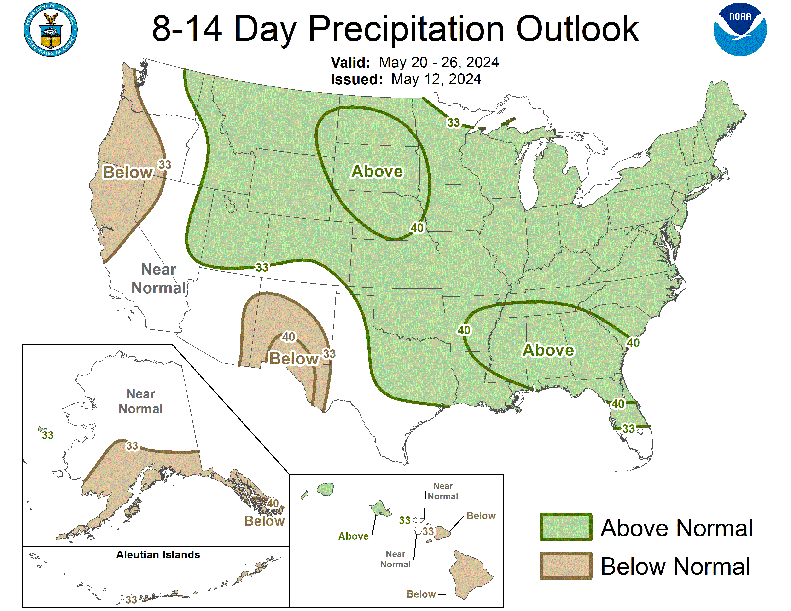
Outlooks
Georgia Road Conditions
Nationwide
Forecasts
Aviation Weather
Activity Planner
Recreational Forecast
Fire Weather
Forecast Discussion
Incident Support
Tropical Weather
Local
Computer Models
Graphical
Current Weather
Observations
Maps
Rivers/Lakes
Satellite Images
Radar Imagery
Warner Robins
Peachtree City
Regional Loop
Nationwide
US Dept of Commerce
National Oceanic and Atmospheric Administration
National Weather Service
Atlanta/Peachtree City, GA
4 Falcon Drive
Peachtree City, GA 30269
770.486.1133
Comments? Questions? Please Contact Us.


