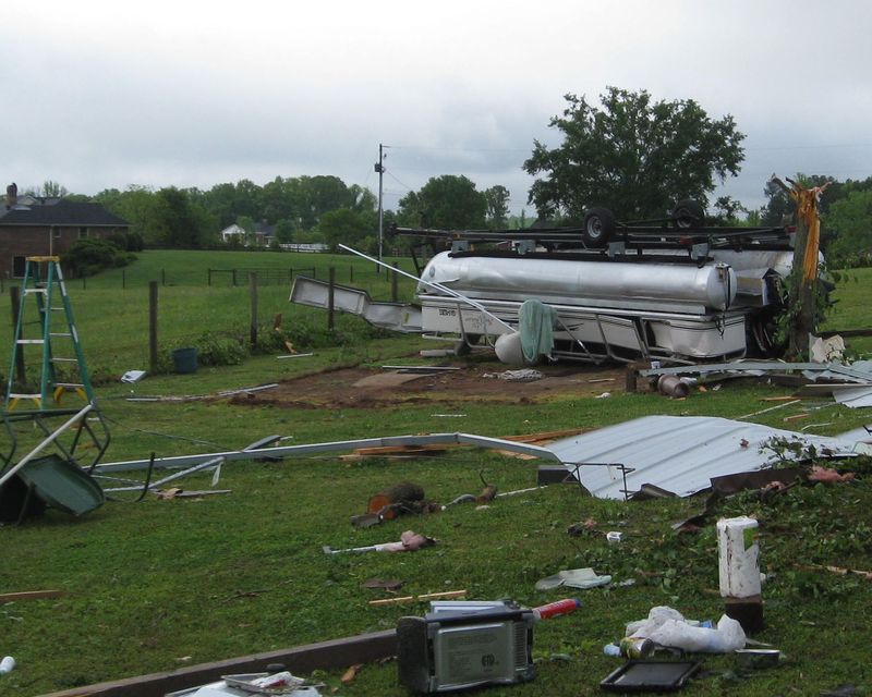
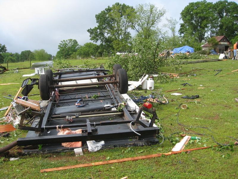
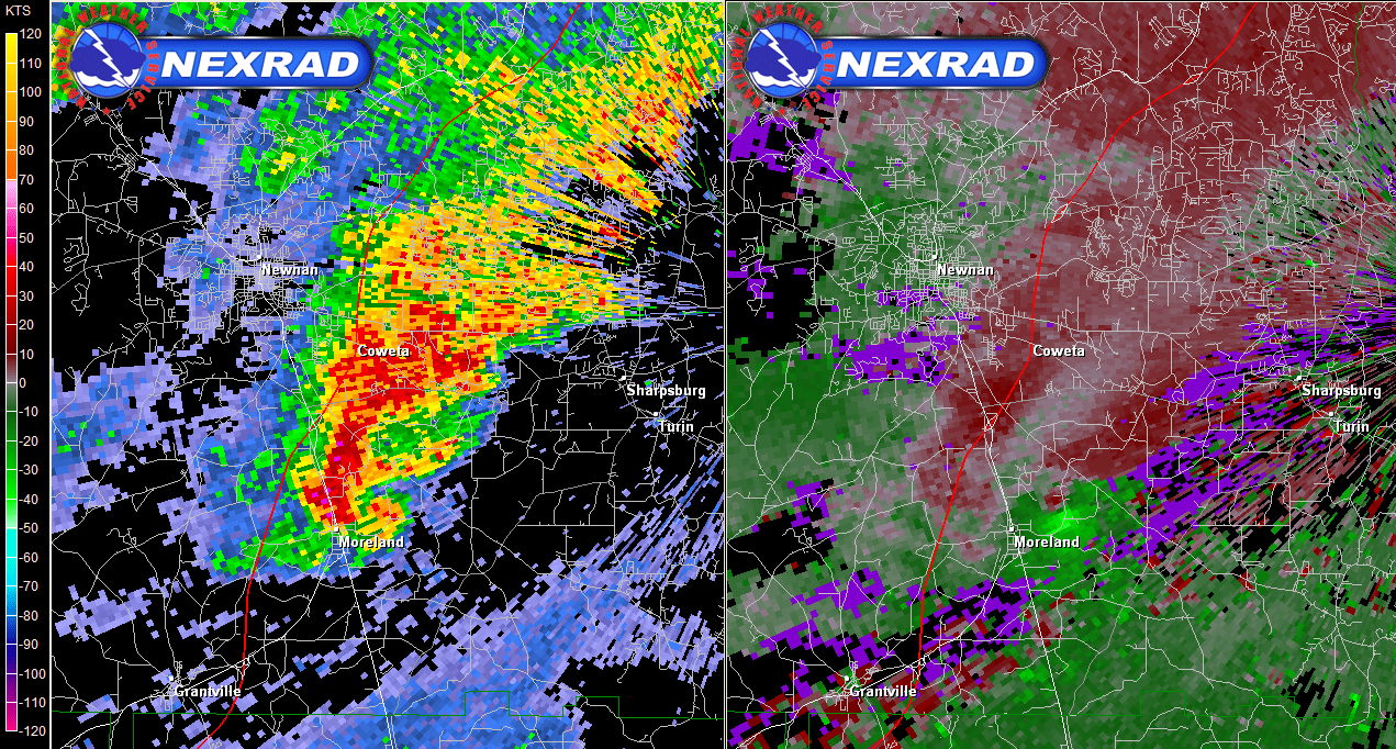
Southerly winds brought rich moisture into the area this weekend ahead of a storm system over the midwest to midsouth states. With rain and clouds to the north and clearing skies to the south, a strong stationary front developed over north Georgia from near LaGrange to south of Augusta. Severe storms developed in the early afternoon along this east-to -west oriented front and tracked east, tapping into the warmer, more unstable air to the south. Some of the storms produced large hail up to golf ball size and wind damage. The storms produced two tornadoes - one near Moreland (Coweta County) and another near McDonough (Henry County).  Map of MSL pressure, temperature and dew point temperature valid at 1 pm EDT, April 28, 2013. Coweta County Tornado Rating: EF-0 Max wind speed: 85 MPH Path length: 0.5 miles Path width: 50 yards Injuries: 0 Deaths: 0 Start time: 1:30 PM EDT (April 28, 2013) End time: 1:30 PM EDT (April 28, 2013) Begin point: 33.2877N / 84.7611W (1/2 mile ENE of Moreland) End point: 33.2888N / 84.7590W (1/2 mile ENE of Moreland)
An NWS and Emergency Management survey team determined an EF-0 tornado with maximum winds of 85 MPH briefly touched down just east of Moreland near Martin Mill Road and Windom Drive where a 35X35 ft outbuilding used as a workshop was destroyed. A 20ft pontoon boat and 30ft camper trailer were thrown about 50 yards and destroyed. The adjacent home sustained minor damage to its patio and roof. Light debris was thrown up to 150 yards. Six medium sized trees were damaged, snapped or uprooted, some of which showed signs of rot.
Henry County Tornado Rating: EF-0 Max wind speed: 75 MPH Path length: 1.10 miles Path width: 100 yards Injuries: 0 Deaths: 0 Start time: 3:20 PM EDT (April 28, 2013) End time: 3:21 PM EDT (April 28, 2013) Begin point: 33.47325N / 84.03811W (6.55 miles ENE of McDonough) End point: 33.47652N / 84.0204W (7.60 miles ENE of McDonough)
A weak EF-0 tornado touched down at Turner Church Road and North Ola Road. A tree was downed at that location. The tornado then lifted and touched down in the Sleepy Hallow subdivision where most of its damage occurred. Siding of 5 houses was damaged, 6 trees were downed and an outbuilding had damage to its roof. The tornado lifted just east of the subdivision. Eyewitnesses reported rotation and that they received the warning in plenty of time to seek shelter.
|
|||||||||||||||||