North Georgia Winter Storm
January 22 - 23, 2016
Event Summary
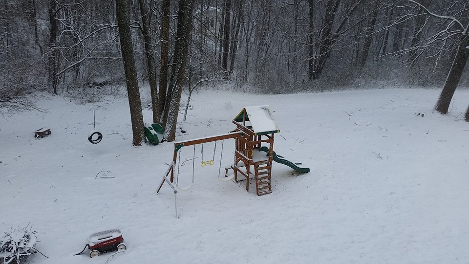
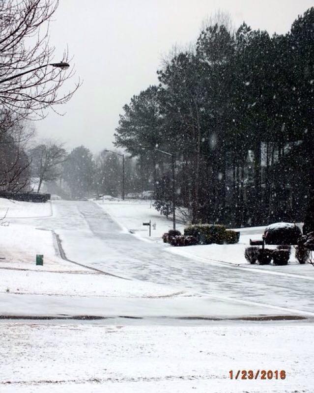
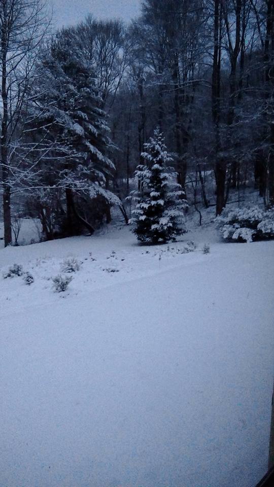
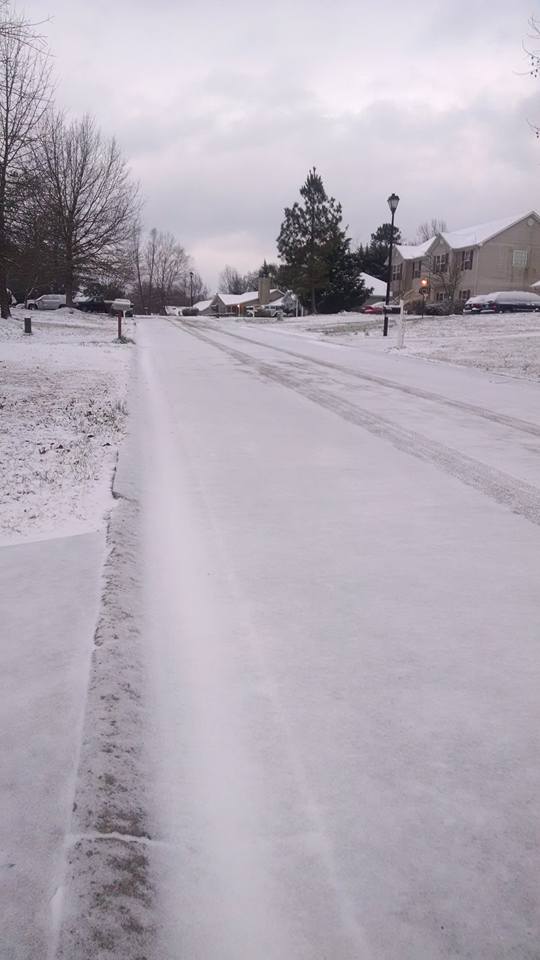
A winter weather event impacted most of north Georgia from Friday, January 22nd through the morning of Saturday, January 23rd. This event resulted in light snowfall accumulations as far south as central Georgia, with more significant snow and ice accumulations in the north Georgia mountains. Snow totals ranged as high as 6+" in far north Georgia.
This snow and ice was in association with a low pressure system moving into Georgia. As the original surface low pushed into the area, it transitioned into a new surface low off the Georgia coast. During this transition period, which can be seen in the surface analyses below, rain changed to frozen precipitation as cold air filtered in. Moreover, the attendant upper low pushing across the state assisted in cold air advection and led to bands of light snow across a large portion of the area. The rain initially changed to freezing rain and snow in northeast Georgia as a wedge of cold air advected into these locations. By midnight Saturday morning, most of the remaining precipitation had transitioned into snow. This is the same system that led to blizzard conditions across the mid-Atlantic and parts of the northeastern United States.
|
Surface Analysis:
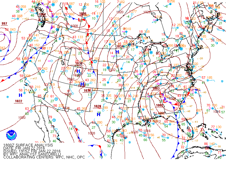 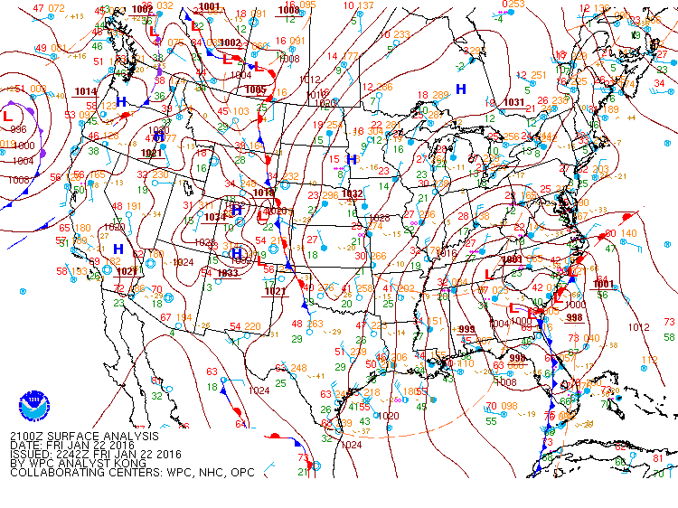
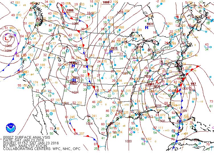 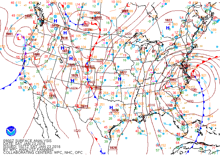
Surface analysis maps around from 1 PM Friday, 4 PM Friday, 7 PM Friday, and 4 AM Saturday. The new surface low can be seen forming off the Georgia coast and moving northeastward a long the Atlantic coast while the initial low weakens across north Georgia.
|
|
Radar Imagery:
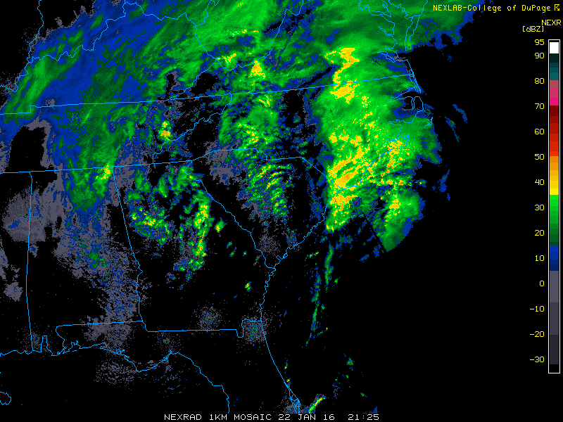 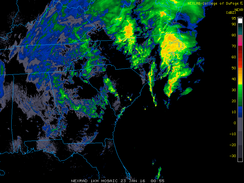 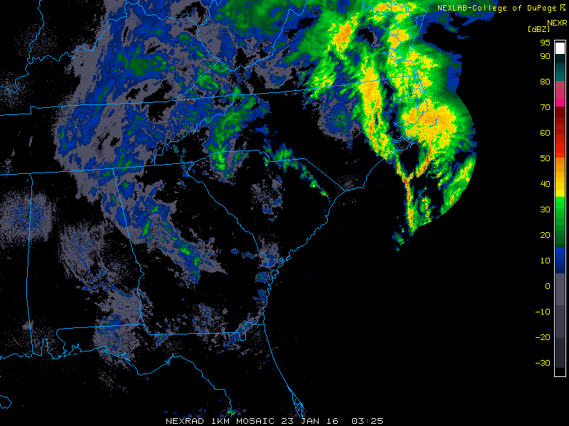 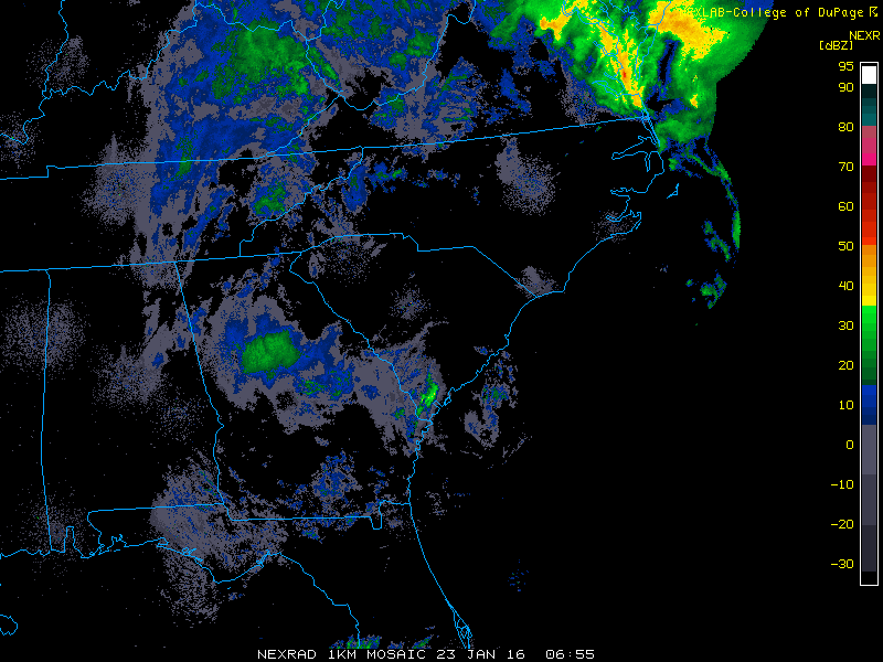
Radar images from 4:25 PM EST, 7:55 PM EST, 10:25 PM EST, and 1:55 EST on 1/22 and 1/23 show wrap around precipitation affecting much of north Georgia. All of this had changed over to light snow showers by around midnight. Light snow showers persisted across parts of the area through the morning of Saturday 1/23.
|
|
Upper Air Soundings:
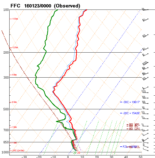 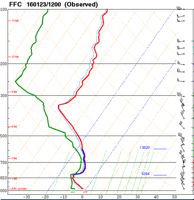
Soundings taken in Peachtree City (FFC) at 00z Friday evening (left) and 12z Saturday morning (right). While temperatures at and near the surface were still just above freezing Friday evening, much of north Georgia was already experiencing snowfall. Rain transitioned to light snow overnight, and by Saturday morning light snow still was falling with temperatures below freezing.
|
|
Snow Accumulation Map:

Light snow accumulations occurred across a large portion of Georgia. Areas of far north Georgia received the highest snow amounts, with the 4-6" of snow in some locations. The highest totals of 6" were reported in Towns County.
|
|
Ice Accumulation Map:
.png)
Some accumulations of freezing rain also occurred prior to the onset of most of the snow. Accumulations were light across portions of north Georgia, though a couple of locations did see accumulations over 1/4".
|
|