March 21, 2017 Severe Weather Event
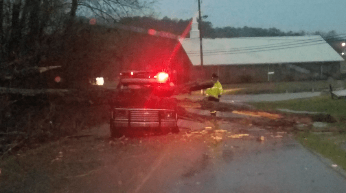
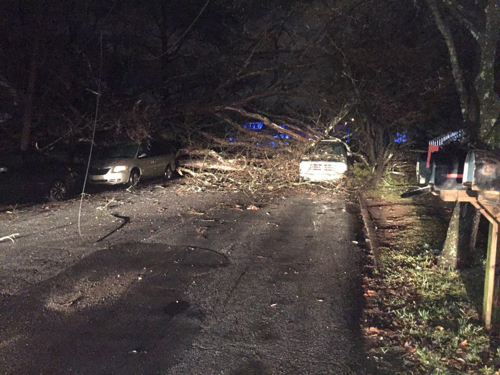
An expansive damaging wind and large hail event unfolded across much of north Georgia during the afternoon and evening hours of March 21, 2017. With a very unstable air mass in place, severe thunderstorms that produced large hail initially developed in north Georgia during the afternoon hours. A strong shortwave sparked additional thunderstorms northwest of the area that congealed into a line and raced southeastward into north Georgia. This line of thunderstorms produced widespread damaging winds as well as a couple of weak tornadoes across north Georgia during the evening hours.
|
|
 |
|
|
Surface Map (3/21, 5 PM) The evening surface analysis showed Georgia in a warm, moist air mass ahead of a cold front over southern Tennessee. |
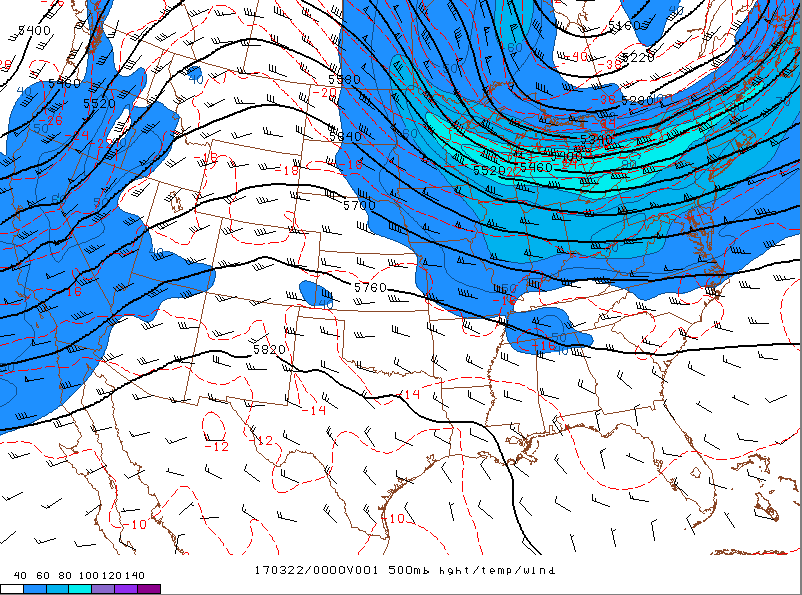
500 mb analysis (3/21, 6 PM) A strong shortwave in northeast Alabama is evident. This shortwave sparked the development of strong and severe thunderstorms in the unstable air mass that existed ahead of it. |
|
|
 |
|
|
Analyzed Surface CAPE (3/21, 4 PM) Plentiful surface instability was in place by late afternoon with surface-based CAPE values near or above 3000 J/kg common across the area. This instability supported the rapid development and strengthening of thunderstorms. |
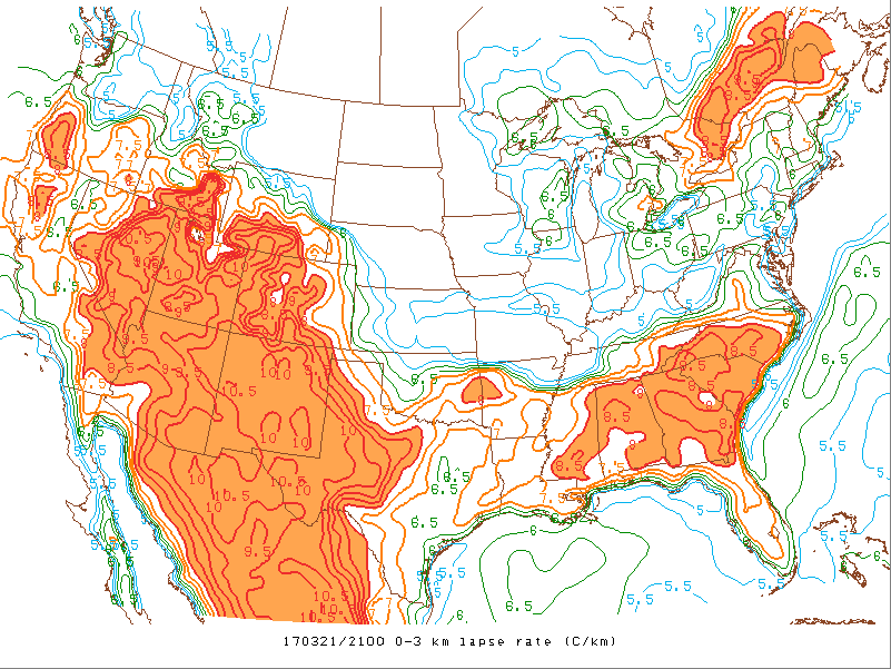
0-3 KM Lapse Rates (3/21, 5 PM) Steep lapse rates supported strong updrafts that allowed for the formation of very large hail in many thunderstorms. |
|
|
|
|
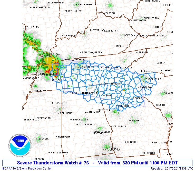
A Severe Thunderstorm Watch covered most of north Georgia during the afternoon and evening. |
An additional Severe Thunderstorm Watch was issued for east central Georgia as the complex of thunderstorms pushed southeastward. |
|
|
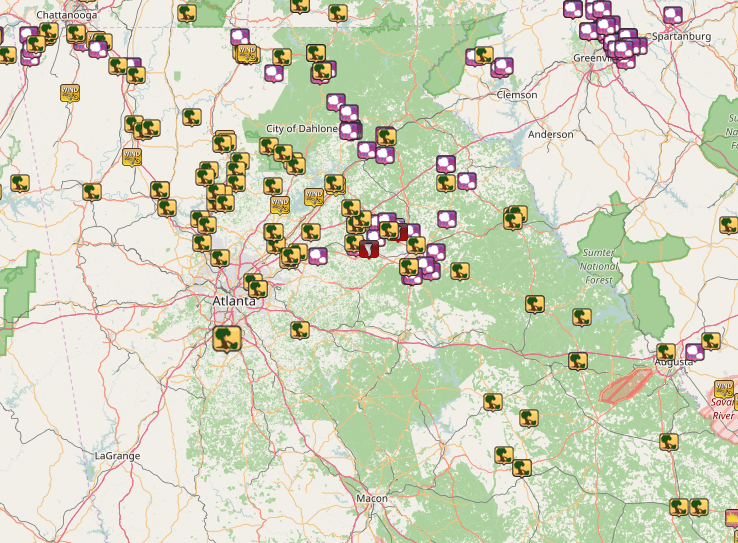
| Storm Reports from March 21, 2017 |
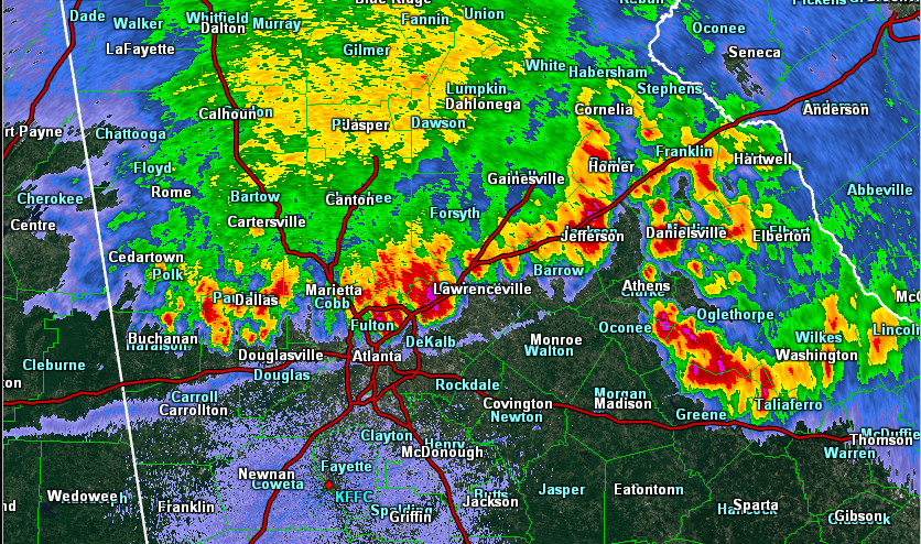 |
| Radar image of the complex of thunderstorms moving across north Georgia around 9 PM on 3/21. |
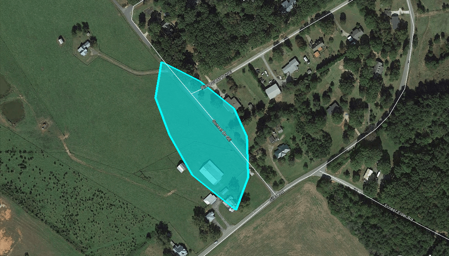
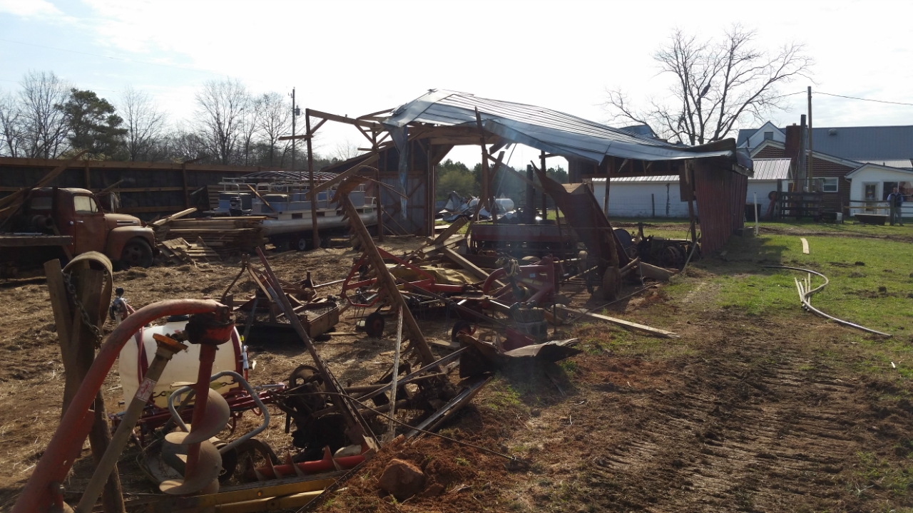
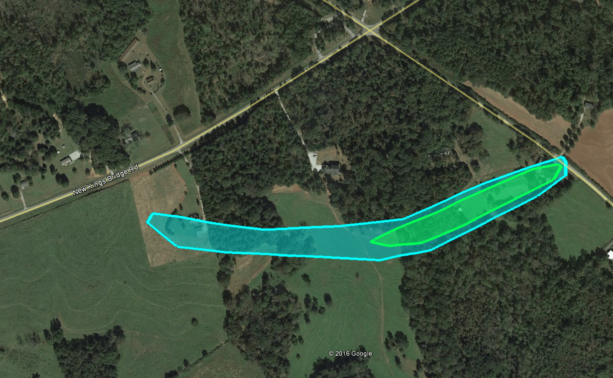
A brief tornado developed along the leading edge of a larger swath of strong winds. The tornado was on the ground for just 200 yeards or 0.1 statute miles. The most concentrated damage was to a barn in which most of the structure was completely destroyed with pieces of the barn carried nearly a quarter of a mile. Several other large trees were snapped and uprooted and converged toward the center of the track.
|
|
|
|
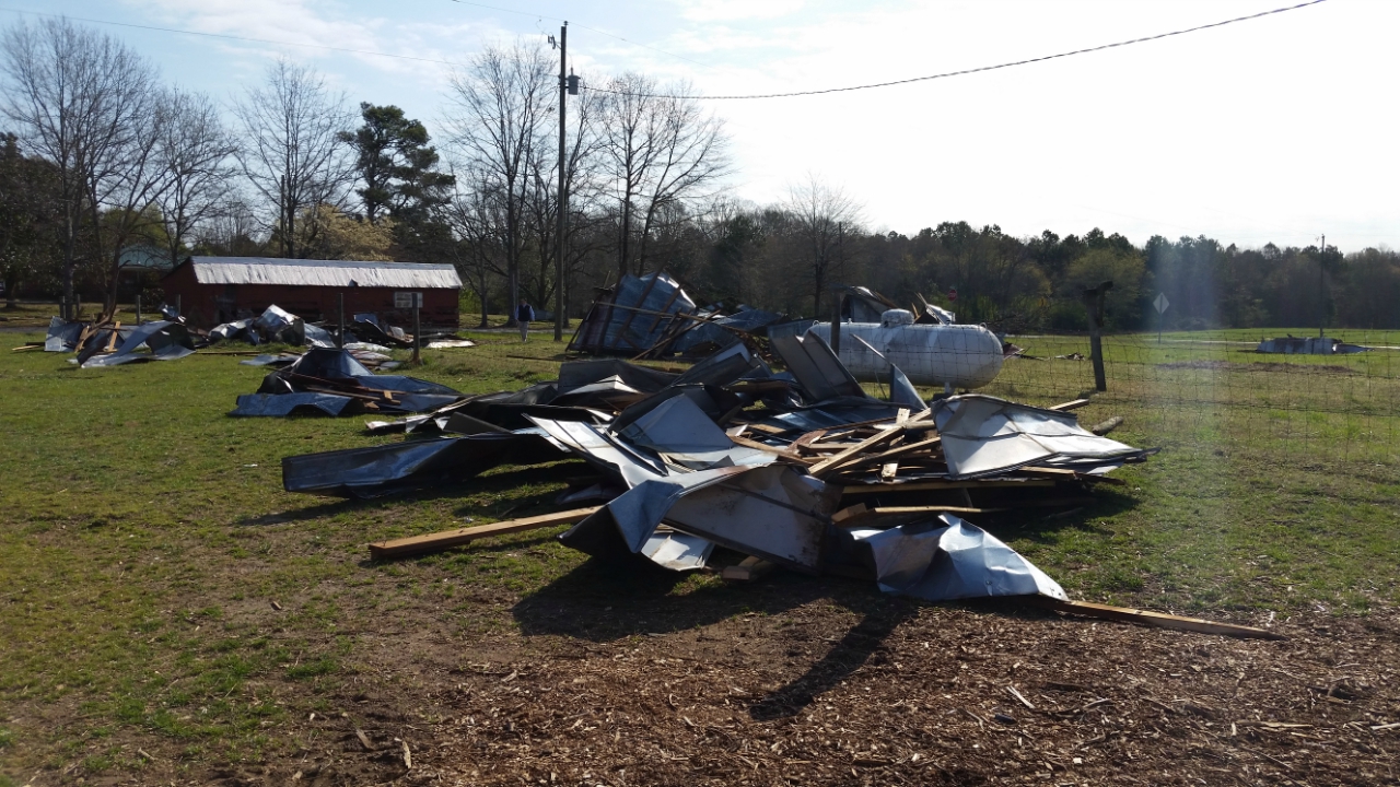 |
| The tornado inflicted the most damage on this barn. | The metal and wood barn components were scattered across the adjacent field. |
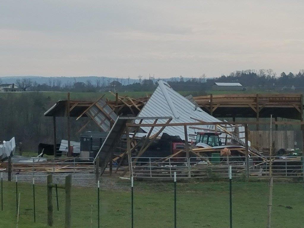
An EF-1 tornado began near and moved across a house under construction. The entire upper level of the home was complete and set upon 6x6 concrete moorings several feet in the ground. This entire structure was lifted and then pulled all moorings from the ground causing additional structural damage. The tornado then moved into an open field before snapping and uprooting at least a dozen large trees. The tornado caused additional minor damage to a residence before lifting.
|
|
 |
 |
| Many large trees were blown down, such as this one in far northwest Georgia. | This tree was blown onto a truck in Chickamauga, GA. |
 |
 |
| Numerous trees were blown down in the Atlanta metro. This tree damage occurred in the Medlock Park area of DeKalb County. | This large tree fell onto power lines and parked cars in East Point. |
 |
|
| This outbuilding was heavily damaged by the strong thunderstorm winds in Dade County. |
 |
 |
| Large hail to the size of golfballs was a common occurrence in White County. | Large hail covered the ground at the City Electric Supply in White County. |