January 11, 2020 Severe Weather
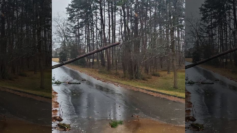
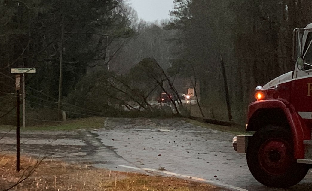
A strong storm system brought widespread severe thunderstorms to the southeastern US during the afternoon and evening hours of January 11, 2020. A line of thunderstorms brought widespread wind damage to the area, most of which consisted of numerous downed trees and power lines. At the peak, over 150,000 customers across Georgia had lost electricity. Additionally, 3 weak tornadoes occurred within the line of storms in eastern Paulding and western Cobb counties, Fannin county, and Upson county, downing more trees, several of which fell onto houses.
|
|
 |
|
|
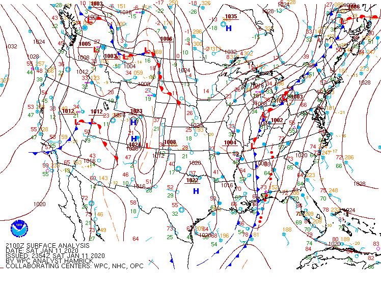
Surface map (4 pm, 01/11/2020) A severe line of thunderstorms was entering west Georgia as a strong low pressure system lifted into the Ohio Valley. |
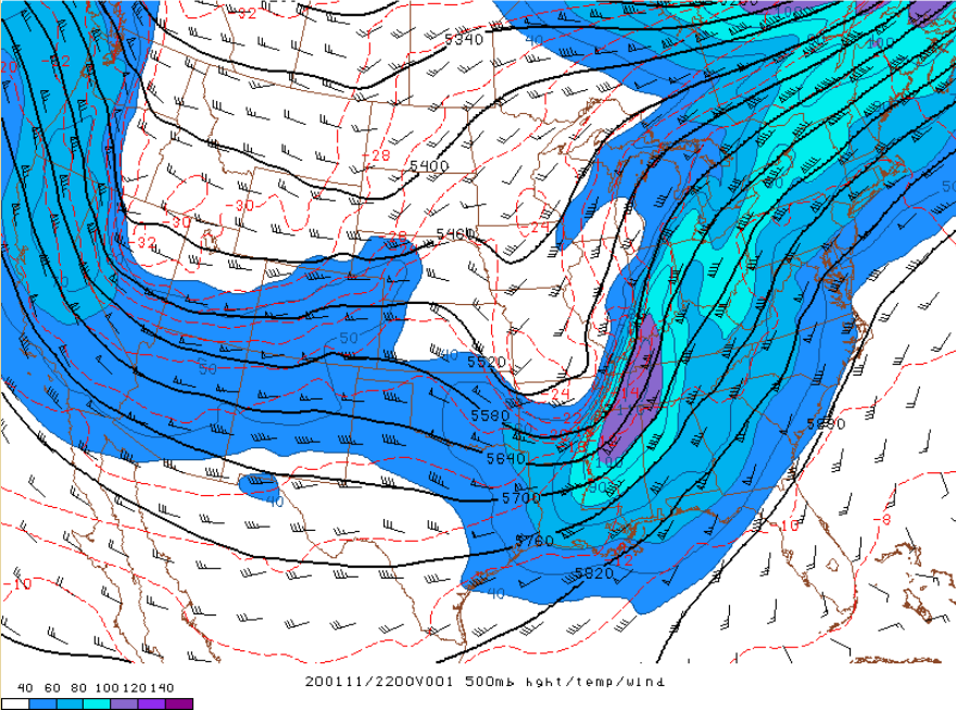
500 mb height/temp/wind (5 pm, 01/11/2020) |
 |
|
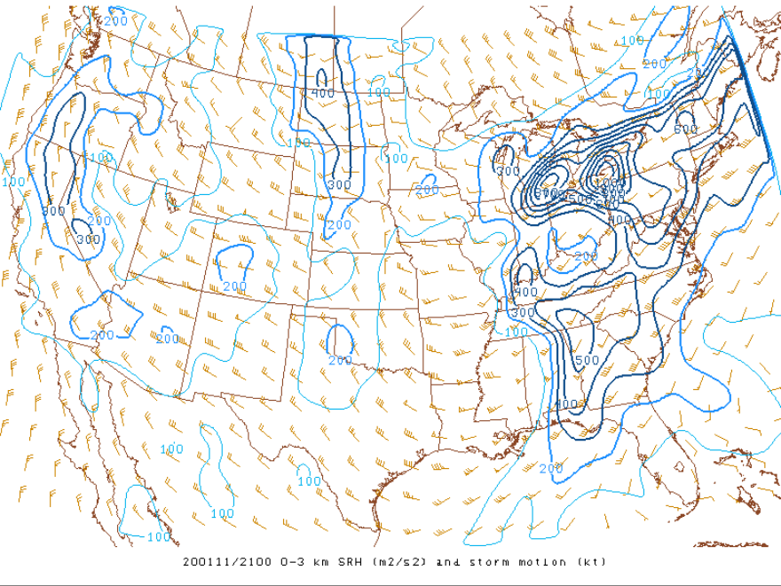
0-3 km storm relative helicity (SRH) map (4 pm, 01/11/2020) High 0-3km SRH values were indicative of the level of shear favorable for a threat for an isolated brief spin-up tornado in the convective line. |
|
|
|
|
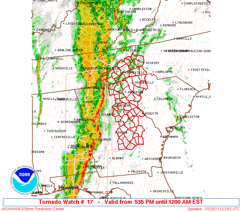
A Tornado Watch was initially issued as a line of severe thunderstorms approached western Georgia in the afternoon hours. |
As the line of severe thunderstorms tracked eastward, an additional Tornado Watch encompassed the rest of the area. |
|
|
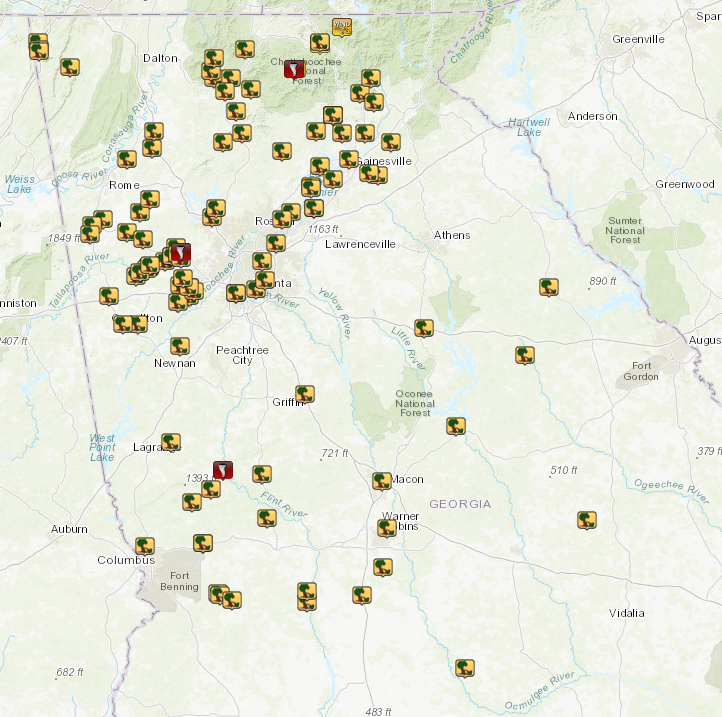
| Storm Reports from January 11, 2020 |
|
|
|
|
This store in Bremen sustained major wall damage from the strong straight-line winds. (Courtesy WSB-TV) |
This large tree snapped onto power lines in Rome. Scenes like this were repeated many times across the area. (Courtesy @Mr_Rains) |
|
|
|
|
The roof covering of this business in Rome was removed by the strong straight-line winds. (Courtesy 11Alive) |
This large tree snapped onto power lines near Temple. Scenes like this were repeated many times across the area. (Courtesy 11Alive) |
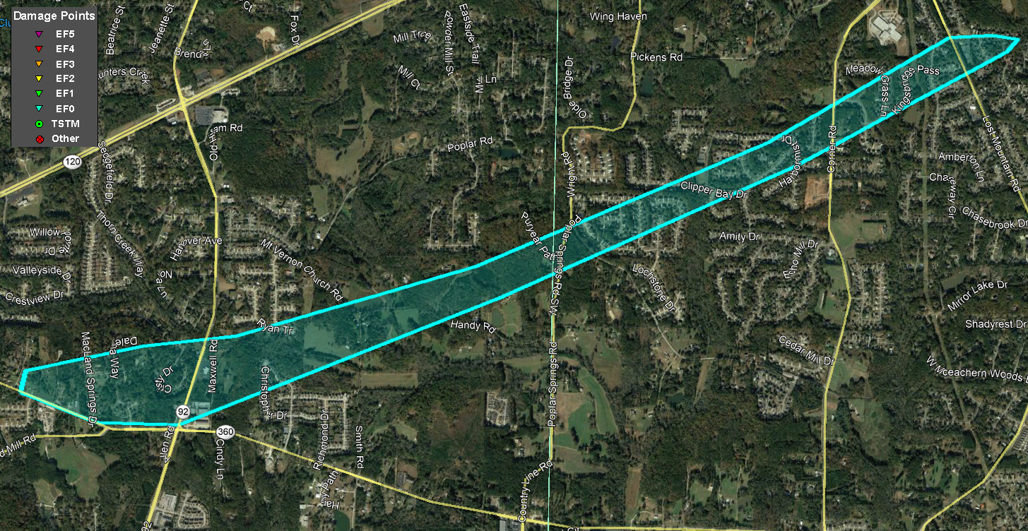
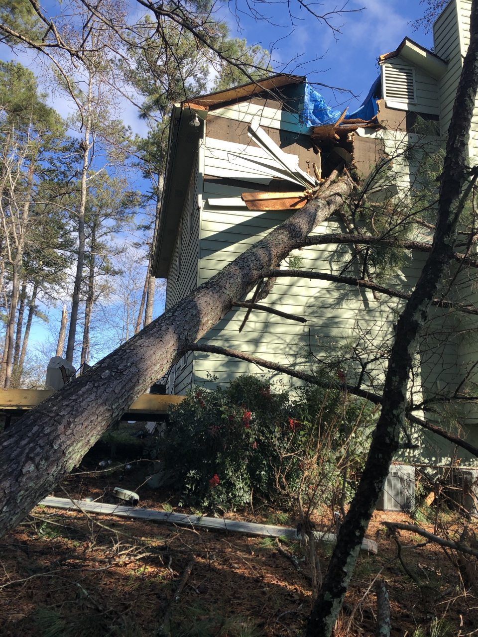
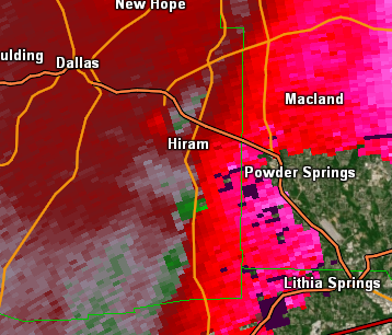
An EF-0 tornado began near Macland Road west of Hiram-Acworth Highway just north of Hiram in eastern Paulding County and traveled east-northeast for nearly 4 miles into western Cobb County. Most of the damage was weak and intermittent, but the most notable damage occurred on Cristy Drive where a dozen large trees were snapped or uprooted, one of which fell on the master bedroom of a two-story home. The tornado caused minimal damage as it moved into west Cobb but downed 15-20 trees around Lost Mountain Road and Kingsbridge Pass including in the Oakleigh subdivision. No significant structure damage was observed in this area. Shortly after this point, the tornado lifted.
Two other areas of straight-line wind damage were identified. One area occurred along Scoggins Road south of Dallas in Paulding County where a few trees were downed on Scoggins Road and Cole Lake Road.
The other area was located about 5 miles southwest of Kennesaw on Vineyard Road in Cobb County. A large sweetgum tree fell onto the bedroom af a two-story home, causing significant damage. One of the residents was in the bedroom at the time of the incident but escaped injury.
|
|
|
|
 |
| This tree fell onto this home on Christy Drive. | Another tree was downed at this location on Christy Drive. |
|
|
 |
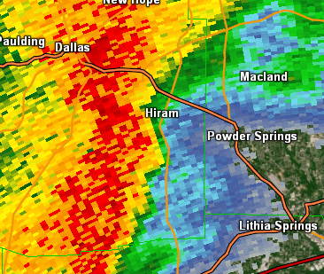
| Reflectivity from KFFC (4:52 PM EST). | Velocity from KFFC (4:52 PM EST). |
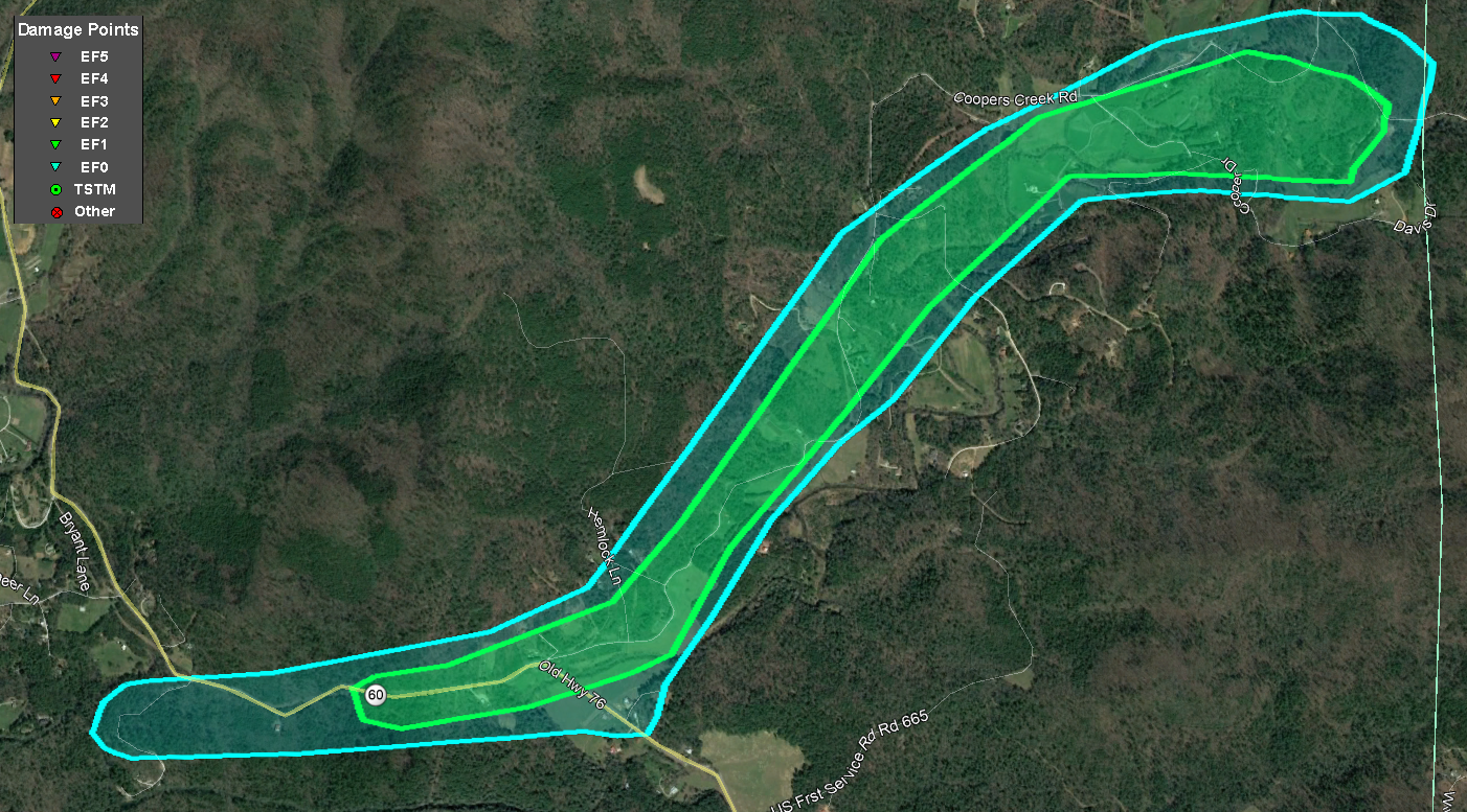
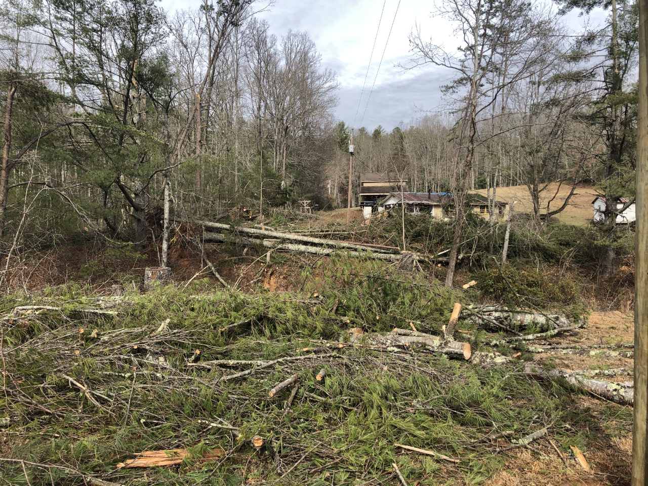
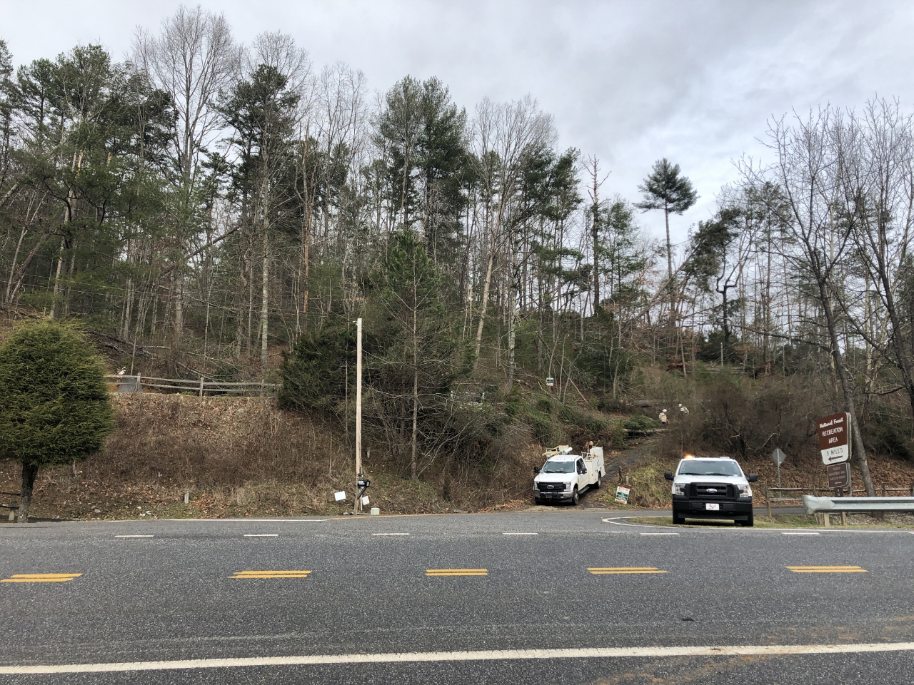
An EF-1 tornado with peak winds of 100 mph began near Deep Hole Campground Road south of Morganton Highway (Georgia Highway 60) and traveled east-northeast along Morganton Highway intensifying and downing hundreds of trees along the highway. A 40-foot steel radio tower at the Fannin County Fire Station was blown down. At least four homes suffered damage from fallen trees. The tornado weakened as it turned northeast along Cooper Creek Road before finally dissipating near the Union County line near the Davis Family Cemetery off of Mulky Gap Road west of the USFS Mulky Campground and USFS Camp Merrill RAWS weather station.
|
|
|
|
 |
| Numerous trees were snapped or uprooted along the tornado's path. | More trees were downed at this location. |
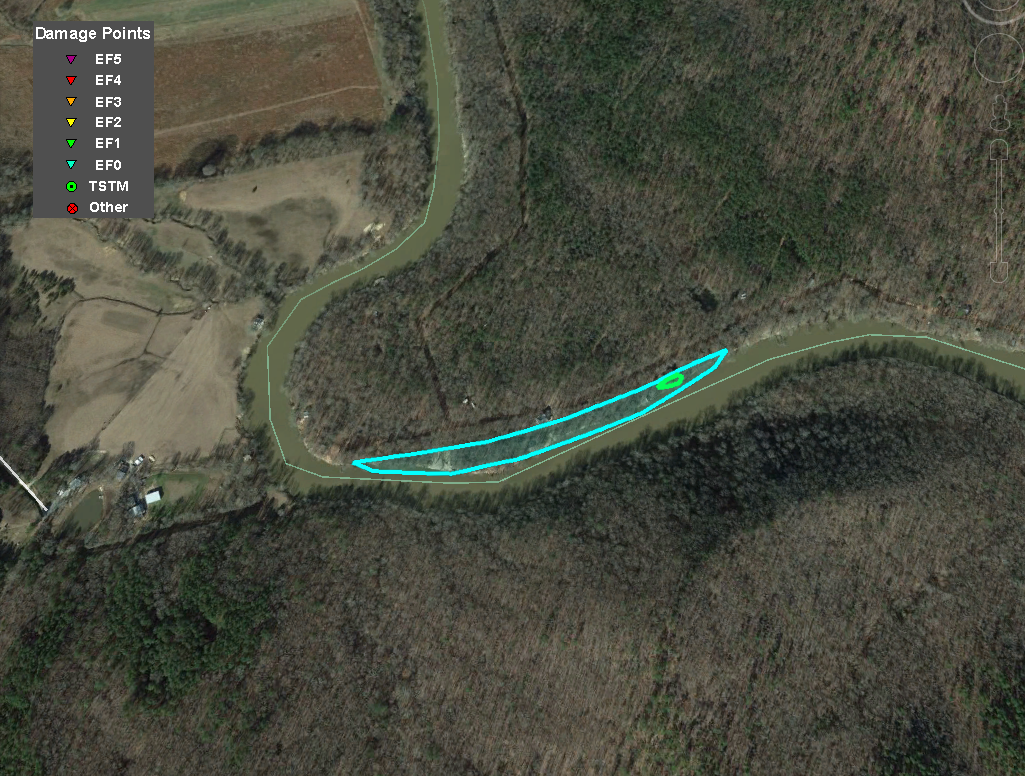
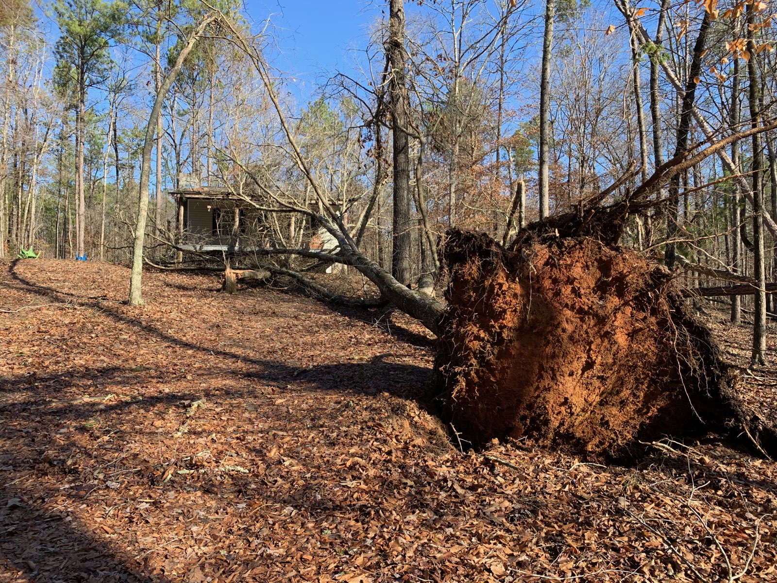
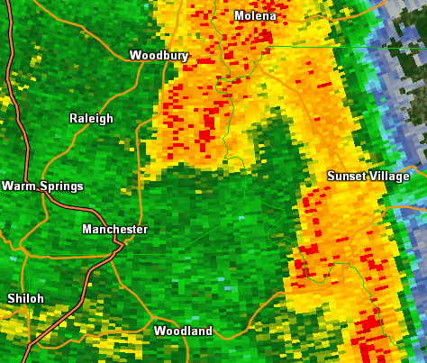
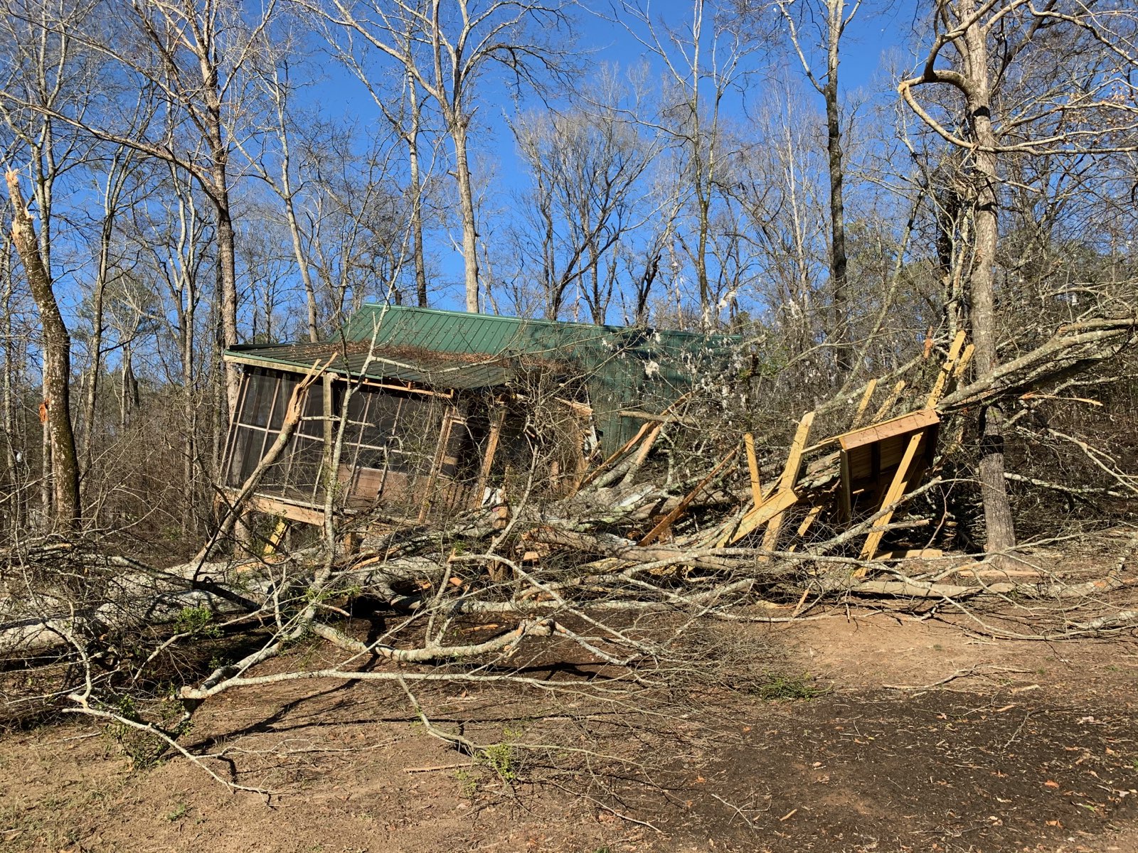
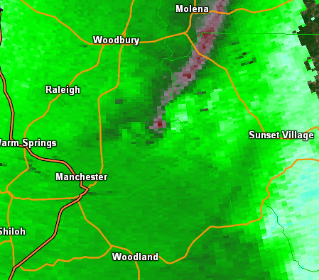
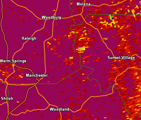
An EF-1 tornado began near the Flint River on the Upson County side a few miles southeast of Woodbury. This tornado traveled for about a third of a mile right along the edge of the river. The majority of the damage was to trees and power lines and nearly 100 trees and power lines were snapped or downed. In addition, a camper was blown over and a boat was damaged when it was blown into a tree. Damage then occurred to a river home when a tree fell on it and knocked the home off its stilts. In addition, another tree fell on another house nearby. Shortly after this point, the tornado lifted.
|
|
|
|
 |
| This tree was downed near the Flint River. | A tree fell on this home knocking it off its stilts. |
|
|
 |
 |
| Reflectivity from KFFC (5:47 PM EST). | Velocity from KFFC (5:47 PM EST). | Correlation Coefficient from KFFC (5:50 PM EST). |