Atlanta/Peachtree City, GA
Weather Forecast Office
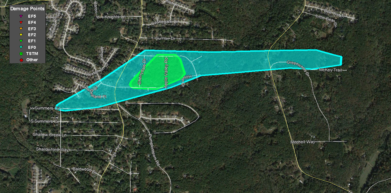
Douglas County EF-1 Tornado
|
|
An EF-1 tornado briefly touched down in Douglas County along North Summers Circle. The tornado uprooted and snapped a few trees at the beginning of the track. The tornado intensified as it crossed Kings Highway, snapping and uprooting trees along Plum Crest Road, Cherry Dale Drive, Orchard Road, and Apple Valley Road. The NWS survey determined at least 10 homes had trees fall on them in this area. The tornado continued east, crossing Apple Way Court and Yeager Road and snapping and uprooting trees there as well as along Greenwood Drive before lifting as it approached Dorset Shoals Road.
 |
|
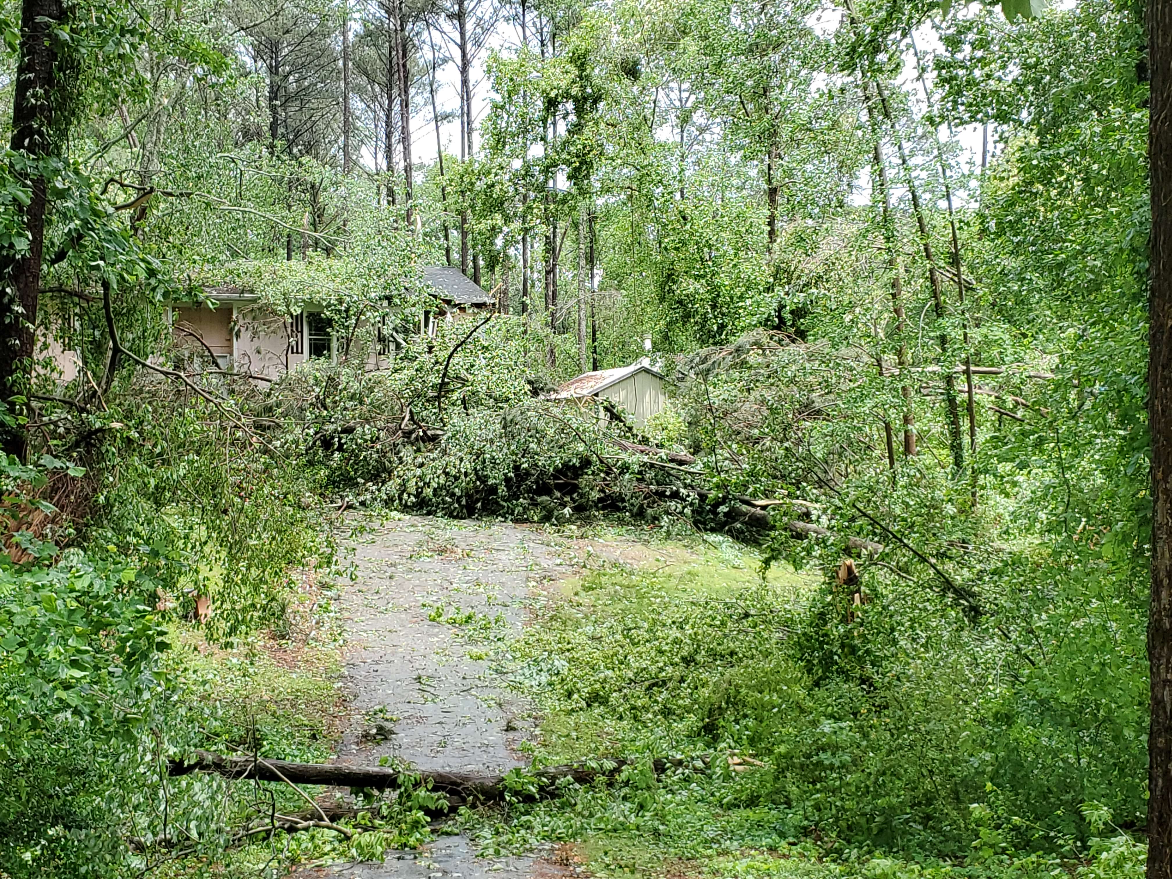
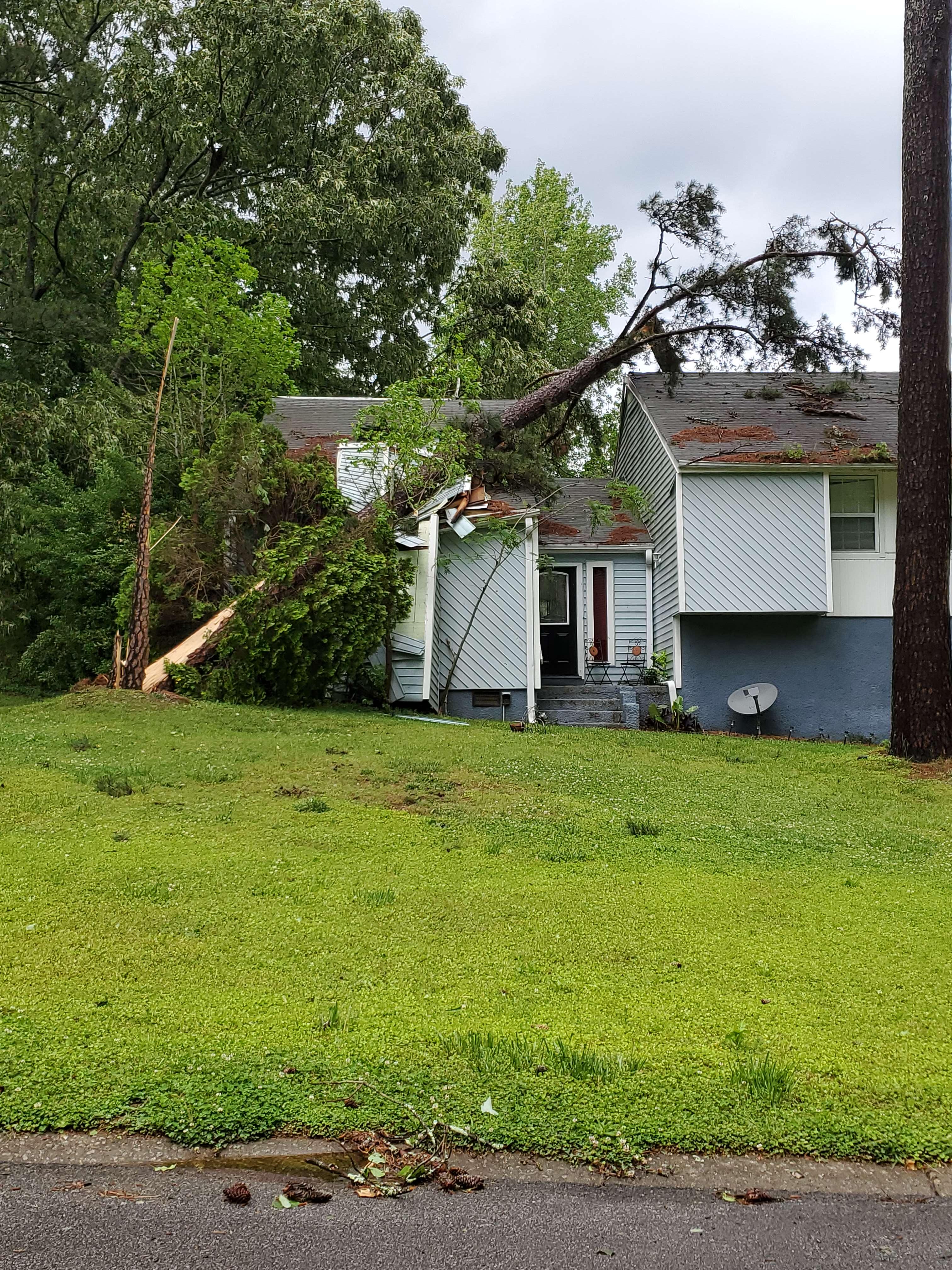
| This large pine tree was downed onto a home on Cherry Dale Drive. | Multiple trees were downed along Apple Valley Road. |
|
|
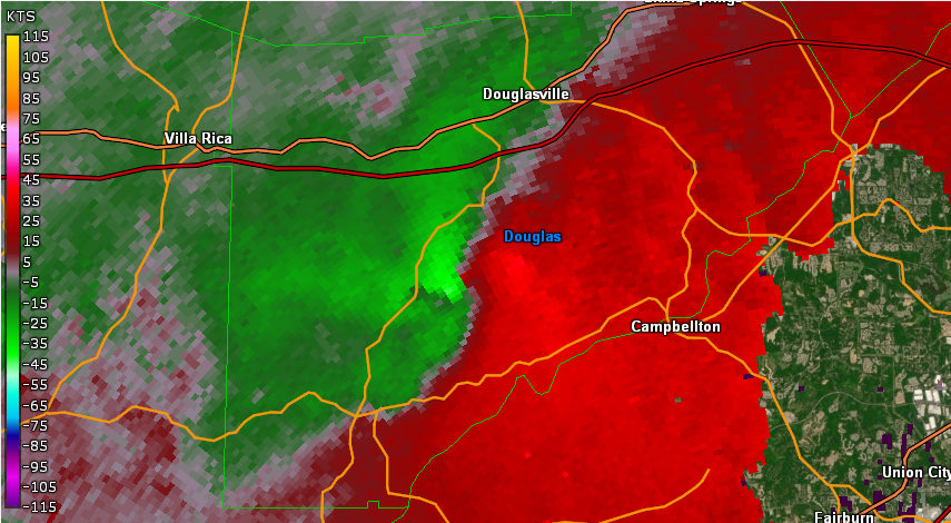 |
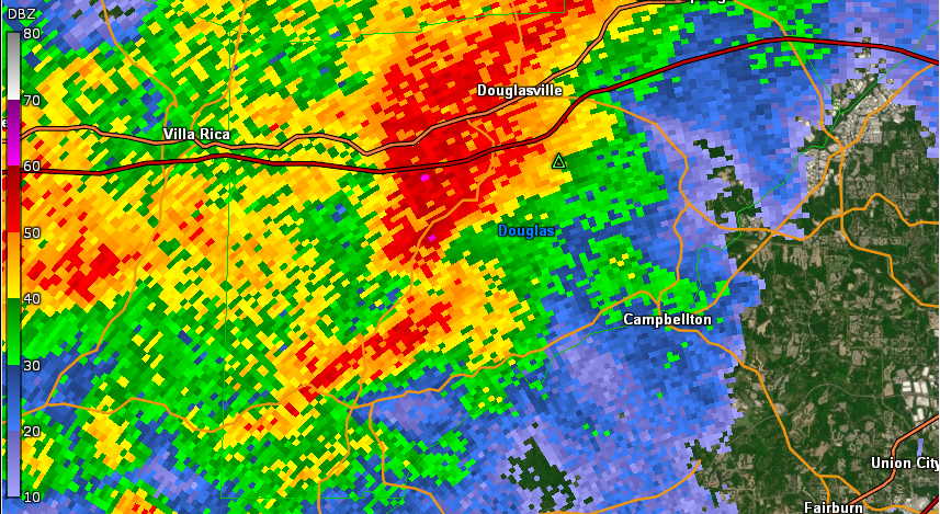
| KFFC Reflectivity (10:02 AM EDT) | KFFC base velocity (10:02 AM EDT) |
Current Hazards
Outlooks
Georgia Road Conditions
Nationwide
Local Storm Reports
Local
Submit Storm Report
Forecasts
Fire Weather
Forecast Discussion
Incident Support
Tropical Weather
Local
Computer Models
Graphical
Aviation Weather
Activity Planner
Recreational Forecast
Current Weather
Rivers/Lakes
Satellite Images
Observations
Maps
Radar Imagery
Regional Loop
Nationwide
Warner Robins
Peachtree City
US Dept of Commerce
National Oceanic and Atmospheric Administration
National Weather Service
Atlanta/Peachtree City, GA
4 Falcon Drive
Peachtree City, GA 30269
770.486.1133
Comments? Questions? Please Contact Us.