On January 24th during the evening, a strong area of high pressure set up over the Eastern Carolinas with ridging into North and Central Georgia. Accompanying this high were cold temperatures with values falling through the 30s into the mid and upper 20s through early Friday morning.
A weak cold front and associated precipitation pushed across the southeast on January 25th. With the cold air in place at the surface and precipitation moving into the area, the ingredients were in place for a Winter Storm for portions of the area. At the low levels of the atmosphere and column of warm air moved in as the precipitation began creating a setup indicative of freezing rain.
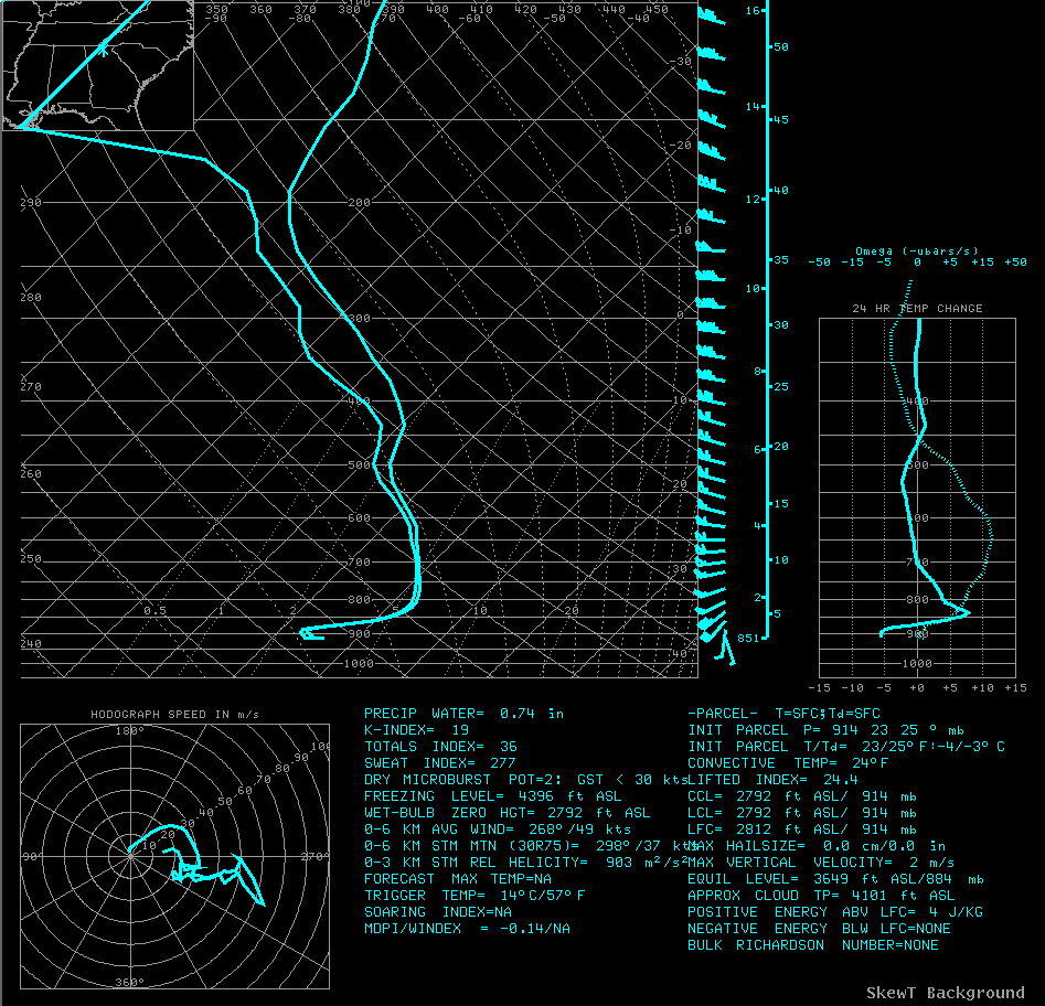
During this event, very dry air was in place across the area, so initially it took a little time for the atmospheric profile to saturate. As precipitation began to fall and the column began to saturate, temperatures at some locations dropped across north Georgia. By mid-morning, the column was saturated with freezing temperatures at the surface and a warm nose around 800mb. Aloft precipitation began falling as supercooled water droplets initially, or even snow as the deeper moisture moved into the area, and then melted or warmed as it fell through the warm nose. Below around 875mb, temperatures were below freezing and thus much of the precipitation fell as freezing rain. Only isolated areas of sleet were reported.
 |
 |
 |
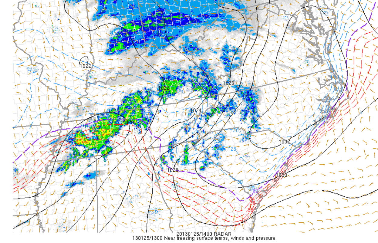
| Radar Image and Freezing line at 1 PM EST. Note the precip shield moving into N and NE Georgia and the corresponding surface obs. | Radar Image and Freezing line at 2 PM EST. The freezing line moved very little between 1-2 PM. Also note the overall decrease in precip. Much of the moisture was evaporating in the very dry air to east. | Radar Image and Freezing line at 3 PM EST. Very few returns were showing up on radar, however, we were still receiving reports. This is in large part due to the fact that the radar was not sampling much below 850 mb (5000 ft) which is where the bulk of the remaining moisture was. |
The Forecast
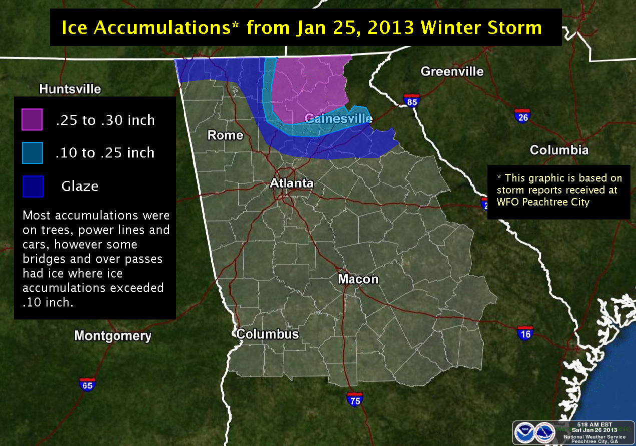
Computer models started to indicate that this was setting up to be an ice event on the 00Z runs on January 23 (7 PM Tuesday night) and our forecast was changed significantly that night to reflect these changes. Initially, models were too far south and too agressive with total precipitation accumulations. Subsequent model runs trended drier and further north with the precip in time...particularly the NAM which ended up being a little too dry but was not far off with the southern extent of the precip. As such, confidence began decreasing Thursday evening that the Atlanta Metro in particular would receive any precip as compared to the intial runs on Wed. However, there was enough data, particularly from the SREF and GFS up to the onset of the event to maintain a chance of freezing rain during the early morning hours of Friday Jan 25. From past experience, even 0.01" of freezing rain/drizzle has created problems and is very difficult to forecast. Largely because of this uncertainty, the freezing rain advisory along the I-20 Corridor was maintained through the morning hours of Jan 25. Ultimately, the precip came in much later in the morning and temperatures had creeped above freezing enough that ice was averted in the southern tier of the advisory area. The map below shows the final precip totals across North GA.
 |
 |
 |
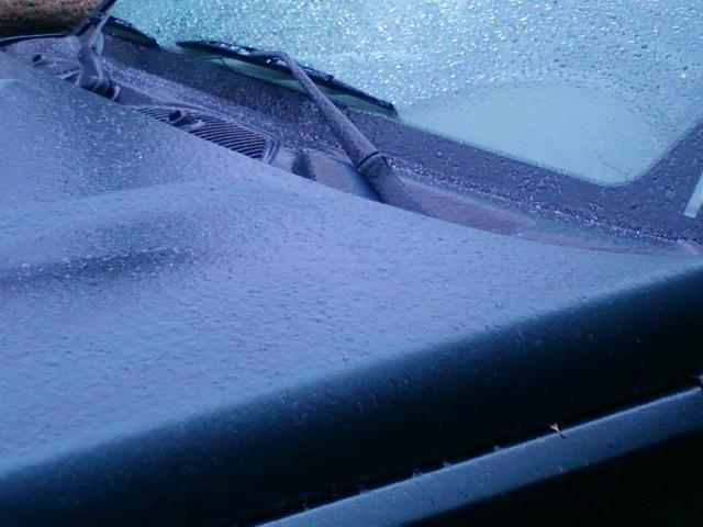
| Courtesy Allison Chinchar WXIA - Ellijay GA | Courtesy Chris Holcomb WATL - Nicholson GA | Courtesy Chris Holcomb WATL |
Impacts:
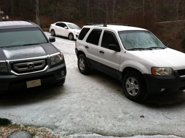
Dozens of school districts north of Interstate 20 were either cancelled or on a delay...particularly in Nourtheast GA. Also, GA State Patrol and GADOT reported several dozen auto accidents in North Georgia, including portions of I-85 in Jackson and Banks Counties.

