A late-March severe weather outbreak was caused by a strong storm system that lifted northeast from the Mississippi Valley into the Tennessee Valley on March 25-26, 2021. The combination of strong shear and instability led to favorable conditions for severe thunderstorms and tornadoes from the afternoon of Thursday, March 25th into the early morning of Friday, March 26th.
The most significant event was a long-track tornado that intensified to EF-4 intensity as it moved into Newnan in Coweta County shortly after midnight on March 26th. This tornado was the first EF-4 tornado in Georgia since 2011 and was spawned by a supercell thunderstorm that had tracked across Alabama before reaching the Georgia border. In addition, 2 other EF-1 tornadoes touched down in Bartow County, and a strong downburst with winds over 100 mph impacted Polk County. Scattered strong wind and hail as well as flash flooding affected other portions of the area.
Preliminary Survey Information:
(click Location for Detailed Survey)
| Location of Tornado / Downburst |
EF-Scale Rating/ Maximum Wind Speed |
Fatalities/ Injuries |
Damage Path Length/Max Width | Start Point/ Time |
End Point/ Time |
|
EF-4 170 mph |
1 Fatality 0 Injuries |
38.9 miles long 1850 yards (1.05 miles) wide |
1 NNE Texas (Heard County) 33.2533 / -85.1895 11:37 PM EDT (March 25) |
3 SE Tyrone (Fayette County) 33.4455 / -84.5624 12:30 AM EDT (March 26) |
|
| Cartersville |
EF-1 95 mph |
5 Injuries |
2.85 miles long 200 yards wide |
2 SE Cassville 34.213 / -84.833 11:55 PM EDT (March 25) |
3 E Cassville 34.2397 / -84.7971 12:00 AM EDT (March 26) |
| Southern Bartow County |
EF-1 95 mph |
0 |
1.7 miles long 125 yards wide |
1 NW Taylorsville 34.092 / -84.9943 9:08 PM EDT (March 25) |
2 NE Taylorsville 34.1025 / -84.9679 9:10 PM EDT (March 25) |
| Polk County Downburst | 105 mph | 0 | 5.5 square miles |
1 SSE Cedartown 33.9948 / -85.2466 12:32 PM EDT (March 25) |
2 E Cedartown
12:38 PM EDT (March 25) |
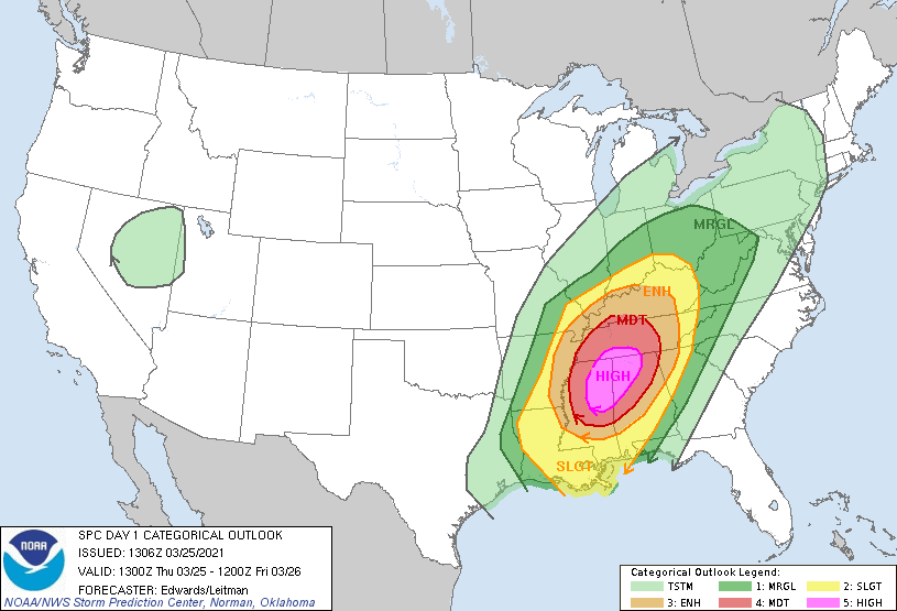
Storm Prediction Center (SPC) Convective Outlooks
 |
|
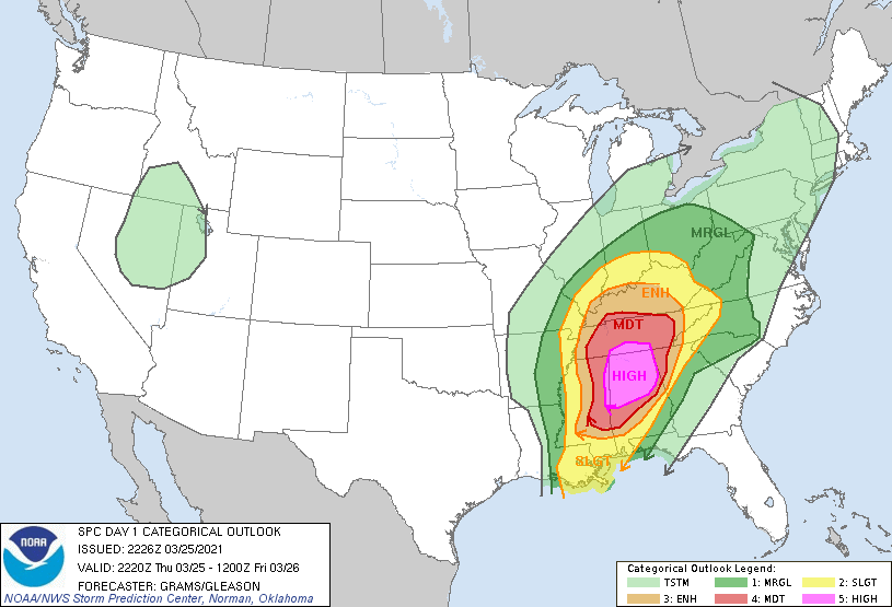
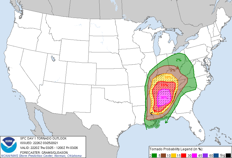
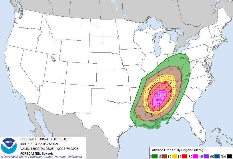
| Initial Day 1 Convective Outlook | Initial Day 1 Tornado Probabilities |
|
|
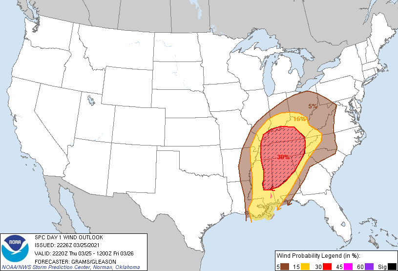
| Initial Day 1 Wind Probabilities |
|
|
|
| Convective Outlook, 4 PM Update | Tornado Probabilities, 4 PM Update |
|
|
| Wind Probabilities, 4 PM Update |
|
|
|
|
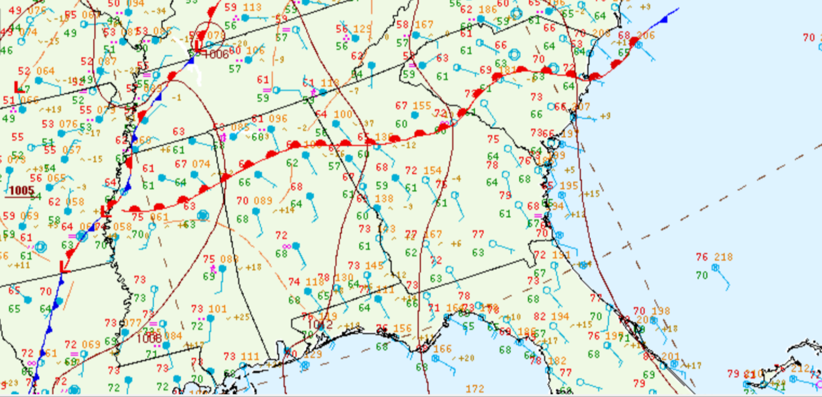
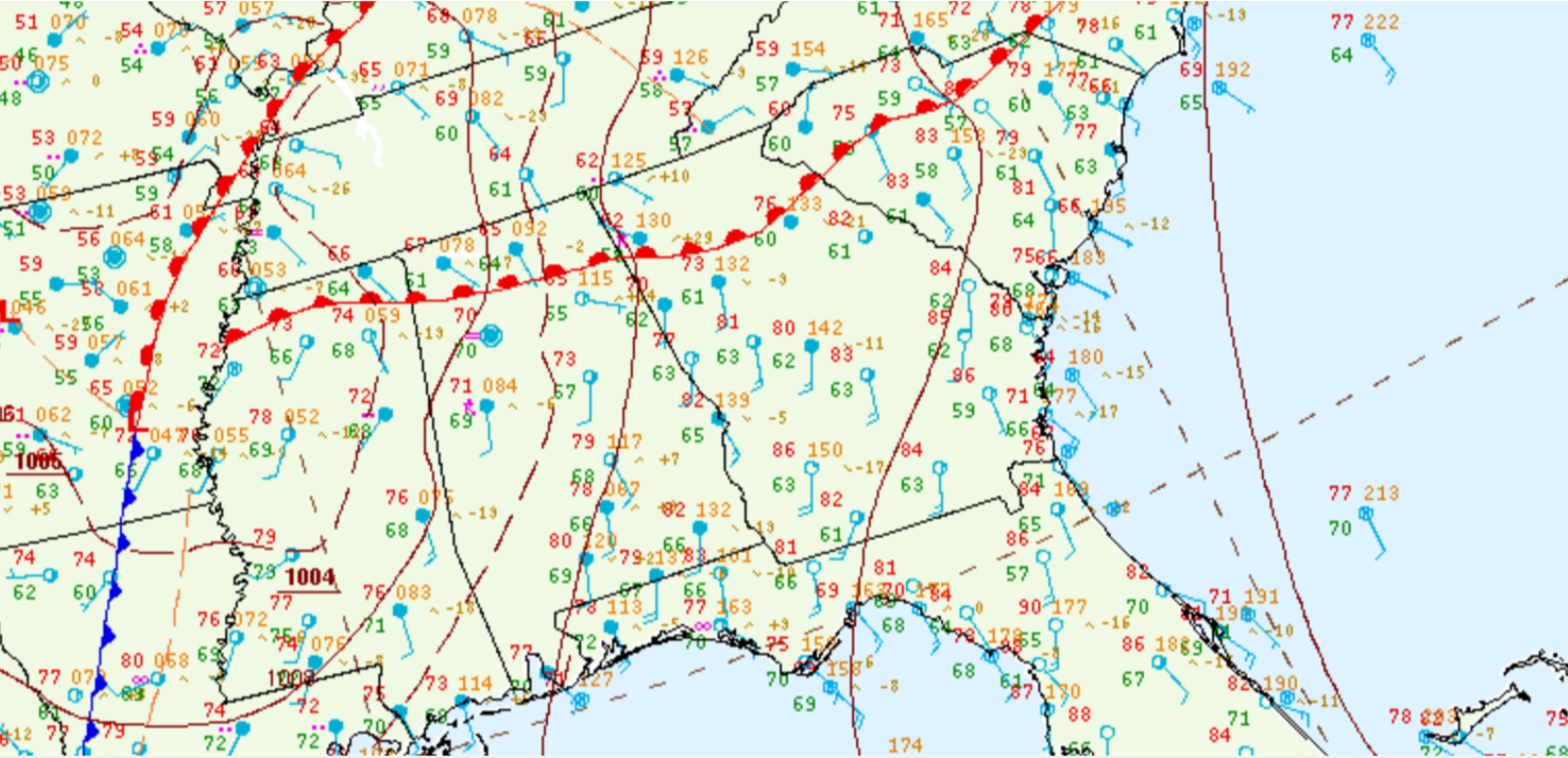
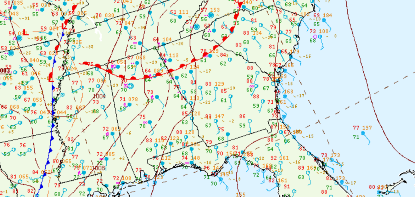
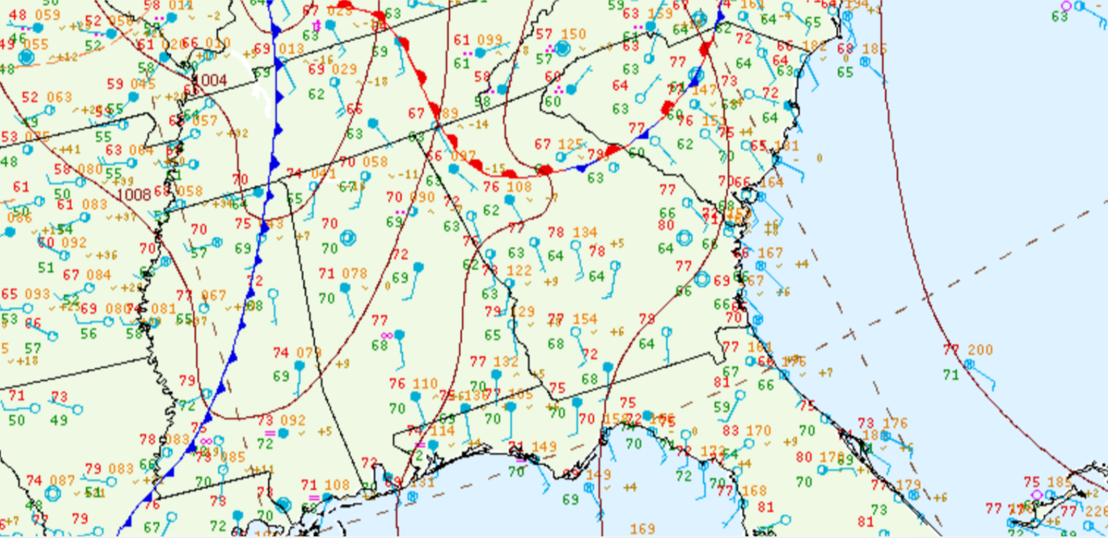
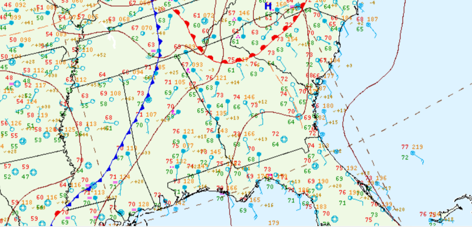
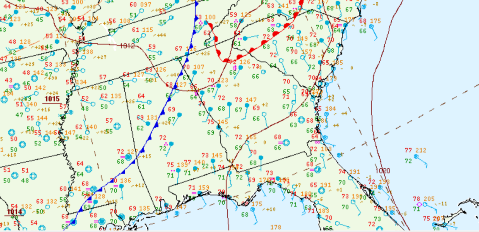
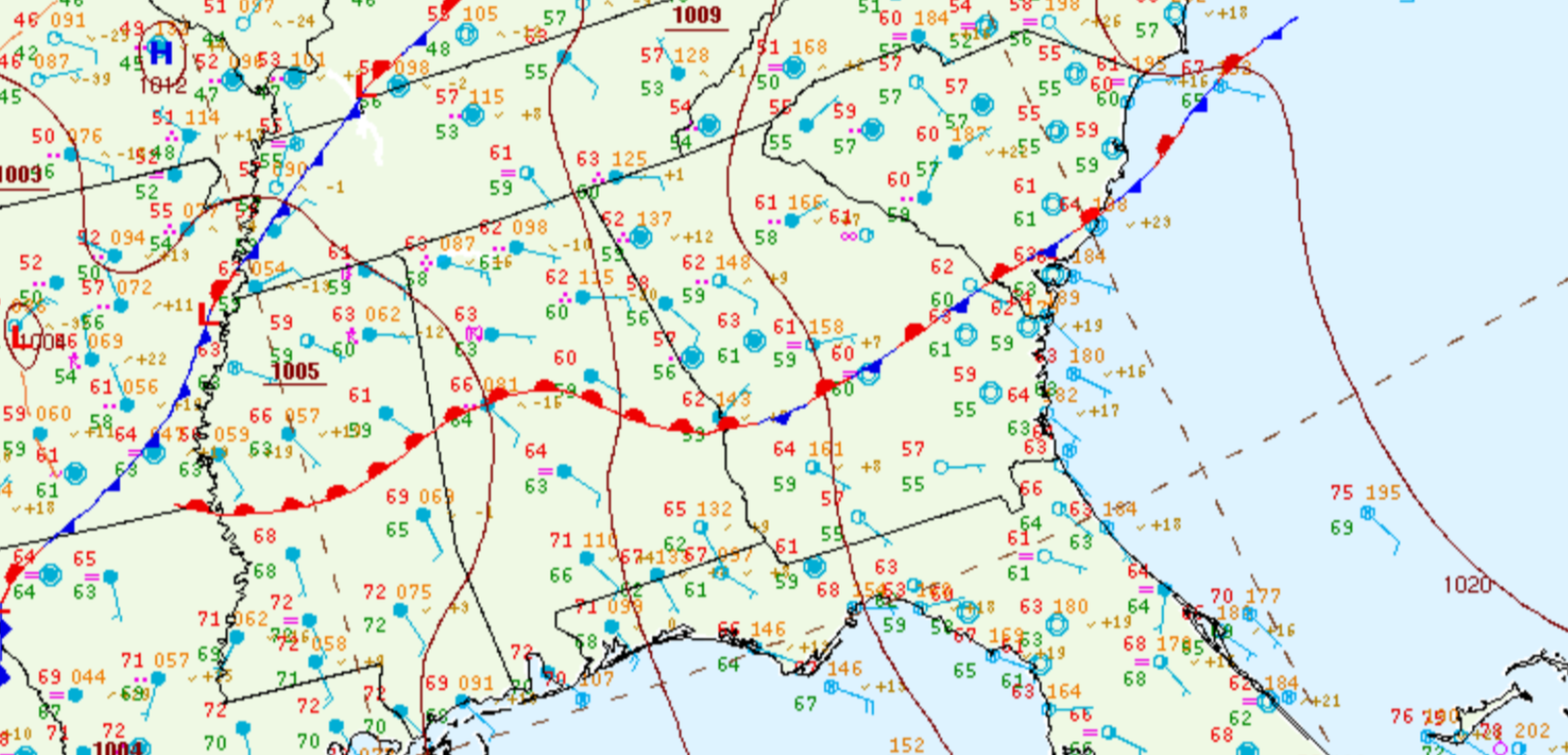
Surface Analysis:
 |
|
| 8 AM EDT, March 25th | 11 AM EDT, March 25th |
|
|
|
| 2 PM EDT, March 25th | 5 PM EDT, March 25th |
|
|
|
| 8 PM EDT, March 25th | 11 PM EDT, March 25th |
|
|
| 2 AM EDT, March 26th |
 |
|
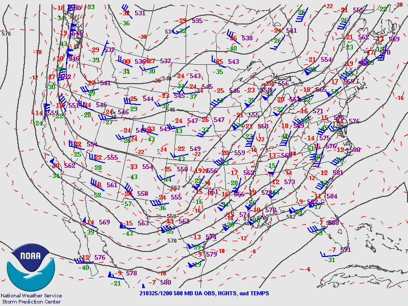
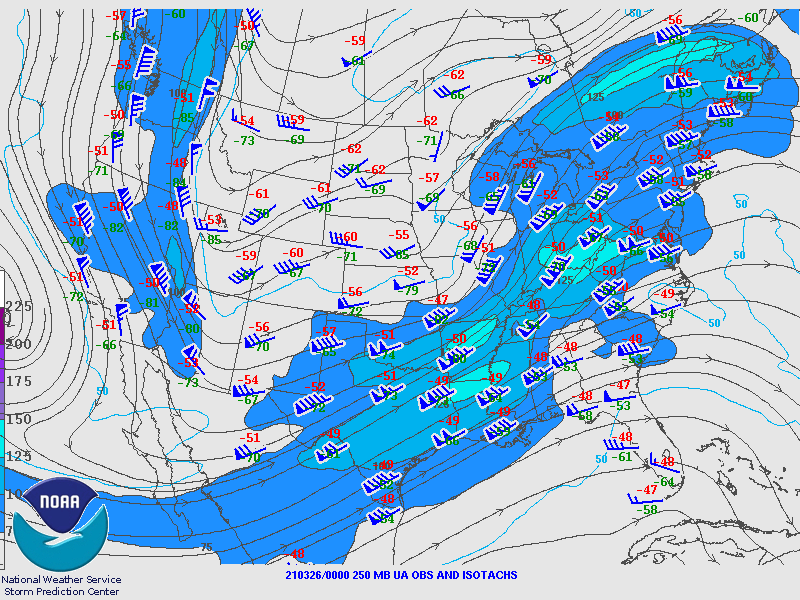
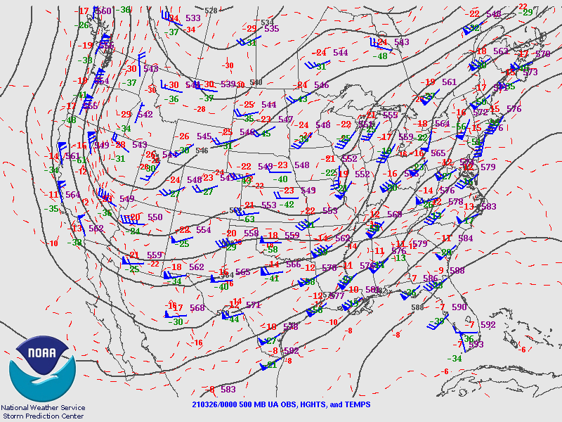
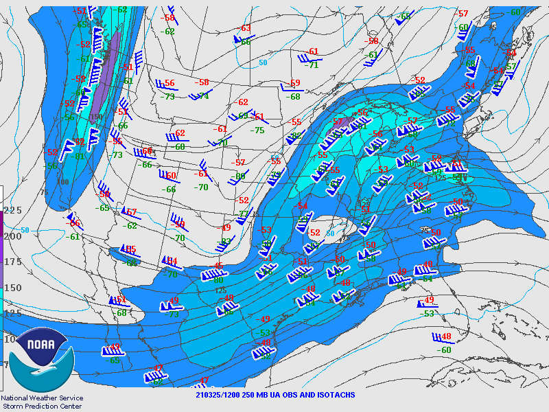
| 250 mb analysis, 8 AM | 500 mb analysis, 8 AM |
|
|
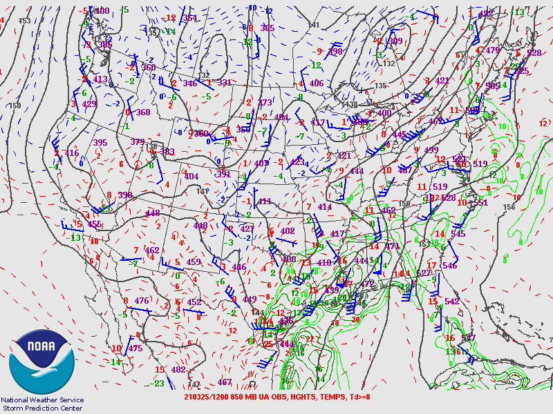
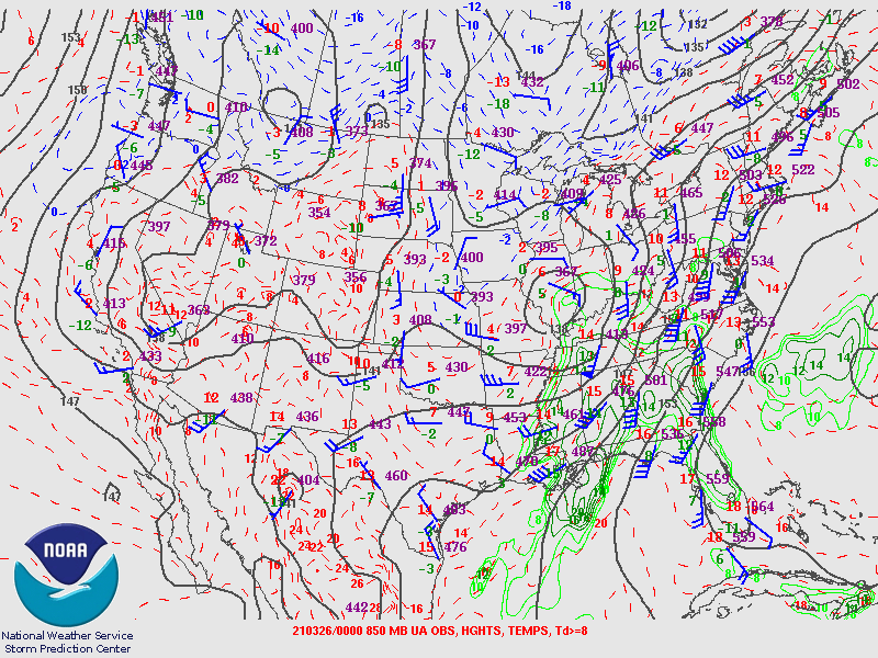
| 850 mb analysis, 8 AM |
|
|
|
| 250 mb analysis, 8 PM | 500 mb analysis, 8 PM |
|
|
| 850 mb analysis, 8 PM |


.gif)