|
Severe Weather Follows Cold Blast
January 11, 2014
|
Just four days removed from lows in the single digits and wind chills close to 30 degrees below zero in some cases, the North and Central Georgia weather pendulum swung quickly to include severe thunderstorms with damaging winds and tornadoes this time around. The setup for this event started at the upper levels with a very strong winter trough at 500mb which allowed a squall line to develop just as the storm system entered into the local area.
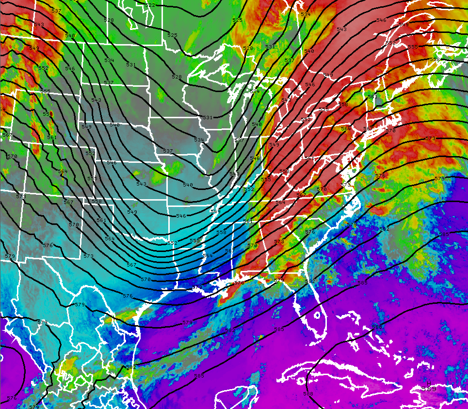
500 mb map with satellite imagery overlaid.
At the surface, a strong cold front provided the focus for widespread showers and embedded strong to severe storms. Note the warm front over Northeast Georgia which is retreating as the cold front approaches. This was key in allowing a warm air return ahead of the cold front and generating just enough instability to take advantage of the strong low level winds already in place.
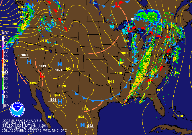
Surface analysis early Saturday morning.
As the line of storms moved through, the map below shows really two distinct area of severe weather across the area. The first was along and just north of the Atlanta metro during the early morning hours Saturday. The secondary area developed across portions of Central Georgia from Macon to Augusta near the midday timeframe. Note, any possible tornadoes are not labled on this map as surveys are pending.

Local storm reports from the event. Click the image for further details.
Storm Surveys
Cherokee County Tornado
Rating: EF-0
Max Wind Speed: 80 MPH
Path Length: 3 miles
Path Width: 10 yards
Injuries: 0
Deaths: 0
Start Time: 7:37 AM EST, January 11, 2014
End Time: 7:41 AM EST, January 11, 2014
Start Location: 1.75 miles NE of Waleska (34.3328, -84.5286)
End Location: 4.5 miles NE of Waleska (34.3476, -84.4811)
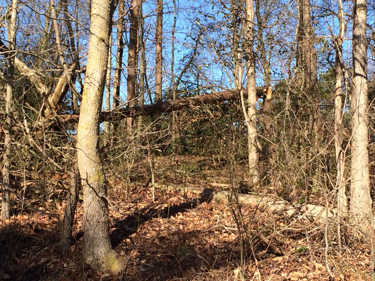
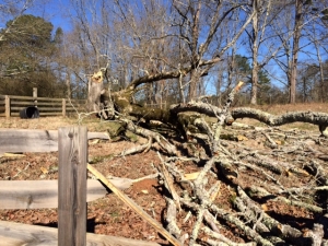
Survey Summary: A brief EF-0 tornado touched down in Cherokee County, Georgia on Saturday, January 11, 2014 just after 7:30 in the morning. Although the total path length was 3 miles, the tornado skipped along the ground as the damage was sporadic. Several trees were downed along a path that stretched 1.75 miles NE of Waleska to 4.5 miles NE of Waleska. In addition to the downed trees, a fence near the starting point of the tornado was damaged when a large tree fell on it.
 |
 |
Downed tree that damaged a wooden fence
at the beginning point of the tornado. |
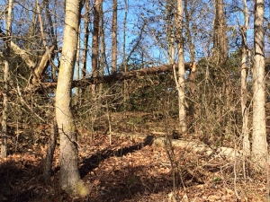
Snapped tree at the end point
of the tornado. |
 |
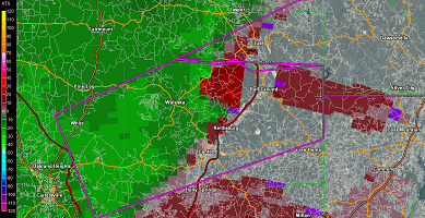 |
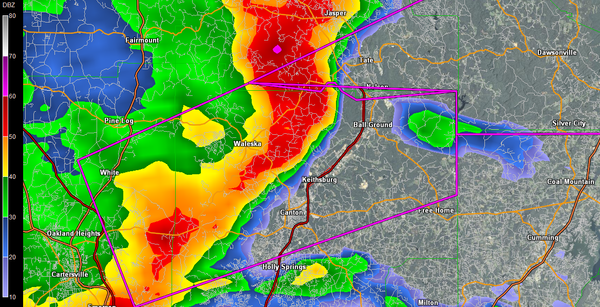
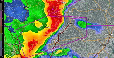
| Radar image of reflectivity (left) and storm relative velocity (right) during the Cherokee County tornado. |
Polk County Thunderstorm Wind Damage
Survey Summary: Straight line winds of 80 MPH struck the Floyd Polk Medical Center in Cedartown, Georgia around 6:50 AM Saturday, January 11, 2014. The winds lifted the vinyl awning off the hospital entrance and pulled some of the metal support beams from the concrete base. These metal support beams punctured the roof and allowed the rain to enter the building through these holes. This water caused damage to the interior of the structure. In addition, some of the debris hit cars parked near the building and damaged six vehicles. A small portion of the metal roof on a nearby building was peeled back. A few limbs were down near the medical center and two signs of nearby businesses received damage.
|