
Scattered severe thunderstorms capable of large hail in excess of two inches, strong tornadoes, and damaging wind gusts are likely across parts of the Upper Mississippi Valley and Midwest this evening. Heavy to excessive rainfall may bring a flooding threat to portions of the Central Plains to the Midwest through Thursday. The heatwave in the Central U.S. will begin to push South and East Thursday Read More >

Media is free to use the NWS Flagstaff Event Summary information. Please acknowledge the NWS as the source of any information accessed from the site unless otherwise noted.
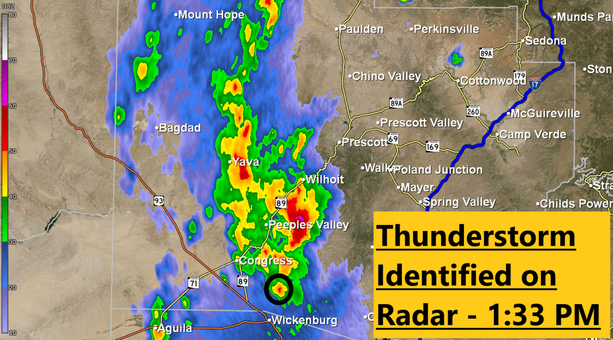
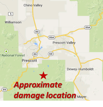
On September 27th, 2014, an EF-0 tornado touched down in the Bradshaw Mountains south of Prescott, AZ. This storm was associated with numerous reports of damage to residential structure and vegetation. An NWS Flagstaff storm survey was conducted in order to assess the Enhanced Fujita scale rating of the tornado. Besides the tornado, reports of flash flooding and heavy rainfall were associated with a variety of storms that impacted much of northern Arizona on this same day.
Map showing the the Highline Burn Scar, Ellison Creek, and the Cold Springs swimming hole
Radar Estimated Storm Total Precipitation on July 15, 2017
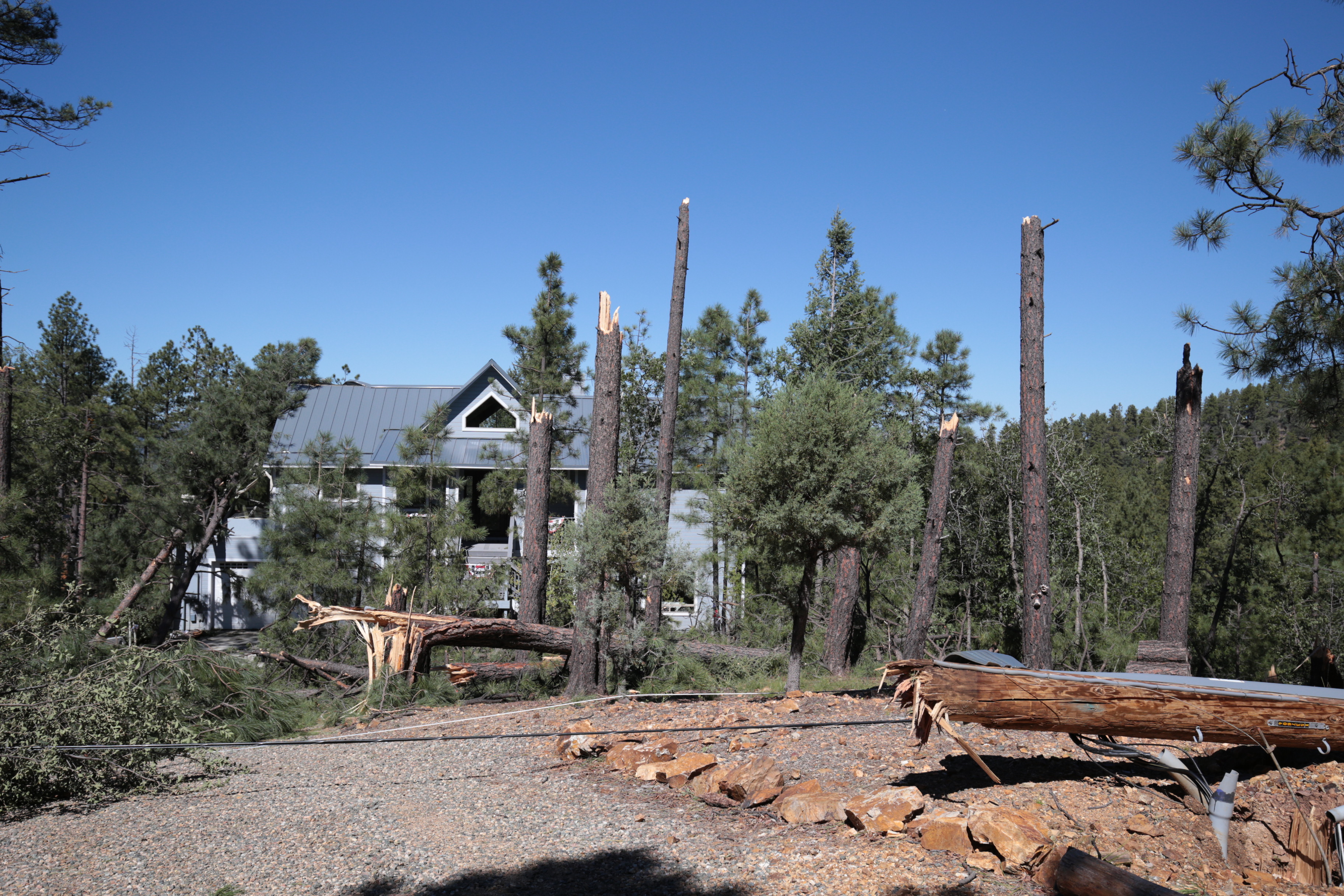
Trees snapped off at the trunk caused damage to the residential structure in the background.
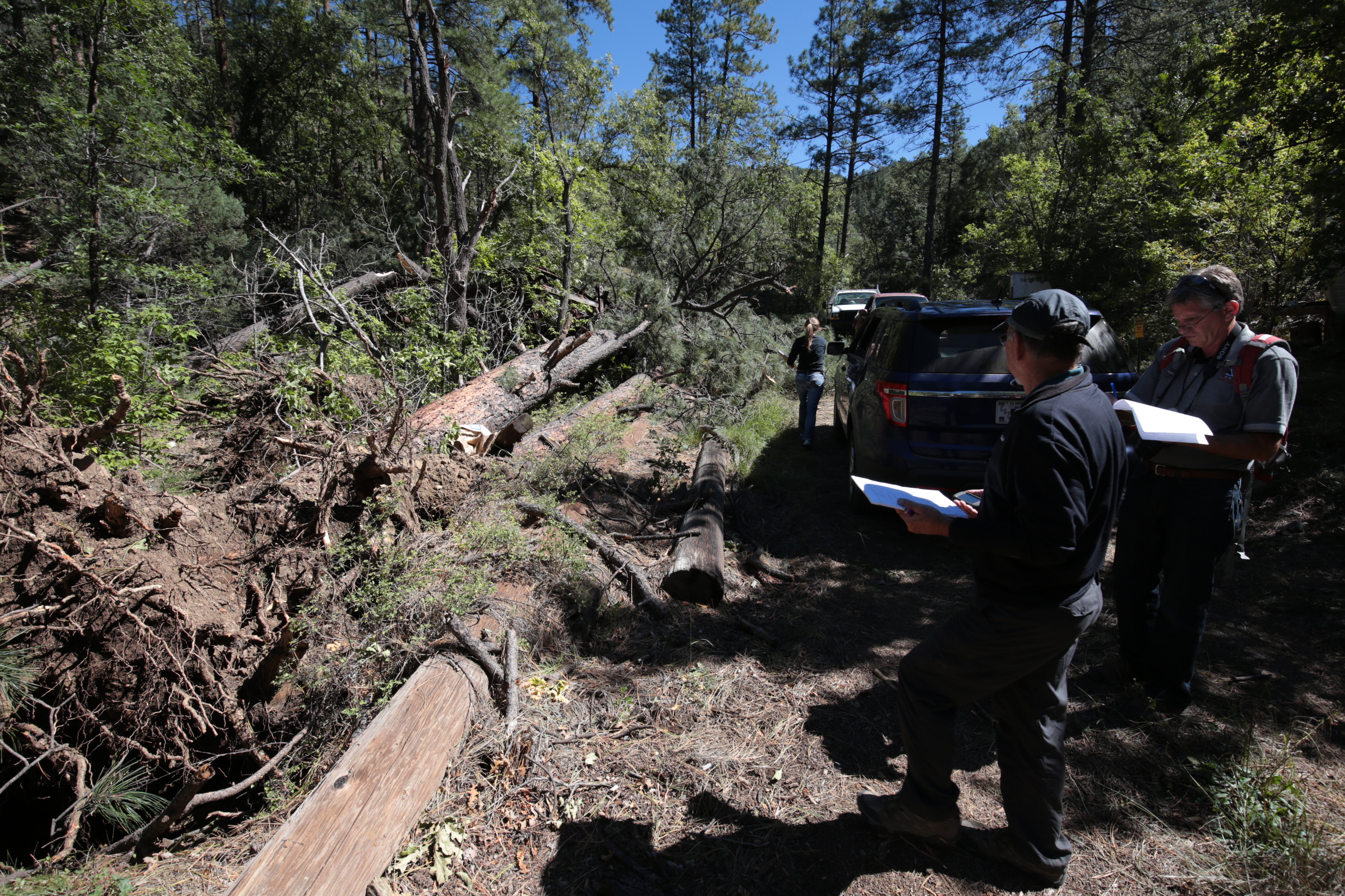
NWS Flagstaff employees assessing tree damage near Groom Creek in the Bradshaw Mountains. The assessment would rate the tornado as an EF-0.
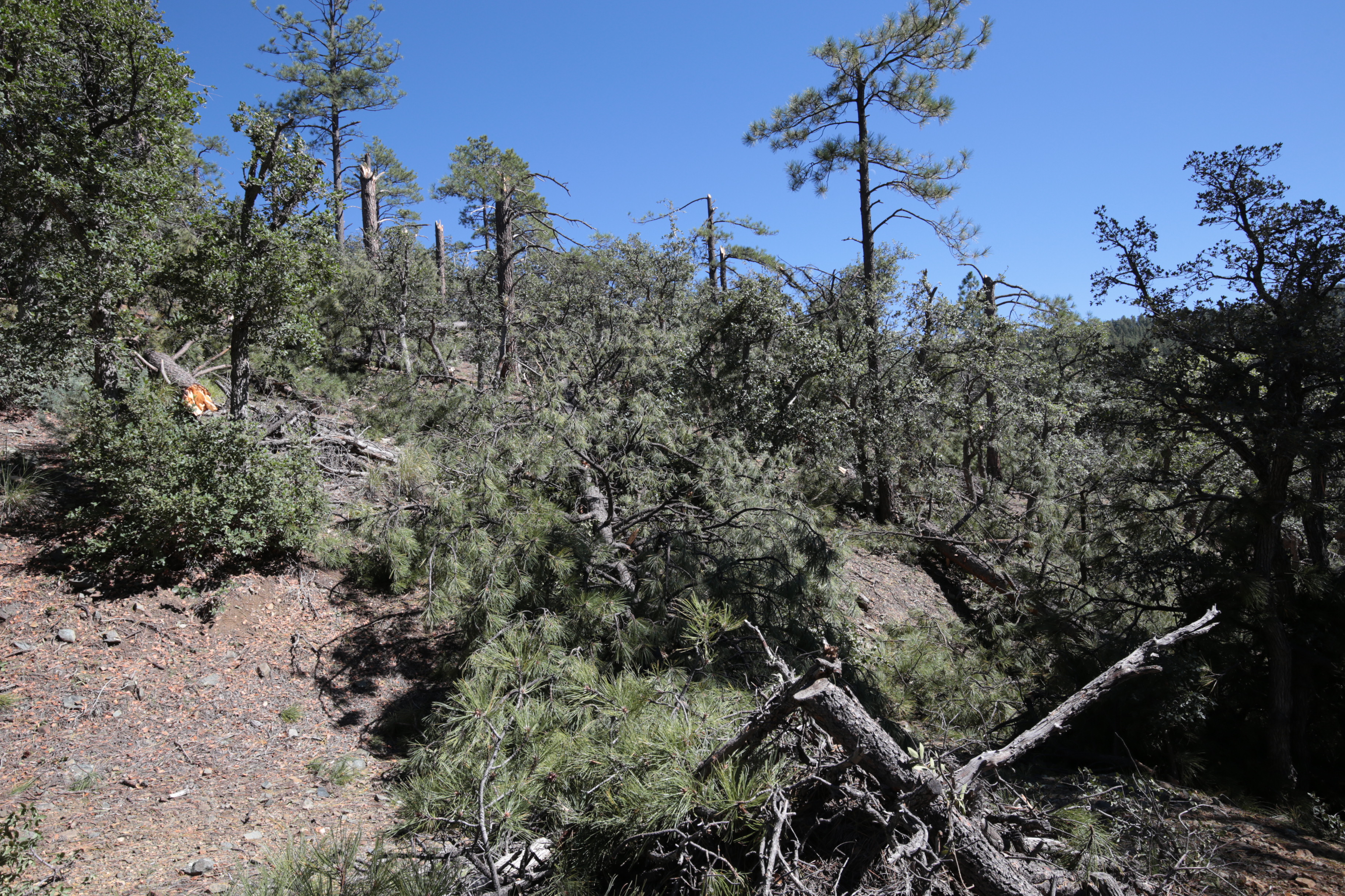
Stand of trees damaged on a hillside. Most of the trees were snapped off at their trunks.
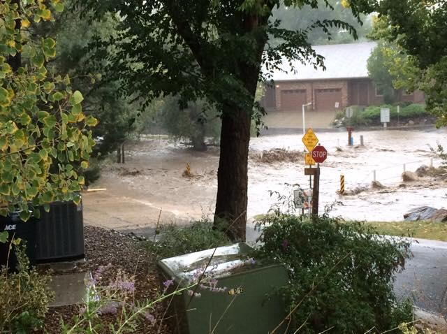
Flash flooding of a roadway in Prescott, AZ on September 27, 2014. Photo Credit: 12 News on Twitter.
A cold front associated with a strong trough of low pressure moved across California and into Arizona. Southerly winds ahead of the storm brought deep moisture into the area. These conditions created severe thunderstorms and heavy rainfall. An EF-0 tornado formed and traveled over areas near Prescott, AZ.
For more information on impacts and general inquiries about this event, contact by sending an email to or by calling .
Media is free to use this event summary information. Please acknowledge the National Weather Service as the source of any information accessed from the site unless otherwise noted.

