
Dangerous and extreme heat will remain across portions of the southern U.S. this week. A heat wave over the Southwest U.S. will intensify this week, peaking and expanding into the Intermountain West and northern High Plains this weekend. Multiple rounds of thunderstorms will produce heavy to excessive rainfall with significant flash flooding across portions of southern New England today. Read More >
Media is free to use the NWS Flagstaff Event Summary information. Please acknowledge the NWS as the source of any information accessed from the site unless otherwise noted.
The October 2010 tornado outbreak was the largest in Arizona history and was also notable for producing the highest count of tornadoes ever in a single event that took place west of the Continental Divide. At least eleven tornadoes were recorded during the morning hours of October 6, 2010. The most active time was from 4:00 AM - Noon MST. The National Weather Service office in Flagstaff issued 28 Tornado Warnings, 25 Severe Thunderstorm Warnings, and 1 Flash Flood Warning during this event. Multiple tornadic storms repeatedly developed over the same locations in north-central Arizona, keeping the small area under a constant tornado threat for several hours. Large hail (up to baseball-sized) was reported. The duration, intensity, and number of tornadoes distinguished this event apart from any other event in history west of the Continental Divide and in Arizona.
This was an unusual event meteorologically for northern Arizona. All parameters that are required to generate severe thunderstorms and tornadoes were in place at once. A cold low pressure system off the California coast and strong southwesterly winds allowed enough moisture, instability, and atmospheric rotation to produce the observed tornadoes.
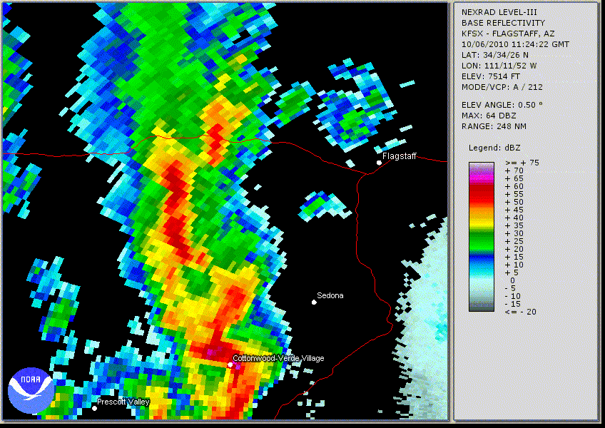
Radar Loop October 6th From 4:24 AM - 10:27 AM
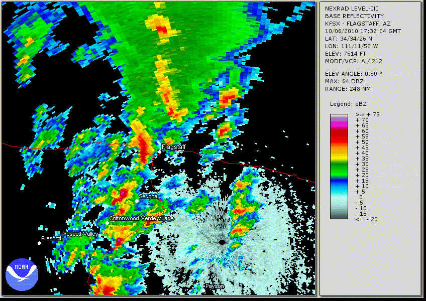
Radar Loop October 6th From 10:32 AM - 1:50 PM
Tornadoes that Impacted Bellemont, AZ on October 6th
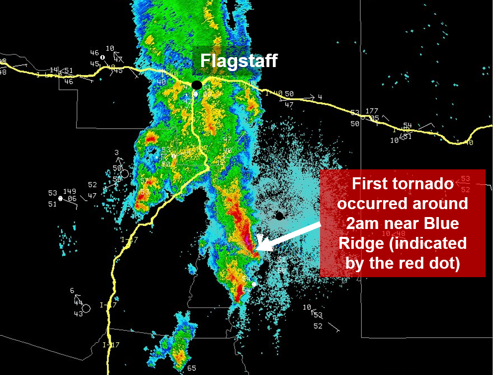
Radar Image Of The First Tornado Near Blue Ridge
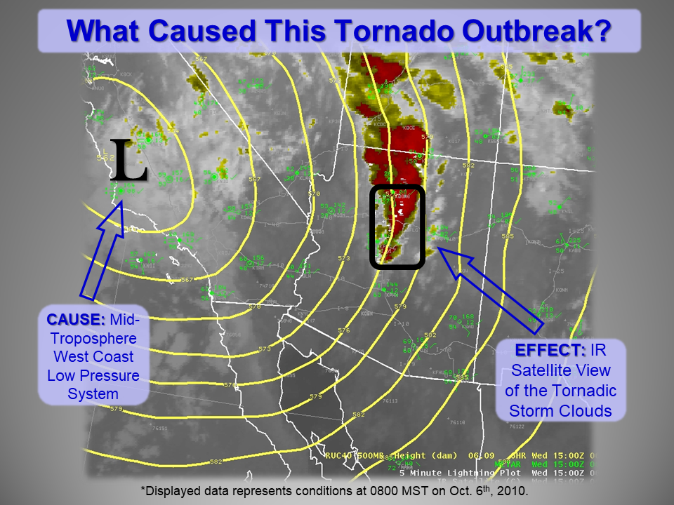
Satellite Infrared Imagery Depticting Tornadic Storm Clouds
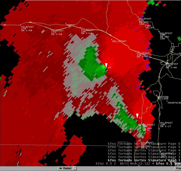
Velocity Image Showing Tornadic Cirulation Headed Towards Bellemont
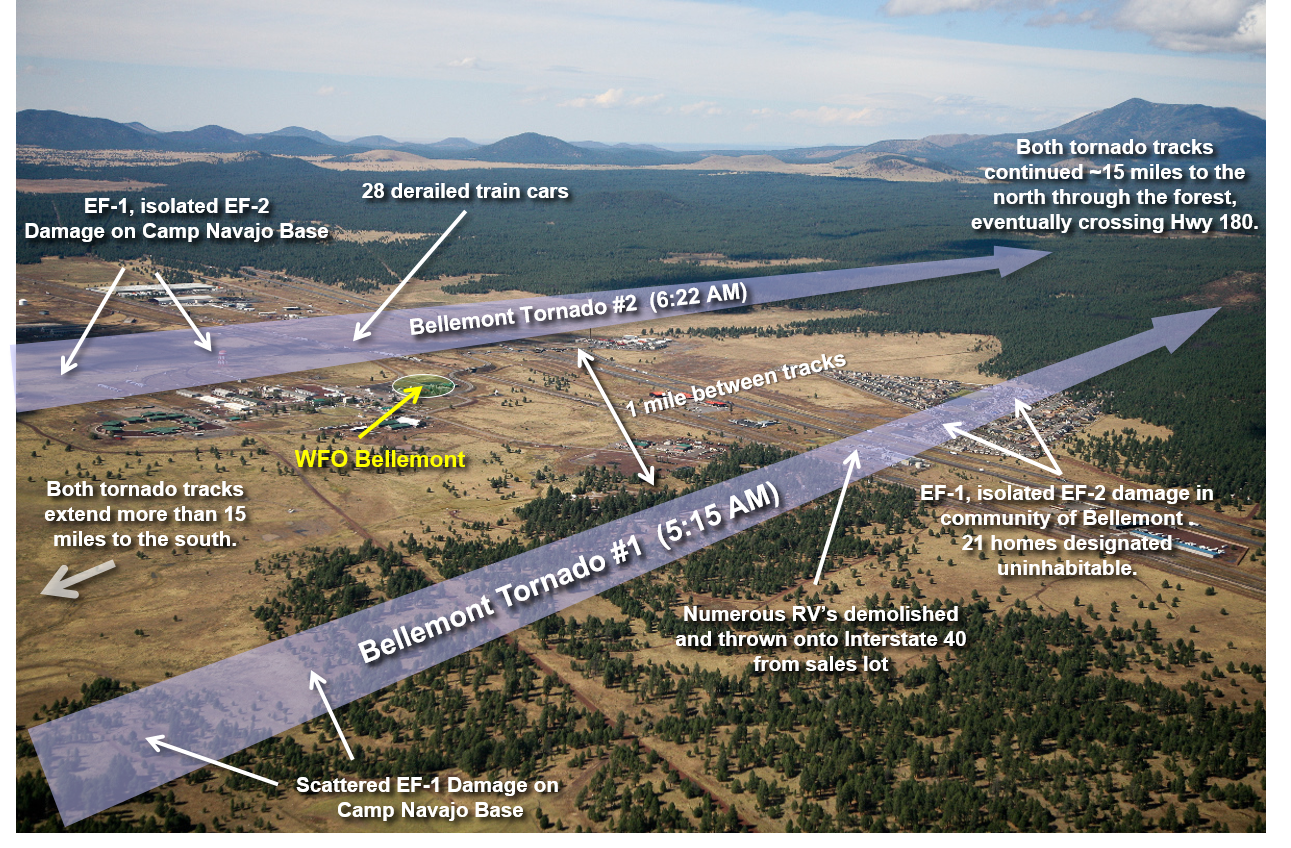
Tornado Tracks In Bellemont
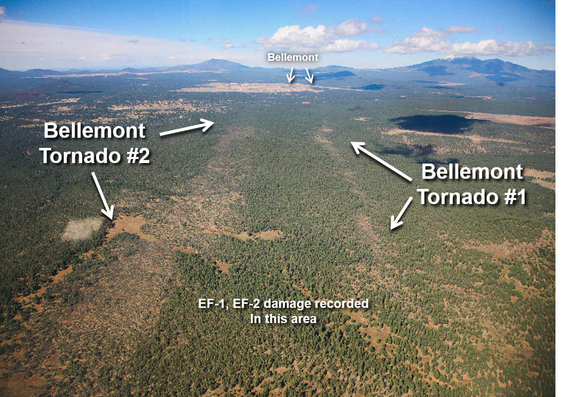
Arial View Of Tornado Tracks In Bellemont

Bellemont Tornado Damage
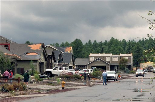
Bellemont Tornado Damage
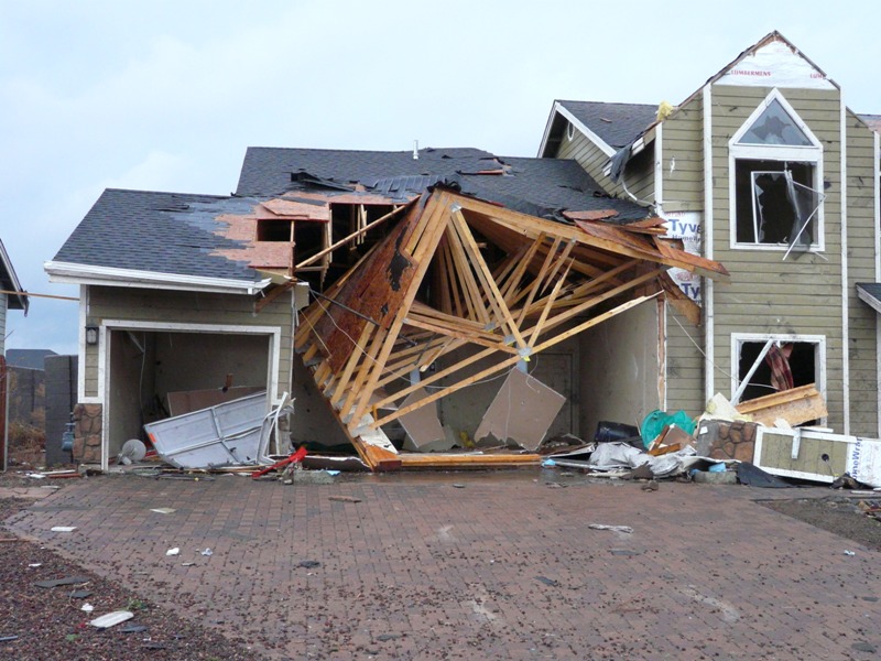
Bellemont Tornado Damage
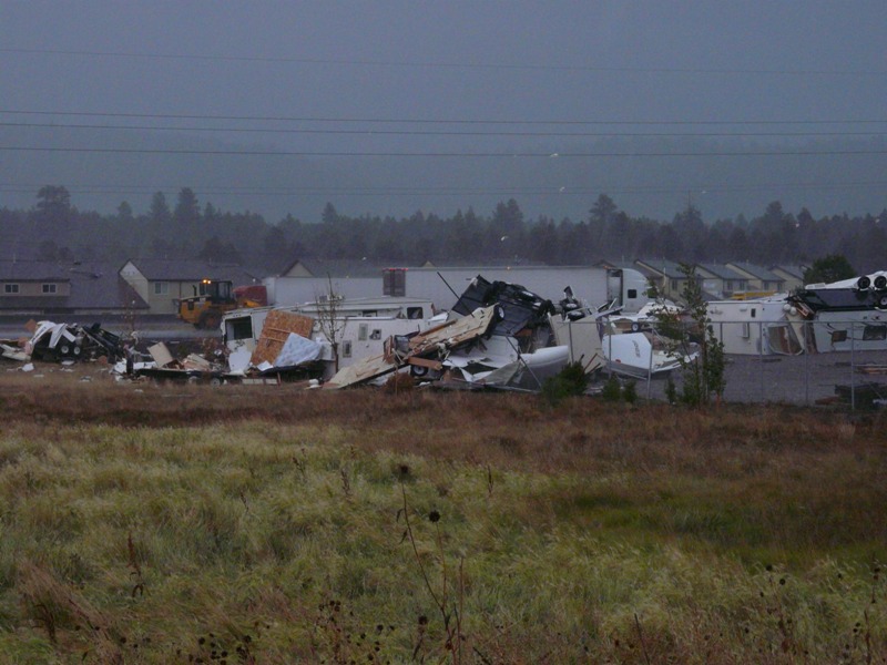
Bellemont RV Park Tornado Damage
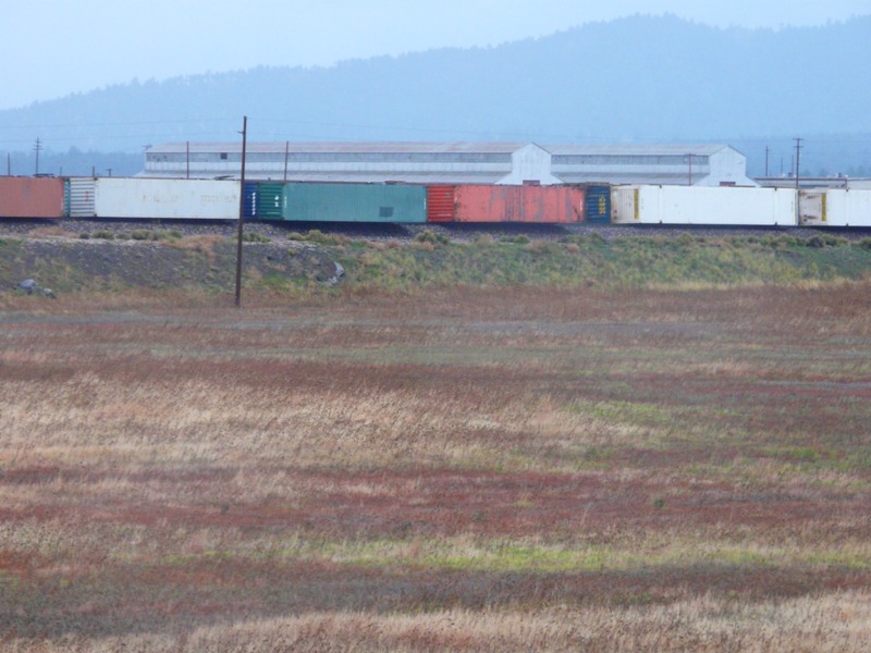
Multiple Train Cars Derailed In Bellemont
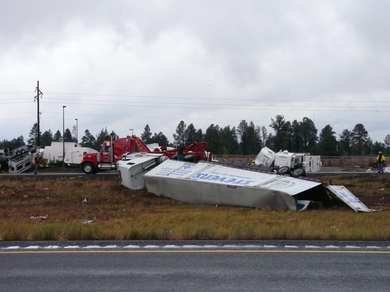
Semi Blown Over On I-40 In Bellemont
Several Trees Snapped In Half Near Bellemont
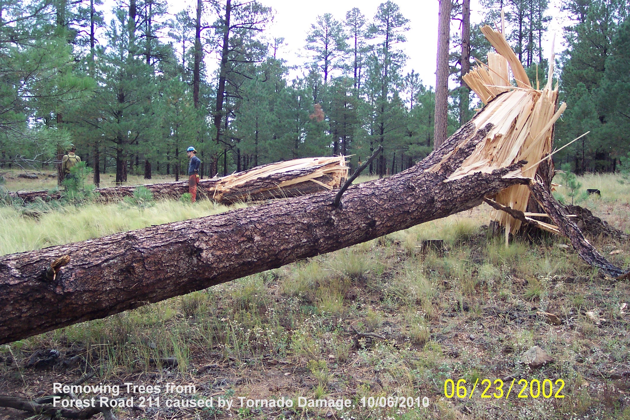
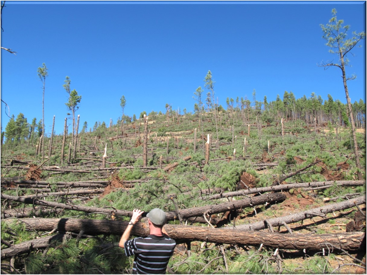
Trees Snapped From The Blue Ridge Tornado
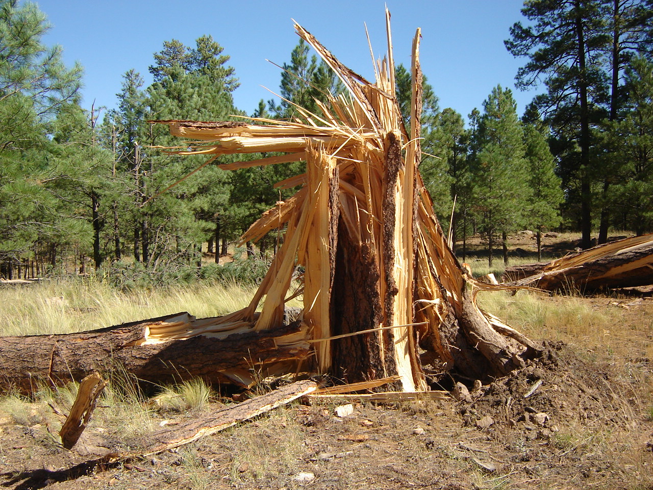
Trees Snapped From The Blue Ridge Tornado
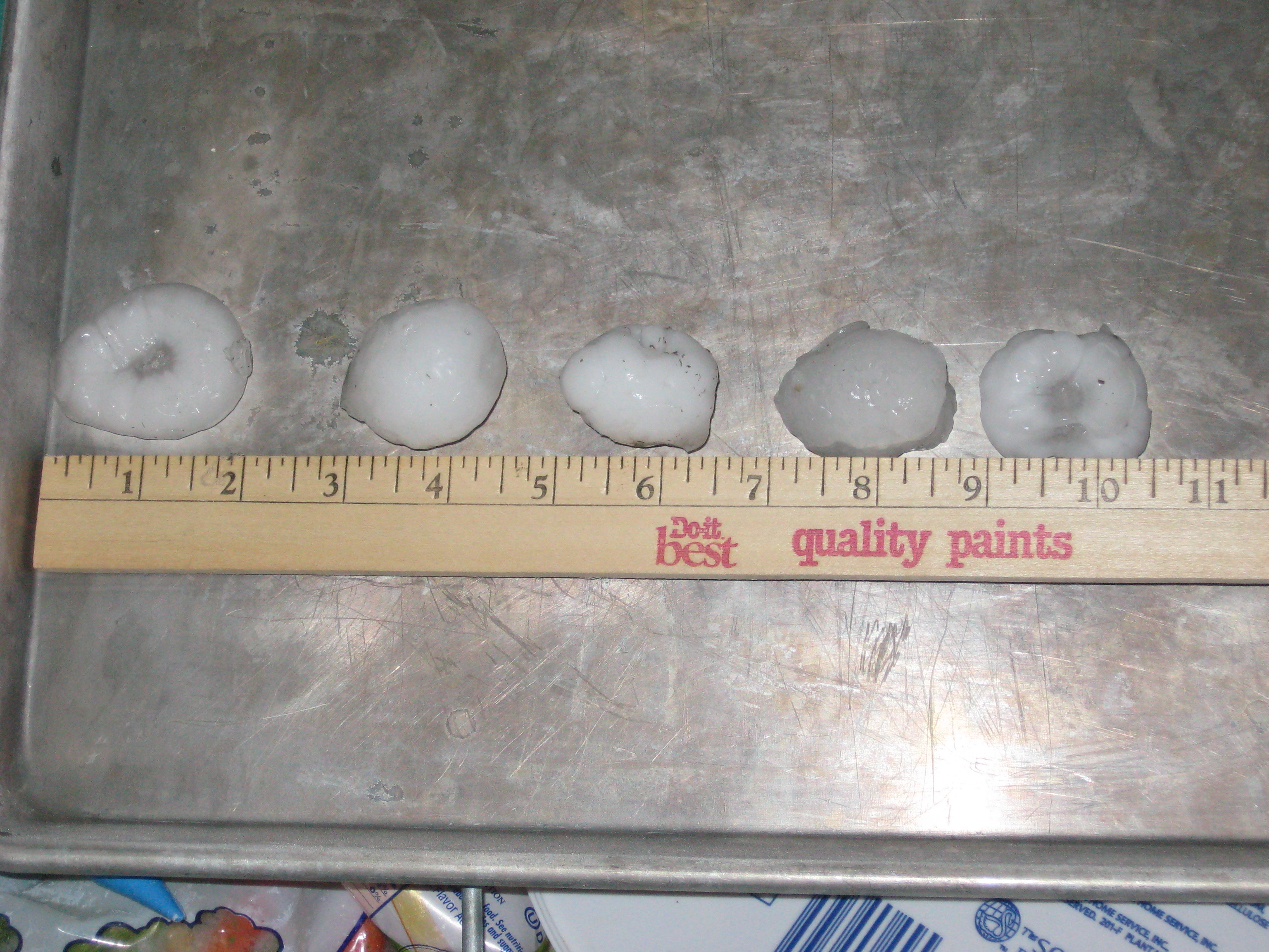
Baseball-sized hail in Cornville
For more information on impacts and general inquiries about this event, contact by sending an email to or by calling .

