
Widespread life-threatening flash and urban flooding will continue to pose a significant threat to life and property in south-central Texas. Catastrophic fiver flooding, with rapid rises on small streams, arroyos, and typically dry washes, is expected. Monsoonal showers persist across the Great Basin and Southwest with greatest flash flooding in southern Arizona. Read More >


Media is free to use the NWS Flagstaff Event Summary information. Please acknowledge the NWS as the source of any information accessed from the site unless otherwise noted.
A line of strong to severe thunderstorms rapidly intensified in strength in the late afternoon of July 10, 2021 along the Mogollon Rim. Low level rotation associated with this line of storms formed around 4:50 PM MST and produced a tornado that lasted from 5:01 PM until 5:07 PM MST. The EF1 tornado left a 1.25 mile damage path oriented northeast to southwest between Happy Jack and Clints Well, Arizona. Damage was limited to intermittent areas of damaged or downed pine trees along the tornado track.
 Loop from 4:44 PM - 5:14 PM July 10, 2021 showing reflectivity (top) and base velocity (bottom) imagery over southeastern Coconino County where a tornado formed. The gray circles denote times with a notable velocity couplet and low-level storm rotation. The orange circles denote formation and termination of the strongest rotation couplet.
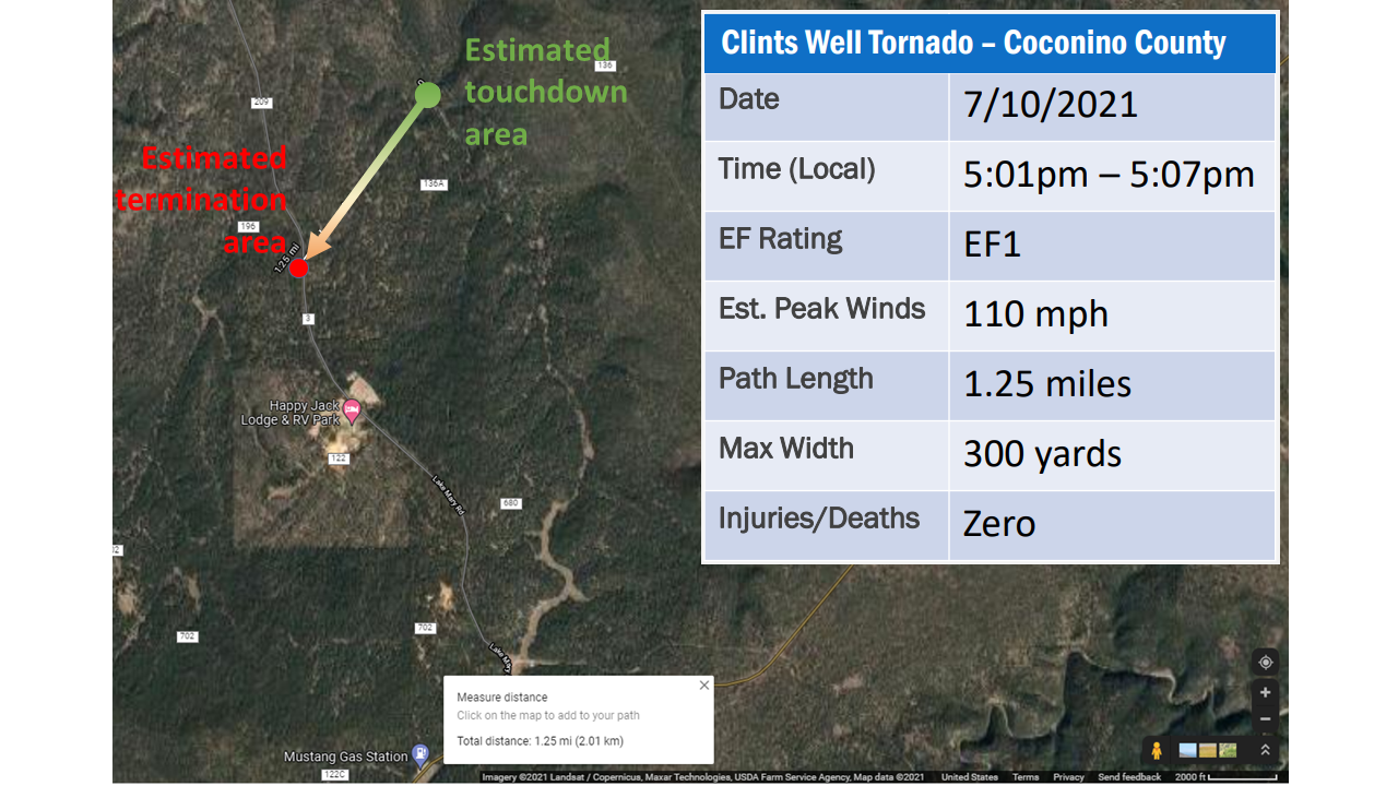 A tornado moved from northeast to southwest between Happy Jack, AZ and Clints Well, AZ in southeastern Coconino County in the late afternoon of July 10, 2021. The tornado track is estimated about a mile and a quarter in length through mainly rural forest.
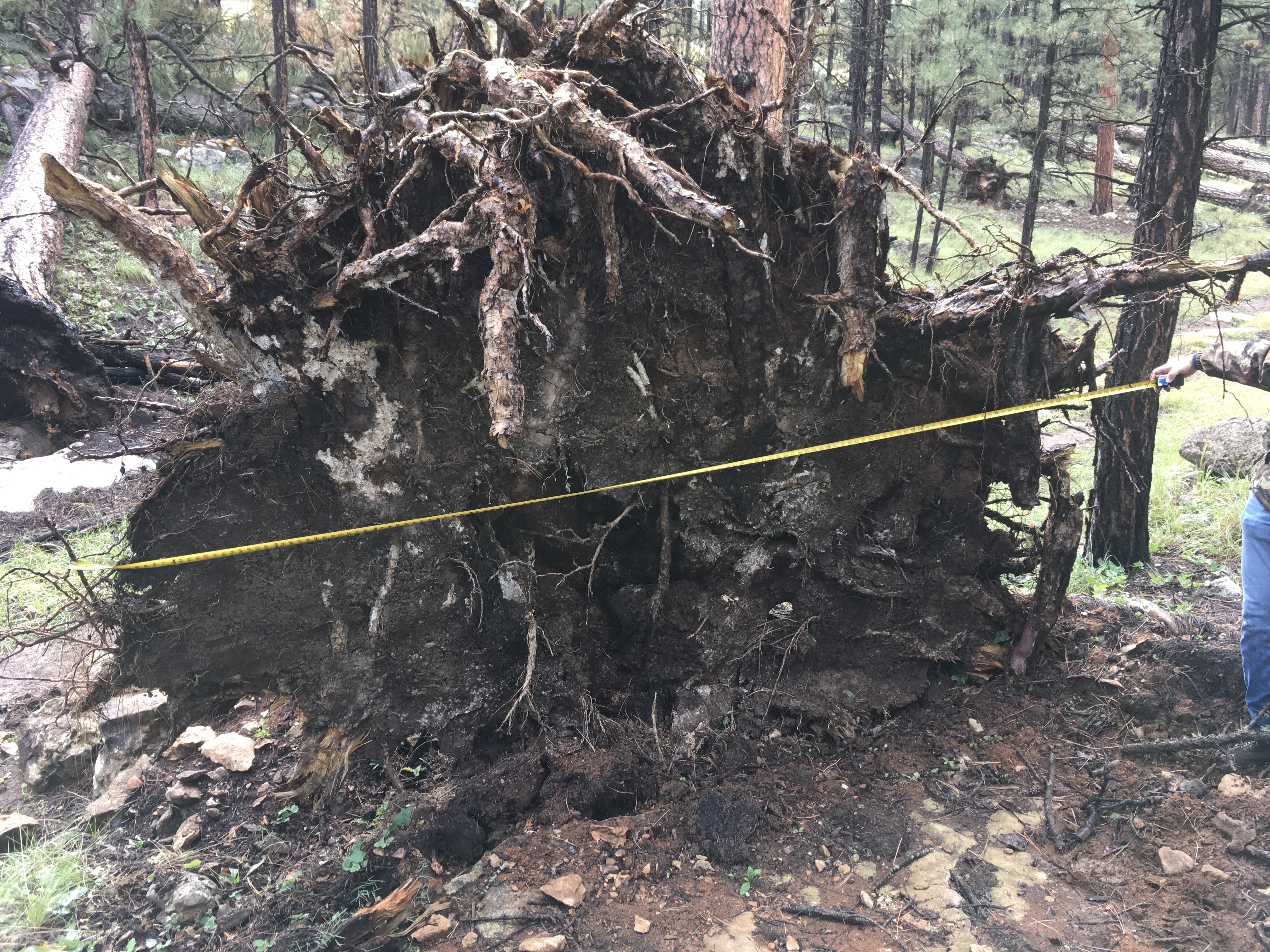
Uprooted pine tree laying southeastward near the start of the damage path. Measured width of the roots was 140 inches.
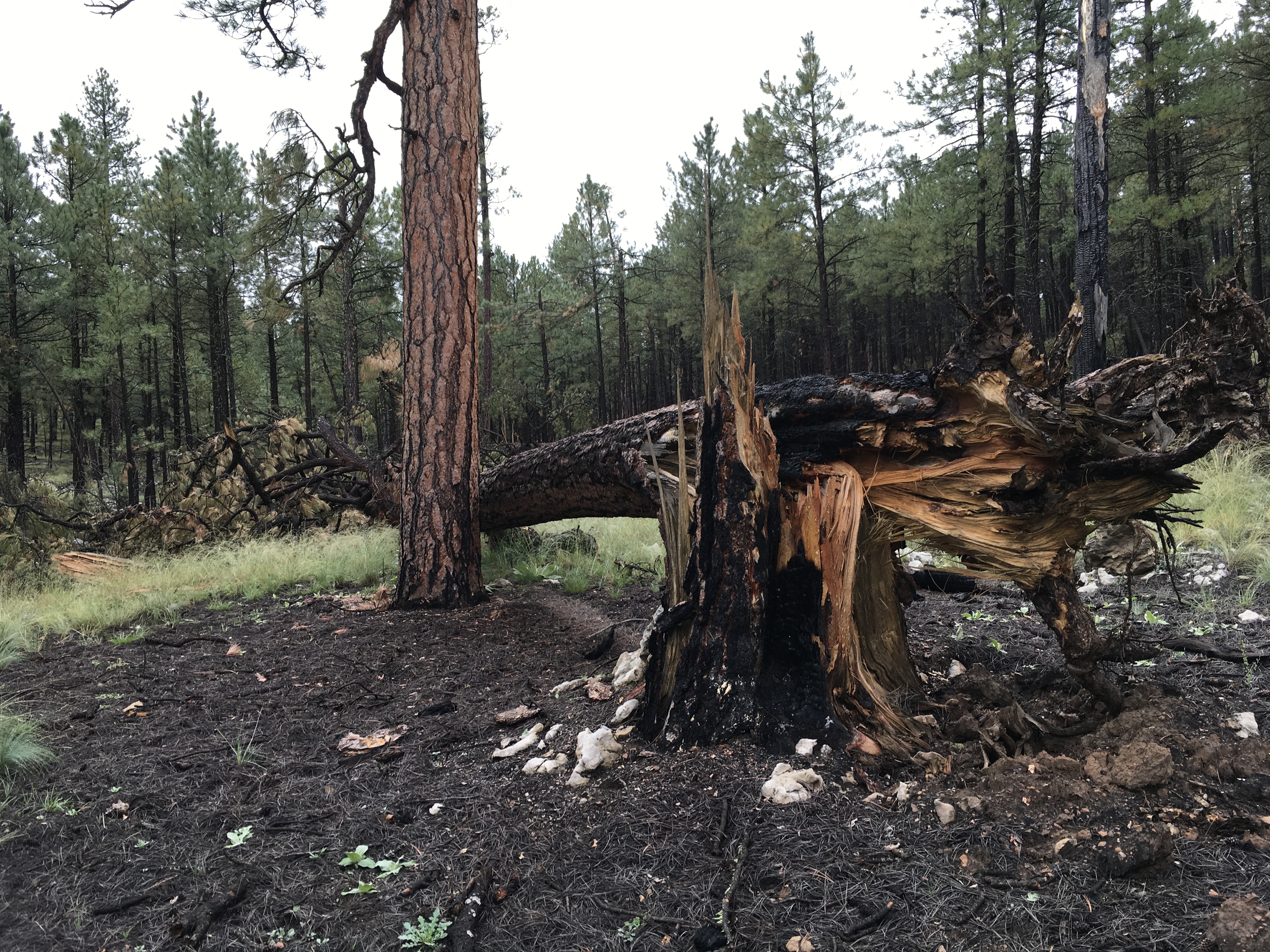
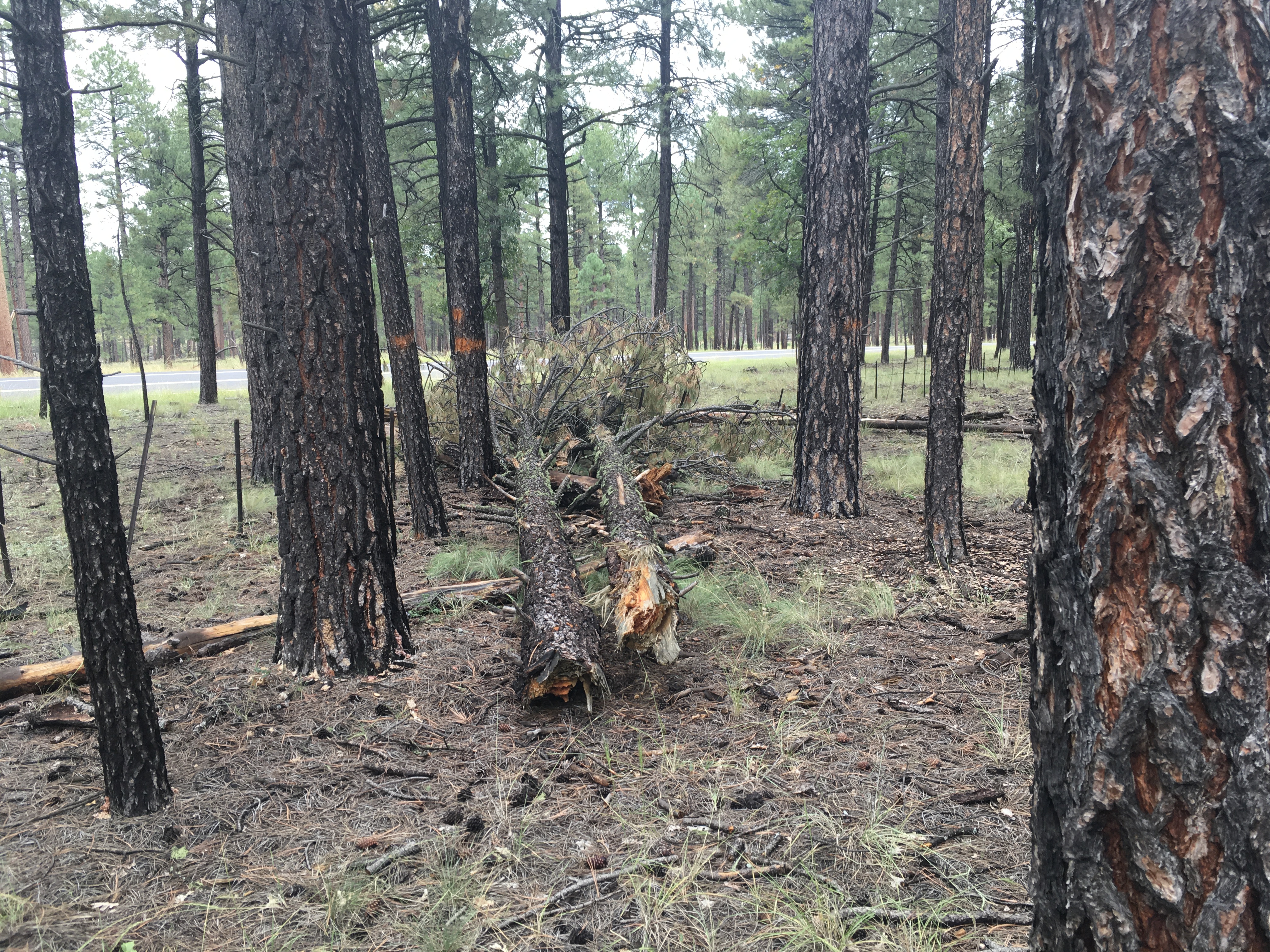
Previously burned pine tree snapped at the base of the trunk
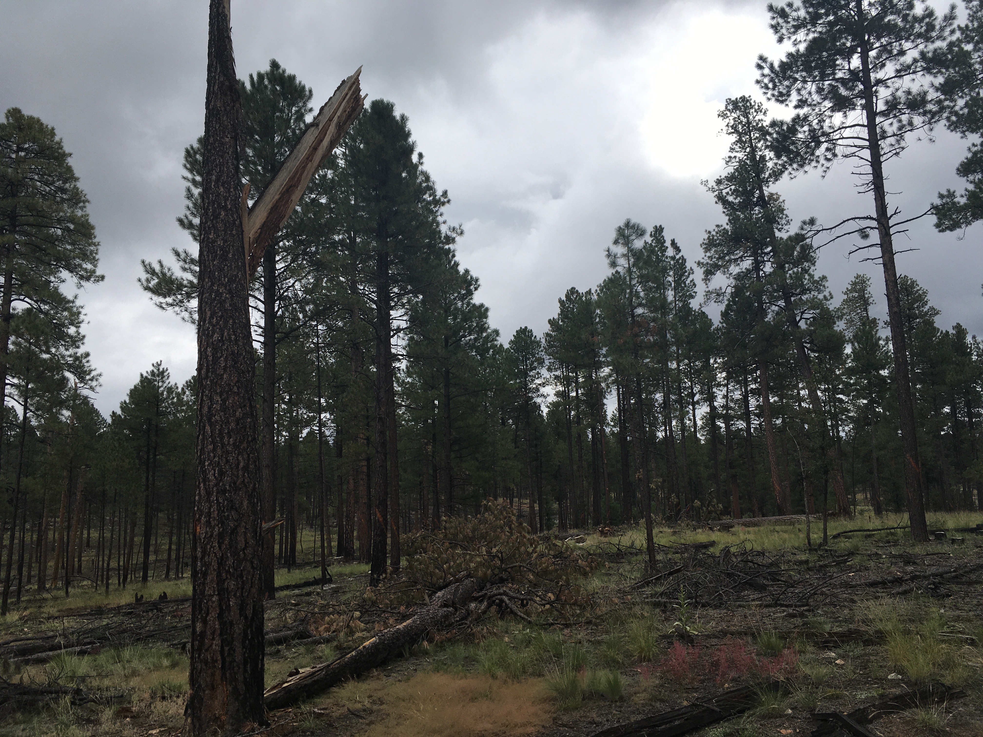
Pine tree snapped about halfway up the trunk with the top half of the tree laying southwestward.
Pine trees snapped in half and laying southeastward near the terminus of the damage path
For more information on impacts and general inquiries about this event, contact by sending an email to or by calling .
Media is free to use this event summary information. Please acknowledge the National Weather Service as the source of any information accessed from the site unless otherwise noted.

