Overview
|
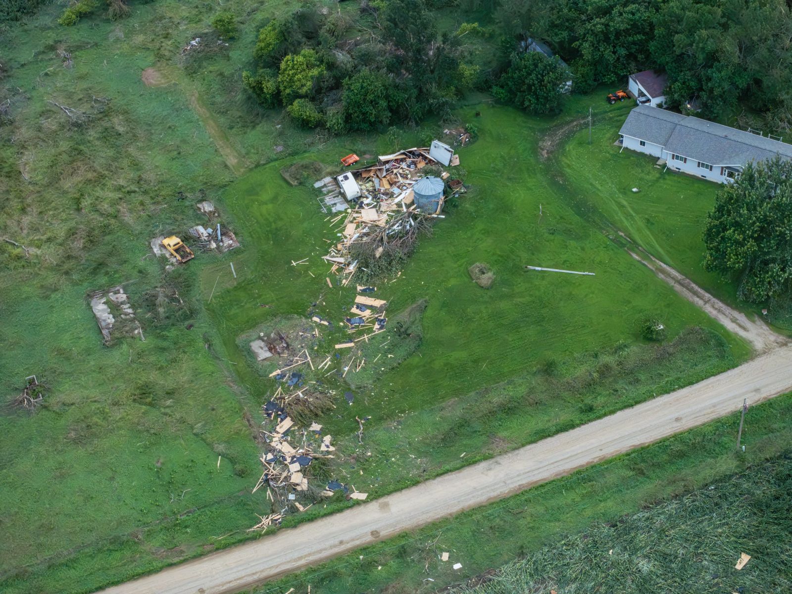
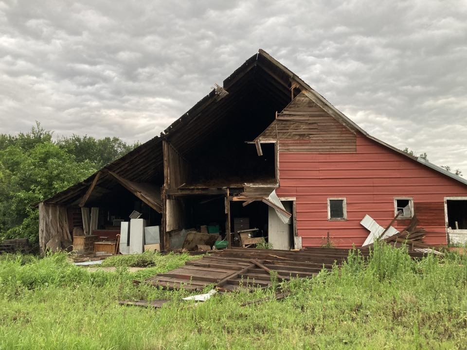
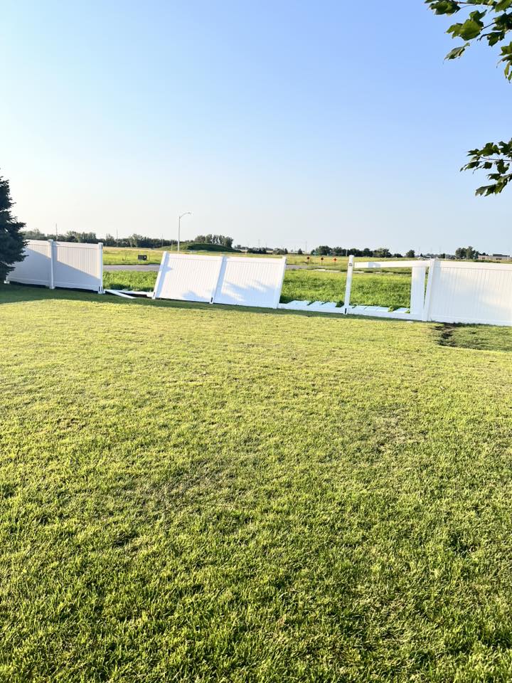
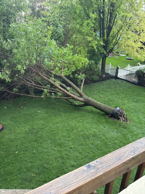
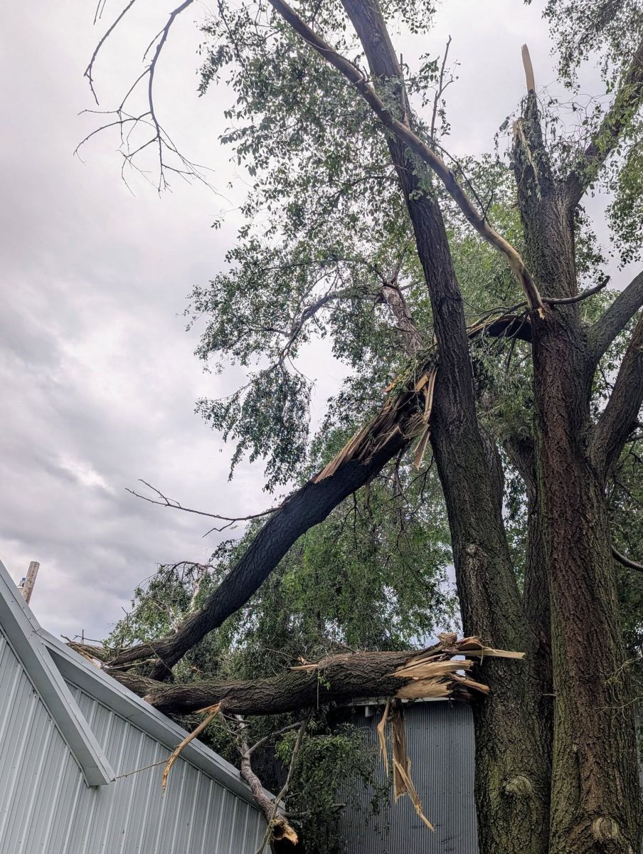
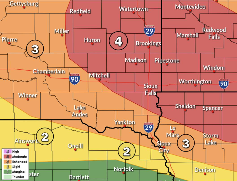
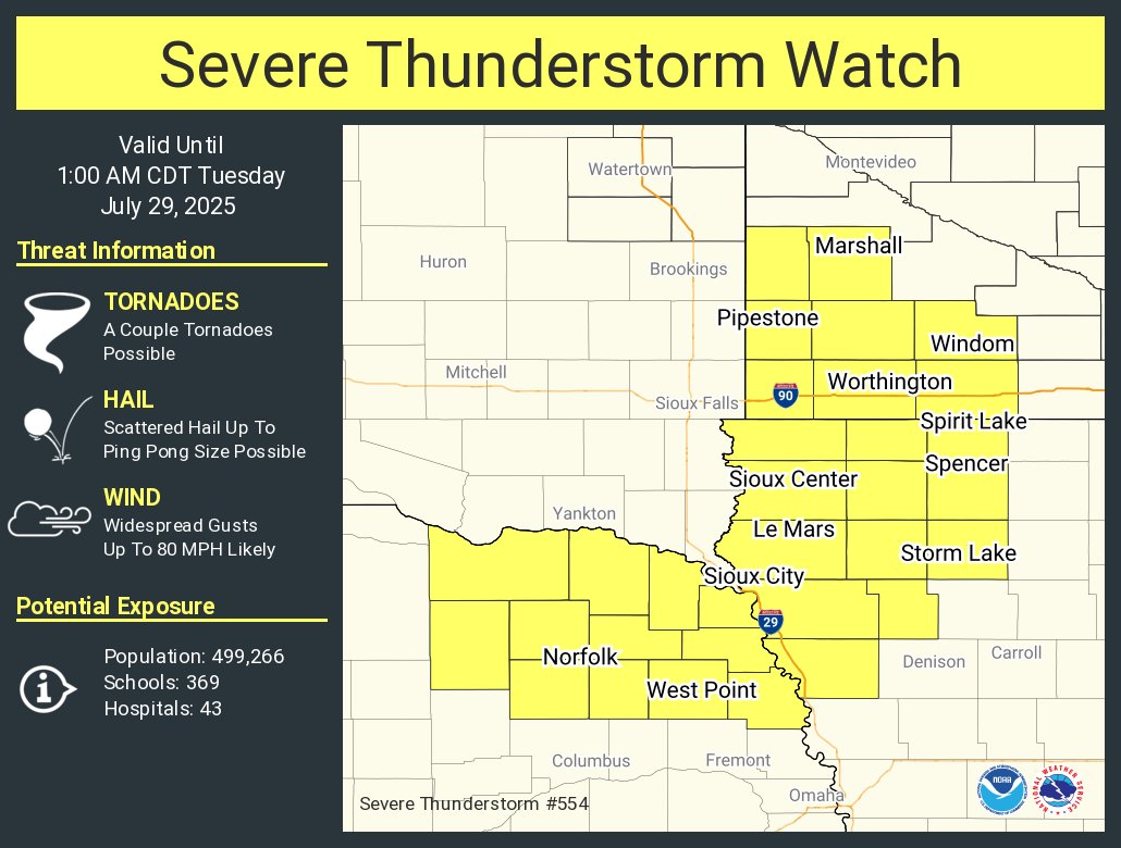
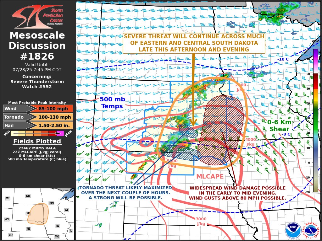
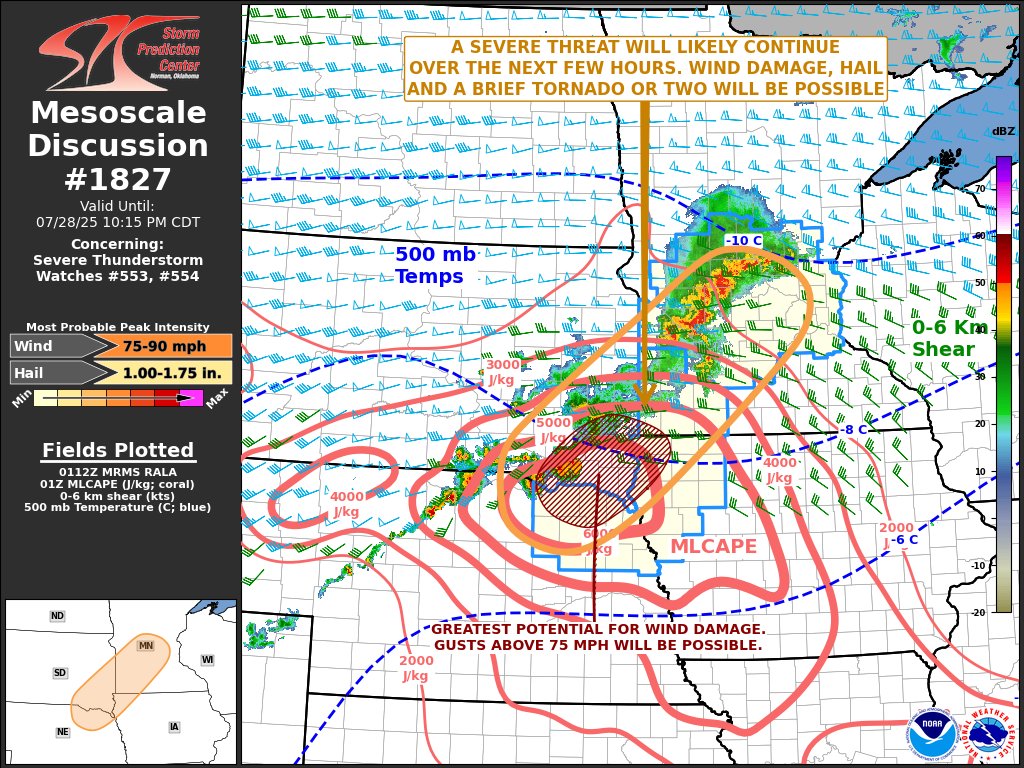
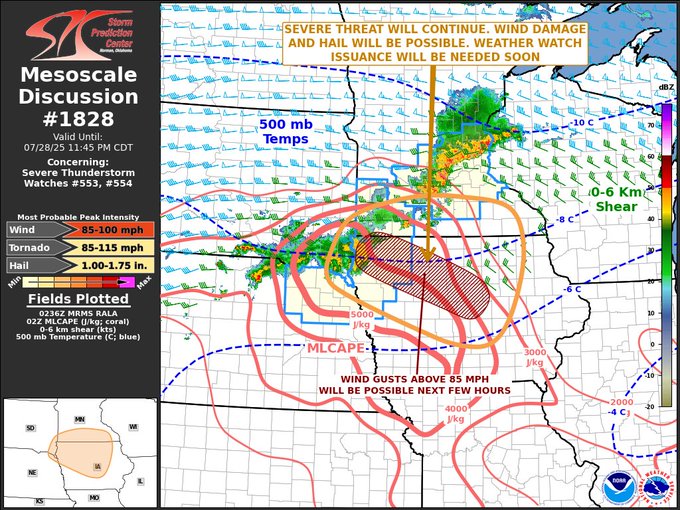
A very warm and humid late July afternoon and subtle low pressure in central South Dakota allowed isolated thunderstorms to quickly evolve on July 28th. The storms became more numerous later in the afternoon and evening as they moved farther east. The storms continued into the late evening and progressed into northwest Iowa during the early hours of July 29th. The initial isolated storms in central South Dakota produced a couple of tornadoes. The first one was about one mile northwest of Dixon. It produced EF-1 damage to a farm outbuilding, some power poles, and a DOT truck shelter. The second one was about eight miles northwest of Bonesteel. It produced EF-2 damage to power poles, a single-family home, two outbuildings, a camper, and an abandoned trailer. As the storms became more numerous farther east, the system developed into a derecho, with many locations impacted by destructive straight-line winds. Wind gusts of 55 to 99 mph were common across the southeast quarter of South Dakota and the northern half of Iowa. Another tornado developed later in the storm event about one mile east of Alvord, Iowa. It produced EF-1 damage to some farm structures, a large barn, and a grove of trees. The greatest concentration of wind damage was near a line from Beresford, SD, to Spencer, IA. Numerous reports of strong wind gusts and photos of structural damage were collected across the area. |
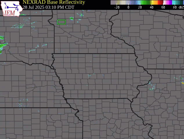 Regional Radar Loop |
 |
 |
 |
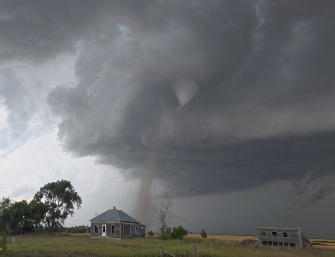
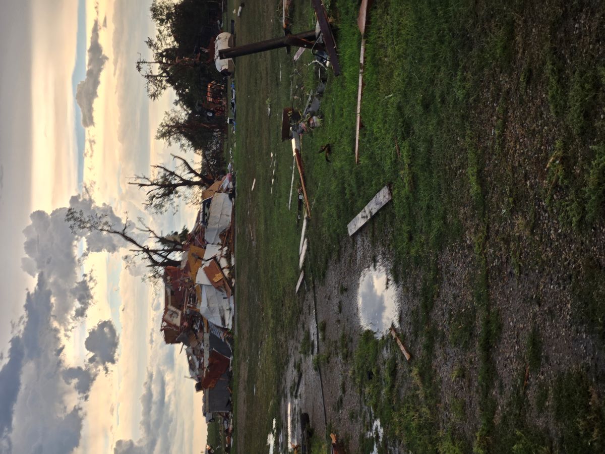
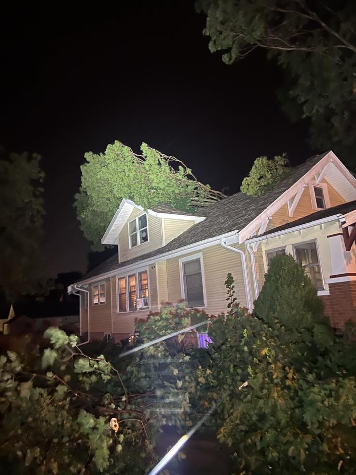
| Dixon SD Tornado (Credit: Jordan Hall) |
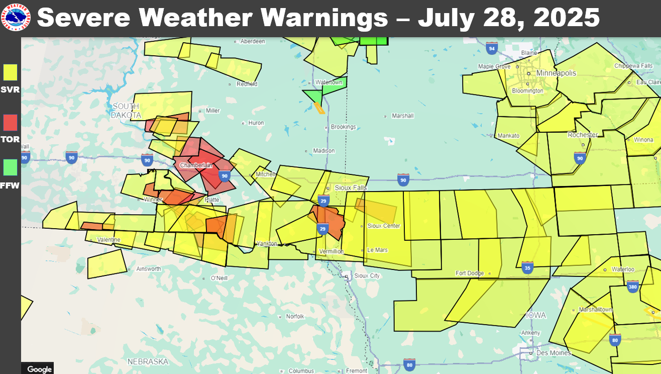
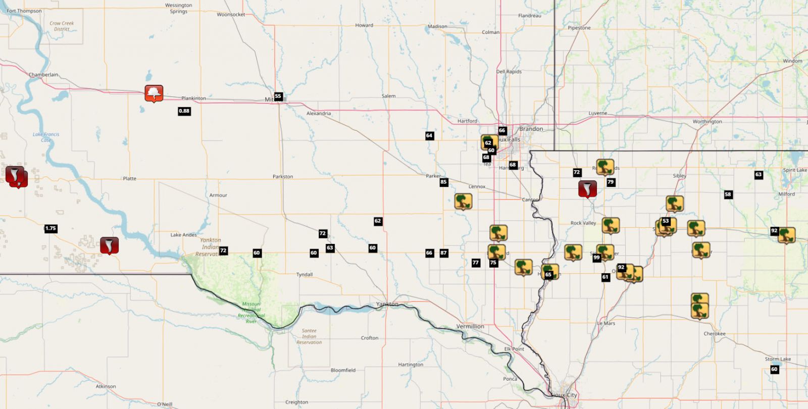
Severe Weather Warnings (July 28, 2025) | Local Storm Reports (July 28, 2025) |
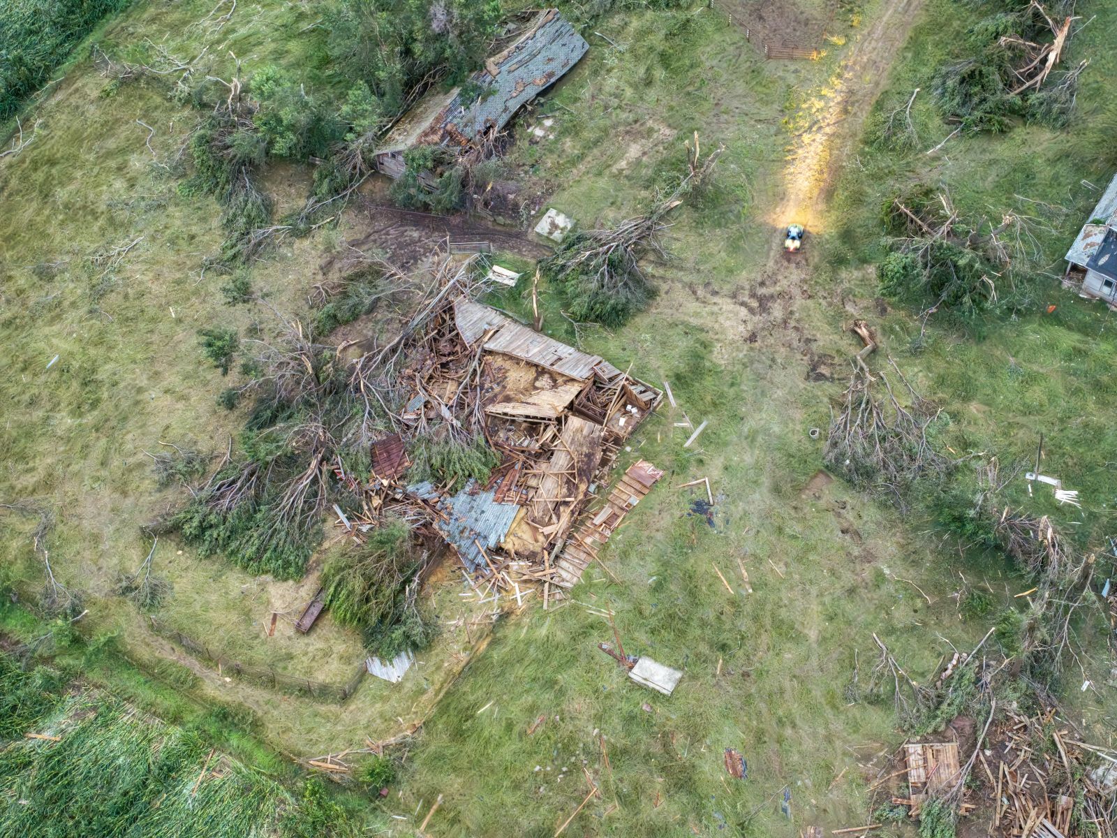
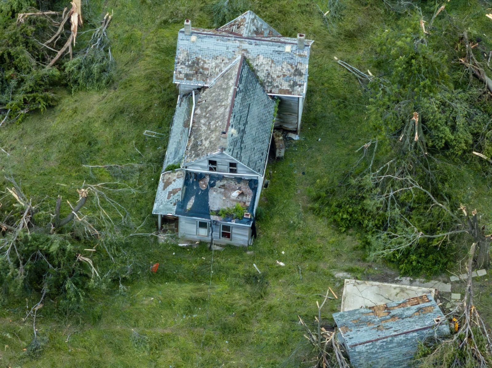
Tornadoes
Select a tornado from the table to zoom into the track and view more information. The default table view is limited to 8 tracks, but can be scrolled by a mouse wheel or dynamically expanded. Additionally, the table can fill the entire window by clicking the small circular expanding arrow icon at the very top right of the table and returned to its original size by clicking the button again. The side information panel that opens over the map can be closed using the "X" on the upper right corner of the pop-up. Zoom into the map and click damage points to see detailed information and pictures from the surveys.
|
NOTE: times shown below are local to your device's time zone. |

The Enhanced Fujita (EF) Scale classifies tornadoes into the following categories:
| EF0 Weak 65-85 mph |
EF1 Moderate 86-110 mph |
EF2 Significant 111-135 mph |
EF3 Severe 136-165 mph |
EF4 Extreme 166-200 mph |
EF5 Catastrophic 200+ mph |
 |
|||||
| Tornadoes that fail to impact any ratable damage indicators on the EF-Scale are rated EF-Unknown (EF-U) | |||||
Storm Reports
|
| Map of Severe Weather Report - July 28, 2025 |
|
..TIME... ...EVENT... ...CITY LOCATION... ...LAT.LON... 1117 PM Tstm Wnd Dmg Alton 42.99N 96.01W On the east side of town, an enclosed 1114 PM Tstm Wnd Dmg Sanborn 43.18N 95.66W Numerous tree branches broken, ranging from 1042 PM Tstm Wnd Gst 4 WNW Spencer 43.17N 95.22W ASOS station KSPW Spencer Municipal Airport. 1040 PM Tstm Wnd Dmg Alton 42.99N 96.01W Social media report of building damage at 1039 PM Tstm Wnd Gst 4 WNW Spencer 43.17N 95.22W ASOS station KSPW Spencer Municipal Airport. 1037 PM Tstm Wnd Gst 3 SSE Lake Park 43.40N 95.31W Personal Weather Station (KIALAKEP2) near 1030 PM Tstm Wnd Gst 3 WSW Lakeside 42.60N 95.22W AWOS station KSLB Storm Lake Airport. 1025 PM Tstm Wnd Dmg Spencer 43.15N 95.15W Trees uprooted in town. Report via mPING. 1024 PM Tstm Wnd Gst 7 ENE Melvin 43.32N 95.48W A personal weather station (KIAMAYCI1) near 1016 PM Tstm Wnd Dmg Sheldon 43.18N 95.84W Many large branches across town knocked down 1008 PM Tstm Wnd Dmg Primghar 43.09N 95.63W Highway 59 across the entire town is closed 1008 PM Tstm Wnd Dmg Primghar 43.09N 95.63W Highway 59 across the entire town is closed 1008 PM Tstm Wnd Dmg Primghar 43.09N 95.63W Highway 59 across the entire town is closed 1002 PM Tstm Wnd Dmg 3 N Meriden 42.84N 95.64W Large trees snapped and uprooted. 1000 PM Tstm Wnd Dmg 5 WNW Larrabee 42.88N 95.64W Large trees down on farmstead. 0952 PM Tstm Wnd Gst 4 SSE Rock Rapids 43.37N 96.14W Personal weather station. 0950 PM Tstm Wnd Dmg 2 SSE Ashton 43.28N 95.78W Large tree blown down into house and two 0950 PM Tstm Wnd Dmg 1 ENE Sheldon 43.19N 95.82W Social media report with pictures of damage 0945 PM Tstm Wnd Gst 2 NNE Sheldon 43.21N 95.83W The Sheldon AWOS recorded a 53 mph wind 0941 PM Tstm Wnd Gst 2 NW Orange City 43.02N 96.08W Personal weather station. 0939 PM Tstm Wnd Gst 2 WSW Sioux Center 43.06N 96.22W Personal weather station. 0934 PM Tstm Wnd Dmg Orange City 43.00N 96.06W Trees knocked down by thunderstorm wind 0934 PM Tstm Wnd Gst 2 S Lester 43.41N 96.33W Personal weather station. 0932 PM Tstm Wnd Dmg Hull 43.19N 96.14W Social media picture of large limb snapped 0930 PM Tornado 1 E Alvord 43.34N 96.27W Mangled trees south of a convergent cord 0930 PM Tstm Wnd Dmg Rock Rapids 43.43N 96.17W Spotter reported a 2-3 foot in diameter live 0930 PM Tstm Wnd Dmg Rock Valley 43.20N 96.30W Spotter reported a 2-3 foot in diameter live 0930 PM Tstm Wnd Dmg Rock Valley 43.20N 96.30W Spotter reported a 2-3 foot section of a 0930 PM Tstm Wnd Gst 1 NE Maurice 42.98N 96.17W AWOS station KSXK 1 NE Maurice. 0930 PM Tstm Wnd Gst 1 SSW Hawarden 42.99N 96.49W Personal weather station. 0926 PM Tstm Wnd Dmg Sioux Center 43.08N 96.17W Trees knocked down by thunderstorm wind 0922 PM Tstm Wnd Dmg 8 NNW Ireton 43.08N 96.35W EM reports a tree with a roughly 5 foot 0919 PM Tstm Wnd Gst 3 SSW Beresford 43.04N 96.80W Personal weather station. 0913 PM Tstm Wnd Gst 3 SSW Beresford 43.04N 96.80W Mesonet station 16 SD RWIS Beresford. 0910 PM Tstm Wnd Dmg Hawarden 43.00N 96.48W Trees knocked down by thunderstorm wind 0910 PM Tstm Wnd Dmg Hawarden 43.00N 96.48W Trees knocked down by thunderstorm wind 0909 PM Tstm Wnd Gst 1 NNE Harrisburg 43.44N 96.69W Personal weather station. 0902 PM Tstm Wnd Dmg Alcester 43.02N 96.63W Tree and powerline damage. 0859 PM Tstm Wnd Dmg 6 N Beresford 43.16N 96.77W 200-foot cell tower was destroyed by winds 0859 PM Tstm Wnd Gst 3 NNW Sioux Falls 43.58N 96.75W ASOS station KFSD Sioux Falls Airport. 0857 PM Tstm Wnd Gst 3 ESE Parker 43.37N 97.08W Mesonet station 310 SD RWIS Parker. 0856 PM Tstm Wnd Gst 1 N Tea 43.47N 96.84W Personal weather station. 0855 PM Tstm Wnd Gst 6 SSE Centerville 43.04N 96.90W Mesonet station BFMS2 Beresford 7 WSW. 0853 PM Tstm Wnd Dmg Beresford 43.08N 96.78W Tree and powerline damage. 0853 PM Tstm Wnd Dmg 2 NE Davis 43.29N 96.97W Thunderstorm wind gusts tore the roof off a 0851 PM Tstm Wnd Gst 4 E Irene 43.08N 97.08W Mesonet station 320 SD RWIS IRENE. 0851 PM Tstm Wnd Gst 5 W Sioux Falls 43.53N 96.83W Personal weather stataion. 0849 PM Tstm Wnd Dmg 5 W Sioux Falls 43.53N 96.82W Large tree limbs broken down by winds 0848 PM Tstm Wnd Gst 4 NNE Tea 43.50N 96.81W Personal weather station. 0836 PM Tstm Wnd Gst Irene 43.08N 97.16W Personal weather station. 0829 PM Tstm Wnd Gst 6 NNE Monroe 43.56N 97.16W Personal weather station. 0825 PM Tstm Wnd Gst 7 ESE Menno 43.21N 97.45W Mesonet station MNMS2 Menno 7ESE. 0818 PM Tstm Wnd Gst 7 NE Lesterville 43.10N 97.48W Personal weather station. 0805 PM Tstm Wnd Gst 3 S Scotland 43.10N 97.72W Corrects previous non-tstm wnd gst report 0759 PM Tstm Wnd Gst 2 WNW Scotland 43.16N 97.76W Personal weather station. 0753 PM Tstm Wnd Gst 6 SW Scotland 43.08N 97.81W Personal weather station. 0740 PM Tstm Wnd Gst 4 NE Dante 43.08N 98.13W Corrects previous non-tstm wnd gst report 0740 PM Tstm Wnd Gst 1 ESE Mitchell 43.72N 98.01W Personal weather station. 0717 PM Tstm Wnd Gst 1 NW Wagner 43.09N 98.32W Personal weather station. 0702 PM Hail 5 SW Plankinton 43.66N 98.54W
0646 PM Funnel Cloud White Lake 43.73N 98.71W Funnel cloud developing right over White 0615 PM Hail Burke 43.18N 99.29W 15 minutes of hail varied in size from 0601 PM Tornado 3 NNW Bonesteel 43.11N 98.96W Major damage to a single family residence. 0435 PM Tornado Dixon 43.38N 99.47W Confirmed tornado on the ground along 0428 PM Tornado 1 NW Dixon 43.40N 99.49W Initial touchdown of tornado which traveled |
Tornado Photos
|
 |
 |
 |
| Dixon SD Tornado (Credit: Jordan Hall) |
Dixon SD Tornado (Credit: Jordan Hall) |
North of Bonesteel SD Tornado (Credit: EM Brad Christensen) |
North of Bonesteel SD Tornado (Credit: EM Brad Christensen) |
 |
 |
 |
 |
| Alvord IA Tornado (Credit: Dan Gottschalk) |
Alvord IA (Credit: Dan Gottschalk) |
Alvord IA (Credit: Dan Gottschalk) |
Alvord IA (Credit: Dan Gottschalk) |
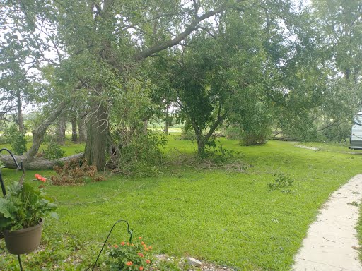
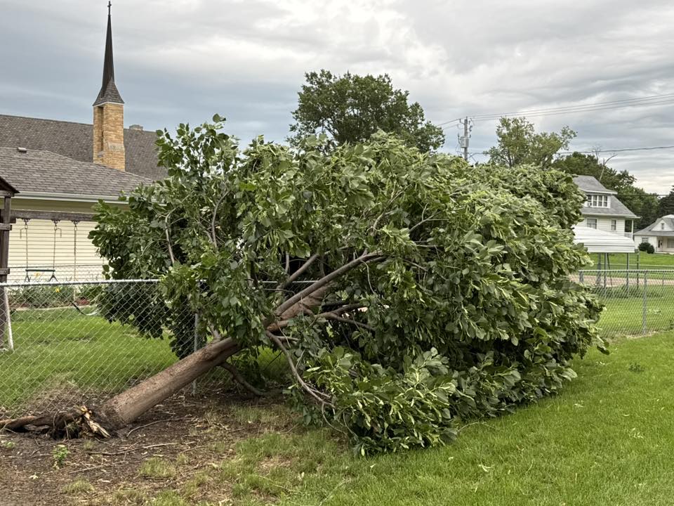
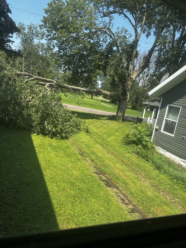
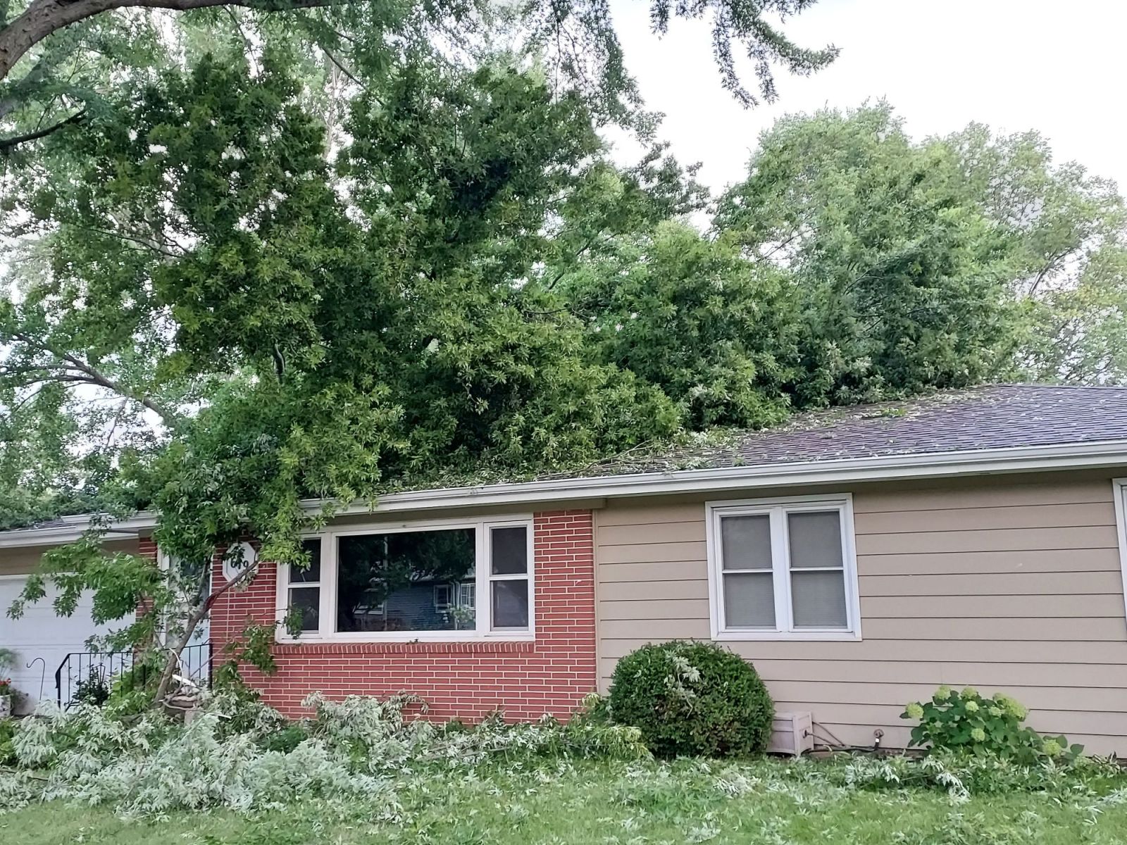
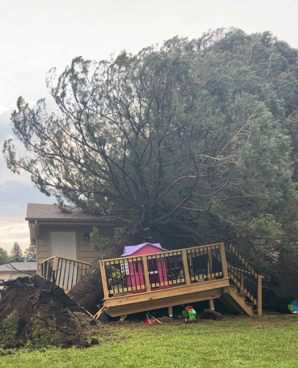
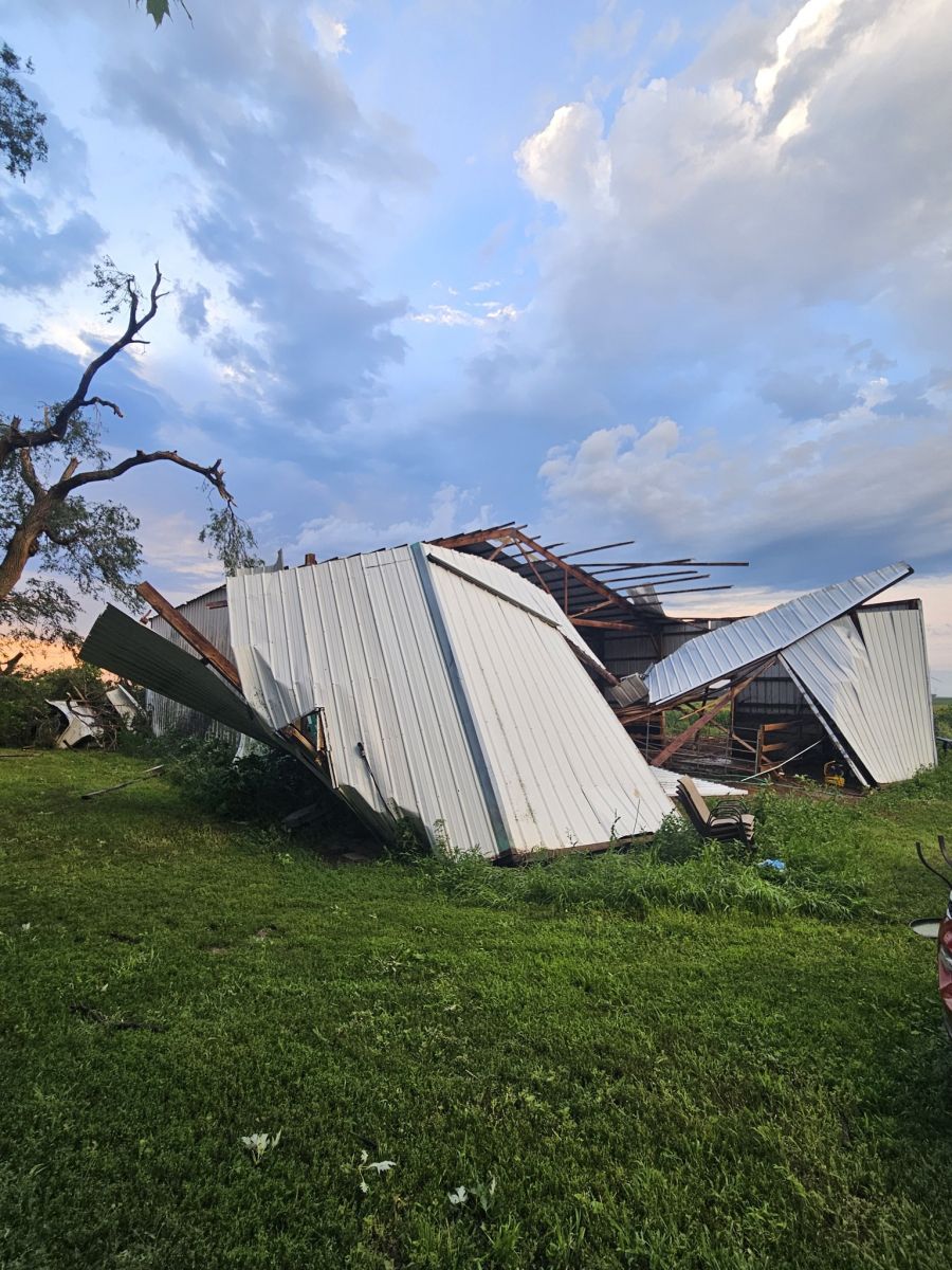
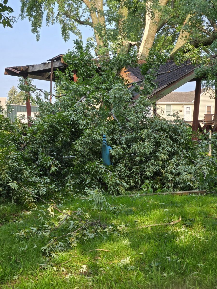
Wind Damage Photos
 |
 |
 |
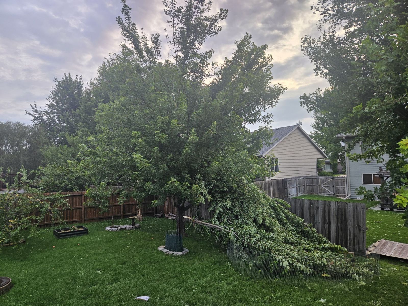 |
| South of Davis SD (Credit: Kayla Beaner) |
Harrisburg SD (Credit: Kassidy Froderman) |
Sioux Falls SD (Credit: Caleb Cooke |
Sioux Falls SD (Credit: Brittney Wise) |
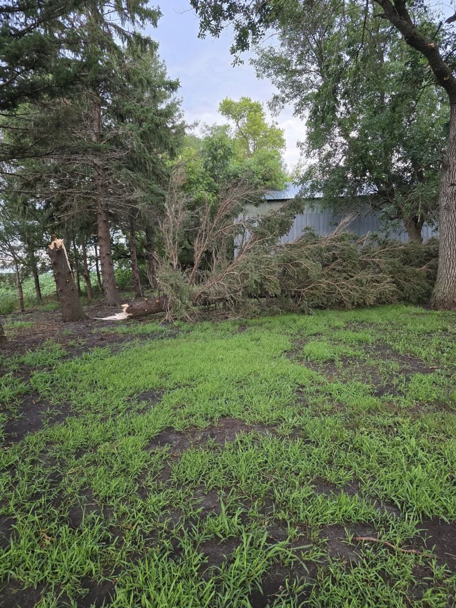
Wind Damage Photos
 |
 |
 |
 |
| Orange City IA (Credit: Ben Choice) |
South of Alton IA (Credit: Ams Rasse |
George IA (Credit: Sharon Kanengieter |
Merriden IA (Credit: Dave KA90ZP) |
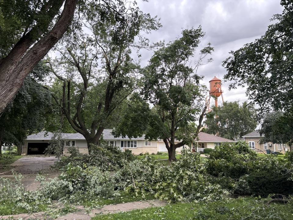
Wind Damage Photos
 |
 |
 |
 |
| Hartley IA (Credit: Heather Hartley) |
Linn Grove IA (Credit: Ezra McKenzie Mattila) |
Spencer IA (Credit: Ardellle Brehmer Faulkender) |
Spencer IA (Credit: Jamie Rusk-Blume) |
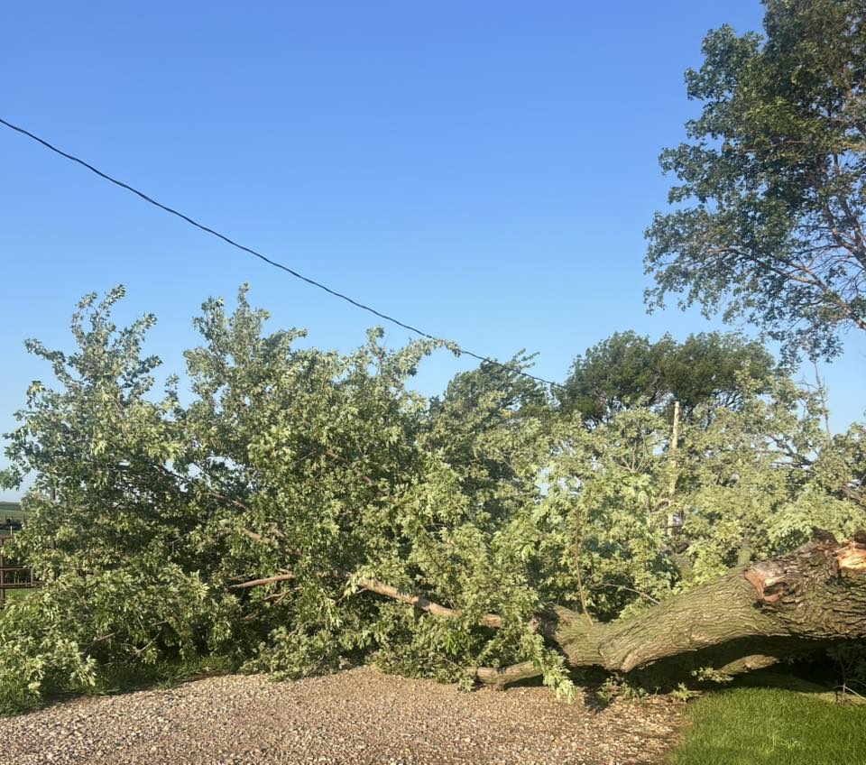
Wind Damage Photos
 |
 |
 |
 |
| Spencer IA (Credit: Steve Grimmius) |
Lake Park IA (Credit: Amanda Sether) |
Orange City (Credit: Christina Blezien) |
Beresford SD (Credit: Stephanie Bartlett) |
Additional Information
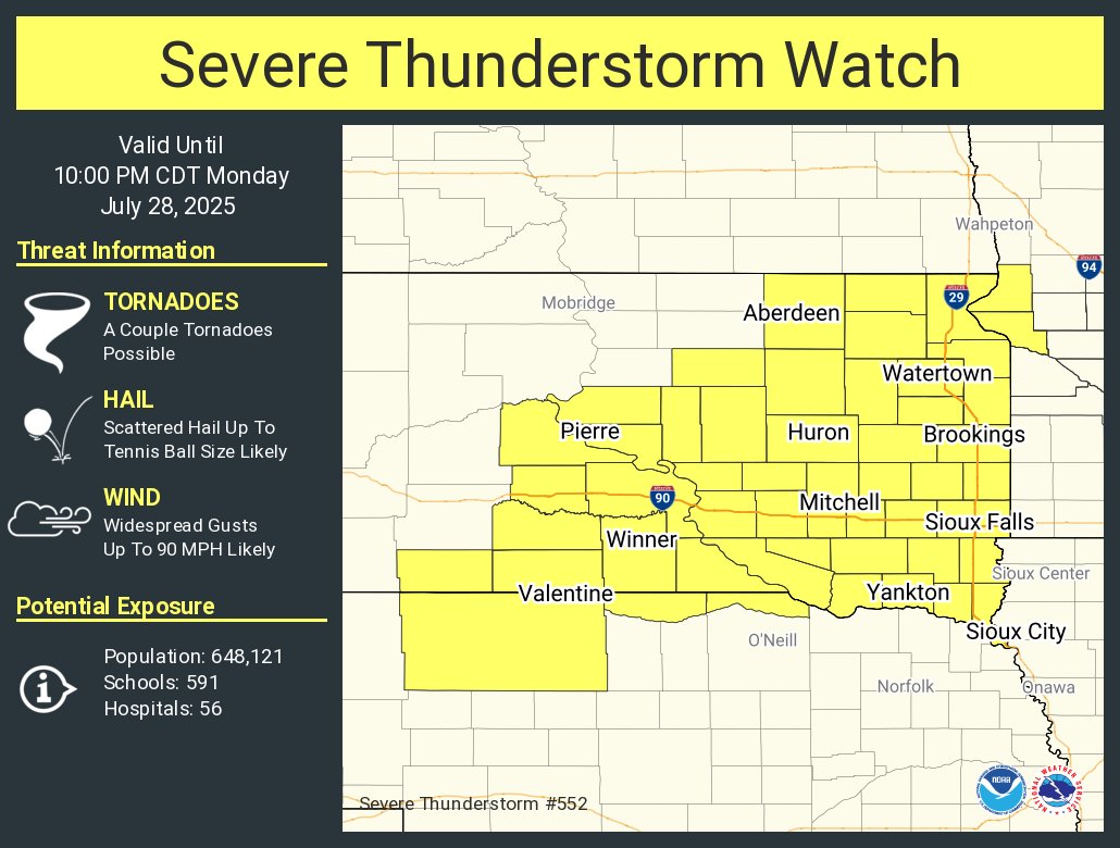
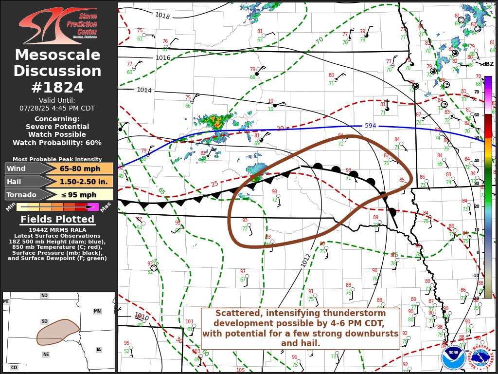
Severe Thunderstorm Outlook, Watches, and Discussions
 |
 |
 |
 |
| SPC Severe Thunderstorm Outlook 1236 PM CDT |
Severe Thunderstorm Watch 345 PM CDT |
SPC Mesoscale Discussion 445 PM CDT |
Severe Thunderstorm Watch 656 PM CDT |
 |
 |
 |
|
| SPC Mesoscale Discussion 745 PM CDT |
SPC Mesoscale Discussion 1015 PM CDT |
SPC Mesoscale Discussion 1145 PM CDT |
 |
Media use of NWS Web News Stories is encouraged! Please acknowledge the NWS as the source of any news information accessed from this site. |
|


 Weather Story
 Weather Map
 Local Radar