Tropical system in the Gulf expected to gradually strengthen the next couple of days off the Florida Panhandle and Alabama coasts. Instances of flash flooding will be possible through Thursday along the eastern and central Gulf Coast. Severe thunderstorms will develop and move along a cold front crossing the Upper Midwest, and through the Ohio Valley/Mid-Atlantic on Tuesday. Read More >
Fort Worth/Dallas, TX
Weather Forecast Office
| Dallas County Tornado Climatology Page 1880-Present |
| Click here to return to the North & Central TX Tornado Climatology mainpage |
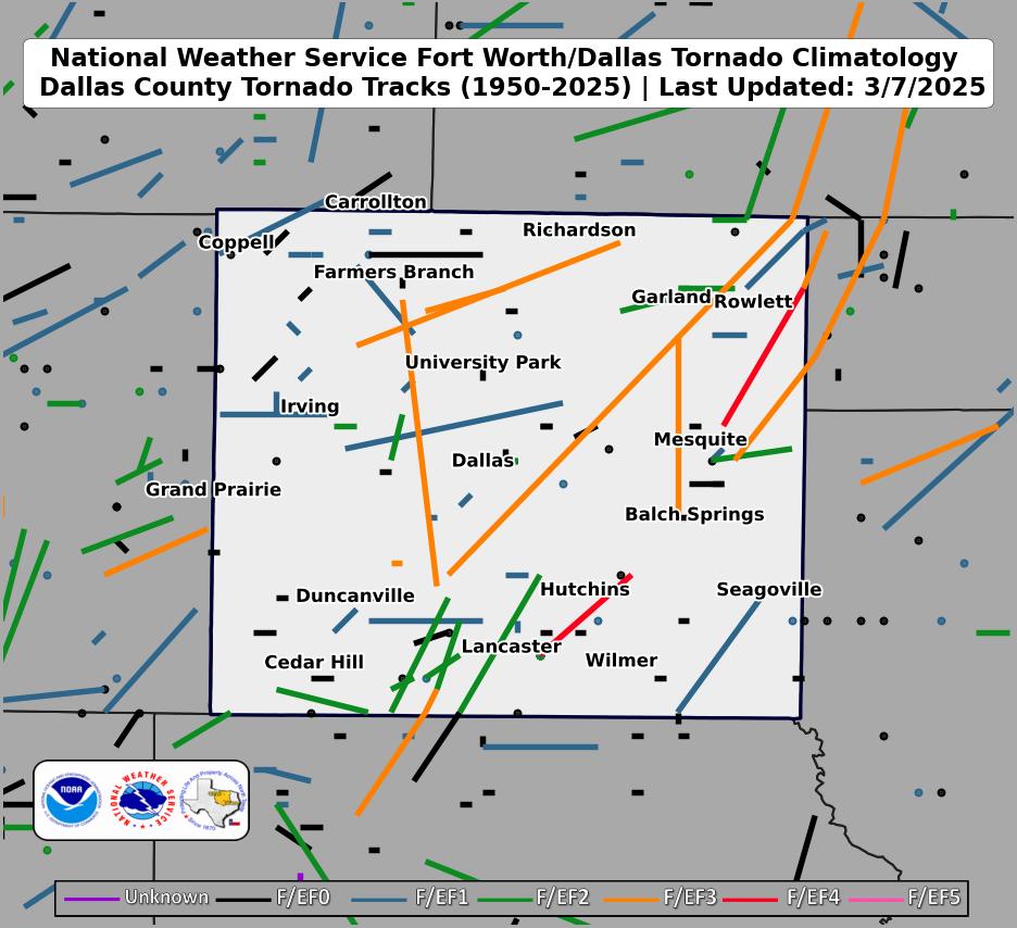 |
| Click map for larger image |
Dallas County Graphical Tornado Data |
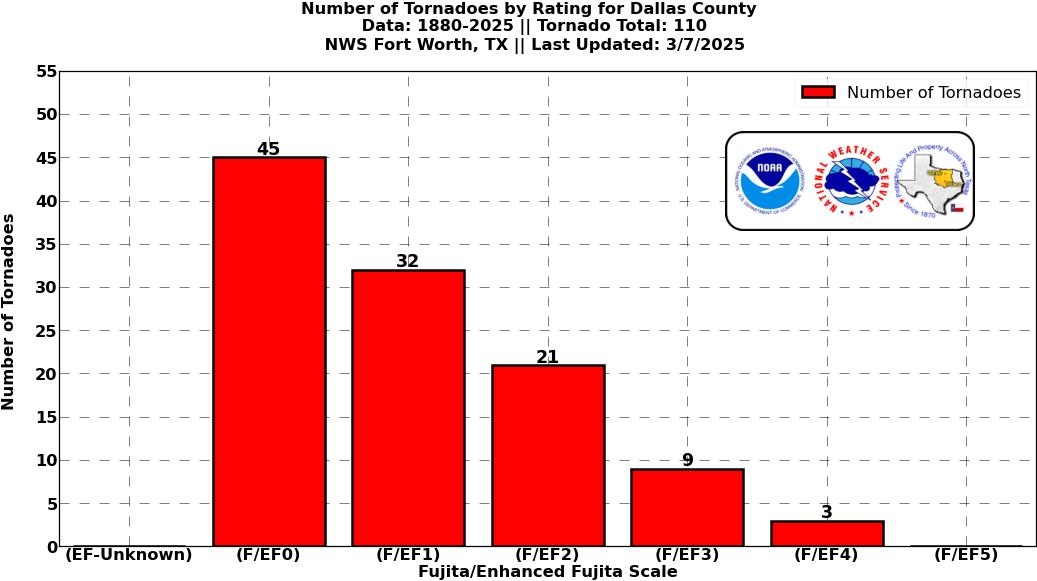
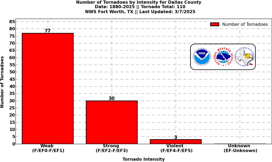
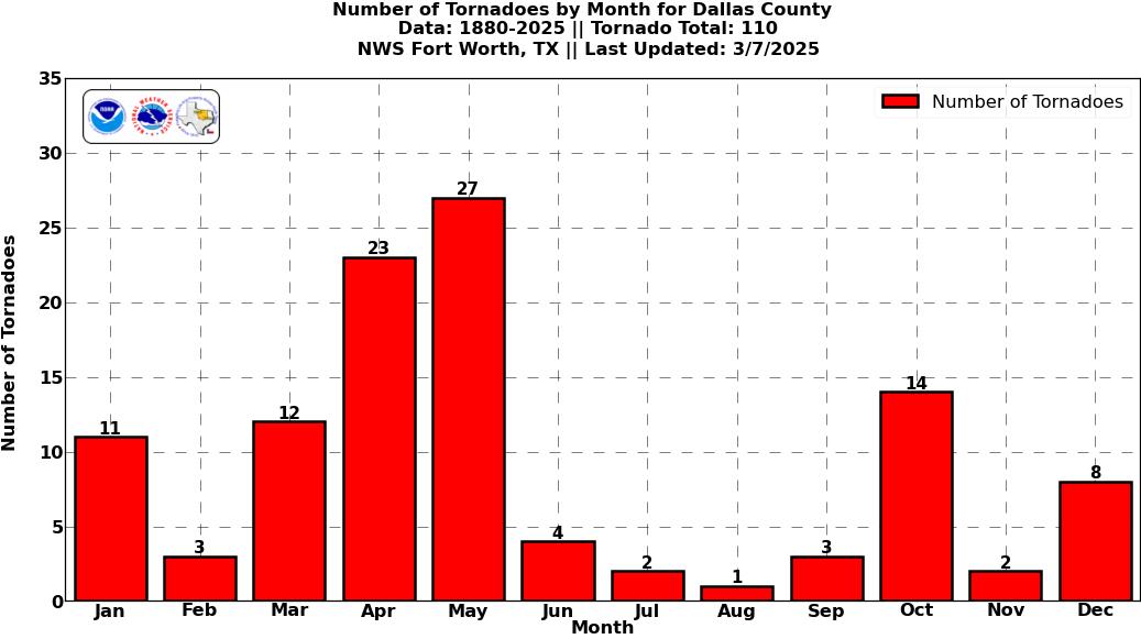
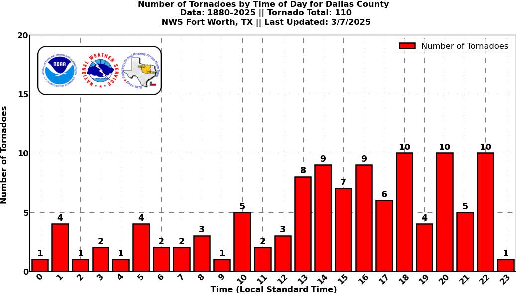
Tornadoes in Dallas Co. by Year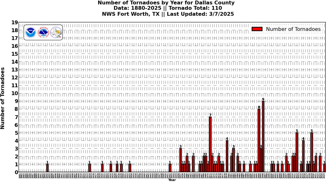 Click image for larger figure |
Tornadoes in Dallas Co.
|
Tornadoes in Dallas Co.
|
Tornadoes in Dallas Co.
|
Tornadoes in Dallas Co.
|
Current Hazards
National Outlooks
Tropical
Local Storm Reports
Storm Reports (Graphical)
Submit Storm Report
Tornado Warnings
Severe Thunderstorm Warnings
Flash Flood Warnings
Forecasts
Forecast Discussion
Graphical Forecast
Aviation Forecasts
Fire Weather
Hazard Planner
N. Texas Convective Parameters
US Dept of Commerce
National Oceanic and Atmospheric Administration
National Weather Service
Fort Worth/Dallas, TX
3401 Northern Cross Blvd.
Fort Worth, TX 76137
817.429.2631
Comments? Questions? Please Contact Us.