Wildfire smoke continues to impact air quality from the Great Lakes region into New England and the Mid-Atlantic today with widespread Air Quality Alerts in effect. Severe thunderstorms are expected across portions of the Ohio Valley and Lower Great Lakes into the Mid-Atlantic and Northeast, this afternoon into the evening. Monsoonal thunderstorms may bring areas of flooding to the Southwest. Read More >
Fort Worth/Dallas, TX
Weather Forecast Office
| Grayson County Tornado Climatology Page 1880-Present |
| Click here to return to the North & Central TX Tornado Climatology mainpage |
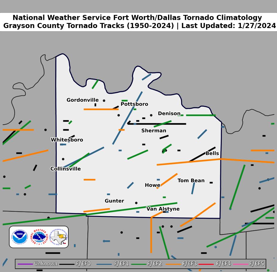 |
| Click map for larger image |
Grayson County Graphical Tornado Data |
Tornadoes in Grayson Co. by Year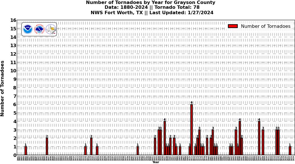 Click image for larger figure |
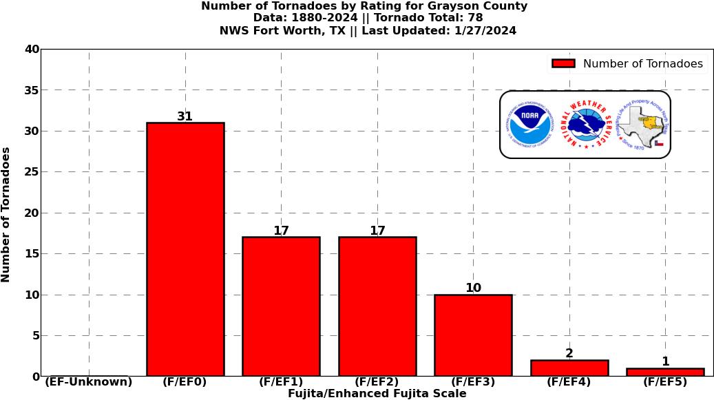
Tornadoes in Grayson Co.
|
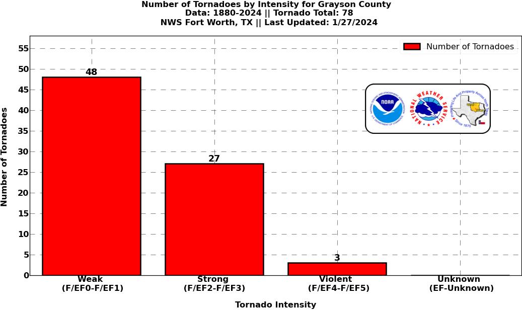
Tornadoes in Grayson Co.
|
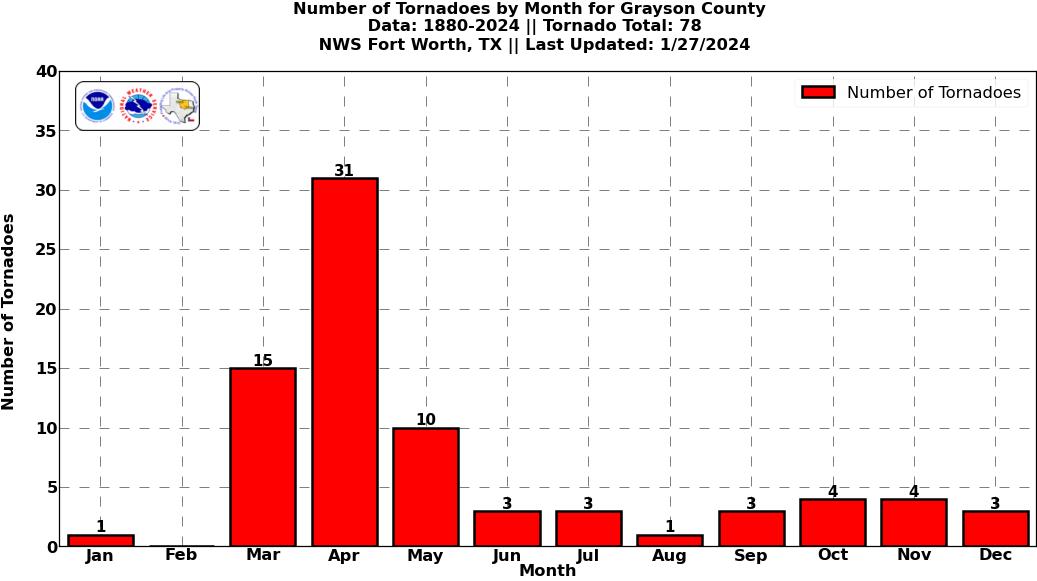
Tornadoes in Grayson Co.
|
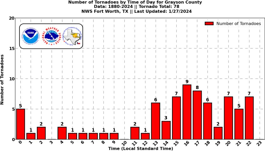
Tornadoes in Grayson Co.
|
Current Hazards
National Outlooks
Tropical
Local Storm Reports
Storm Reports (Graphical)
Submit Storm Report
Tornado Warnings
Severe Thunderstorm Warnings
Flash Flood Warnings
Forecasts
Forecast Discussion
Graphical Forecast
Aviation Forecasts
Fire Weather
Hazard Planner
N. Texas Convective Parameters
US Dept of Commerce
National Oceanic and Atmospheric Administration
National Weather Service
Fort Worth/Dallas, TX
3401 Northern Cross Blvd.
Fort Worth, TX 76137
817.429.2631
Comments? Questions? Please Contact Us.