Severe thunderstorms capable of damaging winds will be possible from the Ozark Plateau east into portions of the Southeast today. Rounds of heavy thunderstorms ahead of a slow moving front will continue locally heavy rainfall and scattered flash flooding potential from the Ozarks to the Ohio and Tennessee Valleys today. Read More >
Fort Worth/Dallas, TX
Weather Forecast Office
| Hood County Tornado Climatology Page 1880-Present |
| Click here to return to the North & Central TX Tornado Climatology mainpage |
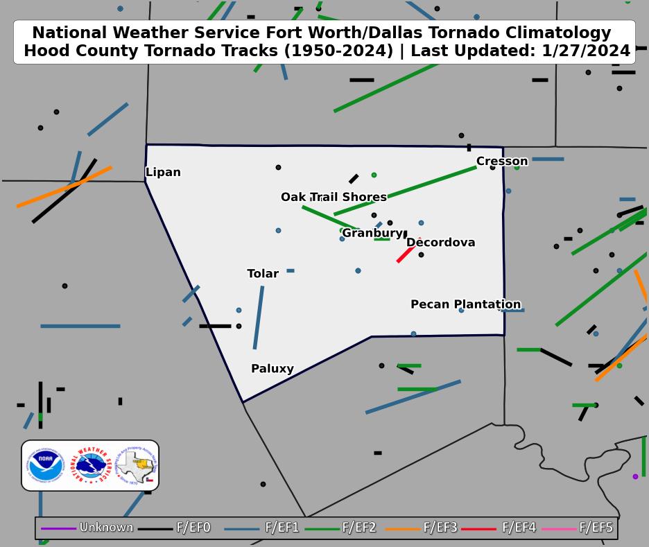 |
| Click map for larger image |
Hood County Graphical Tornado Data |
Tornadoes in Hood Co. by Year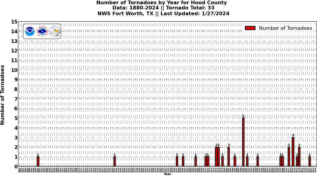 Click image for larger figure |
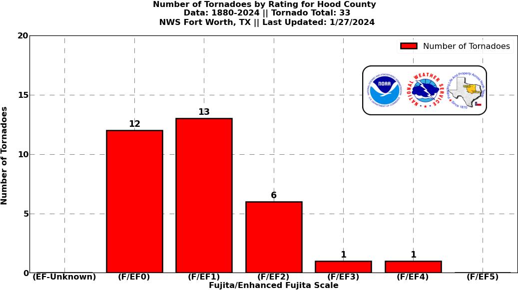
Tornadoes in Hood Co.
|
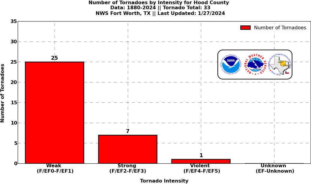
Tornadoes in Hood Co.
|
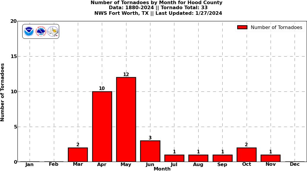
Tornadoes in Hood Co.
|
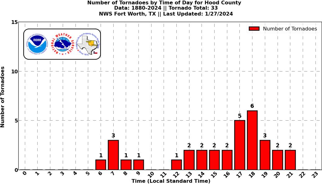
Tornadoes in Hood Co.
|
Current Hazards
National Outlooks
Tropical
Local Storm Reports
Storm Reports (Graphical)
Submit Storm Report
Tornado Warnings
Severe Thunderstorm Warnings
Flash Flood Warnings
Forecasts
Forecast Discussion
Graphical Forecast
Aviation Forecasts
Fire Weather
Hazard Planner
N. Texas Convective Parameters
US Dept of Commerce
National Oceanic and Atmospheric Administration
National Weather Service
Fort Worth/Dallas, TX
3401 Northern Cross Blvd.
Fort Worth, TX 76137
817.429.2631
Comments? Questions? Please Contact Us.