Tropical Storm Bertha could bring tropical storm conditions to portions of the Florida Panhandle and Alabama coast through Wednesday, where a Tropical Storm Watch and Storm Surge Watch is in effect. Numerous severe thunderstorms with heavy rainfall are expected from the Ohio Valley into the Mid-Atlantic and Northeast Tuesday. Read More >
Fort Worth/Dallas, TX
Weather Forecast Office
| Hunt County Tornado Climatology Page 1880-Present |
| Click here to return to the North & Central TX Tornado Climatology mainpage |
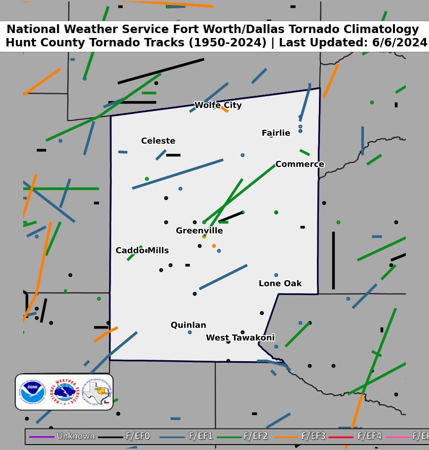 |
| Click map for larger image |
Hunt County Graphical Tornado Data |
Tornadoes in Hunt Co. by Year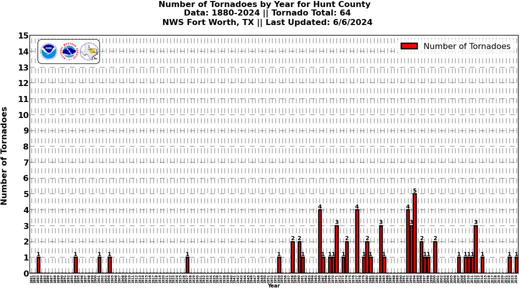 Click image for larger figure |
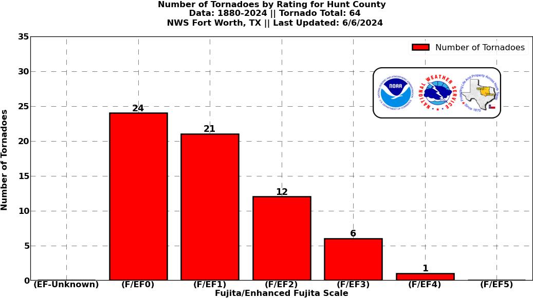
Tornadoes in Hunt Co.
|
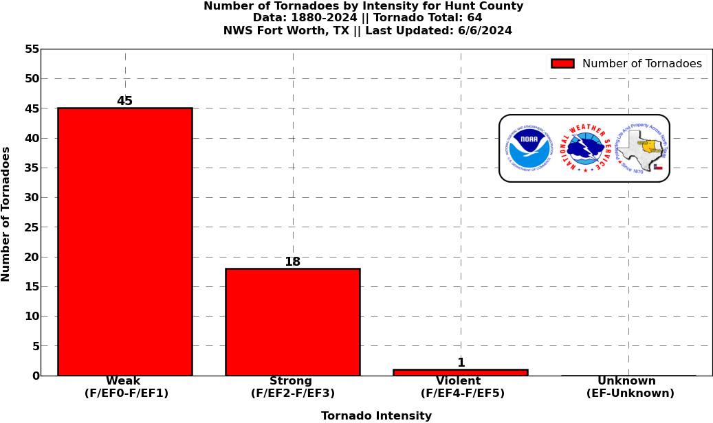
Tornadoes in Hunt Co.
|
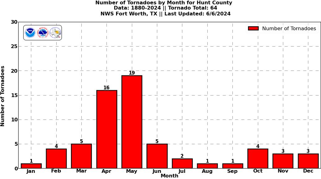
Tornadoes in Hunt Co.
|
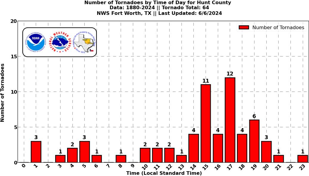
Tornadoes in Hunt Co.
|
Current Hazards
National Outlooks
Tropical
Local Storm Reports
Storm Reports (Graphical)
Submit Storm Report
Tornado Warnings
Severe Thunderstorm Warnings
Flash Flood Warnings
Forecasts
Forecast Discussion
Graphical Forecast
Aviation Forecasts
Fire Weather
Hazard Planner
N. Texas Convective Parameters
US Dept of Commerce
National Oceanic and Atmospheric Administration
National Weather Service
Fort Worth/Dallas, TX
3401 Northern Cross Blvd.
Fort Worth, TX 76137
817.429.2631
Comments? Questions? Please Contact Us.