Severe thunderstorms and showers pose a risk for excessive rain, localized flash flooding, strong gusts and/or large hail across portions of the northern and central Plains, the Lower Missouri to Lower Ohio Valleys, and across the Mid-Atlantic this afternoon and evening. Extreme heat is ongoing over the Desert Southwest and the Southeast U.S.. Read More >
Fort Worth/Dallas, TX
Weather Forecast Office
| Montague County Tornado Climatology Page 1880-Present |
| Click here to return to the North & Central TX Tornado Climatology mainpage |
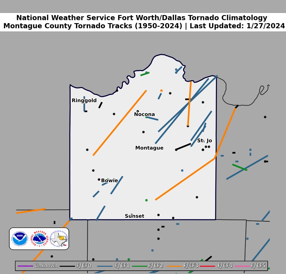 |
| Click map for larger image |
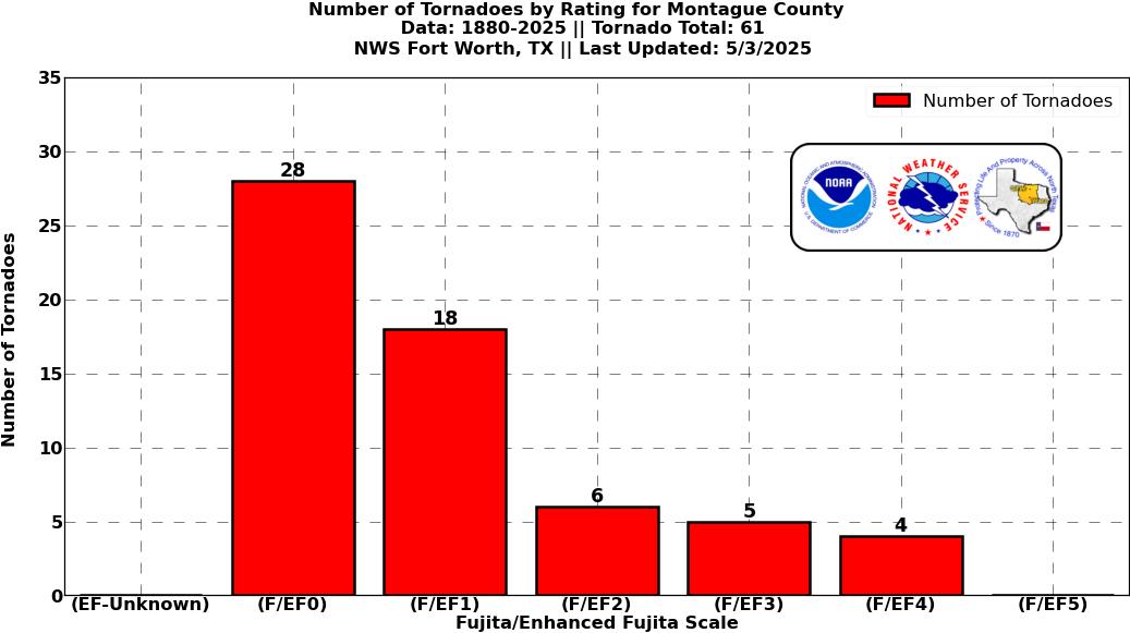
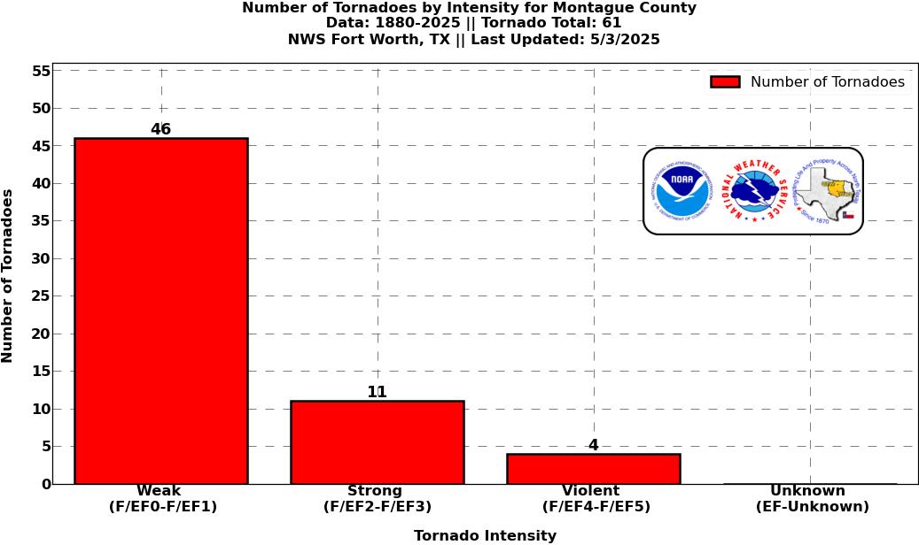
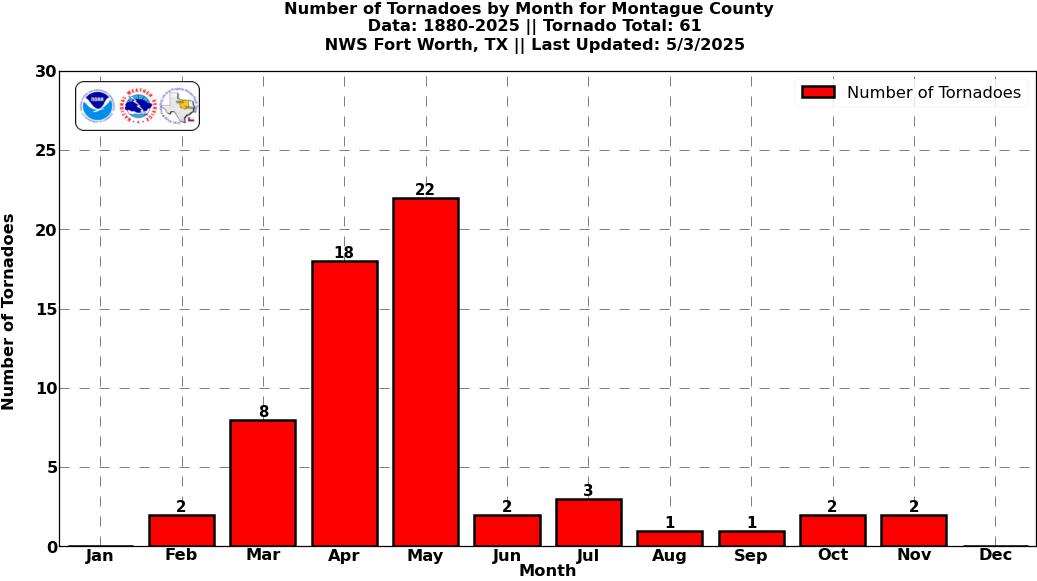
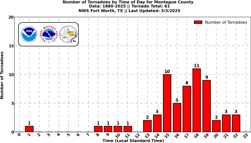
Montague County Graphical Tornado Data |
Tornadoes in Montague Co. by Year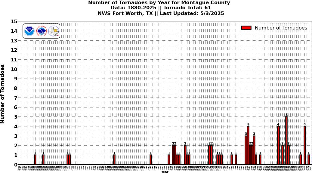 Click image for larger figure |
Tornadoes in Montague Co.
|
Tornadoes in Montague Co.
|
Tornadoes in Montague Co.
|
Tornadoes in Montague Co.
|
Current Hazards
National Outlooks
Tropical
Local Storm Reports
Storm Reports (Graphical)
Submit Storm Report
Tornado Warnings
Severe Thunderstorm Warnings
Flash Flood Warnings
Forecasts
Forecast Discussion
Graphical Forecast
Aviation Forecasts
Fire Weather
Hazard Planner
N. Texas Convective Parameters
US Dept of Commerce
National Oceanic and Atmospheric Administration
National Weather Service
Fort Worth/Dallas, TX
3401 Northern Cross Blvd.
Fort Worth, TX 76137
817.429.2631
Comments? Questions? Please Contact Us.