Dangerous and extreme heat will remain across portions of the southern U.S. this week. Heavy rainfall may bring significant flash flooding across portions of the Mid-Atlantic and Northeast through the night, and additional flash flooding concerns across New England on Wednesday. Monsoonal thunderstorms will bring a flash flood risk to the Four Corners region, especially in burn scar areas Read More >
Fort Worth/Dallas, TX
Weather Forecast Office
| Navarro County Tornado Climatology Page 1880-Present |
| Click here to return to the North & Central TX Tornado Climatology mainpage |
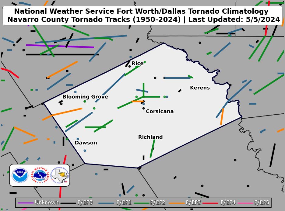 |
| Click map for larger image |
Navarro County Graphical Tornado Data |
Tornadoes in Navarro Co. by Year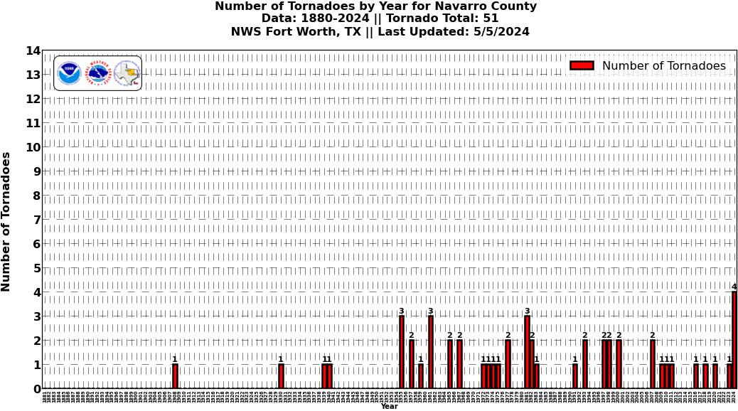 Click image for larger figure |
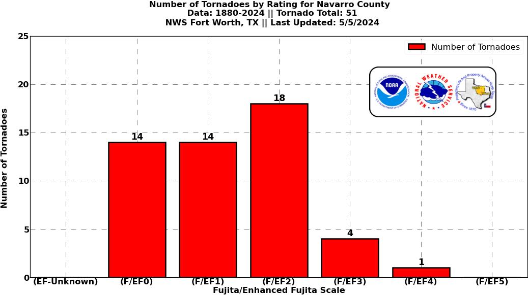
Tornadoes in Navarro Co.
|
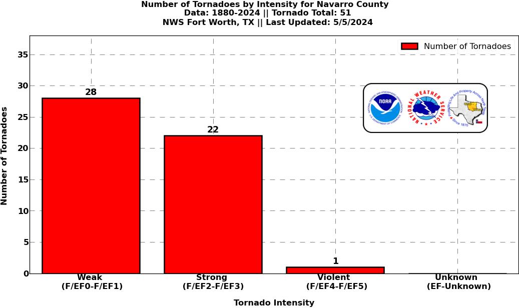
Tornadoes in Navarro Co.
|
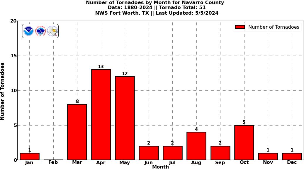
Tornadoes in Navarro Co.
|
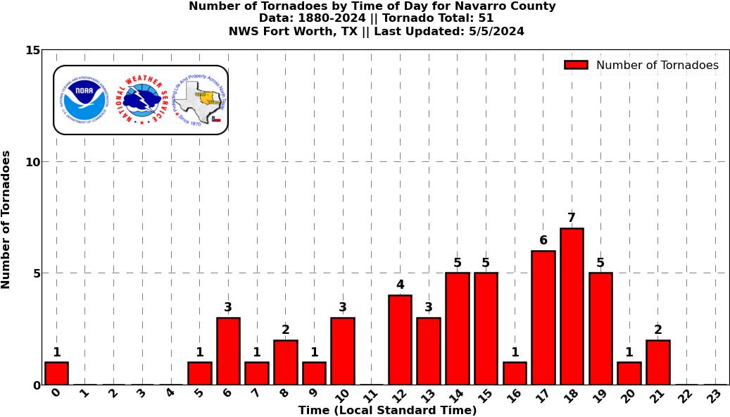
Tornadoes in Navarro Co.
|
Current Hazards
National Outlooks
Tropical
Local Storm Reports
Storm Reports (Graphical)
Submit Storm Report
Tornado Warnings
Severe Thunderstorm Warnings
Flash Flood Warnings
Forecasts
Forecast Discussion
Graphical Forecast
Aviation Forecasts
Fire Weather
Hazard Planner
N. Texas Convective Parameters
US Dept of Commerce
National Oceanic and Atmospheric Administration
National Weather Service
Fort Worth/Dallas, TX
3401 Northern Cross Blvd.
Fort Worth, TX 76137
817.429.2631
Comments? Questions? Please Contact Us.