A heat wave over the Southwest will intensify this week, peaking and expanding into the Intermountain West and northern High Plains this weekend. Severe thunderstorms and heavy rainfall are expected over parts of the Upper Midwest to mid-Mississippi Valley today. Critical to extremely critical fire weather conditions from the Northwest and the northern Great Basin on Saturday and Sunday. Read More >
 |
||||
| About SKYWARN | Training Schedule | Training Certificates | Submit Report | More Resources |
Frequently Asked QuestionsHow do I become a member of SKYWARN? I took the online SKYWARN courses offered by COMET/Meted, does that qualify me as a local spotter for your office? What is my spotter ID number? Do I get an ID card? Do I need an amateur radio license to be a storm spotter? When are your SKYWARN classes? Where do I register for a SKYWARN class? For virtual classes, registration is required so a unique link can be emailed to you that allows you to join at the date and time of the webinar (class). All registration links for virtual SKYWARN classes can be found on our Training Schedule page. What is presented at a SKYWARN Class? |
Past recorded SKYWARN Presentations can be found on our YouTube Channel: |
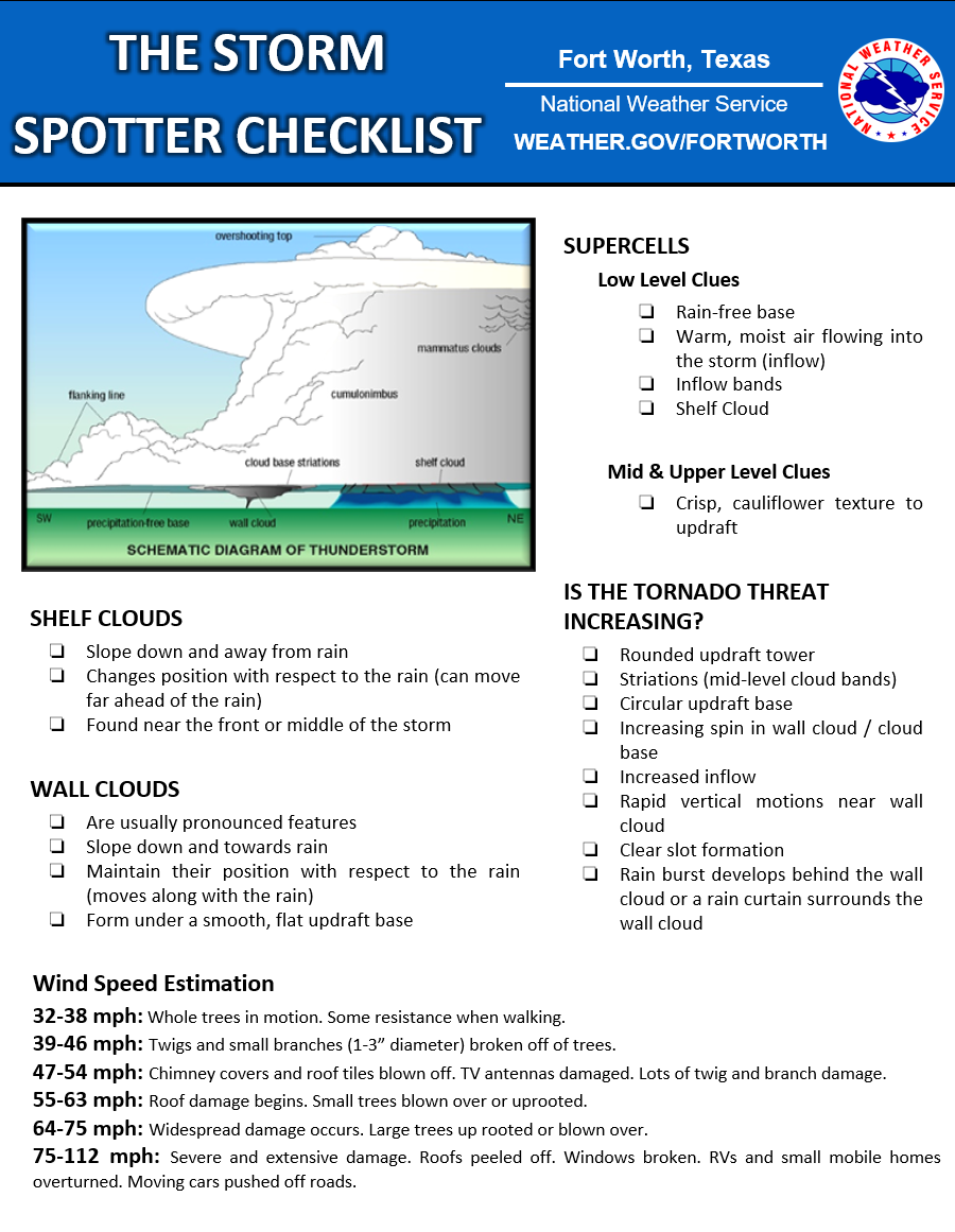
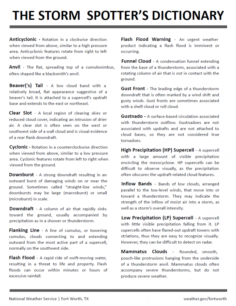
Material ResourcesSpotter Reporting Card (Sheet of 10) | Spotter Reporting Card (2) NWS Fort Worth Spotter Checklist and Dictionary (click for larger sized PDF versions): To learn more about all types of weather, visit the National Weather Service's JetStream - An Online School for Weather National NWS Weather Spotter's Field Guide |
|
|