Scattered thunderstorms with severe gusts, hail and a tornado risk are possible near a cold front from the Ohio Valley to the Mid-Atlantic tonight. Tropical Storm Bertha is expected to bring tropical storm conditions to portions of the Gulf Coast from the panhandle of Florida into Louisiana through Wednesday. Read More >
Rare Christmas Tornadoes and Hurricane Force winds
|
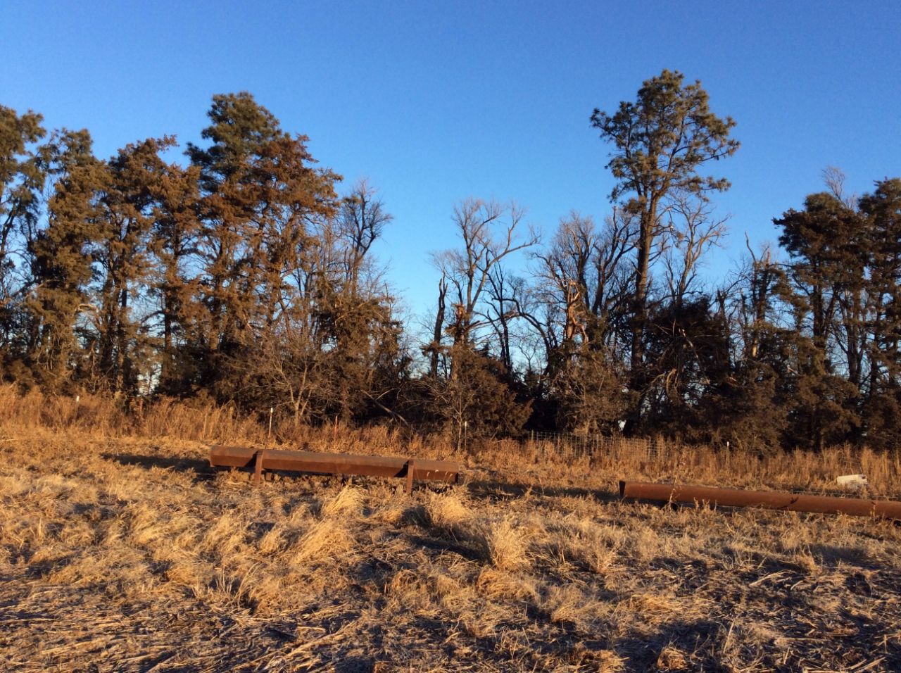
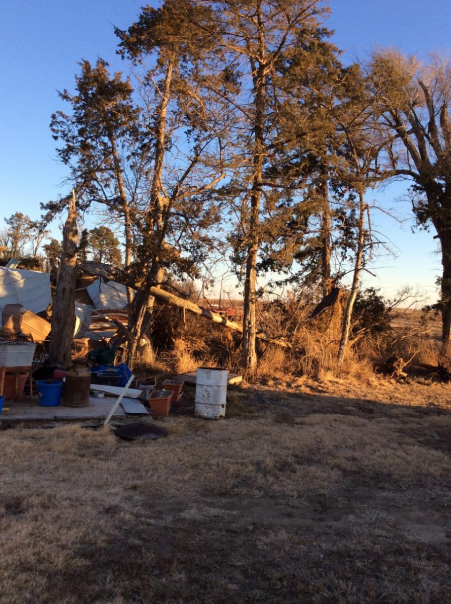
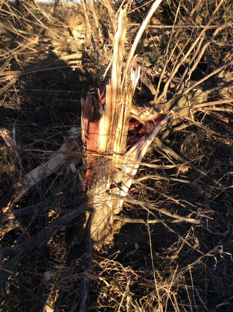
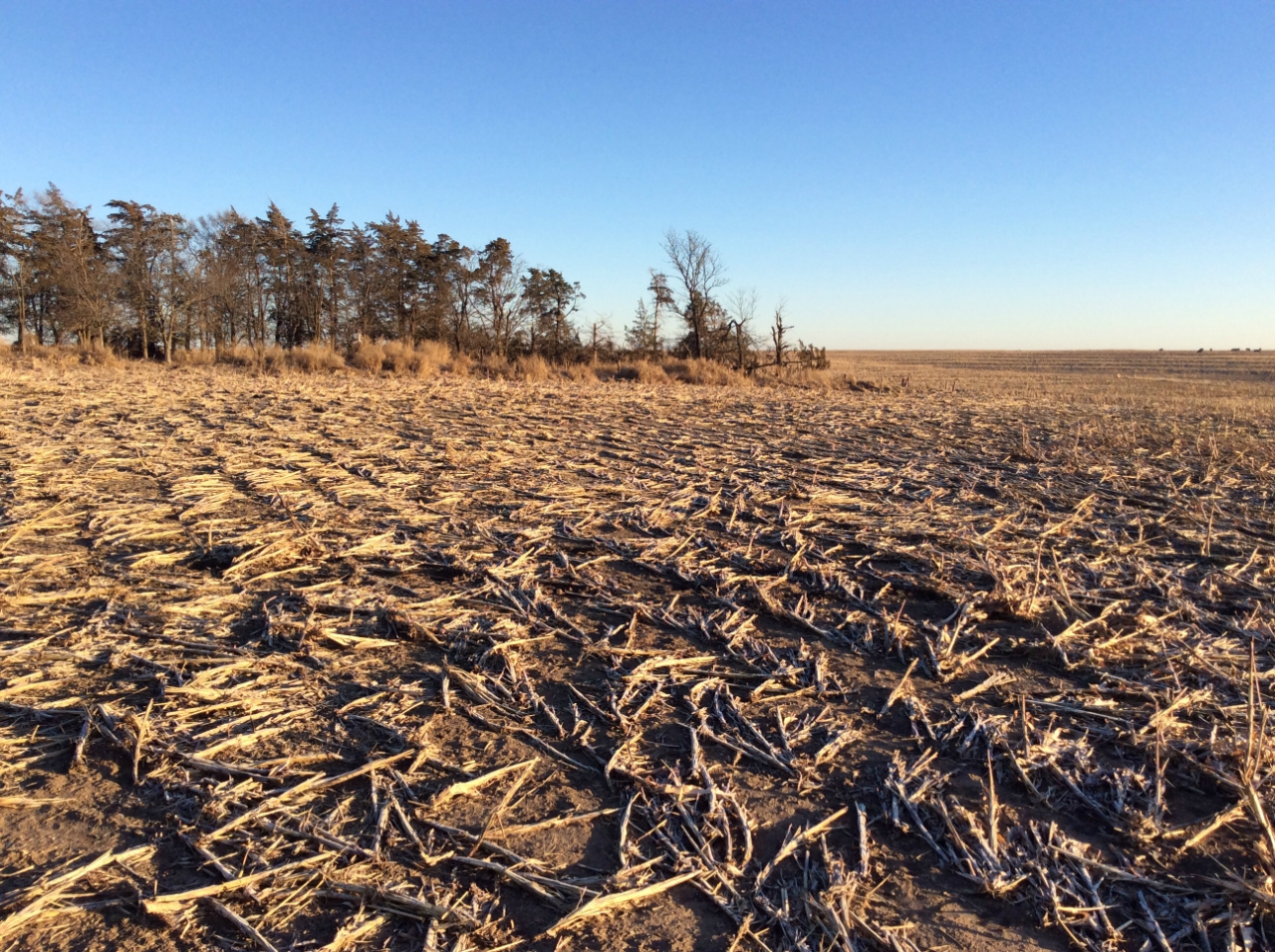
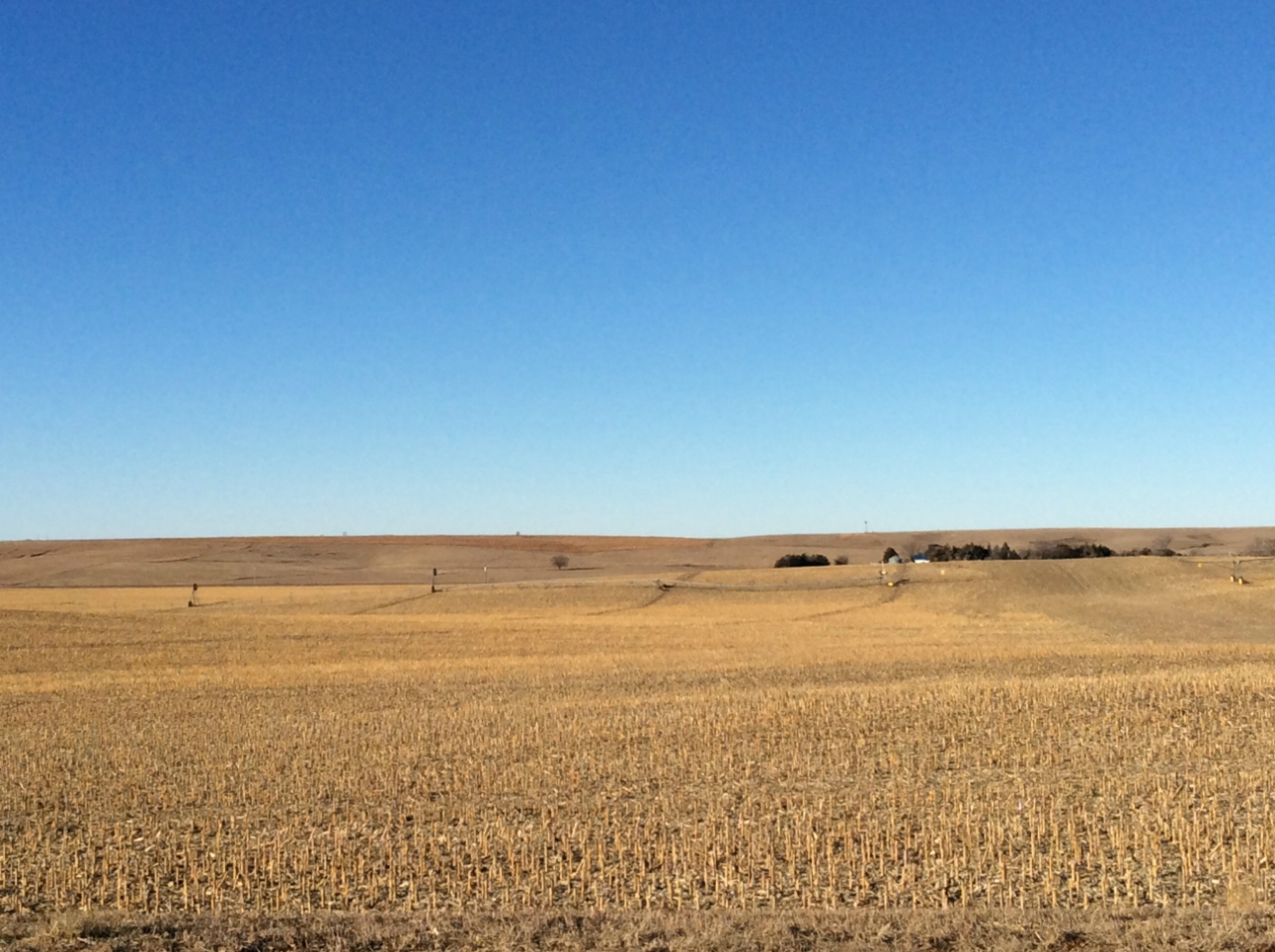
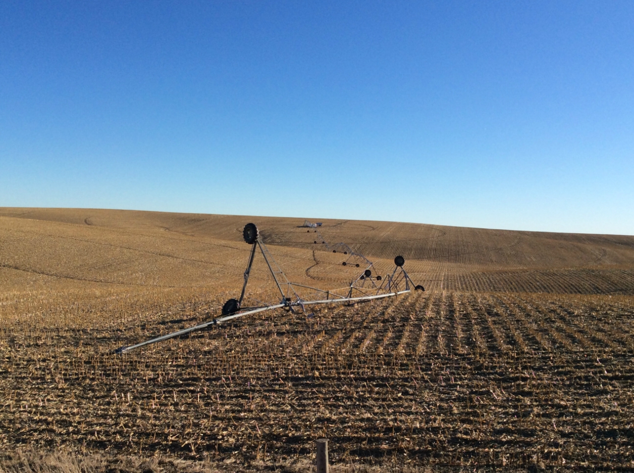
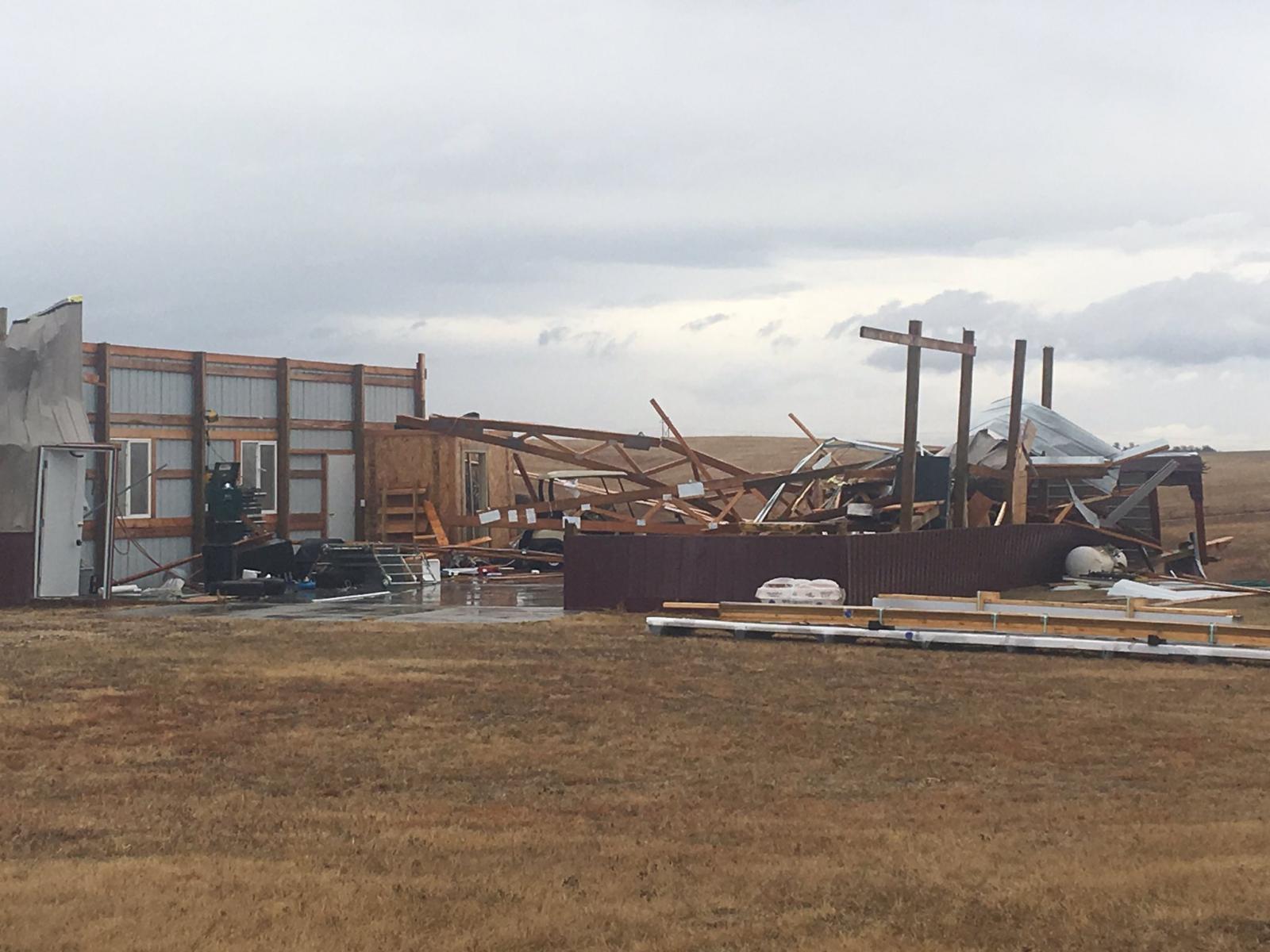
A wide variety of severe weather occurred across the Central Plains on Christmas Day 2016 as a strong storm system moved quickly through northern Kansas and southern Nebraska. The day began with a line of thunderstorms which produced some tornadoes and damaging wind gusts. Then later on Christmas evening, widespread Hurricane Force winds were recorded for a few hours across the area causing widespread damage. A Christmas to go down in the record books. Christmas Day 2016 brought rare December tornadoes to north-central Kansas and south-central Nebraska. The brief, weak tornadoes developed just before noon along a line of thunderstorms. The first tornado touched down at 11:45 AM approximately four miles northwest of Alton, KS and tracked northeast for 1.9 miles. The tornado was rated EF-0 and damaged trees in shelter belts, fencing, a bin feeder, small shed and soffits and shingles on a home. The second tornado set down at 11:50 AM 2.8 miles south of Funk, NE and tracked northeast for 2.8 miles. The tornado was rated EF-1 and damaged at least six power poles and four center pivot systems. Another tornado briefly touched down and did minor damage to a farm at 12:17 PM approximately 7 miles southeast of Minden, NE. This tornado was rated EF-0. Yet another tornado developed at 12:24pm about 4 miles northwest of Gibbon, damaging multiple power poles and center pivots and destroying a small outbuilding in the Blue Sky Subdivision along is 4.2 mile track. This tornado was also rated EF-0. In Kansas, prior to 2016, it appears at least eight tornadoes occurred in Kansas in December since 1950. The most recent December tornado was an EF-0 in Harper County on December 14, 2014. Prior to that two tornadoes occurred in Cherokee County on December 18, 2002. The latest 'calendar year' tornado was on December 26, 1959 when an F2 tornado occurred west of Talmage in Dickinson County. In addition to the tornadoes, thunderstorms produced damaging winds into the afternoon on Christmas, then during the evening hurricane force winds of 60 to near 80 mph blasted the region behind a cold front. More information on the winds and damage can be found here. |
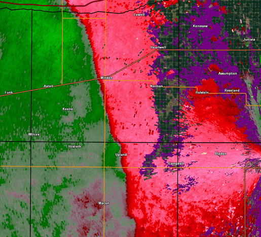
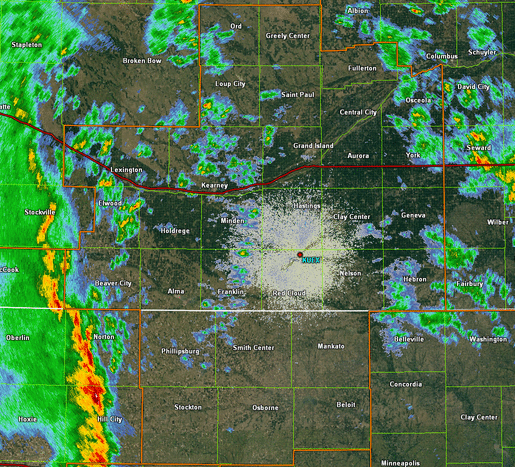
NWS Hastings radar loop from 10:30-3:00 p.m. CST on December 25th. The NWS Hastings coverage area is outlined in orange and interstates are in red. |
Christmas Day Tornadoes
|
|
||||||||||
|
||||||||||
|
Tornado #1 - Northwest of Alton, KS
EF-0 Tornado Track 4 NW of Alton, KS 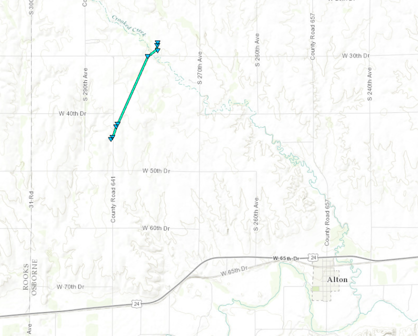  |
||||||||||||||||
|
||||||||||||||||
|
Tornado #2 - Near Funk, NE
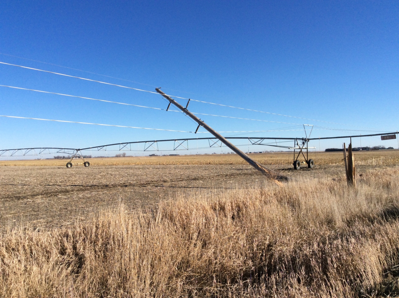
EF-1 Tornado Track Near Funk, NE 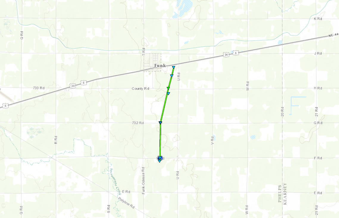 |
||||||||||||||||
|
||||||||||||||||
|
Tornado #3 - Southeast of Minden, NE
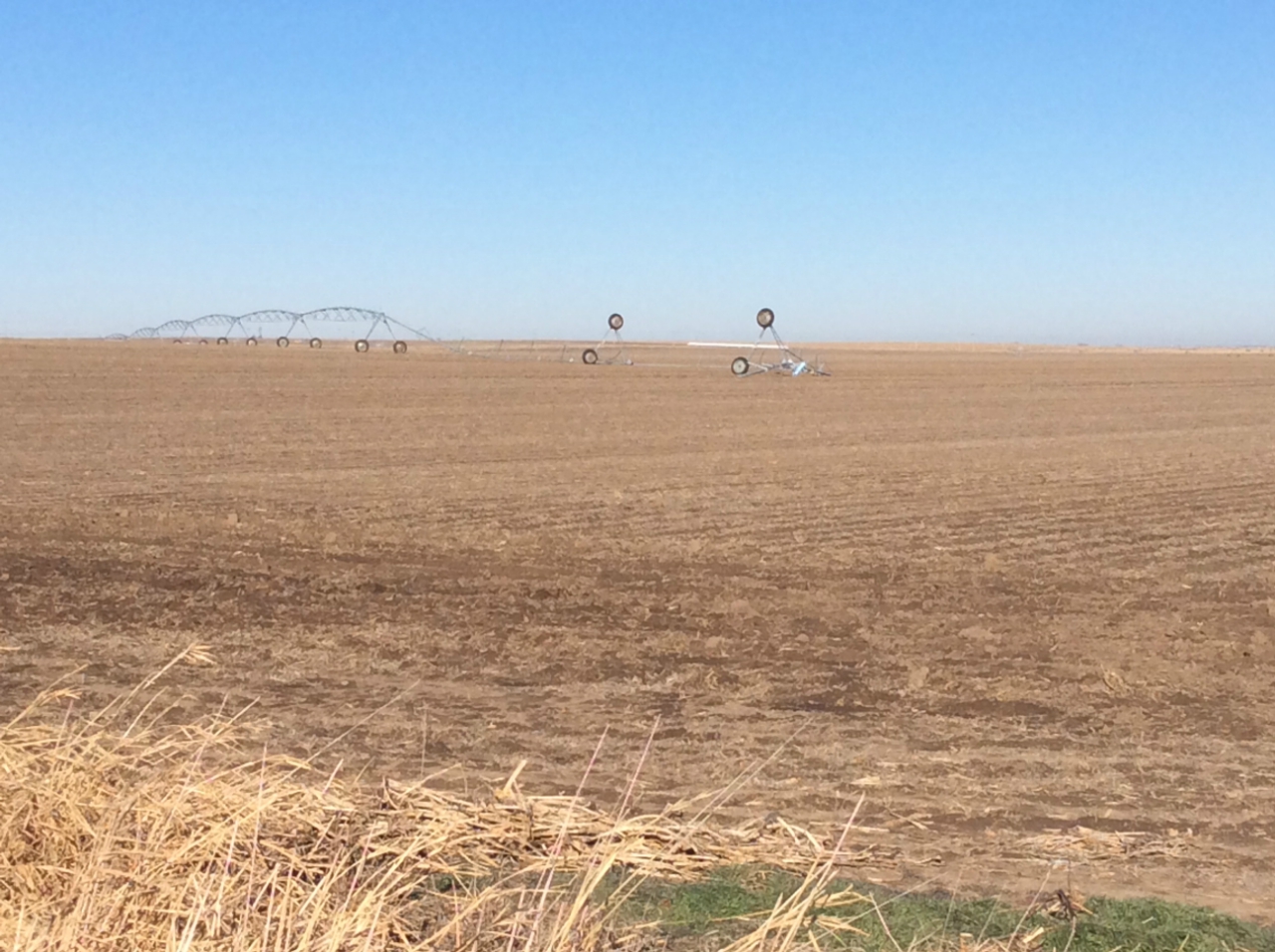
EF-0 Tornado Track 7 SE of Minden, NE 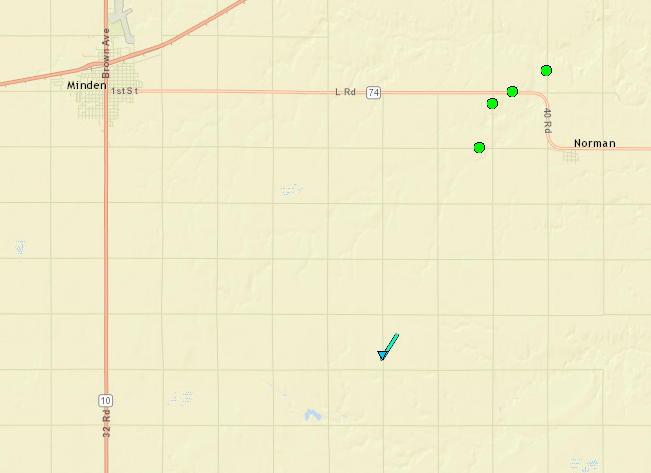 |
||||||||||||||||
|
|
||||||||||||||||
|
Tornado #4 - Northwest of Gibbon, NE
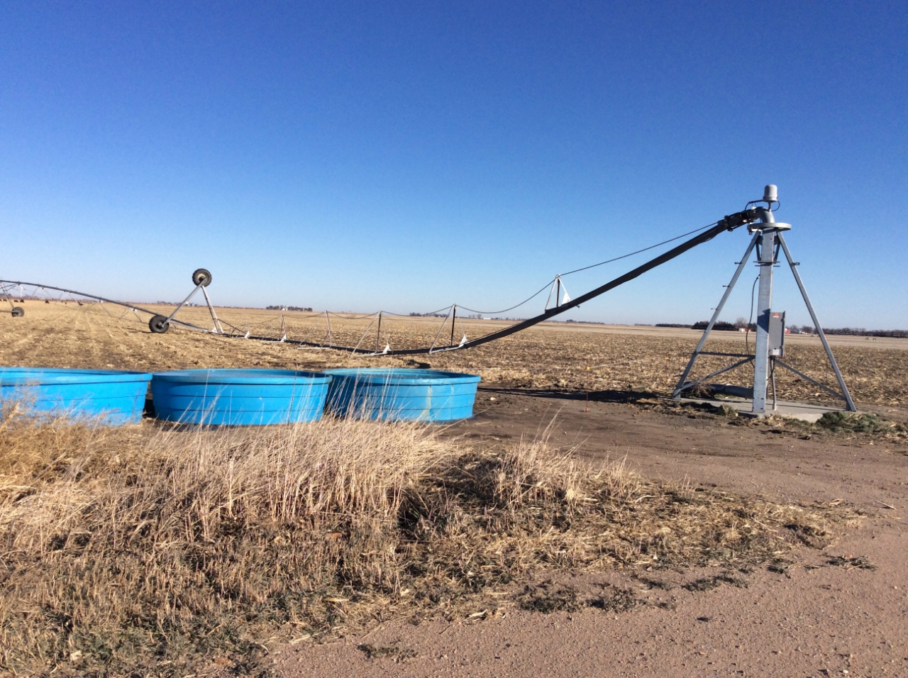
EF-0 Tornado Track 4 NW of Gibbon, NE 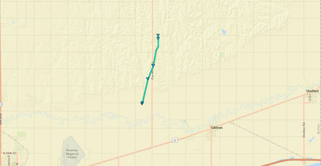 |
||||||||||||||||
|
||||||||||||||||
The Enhanced Fujita (EF) Scale classifies tornadoes into the following categories:
| EF0 Weak 65-85 mph |
EF1 Moderate 86-110 mph |
EF2 Significant 111-135 mph |
EF3 Severe 136-165 mph |
EF4 Extreme 166-200 mph |
EF5 Catastrophic 200+ mph |
 |
|||||
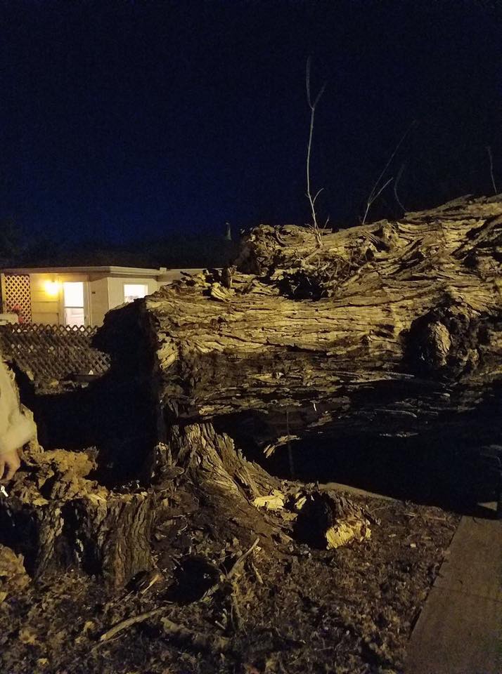
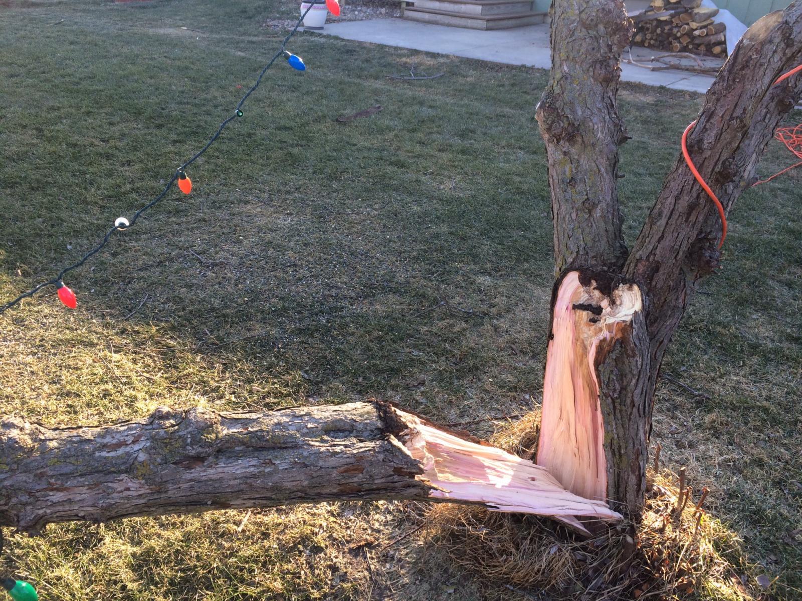
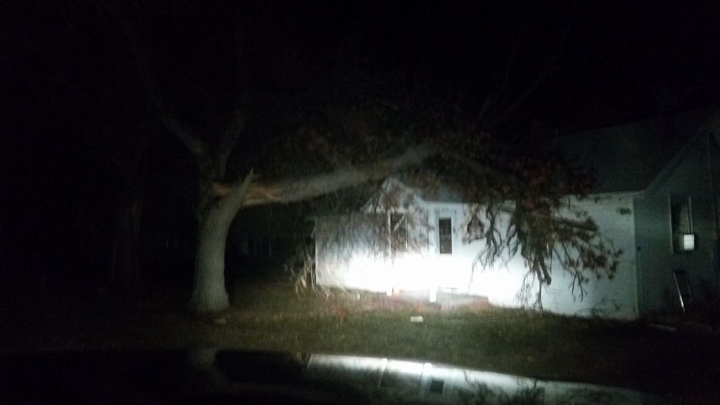
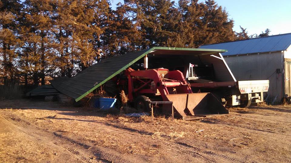
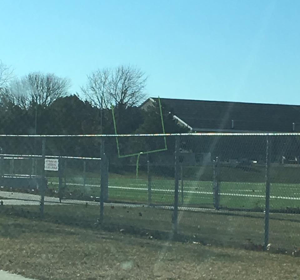
Thunderstorm Damage
A line of thunderstorms moved across the area between 10:30am and 2:30pm. Severe wind gusts and brief heavy downpours in addition to the brief tornadoes were observed at many locations across Nebraska and Kansas.
 |
.jpg) |
 |
.jpg) |
|
Destroyed Building Near Gibbon, NE Photo courtesy of Heather Riggleman |
Damage near Heartwell, NE Photo courtesy of Owen Bridges |
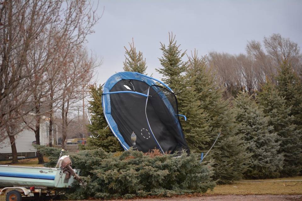
A Trampoline Blown into a Tree in Riverdale, NE Photo courtesy of Buffalo County Emergency Management |
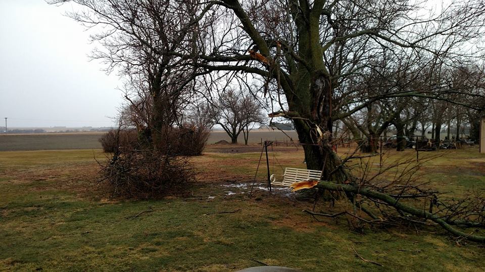
Downed Tree on West Side of Kearney, NE Photo courtesy of Buffalo County Emergency Management |
 |
.jpg) |
.jpg) |
.jpg) |
|
Tree Damage Near Belvidere, NE Photo courtesy of Mitchell Naiman |
Uprooted Tree, West Side of Kearney, NE Photo courtesy of Lucas Dart |
Shingles Torn Off Roof, West Side of Kearney, NE Photo courtesy of Buffalo County Emergency Management |
Overturned Center Pivot Photo courtesy of Buffalo County Emergency Management |
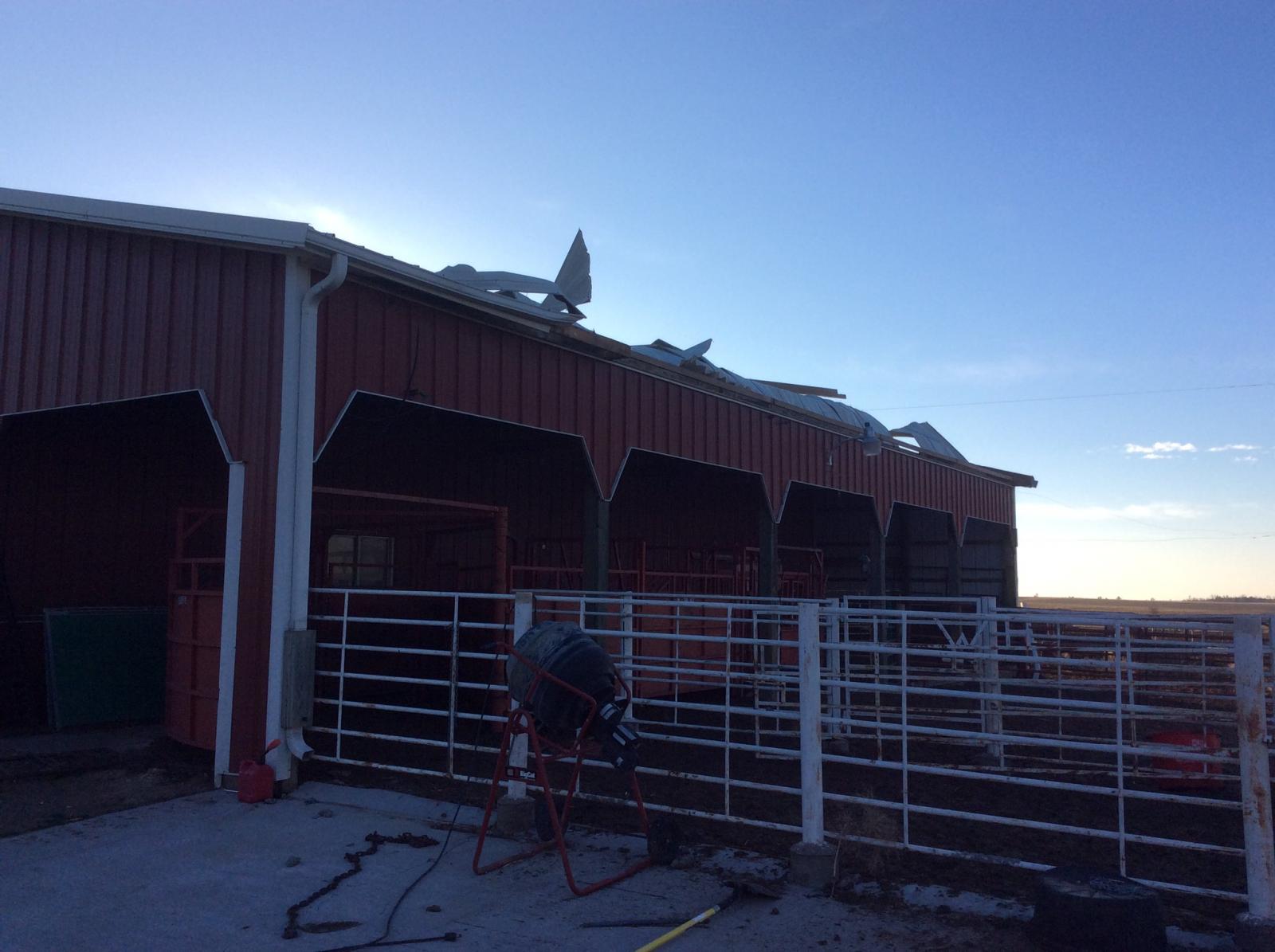
Hurricane Force Winds Cause Damage Across the Area
Overview
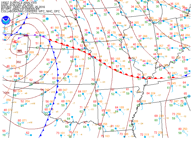
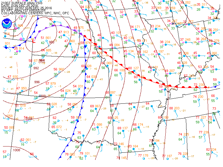
A deep low pressure system formed over Colorado Christmas morning, and it tracked northeast through western Nebraska, roughly along a line from Imperial to Thedford to Valentine. The barometric pressure was as low as 29.06" (986 mb) as the low passed by each of these locations. As this low entered Nebraska, a strong cold front raced east, crossing the area in the late afternoon and early evening hours. Intense winds of 55 to 75 mph snapped trees, downed power lines, destroyed out builds, and whipped through the trees creating a tremendous roar. A couple locations even measured winds between 76 and 79 mph. Two things contributed to the strong winds: 1) Rapidly increasing pressure behind the front, and 2) increased mixing as colder air moved in. Winds were exceptionally strong even down to the lowest 5,000 ft of the atmosphere. Data from the evening weather balloon, launched at Dodge City, indicated winds were 44 kts (51 mph) just 800 ft above the ground, and 57 kts (66 mph) at 1400 ft. These winds were easily mixed to the surface. As for the rapidly increasing pressure, just as one example, the pressure at the Lexington, NE airport increased 0.20" (6.7 mb) in just one hour after the passage of the front. Just three hours after frontal passage, the pressure climbed 0.43" (14 mb). That is extremely impressive.
Surface Weather Maps
 |
 |
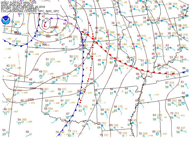 |
| 12 pm CST (18Z) | 3 pm CST (21Z) | 6 pm CST (00Z) |
Non-Thunderstorm Wind Reports
| Location | Speed (mph) | Time | Source |
| Exeter 4 NNW | 79 | 7:10 pm | Mesonet |
| Hastings 1 N | 78 | 6:46 pm | Mesonet |
| Aurora Airport | 76 | 7:15 pm | AWOS |
| Grand Island Rgnl Airport | 75 | 6:35 pm | ASOS |
| Oxford 4 SE | 75 | 5:29 pm | Mesonet |
| Franklin 2 N | 73 | 5:48 pm | Mesonet |
| Norman 2 NE | 73 | 6:19 pm | Mesonet |
| Juniata 1 NE | 73 | 6:01 pm | Mesonet |
| Bradshaw 4 WSW | 72 | 7:00 pm | Mesonet |
| Osceola | 72 | 7:32 pm | Mesonet |
| Hastings NWS | 71 | 6:41 pm | Mesonet |
| Logan, KS | 70 | 5:16 pm | Mesonet |
| Phillipsburg, KS Airport | 70 | 5:14 pm | AWOS |
| Pleasanton | 70 | 5:58 pm | Mesonet |
| Oxford 5 NNW | 68 | 5:12 pm | Mesonet |
| Hildreth 4 NNW | 67 | 5:56 pm | Mesonet |
| Osceola 9 WNW | 67 | 6:54 pm | Mesonet |
| Kearney Rgnl Airport | 66 | 5:55 pm | AWOS |
| Roseland 2 SW | 65 | 6:25 pm | Mesonet |
| Sumner 3 W | 65 | 5:56 pm | Mesonet |
| Wilcox 7 SSE | 65 | 5:25 pm | Mesonet |
| Shelby 1 ENE | 65 | 6:48 pm | Mesonet |
| Wood River 1 S | 65 | 7:06 pm | Mesonet |
| Harvard 5 SW | 65 | 6:56 pm | RAWS |
| Ord Airport | 64 | 8:03 pm | ASOS |
| Prosser 2 SSE | 64 | 6:30 pm | Mesonet |
| Naponee 3 SSW | 64 | 5:46 pm | Mesonet |
| Kearney 2 ENE | 64 | 6:09 pm | Mesonet |
| Hastings Airport | 63 | 7:05 pm | ASOS |
| Glenvil 5 S | 63 | 6:36 pm | Mesonet |
| Kearney 6 E | 63 | 6:30 pm | Mesonet |
| Lexington 2 W | 63 | 6:00 pm | Mesonet |
| Wood River 4 WSW | 63 | 6:45 pm | Mesonet |
| Lexington Airport | 62 | 6:35 pm | AWOS |
| Holdrege Airport | 61 | 5:55 pm | AWOS |
| Grand Island 3 WSW | 60 | 7:15 pm | Mesonet |
| Axtell 2 E | 60 | 5:45 pm | Mesonet |
| Stromsburg 6 SW | 60 | 6:41 pm | Mesonet |
| Phillips 7 NE | 60 | 6:32 pm | Mesonet |
| Wood River 3 WSW | 59 | 6:30 pm | Mesonet |
| Funk 8 N | 59 | 5:32 pm | Mesonet |
| Kearney 1 NNE | 58 | 5:52 pm | Mesonet |
| Wood River | 57 | 5:43 pm | Mesonet |
| Minden 6 NW | 57 | 6:15 pm | Mesonet |
| Loomis | 56 | 5:35 pm | Mesonet |
| Chapman 1 WSW | 55 | 8:00 pm | Mesonet |
| Alda 5 SSW | 55 | 6:26 pm | Mesonet |
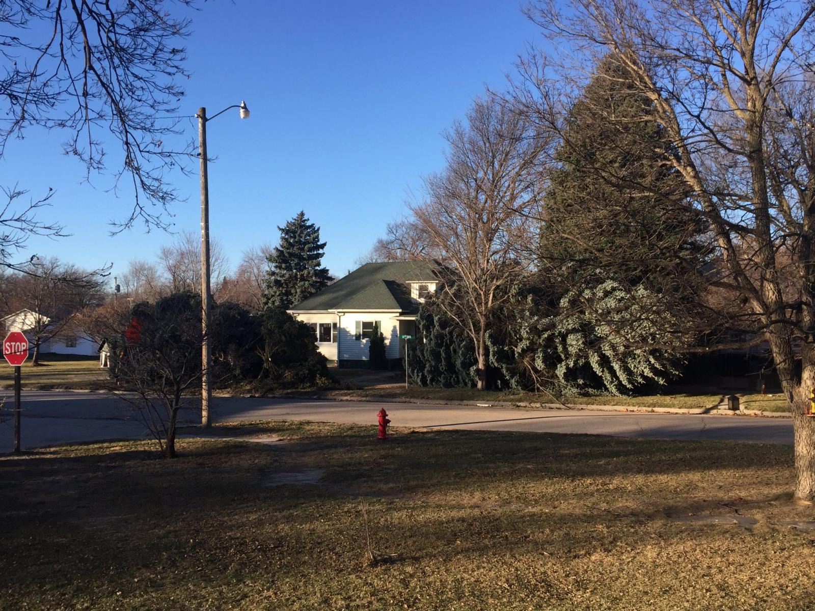
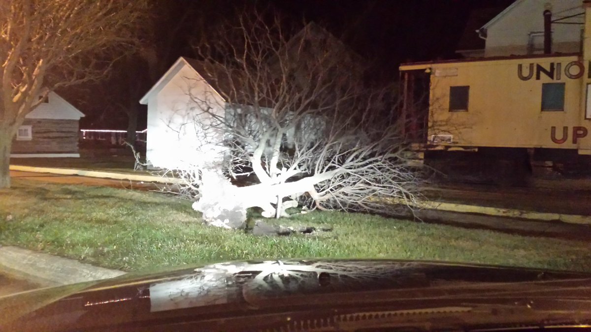
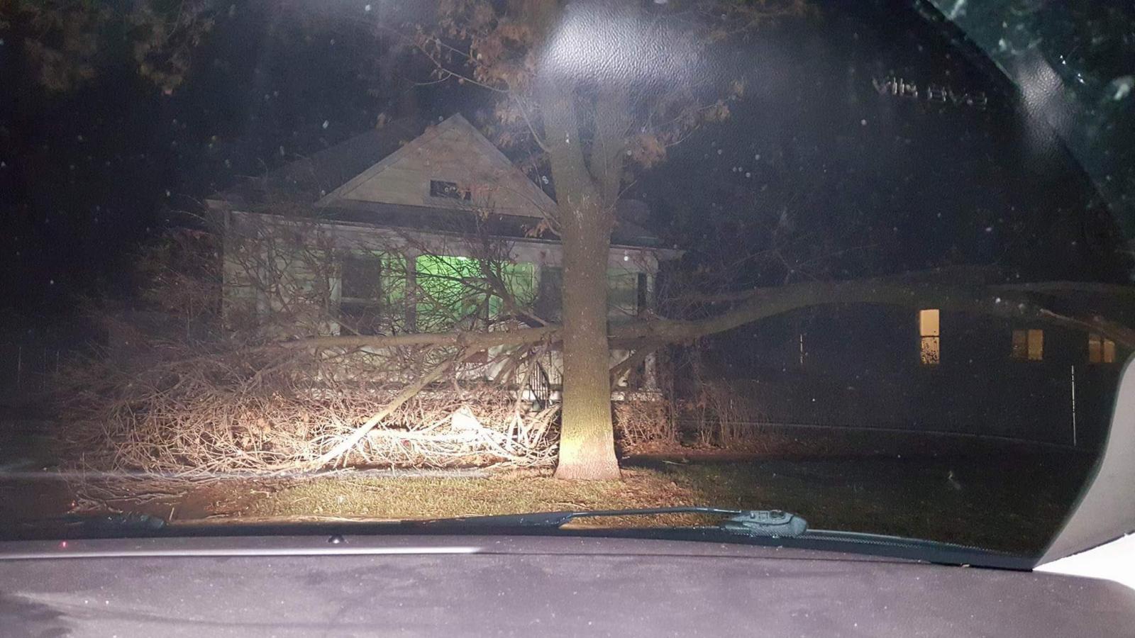
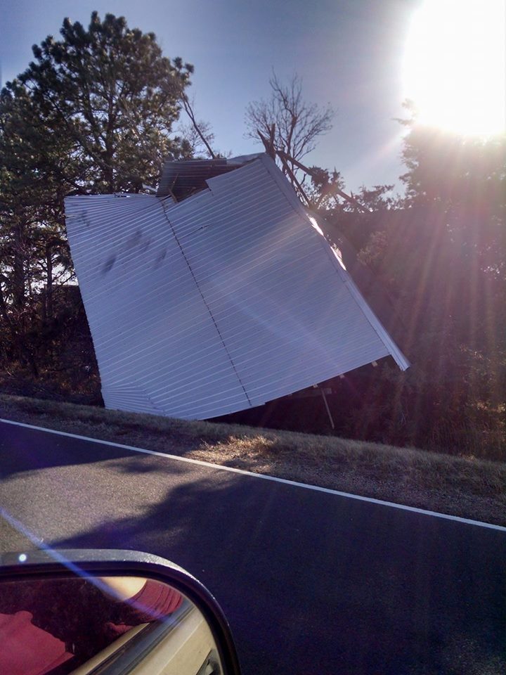
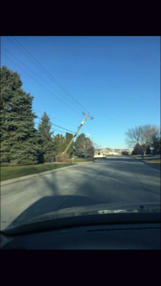
Damage from High Winds Christmas Evening
.jpg) |
 |
 |
 |
|
Aurora, NE Photo courtesy of Kirt Smith |
Central City, NE Photo courtesy of Nathan Erickson |
Blue Hill, NE Photo courtesy of Bessie Skarin |
6 mi N of Inavale, NE Photo courtesy of Wade Gibson |
 |
 |
 |
 |
|
Osceola, NE Photo courtesy of John McKinney |
Shelby, NE Photo courtesy of Melanie McKinney |
Ashton, NE Photo courtesy Cayla S. |
Grand Island, NE Photo courtesy of Alicia Elson |
 |
 |
 |
 |
|
Bruning, NE Photo courtesy of Michelle Naiman Sybrant |
North Shore Drive, Hastings, NE Photo courtesy of Zach Nicholson |
South of Loup City, NE Photo courtesy of Corrie Walthers |
Hastings College Photo courtesy of Sara Schnase |
 |
Media use of NWS Web News Stories is encouraged! Please acknowledge the NWS as the source of any news information accessed from this site. |
|