
Heat expands across the Desert Southwest, Plains, Mississippi Valley and Midwest into Monday. Fire weather concerns continue for portions of the Intermountain West. Active monsoonal moisture fuels thunderstorms over the Southwest with possible flash flooding. Tropical cyclone Fausto in the Pacific, should weaken as it approaches Hawaii; Dangerous surf, swells and rip currents are expected. Read More >
Overview:
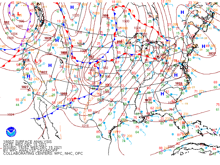
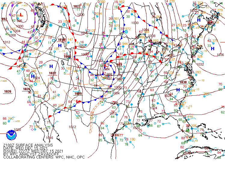
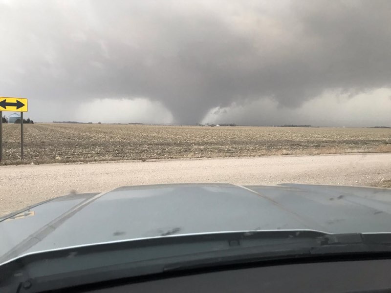
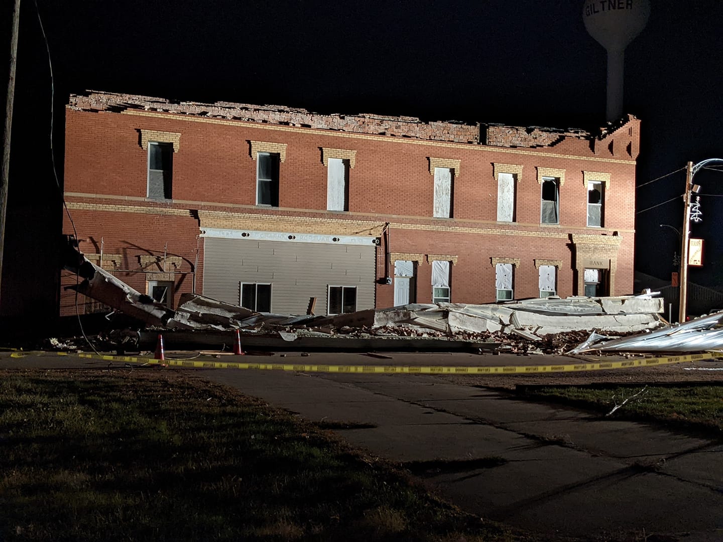
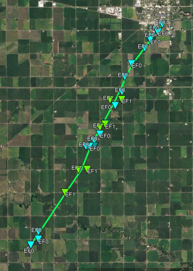
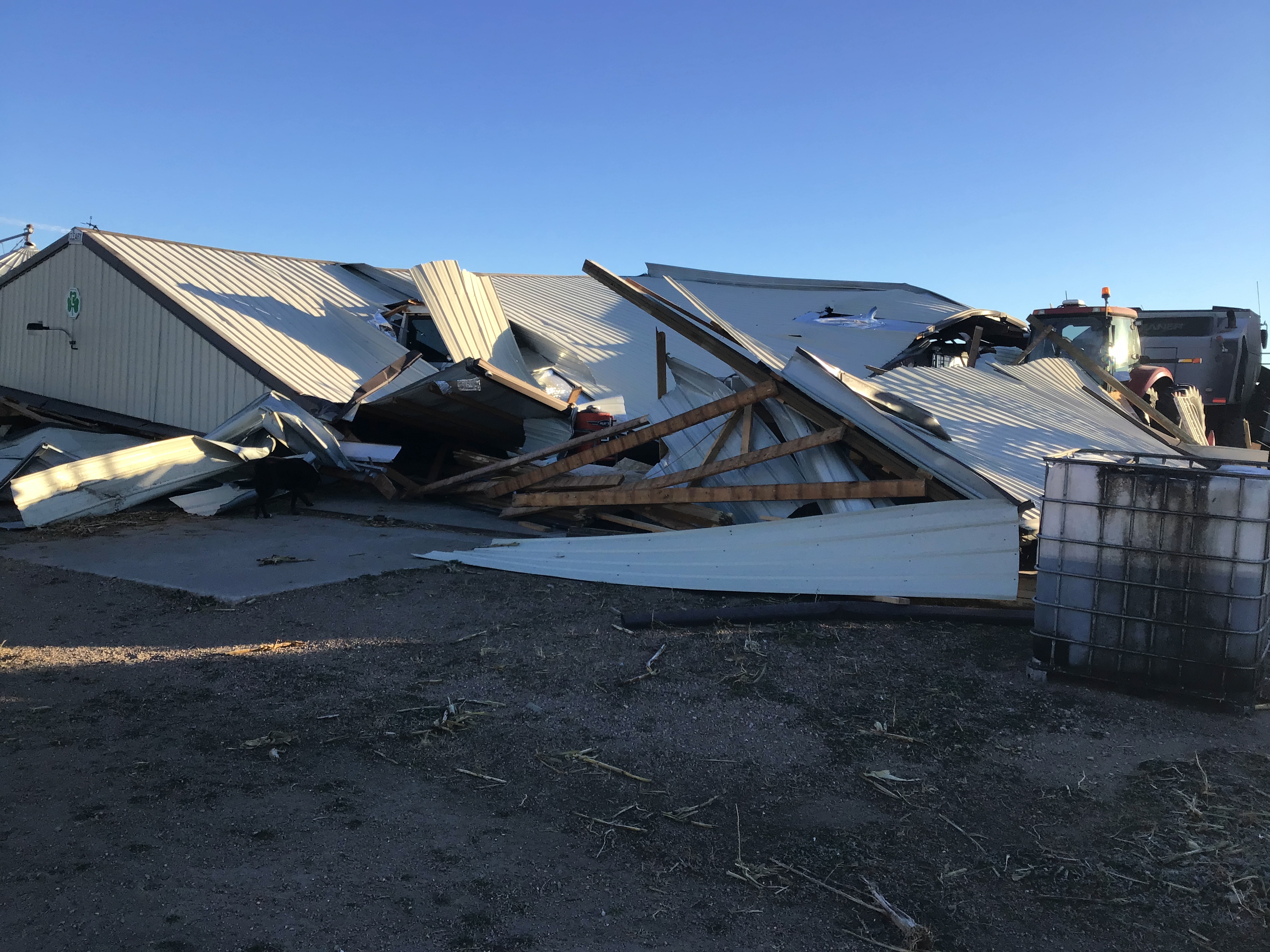
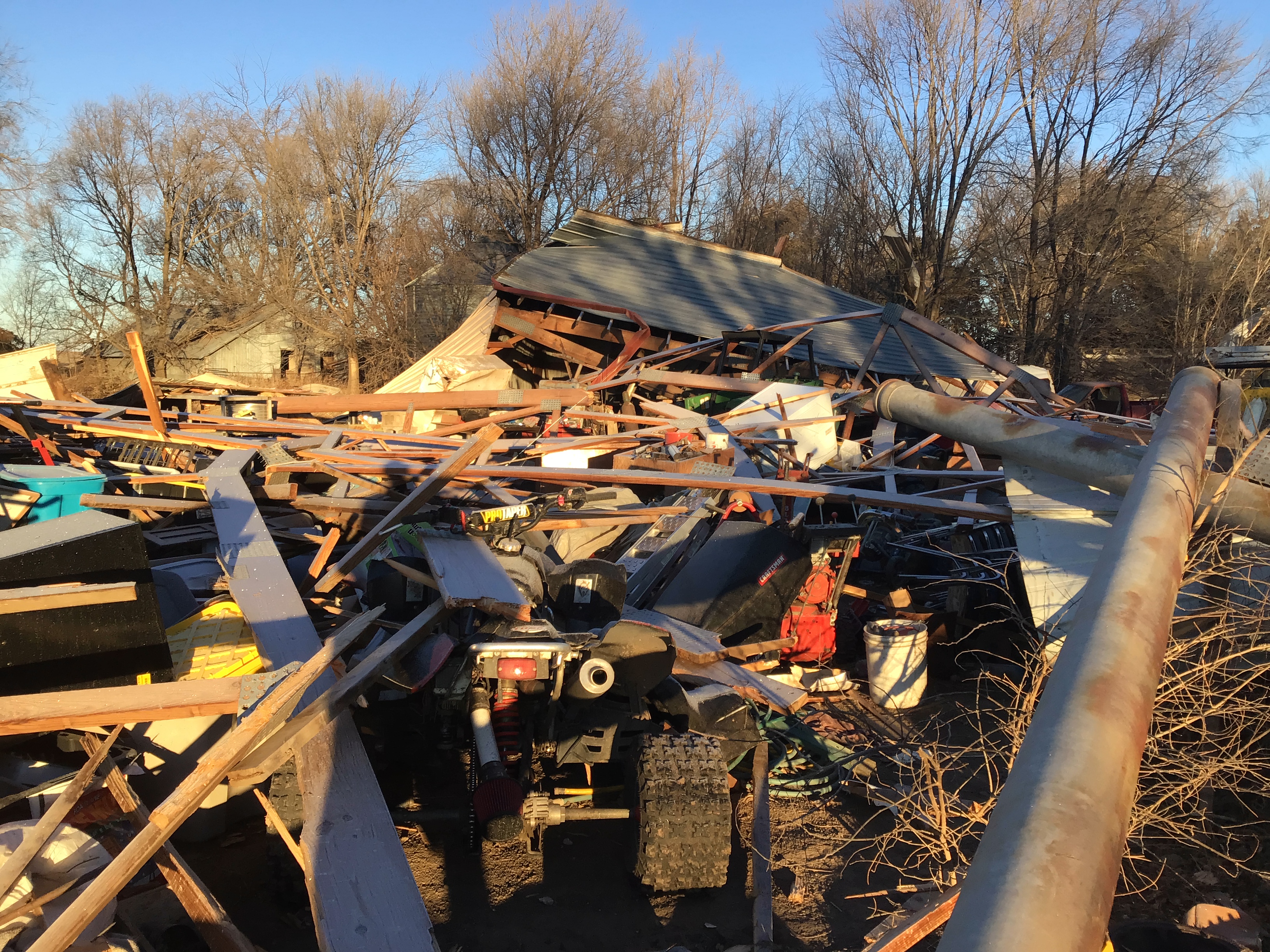
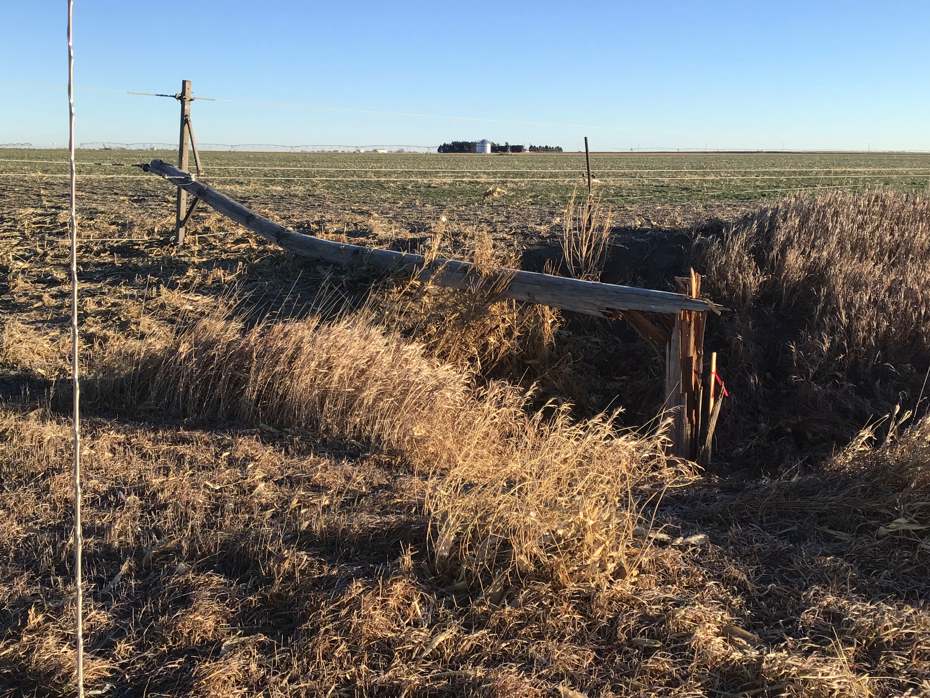
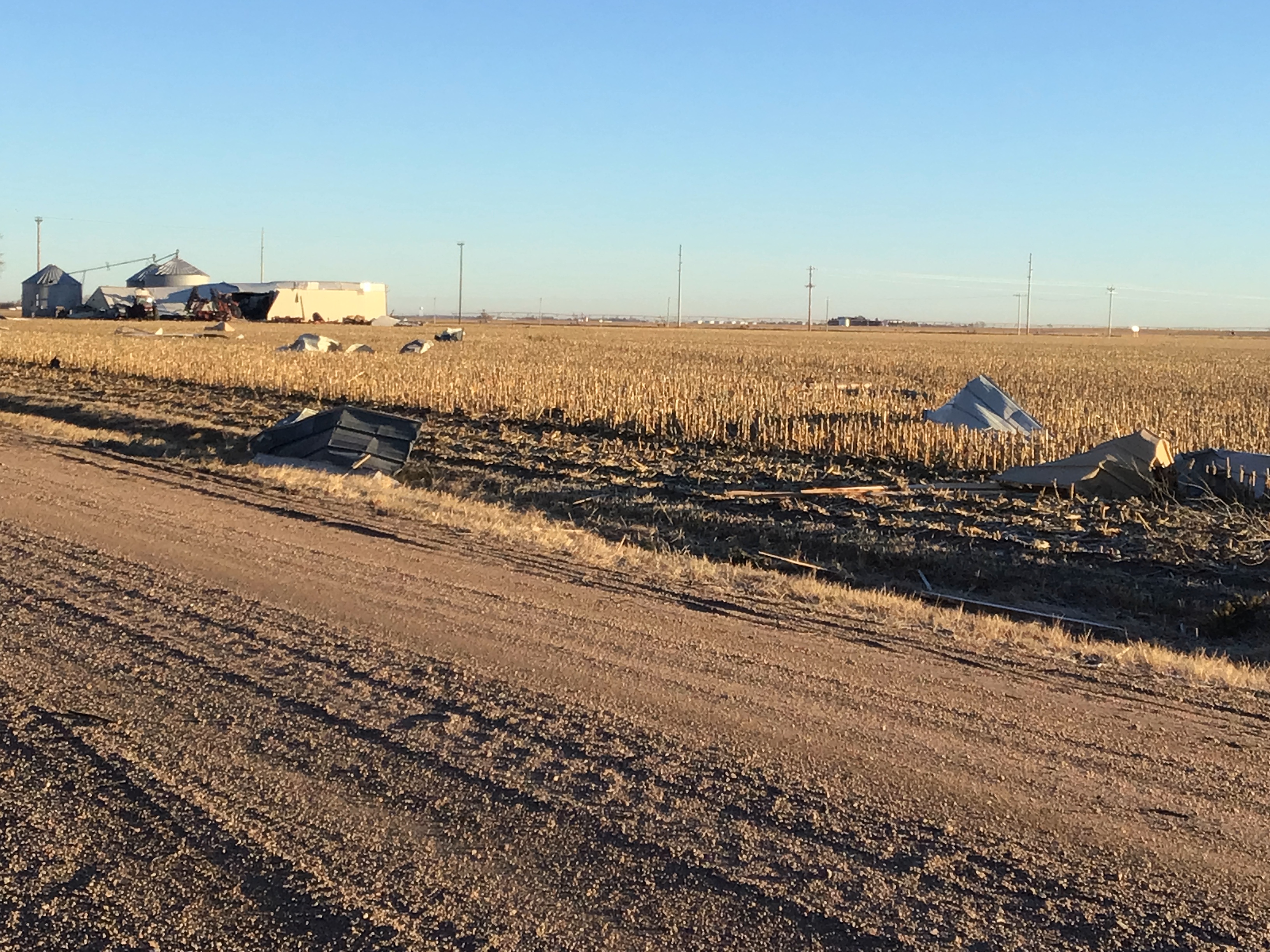
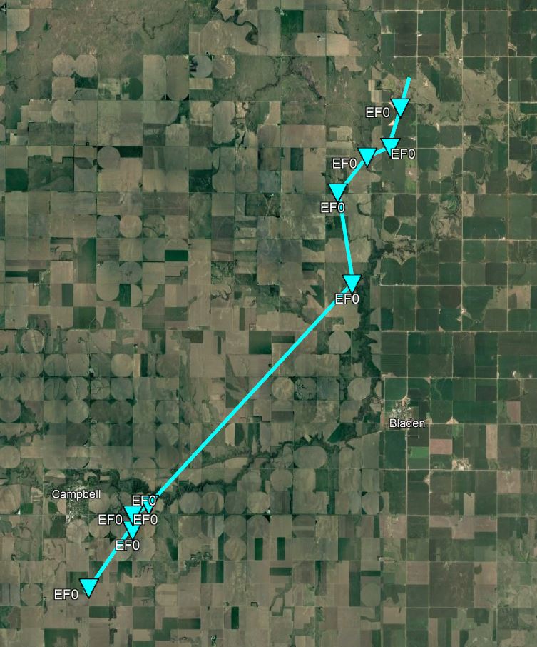
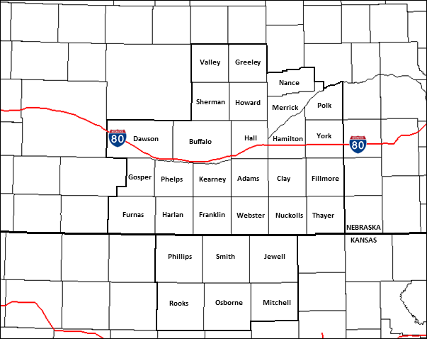
During the afternoon-evening of Wed. Dec. 15, 2021, a highly unusual and impactful severe thunderstorm/tornado/high wind event took aim on our coverage area of south central NE/north central KS (along with other parts of the Central Plains/Midwest), incredibly just five years after a similarly-unusual (but overall-less-impactful) event back on Christmas Day 2016. Briefly summarizing what occurred in our local area: an intense and fast-moving low pressure system swept through the region, setting off: 1) A rapidly-moving squall line of severe thunderstorms that produced not only widespread, damaging straight-line winds, but also several, embedded tornadoes. In fact, nine total tornadoes were confirmed in our coverage area (five rated EF-1, four EF-0). 2) Behind (in the wake of) the severe thunderstorms, a several-hours period of intense, damaging NON-thunderstorm westerly winds featuring widespread measured gusts of 60-80 MPH (and isolated, unofficial gusts to nearly 100 MPH!) 3) Due to the intense NON-thunderstorm winds and very dry air 4) Lastly (and ironically for December of least-overall impact), far western/northern parts of our coverage area observed a brief period of wind-whipped snow/reduced visibility, although actual snow accumulation was typically only around one-half inch (primarily affecting Dawson/Sherman/Valley/Greeley counties). |
 |
 |
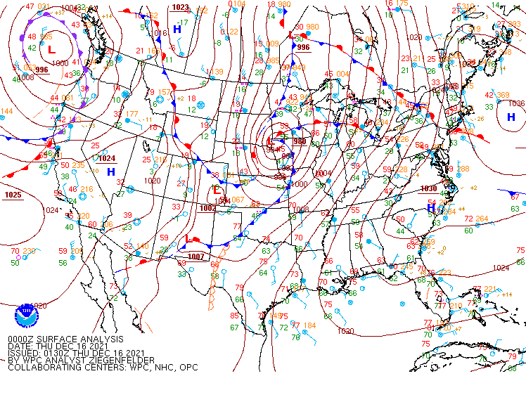 |
| Surface Weather Map - 12 PM | Surface Weather Map - 3 PM | Surface Weather Map - 6 PM |
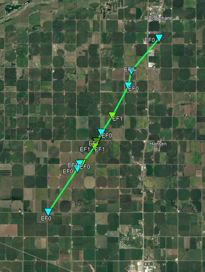
Tornadoes
|
Aurora Tornado
|
||||||||||||||||
|
||||||||||||||||
|
Rosedale Road Tornado
|
||||||||||||||||
|
||||||||||||||||
|
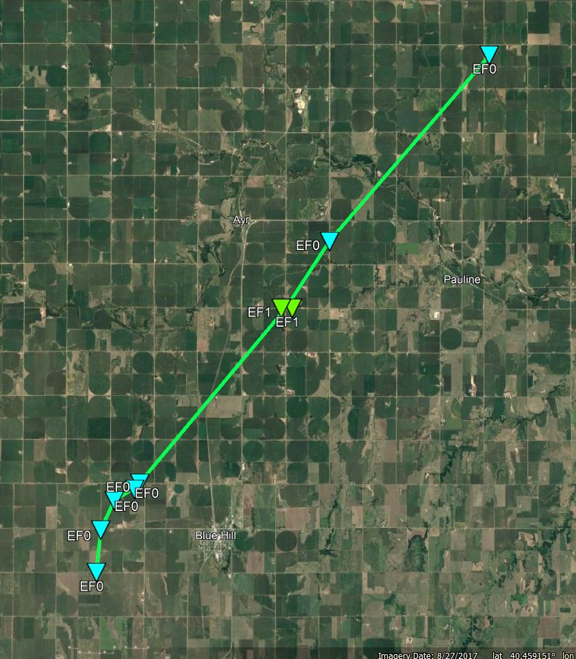
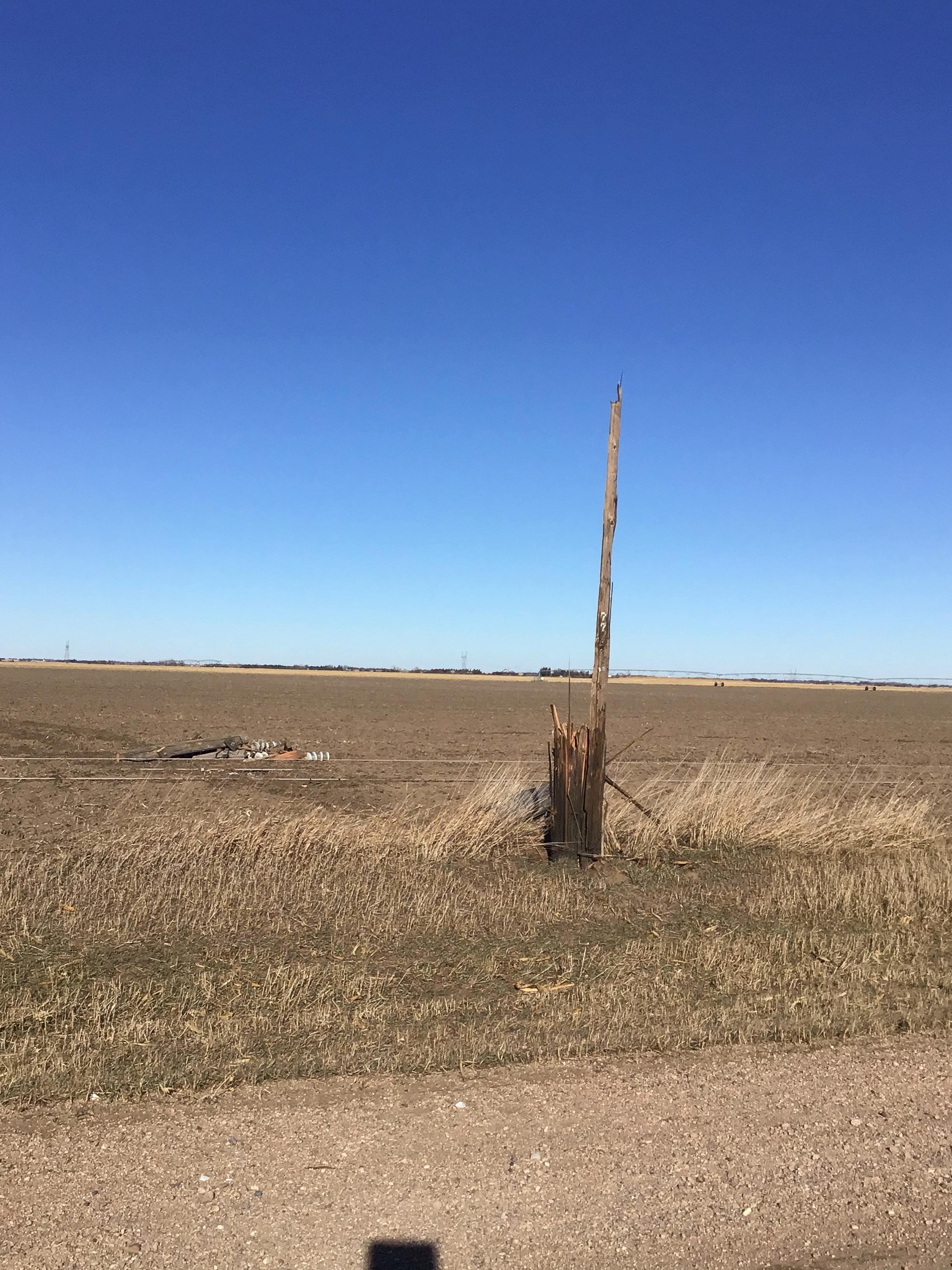
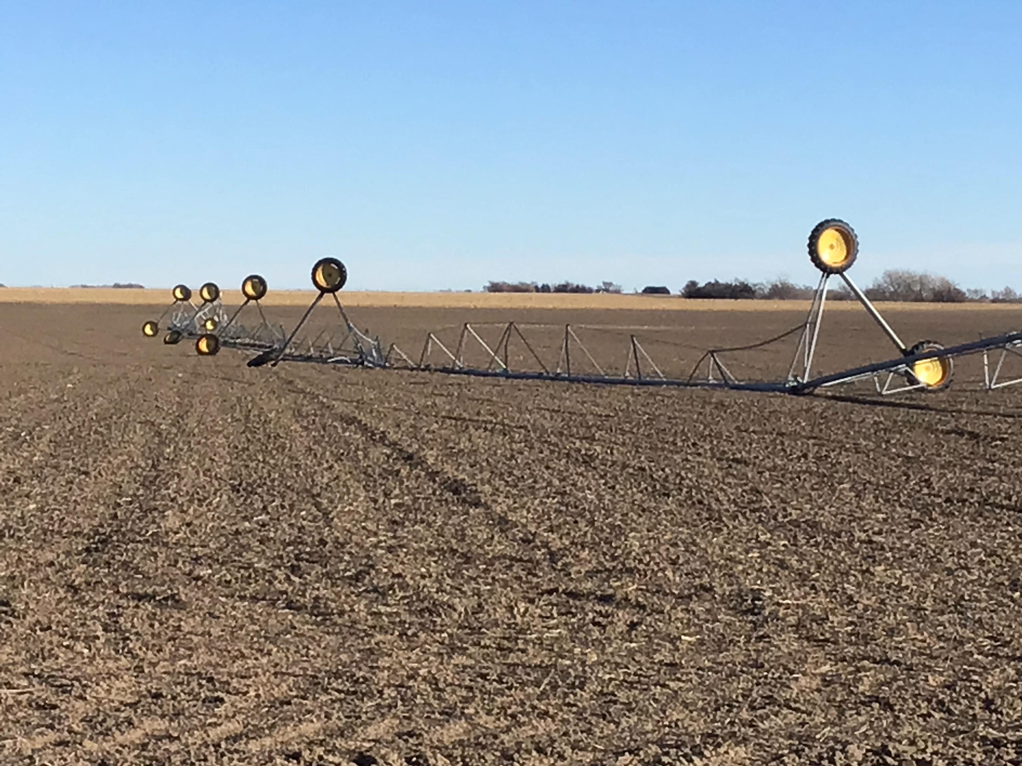
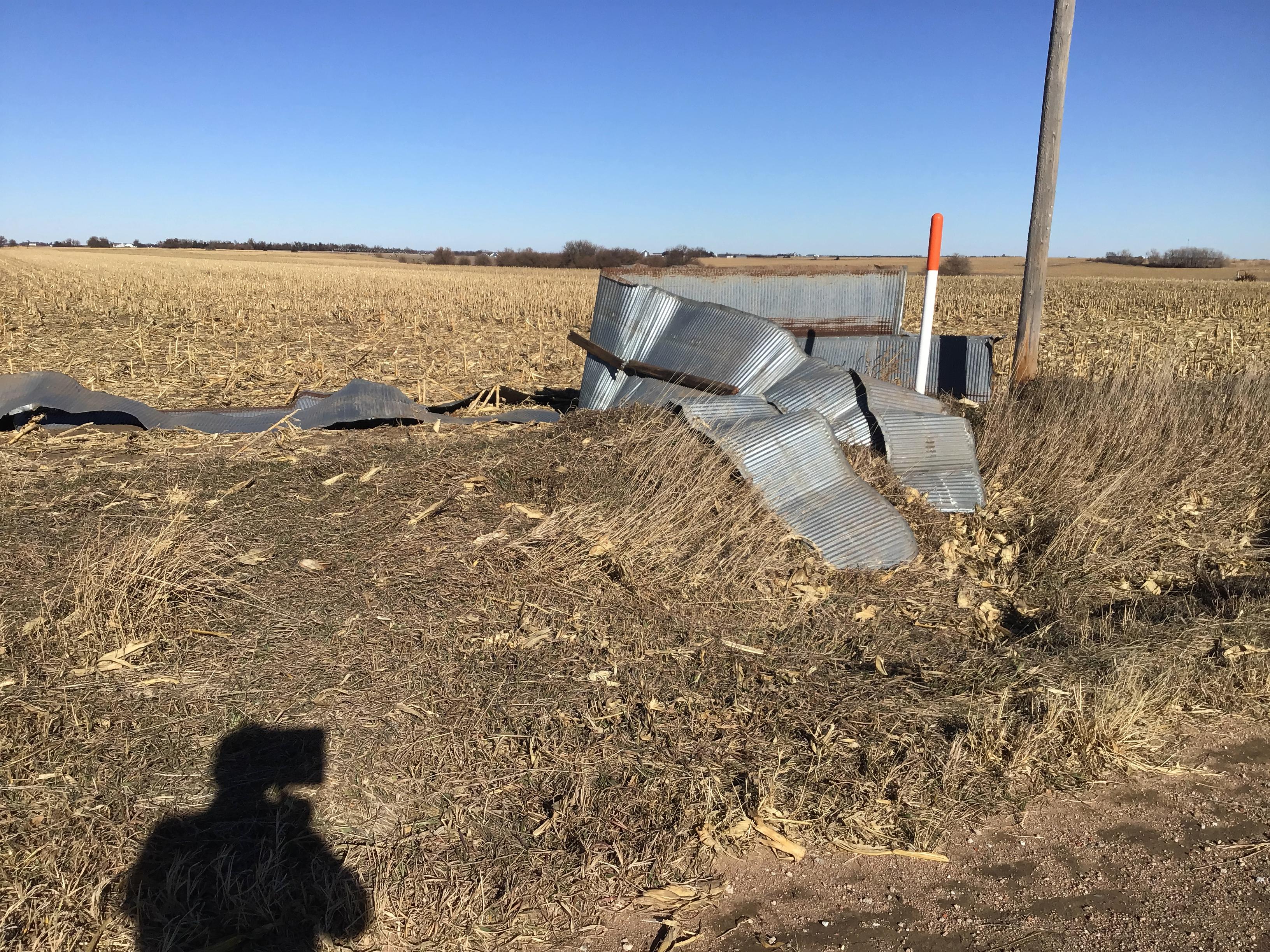
Blue Hill Area Tornado
|
||||||||||||||||
|
||||||||||||||||
|
Kronborg/Hordville Area Tornado
|
||||||||||||||||
|
||||||||||||||||
|
Eastern Polk Area Tornado
|
||||||||||||||||
|
||||||||||||||||
|
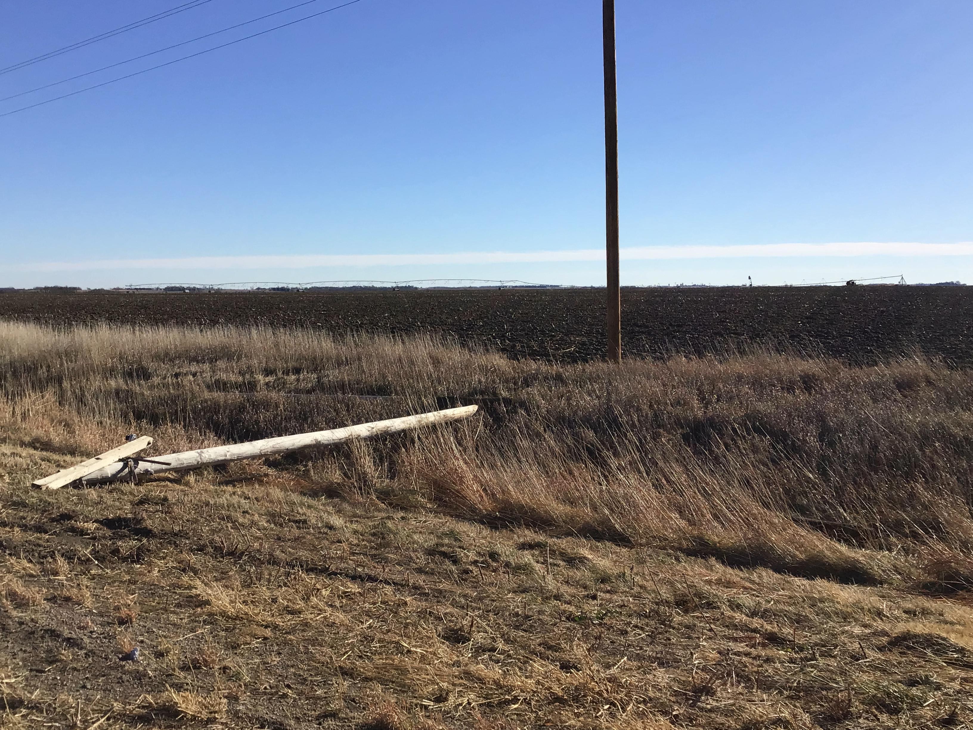
Campbell Tornado
|
||||||||||||||||
|
||||||||||||||||
|
Trumbull Tornado
|
||||||||||||||||
|
||||||||||||||||
|
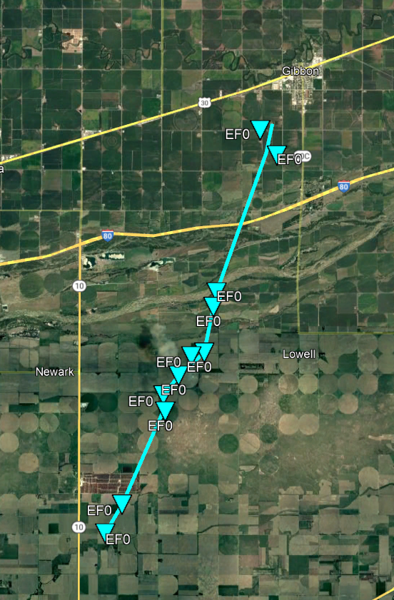
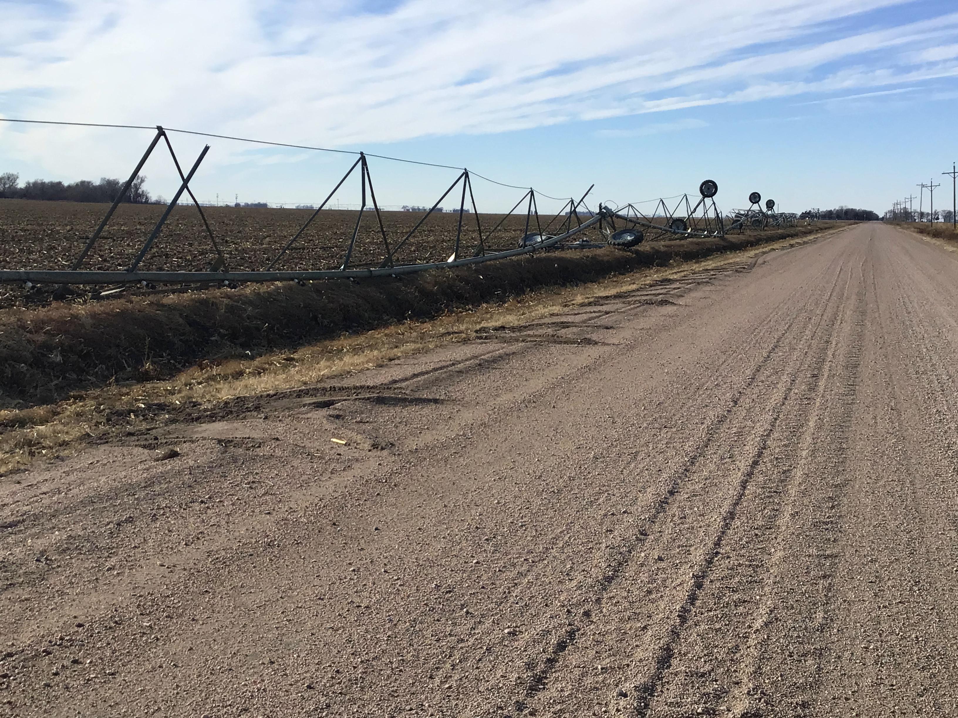
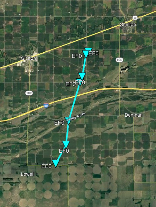
Gibbon Tornado
|
||||||||||||||||
|
||||||||||||||||
|
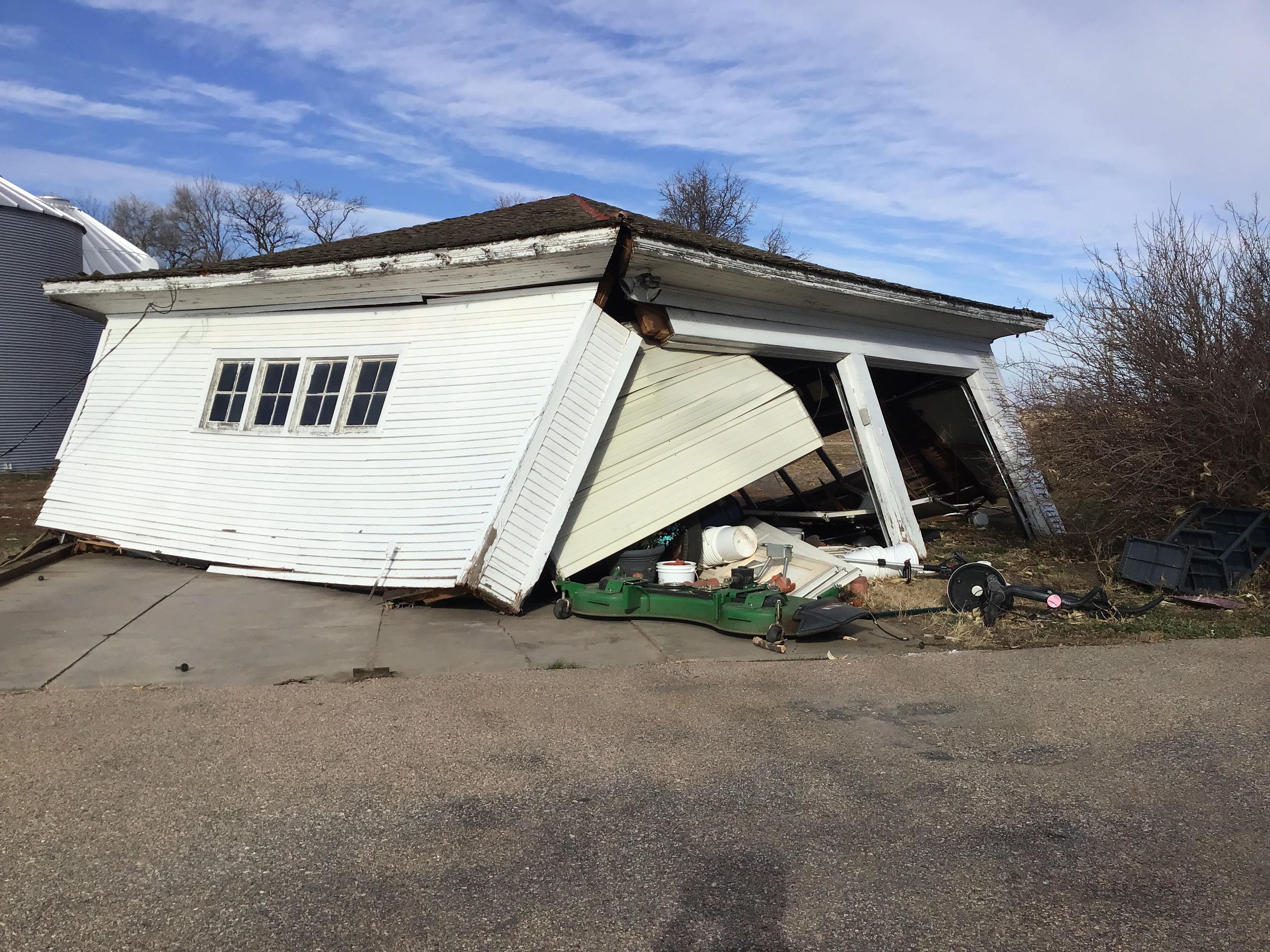
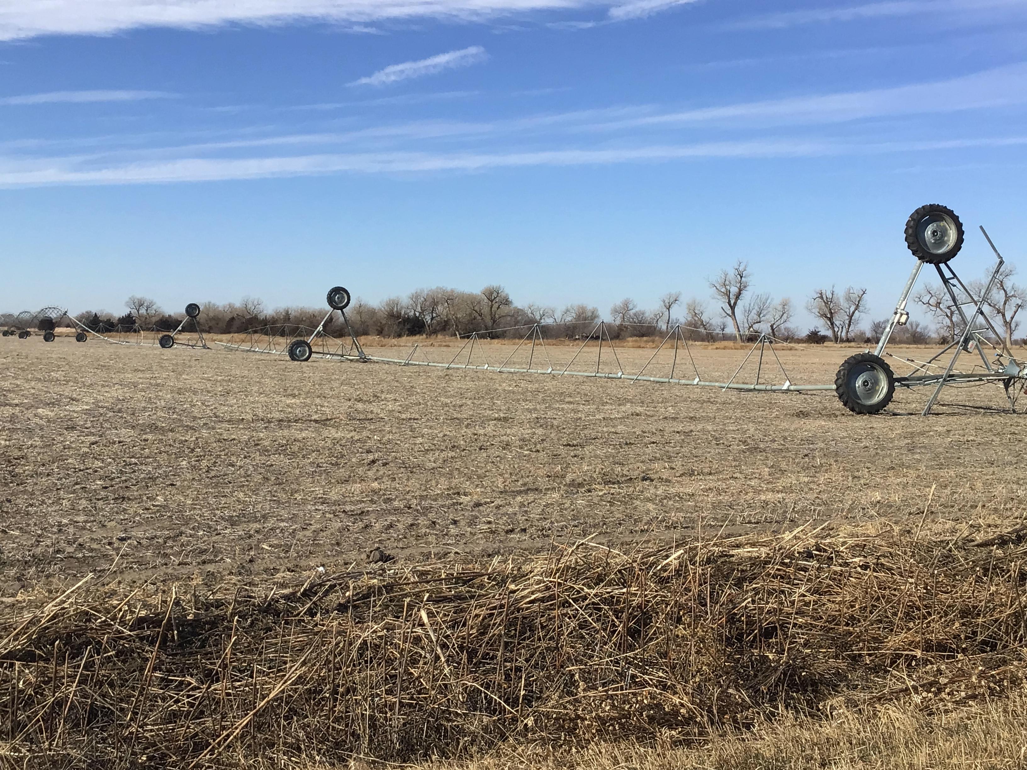
Lowell Tornado
|
||||||||||||||||
|
||||||||||||||||
The Enhanced Fujita (EF) Scale classifies tornadoes into the following categories:
| EF0 Weak 65-85 mph |
EF1 Moderate 86-110 mph |
EF2 Significant 111-135 mph |
EF3 Severe 136-165 mph |
EF4 Extreme 166-200 mph |
EF5 Catastrophic 200+ mph |
 |
|||||
Wind & Hail:
Peak Thunderstorm Wind Gusts:
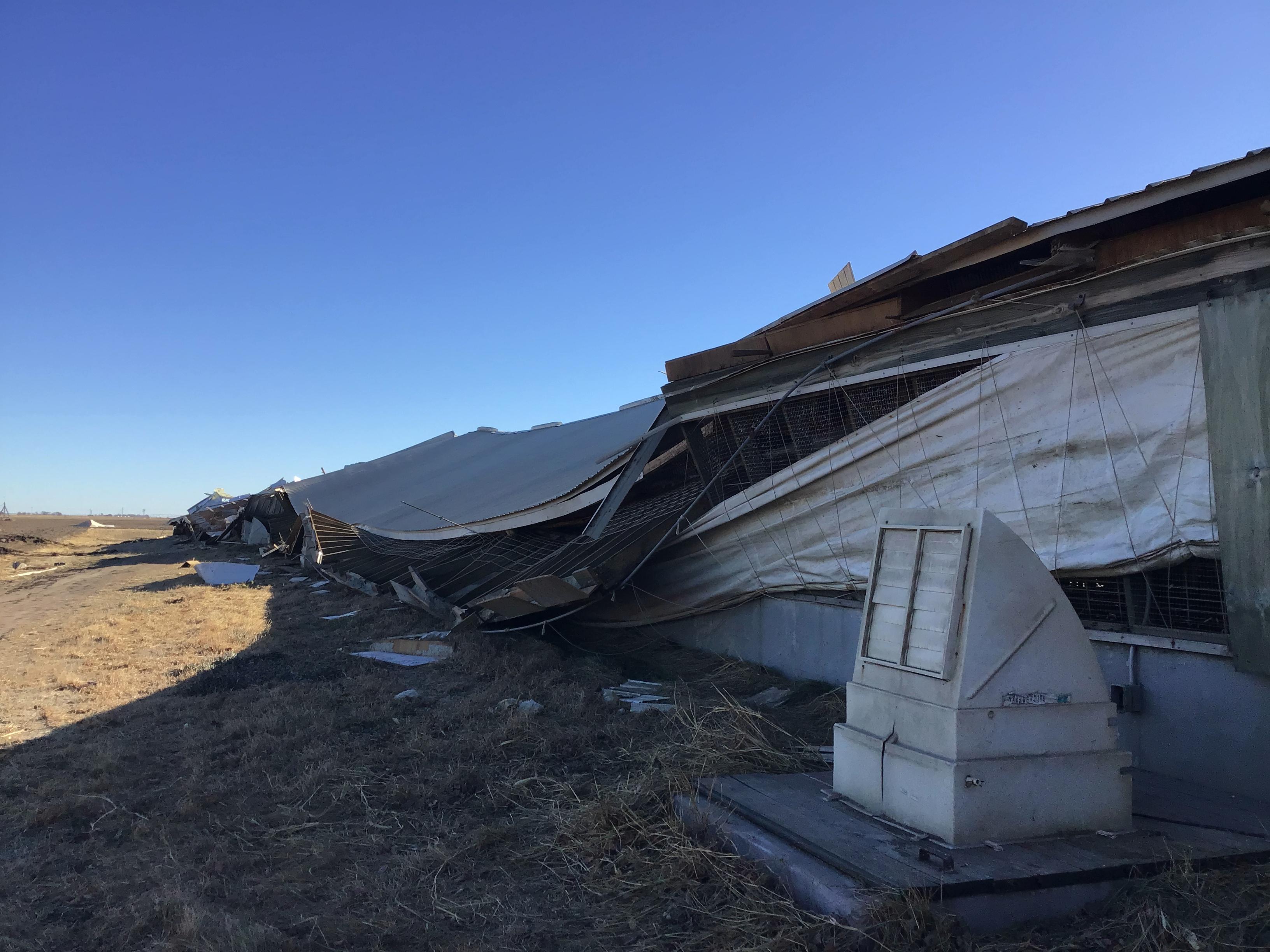
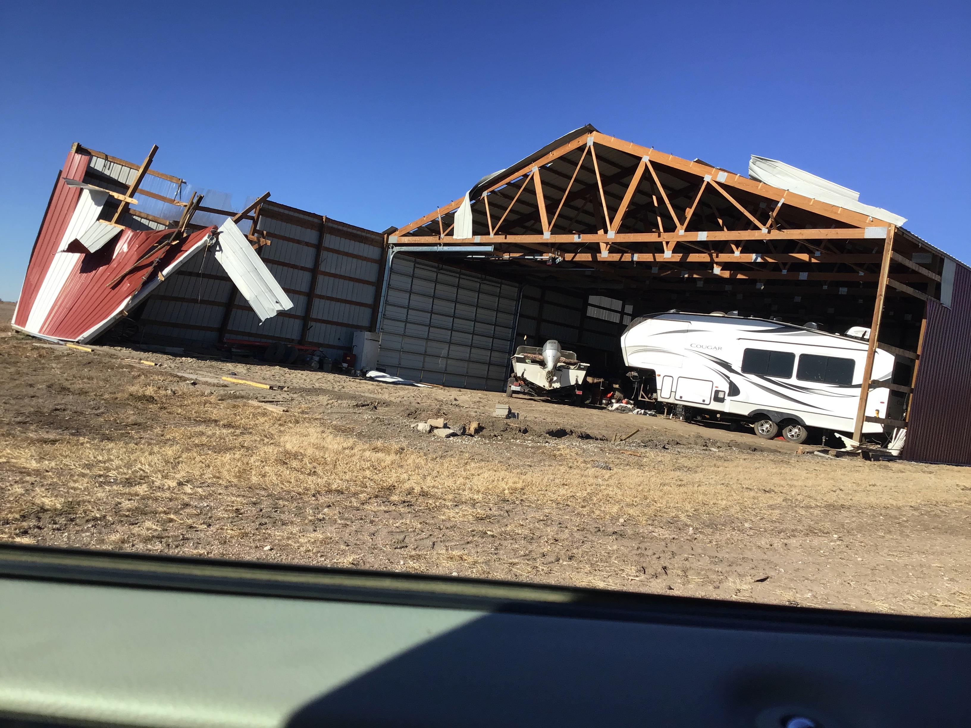
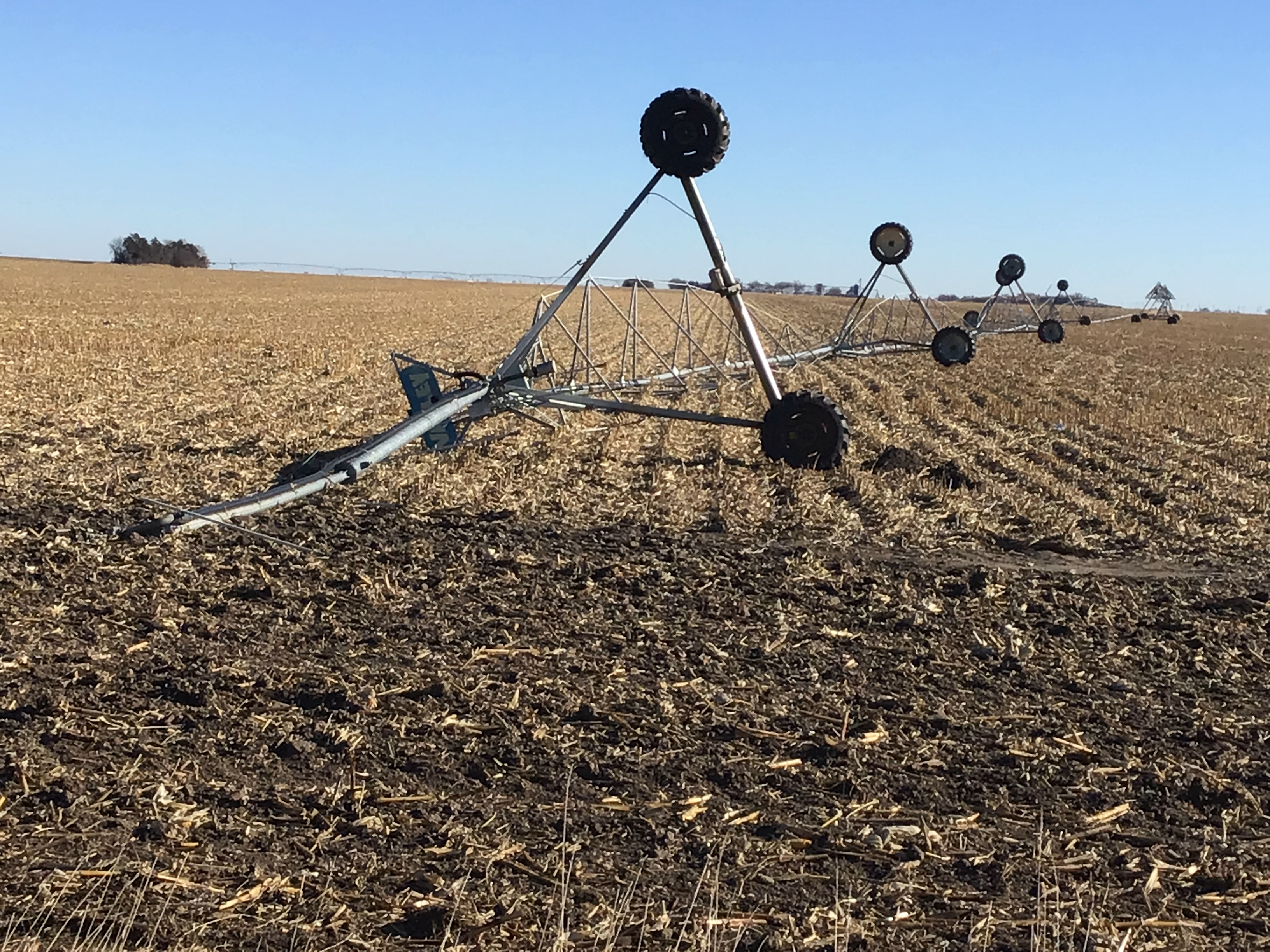
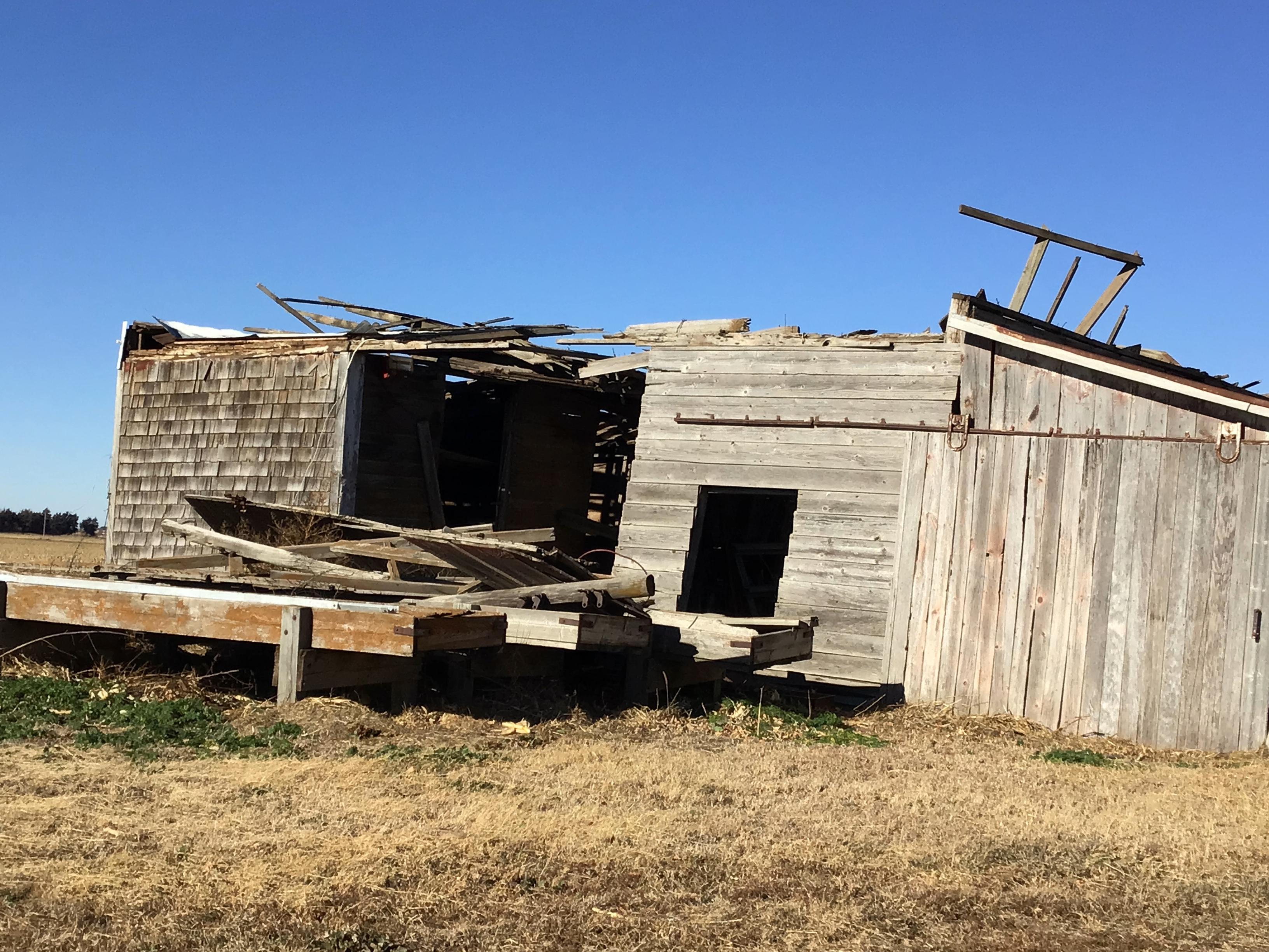
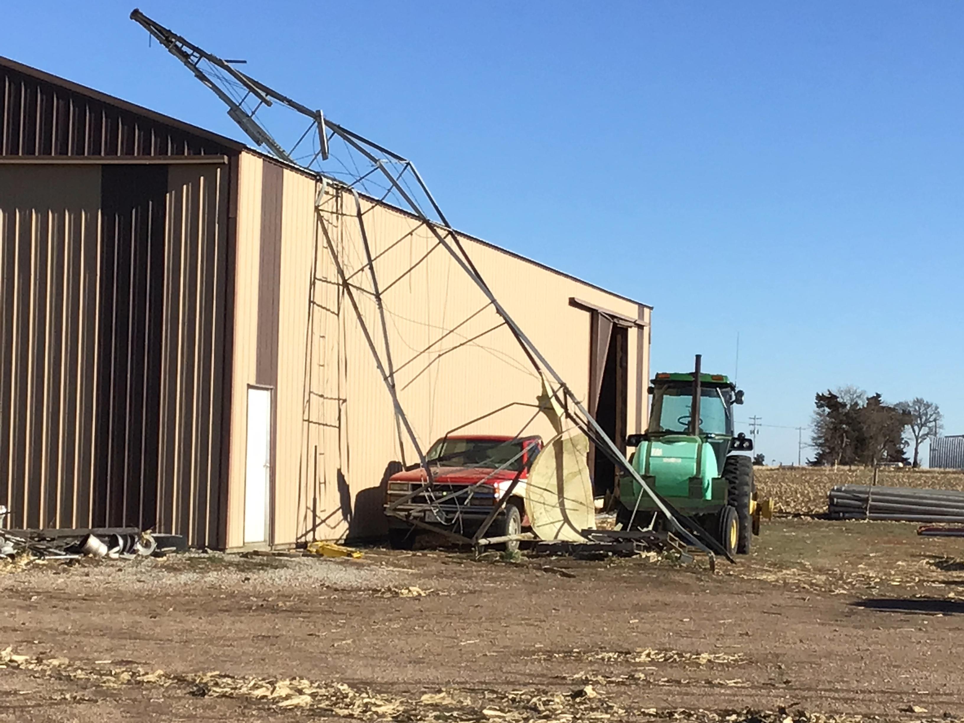
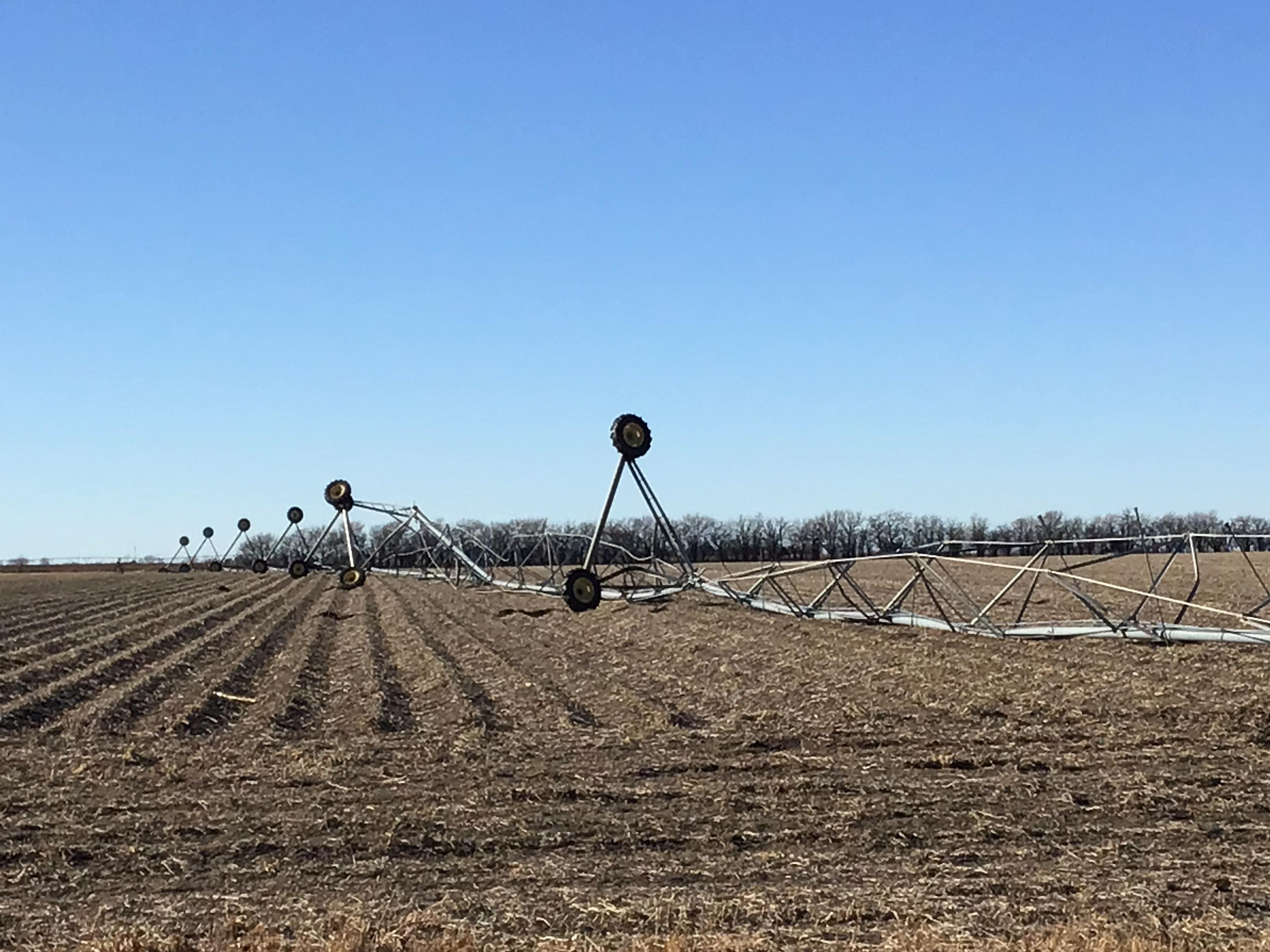
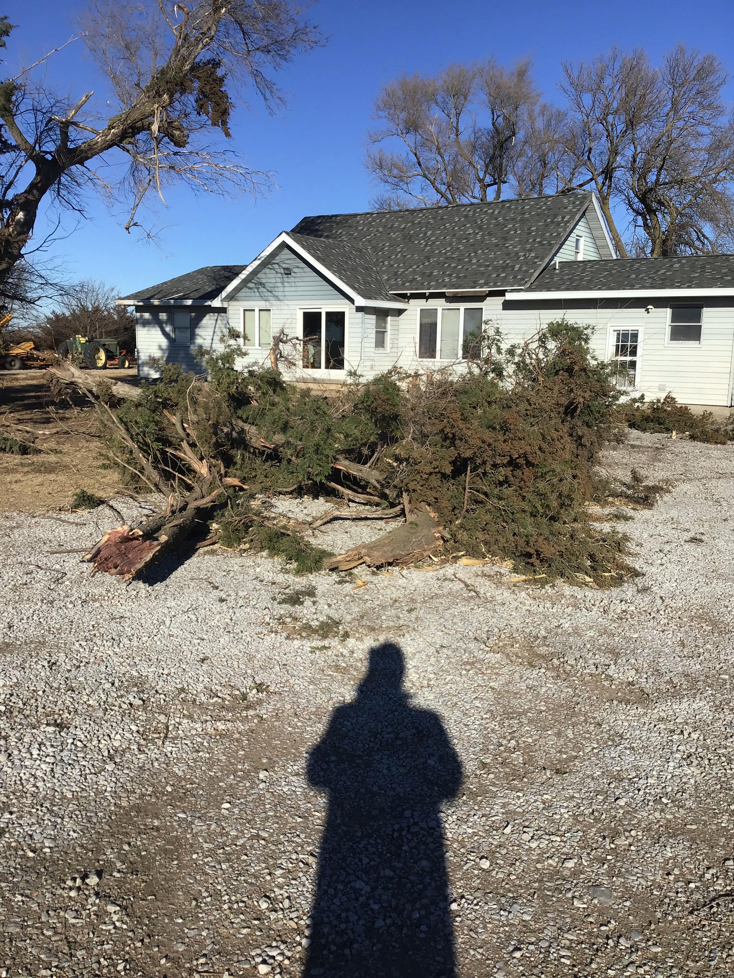
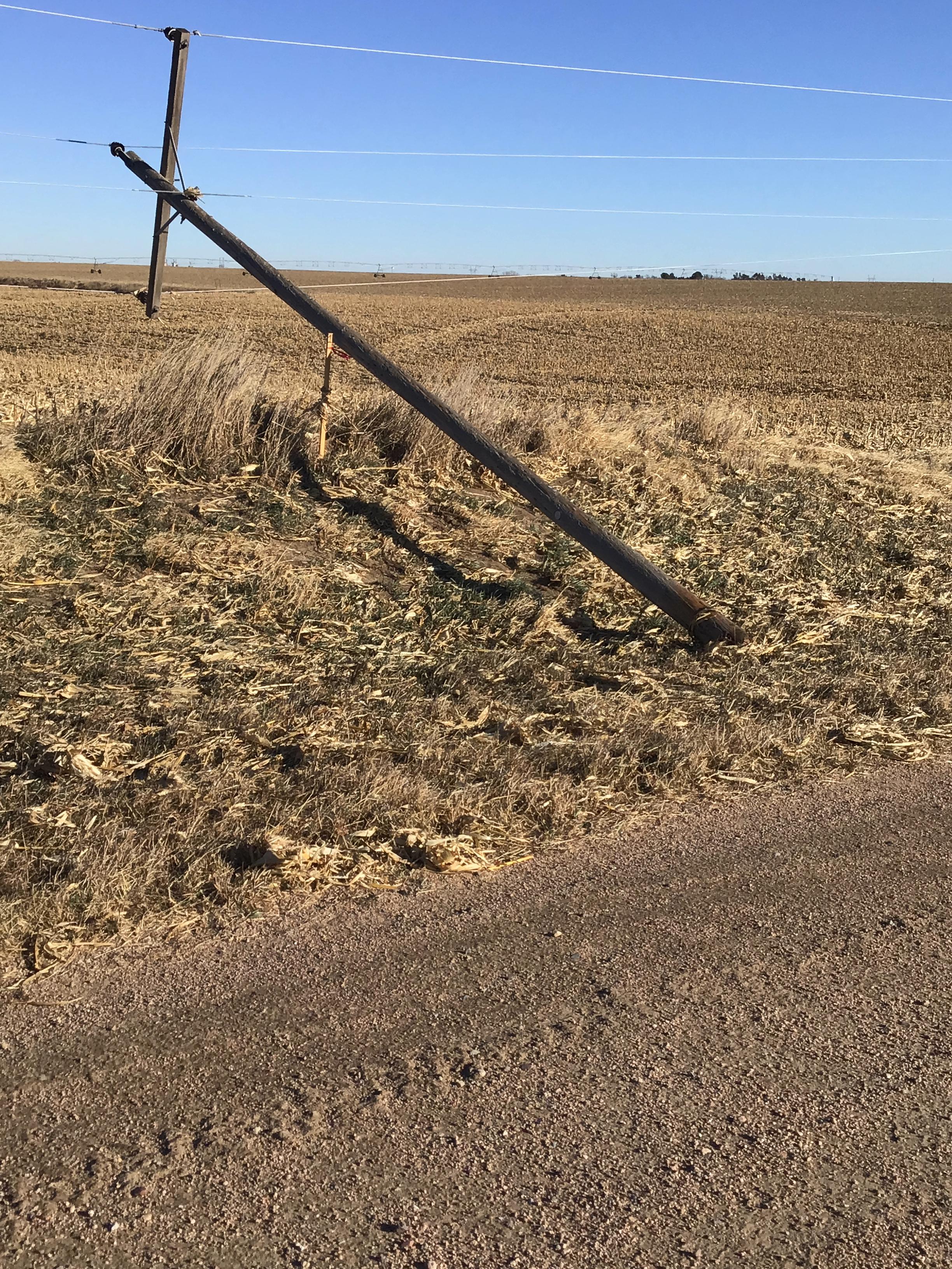
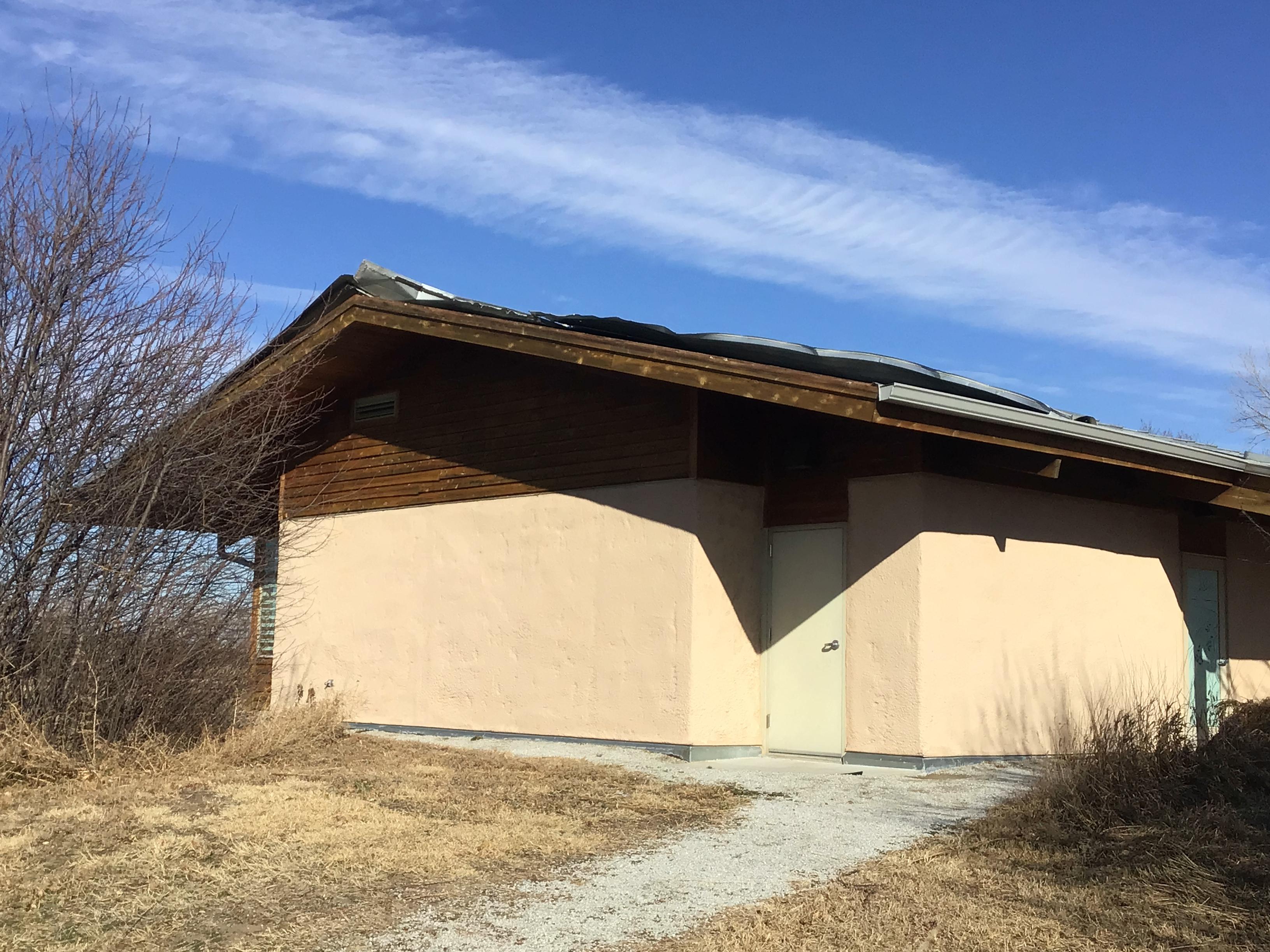
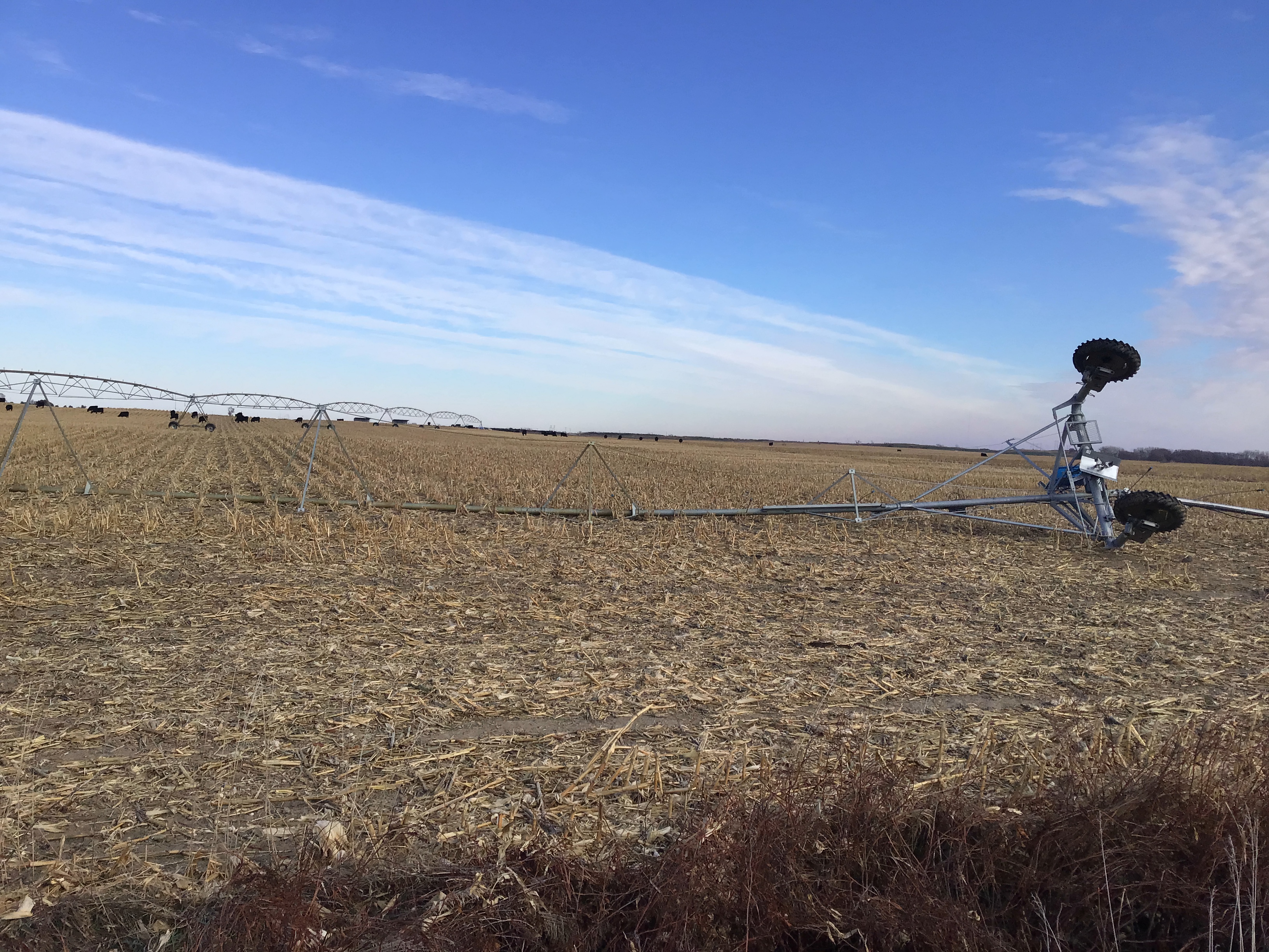
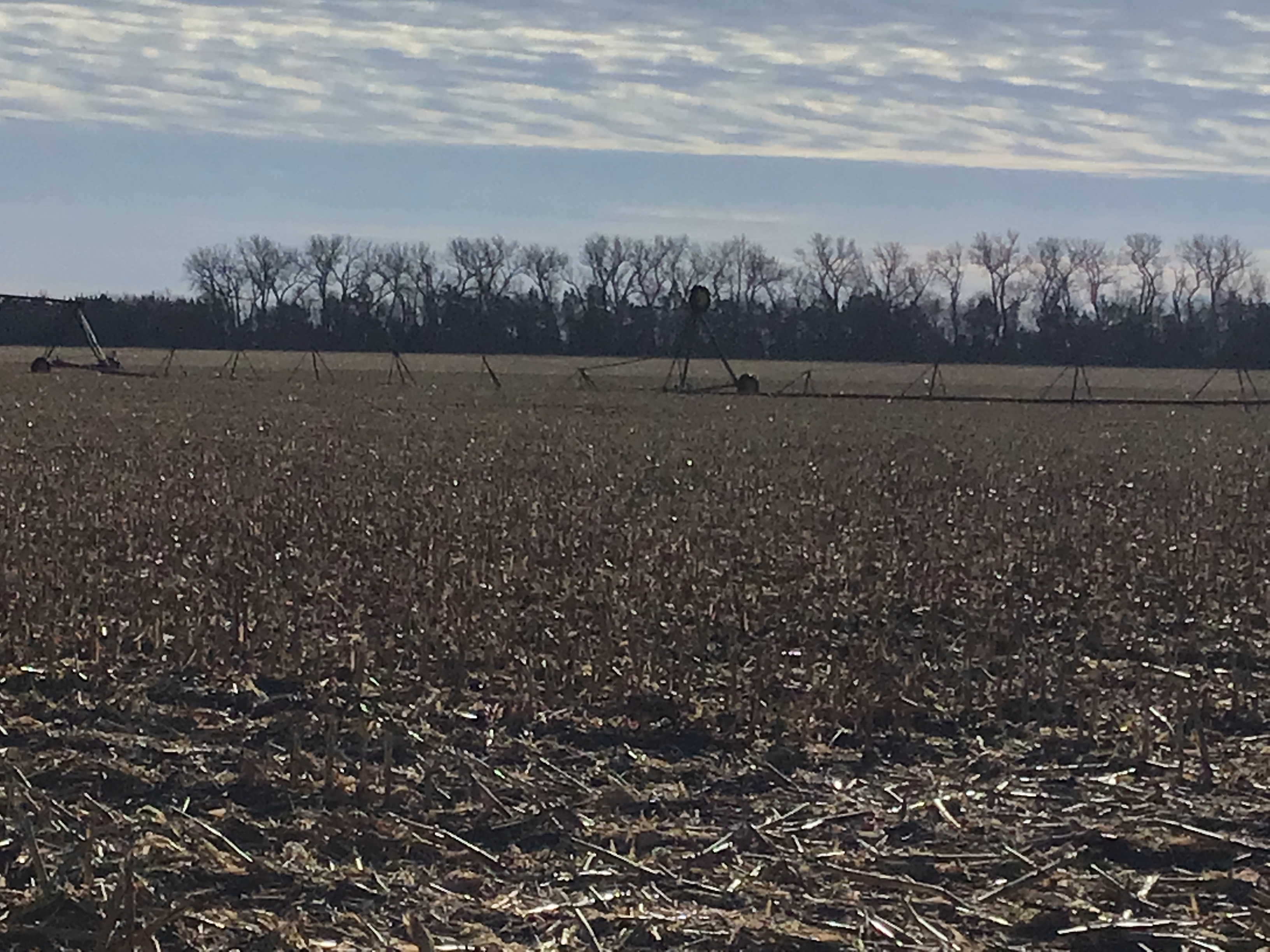
Wind gusts of 60-75 MPH were common with the line of thunderstorms as it raced west to east across south central Nebraska and north central Kansas. Several gusts of 80-85 MPH were also reported.
|
Peak NON-Thunderstorm Wind Gusts (mainly westerly winds associated with the intense low pressure system):
In addition to the strong winds associated with the line of thunderstorms, very intense NON-thunderstorm winds developed during the mid to late afternoon hours and persisted well into the evening. The most intense wind gusts of 80+ MPH were focused across north central Kansas.
|
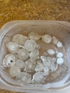
Hail:
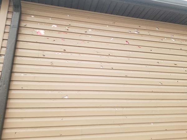
Although taking a major "back seat" to the tornadoes and damaging winds, a few instances of hail were reported across portions of south central Nebraska. Most of the reports ranged from penny to quarter size, but one report of golf ball size hail was received from the Marquette area in Hamilton County. Wind-driven hail resulted damaged siding and windows, including in and near Hastings NE.
 |
 |
 |
|
2 NE of Hordville, NE (Jerry Schuele) |
Damaged Siding in Hastings, NE (Mark W.) |
Hastings, NE at Big G Ace (Linda Dill) |
Snow:
|
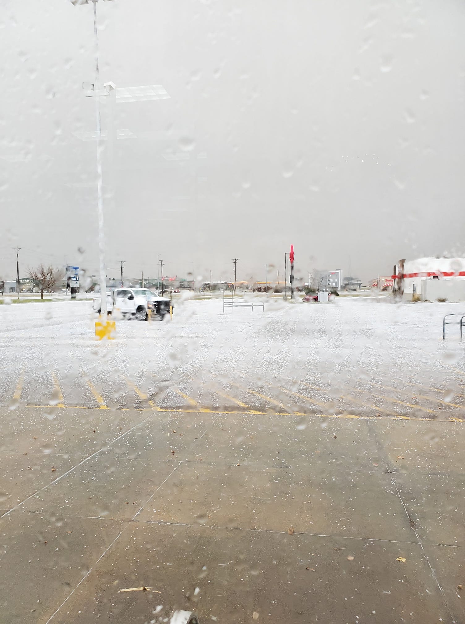
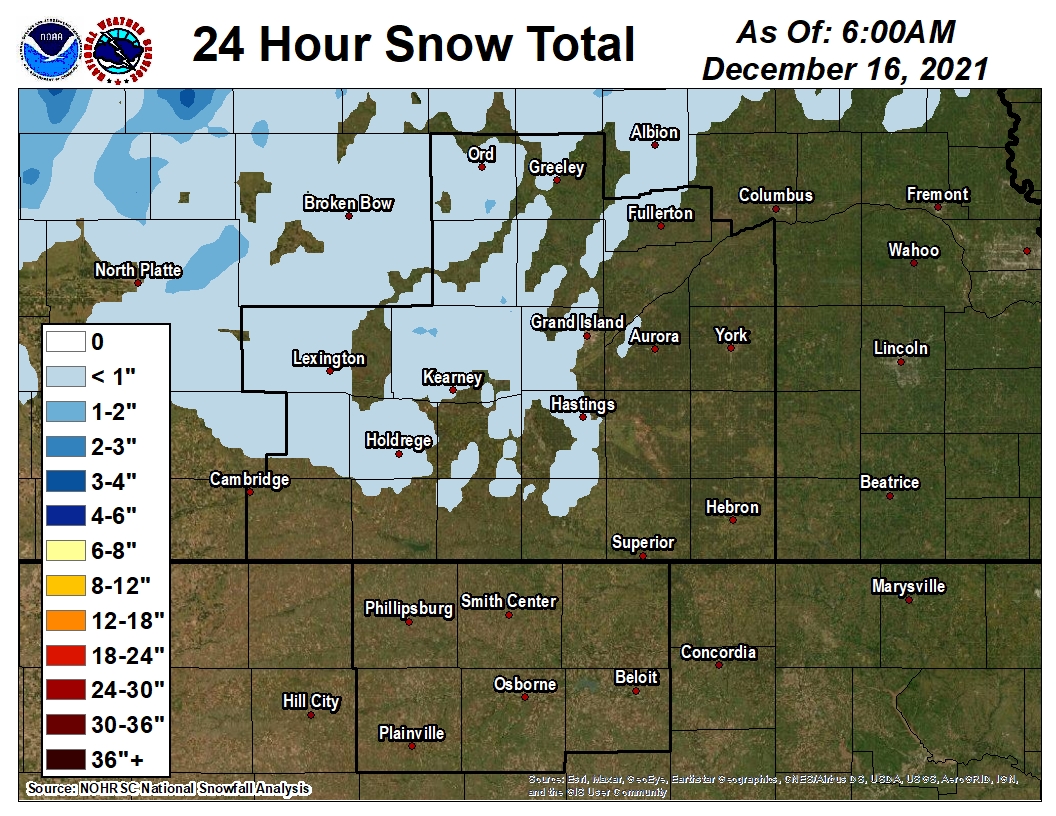
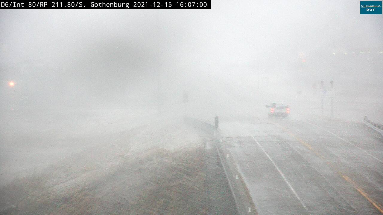
Wind-whipped snow occurred over western/northern parts of south central NE late in the afternoon on the backside of the low pressure system. Snow accumulation was minimal, but plummeting temperatures and strong winds resulted in some travel issues, especially along I-80 in parts of Dawson County. A Snow Squall Warning was issued for this area, and this was the FIRST-EVER issuance of this relatively-new product by NWS Hastings.
|
 |
 |
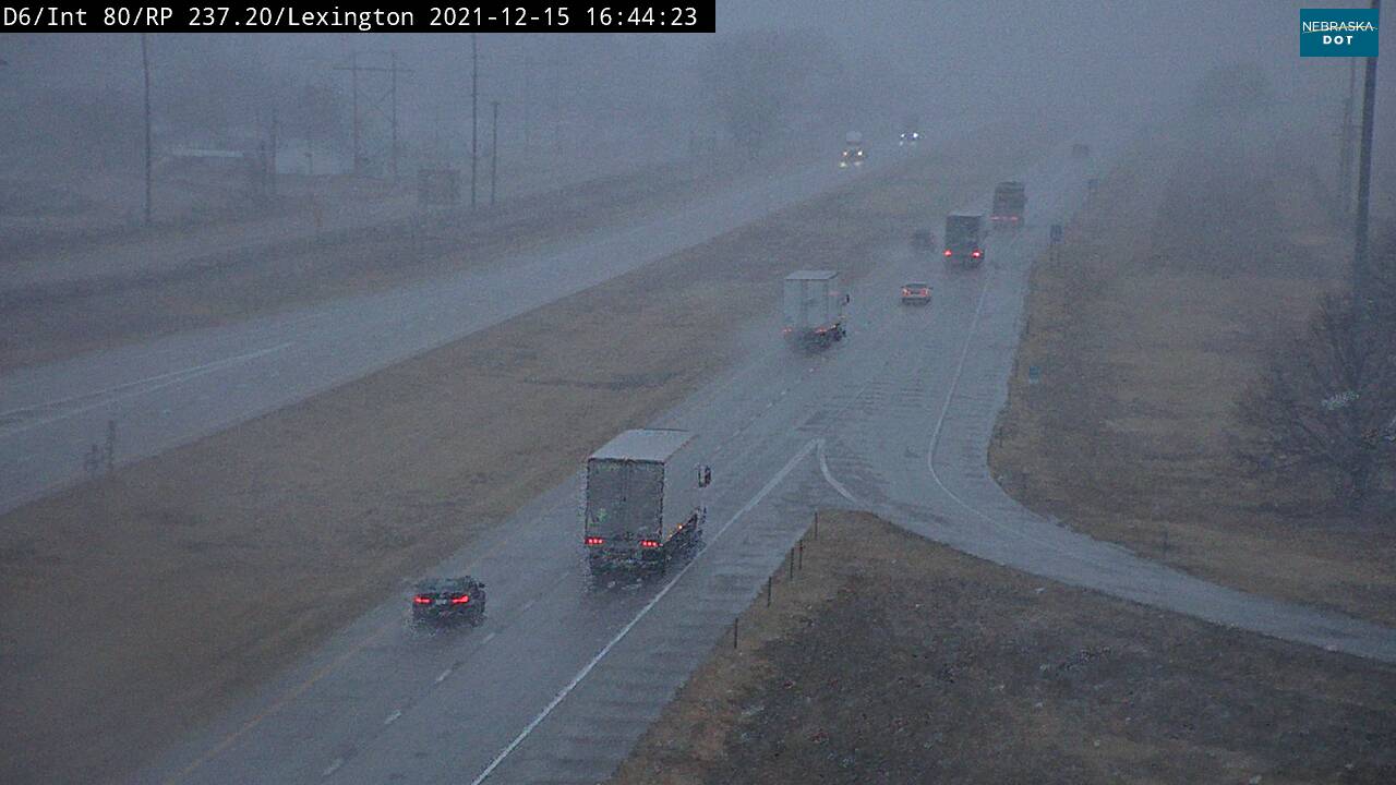 |
| NDOT Camera at Gothenburg, NE | NDOT Camera at Lexington, NE |
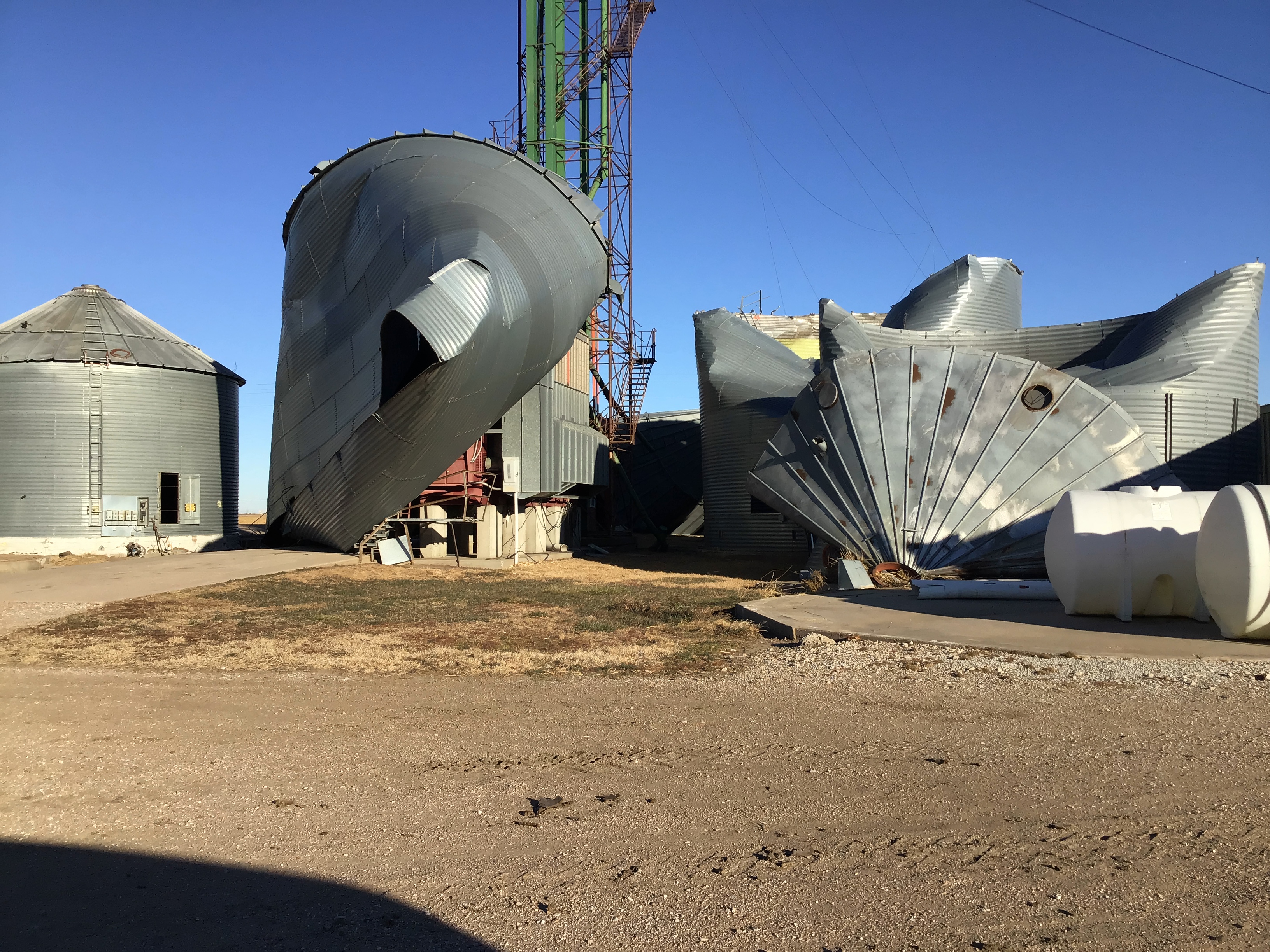
Destructive Wildfires:
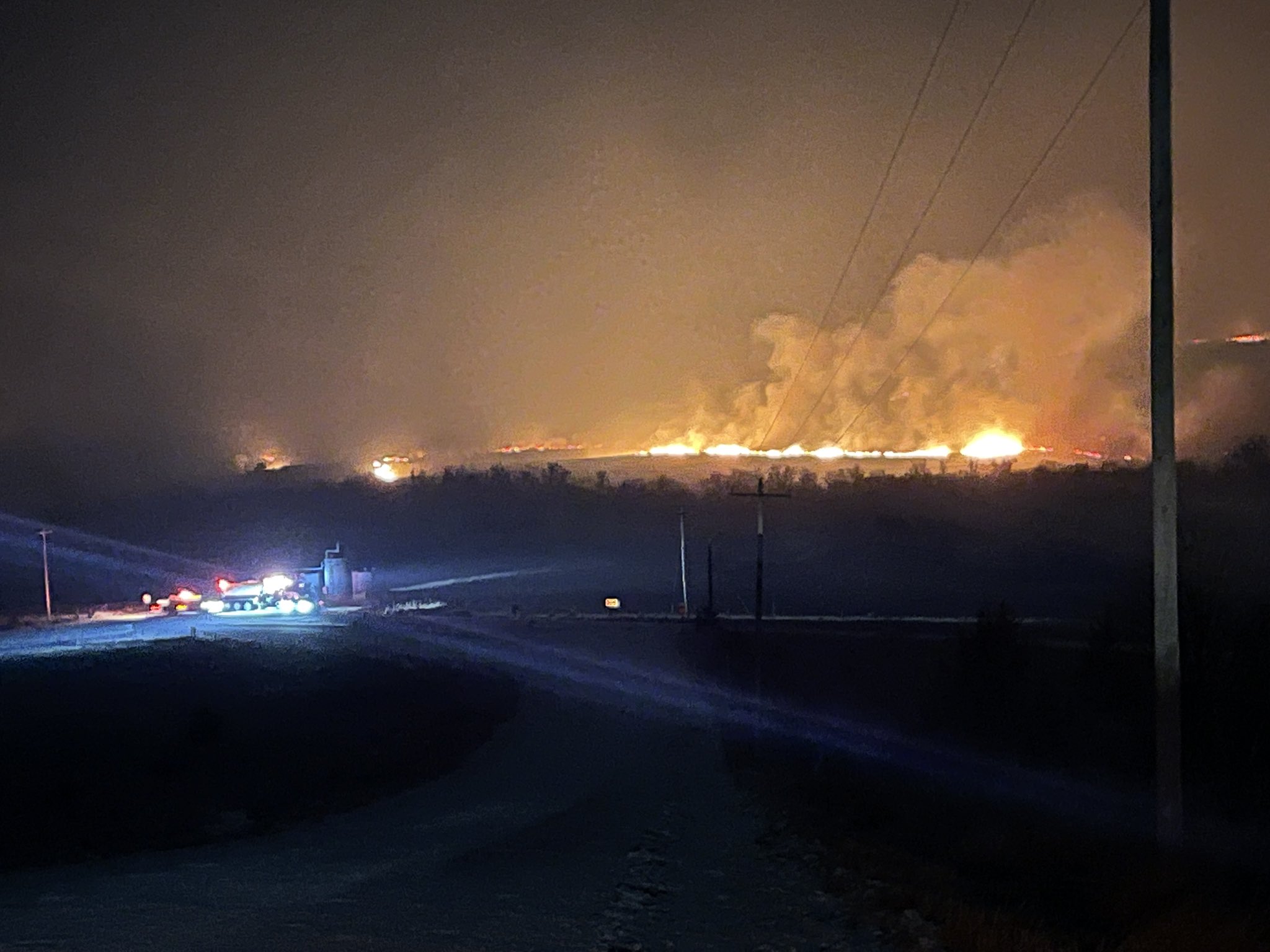
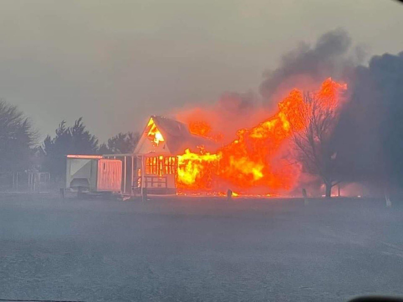
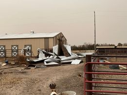
Several large wildfires developed in north central and central Kansas during the afternoon and evening in response to the 80-100 MPH non-thunderstorm wind gusts. Portions of Russell, Ellis, Osborne, and Rooks counties were impacted by the fires (please note: Rooks and Osborne counties are in our coverage area, while Ellis County is covered by NWS Dodge City and Russell County by NWS Wichita) . This overall complex of fires was dubbed the "Four Counties Fire", and according to the Kansas Forest Service, this fire alone consumed approx. 121,600 acres (including approx. 11,000 in Osborne County) . Smoke could be smelled and seen across much of Kansas and Nebraska, and was actually even observed as far away as Chicago the following morning. Unfortunately, several farms and homesteads were significantly damaged or destroyed in the Four Counties Fire.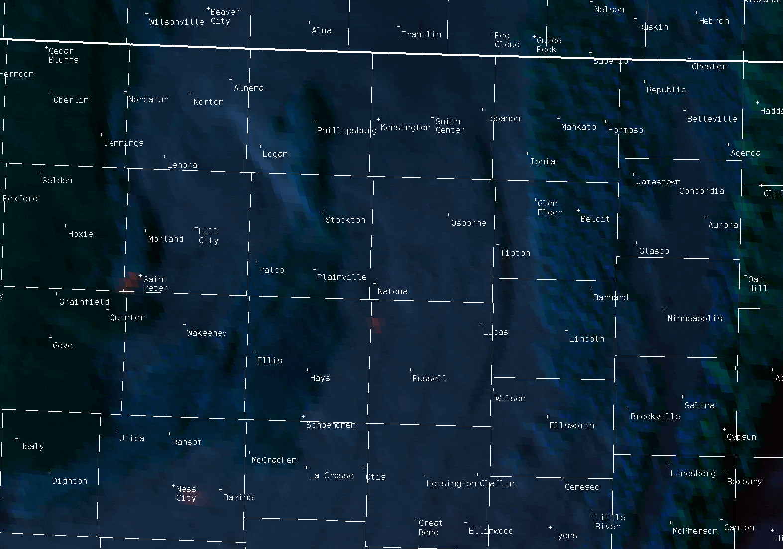 |
| This satellite imagery shows the fires exploding in intensity and size as the strong winds arrived during the afternoon-evening. |
 |
 |
| 10 S of Paradise, KS in Russell County (Eli Higgins) |
Near Natoma, KS |
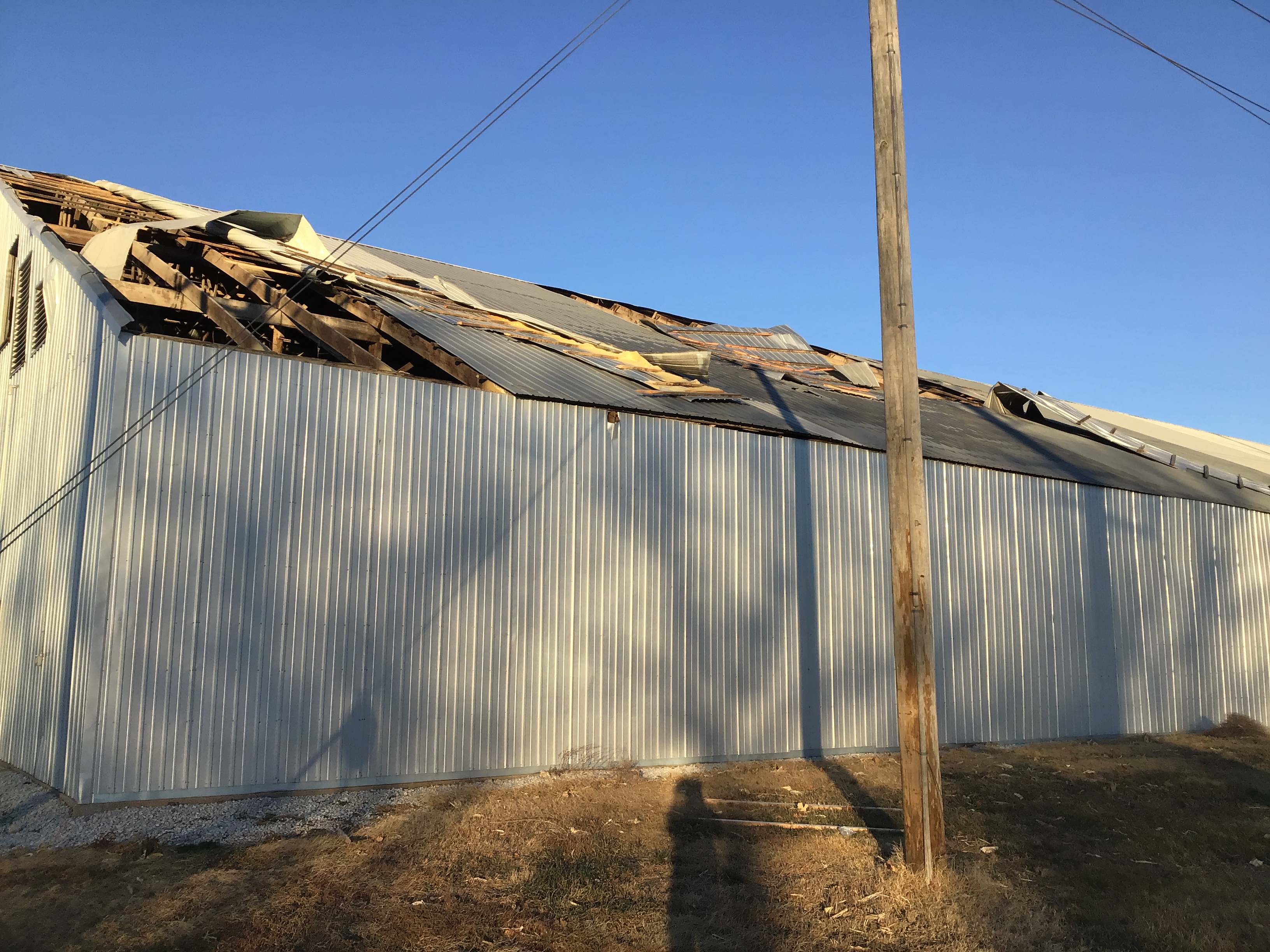
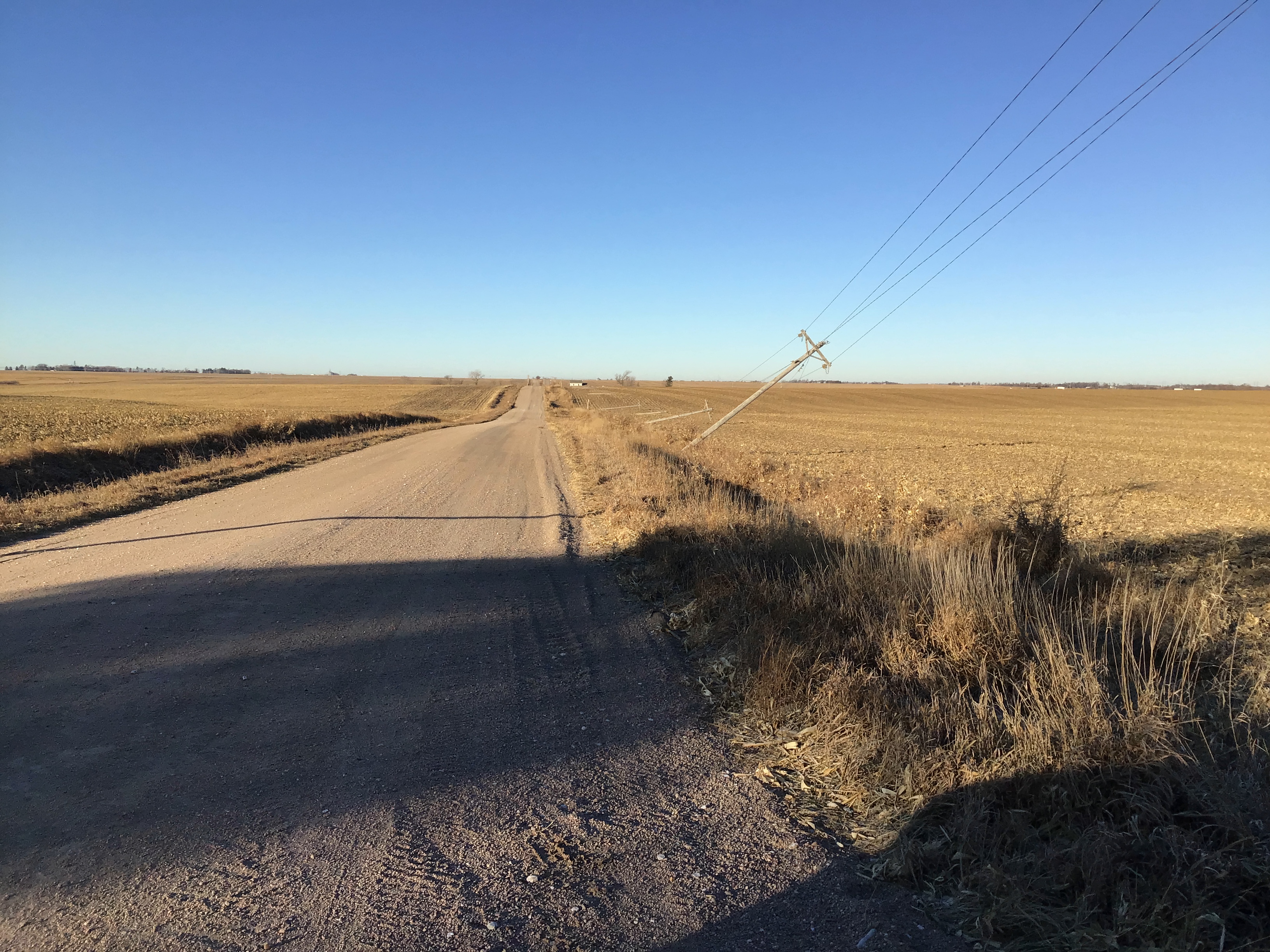
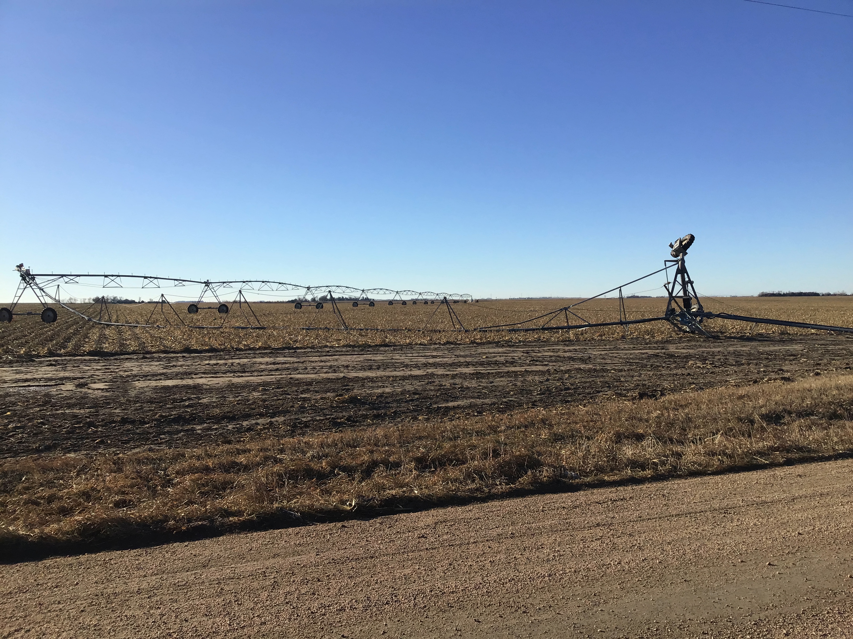
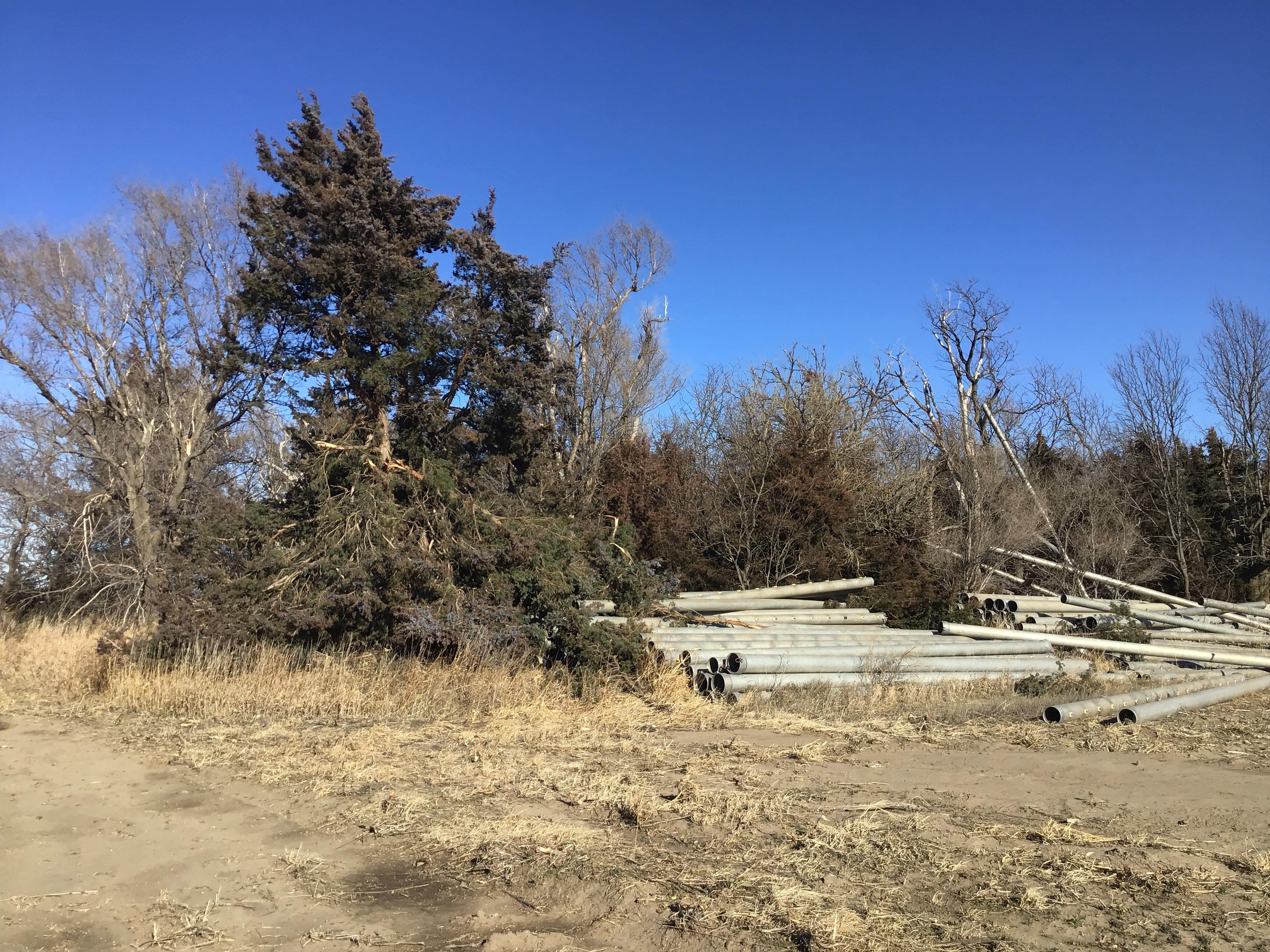
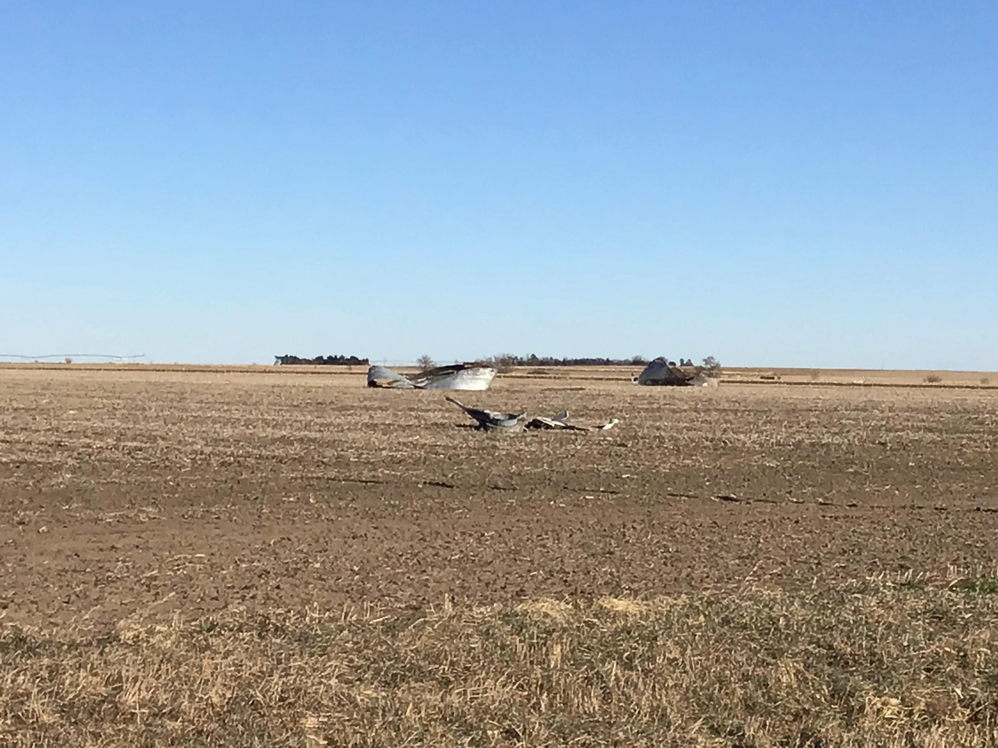
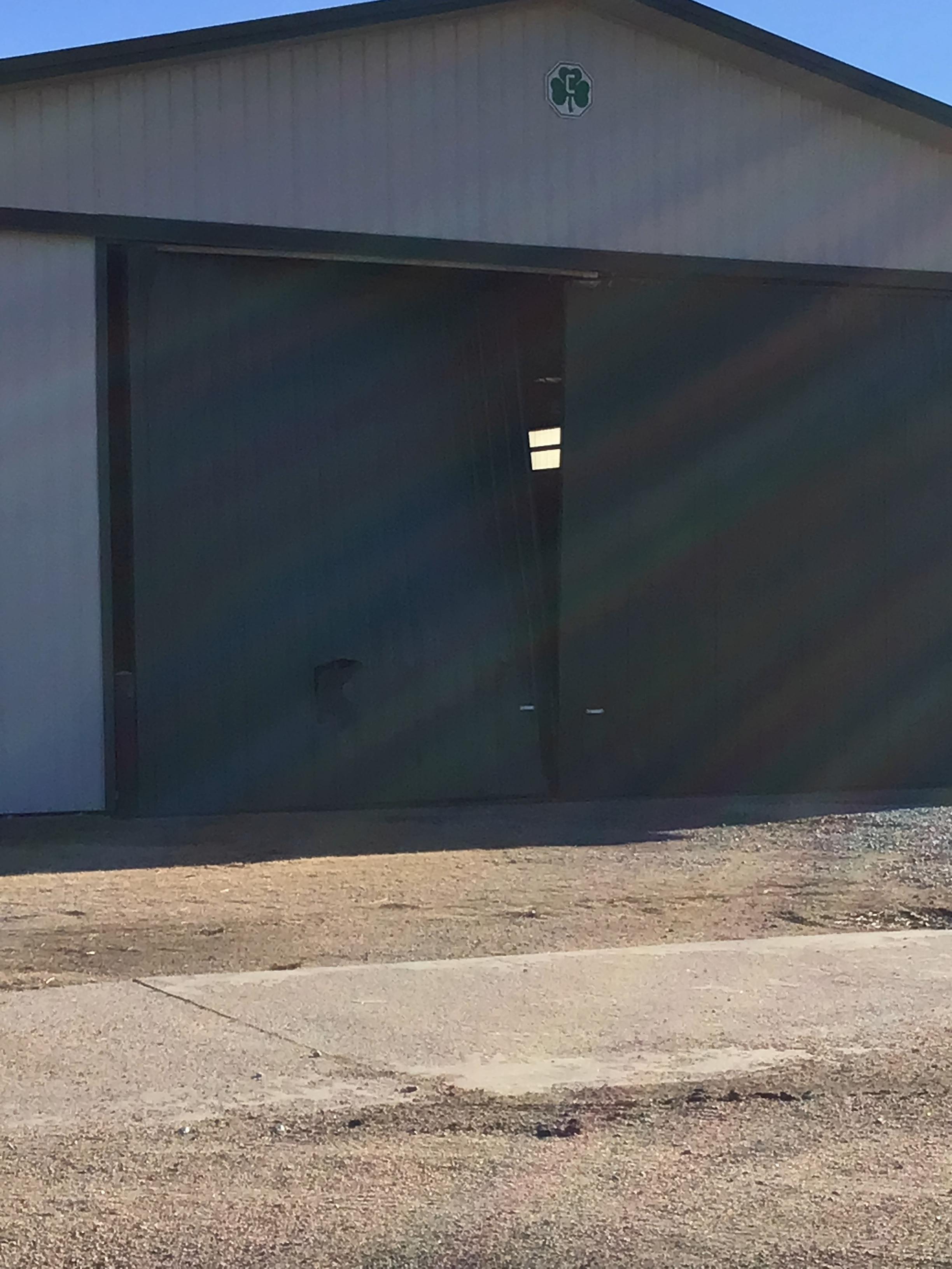
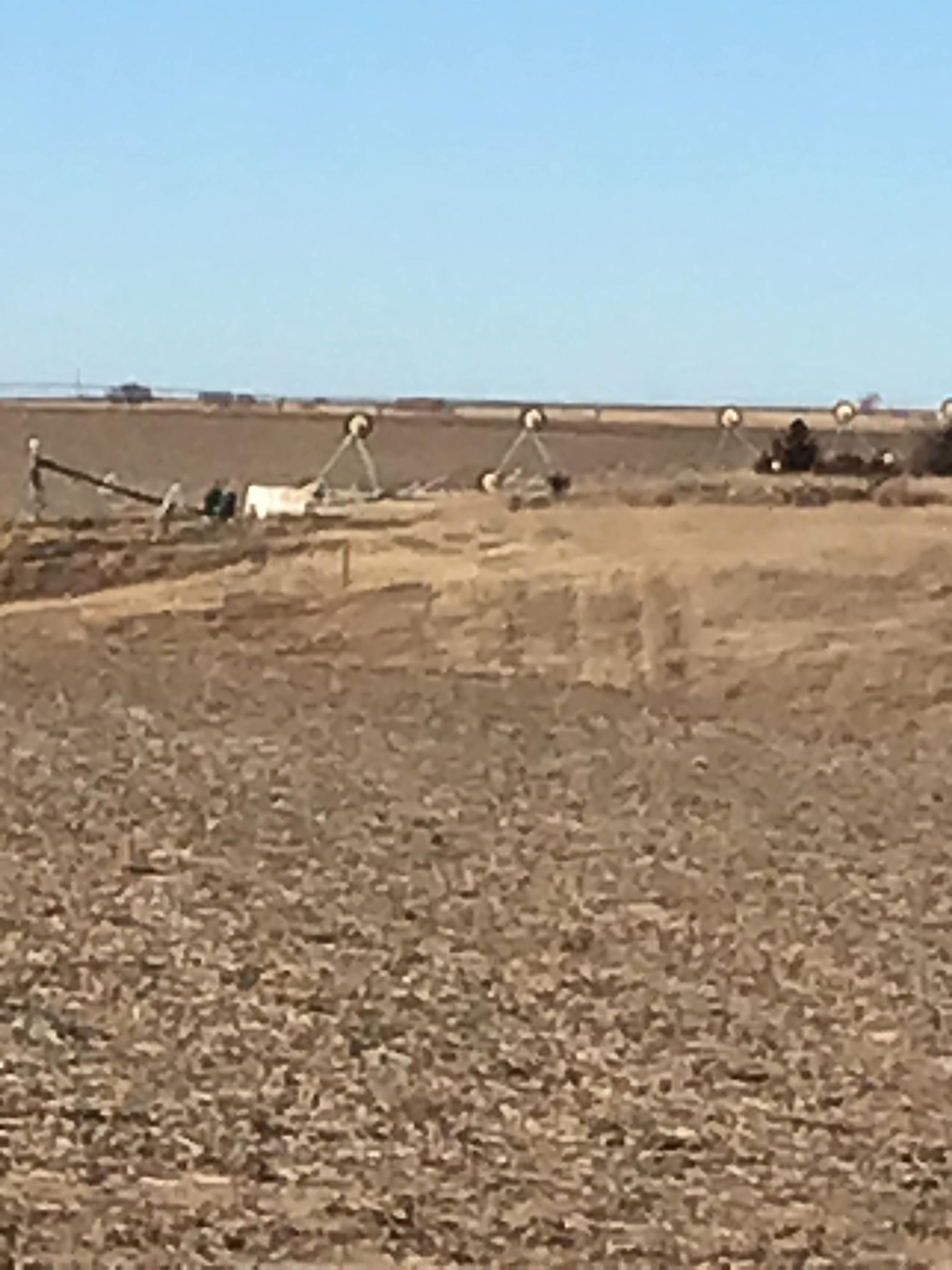
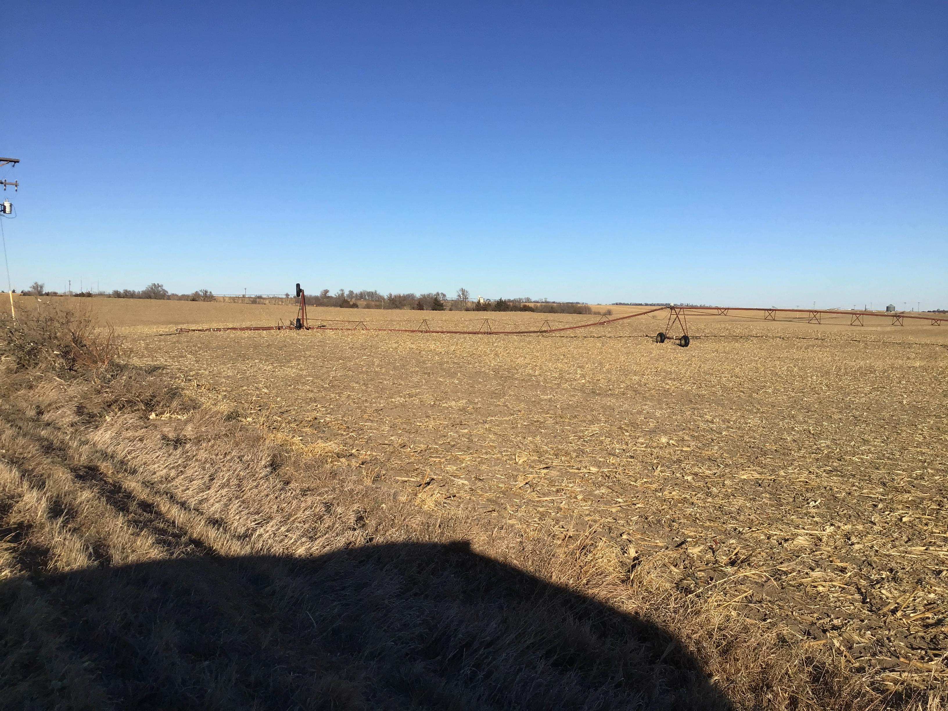
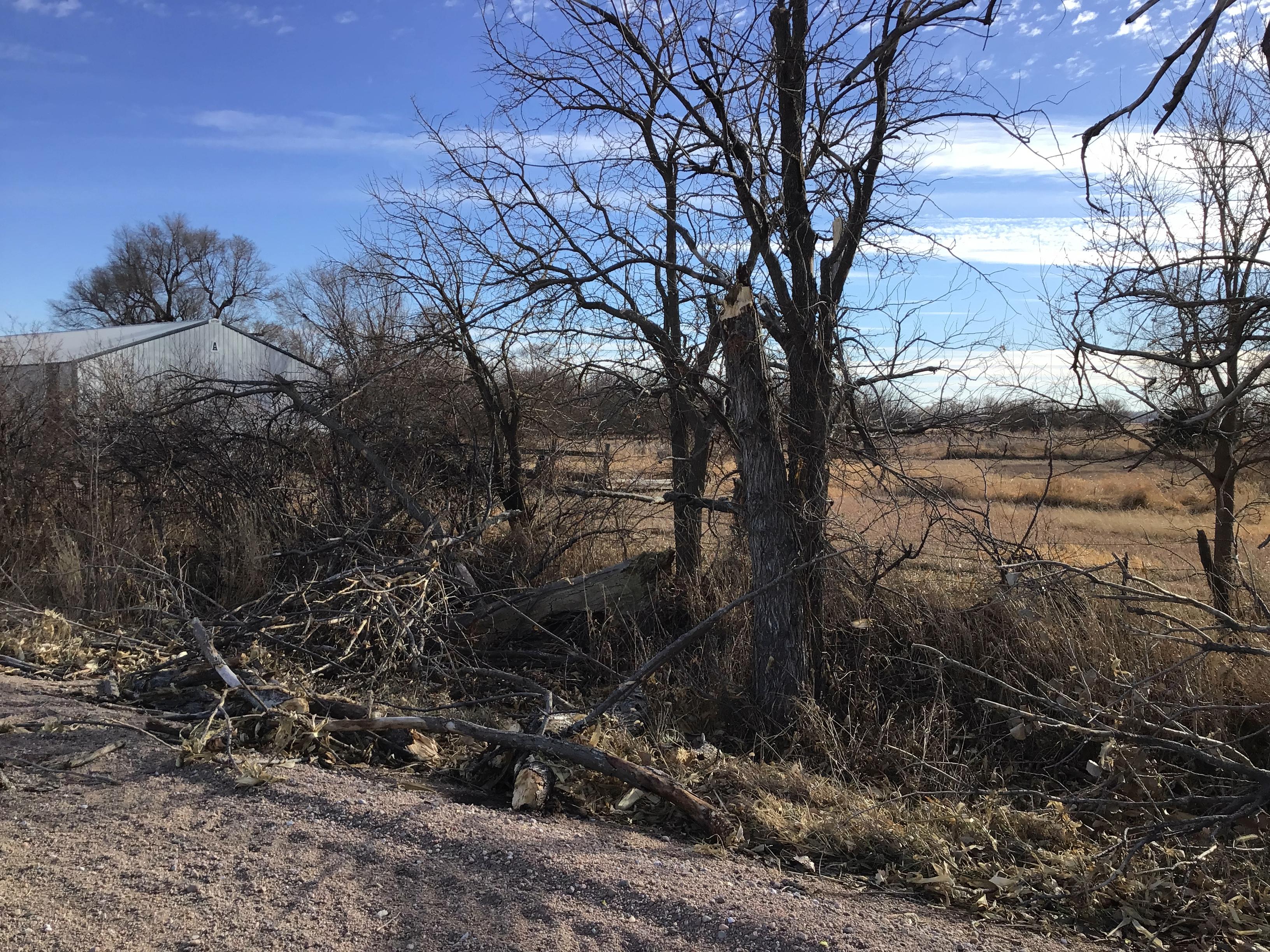
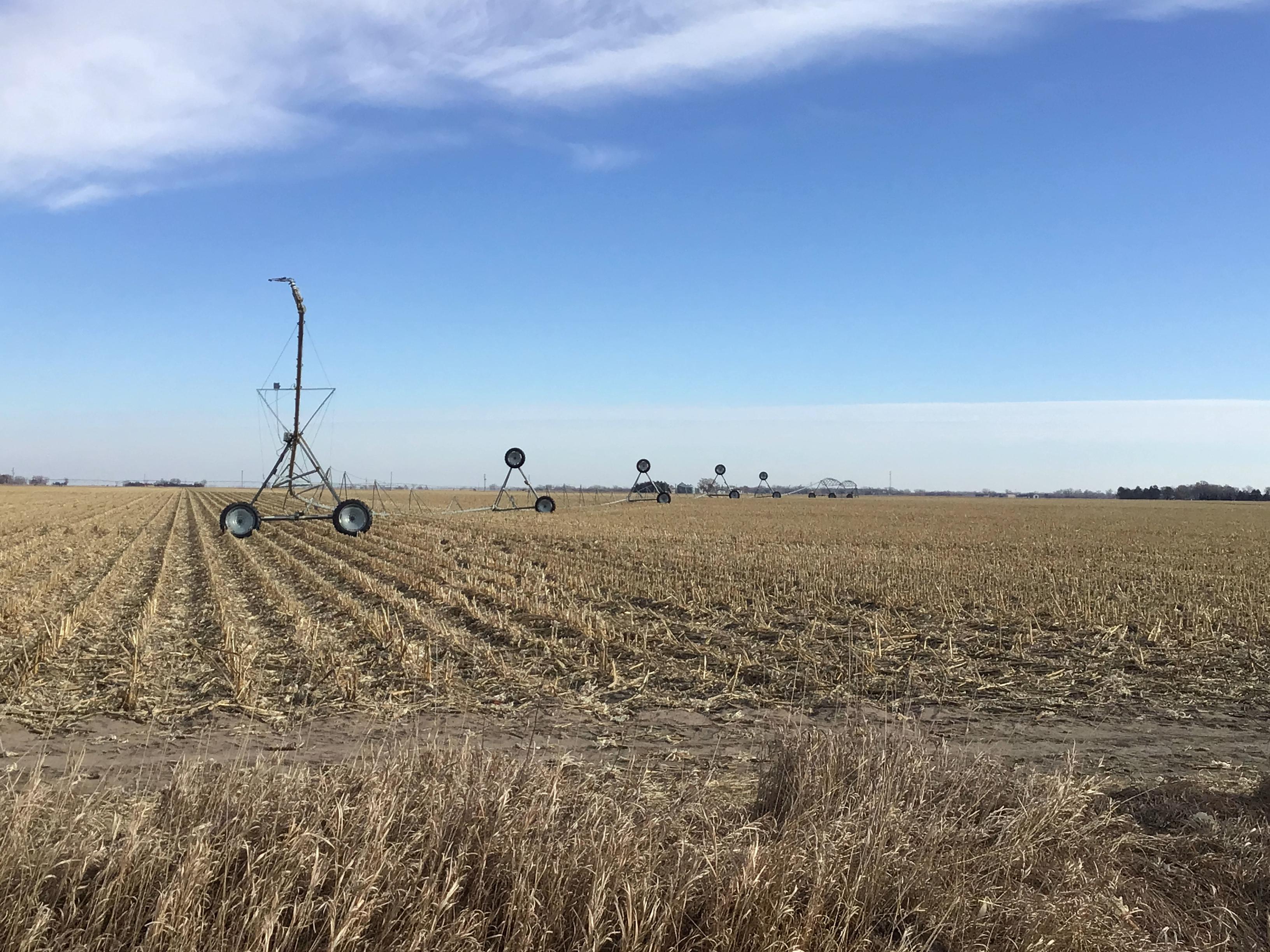
Additional Photos:
.jpg) |
 |
 |
.jpg) |
| 1 N of Fullerton (Scott Gonsior) |
3 NE of Marquette (Rick Larson) |
Giltner (Amy Lesonik) |
Gibbon (Stephen Slone) |
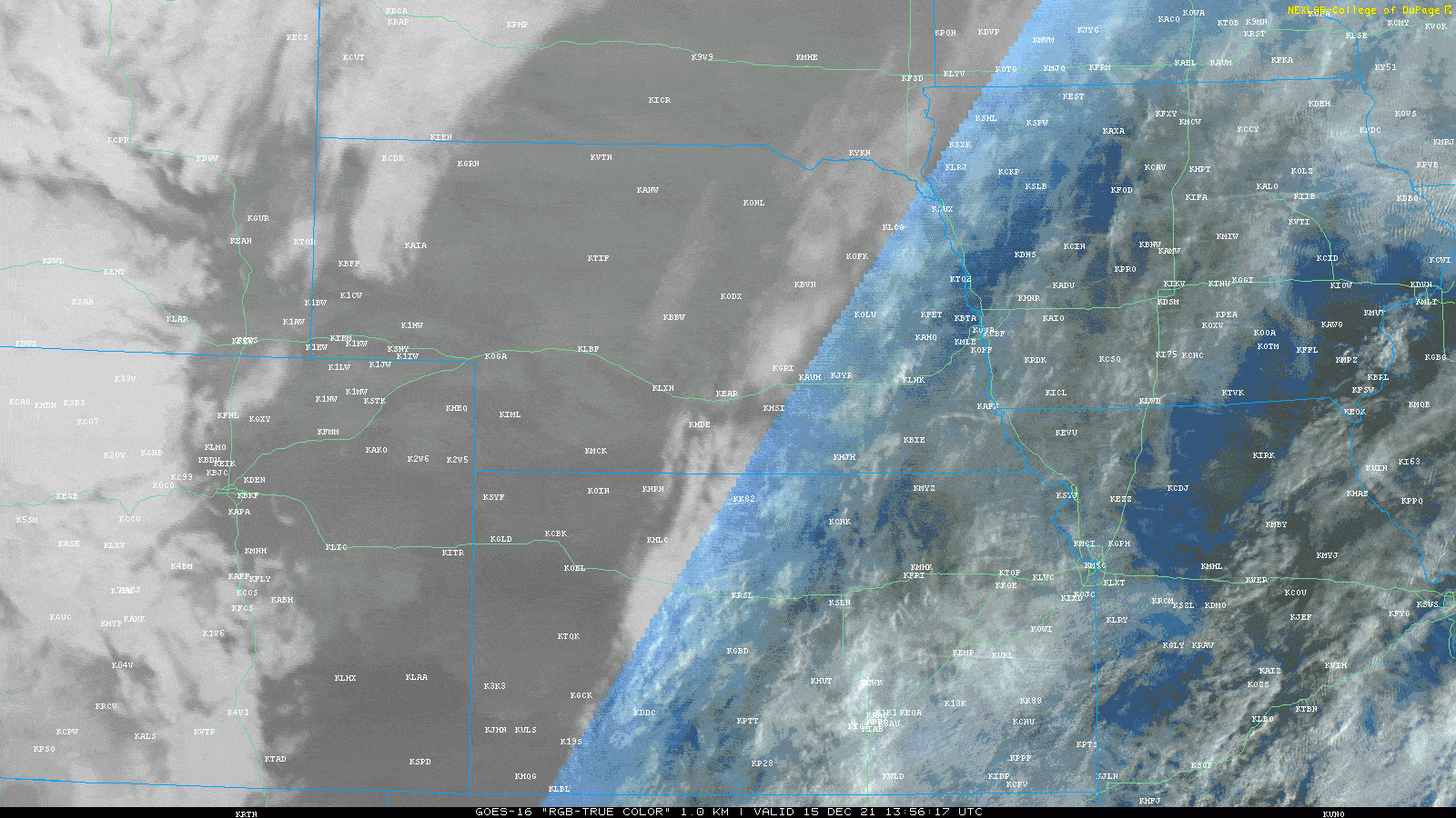
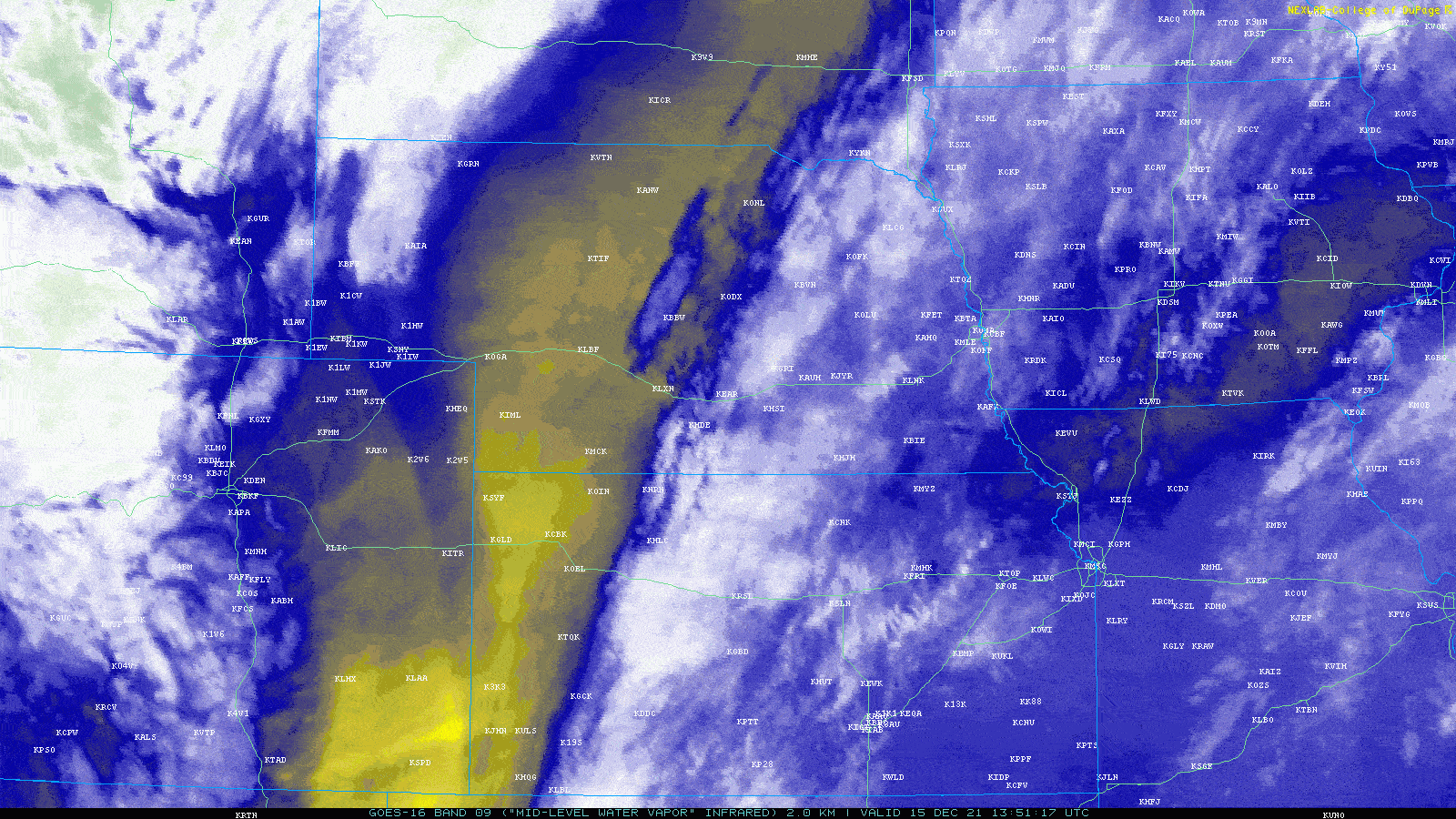
Satellite Imagery:
 |
 |
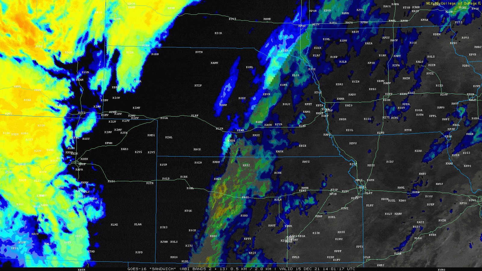 |
| True Color | Water Vapor | Day Cloud Phase |
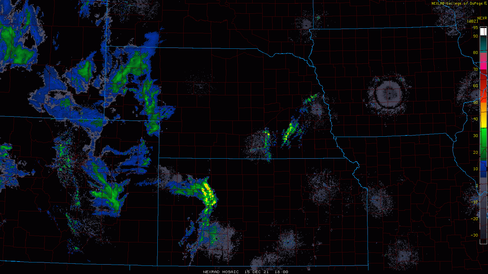
Storm Reports:

 |
Media use of NWS Web News Stories is encouraged! Please acknowledge the NWS as the source of any news information accessed from this site. |
|


