Scattered thunderstorms with severe gusts, hail and a tornado risk are possible near a cold front from the Ohio Valley to the Mid-Atlantic tonight. Tropical Storm Bertha is expected to bring tropical storm conditions to portions of the Gulf Coast from the panhandle of Florida into Louisiana through Wednesday. Read More >
Elm Creek EF-2 Tornado - June 20, 2011
|
|
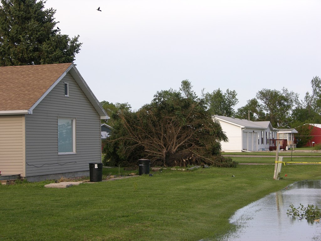
While the tornado south of Elm Creek was in the process of dissipating, a second tornado formed approximately 1 mile west of Elm Creek at 3:51 p.m. CDT. This multi-vortex tornado moved east into town, and caused widespread damage, before making a sharp turn to the north, likely lifting and touching down a number of times before dissipating approximately 4 miles north of Elm Creek at 4:07 p.m. CDT. Much of the damage occurred to treed, however several homes received damage, including major roof damage to homes in both the north and south parts of Elm Creek. Outbuildings were also destroyed in the northwest part of town. One non-life threatening injury occurred to a man whose semi-truck was tipped on its side by the tornado. The maximum wind speed of this tornado was estimated to be 120 miles per hour. |
 |
 |
 |
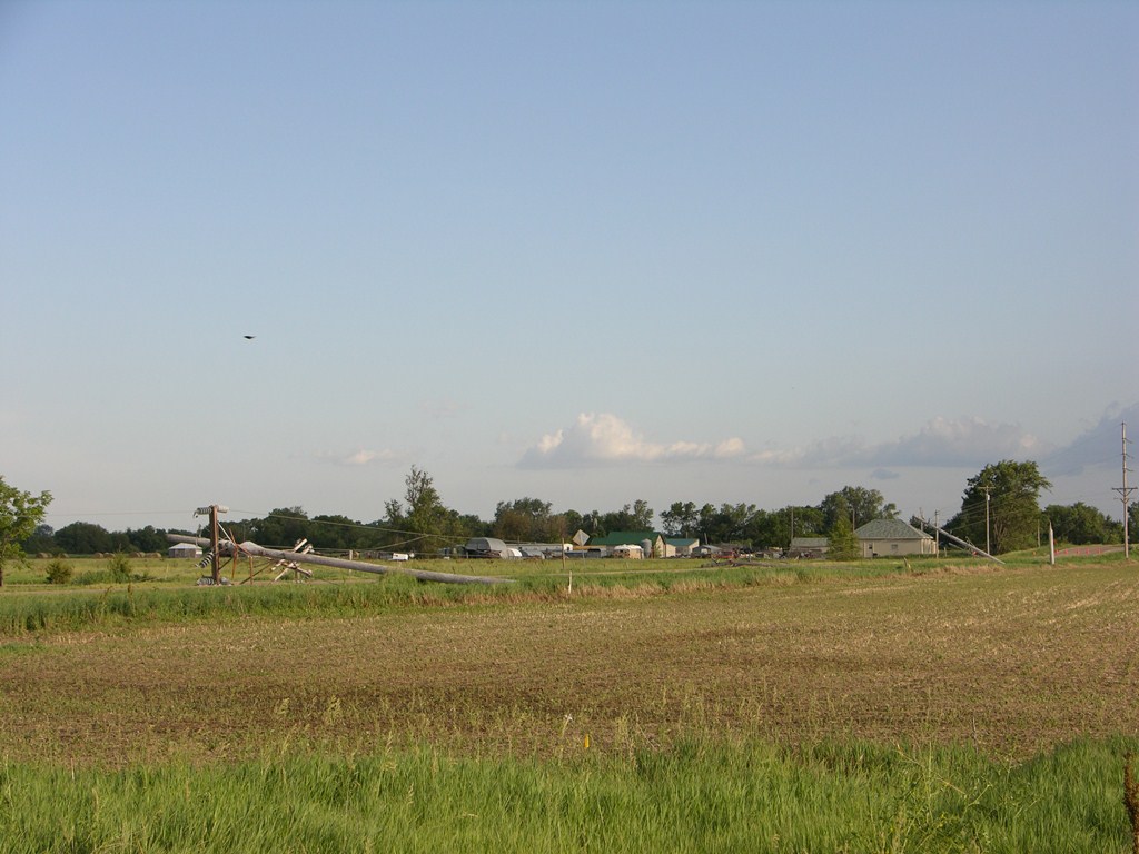
| Power poles down near Elm Creek, Nebraska. Photo by NWS staff. | Power poles snapped in half near Elm Creek, Nebraska. Photo by NWS Staff. | Large evergreen tree blown over in Elm Creek. Photo by NWS staff. |
 |
 |
 |
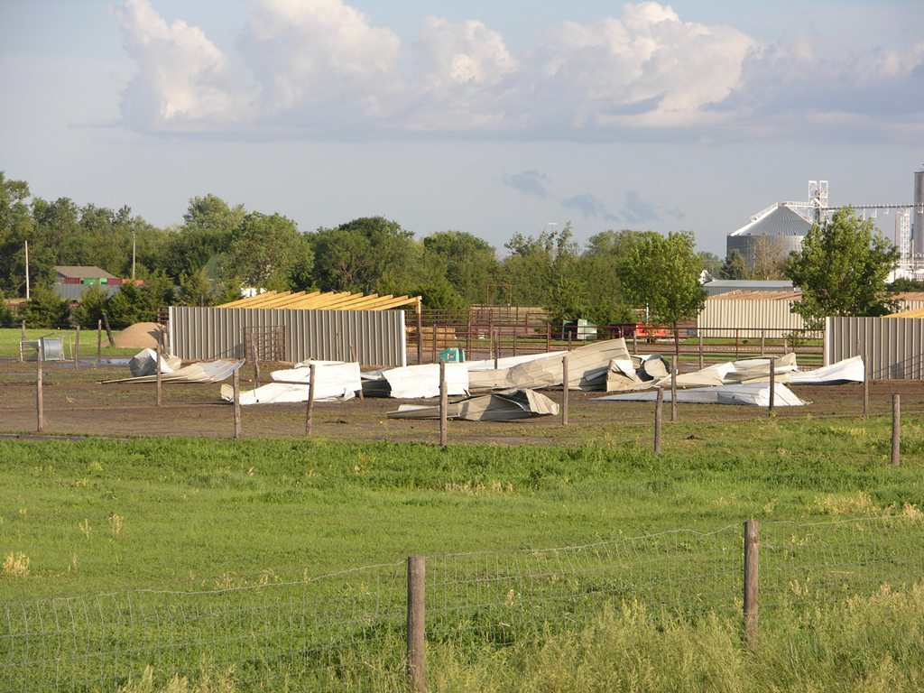
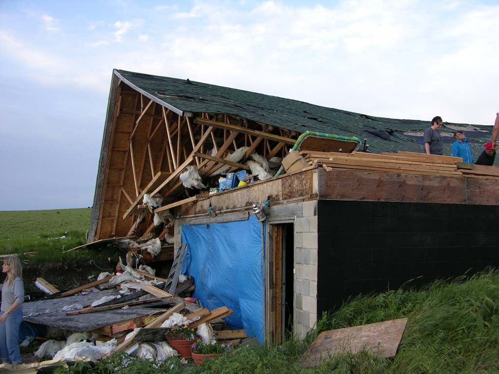
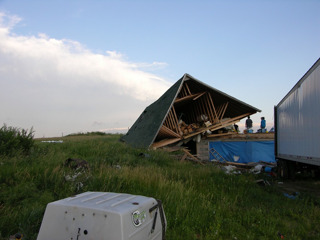
| Portions of a metal building scattered in a field. Photo by NWS Staff. |
Debris scattered in a field. Photo by NWS Staff. |
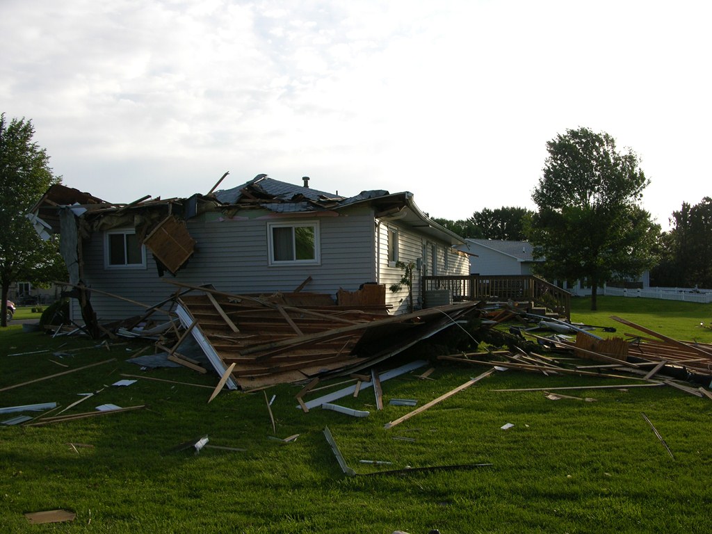
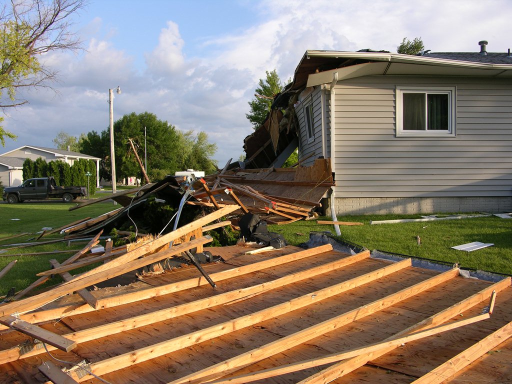
Roof blown off of residence in Elm Creek. Photo by NWS Staff. |
 |
 |
 |
| Side view of roof missing from residence. Photo taken by NWS Staff. | Debris from roof blown off of residence. Photo by NWS Staff. | Portion of roof hanging from residence. Photo by NWS Staff. |
 |
 |
 |
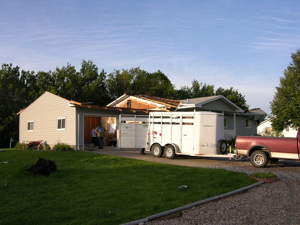
| Roof blown off of garage. Photo by NWS Staff. | House moved from foundation north of Elm Creek, Nebraska. Photo by NWS Staff. | Portion of house destroyed by tornado. Photo by NWS Staff. |
 |
 |
 |
| Roof blown completely off of house. Photo by NWS Staff. | Another view of roof blown off of house. Photo by NWS Staff. | Roof from house destroyed by tornado. Photo by NWS Staff. |
|
|
This page was composed by the staff at the National Weather Service in Hastings, Nebraska. |  |