
A significant heat wave is underway for the Intermountain West, Northern Plains, and Upper Great Lakes, peaking in intensity through midweek and lingering across parts of the Northern Plains and Midwest until this weekend. In southwest Texas, excessive rainfall may bring a risk for potentially life-threatening flash and arroyo flooding through Thursday. Read More >
Overview
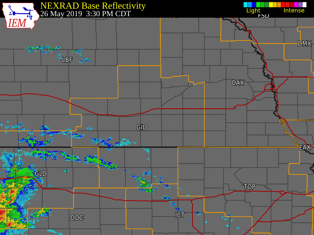
The days surrounding (and including) Memorial Day 2019 will be remembered as a particularly stormy and wet period, featuring multiple rounds of rain and severe weather within the NWS Hastings coverage area. Sunday (May 26) saw widespread rain with embedded lines of thunderstorms. These storms primarily produced very heavy rainfall amounts of 2-4", which caused areas of flooding in lowlands, rivers and streams. However, two brief tornadoes also developed, one during the evening near Upland, NE (Franklin County) and the second one near Tipton, KS (Mitchell County) on the very early AM of the 27th. The tornado near Upland was rated EF-1 and the tornado near Tipton, KS was rated EF-0. Both tornadoes caused damage to residences and outbuildings/garages. Behind the line of storms, a wake low developed in north central KS which produced wind gusts up to 70 mph that downed trees and damaged a carport.
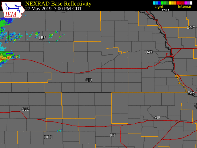
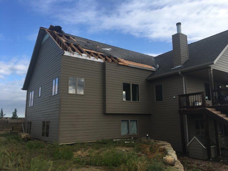
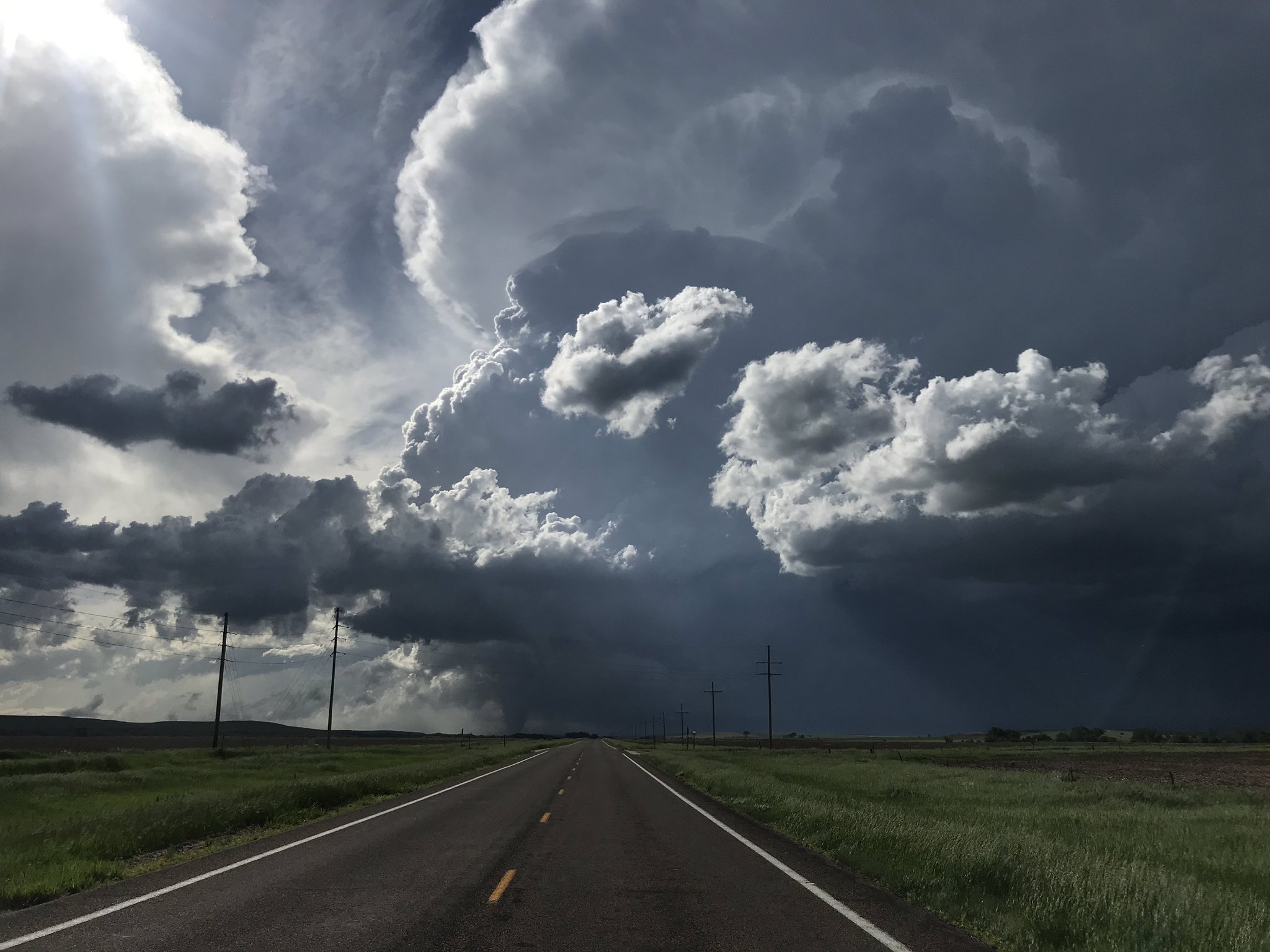
On Memorial Day (May 27), thunderstorms redeveloped during the evening, producing another round of heavy rain and severe weather, including a brief tornado in Superior (Nuckolls County). This weak tornado, rated EF-0, destroyed a detached garage and damaged a nearby fence and trees. The following day (Tuesday the 28th) featured intense supercell storm development along a sharp warm front in north central KS. One of these storms produced the most intense tornado of all three days within our local area, an EF-2 that first touched down in extreme northern Russell County (near Waldo) before tracking northeast for 22 miles across rural portions of southeastern Osborne and southwestern Mitchell counties before lifting near Tipton. The tornado was witnessed by several storm chasers, county officials and local residents. It caused damage at primarily three farmsteads, including: destroying a grain bin and several outbuildings.
See below for more details regarding each of the aforementioned tornadoes, including path maps, damage photos etc.
 |
 |
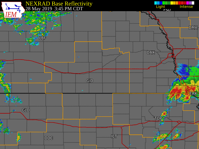 |
| Radar Loop: 3:30 PM May 26th - 7:00 AM May 27th | Radar Loop: 7:00 PM May 27th - 6:00 AM May 28th | Radar Loop: 3:45 PM - 11:00 PM May 28th |
Tornadoes:
|
|
||||||||||
|
||||||||||
|
Tornado #1 - Near Upland
Track Map 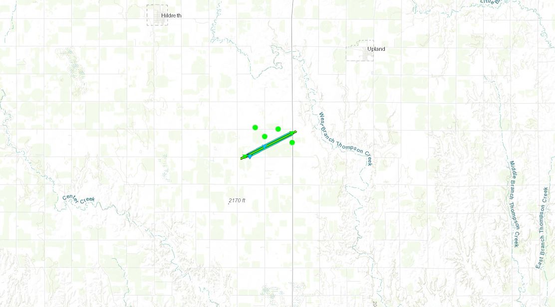  |
||||||||||||||||
|
Tornado #2 - Near Tipton
Track Map 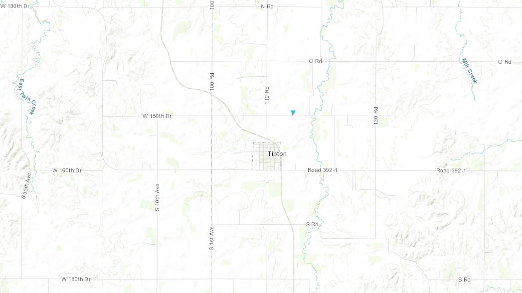 |
||||||||||||||||
|
Tornado #3 - Superior
Track Map 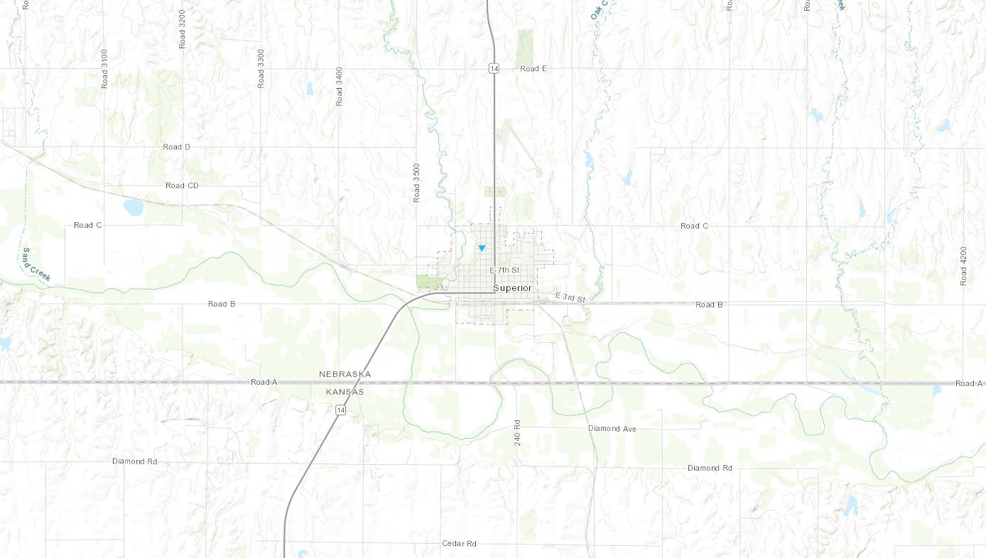 |
||||||||||||||||
|
Tornado #4 - Waldo/Tipton
Track Map 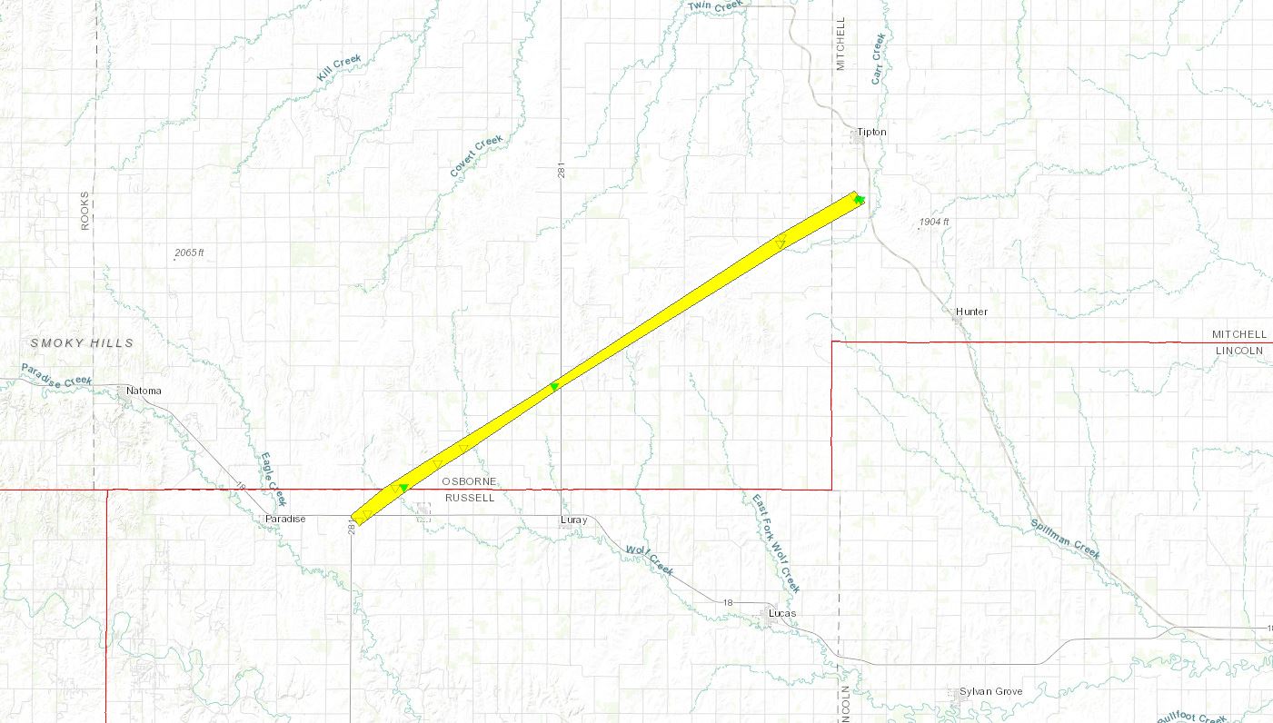 |
||||||||||||||||
The Enhanced Fujita (EF) Scale classifies tornadoes into the following categories:
| EF0 Weak 65-85 mph |
EF1 Moderate 86-110 mph |
EF2 Significant 111-135 mph |
EF3 Severe 136-165 mph |
EF4 Extreme 166-200 mph |
EF5 Catastrophic 200+ mph |
 |
|||||
Photos
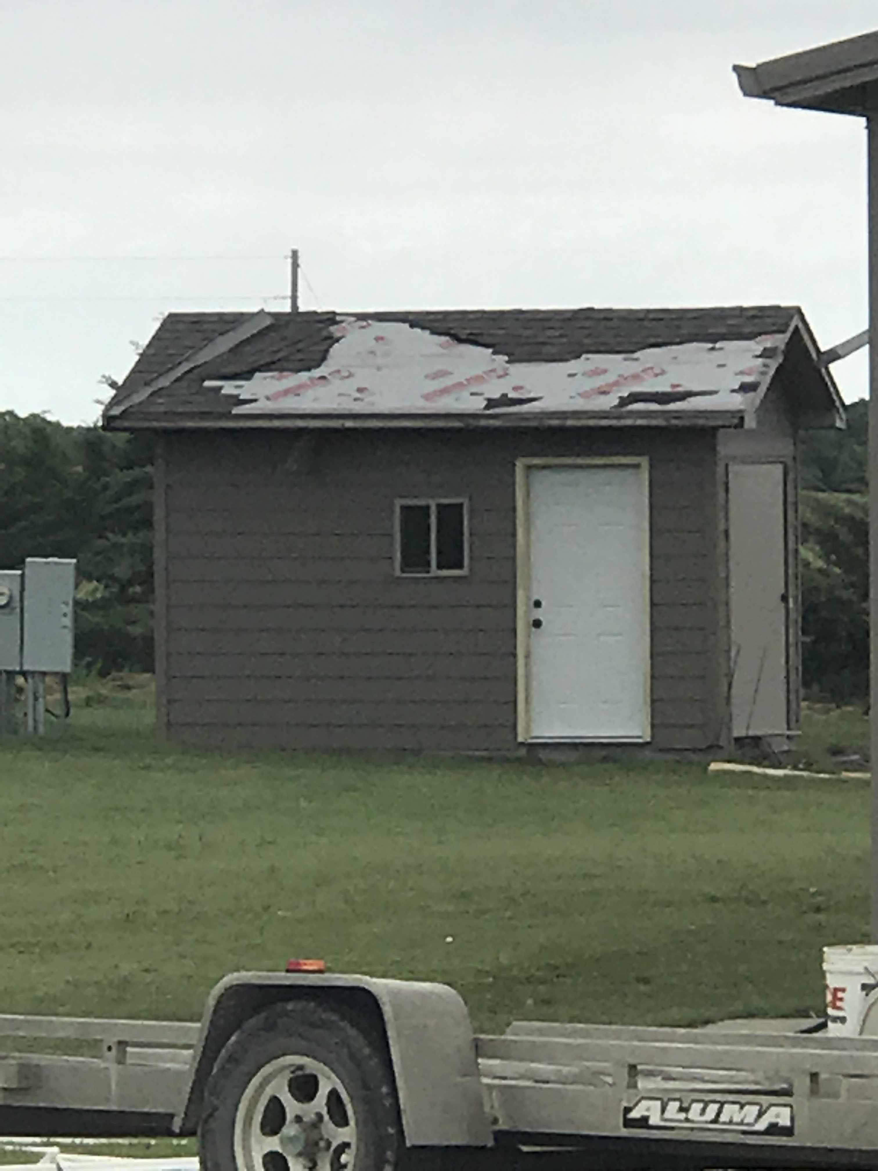
Upland Tornado (Franklin County) May 26, 2019
 |
 |
 |
 |
| Debris tossed by tornado Photo by NWS Hastings |
Destroyed garage Photo by NWS Hastings |
Debris and tree damage Photo by NWS Hastings |
Building damage Photo by NWS Hastings |
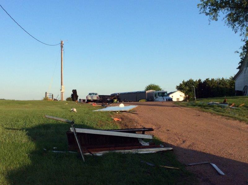
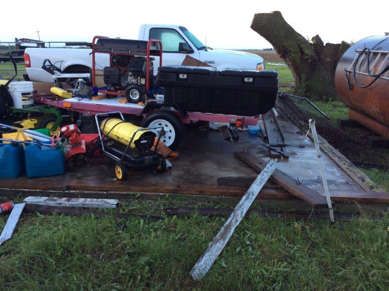
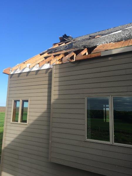
Tipton Tornado (Mitchell County, KS) May 27, 2019
 |
 |
 |
 |
| Trailer displaced by tornado Photo by Rick Horn |
House damage from tornado Photo by Rick Horn |
Roof damage from tornado Photo by Rick Horn |
Roof damage from tornado Photo by Rick Horn |
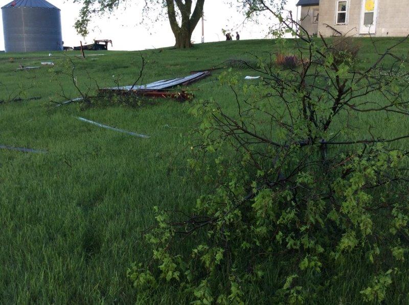
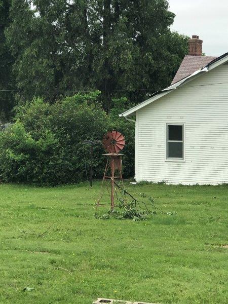
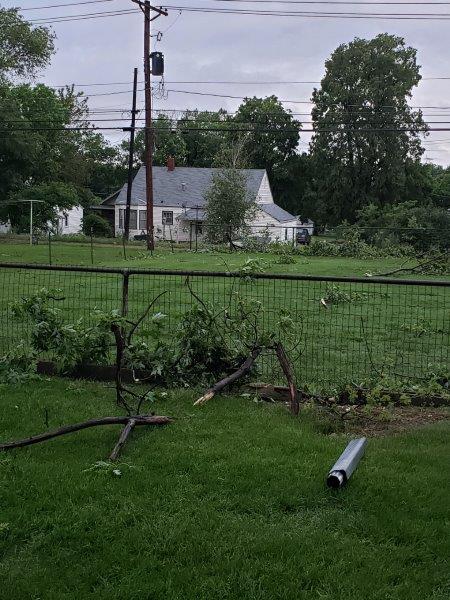
Superior Tornado (Nuckolls County) May 27, 2019
 |
 |
 |
 |
|
Garage destroyed |
Branch wedged into windmill Photo by Nick Elledge |
Tree branch lofted into powerlines Photo by Nick Elledge |
Broken tree branches & debris Photo by Nick Elledge |
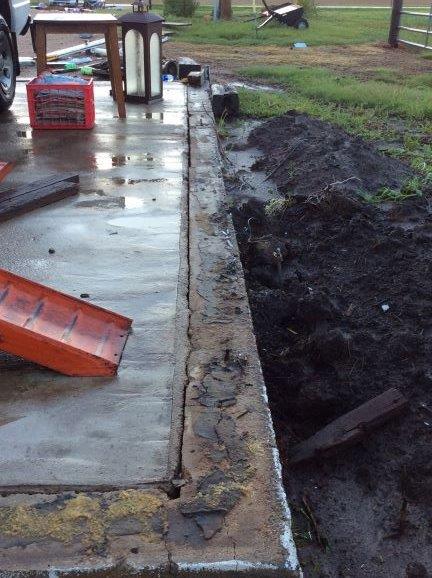
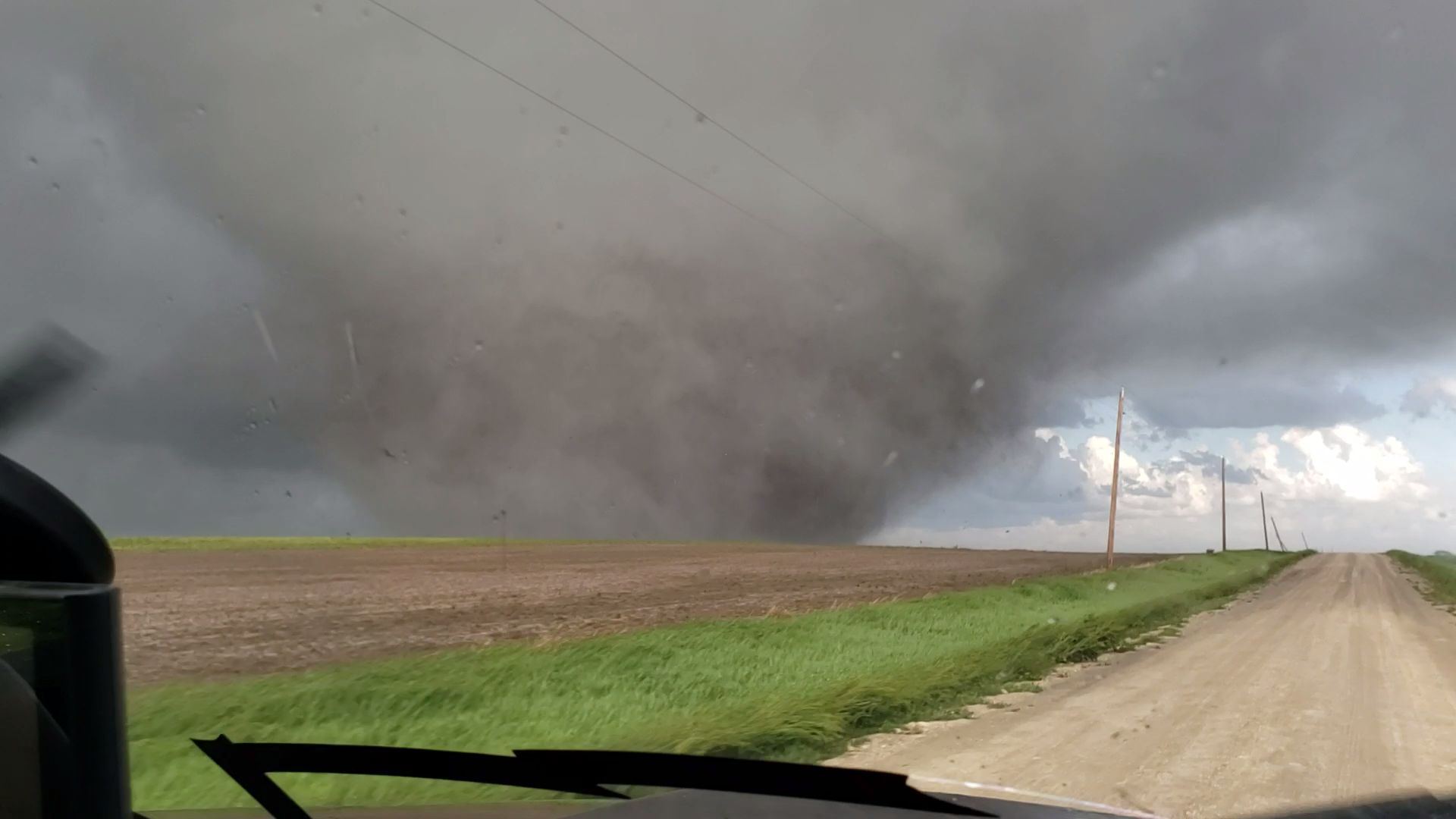
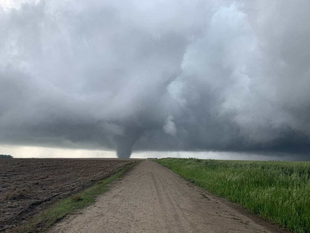
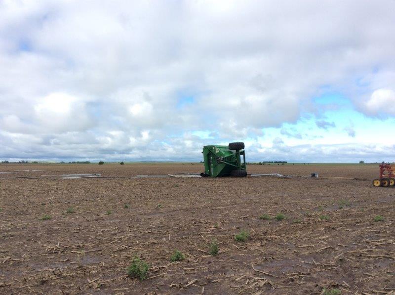
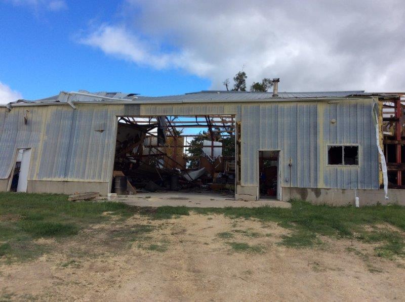
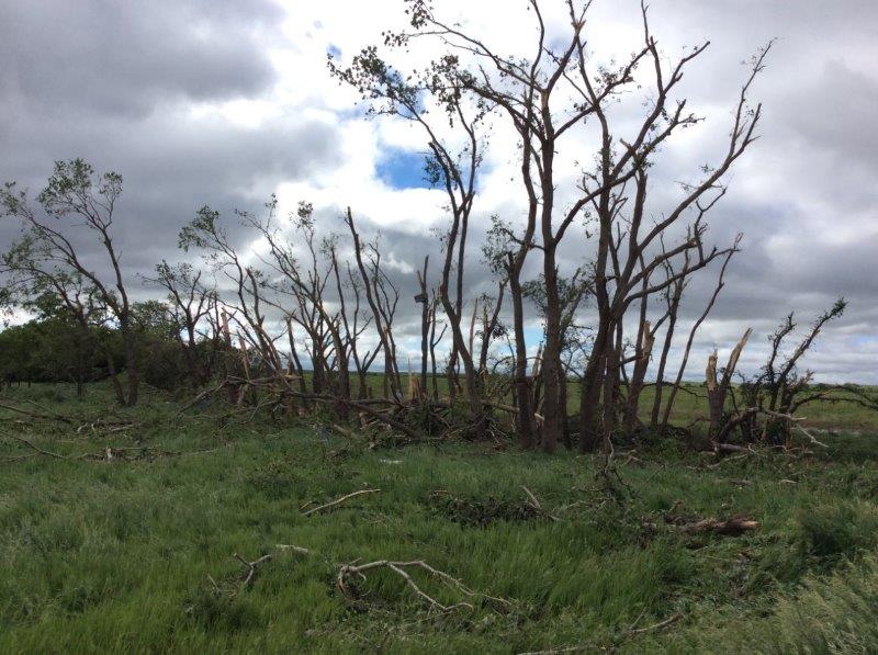
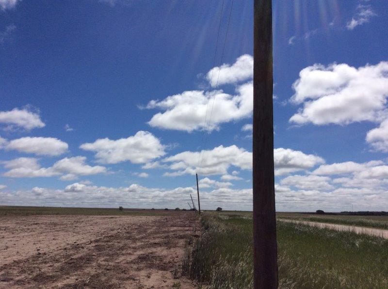
Tipton/Waldo Tornado (Osborne, Mitchell Counties, KS) May 28, 2019
 |
 |
 |
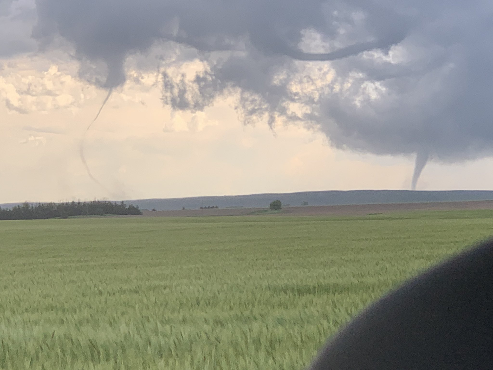 |
| Tornado near Luray, KS Photo by Connor McCrorey |
Tornado near Paradise, KS Photo by Braydon Morisseau |
Tornado near Tipton, KS Photo by Matt Coker |
Tornado near Tipton, KS Photo by Peyton Capute |
 |
 |
 |
 |
| Overturned grain cart, 2S Tipton Photo by NWS Hastings |
Damaged outbuilding, 5SW Tipton Photo by NWS Hastings |
Tree damage 5SW Tipton Photo by NWS Hastings |
Power line damage 1NW Waldo Photo by NWS Hastings |
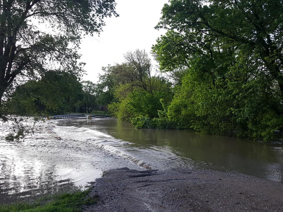
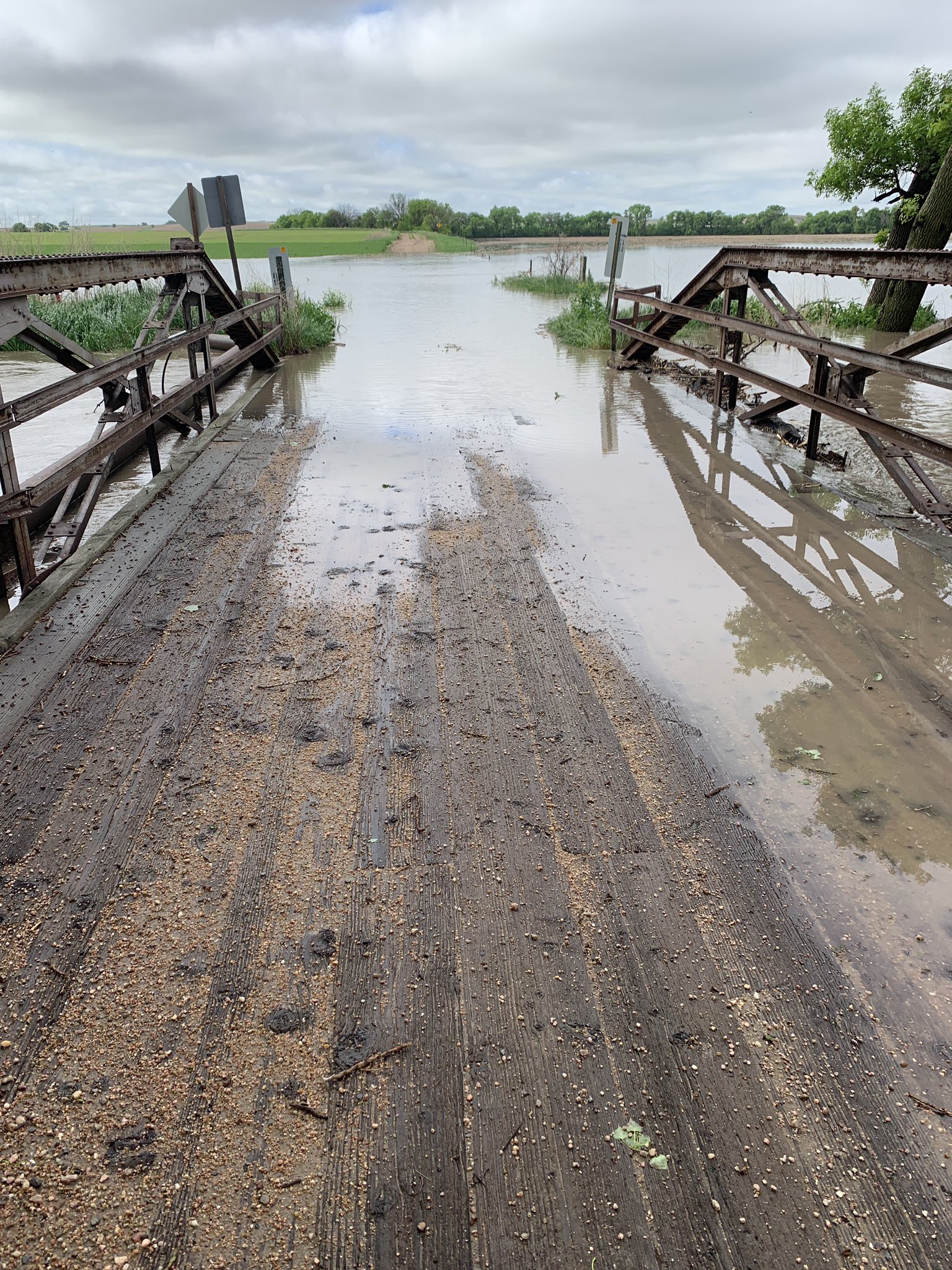
Flooding
 |
_Lexington%20Clipper-Herald_May28.jpg) |
 |
 |
| Camp Katari near McCool Junction Photo by Steve Green |
Jay Bros Truck Stop at I-80 Overton Exit Photo by Lexington Clipper-Herald |
Prairie Dog Creek Photo by Todd Christensen |
School Creek in Sutton Photo by Clay County News |
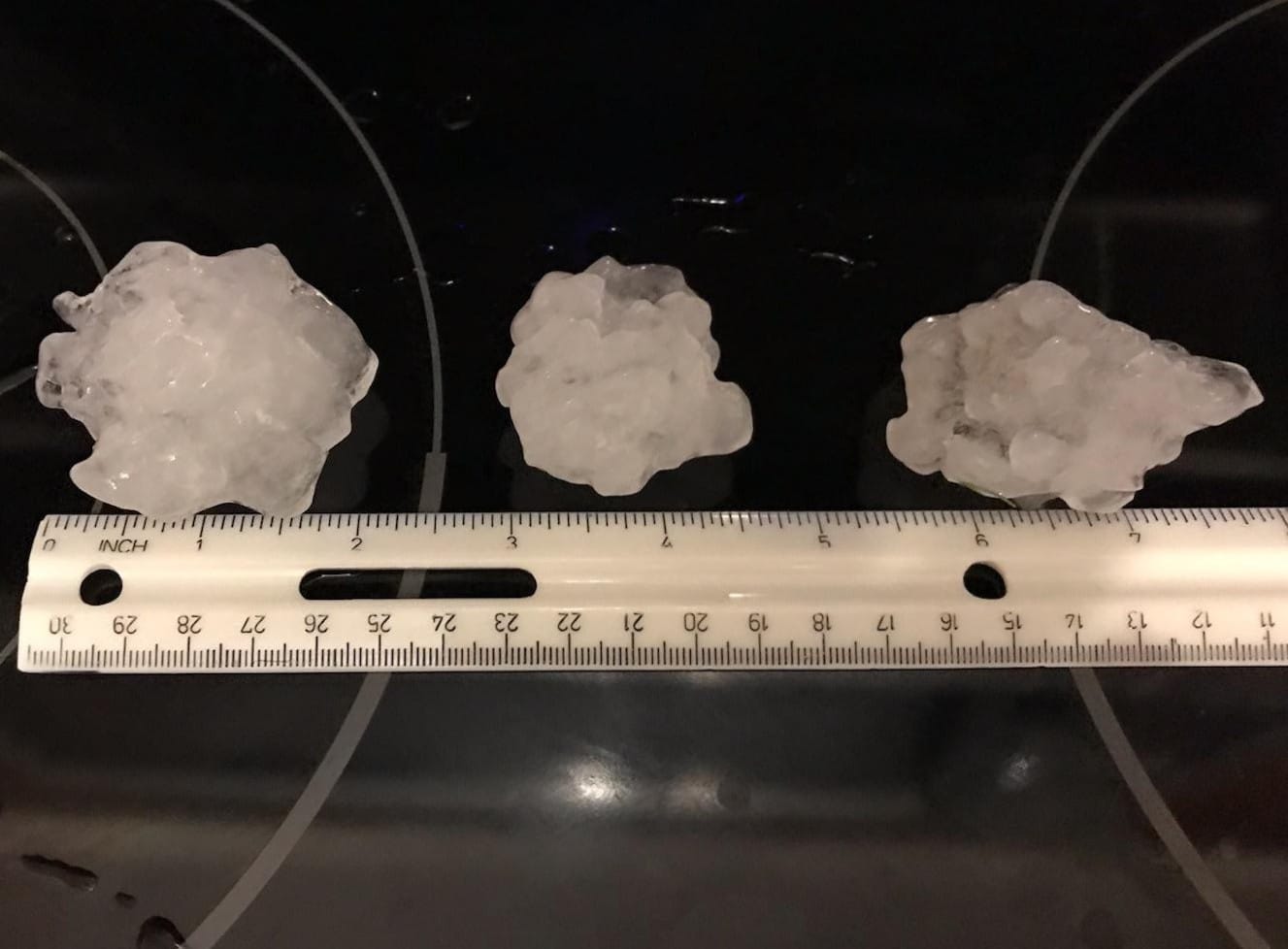
Hail
 |
 |
 |
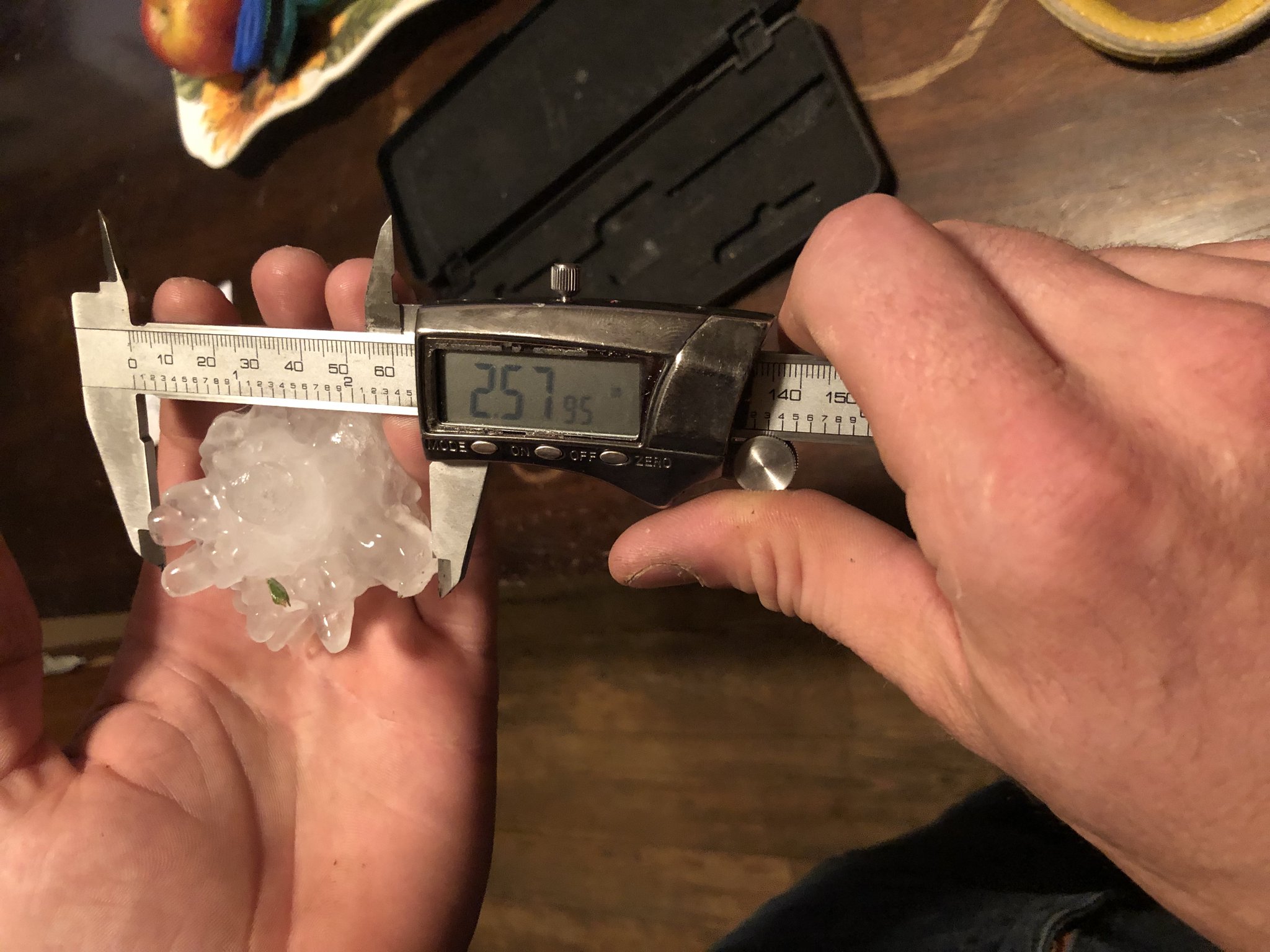 |
| Aurora - May 23rd Photo by @sRugan |
Minden - May 24th Photo by Tim Reith |
Kearney - May 27th Photo by Ashley Weesner |
North of Zurich, KS - May 27th Photo by Joe Hageman |
Storm Reports
Below is an image of all of the storm reports across the area from May 26th through May 28th. Clicking on the image will take you to a new web page where more detailed information about each report can be found. Following the image is a table of a few of the more notable non-tornado storm reports that were received.
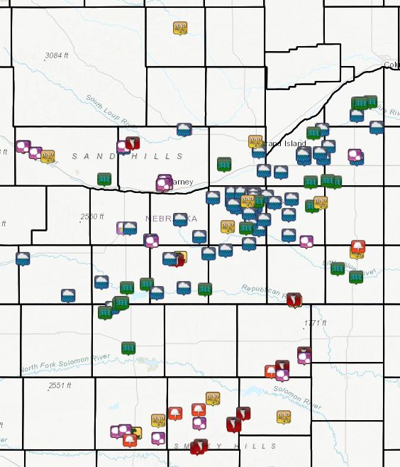 |
| Local Storm Reports From May 26-28th. Click On Image For More Detailed Information. |
| Location | Report | Date |
| 3 E Codell, KS | 3.0" Hail | 5/28/19 |
| 1 NNW Zurich, KS | 2.50" Hail (tennis ball) | 5/27/19 |
| 2 NNE Kearney, NE | 2.0" Hail (hen egg) | 5/27/19 |
| Gothenburg | 1.75" Hail (golf ball) | 5/27/19 |
| Willow Island | 1.75" Hail (golf ball) | 5/27/19 |
| 2 SSW Bruning | 65 mph Wind Gust | 5/27/19 |
Rainfall
The image below shows an estimation of the rainfall that occurred across the area over a 7-day period, ending Wednesday morning, May 29th. See the photos tab for an idea of the flooding that affected portions of the area.
Sources for the rainfall map: NCEP Stage IV Precipitation Analysis & National Weather Service AHPS
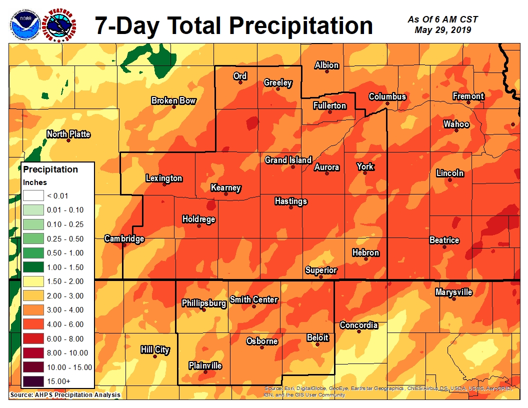 |
| 7-day Precipitation Map Ending Wednesday Morning, May 29th. Click on image for larger version. |
 |
Media use of NWS Web News Stories is encouraged! Please acknowledge the NWS as the source of any news information accessed from this site. |
|

