
Cooler and less humid conditions for the eastern third of the nation as a cold slides off the east coast. Combination of dry and breezy conditions may result in spread of wildfires across the lower Mississippi Valley. In addition, fire weather conditions linger into portions of Southern California. For Guam, a super typhoon is approaching. Read More >
Grand Junction, CO
Weather Forecast Office
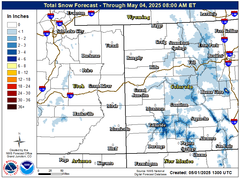
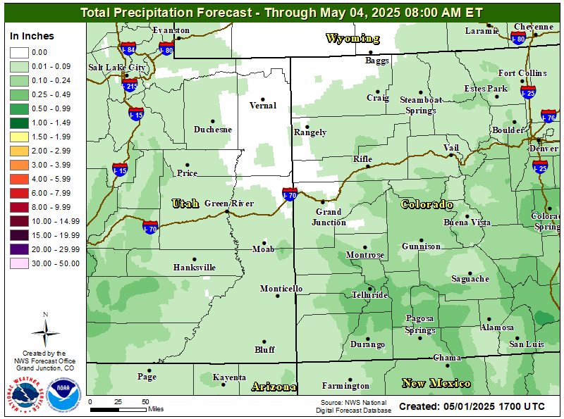
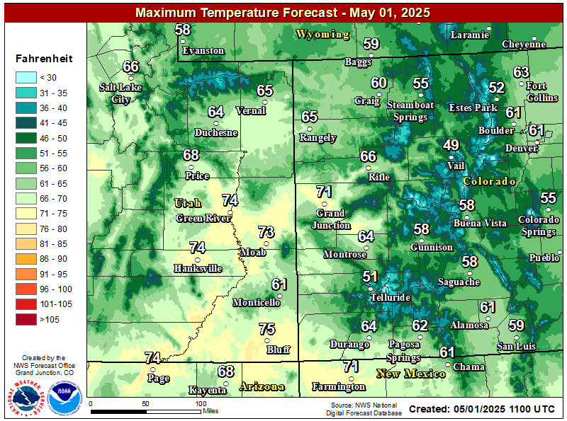
High pressure will build over the Great Basin bringing drier conditions to eastern Utah and western Colorado through the weekend. High temperatures will warm back to near normal by Sunday.
Due to the recent weather conditions several mountains have been experiencing increased avalanche activity, and several main highways have closed for extended periods of time. Stay up to date with the latest road conditions and avalanche forecasts found below.
Colorado Department of Transportation Travel Information
Colorado Avalanche Information Center
Forecast Snowfall Accumulation
Forecast Precipitation Accumulation
Today's Forecast High Temperatures
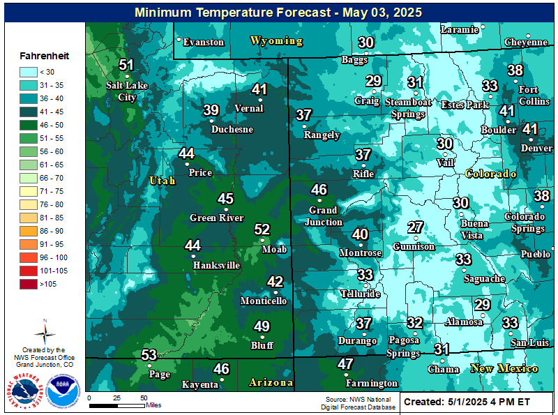
Tonight's Forecast Low Temperatures
Hazards
Detailed Hazards Viewer
National Briefing
Outlooks
Transportation Decision Support
Winter Storm Severity Index
Forecasts
Aviation Weather
Fire Weather
Forecast Discussion
Forecast Points
Local Area
Severe Weather
Soaring Forecast
Winter Weather
Hydrology
Recreational River Report
River Forecast
Weather Safety
Preparedness
NOAA Weather Radio
StormReady
SkyWarn

US Dept of Commerce
National Oceanic and Atmospheric Administration
National Weather Service
Grand Junction, CO
2844 Aviators Way
Grand Junction, CO 81506-8644
970-243-7007
Comments? Questions? Please Contact Us.


 Follow us on X
 Follow us on Facebook
 Follow us on YouTube
 GJT RSS Feed