Overview
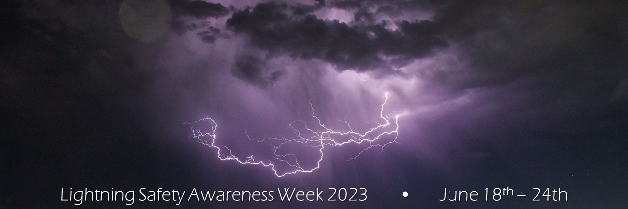
The National Weather Service wants to build a Weather-Ready Nation where all are prepared for a variety of weather-related hazards. All thunderstorms share a dangerous threat: lightning. Lightning is unpredictable, occurring at any time and striking up to 10-15 miles away from the storm. Are you weather-ready? Now is the time to make sure you know how to stay safe when severe weather threatens. This year, the week of June 19th to 25th has been designated National Lightning Safety Awareness Week.
This page has been created to raise lightning awareness for the High Plains. Storms can pop up almost any day during the warm season, so stay aware and please prepare!
Anytime the threat for severe weather exists, stay updated on the latest weather information by going to the National Weather Service Website, https://www.weather.gov or mobile.weather.gov, by tuning in to NOAA Weather Radio, or your local television and radio stations.
Sunday:
Lightning can strike anywhere across the High Plains, especially during the warm season. Lightning strikes the ground around 25 million times each year across the United States. With many of us participating in outdoor activities (sports, farming, etc.), we need to know how to protect ourselves from this deadly hazard.
Including today, the next 7 days will focus on various lightning related topics to help our lightning awareness and become weather-ready! Here is the list of topics:
Sunday: Introduction and Lightning Statistics
Monday: Lightning Science
Tuesday: Outdoor Lightning Risk Reduction
Wednesday: Indoor Lightning Safety
Thursday: Outdoor Activities and Lightning
Friday: Lightning Myths and Facts / Helping Victims
Saturday: Review
Lightning is a dangerous weather threat. In fact, over the past 10 years, lightning has claimed the lives of 25 people per year on average. Most if not all of the victims were caught unaware of the incoming strike during leisure and work activities where their attention was diverted. Water-related activities accounted for 34% of all leisure fatalities while farming/ranching accounted for 23% of work-related fatalities.
Lightning deaths occur most frequently during the summer time months when people are outside enjoying the sun or working while the weather is good. Not only do the number of outdoor activities increase in the summer, but also the frequency of thunderstorms. During the winter months when storms are less common, lightning fatalities take a noticeable dip. However, lightning remains a dangerous threat at all times as it only takes one strike to cause life-changing injuries.
Sunday's Social Media Posts (click to enlarge)
.PNG) |
.PNG) |
.PNG) |
.PNG) |
Additional Links:
NOAA’s lightning website: https://www.weather.gov/safety/lightning
NOAA’s lightning media website: https://www.weather.gov/safety/lightning-media
NOAA’s Summer Safety website: https://www.weather.gov/wrn/summer-safety
NOAA’s U.S. Lightning Deaths for 2023: https://www.weather.gov/safety/lightning-fatalities
NOAA's U.S. Lightning Deaths for previous years: https://www.weather.gov/safety/lightning-victims
National Lightning Safety Council (NLSC) National Lightning Safety Awareness Week: http://www.lightningsafetycouncil.org/LSC-LSAW.html
Monday:
Today, we will discuss the science of lightning.
Lightning is simply a giant spark that moves within a cloud, between clouds, or between a cloud and the ground. As lightning passes through the air, it heats the air rapidly to a temperature of about 50,000 degrees Fahrenheit. This causes a rapid expansion of the air along the lightning channel. This rapid expansion causes a shock wave that we hear as thunder.
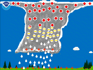
Every thunderstorm produces lightning. Thunderstorms will form if there is sufficient moisture and instability in the atmosphere. As the sun warms the air near the ground, pockets of warmer air begin to rise and cool. Condensation of water vapor causes cumulus clouds to form. Continued heating can cause these cumulus clouds to continue to grow upward into the atmosphere. Towering cumulus clouds may be one of the first indications of a developing thunderstorm. The mature thunderstorm has both an updraft of rising warm air and a downdraft of sinking cool air accompanied by rain and sometimes hail.
Thunderstorms grow tens of thousands of feet into the atmosphere. Within the thunderstorm, precipitation forms as ice crystals, graupel, and rain. Collisions between these particles causes electrical charges to separate, with the positively charged ice crystals carried up into the updraft, while the negatively charged heavier graupel are carried downward in the downdraft. With time, the top of the thunderstorm becomes positively charged and the lower part of the thunderstorm becomes negatively charged.
 |
 |
 |
| Storm development. | Particles colliding within a thunderstorm, leading to a separation in the charges. | Charges separating and building in the thunderstorm. |
Due to the pool of negative charges in the lower part of the storm, a pool of positive charges will develop along the ground and follow the cloud base like a shadow. Farther away from the cloud base, but under the positively charged anvil, a strong negative charge may be induced along the ground.
Cloud-to-ground lightning can either be a negatively charged flash or a positively charged flash. The negative flash usually occurs between the negative charges in the lower part of the storm and the positive charges on the ground under and near the cloud base. Positive flashes usually occur between the positively charged upper levels of the storm and the negatively charged area surrounding the storm.
In the negative cloud-to-ground flash, a negatively-charged step leader forms and begins to move down toward the ground. As this step leader approaches the ground, streamers of positive charge move upward from the Earth's surface. When these upward streamers meet the step leader, the connection is completed and the result is a cloud-to-ground lightning flash. The entire process takes place in fractions of a second. If you are near, or under a thunderstorm, and your hair rises, you are in an area where the positive electrical charges are rising up objects towards the storm. You are in a very dangerous location, because lightning may be about to strike!
The process for a positive flash is similar except that a positive channel usually originates in the anvil of the storm and surges downward. In this case, streamers of negative charge shoot up to meet the positively charged channel as it approaches the ground. When a connection is made, a positive flash of lightning occurs.
While both negative and positive flashes of lightning can be deadly, the positive flashes generally are more destructive as they typically deliver more overall electrical charge to the ground, and they remain in contact with the ground surface for a relatively longer period of time as compared to a negative cloud-to-ground flash.
Monday's Social Media Posts (click to enlarge)
.PNG) |
.PNG) |
.PNG) |
Tuesday:
Today, we will discuss outdoor lightning risk reduction.
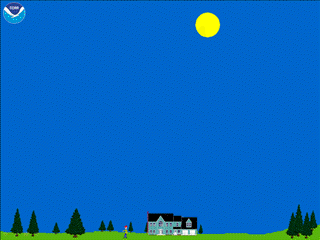
Outdoors is the most dangerous place to be during a thunderstorm. Each year, nearly all people in the United States who are injured or killed by lightning were involved in an outdoor activity. They were struck while working outside, were at or participating at an outdoor sporting event, or were boating or fishing. Other examples include people struck while they were hiking, mowing the lawn or simply going to or from their car. Quite a few were on their own property when they were struck.
Unfortunately, there is no place outside that is safe from lightning. The only safe place to be when lightning is occurring is either inside a substantial building, or an enclosed automobile.
An informed decision will help you avoid being in an area where lightning is expected to occur. Before heading out, get an updated forecast. Stay tuned to NOAA Weather Radio, check National Weather Service web sites, go to your favorite broadcast or print media, or access your favorite weather apps on your cell phone for the latest forecast. If thunderstorms are in the forecast, consider planning an alternate indoor activity or, if you still plan to be outside, make a plan which will allow you to quickly get to a safe shelter if a storm should develop.
Once you are outside, keep up-to-date on the weather via your smart phone or portable NOAA weather radio receiver. Check for updated forecasts. Check if storms are near you by checking the latest radar imagery on your cell phone. There are now several smart phone apps you can purchase that show you real-time lightning activity in your area. Do not forget to simply look around you to make sure storms are not developing in your vicinity.
If you are outside, such as a park, a lake, or an outdoor sporting event, know where the nearest safe location can be accessed. A safe location is any substantial building (a substantial building is a structure which is fully enclosed and has electrical wiring and plumbing). In addition, any enclosed hard-topped car or truck also offers excellent protection from a lightning strike. Once you hear thunder or see lightning, immediately stop what you are doing and quickly get to the safe shelter. Looking around for your safe space ahead of time will help you get to safety faster once the lightning does begin.
What can you do to reduce your chances of being injured or killed by lighting if no safe shelter is nearby? Unfortunately, in this scenario, there is not much you can do to reduce your risk from being struck by lightning. The best thing to do is move away from tall isolated objects, such as trees. Stay away from wide open areas. Stay as low as possible with your feet close together if lightning is nearby. If you are with a group of people, spread out, that way if someone is struck by lightning, the others can offer first aid.
Tuesday's Social Media Posts (click to enlarge)
.PNG) |
.PNG) |
.PNG) |
.PNG) |
.PNG) |
Wednesday:
Today, we will discuss indoor lightning safety.
Statistics tell us that we are much less likely to become a lightning strike victim if we are inside a substantial structure such as a home or office building. While the majority of people who are injured or killed by lightning are outside, a small percentage of people are injured by lightning while indoors. Therefore, it is important to discuss indoor lightning safety.
The dangerous electrical current associated with a lightning strike typically enters a structure through wires, cables or pipes that connect to the building from the outside. Lightning can also directly enter into a structure through an open window, door or garage door. Once in a structure, the dangerous current can travel through the electrical, phone, cable and plumbing systems and through metal wires or bars in concrete walls or flooring.
Corded electronic devices are the leading cause of indoor lightning injuries in the United States. These include personal computer keyboards, game consoles, and corded phones. Other injuries have occurred when people were close to televisions which connect to an outside cable or satellite system. Open windows, doors and garage doors allow for a direct strike to enter a home, so make sure all windows and doors are closed when lightning is occurring. Never watch a lightning storm from a porch or open garage door. There are several YouTube videos that show people being injured by lightning while they were recording lightning from their porch or open garage door.
It is very important to stay away from any plumbing when lightning is occurring outside. This includes sinks, bathtubs and showers. When lightning is occurring, do not hand wash dishes, do not give kids a bath, and do not take a shower. It is best to wait to do laundry until after the storm goes by as washers and dryers are connected to both the electrical and plumbing systems.
People have also been injured while leaning and standing near concrete in their homes and offices. This is due to metal rebar which is in the concrete, and this metal acts as a conductor when lightning hits the building.
A house or other substantial building offers the best protection from lightning. In contrast, many small shelters such as bullpens, picnic shelters, sheds or tents (no matter what the size) offer no protection from lightning, and should be avoided at all cost.
Wednesday's Social Media Posts (click to enlarge)
.PNG) |
.PNG) |
.PNG) |
Thursday:
Today, we will discuss some things you should think about regarding activities when lightning is in the area.
It's a common situation — a thunderstorm is approaching or nearby. Are conditions outside safe, or is it time to head for safe place? Not wanting to appear overly cautious, many people wait far too long before reacting to this potentially deadly weather threat.
Anyone who is outside in the summer needs to understand some basic information about lightning. Each year, thunderstorms produce an estimated 20 to 25 million cloud-to-ground lightning flashes in the United States — each one of those flashes is a potential killer. Some of those flashes strike directly under the storm where it is raining, but some of the flashes reach out away from the storm where people perceive the lightning threat to be low or nonexistent, and catch people by surprise.
Based on cases documented by the National Weather Service in recent years, about 25 people are killed by lightning each year and hundreds more are injured, some suffering devastating neurological injuries that persist for the rest of their lives. About two thirds of the deaths are associated with outdoor recreational activities.
Officials responsible for sports outdoor activities need to understand thunderstorms and lightning to make educated decisions on when to seek safety. Without this knowledge, officials may base their decisions on personal experience and or a desire to complete the activity. Unfortunately, decisions based on past experience or a desire to complete the activity can put the lives of those involved at risk.
For organized outdoor activities, the National Weather Service recommends that organizers have a lightning safety plan and follow it without exception. The plan should give clear and specific safety guidelines to eliminate errors in judgment. These guidelines should address the following questions.
When should activities be stopped?
Where should people go for safety?
When should activities be resumed?
Who should monitor the weather and make the decision to stop activities?
What should be done if someone is struck by lightning?
Thursday's Social Media Posts (click to enlarge)
.PNG) |
.PNG) |
Friday:
Today, we will highlight some facts about lightning strike victims.
While any lightning fatality is tragic, injuries caused by lightning can be devastating to both the victim and the family. For those who have a family member or relative that suffers a significant disability from lightning, life changes forever. In addition to the physical pain and mental anguish suffered by the victim and their family, the incident may lead to a loss of income for all involved as medical expenses can drain the family’s financial resources.
If someone is struck by lightning, it is critically important that they receive the appropriate medical attention immediately. Some deaths can be prevented if the victims are attended to promptly. First, check to see that the victim is breathing and has a pulse, and start cardio-pulmonary resuscitation, if needed. Then have someone dial 911. If possible, move the victim to a safer place. Do not let the rescuers become lightning victims. Lightning can strike the same place twice.
Lightning strike victims may face many mental challenges that they will have to live with for the rest of their lives. When the brain is affected by a lightning strike, the person often has difficulty with many of the mental processes that most people take for granted. The person may suffer from short-term memory loss, and may have difficulty remembering new information and accessing old information. Victims may often find it very difficult to carry on more than one task at a time, and may be easily distracted. Their personality may change and they may become easily irritated.
Lightning strike victims often become easily fatigued and may become exhausted after only a few hours of work. This may be because mental tasks that were once automatic may now require intense concentration to accomplish. Although some victims may sleep excessively at first, after a few weeks many find it difficult to sleep more than two or three hours at a time.
Another common long-term problem for survivors is pain.
Medically, pain is difficult to quantify. Lightning strike victims often suffer irreparable nerve damage that causes intense pain that affects the ability to function. Many survivors complain of chronic headaches, some of which are very intense and debilitating.
Lightning Strike and Electric Shock Survivors International is a support group for individuals and families that are struggling with life after a lightning injury. Helpful information is available at their web address: www.lightning-strike.org
It is important to note that lightning victims do not carry an electrical charge and are safe to handle and attend to. For other lightning myths and facts, please visit https://www.weather.gov/safety/lightning-myths
Friday's Social Media Posts (click to enlarge)
.PNG) |
.PNG) |
.PNG) |
Saturday:
Lightning Safety Awareness Week concludes today and we will reflect on what we have learned this week.
Thank you for being a part of our Lightning Safety Awareness Week and spreading our messages to help keep the community safe.
The best way for you to protect yourself from lightning is to avoid the threat. You simply don’t want to be caught outside in a storm. Have a lightning safety plan, and cancel or postpone activities early if thunderstorms are expected. Monitor weather conditions and get to a safe place before the weather becomes threatening. Substantial buildings and hard-topped vehicles are safe options. Picnic shelters, small sheds, overhangs, and open vehicles are not safe.
When inside, do not touch anything that is plugged into an electrical outlet, plumbing, and corded phones. Cell phones and cordless phones are safe. Also, keep away from outside doors and windows and do not lie on a garage floor.
Finally, wait 30 minutes after the last lightning or thunder before going back outside. If everyone followed those simple rules, the number of lightning casualties in this country could be greatly reduced.
If someone is struck by lightning, they may need immediate medical attention. Lightning victims do not carry an electrical charge and are safe to touch. Call 911 and monitor the victim. Start CPR or use an Automated External Defibrillator if needed.
Saturday's Social Media Posts (click to enlarge)
.PNG) |
.PNG) |
.PNG) |
.PNG) |
.png) |
 |
Media use of NWS Web News Stories is encouraged! Please acknowledge the NWS as the source of any news information accessed from this site. |
|

