
Flash flooding threatens areas from the Tennessee Valley to the Carolinas as storms repeat along a stalled front. Monsoonal storms may trigger flooding in the Southwest. Dangerous heat expands across the Desert Southwest, Plains, mid-Mississippi Valley and Southern Tier. Critical fire weather for interior Pacific Northwest. Cooler, drier air brings brief relief to the Great Lakes and Northeast. Read More >
ASHEVILLE AREA
|
|||
| JANUARY | FEBRUARY | MARCH | APRIL |
| Records Normals |
Records Normals |
Records Normals |
Records Normals |
| MAY | JUNE | JULY | AUGUST |
| Records Normals |
Records Normals |
Records Normals |
Records Normals |
| SEPTEMBER | OCTOBER | NOVEMBER | DECEMBER |
| Records Normals |
Records Normals |
Records Normals |
Records Normals |
| Records are from 1869 to Present, Normals are from 1981 to 2010. | |||

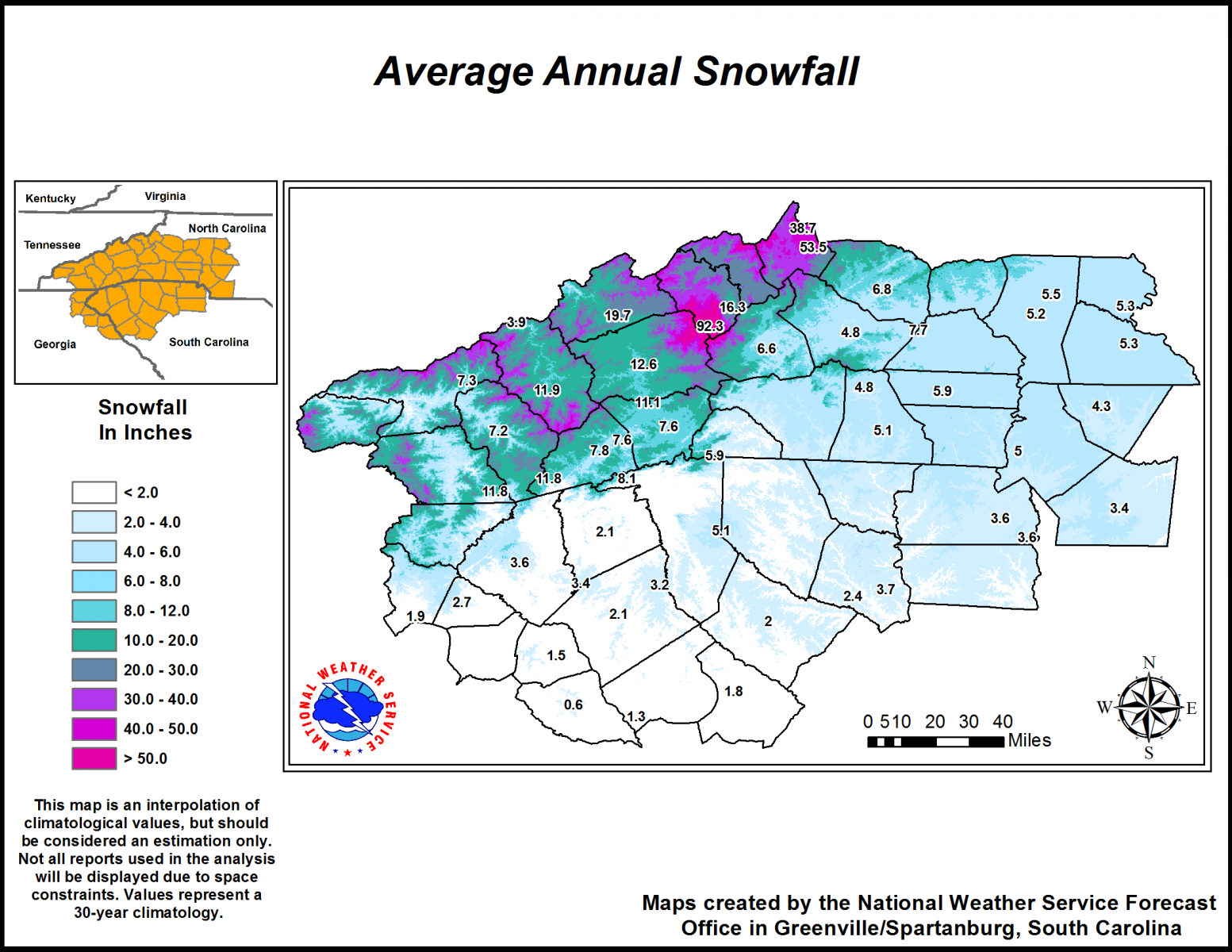
Climatology Maps
| Precipitation | High Temperatures | Low Temperatures |
| TEMPERATURE DATA | ||
| MONTHLY OBSERVED TEMPERATURES | ||
| WARMEST AND COLDEST MONTHS | ||
| 90° HIGH TEMPERATURE DATA | ||
| FREEZE DATA (GROWING SEASON) | ||
| FREEZE STREAKS | ||
| RAINFALL DATA | ||
| MONTHLY OBSERVED PRECIPITATION | ||
| WETTEST AND DRIEST MONTHS | ||
| HEAVIEST RAIN EVENTS | ||
| RECORD DRY SPELLS | ||
| SNOWFALL DATA | ||
| MONTHLY OBSERVED SNOWFALL | ||
| MAXIMUM SNOWFALL PER MONTH AND PER DAY |
||
| HEAVIEST SNOW EVENTS | ||
| SNOW RECORDS | ||
| OTHER SIGNIFICANT DATA | ||
| OBSERVER HISTORY | ||
| MONTHLY PRESSURE AND WIND RECORDS | ||


 Hourly Weather
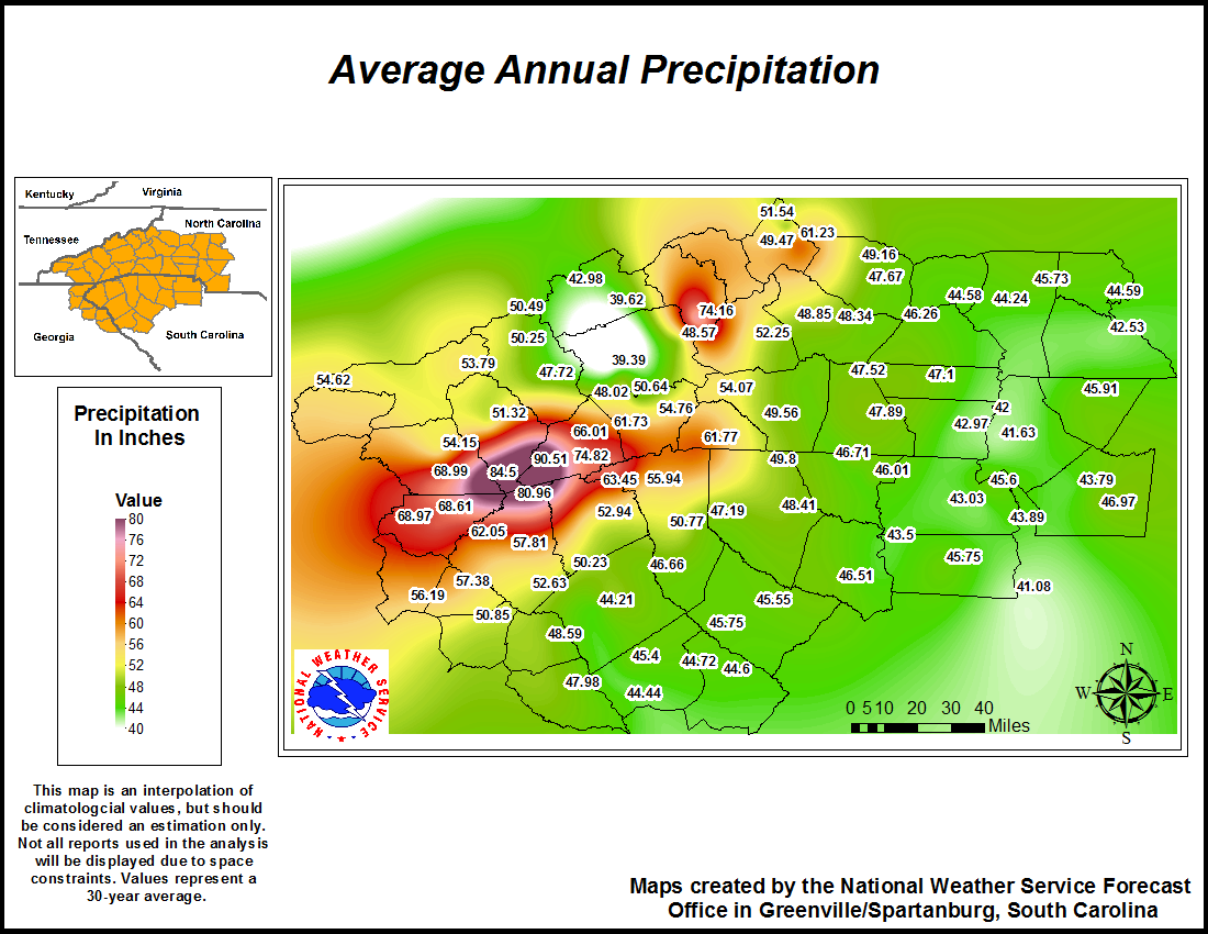