


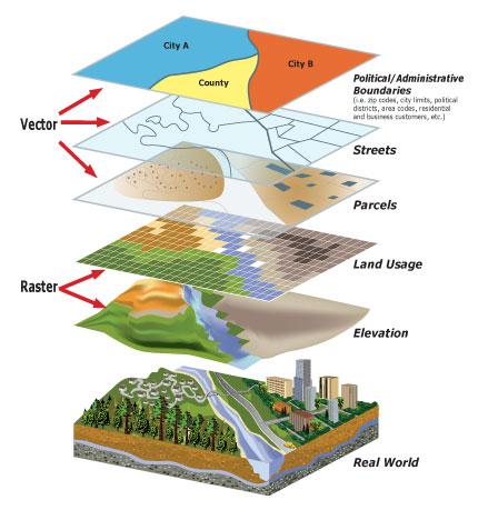
A Geographic Information System (GIS) integrates hardware, software, and data for capturing, managing, analyzing, and displaying all forms of geographically referenced information. GIS allows us to view, understand, question, interpret, and visualize data in many ways that reveal relationships, patterns, and trends in the form of maps, globes, reports, and charts.
ESRI Shapefiles are offered for GIS analysts and agencies looking to create their own maps in ArcGIS and perform spatial
modeling/analysis. Interactive web maps are also available through the use of ArcGIS Online and the NOAA GeoPlatform
for those that don't have GIS software installed on their PC, but would still like to view detailed GIS information from the
convenience of their web browser or mobile device.
 Local Radar
 Weather Map