
Record setting heat is expected over the next several days from the Intermountain West through the northern Plains. Furthermore, fire weather concerns increase with dry and breezy conditions. Meanwhile, heavy rainfall and severe thunderstorm threats for the Ohio/Tennessee Valleys, central Appalachians and Southeast today. The threat shifts to central Gulf Coast and across central Texas this week. Read More >
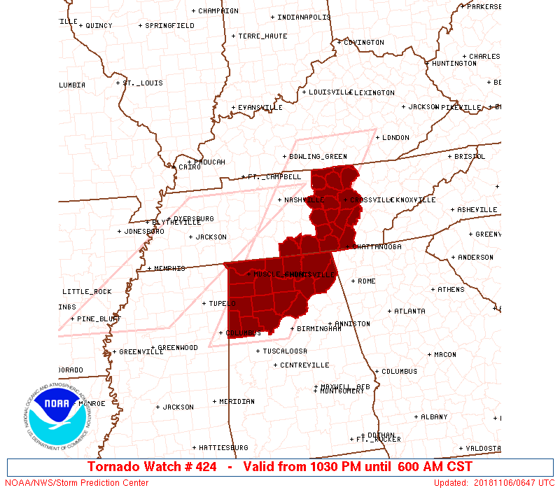
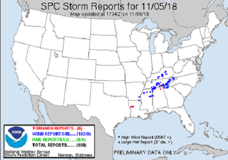
Event Summary |
|||||||
|
|||||||
|
|||||||
Tornadoes:
|
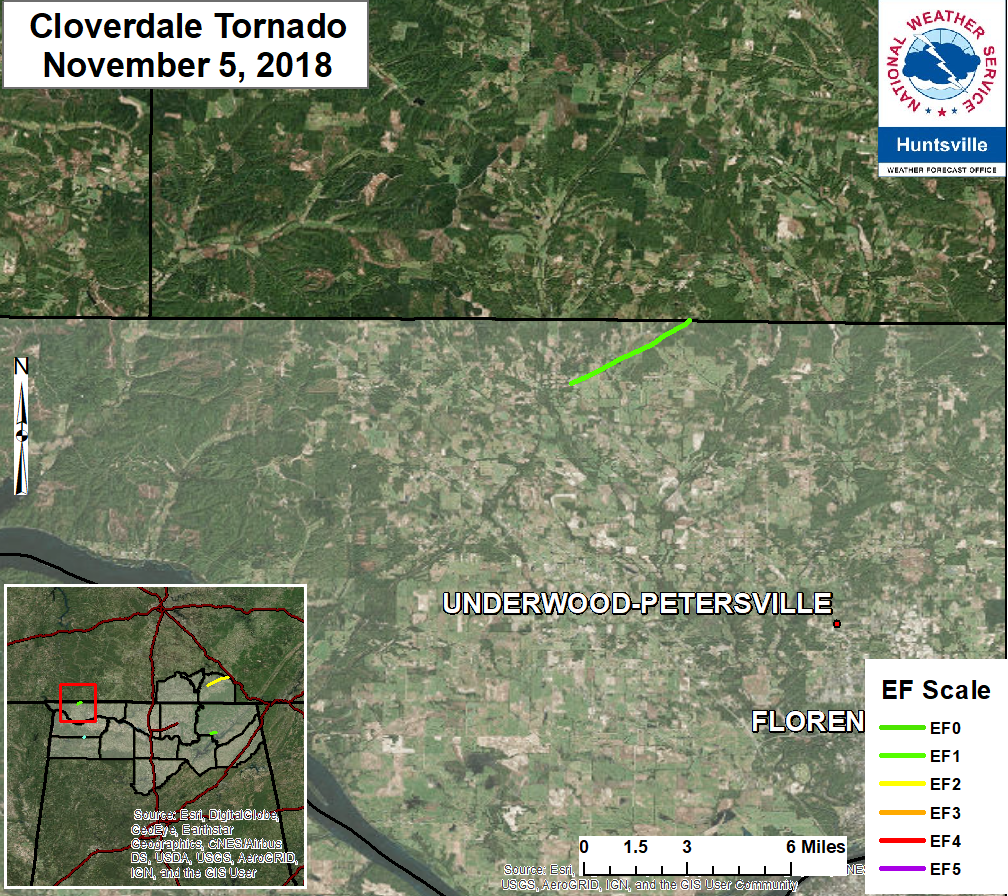
Cloverdale Tornado
|
||||||||||||||||||||||||||
|
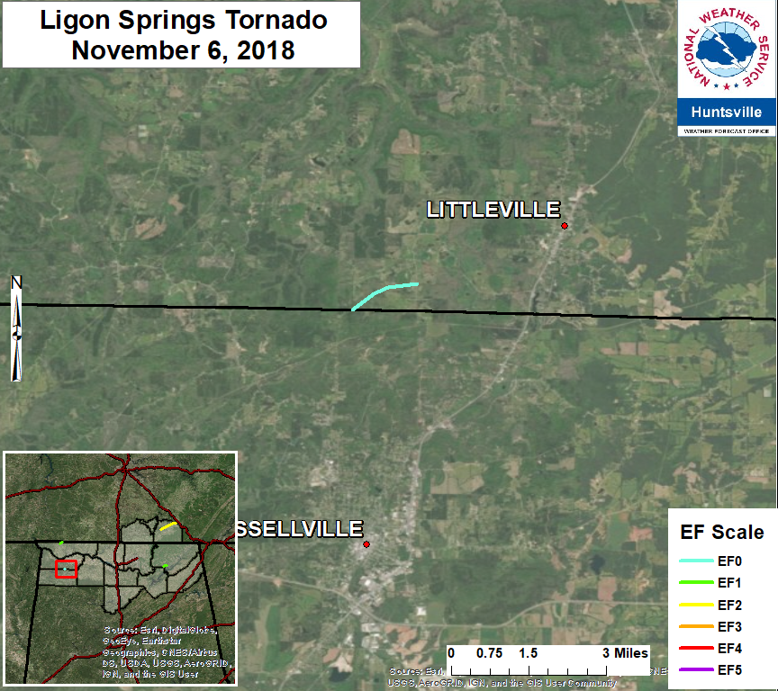
Ligon Springs Tornado
|
||||||||||||||||||||||||||
|
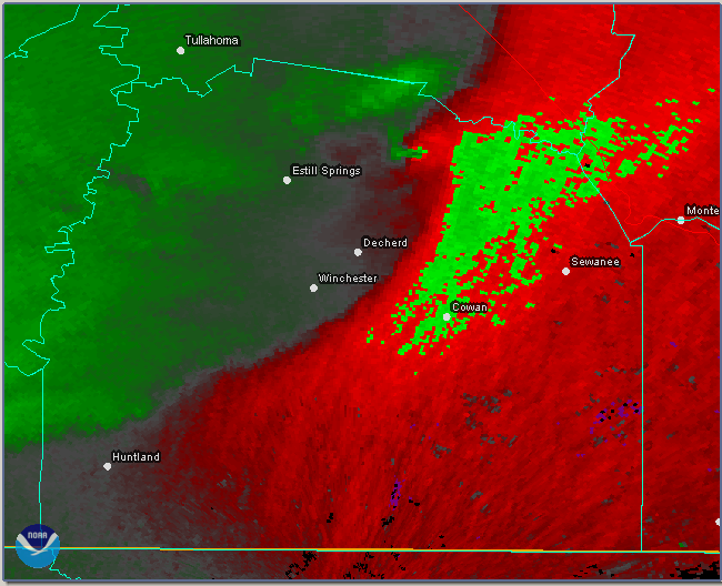
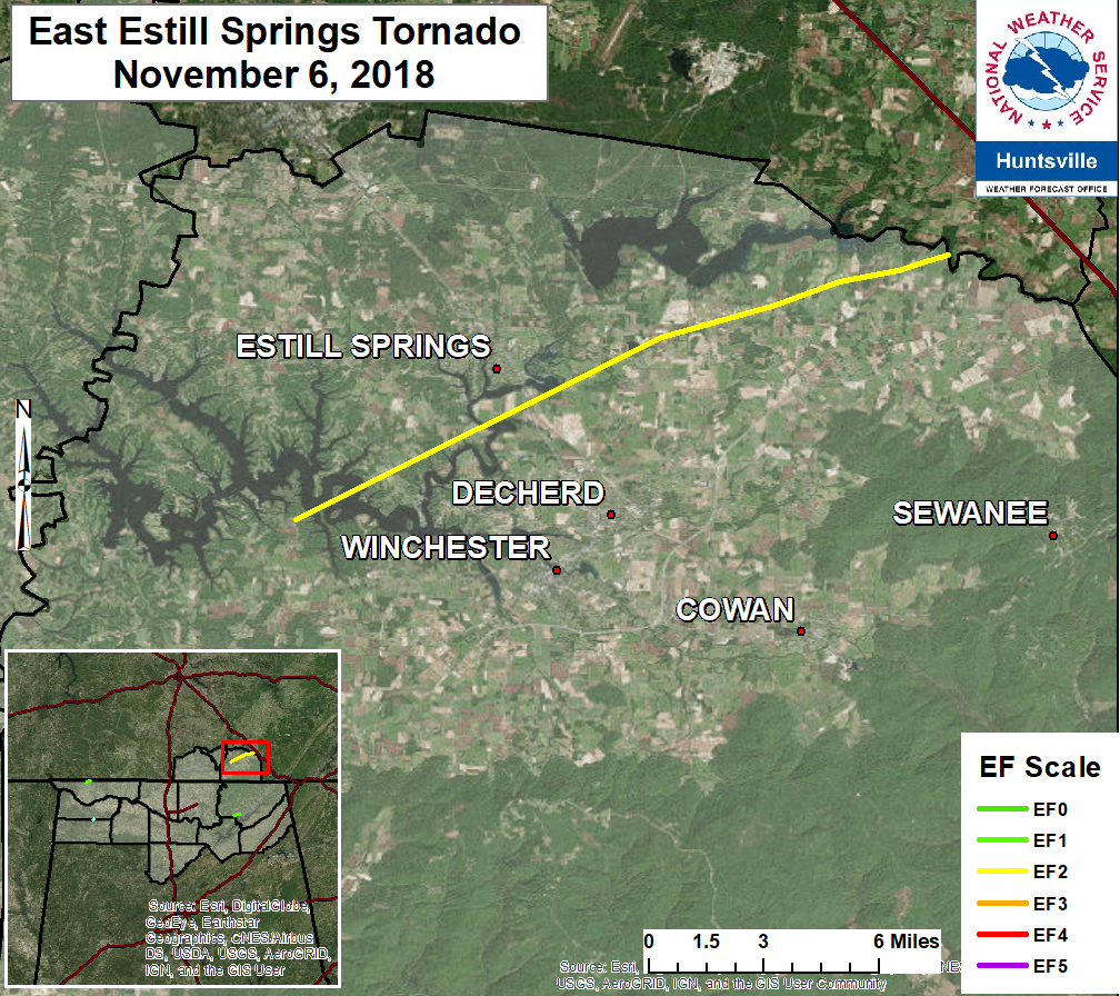
Estill Springs/Decherd Tornado
|
||||||||||||||||||||||||||
|
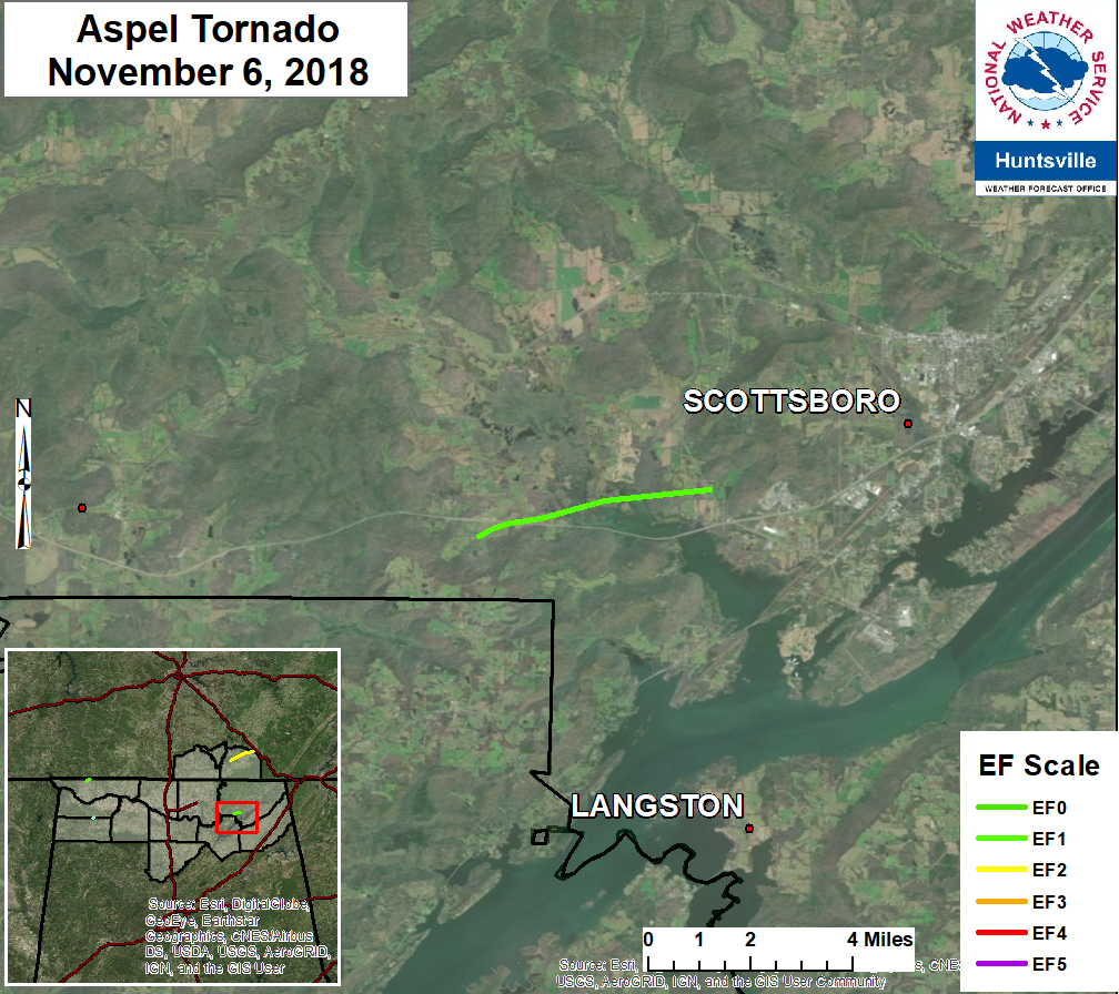
Aspel/Scottsboro Tornado
|
||||||||||||||||||||||||||
| EF0 Weak 65-85 mph |
EF1 Moderate 86-110 mph |
EF2 Significant 111-135 mph |
EF3 Severe 136-165 mph |
EF4 Extreme 166-200 mph |
EF5 Catastrophic 200+ mph |
 |
|||||
Upper Air Charts
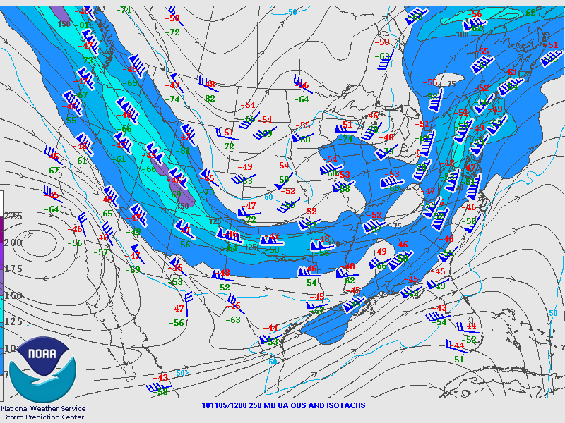
250mb Chart at 6am November 5th |
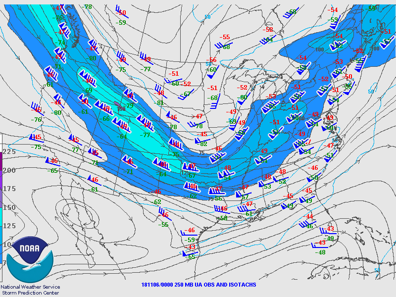
250mb Chart at 6pm November 6th |
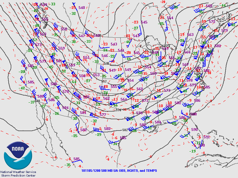
500mb Chart at 6am November 5th |
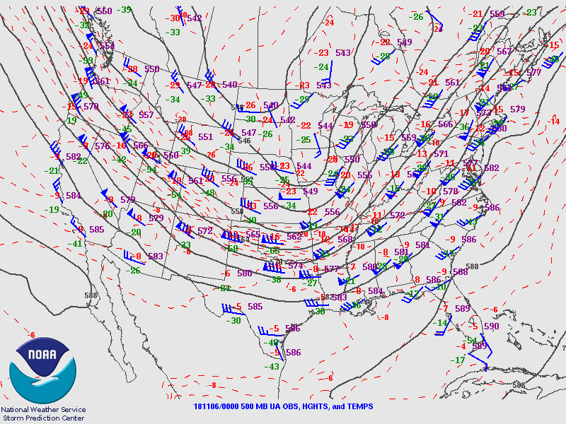
500mb Chart at 6pm November 6th |
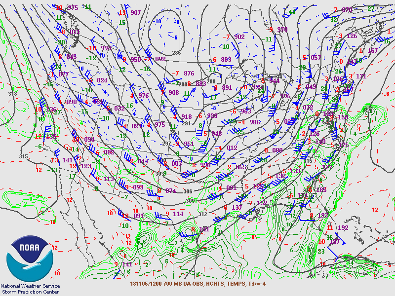
700mb Chart at 6am November 5th |
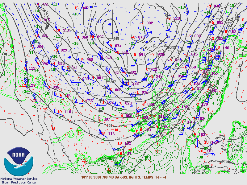
700mb Chart at 6pm November 6th |
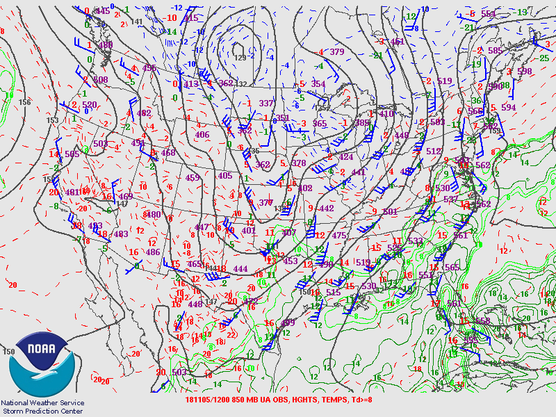
850mb Chart at 6am November 5th |
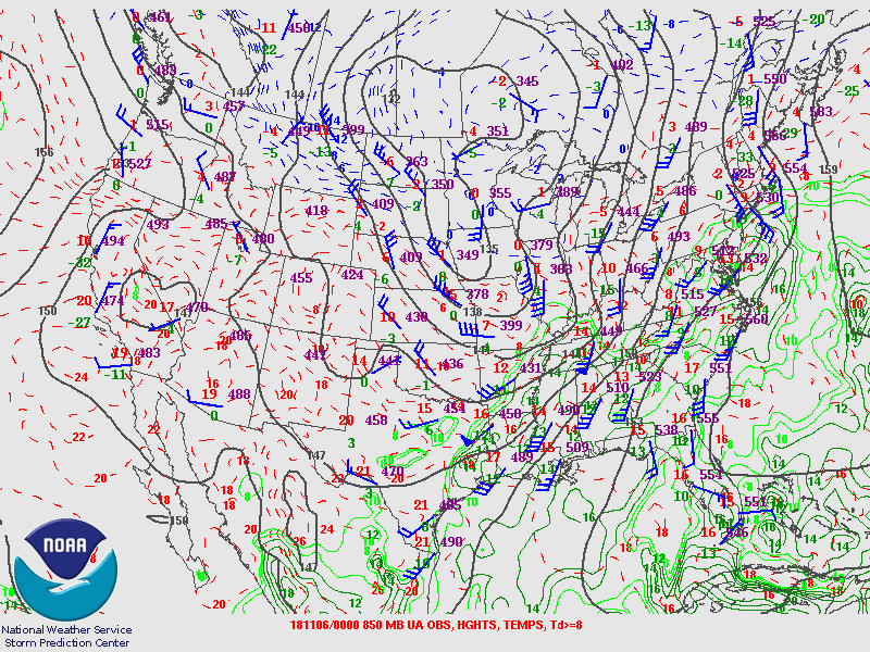
850mb Chart at 6pm November 6th |
Soundings
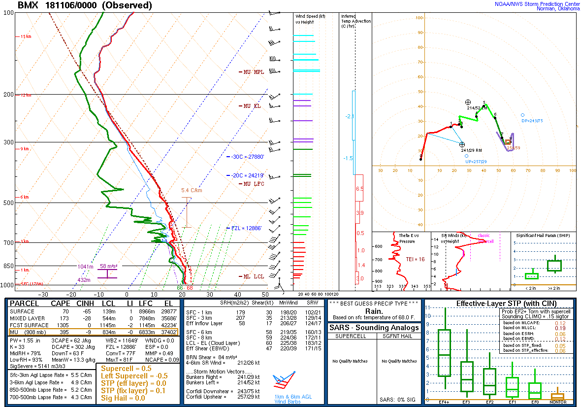
00Z Sounding Nov 6th, 2018 from BMX |
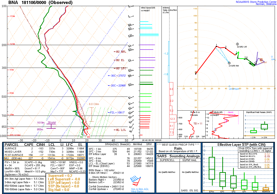
00Z Sounding Nov 6th, 2018 from BNA |
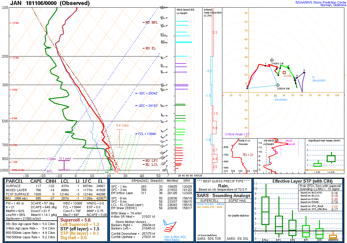
00Z Sounding Nov 6th, 2018 from JAN |
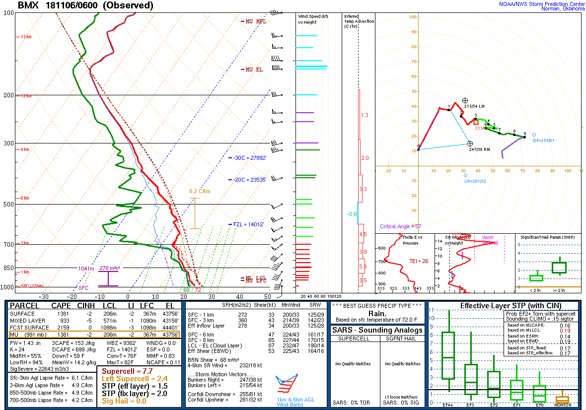
06Z Sounding Nov 6th, 2018 from BMX |
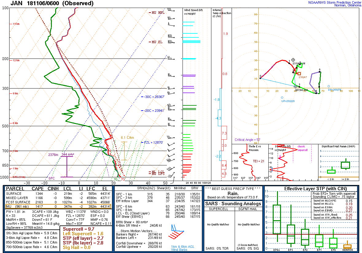
06Z Sounding Nov 6th, 2018 from JAN |
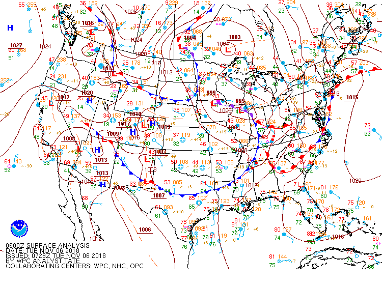
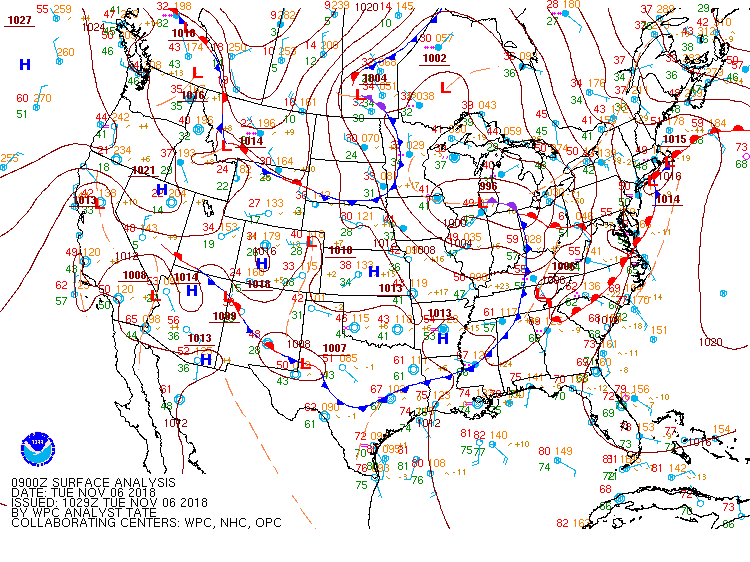
Surface Charts
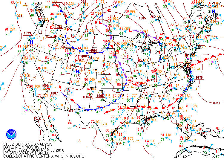
3 PM Nov 5th |
6 PM Nov 5th |
9 PM Nov 5th |
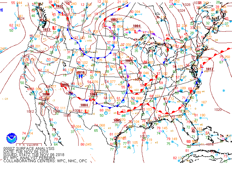
Midnight Nov 5th |
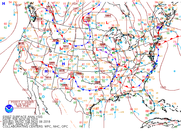
3 AM Nov 6th |
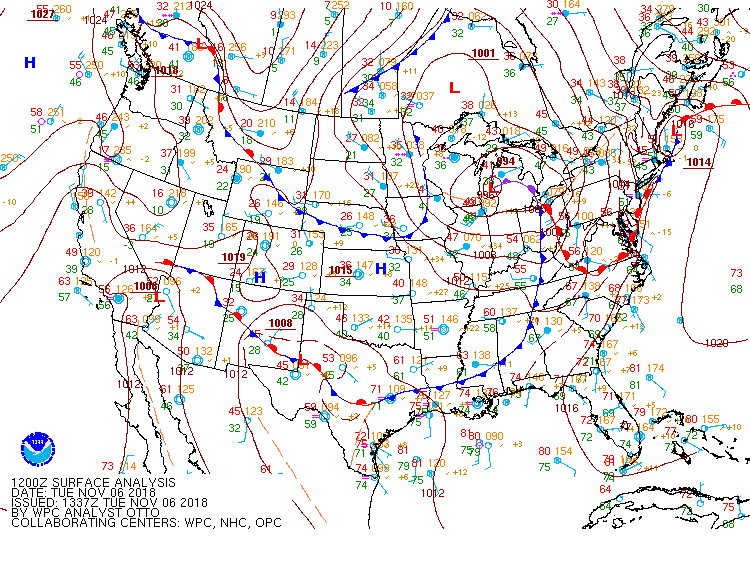
6 AM Nov 6th |
SPC Outlooks
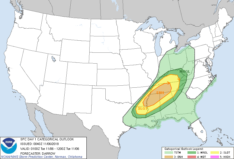
Day 1 Outlook |
||
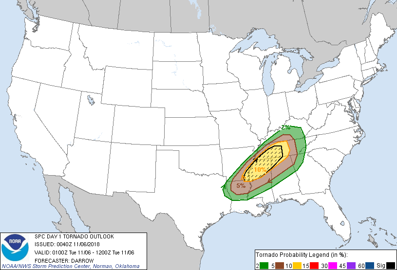
Day 1 Tornado Probability |
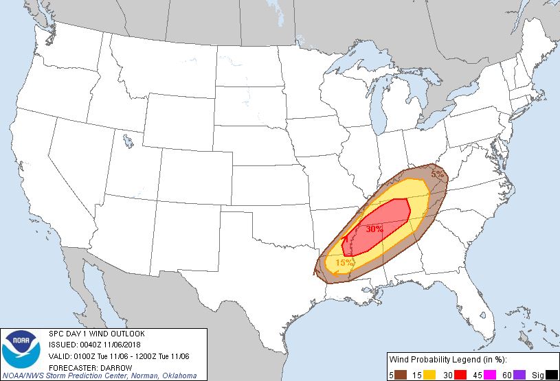
Day 1 Wind Probability |
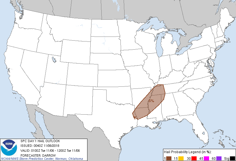
Day 1 Hail Probability |


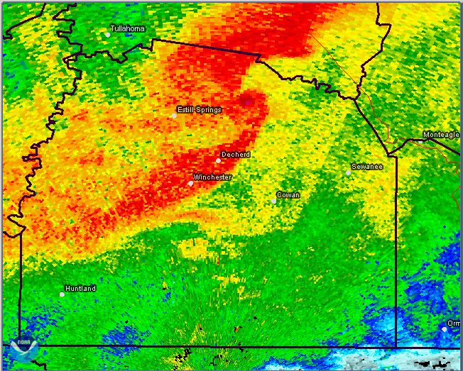
 Local Radar
 Weather Map