Large Hail, Tornadoes, and Heavy Rains
Across Central Kansas
June 1st, 2011
|
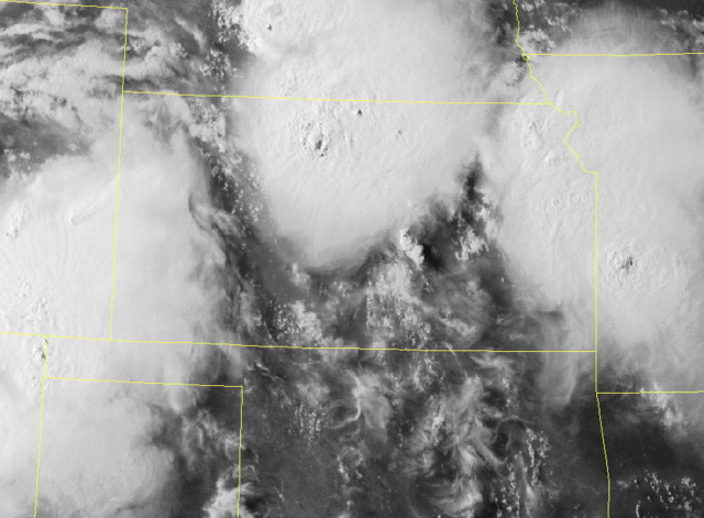
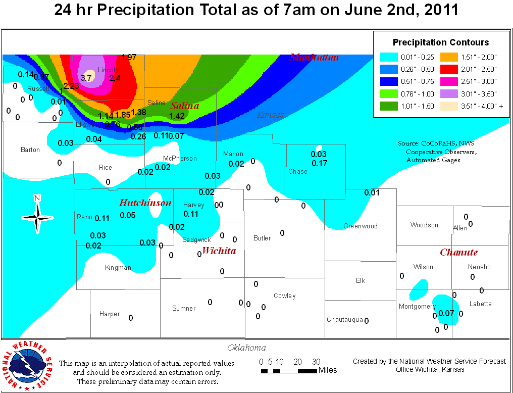
What happened: Initial development of thunderstorms began in the mid morning hours which further evolved through the afternoon and evening hours. These storms produced a few tornadoes, large hail, gusty winds, and flooding rains. Meteorological Background: A ridge of high pressure had camped out across the central United States for much of Wednesday, June 1st; however, a surface boundary which stretched from northwestern Kansas and sourthwestern Nebraska to eastern Kansas combined with abundant instability helped prompt development of severe thunderstorms. The early development of storms and associated outflow helped to enhance the surface boundary which further aided these storms. A brief tornado touched down in central Kansas. These storms also produced large hail up to baseball size, winds of about 65-80 mph, and very heavy rains which led to significant flooding for northern Kansas.
|
|
|
|
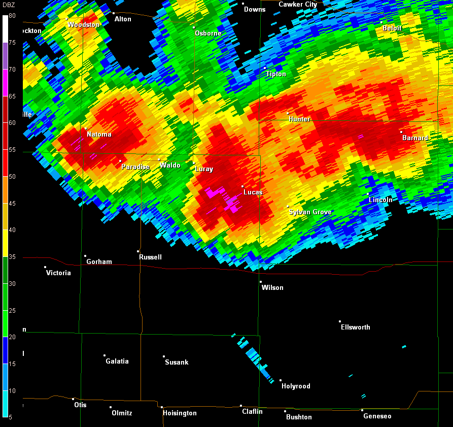
Radar Images
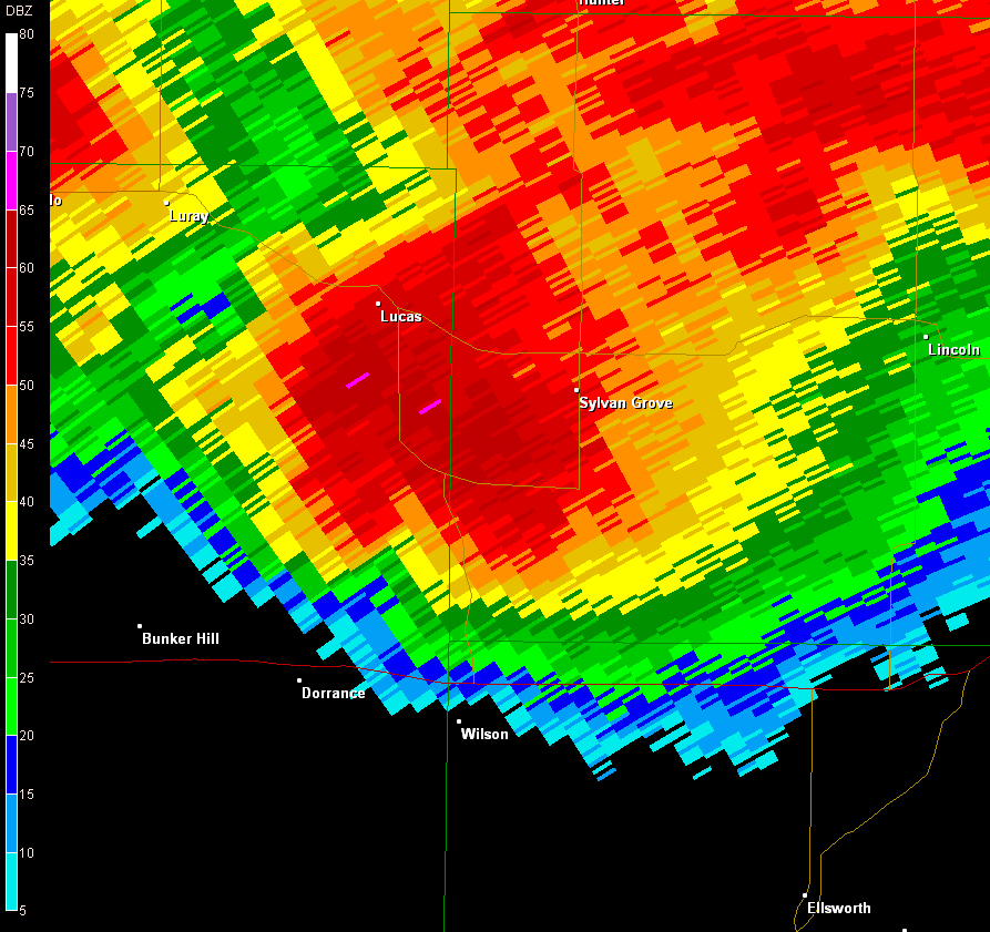
Radar image of supercell along the Russell and Lincoln County border.
|
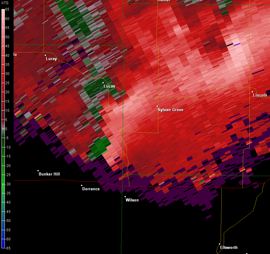 Radar image of doppler wind velocities. Strong rotation occurs where bright red and green are close together seen along the eastern edge of Russell County. |
|
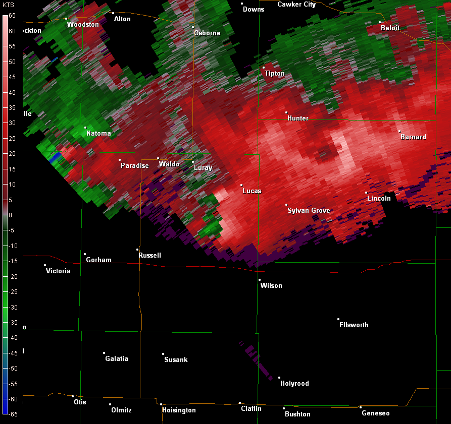 Radar image of doppler wind velocities. Strong rotation occurs where bright red and green are close together seen along the eastern edge of Russell County. |
Damage Pictures
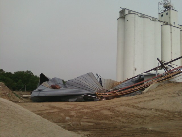 Straight-line wind damage to grain elevator on the south side of Lincoln. |
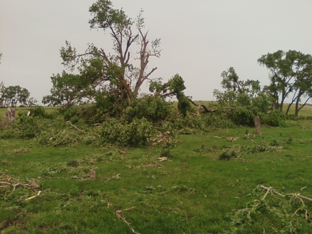 Weak tornado damage 3 miles west/northwest of Lincoln |
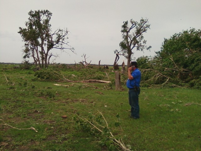 Weak tornado damage 3 miles west/northwest of Lincoln |
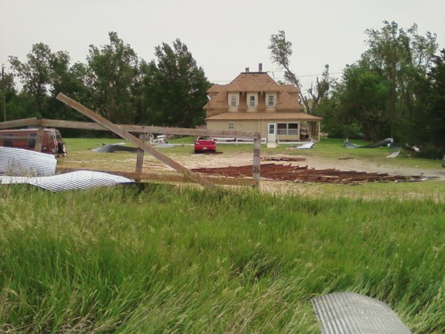 Straight-line wind damage 2NW of Sylvan Grove |
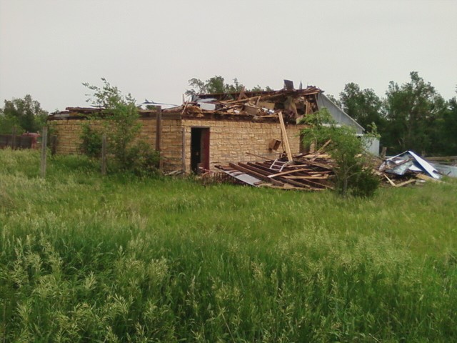 Straight-line wind damage 2NW of Sylvan Grove |
|||
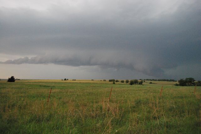
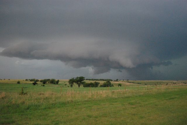
Storm Pictures
|
Storms moving into Central KS. Picture by Damon Vonada. |
Storms moving into Central KS. Picture by Damon Vonada. |
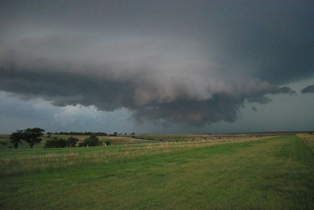
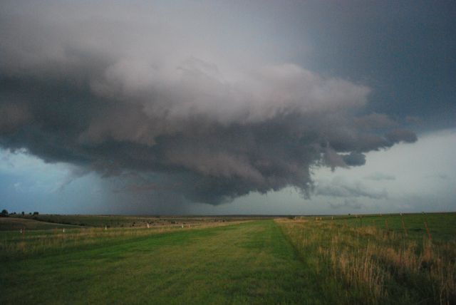
Supercell thunderstorm moving into Central KS by Damon Vonada. |
||
|
Supercell thunderstorm moving into Central KS by Damon Vonada. |
||||
Flooding
 |
Reports
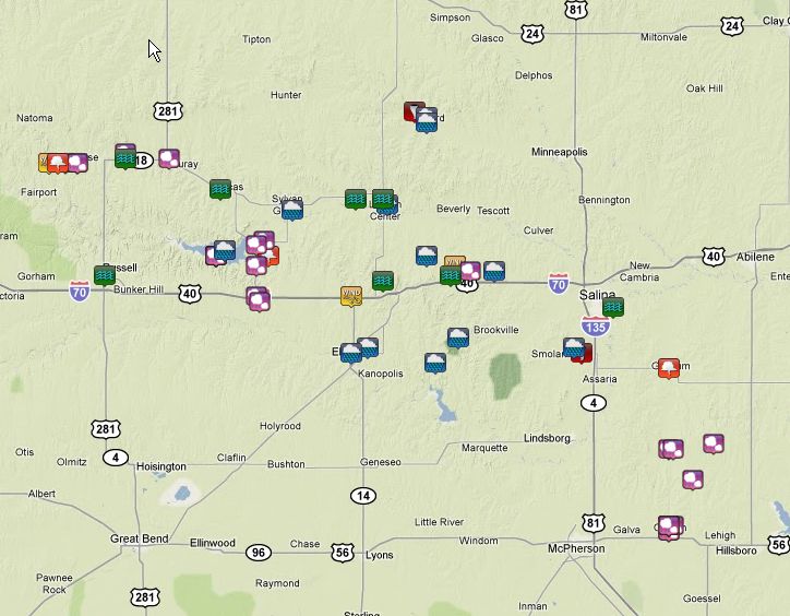 |
View Click to view larger map in a larger map
|
| Summary of Most Significant Severe Reports |
|
Large Hail: 2.00 inches (hen egg) - 6 N Wilson 2.75 inches (baseball) - 1 N Canton, 2 W Paradise, and Wilson Lake
Damaging Wind: E80 mph - Lincoln E65 mph - 4 W Paradise Flooding: Most of the roads in and out of Barnard closed from high water on the Salt Creek.
|