Wichita, Kansas
Weather Forecast Office
Overview
|
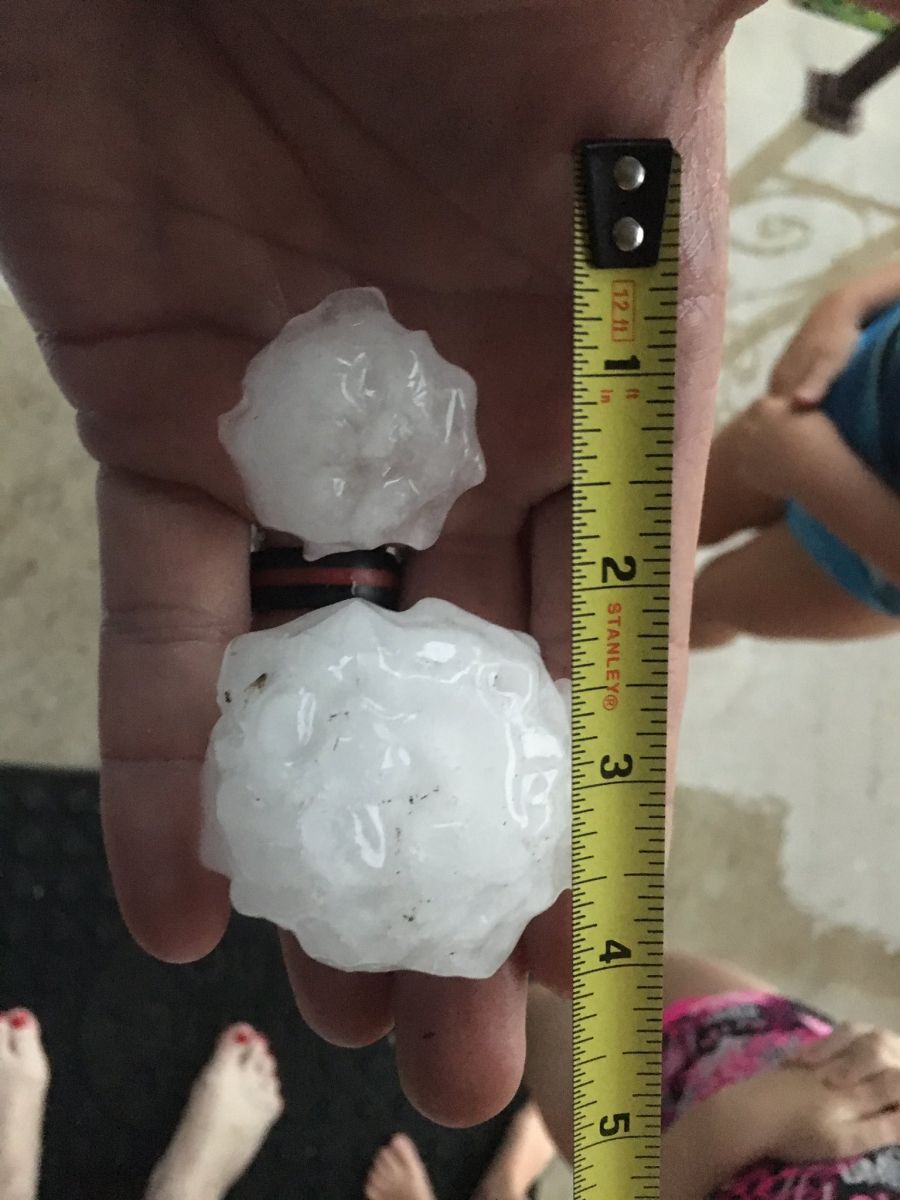
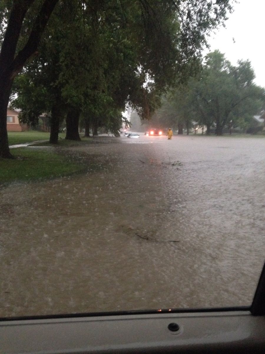
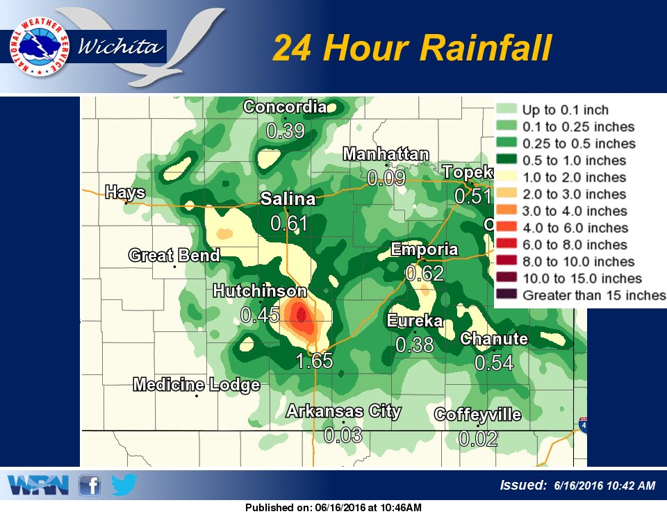
Storms developed during the late afternoon hours on June 15th over south central Kansas. With an extremely unstable environment in place, these storms quickly became severe. Outflow from these storms then allowed additional development to occur for the next several hours. The slow movement of the storms lead to flash flooding, especially across northern Sedgwick and southern Harvey counties. In addition, up to 2 inch hail was reported over parts of south central Kansas. |
 Large hail in Halstead. Picture by Mike Burke (@firemedic_mike) |
Wind & Hail:
Hail
 |
|
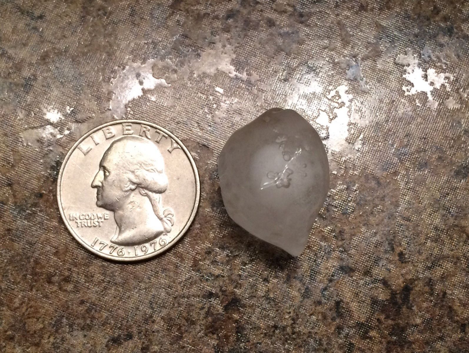 |
| 2 inch diameter hail in Colwhich. Picture by Peter Spexarth (@peterspexarth) | Large hail in Halstead. Picture by Mike Burke (@firemedic_mike) | Hail in Valley Center. Picture by Matt Morford (@mmorford7) |
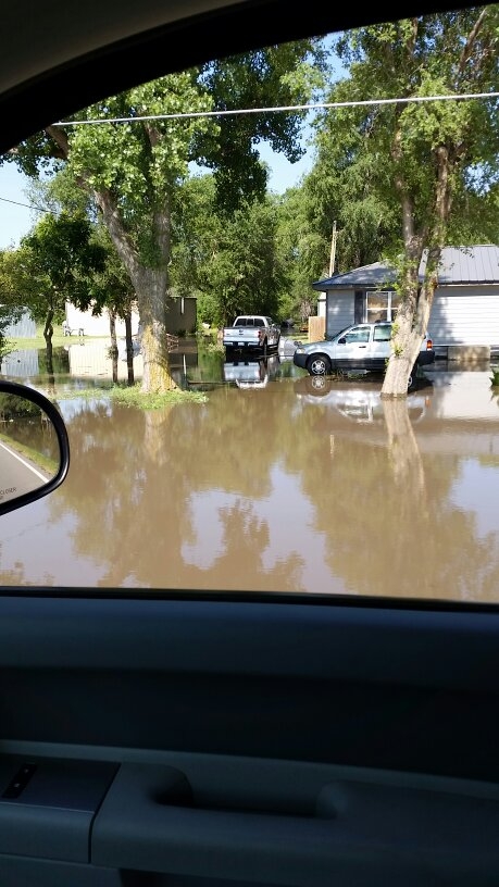
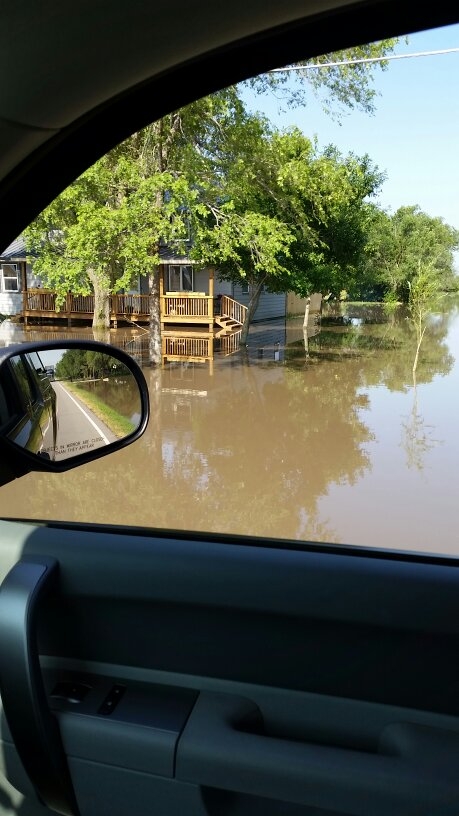
Heavy rain & flooding
 |
 |
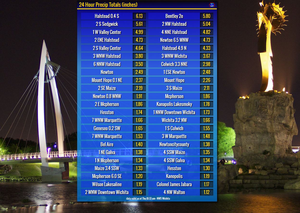 |
| Flash flooding in southern Harvey county. | Map of observed rainfall showing highest amounts across northern Sedgwick and southern Harvey counties | List of rainfall reports from this event. |
 |
 |
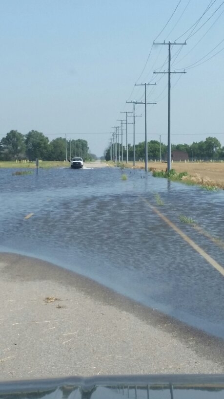 |
| Flooding along Ridge Road and 77th St north. | Flooding along Ridge Road near 77th St north | Flooding along 119th street and 109th north |
Radar:
 |
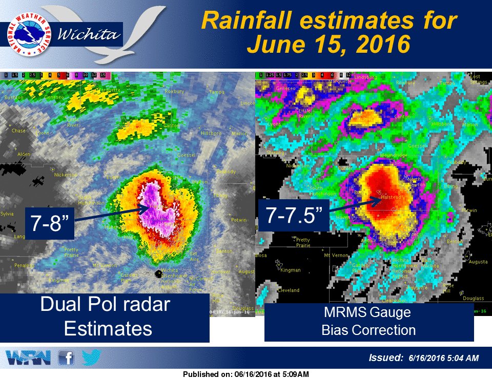 |
| Radar animation from late afternoon through early the evening of June 15th. | Radar estimated rainfall |
 |
Media use of NWS Web News Stories is encouraged! Please acknowledge the NWS as the source of any news information accessed from this site. |
|
Hazards
Briefing pages
Local weather story
Submit a storm report
Storm Prediction Center
Enhanced Hazardous Weather Outlook
Current Conditions
Local Radar
National Radar
Satellite
Hourly weather(text)
Precip Analysis
Snowfall analysis
This day in weather history
7 Day Lightning Archive
Forecasts
Forecast Discussion
Weather Story
Fire Weather
Activity Planner
Aviation Weather
Soaring Forecast
Hurricane Center
Graphical Forecasts
Regional Weather Summary
Probabilistic Snow
Probabilistic QPF
Wet Bulb Globe temp
Climate
Local Climate Page
Daily/Monthly data(F6)
Daily Records
Climate Normals
Local drought page
Latest Climate Report(ICT)
Latest Climate Report(SLN)
Latest Climate Report(CNU)
CoCoRaHS
7 Day Lightning Archive
US Dept of Commerce
National Oceanic and Atmospheric Administration
National Weather Service
Wichita, Kansas
2142 S. Tyler Road
Wichita, KS 67209-3016
316-942-3102
Comments? Questions? Please Contact Us.

